
Scan the QR code and open PeakVisor on your phone
Kokanee Glacier Provincial Park is located in the southeastern section of British Columbia in Canada. The park was established in 1922, making it one of the oldest parks in BC. The region spans 123.69 square miles. There are 53 named mountains in Kokanee Glacier Provincial Park. The highest and the most prominent mountain is Kane Peak. Inside the park there are three glaciers; Kokanee, Caribou, and Woodbury. Together these glaciers feed into the over 30 lakes within the park. A majority of the park sits above 6,000 feet, making it one of the highest elevated parks in the region. Throughout the park there are cabins and campsites, many which can still be accessed by snowshoeing or skiing during winter months.
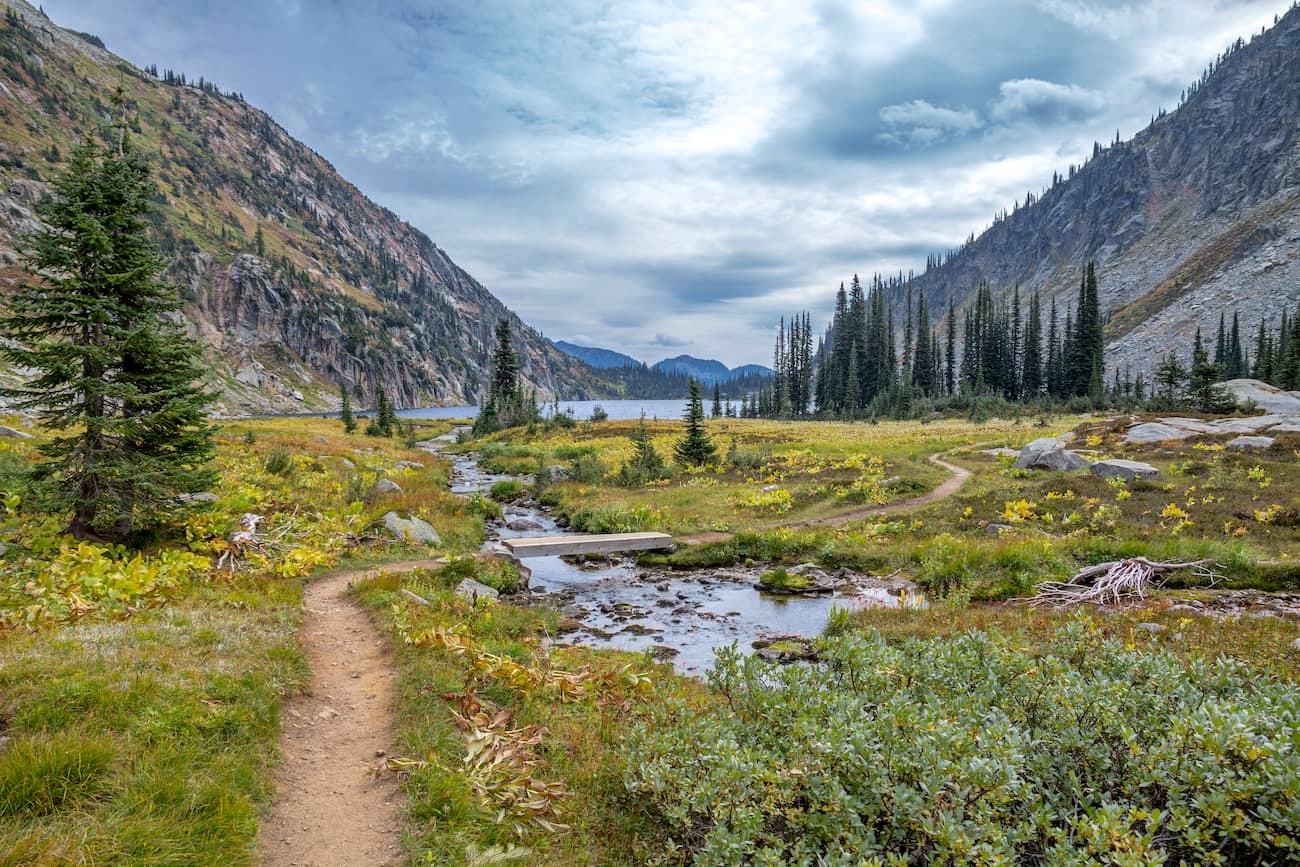
Kokanee Lake is one of the most iconic lakes within the entire park. This out and back hike totals 6.3-miles and has 1,748 feet of elevation gain. Starting at Gibson Lake, ascend the trail until you reach the lake. During the summer months the trail is full of wildflowers. Once at the lake, hikers will also have impeccable views of Kokanee Glacier. A perfect hike for a quick day trip or take advantage of one of the many campsites at Kokanee Lake.
Gibson Lake Trail to Keen Lake, Kaslo Lake, and Garland Lake: This moderately trafficked trail is 11.6 miles roundtrip with 2,414 feet of elevation gain. The trail leads you through Kokanee Glacier Provincial Park past numerous alpine lakes and wildflower fields. Note that some sections of the trail are more remote so wildlife encounters can be quite common.

This loop trail is 3-miles long with 1,200 feet of elevation gain. Once at the top take in the unobstructed views of the valley, river, and forests below. The trail up to the peak is heavily forested but cleared at the top. The trail is used for hiking, mountain biking, and snowshoeing during the winter months.
The nearest town to Kokanee Glacier Provincial Park is Nelson. Located in the Selkirk Mountains, on the West Arm of Kootenay Lake, sits this small city. It is known as “The Queen City” due to the high number of restored buildings during the gold and silver rush days. It was during the 1880’s that the town was formed and railroads passed through the city to connect it with the rest of Canada. The city of Nelson is known for a wide array of restaurants, cafes, and coffee shops, perfect for a post hike meal. Nelson is also known for being near a plethora of outdoor activities including hiking, trail running, mountain biking, skiing, snowshoeing and mountaineering.


