
Scan the QR code and open PeakVisor on your phone
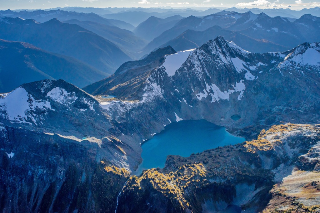
St. Mary’s Alpine Provincial Park is a rugged protected area located in the Purcell Mountains of British Columbia, Canada. The park features rugged peaks, rolling terrain, avalanche paths, alpine lakes and tarns, creeks, waterfalls, and steep valleys. Nowitka Mountain is the tallest and the most prominent of the 4 peaks in the park standing 2,930 m (9,613 ft) tall with 711 m (2,333 ft) of prominence.
Situated south of Purcell Wilderness Conservancy Provincial Park in the Purcell Mountains of southern British Columbia, Canada, St. Mary’s Alpine Provincial Park is a rugged backcountry park that receives few visitors.
The park encompasses over 90 square kilometers (34 square miles) of granite cliffs, alpine lakes, tundra, snowfields, dense forests, and seven creeks. The seven creeks drain the 32 alpine lakes, creating an abundance of cataracts and waterfalls, some of which fall over 150 m (492 ft) tall. The park was created in 1973 and is a fantastic destination for avid backcountry enthusiasts.
The park is accessible via several trails that you can reach from some of the many forest service roads in the Regional District of East Kootenay. Highways 3 and 3A are the primary highways that lead to these forestry service roads.
The remote St. Mary’s Alpine Provincial Park is located in the Purcell Mountains, which is a subrange of the Columbia Mountains. The park is connected to the south side of Purcell Wilderness Conservancy Provincial Park and they share Nowitka Mountain, Mount St. Mary, and Mount Alton. Some of the other nearby parks include:
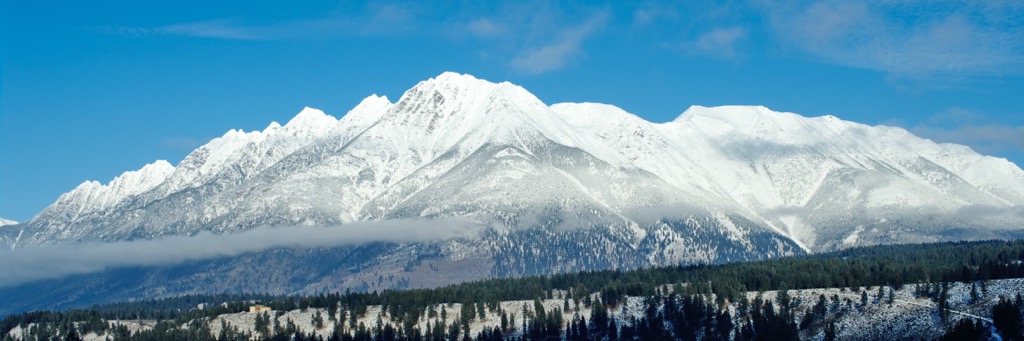
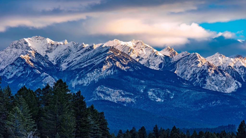
St. Mary’s Provincial Park is in the Purcell Mountains, which is one of the three major subranges of the Columbia Mountains. The Purcells extend westward from the Rocky Mountain Trench to the valley occupied by both Kootenay and Duncan lakes and the Beaver and Duncan rivers.
Most of the rocks in the Purcell Mountains are metamorphic and sedimentary in origin and they date back to the Proterozoic and lower Paleozoic. These metamorphic and sedimentary rocks were also intruded by granitic batholiths over the millennia. Some of the most prominent batholiths of the Purcells are found in Bugaboo Provincial Park, which is near the north end of the range.
The rocks of the Purcell Mountains are much older than the layers of limestone, shale, and sandstone that compose the adjacent Rocky Mountains. Limestone, quartzite, argillaceous quartzite, and argillite are the main sedimentary and metamorphic rocks of the Purcells.
The metamorphic rocks in the range were created as a result of the intense heat that accompanied the intrusions of magma into the region’s underlying layers of rock. These magma intrusions cooled slowly beneath the surface to form the granitic batholiths that we see in the range today. Intense erosion has removed the upper layers of rock in some areas of the Purcells to expose these granitic intrusions.
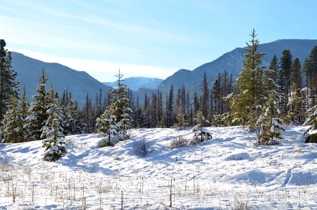
About half of St. Mary’s Alpine Provincial Park is part of the Interior Mountain-heather Alpine zone, while the remainder of the park is subalpine forests which are part of the Engelmann Spruce – Subalpine Fir biogeoclimatic zone of British Columbia.
The rugged alpine tundra typically has a deep winter snowpack which lingers long into the summer months. The ample moisture has created a diverse riparian ecology around the many alpine lakes and creeks.
Dense forests of Engelmann spruce and subalpine fir transition from the heath and shrubs of the alpine. The alpine is inhabited primarily by mountain goats and bighorn sheep while the lower elevations are home to deer, moose, black bear, grizzly bear, wolverine, fisher, and the endangered mountain caribou.
St. Mary’s Alpine Provincial Park is part of the traditional territory of the Ktunaxa First Nation. The park is considered a significant area of traditional use for hunting and gathering.
The Ktunaxa are a fascinating nation to study, as their ancestors possibly started inhabiting their territory at the end of the Pleistocene ice age. While many of the modern First Nations in the interior of British Columbia supplanted previous cultures, it’s possible that the Ktunaxa have continuously occupied the region for the past 11,000 years.
Regarding the Ktunaxa, archeological evidence suggests that about 11,500 years ago, people began migrating into the eastern Kootenay valley as the glaciers melted. The earliest artifacts of human habitation in the region were found in the southern Purcell Mountains, which are located in the southwestern corner of East Kootenay.
One theory regarding the historical habitation of the region is that there has been an uninterrupted habitation and the regional technological advancement appears to support this theory. As a result, unlike most other areas of the province, archeologists believe that the original inhabitants of the region never completely emigrated away from the area and are the ancestors of the modern Ktunaxa First Nation.
While the traditional territory of the Ktunaxa traditionally originally extended to the foothills east of the Rocky Mountains, their territory was reduced by the encroachment of other nations. Their current territory is centralized around the Kootenay and Columbia Rivers of southern British Columbia.
There are no known cultural sites in St. Mary’s Alpine Provincial Park; however, it is part of the traditional area for hunting and gathering. The park is rugged and difficult to access with very few visitors compared to other provincial parks in the region.
The rugged alpine wilderness of St. Mary’s Alpine Provincial Park contains few trails; however there are many attractions for seasoned backcountry adventurers.
The main route into the park is via the trail leading from Dewar Creek FSR which leads to Mortar Lake on the west side of the park. Additional trail access into the park includes a route along the east side of Mount Manson and another trail leading up White Creek on the east side of the park.
Day trips to the park have increased over the past years; however, the rugged and remote nature of the park is best suited to experienced backcountry travelers. Experienced travelers will have the route-finding skills to navigate among the 32 pristine alpine lakes, along the seven creeks that empty the lakes, and to the many stunning cataracts and waterfalls.
There are few visitors to the park and you may find yourself completely isolated while you roam the backcountry. Please ensure that your skill level matches the area before you visit to search out the 150 m (492 ft) tall waterfalls.
The Columbia Mountains and St. Mary’s Alpine Provincial Park are filled with opportunities for hiking, backpacking, mountain biking, kayaking, and so much more. The following communities are great places to rest while in the region.
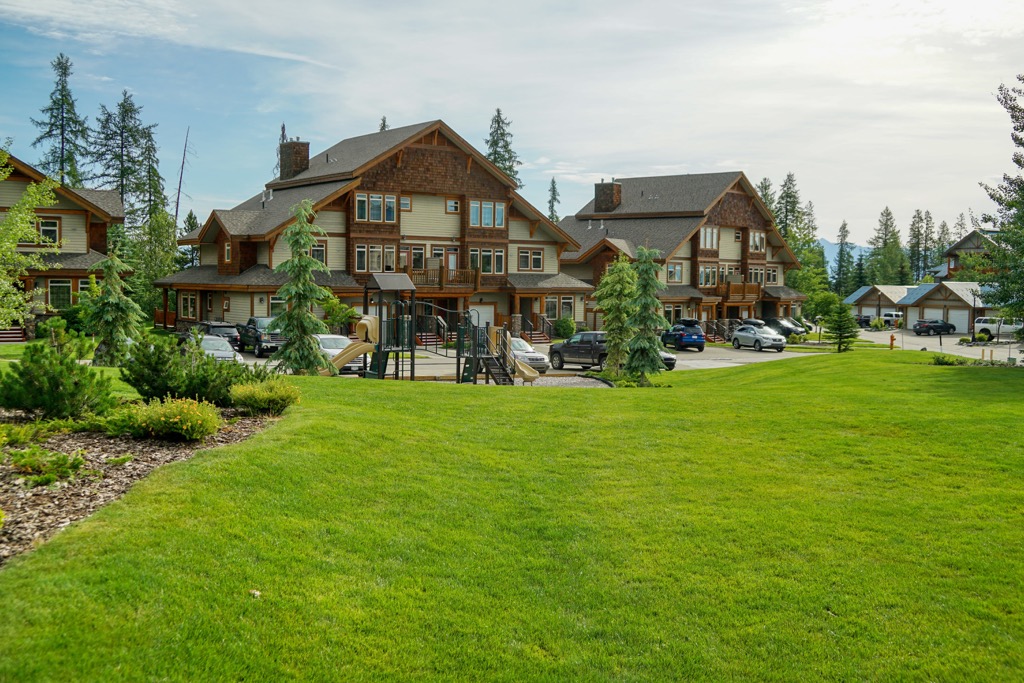
Kimberley is the closest community to St. Mary’s Alpine Provincial Park, and it is situated about 40 km (24 mi) southeast of the park. Kimberley is a popular mountain destination that features incredible winter powder on the nearby slopes, vibrant fall colors, and nearly endless trails for hiking and cycling.
The community is a four-season destination that offers a clear blue sky throughout the year. In fact, Kimberley has been considered the best small town in British Columbia.
Some of the local attractions include their Underground Mining Railway, their Heritage Museum, Cominco Gardens, and Marysville Falls. The mine offers insight into the beginnings of the town as a mining community while the Heritage Museum displays over 10,000 artifacts and 11,000 historical pictures of the community and region.
Cominco Gardens were created in 1927 and command a stunning view of Mark Creek Valley, in addition to the over 45,000 flowers that grow on the 5-hectare property. The gardens were a way to display the effectiveness of a fertilizer created from the by-products of the local mine.
A short hike leads to a viewpoint which overlooks the 30 m (98 ft) tall Marysville Falls. Surrounding the falls is a developed natural area with trails and picnic areas that are available year-round.
Some of the popular trails around Kimberley include routes on Bootleg Mountain, and in the Dipper Lake/ Horsebarn Recreation Site. Other popular hiking areas near Kimberley are St. Mary’s Alpine Provincial Park, Purcell Wilderness Conservancy Provincial Park, Top of the World Provincial Park, and Kianuko Provincial Park.
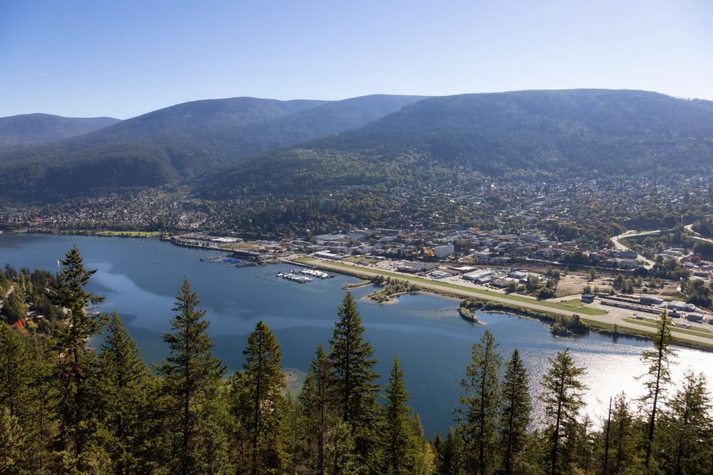
Nelson is one of the three major cities in the Kootenay Boundary Regional District along with Castlegar and Trail. The community of Nelson is situated along the western arm of Kootenay Lake, about 100 km (60 mi) southwest of St. Mary’s Alpine Provincial Park.
The community of Nelson was established during the regional gold and silver rushes of the late nineteenth century. The community quickly grew to be a supplier to the local mines and a regional transportation hub.
Mining activity declined throughout the twentieth century putting a strain on the local economy. To combat declining commodity prices, Nelson pivoted from forestry and mining to focus on arts and tourism.
Of the many tourist attractions in town, the twentieth-century chateau-style civic buildings are the most remarkable. Furthermore, the surrounding wilderness and rugged mountain landscape give inspiration to the many artists that call the town home.
In fact, Nelson is considered to be one of the best communities for the arts in Canada, so it comes as no surprise that there are many art galleries and museums located within the city itself.
Among the local hikes, Pulpit Rock Trail, which leads to a view of the city, and the CBC Tower Trail, which brings you to the summit of Elephant Mountain are among the most popular. Other hiking areas located near Nelson that are worth checking out include Valhalla Provincial Park, West Arm Provincial Park, Kokanee Glacier Provincial Park, and Purcell Wilderness Conservancy Provincial Park.
Cranbrook is a city that’s located about 50 km (30 mi) southeast of St. Mary’s Alpine Provincial Park. Some of the popular local attractions include the Cranbrook History Center and the North Star Rails to Trails path.
The 26 km (16 mi) paved North Star Rails to Trails path follows the old Canadian Pacific Railway right of way between Cranbrook and the nearby community of Kimberley. This path highlights the importance of the railway in Cranbrook’s history and it makes for a great place to walk, run, cycle, or ski during any trip to the region.
Further immersion into the history of the region can be found at the Cranbrook History Center. The Cranbrook History Center showcases passenger rail cars from the early 1900s, as well as natural history specimens and artifacts from the early history of human settlement in the region.
Additional hiking and backpacking opportunities around Cranbrook include Kianuko Provincial Park, Top of the World Provincial Park, Mount Fernie Provincial Park, and Purcell Wilderness Conservancy Provincial Park. While there are many opportunities for day trips, the region is best explored through multi-day backpacking and cycling trips.


