
Scan the QR code and open PeakVisor on your phone
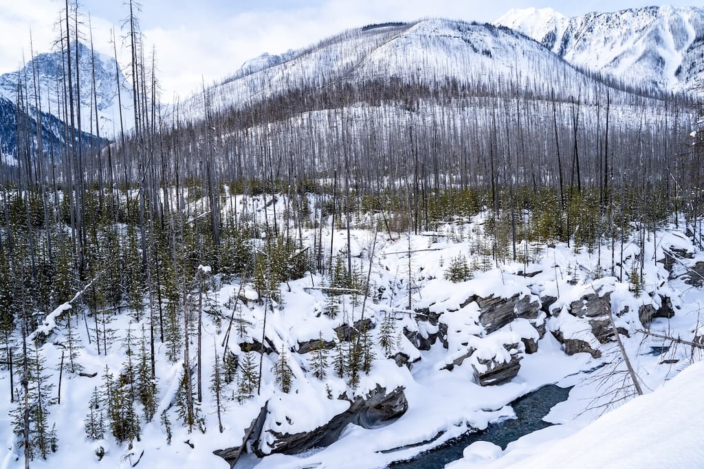
Kinuko Provincial Park is a mountainous protected area located in the western Purcell Mountains of British Columbia, Canada. The park features rugged peaks, rolling terrain, avalanche paths, alpine lakes, plateaus, and steep valleys. Haystack Mountain is the tallest of the 4 named peaks in the park with an elevation of 2,686 m (8,812 ft) above sea level.
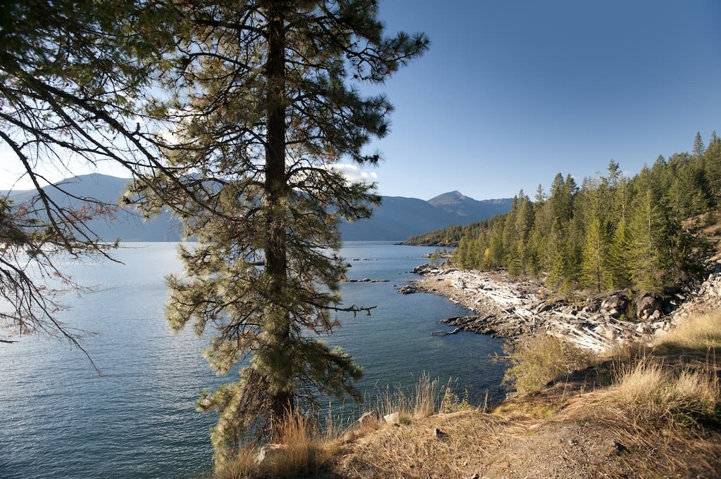
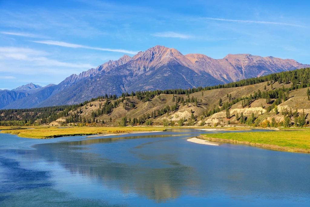
Kianuko Provincial Park is an outdoor recreation area located in the Purcell Mountains of southern British Columbia, Canada that protects the headwaters of Kianuko Creek. The park is located to the east of Kootenay Lake, and it encompasses 11,638 ha (28,758 acres) of beautiful wilderness.
Kianuko Provincial Park is known for its steep valleys, rugged peaks, lofty plateaus, and stunning alpine lakes and meadows. Of the four peaks that are located within the park, Haystack Mountain is the tallest with an elevation of 2,686 m (8,812 ft).
The park is accessible via several trails that you can reach from some of the many forest service roads in the Regional District of Kootenay Boundary. Highways 3 and 3A are the primary highways that lead to these forestry service roads.
The beautiful Kianuko Provincial Park is located in the Purcell Mountains, which is a subrange of the Columbia Mountains. Across Kootenay Lake from the Purcells, you’ll find the Nelson Range of the Selkirk Mountains, which are also subranges of the Columbia Mountains.
Additionally, Kianuko Provincial Park is surrounded by a number of other parks and protected areas. Some of the other parks that are located in the region include:
Kianuko Provincial Park is a protected area located in the Purcell Mountains, which is one of the three major subranges of the Columbia Mountains. The Purcells extend westward from the Rocky Mountain Trench to the valley occupied by both Kootenay and Duncan lakes and the Beaver and Duncan rivers. This valley also separates the Purcells from the Selkirk Mountains.
The Selkirk Mountains are one of the other major subranges of the Columbia Mountains, as are the Monashee Mountains. The Purcell Mountains encompass a roughly triangular area that is about 300 km (190 mi) long and 80 km (50 mi) wide at its longest and widest points.
In the provincial park, most of the rocks are metamorphic and sedimentary in origin and they date back to the Proterozoic and lower Paleozoic. These metamorphic and sedimentary rocks were also intruded by granitic batholiths over the millennia. The rocks of the Purcell Mountains are much older than the layers of limestone, shale, and sandstone that compose the adjacent Rocky Mountains.
Limestone, quartzite, argillaceous quartzite, and argillite are the main sedimentary and metamorphic rocks of the Purcells. The metamorphic rocks in the range were created as a result of the intense heat that accompanied the intrusions of magma into the region’s underlying layers of rock. These magma intrusions cooled slowly beneath the surface to form the granitic batholiths that we see in the range today.
Intense erosion has removed the upper layers of rock in some areas of the Purcells to expose these granitic intrusions. Nowhere are these granitic batholiths more apparent in the region, however, than in nearby Bugaboo Provincial Park, where climbers from around the world come to try their skills against the range’s sharp granite spires.
Kianuko Provincial Park boasts both alpine and subalpine ecosystems. The rugged and rocky peaks in the park are located alongside plateaus, alpine meadows, and tarns, where you can also find some rich riparian communities.
The shrubs and heath of the park’s alpine zone transition to forests of Engelman spruce and subalpine fir. As you move toward the lower elevations in the park, you’ll also find examples of the Interior Cedar-Hemlock forests ecosystem.
Western hemlock, western red cedar, white-Engelmann spruce hybrids, Douglas fir, and lodgepole pine are common trees in the Interior Cedar-Hemlock forests of Kianuko Provincial Park.
The park’s undisturbed watershed protects the habitats of many different species. Some of the many animals that benefit from the old-growth forests of the park are grizzly bears, moose, and mountain caribou.
Kianuko Provincial Park is part of the traditional territory of the Ktunaxa First Nation. The park is considered a significant area of traditional use and it has high spiritual value to the Ktunaxa. Historically, the park was used by the Ktunaxa for hunting and gathering purposes. It also hosted cultural and spiritual ceremonies for generations.
It’s also worth noting that members of the contemporary Ktunaxa First Nation may be the descendants of the original inhabitants of the Kootenay and Columbia valleys. While many of the modern First Nations in the interior of British Columbia supplanted previous cultures, it’s possible that the Ktunaxa have continuously occupied the region for the past 11,000 years.
Archeological evidence suggests that about 11,500 years ago, people began migrating into the eastern Kootenay valley as the glaciers melted. The earliest artifacts of human habitation in the region were found in the southern Purcell Mountains, which are located in the southwestern corner of East Kootenay. These artifacts are part of what is now called the Goatfell Complex.
Some archeologists believe that all of the artifacts that have been recovered from the region to date are from the same lineage of technological advancement. As a result, these archeologists believe that the original inhabitants of the region never completely emigrated away from the area.
The traditional territory of the Ktunaxa traditionally extended to the foothills east of the Rocky Mountains where they would hunt buffalo on the prairies. However, a second origin theory of the Ktunaxa proposes that, due to their cultural similarities with many plains First Nations, the Ktunaxa actually immigrated to the interior from the prairies.
According to this theory, as the Blackfoot Confederacy moved west, they came to dominate the prairies and the foothills of the Rocky Mountains. The Blackfoot were therefore responsible for displacing many First Nations as they rose to dominate the prairie. However, despite the reduction of the Ktunaxa’s territory on the prairie, they still made annual treks from the Kootenays across the Rockies to hunt buffalo on the plains.
There is currently no inventory of cultural sites in Kianuko Provincial Park; however, there are many significant cultural sites located near the park and there may be as-of-yet uncovered artifacts within the park itself. Some of the artifacts that have been uncovered near the park include petroglyphs, ancient quarries, workshops, and ancient trails.
The lifestyle of the Ktunaxa, which included seasonal hunting and gathering, remained relatively unchanged for millennia until European fur traders arrived in the area at the beginning of the nineteenth century. Alexander Mackenzie was likely the first non-Indigenous person to meet the Ktunaxa, perhaps during his expedition to the region in the late eighteenth century.
After John Palliser mapped the area in the mid-nineteenth century, European settlers began to arrive in the region that is now the interior of British Columbia. Most of the towns in the region were founded to house the workers of the local mines and mills.
Nowadays, most of the communities around Kianuko Provincial Park rely heavily on their tourism industries. There are many resorts in the region around the park that cater primarily to skiers and other outdoor enthusiasts.
The rugged wilderness of Kianuko Provincial Park contains several incredible trails for visitors to enjoy. Here are some of the best hikes in Kianuko Provincial Park to check out during your next trip to the region.
Haystack Mountain is the tallest peak in the park and in the southern Purcell Mountains. From the summit, you can see the town of Creston and even the Rocky Mountains. Plus, even though the hike to Haystack Mountain is a relatively popular trek for the area, there’s still a good chance that you’ll have the trail to yourself during your outing.
To get to the trailhead, you’ll need to drive to the end of the Sanca Creek Forestry Service Road, which is located off of Highway 3A. The trail follows Sanca Creek into the park and continues to the summit of Haystack Mountain.
This is a challenging hike, and it can take upward of 6 hours to complete the 11 km (6.6 mi) trail that leads to and from the summit. While the first half of the trail is relatively easy to follow, the second half winds through wetlands and forests, so it can be difficult to find at times. Therefore, any hikers on this trail should be confident in their backcountry navigation skills.
The Kianuko Creek Trail follows an old Forestry Service Road through the Kianuko Valley to the park. Once in the park, the terrain and wilderness are open for adventure.
Backcountry camping is permitted in the park and you can create your own adventures in the region using both maintained and unmaintained trails. The Kianuko Creek Trail is a popular hiking option for people who want to trek into the park’s backcountry on one of its official routes.
To reach the Kianuko Creek Trail, visitors will have to drive Highway 3 to the Skelly Creek FSR and follow it to its junction with the Kianuko Creek FSR. The Kianuko Creek FSR continues toward the park; however, keep in mind that no motorized vehicles are permitted on the road within the park boundaries.
The Haystack Alpine Trail traverses the north end of the park along parts of the Sanca Creek and Meachen Creek trails. This hike starts on the Upper Meachen Creek FSR, which eventually turns into a hiking trail. After several kilometers of hiking on this trail, you’ll arrive at a junction and a campsite.
From the junction, hikers can choose to explore Haystack Lake, which is located under the north face of Haystack Mountain. Alternatively, you can continue toward Sanca Pass. If you follow the Sanca Pass Trail, you’ll eventually arrive at the ruins of a log hotel from the 1800s. Afterward, you’ll walk around Carrot Lake and finally down the banks of the Kianuko River and Sanca Creek to your trailhead on the western side of the park.
Kianuko Provincial Park and the surrounding Columbia Mountains are both filled with opportunities for hiking, backpacking, mountain biking, kayaking, and so much more. The following communities are great places to rest before or after hiking and climbing in Kianuko Provincial Park.
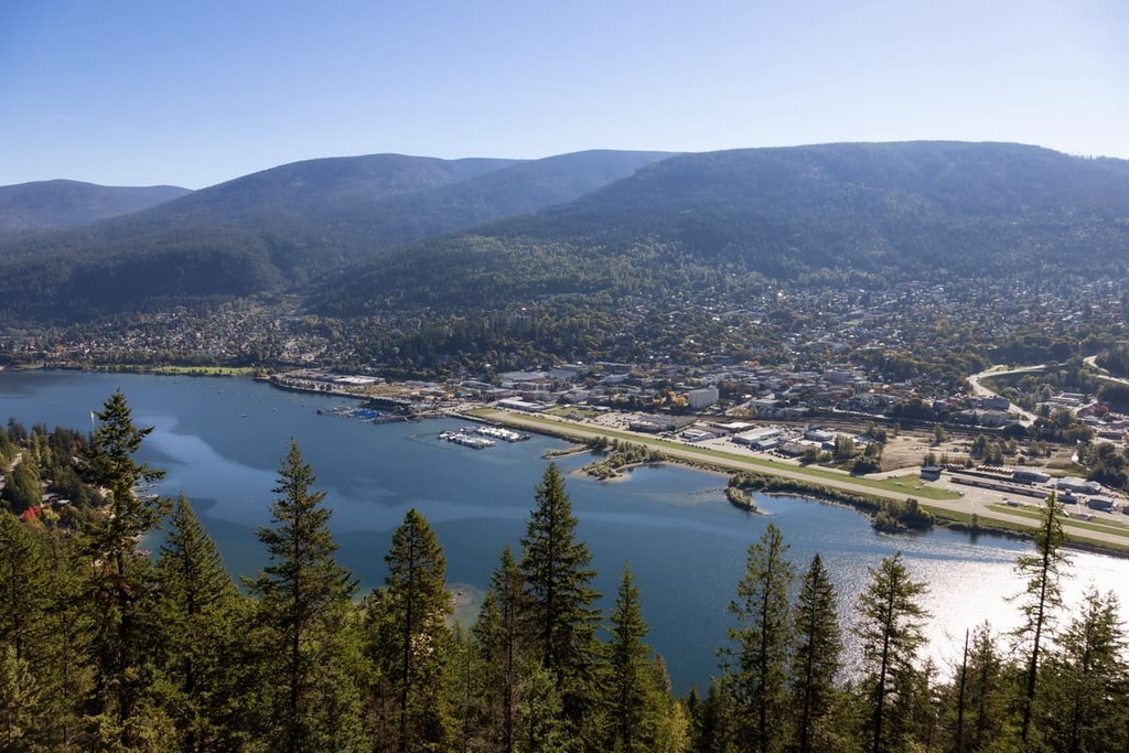
Nelson is one of the three major cities in the Kootenay Boundary Regional District along with Castlegar and Trail. The community of Nelson is situated along the western arm of Kootenay Lake, about 50 km (24 mi) to the west of Kianuko Provincial Park.
Named in 1888 after Hugh Nelson, the Lieutenant-Governor of British Columbia at the time, the community was established during the regional gold and silver rushes of the late nineteenth century. The community quickly grew to be a supplier to the local mines and a regional transportation hub.
With the decline in mining activity in the region during the twentieth century, Nelson pivoted from its forestry and mining industry to become a city focused on arts and tourism. The fact that the city is home to charming twentieth-century chateau-style civic buildings made of granite (many of which were restored in the 1980s) has helped it become a popular tourist destination.
The wilderness and rugged mountain landscape surrounding Nelson give inspiration to the many artists that call the town home. In fact, Nelson is considered to be one of the best communities for the arts in Canada, so it comes as no surprise that there are many art galleries and museums located within the city itself.
Two popular hikes that you can enjoy in Nelson are the Pulpit Rock Trail, which leads to a view of the city, and the CBC Tower Trail, which brings you to the summit of Elephant Mountain. Other hiking areas located near Nelson that are worth checking out include Valhalla Provincial Park, West Arm Provincial Park, Kokanee Glacier Provincial Park, and Purcell Wilderness Conservancy Provincial Park.
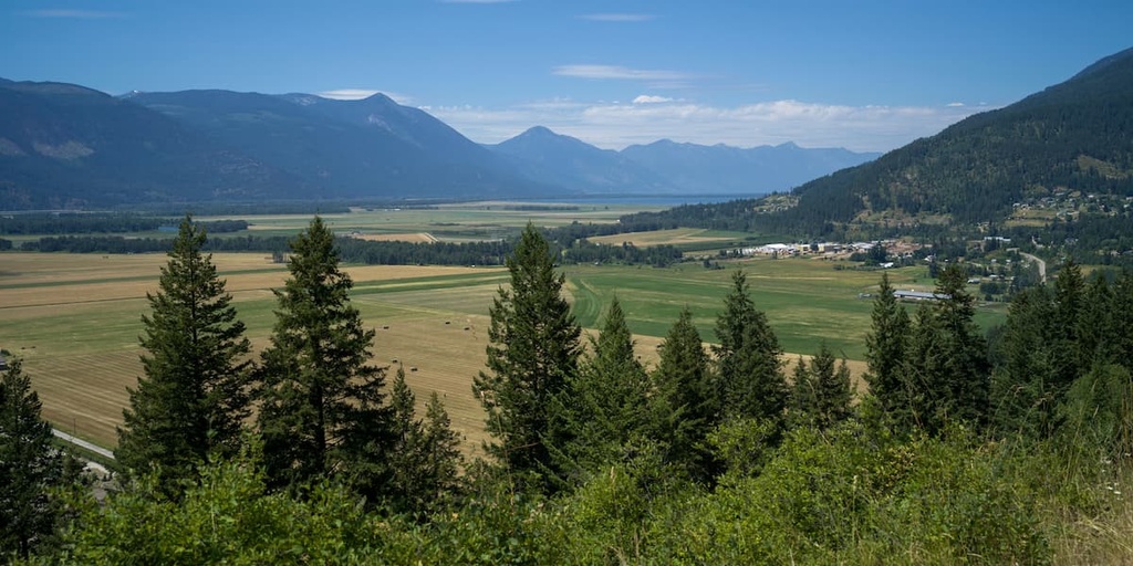
The town of Creston is located about 50 km (30 mi) to the south of Kianuko Provincial Park at the southern end of Kootenay Lake. Although the town itself was incorporated during the 1920s, it has been home to the Ktunaxa since time immemorial.
Creston’s official founding can be traced back to the 1880s when William A. Baillie-Grohman was in the area on a hunting trip with future US President Teddy Roosevelt. Baillie-Grohman noticed that the area had a high potential for a successful agricultural industry if it could be protected from regular flooding.
Shortly after Baillie-Grohman’s visit, several settlers purchased the rights to farm the land (which was and continues to be unceded Ktunaxa territory) and began creating homesteads. In due time, the Canadian Pacific Railway took interest in the expanding settlement and Creston became tied to the rest of Canada via the railway.
Nowadays, the quaint town of Creston provides ample opportunity for tourist activities in the incredible Kootenay wilderness. From wine tours and yoga retreats to backcountry excursions, the sheer number of activities on offer in Creston are sure to appeal to any visitor.
There are plenty of opportunities for hiking in and around Creston, too. Some of the popular wilderness areas that are located near the town include Kianuko Provincial Park, Lockhart Creek Provincial Park, and both the Idaho Panhandle National Forests and Kootenai National Forest in the US states of Idaho and Montana.
Cranbrook is a city that’s located about 40 km (24 mi) to the east of Kianuko Provincial Park. The shortest access route to the park from Cranbrook is via the Meachen Creek Trail, which is found at the end of the Meachen Creek FSR.
Whether you’re staying the night in Cranbrook or just passing through, some of the many local attractions to look for during your visit include the Cranbrook History Center and the North Star Rails to Trails path.
The Cranbrook History Center showcases passenger rail cars from the early 1900s, as well as natural history specimens and artifacts from the early history of human settlement in the region.
Meanwhile, the 26 km (16 mi) paved North Star Rails to Trails path follows the old Canadian Pacific Railway right of way between Cranbrook and the nearby community of Kimberley. This path highlights the importance of the railway in Cranbrook’s history and it makes for a great place to walk, run, cycle, or even ski during any trip to the region.
If you’re looking for additional hiking opportunities during a trip to Cranbrook, Kianuko Provincial Park is a sure bet. Alternatively, some of the other wilderness areas that are located near Cranbrook include Top of the World Provincial Park, Mount Fernie Provincial Park, Purcell Wilderness Conservancy Provincial Park, and St. Mary’s Alpine Provincial Park.


