Scan the QR code and open PeakVisor on your phone
The Dupont State Recreational Forest (often simply called Dupont Forest) is located in the western portion of the US state of North Carolina. The forest features rolling forested ridgelines and a plethora of waterfalls. The tallest peak in the region is Stone Mountain at 3,619 feet (1103 m) tall while the most prominent is Hickory Mountain with 233 feet (71 m) of prominence.
The Dupont Forest is situated in western North Carolina near the state’s border with South Carolina. Within the forested landscape lie dozens of miles of trails and a plethora of stunning waterfalls.
The forest spans 10,300 acres (4,168 ha) across Henderson and Transylvania counties. Peaks in the region are part of the Blue Ridge Mountains, which mark a rugged subrange of the larger Appalachian Mountains which extend across the eastern United States.
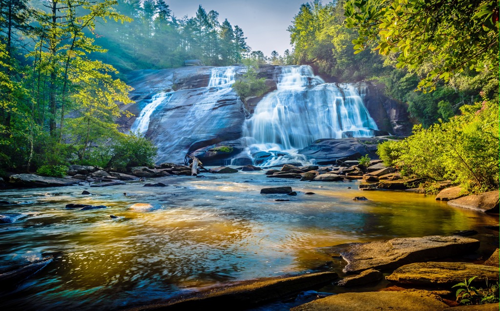
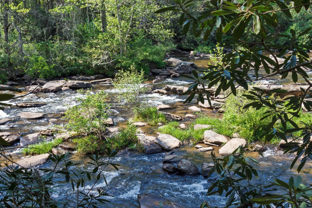
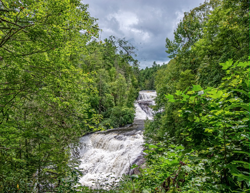
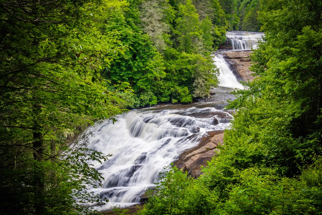
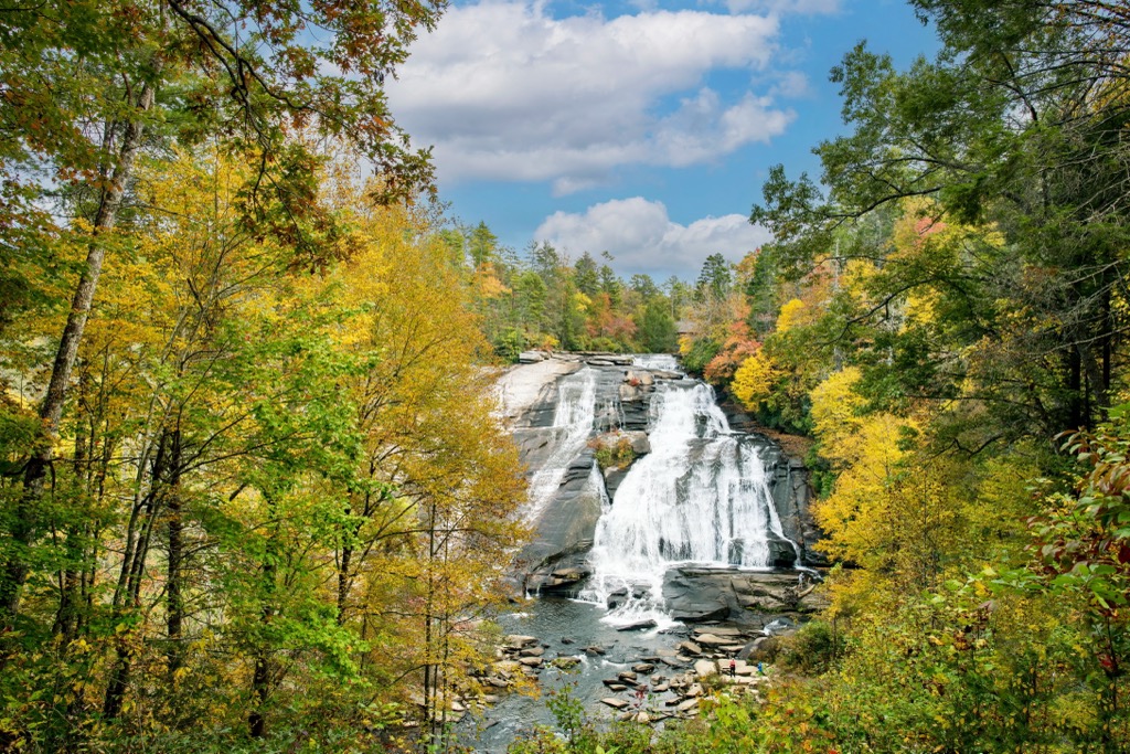
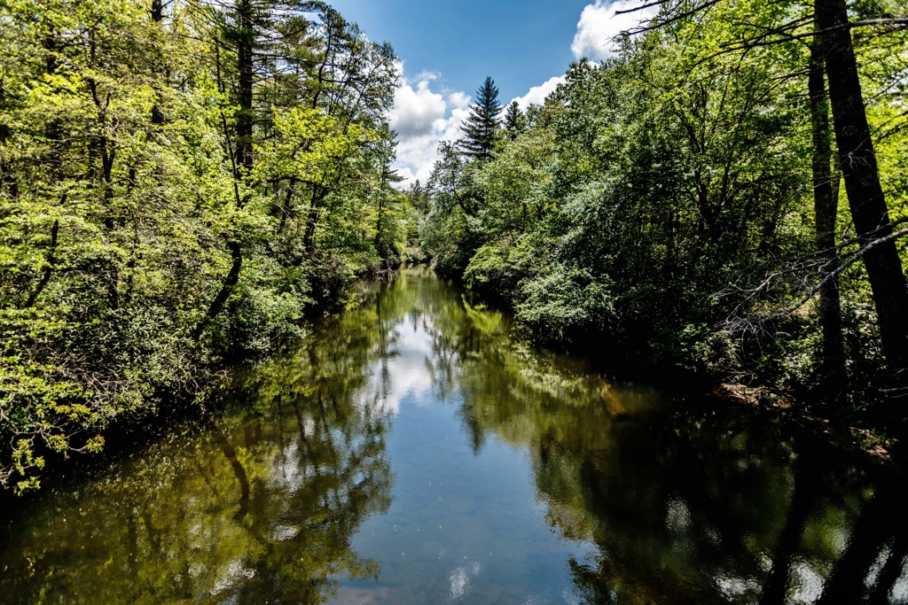
Various bodies of water run through the protected forest. Some of the most prominent waterways include the Little River, Green River, Grassy Creek, Briery Fork Creek, and Reasonver Creek.
Near the center of the forest, Reasonover Creek opens up to form Lake Julia, the largest lake within the protected region. Other lakes in the state forest include Lake Dense, Dupont Lake, Reasonover Lake, and Fawn Lake. This series of rivers, creeks, and lakes mark one of the defining features of the forest and the surrounding region.
Additionally, the Dupont State Recreational Forest is located near numerous other areas for outdoor recreation. South of the forest, within the state of South Carolina, lies Watson-Cooper Heritage Preserve and Jocassee Gorges Wildlife Management Area. Headwaters State Forest is to the southwest while sections of Pisgah National Forest and Nantahala National Forest extend to the northwest.
The peaks and ridgelines in Dupont Forest are part of the Blue Ridge Mountains which extend from the US state of Georgia northward to Maryland and Pennsylvania.
The Blue Ridge Mountains mark a subrange of the greater Appalachian Mountains which span along the east coast of the US into the Canadian province of Newfoundland and Labrador. Peaks in the surrounding region are part of the Blue Ridge Mountain geologic province.
These mountains contain both metamorphic and igneous rocks. Peaks found within Dupont Forest share a close geological history with the rest of the Blue Ridge Mountains. Rocks found throughout western North Carolina date back to the Precambrian and Palezoic eras.
This range began forming between 1 billion to 250 million years ago during both the Grenville and Alleghnian orogenies. This extensive geological history makes the Blue Ridge Mountains much older than other major ranges in the world such as the Alps and Himalayas.
These peaks once laid along the seafloor and were slowly thrust upwards over the course of millions of years. Tectonic shifting and folding formed the range into peaks much higher than those than they are today. Over the course of millions of years, the range was heavily eroded, leaving behind the distinct ridges and valleys visible today.
Major peaks within Dupont Forest are Stone Mountain, Hickory Mountain, Cedar Rock, Grassy Mountain, and Mine Mountain.
The ecology of Dupont Forest is similar to that found in nearby Pisgah National Forest and Nantahala National Forest. The surrounding network of protected land allows for a diverse array of both flora and fauna to thrive.
A variety of wildflowers are able to thrive in the forest with spring and summer marking the best time to spot them. Some common species include flame azalea, yellow fringe orchids, turk’s cap lilies, and yellow lady’s slippers.
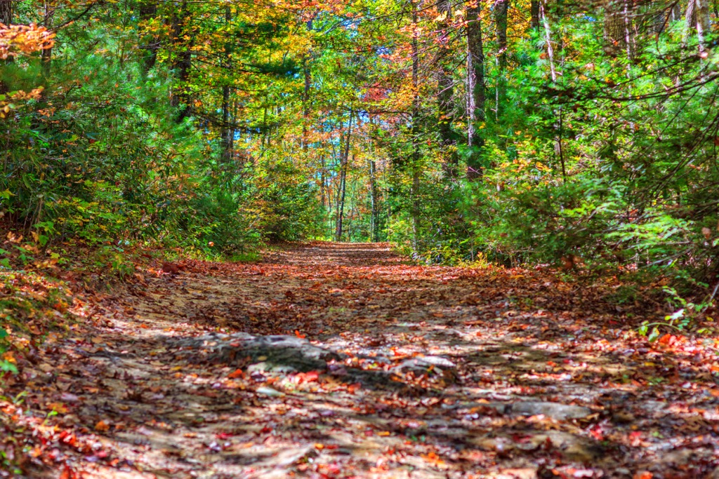
The rolling hillsides are primarily filled with deciduous trees, making the region a popular spot to witness the changing colors during the autumn months. Common trees in the region include yellow poplar, black gum, red maple, sourwood, oaks, and hickories.
Some of the most common mammals in the forest are white-tailed deer, coyotes, beavers, and raccoons. Bobcats and black bears inhabit the surrounding region though it is unlikely that hikers will spot one.
The plethora of waterways in the region are populated by rainbow, brook, and brown trout. Wood frogs and salamanders are commonly found near the rivers and creeks within the forest.
The land in and surrounding Dupont Forest has been inhabited by humans for thousands of years. This region of terrain marks part of the ancestral homelands of the Cherokee people. The fertile lands, coupled with the numerous water sources, helped make the Blue Ridge Mountains an ideal place for these Indigenous peoples.
Artifacts from the Paleo-Indian culture, dating back 8,000 years, have been found throughout the southeastern US, showcasing the long and rich history of the Indigenous peoples of the region. Traditional territory and ancestral homelands of the Cherokee Nation, and the Eastern Band of Cherokee Indians, spans across present-day North Carolina, Tennessee, and Georgia.
In 1540, a Spanish expedition led by Hernando de Soto, marked the first recorded contact between the Europeans and the Indigenous peoples in the area. Many of the first Europeans to inhabit the region were Irish, English, and Scottish immigrants who formed treaties and trade deals with the surrounding tribes.
The various bands of Cherokee joined forces and formed a unified government during the 1700s. In the early 1800s, gold was discovered in present-day Georgia, leading to a drastic increase of population throughout the area.
This increased population led to numerous disputes between the people of European descent and the Cherokee Nation. The settlers continued to disregard the Indigenous peoples' claim to the region, repeatedly harassing, attacking, displacing, and killing tribal members.
The discovery of gold ultimately led to the forced removal and massacre of the Cherokee people. During this time the US government also attempted to trick the Cherokee Nation into signing the Treaty of New Echota. This treaty would force the Cherokee people to sign over all of their land to the US.
Though the treaty was never signed, the government passed the Indian Removal Act of 1830, which led to the removal of Indigenous peoples throughout the eastern US. Tribes were forced onto reservations west of the Mississippi River, a treacherous journey that would later be known as the Trail of Tears. It is estimated that over a quarter of the people who began this journey died en route.
The Dupont Forest was acquired in three major phases between 1995 and 2000. The forest is named after the Dupont company who owned the land before it became a protected forest. In recent decades the forest has grown in popularity after being a major filming location for “The Hunger Games” movie.
The Dupont State Recreational Forest is home to over 80 miles (129 km) of trails for hiking, mountain biking, and backpacking. Here are a few of the most popular trails in the region:
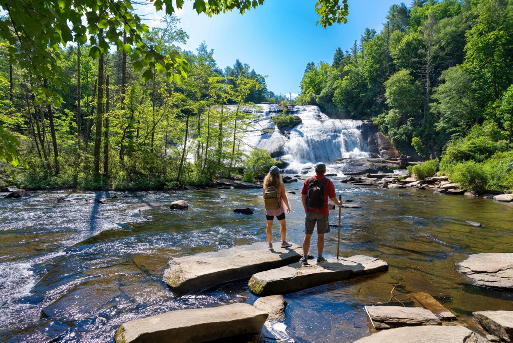
Triple Falls Trail showcases some of the most stunning waterfalls within the state forest. The route begins along the banks of the Little River before climbing steadily through the forested terrain. The trail then opens up to views of Triple Falls, a series of waterfalls situated along the Little River.
Hikers can turn around here or continue upstream to the High Falls Overlook. This loop trail is 2.9 miles (4.7 km) long and features 439 feet (134 m) of total elevation gain. The trail can be completed throughout the year.
The route to Bridal Veil Falls begins along the southern edge of the state forest. The trial begins by slowly dropping in elevation while winding through the deciduous forest. After crossing over a small creek, the trail reaches Bridal Veil Falls situated along the Little River.
The falls features a wide gently sloping rock face as the water slowly cascades down. The route passes along the shores of Fawn Lake on its way back to the trailhead. This loop is 4.6 miles (7.4 km) long and features 587 feet (179 m) of elevation gain.
This loop trail is located in the southwestern section of the forest, beginning on Cascade Lake Road. The loop trail begins by climbing through the forest up to the summit of Cedar Rock, the second most prominent peak in the forest.
From the top of Cedar Rock, hikers have sweeping views of the surrounding forested ridgelines and valleys. The trail then descends and follows along the Little River before looping back to the trailhead. This route is 3.6 miles (5.8 km) long and features 482 feet (147 m) of elevation gain.
Looking for a place to stay near the Dupont State Recreational Forest? Here are some of the best cities and villages to check out in the region:
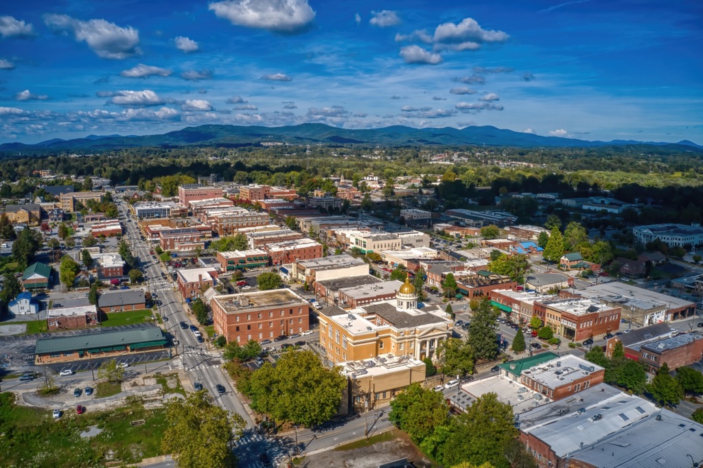
The city of Hendersonville lies northeast of the state forest, marking the closest city to the protected region. Home to roughly 15,000 residents, Hendersonville is surrounded by the stunning Blue Ridge Mountains.
Compared to the nearby bustling Asheville, Hendersonville offers a quieter experience for those visiting the region. Along with being surrounded by a plethora of hiking, running, and mountain biking trails, the city also features numerous museums, historical sites, and a thriving food scene.
Hendersonville is home to the Apple Valley Model Railroad Museum, Mineral and Lapidary Museum, Henderson County Heritage Museum, and the Western North Carolina Air Museum. The downtown streets are home breweries and restaurants which feature local wines and farm to table menus.
The city of Asheville lies less than an hours’ drive north of the state forest. Situated at the confluence of the French Board and Swannanoa rivers, the city is home to 91,000 residents. As the most populous city in western North Carolina, the city has blossomed into the cultural and economic hub of the region.
The Blue Ridge Mountains surround the city, helping establish Asheville as a center for outdoor recreation. While the surrounding trails are used for hiking and mountain biking, the various waterways are popular spots for paddle boarding and whitewater rafting.
Asheville is home to numerous craft breweries, boasting the most breweries per capita for any US city. Popular sites in the area include the River Arts District and the nearby Biltmore Estate.