Scan the QR code and open PeakVisor on your phone
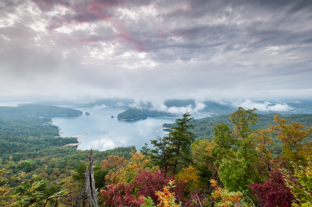
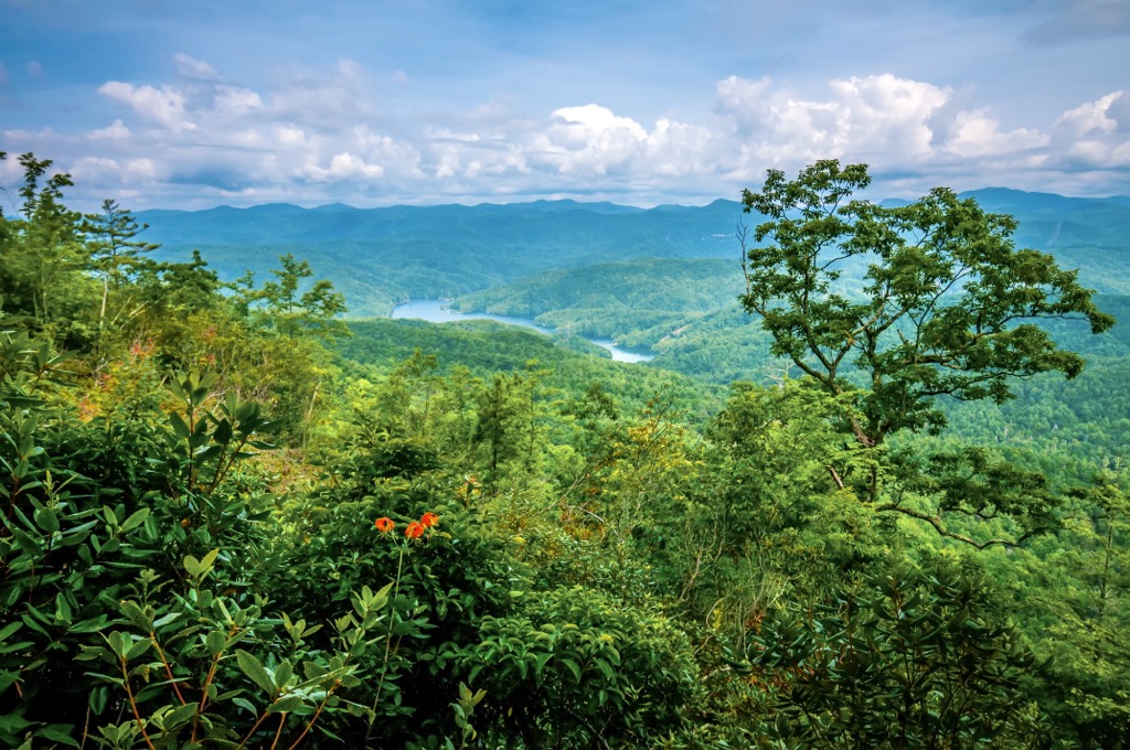
The Jocassee Gorges Wildlife Management Area (WMA) is located in the northern part of the US state of South Carolina. The mountains in the area are part of the Blue Ridge Mountains of the Appalachian Range. Within the WMA, there are 32 named mountains, including the tallest point in the state—Sassafras Mountain (3,566 ft/1,087 m).
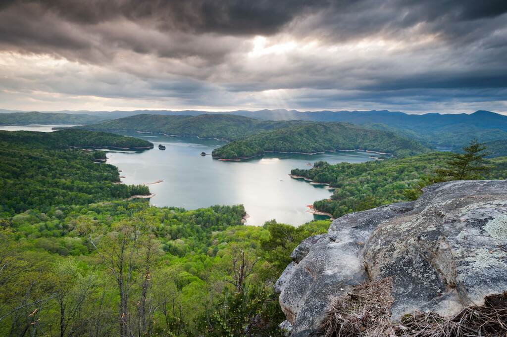
Covering 43,500 acres (17,604 hectares) of terrain, the Jocassee Gorges Wildlife Management Area is a conservation area located in Pickens County in northern South Carolina.
The tallest peak in the state, Sassafras Mountain, is found within the WMA and is part of the Blue Ridge Mountains. The Blue Ridge Mountains belong to the Appalachians, a mountain system that extends along much of the eastern United States.
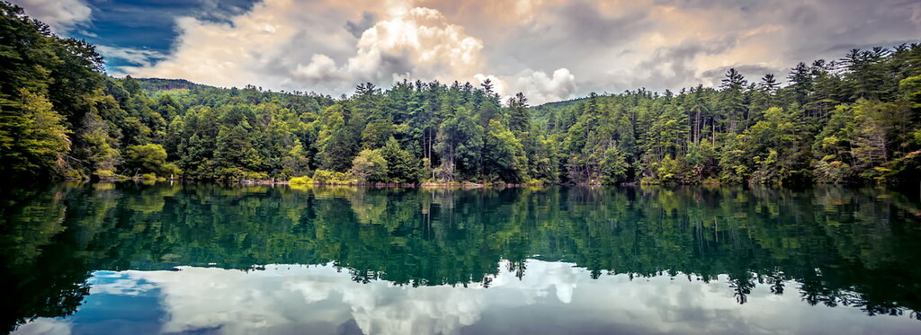
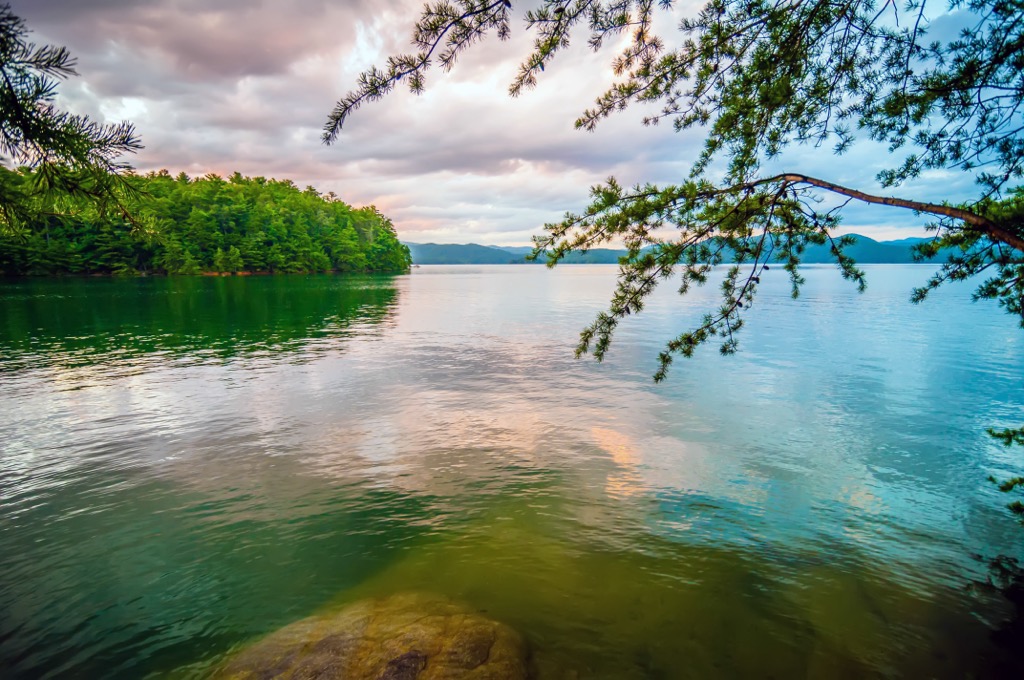
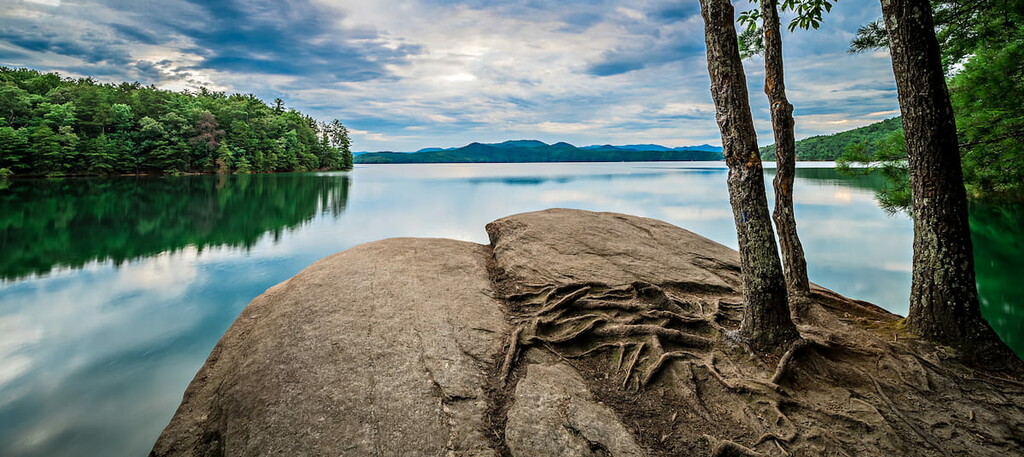
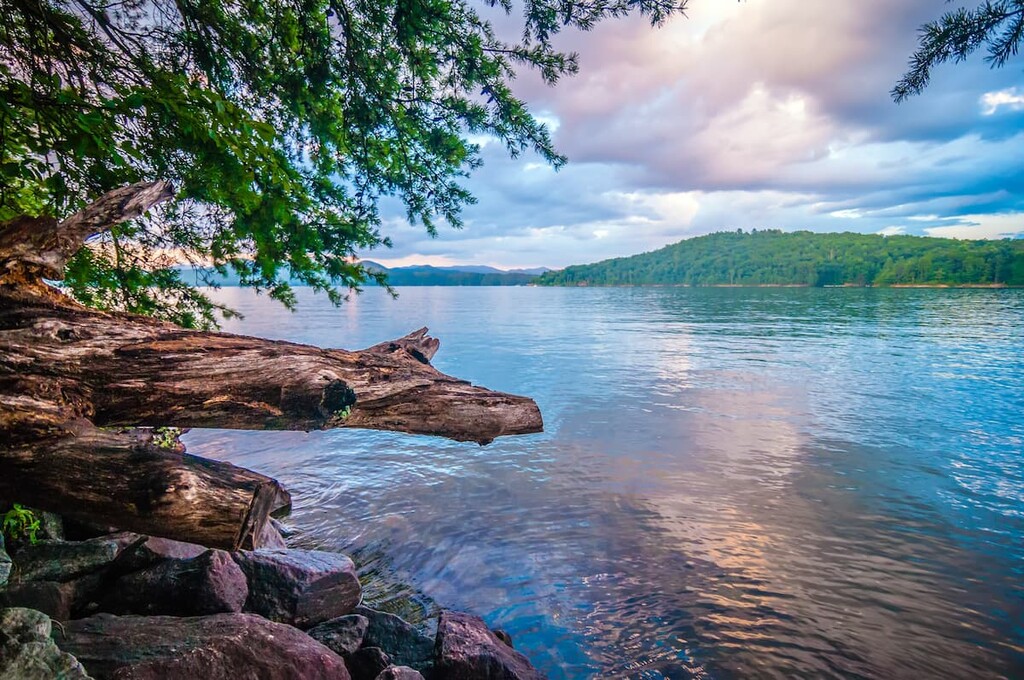
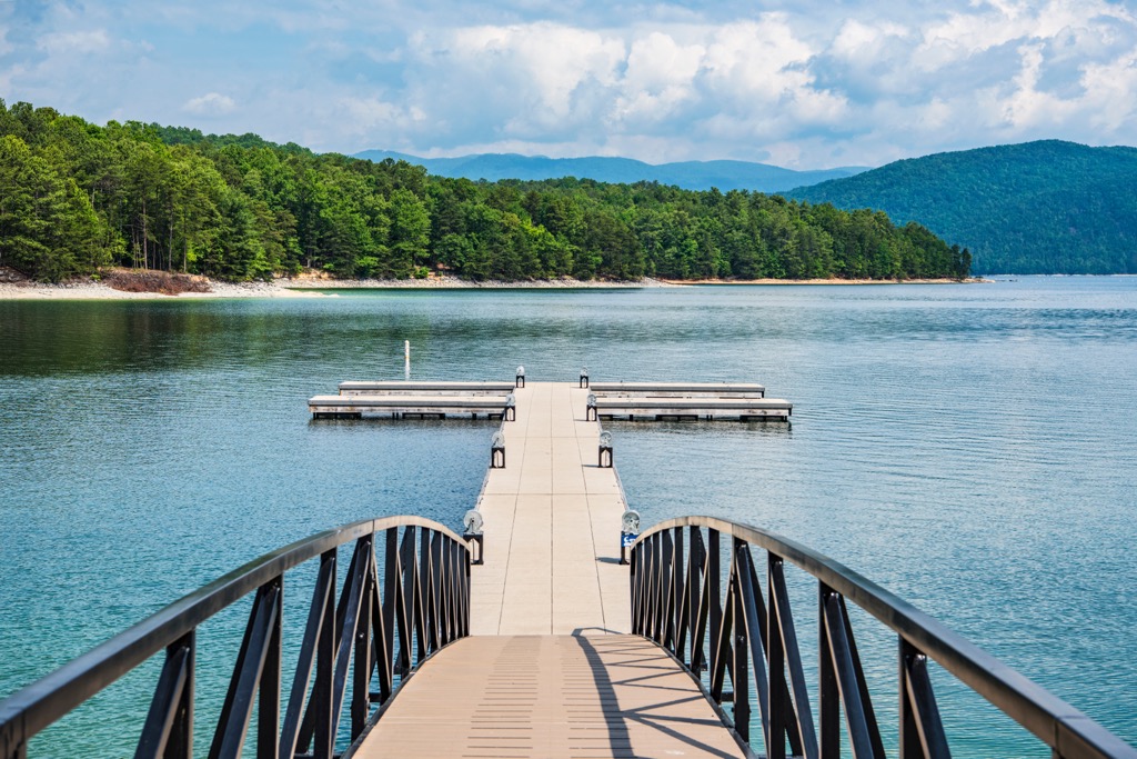
Multiple streams and rivers run through the gorges and forests of the WMA. Some of the most popular waterways for fishing in the WMA are Eastatoe River, Laurel Fork Creek, Corbin Creek, Howard Creek, Whitewater River, and Thompson River. The forest abuts Lake Jocassee, which is another popular destination for fishing and water recreation.
The Jocassee Gorges WMA neighbors Table Rock State Park, Devils Fork State Park, and the Mountain Bridge WMA. In South Carolina, wildlife management areas are managed by the state in order to preserve habitat and wildlife populations while simultaneously creating opportunities for hunting and outdoor recreation.
Plate tectonics played a large role in shaping the mountainous region that we now see in the Jocassee Gorges WMA. Sassafras Mountain and the Blue Ridge Escarpment lie within the inner Piedmont belt. It is believed that this continental fragment, which is now a highly eroded thrust sheet, was attached to the North American plate during the Taconic orogeny.
The landscape in what is now the WMA continued to morph during the Acadian orogeny and the Alleghanian orogeny. During these events, pressure and heat turned sedimentary and igneous rocks into the schists, gneiss, and metagranites that are commonly seen in the mountains today. Faulting during the Mesozoic period and uplifting during the Oligocene to the Miocene created the area’s many gorges and waterfalls.
The Jocassee Gorges WMA receives more than 75 in (190 cm) of rain annually. This high level of rainfall and the region’s abundance of rivers and creeks support a vast array of floral diversity, including some species that are found in no other region of the US. Wildflowers in the WMA peak during the spring with trilliums, orchids, and Oconee bells, to name just a few, bursting into bloom.
Although logging removed much of the old-growth forest in the WMA about a century ago, a few old-growth patches of hemlock, white pine, and yellow poplar trees remain in the region. During the fall, yellow poplar, sourwood, black gum, red maple, hickories, and oaks put on a vibrant display of colors. Rhododendrons, ferns, and mosses grow abundantly along the forest floor, too.
Many mammals call the forest home, most commonly white-tailed deer, bobcats, raccoons, beavers, skunks, and coyotes. Although it is not likely to see one, the area also houses one of the southeast’s most thriving black bear populations.
Rainbow trout, brown trout, and smallmouth bass all live in Lake Jocassee. Brook trout also live in the headwaters of several streams in the WMA. The forest is also home to an abundance of salamander species and is a breeding site for wood frogs.
As far as birdlife goes, the Jocassee Gorges WMA boasts a wide range of species, many of which find their niche in the varying habitats and elevations. The Blue Ridge Escarpment, where the mountains and foothills meet, supports an especially diverse array of birds. Ovenbirds, summer tanagers, solitary vireos, pine warblers, black and white warblers, worm-eating warblers, and Eastern towhees all frequent the drier slopes and ridges of the WMA.
Black-throated green warblers, scarlet tanagers, hooded warblers, yellow-throated vireos, Northern parula warblers, and American redstarts prefer to hang out in the region’s shaded and watery coves. Juncos winter in the area and bald eagles, common loons, wild turkeys, and blue herons are residents here, too.
Pickens County is the traditional territory of the Cherokee. The Cherokee historically established villages in the region due to its fertile lands that could support an important staple crop—corn. In addition to agriculture, the Cherokee historically hunted and traded throughout the region. The numerous waterways in the region also facilitated extensive trade routes between tribes throughout the Appalachians.
European traders and settlers began arriving in the region during the late seventeenth century. The Cherokee and British formed an alliance during the period of early contact. When competing French and Spanish powers moved into the region by the mid-1700s, the government of South Carolina erected a series of forts, including Fort Prince George, to protect their Indigenous allies from being swayed or harassed by foreign forces and rival tribes.
During the Revolutionary War, most Cherokees sided with the British. As a result of rising tensions and colonial-driven assaults on the tribe, the Cherokee were forced to cede their lands. Most Cherokee lands in South Carolina were ceded in 1777 and the last piece of Cherokee land in South Carolina was given up in 1816.
The arrival of the railway system during the 1800s ushered in a new era of development, settlements, and industry in the region. Cotton mills and manufacturing quickly became a key source of income in the area, which was a major slave-holding region prior to the Civil War.
In 1916, North Carolina’s Toxaway Dam failed, flooding much of the region located immediately downstream. This flooding destroyed the topsoil around much of what is now the Jocassee Gorges WMA, limiting its suitability for agriculture.
Over the years, the main industries in the region shifted again toward logging. Many of the region’s trees were cut to support the timber industry and these logging companies purchased large tracts of land in what is now the Jocassee Gorges.
By 1963, the Duke Power Company purchased a large tract of land in the region and began the development of two large lakes: Lake Keowee and Lake Jocassee. In the decades that followed, some of the region’s largest timber companies started to take a more sustainability-focused approach to their logging to ensure that reforestation efforts would meet future timber needs.
In 1964, the predecessor to the South Carolina Department of Natural Resources (SCDNR) entered into a formal agreement with the Duke Power Company and other major landowners in the region. This agreement included the lands in what’s called the Jocassee Gorges as part of a new WMA program. As a result, the area in the WMA was formally open to the public for outdoor recreation and wildlife management.
Today the Jocassee Gorges WMA is used for hunting, fishing, bird-watching, hiking, and camping. Do note, however, that hunters typically need a hunting license and WMA permit to hunt on these public lands. Anglers may also need to acquire a license or permit for fishing in the WMA.
Check with the SCDNR for the most up-to-date information on permit requirements for recreation in the Jocassee Gorges WMA before your next trip to the region.
The Jocassee Gorges Wildlife Management Area is home to a collection of hiking trails to suit a range of outdoor adventure styles. Within the WMA, you can also find South Carolina’s highest point, so it’s a popular destination for peak baggers. Here’s a look at some of the most popular hikes in the WMA.
The 5.1 mi (8.2 km) out-and-back trail from Chimney Top Gap to Sassafras Mountain gains 1,300 ft (396 m) in elevation. It traverses a portion of the Foothills Trail and is rated as moderately challenging.
This trail is decently well marked but hikers may want to wear long pants as thick vegetation can encroach on the path during the summer. Most of the trail has shade cover from trees, and the views from the top are fantastic when the weather cooperates.
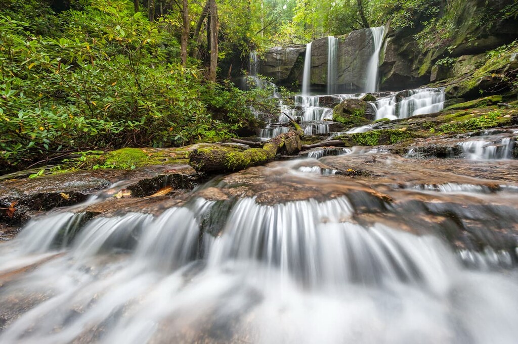
The aptly named Beech Bottom Falls Trail is a casual 1.7 mi (2.7 km) walking path that takes you to see Beech Bottom Falls. It leads to a viewing platform that’s set back from the falls so visitors can appreciate the waterfall in all its glory.
Keep in mind, however, that thick summer foliage can block the view of the falls from the viewing platform. Therefore, it is generally best to visit during late fall, winter, or spring when the trees are not covered in leaves.
The Foothills Trail, an 80 mi (129 km) footpath from Table Rock State Park to Oconee State Park, passes through the heart of Jocassee Gorges WMA, running along its mountain passes, gorges, and creeks.
This portion of the Foothills Trail covers 30.4 mi (48.9 km) of terrain and has 6,500 ft (1,980 m) of elevation gain. It is a point-to-point trail that is popular for backpacking. This path passes by many waterfalls, suspension bridges, and streams, and lets hikers take in the verdant forests of South Carolina.
Camping opportunities abound in and around the WMA. Backcountry camping is generally allowed in the WMA and nearby state parks offer developed campsites and RV hookups for visitors to enjoy.
If you’d rather stay in a hotel or B&B, the small town of Pickens is a short 30-minute drive away, and it has all the basic amenities. Greenville in South Carolina and Asheville in North Carolina are both larger cities that are located a 1 and 1.5 hours drive away, respectively.
A quaint town with a population of only 3,200 people, Pickens nonetheless has all the basics plus some added attractions for visitors to enjoy. Visitors to Pickens can stay over in an inn or B&B, camp, or rent a cabin, and can find restaurants ranging from fast food to cafes and taverns.
The town has an amphitheater in the downtown area, a bike park for off-road BMX riders, and it offers access to the Doodle Trail, which is a paved 8.5 mi recreational path that connects Pickens to the nearby city of Easley. There are also a handful of agritourism opportunities in the area around Pickens where guests can visit local farms and vineyards to get a glimpse of rural life.
Greenville, which has a population of just shy of 70,000 people, is an up-and-coming city in South Carolina. In fact, it was called the “Next Big Food City of the South” by Esquire in 2013 and it received a similar accolade from Food & Wine in 2022. Foodies in Greenville can sample Southern classics, find fresh farm-to-table restaurants, or dine in historic buildings or along scenic rivers.

Visitors to Greenville can also stop by the history museum and science center, get an adrenaline rush on a Gorge Zipline Canopy Tour, or take to the rivers with a whitewater rafting adventure. Hotels, camping, and rental cabins are all popular options for those looking to stay the night in Greenville, too.
With a population of around 92,000 people, Asheville, North Carolina, is a vibrant city that packs in lots to see and do while still maintaining its charming southern feel. Whether you want to go ziplining, hiking, and rafting in the mountains or relaxing at a local spa, Asheville has a little something for everyone.

In Asheville, you can stop by, eat at, or stay over at the Biltmore Estate, a 250-room estate originally owned by a member of the Vanderbilt family. The dining scene in town is diverse, too, as you can check out local breweries and sample craft cocktails, get a taste of local foods, find southern comfort foods, or try some international cuisines while in Asheville. Places to stay in Asheville also run the gamut from campgrounds and cozy B&Bs to hotels and luxury spas.