















Curated by Consorzio Val di Zoldo Turismo
Val di Zoldo
The Zoldo valley of the ice-cream makers, below Monte Pelmo and the Civetta with the Zoldo slopes above.
- 6Highlights
- 55Routes
- Featured summit · Col Dei Baldi
Highlights
All 6 from neighbouring places
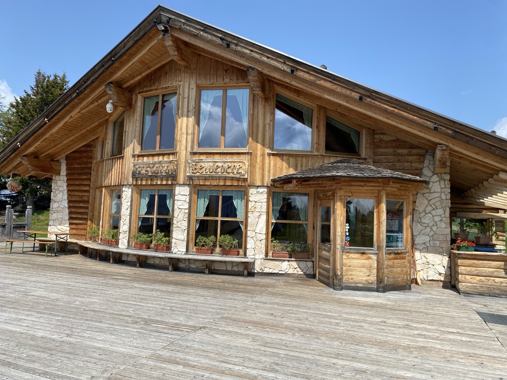
Rifugio Ristoro Belvedere
11.4 km away, in Alleghe
A hut on the lower slopes of the Civetta above Alleghe, reached from the Piani di Pezzè lift and looking across to the lake.
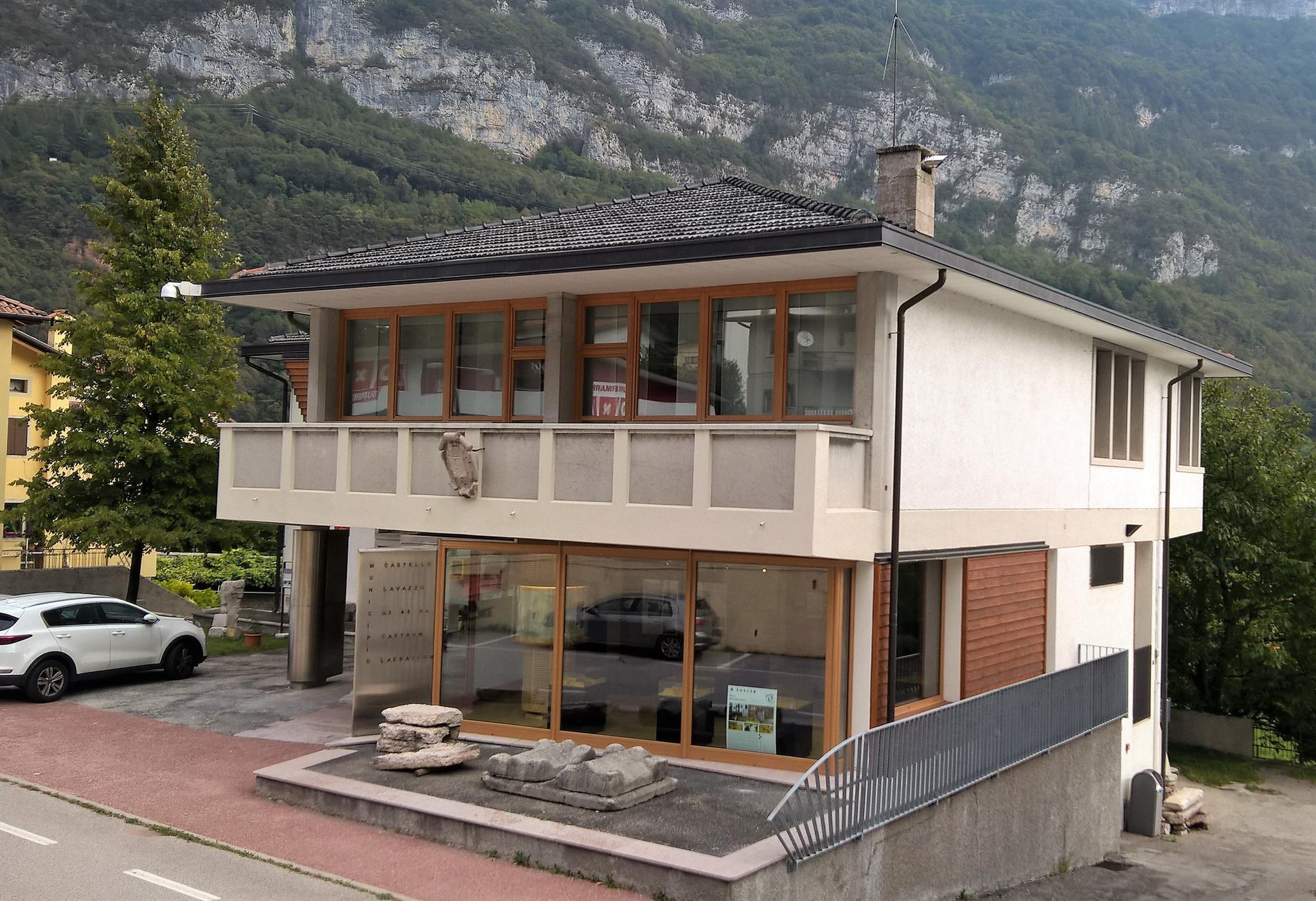
Museo della Pietra e degli Scalpellini
14 km away, in Longarone
A museum at Castellavazzo, in the comune of Longarone, on the local building stone and the quarrymen and stonecutters who worked it.
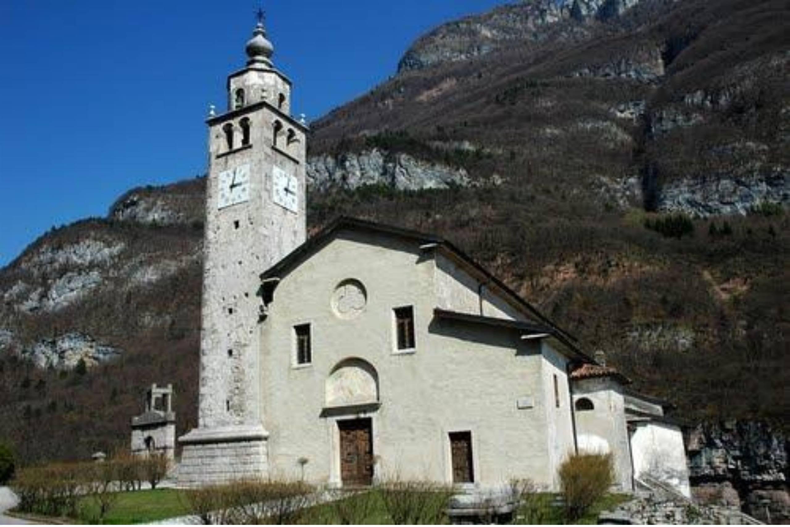
Chiesa di San Quirico e Giulitta in Castellavazzo
14.1 km away, in Longarone
A church at Castellavazzo, above the Piave north of Longarone, dedicated to the martyrs Quirico and Giulitta.
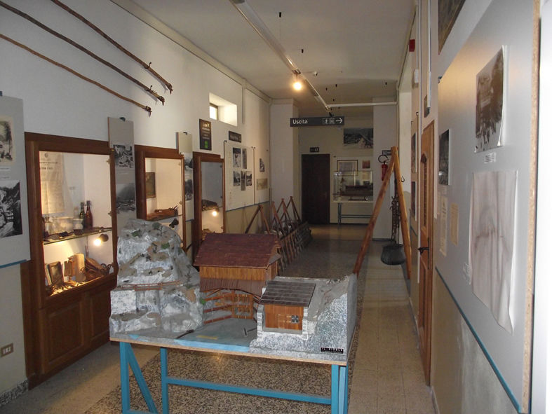
Museo delle Zattere e degli Zattieri
14.6 km away, in Longarone
A museum on the raftsmen who floated Cadore timber down the Piave to Venice.
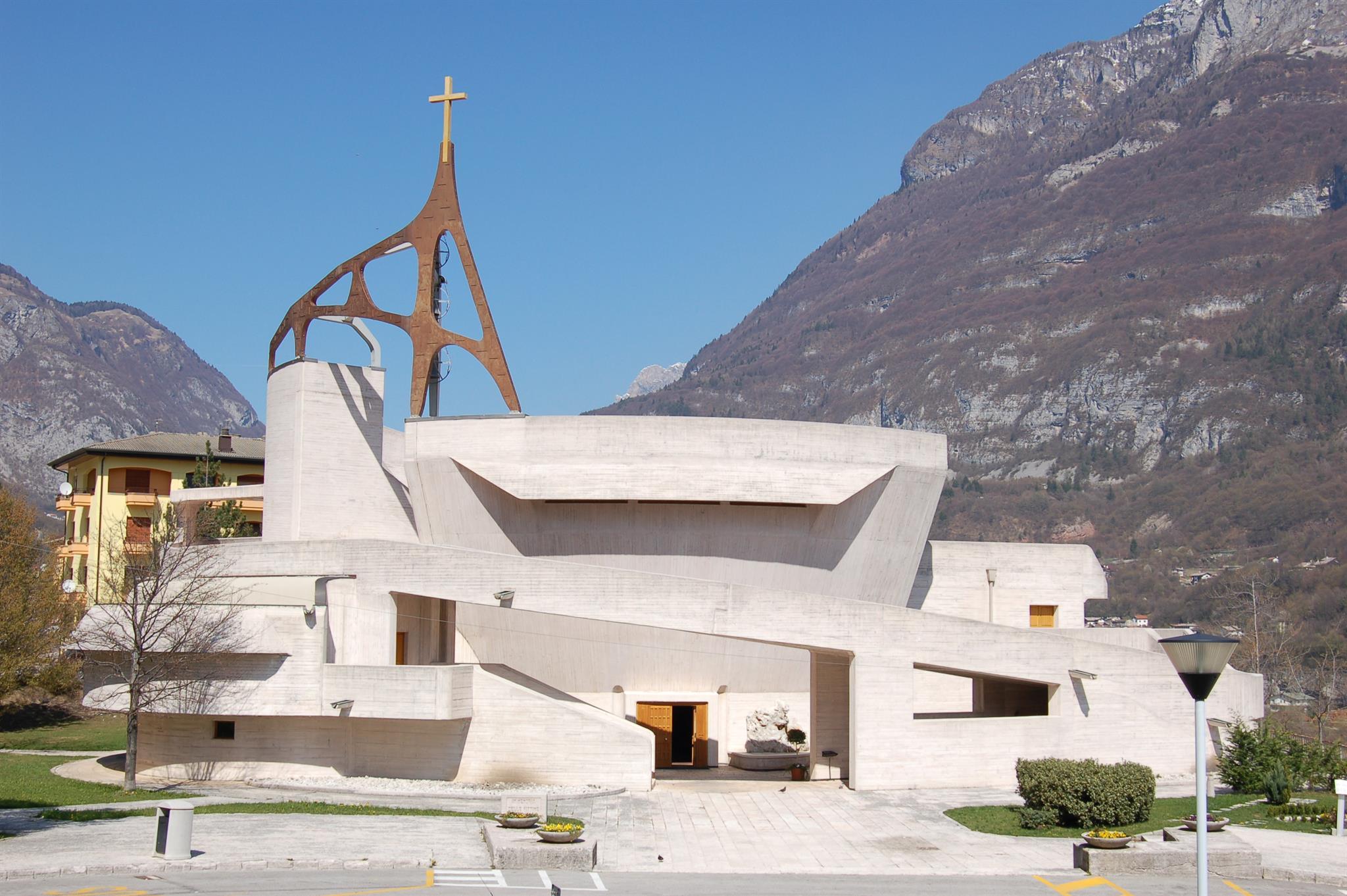
Chiesa del Michelucci
14.7 km away, in Longarone
The parish church of Longarone, rebuilt to Giovanni Michelucci's design after the 1963 Vajont disaster, above the Piave.
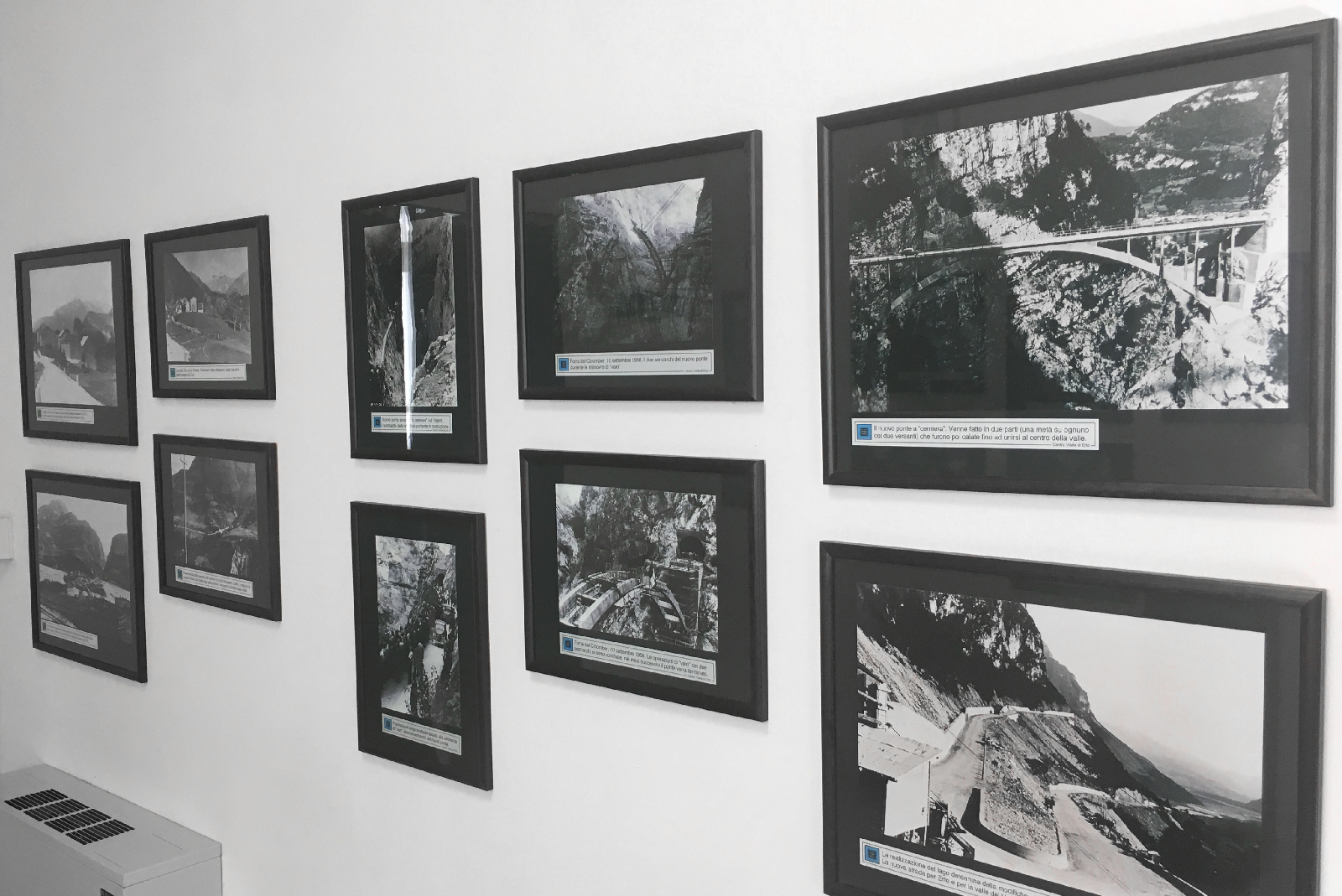
Museo Longarone Vajont Attimi di Storia
14.7 km away, in Longarone
A museum at Longarone on the night of 9 October 1963, when the Vajont landslide destroyed the town.
Nothing of this kind in Val di Zoldo.
Routes
50 routes, an even mix of activities · see the rest on italia.it ↗
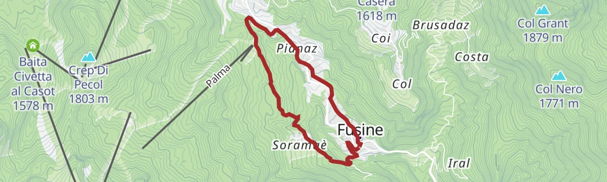
ZIGZAGGING THROUGH THE VILLAGES
A loop through Fusine and Pianaz in the Val di Zoldo, out along minor roads and back on footpaths.
- 4.5 km
- Distance
- 178 m
- Ascent
- 1 h 30 min
- Duration
- 6
- Check-ins
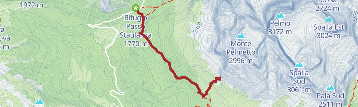
Open route Consorzio Val di Zoldo TurismoZoldano Loop - Stage 4: Rif. Sonnino al Coldai - Rif. Venezia
A stage from the Coldai hut down by Malga Pioda and the Vescova dairy to the Staulanza pass, then up through wood and dwarf pine towards the Venezia hut.
- 12.7 km
- Distance
- 458 m
- Ascent
- 4 h 17 min
- Duration
- 543
- Check-ins
 Col delle Crepe Cavaliere 1 900 m
 Rifugio Adolfo Sonino al Coldai 2 135 m
 Passo Staulanza 1 766 m
- Rifugio "Alba Maria De Luca" Venezia 1 936 m
- Rifugio Passo Staulanza 1 770 m
- Casera di Pioda 1 820 m
- +3
Open route Consorzio Val di Zoldo TurismoAlta Via no.1 - Stage 7
From the Palafavera campsite on the closed military road 564 to the Casera di Pioda, then up mule track 556 over open pasture to the Sonino hut at Coldai.
- 13.7 km
- Distance
- 953 m
- Ascent
- 5 h 58 min
- Duration
- 511
- Check-ins
- Rifugio Adolfo Sonino al Coldai 2 135 m
- Forcella Coldai 2 191 m
- Casera di Pioda 1 820 m
- Rifugio Palafavera 1 514 m
- Rifugio Mario Vazzoler 1 714 m
- Rifugio Monte Pelmo 1 520 m
- +5
Open route Cortina Marketing Se.Am.MTB Alleghe 1 - Civetta Bike Tour
A signed circuit in the Civetta area combining lifts with forest-road climbs to Cima Fertazza, and steep technical descents for practised riders.
- 24.3 km
- Distance
- 1 025 m
- Ascent
- 3 h 21 min
- Duration
- 446
- Check-ins
- Cima dei Viai - Cima Fertazza 2 101 m
- Casera di Pioda 1 820 m
- Ristoro Belvedere - Cima Fertazza 2 076 m
- Rifugio Palafavera 1 514 m
- Grande Baita Civetta 1 456 m
- Ristoro La Ciasela 2 050 m
- +7
Open route Consorzio Operatori Turistici Alleghe - CaprilePECOL - BAITA CIVETTA by E-BIKE (11)
An easy ride through meadow and larch wood to Le Palanche on the Maè, where a picnic area sits just short of the baita at 1,578 m.
- 5.4 km
- Distance
- 233 m
- Ascent
- 42 min
- Duration
- 41
- Check-ins
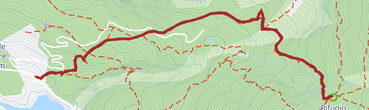
Open route Consorzio Val di Zoldo TurismoPALAFAVERA - COL DEI BALDI by E-BIKE (10)
A loop below Monte Civetta with the Pelmo in sight, passing Casera di Pioda and Agriturismo Malga Fontanafreda on the way up.
- 12.6 km
- Distance
- 509 m
- Ascent
- 1 h 36 min
- Duration
- 251
- Check-ins
- Col Dei Baldi 1 918 m
- Casera di Pioda 1 820 m
- Rifugio Palafavera 1 514 m
- Rifugio Col dei Baldi 1 922 m
- Agriturismo Malga Fontanafreda 1 770 m
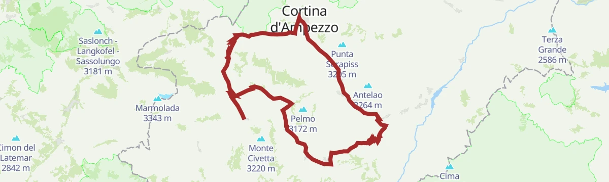
Open route Consorzio Val di Zoldo TurismoRoad Bike Alleghe 5 - Pelmo Croda da Lago loop
A big road loop from Alleghe with three Dolomite passes, Staulanza, Cibiana and Falzarego, and a string of valley villages in between.
- 118.4 km
- Distance
- 2 931 m
- Ascent
- 13 h 16 min
- Duration
- 783
- Check-ins
- Falzarego Pass 2 105 m
- Passo Staulanza 1 766 m
- Bar Bazar 2 106 m
- Rifugio Passo Staulanza 1 770 m
- Strobel 2 060 m
- Rifugio Monte Pelmo 1 520 m
- +22
Open route Consorzio Operatori Turistici Alleghe - CaprileFERTAZE POND
A short, easy walk to the Fertaze pond on the wooded slopes of the Val di Zoldo.
- 1.7 km
- Distance
- 88 m
- Ascent
- 39 min
- Duration
- 3
- Check-ins
Open route Consorzio Val di Zoldo TurismoHikes in Alleghe 3 - Lago del Coldai
From the Col dei Baldi cable car towards the Coldai hut and the Forcella Alleghe, then up a mule track from Casera Pioda to the Coldai lake.
- 7.8 km
- Distance
- 494 m
- Ascent
- 3 h 24 min
- Duration
- 383
- Check-ins
- Col Dei Baldi 1 918 m
- Rifugio Adolfo Sonino al Coldai 2 135 m
- Forcella Coldai 2 191 m
- Casera di Pioda 1 820 m
- Rifugio Col dei Baldi 1 922 m
Open route Consorzio Operatori Turistici Alleghe - CaprileMONTE CIVETTA CROSSING
The classic traverse of the Civetta, under long rock walls and across wide pasture past mountain huts; not hard, but a long day on the feet.
- 17.7 km
- Distance
- 1 023 m
- Ascent
- 7 h 52 min
- Duration
- 460
- Check-ins
- Rifugio Adolfo Sonino al Coldai 2 135 m
- Forcella Coldai 2 191 m
- Casera di Pioda 1 820 m
- Rifugio Mario Vazzoler 1 714 m
- Rifugio Capanna Trieste 1 135 m
- Forcella Col Negro di Coldai 2 199 m
- +5
Open route Consorzio Val di Zoldo TurismoCIVETTA E-BIKE ROUTE (14)
An e-bike loop in the Ski Civetta area up to Cima Fertazza at over 2,000 m, calling at Rifugio Col dei Baldi and Malga Staulanza.
- 24.0 km
- Distance
- 1 084 m
- Ascent
- 3 h 9 min
- Duration
- 394
- Check-ins
- Col Dei Baldi 1 918 m
- Cima dei Viai - Cima Fertazza 2 101 m
- Casera di Pioda 1 820 m
- Ristoro Belvedere - Cima Fertazza 2 076 m
- Rifugio Col dei Baldi 1 922 m
- Ristoro La Ciasela 2 050 m
- +4
Open route Consorzio Val di Zoldo TurismoPIAN DE LE MANDRATE by E-BIKE (12)
A loop from Pecol up to Coi, the highest hamlet in the valley at 1,494 m, with its frescoed old houses, barns and Rifugio Monte Pelmo above.
- 11.1 km
- Distance
- 417 m
- Ascent
- 1 h 23 min
- Duration
- 85
- Check-ins
Open route Consorzio Val di Zoldo TurismoRoad Bike Alleghe 1 - The Civetta Loop
A long road circuit out of Alleghe over Passo Duran and Passo Staulanza, two Dolomite climbs that the Giro d'Italia has used.
- 77.3 km
- Distance
- 2 029 m
- Ascent
- 8 h 46 min
- Duration
- 516
- Check-ins
- Passo Staulanza 1 766 m
- Rifugio Passo Staulanza 1 770 m
- Rifugio Monte Pelmo 1 520 m
- Passo Duran 1 605 m
- Rifugio San Sebastiano 1 596 m
- Bierstube 977 m
- +13
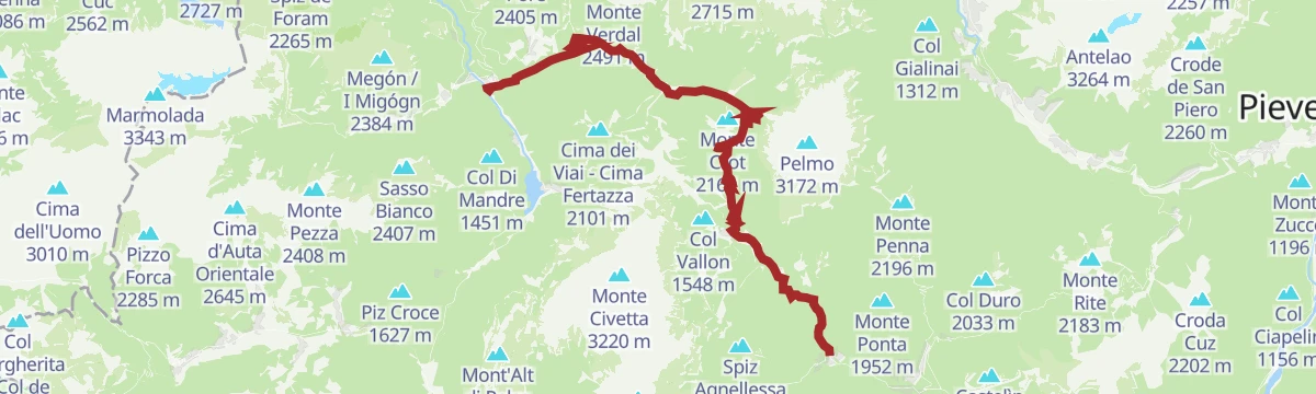
Open route Consorzio Operatori Turistici Alleghe - CaprilePAZ Stage 2: Colcerver - Dont
From the small square at Colcerver by dirt road towards Col Baion, then CAI 539 through tall beech and conifer wood to Col de le Ole and down to Dont.
- 5.4 km
- Distance
- 177 m
- Ascent
- 2 h 2 min
- Duration
Open route Consorzio Val di Zoldo TurismoVENEZIA REFUGE - from Staulanza pass
A walk from the Staulanza pass around the flank of Monte Pelmo to the Venezia hut.
- 13.3 km
- Distance
- 501 m
- Ascent
- 4 h 22 min
- Duration
- 321
- Check-ins
- Col delle Crepe Cavaliere 1 900 m
- Passo Staulanza 1 766 m
- Rifugio "Alba Maria De Luca" Venezia 1 936 m
- Rifugio Passo Staulanza 1 770 m
- Passo Rutorto 1 931 m
Open route Consorzio Val di Zoldo TurismoMonte Pelmo Circuit
A full circuit of Monte Pelmo from the Staulanza pass, round the south walls, the great eastern cirque and the severe north-west face.
- 13.1 km
- Distance
- 960 m
- Ascent
- 6 h 19 min
- Duration
- 342
- Check-ins
- Col delle Crepe Cavaliere 1 900 m
- Passo Staulanza 1 766 m
- Rifugio "Alba Maria De Luca" Venezia 1 936 m
- Rifugio Passo Staulanza 1 770 m
- Passo Rutorto 1 931 m
- Forcella Val d'Arcia 2 474 m
Open route Consorzio Val di Zoldo TurismoMtb Alleghe 4 - Dolomite gems between Zoldo and Selva and Colle S.Lucia
A long ride from Col dei Baldi, reached by cable car, past Malga Pioda and Malga Staulanza, with a technical drop to Pecol below the Pelmo.
- 43.0 km
- Distance
- 1 213 m
- Ascent
- 5 h 18 min
- Duration
- 259
- Check-ins
- Col Dei Baldi 1 918 m
- Col Vallon 1 548 m
- Casera di Pioda 1 820 m
- Rifugio Col dei Baldi 1 922 m
- Agriturismo Malga Fontanafreda 1 770 m
- Malga Staulanza 1 680 m
- +4
Open route Consorzio Operatori Turistici Alleghe - CaprileTO THE VACH POND by E-BIKE (01)
A ride into the Val Barance below the Tàmer and San Sebastiano peaks, to a pond under a waterfall, returning through the village of Colcervèr.
- 12.2 km
- Distance
- 559 m
- Ascent
- 1 h 37 min
- Duration
- 19
- Check-ins
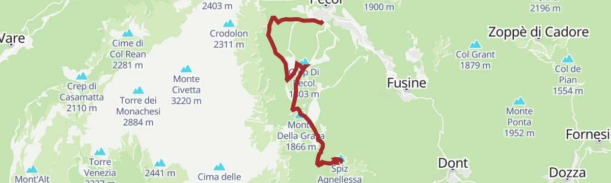
Open route Consorzio Val di Zoldo TurismoSPIZ DE ZUEL in E-BIKE (13)
A climb on an old military road through open pasture to Italian wartime defences below a 2,033 m peak facing Civetta and Pelmo.
- 17.0 km
- Distance
- 780 m
- Ascent
- 2 h 15 min
- Duration
- 123
- Check-ins
- Spiz Agnellessa 2 046 m
- Monte Della Grava 1 866 m
- I Spiz 2 033 m
- Ristoro Da Bepi 1 747 m
- Baita Civetta al Casot 1 578 m
- Ristorante Su'n Paradis 1 862 m
- +1
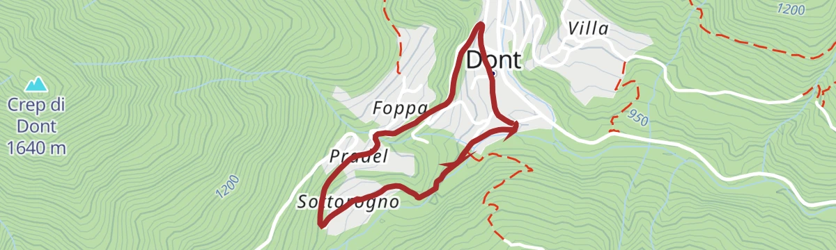
Open route Consorzio Val di Zoldo TurismoPAZ Stage 3 : Dont - Fusine
A short low stage of the Piccolo Anello Zoldano, from Dont to Fusine on the floor of the Val di Zoldo.
- 4.5 km
- Distance
- 318 m
- Ascent
- 1 h 43 min
- Duration
Open route Consorzio Val di Zoldo TurismoPALAFAVERA LOOP
A loop from Palafavera up to the Col dei Baldi below the Civetta, on ski-area slopes and forest track.
- 9.4 km
- Distance
- 400 m
- Ascent
- 3 h 11 min
- Duration
- 312
- Check-ins
- Col Dei Baldi 1 918 m
- Casera di Pioda 1 820 m
- Rifugio Palafavera 1 514 m
- Rifugio Col dei Baldi 1 922 m
- Rifugio Monte Pelmo 1 520 m
- C. ra Vescovà 1 724 m
- +1
Open route Consorzio Val di Zoldo TurismoStaulanza Pass
A road climb to the Staulanza pass between the Pelmo and the Civetta, long a fixture of the Giro d'Italia; Hinault rode it to effect in 1980.
- 27.0 km
- Distance
- 799 m
- Ascent
- 8 h 21 min
- Duration
- 325
- Check-ins
- Passo Staulanza 1 766 m
- Rifugio Passo Staulanza 1 770 m
- Rifugio Palafavera 1 514 m
- Rifugio Monte Pelmo 1 520 m
- Baita Flora Alpina 1 525 m
- Club delle Capre 1 510 m
- +2
Open route Dolomiti Bellunesi - The Mountains of VeniceFORNO DI ZOLDO – VILLA in E-BIKE (04)
A tour through the lower Val di Zoldo hamlets, past the tenth-century church of San Floriano at Pieve and up the Strada dell'Acqua mule track.
- 10.8 km
- Distance
- 490 m
- Ascent
- 1 h 25 min
- Duration
- 2
- Check-ins
Open route Consorzio Val di Zoldo TurismoPECOL - ZOPPE – RIF. TALAMINI by E-BIKE (07)
A long, demanding link over the Forcella Tamai to Zoppè di Cadore, then a wide forest road to the refuge on the saddle of Col Botéi.
- 32.9 km
- Distance
- 1 590 m
- Ascent
- 4 h 28 min
- Duration
- 87
- Check-ins
- Col Botei 1 616 m
- Malga Livan 1 544 m
- Rifugio Giampietro Talamini 1 582 m
- Tourism Info 1 377 m
- Forcella Chiandolada 1 585 m
- Forcella Ciandolada 1 565 m
- +1
Open route Consorzio Val di Zoldo TurismoPAZ Stage 4: Fusine - Villa
A short valley-floor stage of the Piccolo Anello Zoldano, from Fusine to Villa in the Val di Zoldo.
- 5.2 km
- Distance
- 152 m
- Ascent
- 1 h 44 min
- Duration
Open route Consorzio Val di Zoldo TurismoHikes in Alleghe 9 - To the dinosaur footprints
A long day from the Col dei Baldi by Malga Boi Vescova to the Staulanza pass, then CAI 472 towards the Venezia hut and the tracks under the Pelmetto.
- 13.2 km
- Distance
- 620 m
- Ascent
- 4 h 39 min
- Duration
- 298
- Check-ins
- Col Dei Baldi 1 918 m
- Passo Staulanza 1 766 m
- Rifugio Passo Staulanza 1 770 m
- Rifugio Col dei Baldi 1 922 m
- C. ra Vescovà 1 724 m
- Malga Boi Vescova 1 726 m
Open route Consorzio Operatori Turistici Alleghe - CaprileZoldano Ring - Stage 3: Rif. San Sebastiano - Rif. Sonnino al Coldai
From the Duran pass on the Angelini trail 578 below the Moiazza, past the Grisetti bivouac and over the Forcella Inferiore towards the Coldai hut.
- 12.4 km
- Distance
- 1 301 m
- Ascent
- 6 h 56 min
- Duration
- 219
- Check-ins
- Crodolon 2 311 m
- Col Del Vant 2 324 m
- Rifugio Adolfo Sonino al Coldai 2 135 m
- Passo Duran 1 605 m
- Rifugio San Sebastiano 1 596 m
- Bivacco Grisetti 2 007 m
- +1
Open route Consorzio Val di Zoldo TurismoDONT – CASERA BIDOCH by E-BIKE (02)
A loop into the Valle di Goima to Casera Bidoch below Monte San Sebastiano, coming back down to the valley on the SP 347 road.
- 10.0 km
- Distance
- 510 m
- Ascent
- 1 h 24 min
- Duration
Open route Consorzio Val di Zoldo TurismoFORNO DI ZOLDO - MALGA PRAMPER by E-BIKE (03)
A climb into the Parco Nazionale Dolomiti Bellunesi between the Moschesin and Pramper peaks, ending at a pasture hut at 1,540 m.
- 15.2 km
- Distance
- 730 m
- Ascent
- 2 h 3 min
- Duration
- 38
- Check-ins
Open route Consorzio Val di Zoldo TurismoTHE ANCIENT FOREST
An easy walk through old-growth forest on the slopes of the Val di Zoldo.
- 4.5 km
- Distance
- 166 m
- Ascent
- 1 h 28 min
- Duration
Open route Consorzio Val di Zoldo TurismoLAKE AND RIFUGIO COLDAI
A climb to the Coldai lake and hut below the Civetta; a variant starts at Casera Vescova on the Staulanza road and takes CAI 561 by the Col dei Baldi.
- 11.9 km
- Distance
- 754 m
- Ascent
- 5 h 8 min
- Duration
- 274
- Check-ins
Open route Consorzio Val di Zoldo TurismoZoldano Loop - Stage 2: Rif. Angelini Sora 'l sass - Rif. San Sebastiano
From Casel Sora 'l Sass on path 534 down a gully fitted with cables, then up the Val Pramper by Pian de Palui towards the San Sebastiano hut.
- 12.1 km
- Distance
- 1 015 m
- Ascent
- 6 h 28 min
- Duration
- 118
- Check-ins
- Col de Michiel 1 519 m
- Passo Duran 1 605 m
- Rifugio San Sebastiano 1 596 m
- Rifugio Giovanni Angelini 1 588 m
- Ricovero del Piano degli Ontani 1 322 m
- Baita Valentino Angelini 1 680 m
Open route Consorzio Val di Zoldo TurismoFORNO DI ZOLDO – MONTE PUNTA by E-BIKE (05)
A climb to a First World War summit position above the Val di Zoldo, where trenches and an observation post look out over the ring of peaks.
- 17.6 km
- Distance
- 1 097 m
- Ascent
- 2 h 51 min
- Duration
- 31
- Check-ins
Open route Consorzio Val di Zoldo TurismoTHE VILLAGES OF SILENCE
A short walk linking a few of the near-empty old hamlets on the slopes of the Val di Zoldo.
- 2.1 km
- Distance
- 82 m
- Ascent
- 41 min
- Duration
Open route Consorzio Val di Zoldo TurismoHiking in Alleghe 10 - The southern slope of the Civetta
From the Col dei Baldi down to Casera Pioda and Val di Zoldo, then by lift to Pian del Crep and CAI 585 to the Su'n Paradis hut under the south Civetta.
- 13.3 km
- Distance
- 883 m
- Ascent
- 5 h 58 min
- Duration
- 246
- Check-ins
- Col Dei Baldi 1 918 m
- Crep Di Pecol 1 803 m
- Casera di Pioda 1 820 m
- Rifugio Col dei Baldi 1 922 m
- Ristoro Da Bepi 1 747 m
- Baita Civetta al Casot 1 578 m
Open route Consorzio Operatori Turistici Alleghe - CaprileCibiana Pass
A road climb from the Val di Zoldo to the Cibiana pass and Cadore, above the village of Cibiana with its murals and its Messner mountain museum.
- 21.7 km
- Distance
- 834 m
- Ascent
- 7 h 6 min
- Duration
- 87
- Check-ins
Open route Dolomiti Bellunesi - The Mountains of VeniceFORNO – ZOPPE’ - DONT by E-BIKE (09)
A demanding circuit around Monte Punta, reaching Zoppè di Cadore below Monte Pelmo on tarmac and crossing the Forcella Tamai at 1,715 m.
- 21.1 km
- Distance
- 1 222 m
- Ascent
- 3 h 15 min
- Duration
- 4
- Check-ins
Open route Consorzio Val di Zoldo TurismoTHROUGH TABIA’ AND MAS OF VAL DI ZOLDO
A walk past the churches at Brusadaz and the old barns of the lower Val di Zoldo, with cattle grazing at Pra Grant and deer at Mas di Sabe.
- 5.5 km
- Distance
- 324 m
- Ascent
- 2 h 15 min
- Duration
Open route Consorzio Val di Zoldo TurismoMount Crot
A climb from the Staulanza pass on CAI 561 through fir wood and mugo pine onto open slopes, facing the Pelmo, the Civetta and the Marmolada.
- 4.8 km
- Distance
- 418 m
- Ascent
- 2 h 39 min
- Duration
- 191
- Check-ins
Open route Dolomiti Bellunesi - The Mountains of VeniceAVDB - Stage 1: Forno di Zoldo - Rif. Pramperet
From Forno di Zoldo into the wild Val Pramper, following the Prampera stream past the Pramper hut, with the Spiz de Mezzodi above and the Pelmo behind.
- 9.3 km
- Distance
- 1 043 m
- Ascent
- 4 h 23 min
- Duration
- 57
- Check-ins
- Malga di Pramper 1 540 m
- Rifugio Sommariva al Pramperet 1 857 m
- Ricovero del Piano degli Ontani 1 322 m
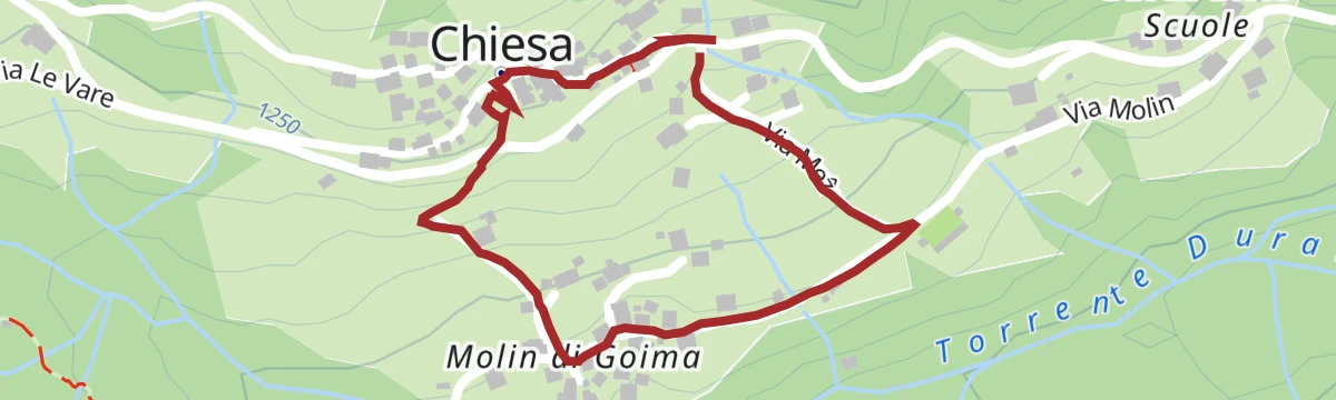
Open route Dolomiti Bellunesi - The Mountains of VeniceUnder the Moiazza amphitheater, the Goima Valley
A very short walk in the Goima valley, under the amphitheatre of rock walls on the Moiazza.
- 1.1 km
- Distance
- 62 m
- Ascent
- 27 min
- Duration
Open route Consorzio Val di Zoldo TurismoAT THE DINOSAUR FOOTPRINTS
A walk to the dinosaur tracks on the slabs below Monte Pelmo, above the Val di Zoldo.
- 5.5 km
- Distance
- 372 m
- Ascent
- 2 h 29 min
- Duration
- 157
- Check-ins
Open route Consorzio Val di Zoldo TurismoZoldo Ring - Stage 1: Le Bocole - Angelini Sora 'l sass Refuge
From San Giovanni near the Pontesei lake, trail 531 climbs steeply beside the power station wall towards the Angelini hut at Sora 'l Sass.
- 9.4 km
- Distance
- 1 615 m
- Ascent
- 7 h 40 min
- Duration
- 26
- Check-ins
- Spiz Piccolo Belvedere 2 004 m
- Rifugio Giovanni Angelini 1 588 m
- Forcella di Col Pelos 1 900 m
- Casera Col Marsànch 1 290 m
Open route Consorzio Val di Zoldo TurismoZoldano Loop - Stage 6: Rif. Remauro - Forno di Zoldo
A stage crossing Forcella delle Ciavazole on forest roads and paths, passing the Casera Bosconero hut on the way down to Forno di Zoldo.
- 11.4 km
- Distance
- 626 m
- Ascent
- 5 h 47 min
- Duration
- 124
- Check-ins
- Passo Cibiana 1 530 m
- Rifugio Casèra Bosconero 1 457 m
- Malga Dèona 1 530 m
- Rifugio Remauro 1 536 m
- Forcella delle Ciavazòle 1 994 m
Open route Consorzio Val di Zoldo TurismoZoldano Ring Stage 1VAR (variant from Forno di Zoldo): Loc. Baron - Rif. Angelini sora 'l Sass
A variant from Baron above Forno di Zoldo, past the Col Marsang shelf and up path 532 to the Col Pelos, joining the main line to the Angelini hut.
- 10.3 km
- Distance
- 1 624 m
- Ascent
- 7 h 56 min
- Duration
- 22
- Check-ins
- Spiz Piccolo Belvedere 2 004 m
- Rifugio Giovanni Angelini 1 588 m
- Forcella di Col Pelos 1 900 m
- Casera Col Marsànch 1 290 m
Open route Consorzio Val di Zoldo TurismoSPIZ ZUEL (FROM PECOL)
A climb to the Spiz Zuel above Pecol, an isolated grassy top west of the Mae with the Civetta and the Pelmo to the north.
- 8.5 km
- Distance
- 446 m
- Ascent
- 3 h 12 min
- Duration
- 83
- Check-ins
- Spiz Agnellessa 2 046 m
- Monte Della Grava 1 866 m
- I Spiz 2 033 m
- Crep Di Pecol 1 803 m
- Ristoro Da Bepi 1 747 m
- Ristorante Su'n Paradis 1 862 m
- +1
Open route Consorzio Val di Zoldo TurismoPAZ - Piccolo Anello Zoldano: The 5 stages together
The whole low Zoldo circuit from Forno, where a museum recalls the old nail-making trade, on easy forest paths by Pralongo to Colcerver and its tabia.
- 24.9 km
- Distance
- 1 266 m
- Ascent
- 9 h 12 min
- Duration
- 4
- Check-ins
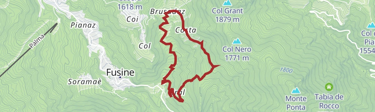
Open route Consorzio Val di Zoldo TurismoMONTE PONTA FROM THE HAMLET OF COSTA
Called the navel of Zoldo for its full round view of the valley peaks; an old military road climbs the south side through wood and pasture past war remains.
- 8.3 km
- Distance
- 637 m
- Ascent
- 4 h 8 min
- Duration
- 38
- Check-ins
- Monte Ponta 1 952 m
- Col de Salera 1 629 m
- Col Nero 1 771 m
- La Forzela 1 723 m
- Forcella Tamai 1 715 m
Open route Consorzio Val di Zoldo TurismoHike to Rifugio Bosconero
A varied climb through thick wood to the Bosconero hut, which looks across at the Civetta and has hosted University of Padua waste and water research since 2006.
- 6.7 km
- Distance
- 651 m
- Ascent
- 4 h 1 min
- Duration
- 33
- Check-ins
Open route Consorzio Val di Zoldo TurismoRIFUGIO SORA'L SASS - NORMAL PATH
A walk entirely in the wood to the clearing that holds the Sora 'l Sass hut.
- 5.9 km
- Distance
- 597 m
- Ascent
- 3 h 40 min
- Duration
- 29
- Check-ins
Open route Consorzio Val di Zoldo Turismo
No routes of this kind in Val di Zoldo yet.
The region's own picks
Featured route
ZIGZAGGING THROUGH THE VILLAGES
A loop through Fusine and Pianaz in the Val di Zoldo, out along minor roads and back on footpaths.
Planning a trip to Val di Zoldo?
Everything else Veneto has, in one place


Take Val di Zoldo with you into the mountains
Every route on this page with 3D terrain, GPX navigation and offline maps — including the valleys with no signal.
Data sources
- Official website: italia.it ↗
- Routes and highlights: Consorzio Val di Zoldo Turismo, Consorzio Operatori Turistici Alleghe - Caprile, Dolomitiprealpi, Dolomiti Bellunesi - The Mountains of Venice, YesAlps, Cortina Marketing Se.Am.
- Published as open data by the tourist boards named above.
- Region summary generated from the board's own material.
