


Curated by APT San Martino di Castrozza, Primiero e Vanoi
Taibon Agordino
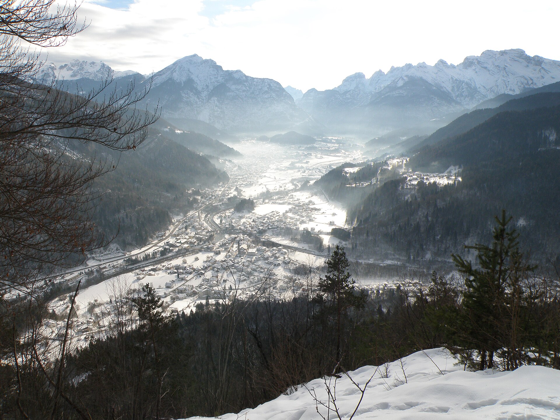
Agordino village under the Pale di San Lucano, whose great south wall is one of the least-visited big faces in the Dolomites.
Photo: Loris Lote · CC BY-SA 4.0 licence
- 2Highlights
- 12Routes
- Featured summit · Col Dei Baldi
Highlights
All 2 from neighbouring places
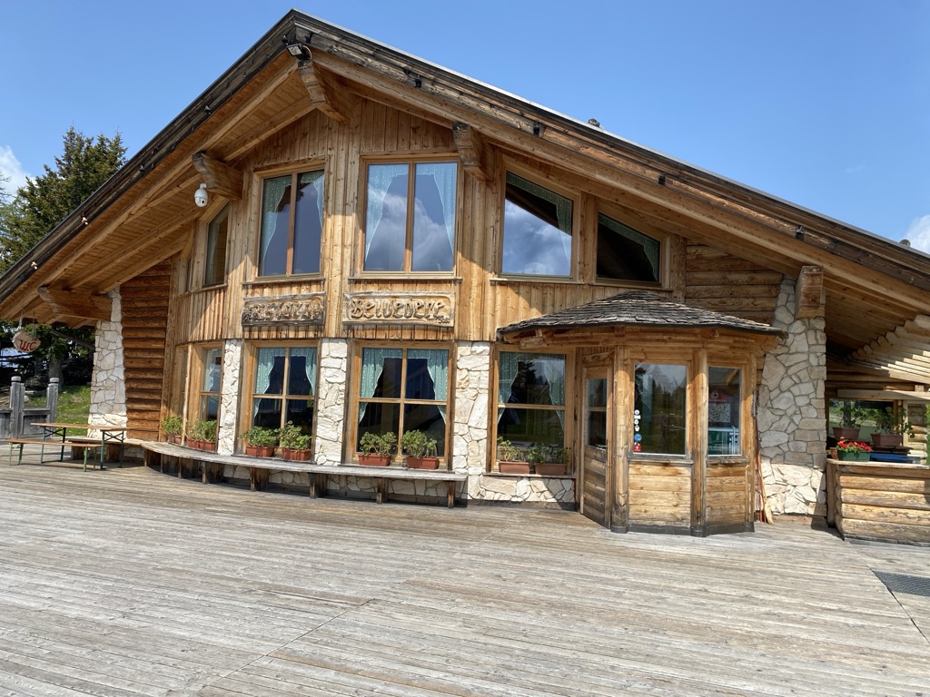
Rifugio Ristoro Belvedere
13.7 km away, in Alleghe
A hut on the lower slopes of the Civetta above Alleghe, reached from the Piani di Pezzè lift and looking across to the lake.
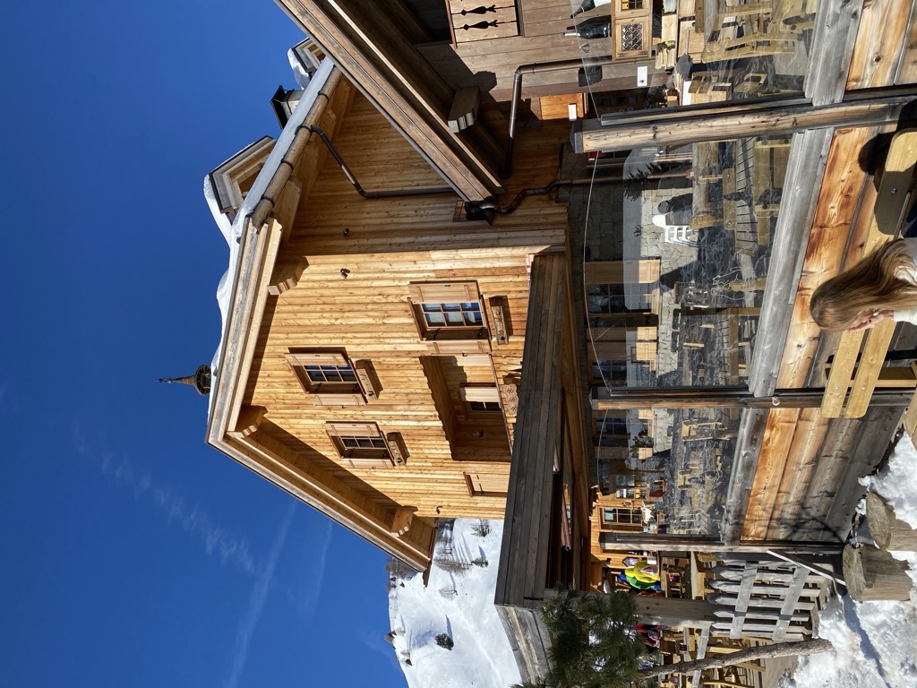
Rifugio Fuciade
13.9 km away, in Soraga di Fassa
A refuge in the Fuciade basin below the Passo San Pellegrino, in the comune of Soraga di Fassa, under the Cima Uomo.
Nothing of this kind in Taibon Agordino.
Routes
Dolomiti Palaronda Ferrata Classic - 4th stage
A long, steeply climbing stage of the Palaronda Classic circuit, crossing the Pale di San Martino from one hut of the group to the next.
- 10.1 km
- Distance
- 1 419 m
- Ascent
- 8 h 3 min
- Duration
- 145
- Check-ins
 Rifugio Rosetta "Giovanni Pedrotti" 2 580 m
- Rifugio Treviso 1 631 m
 Passo di Pradidali basso 2 658 m
- Passo Canali 2 467 m
- Passo della Fradusta 2 680 m
Open route APT San Martino di Castrozza, Primiero e VanoiCrossing the Plateau, Fradusta Peak and descent to the Canali valley
A crossing of the Pale di San Martino plateau from Rifugio Rosetta over dips and sinkholes to the Passo Canali, dropping to Rifugio Treviso.
- 13.3 km
- Distance
- 503 m
- Ascent
- 6 h 31 min
- Duration
- 177
- Check-ins
 Cima La Fradusta 2 939 m
- Rifugio Rosetta "Giovanni Pedrotti" 2 580 m
- Rifugio Treviso 1 631 m
- Passo di Rosetta 2 567 m
- Passo Canali 2 467 m
Open route APT San Martino di Castrozza, Primiero e VanoiHiking in Alleghe 7 - The crossing of Val Civetta
The line of the Transcivetta race: past the Coldai lake, then CAI 560 with the Alta Via 1 under the north-west wall of the Civetta.
- 20.6 km
- Distance
- 787 m
- Ascent
- 8 h 38 min
- Duration
- 656
- Check-ins
- Col Dei Baldi 1 918 m
- Cime di Col Rean 2 281 m
- Rifugio Adolfo Sonino al Coldai 2 135 m
- Forcella Coldai 2 191 m
- Casera di Pioda 1 820 m
- Rifugio Col dei Baldi 1 922 m
- +10
Open route Consorzio Operatori Turistici Alleghe - CaprileRoad Bike Alleghe 3 - Pale di San Martino Loop
A three-climb road circuit from Alleghe, crossing Passo Valles and the Rolle Pass on the ring around the Pale group above Paneveggio.
- 112.0 km
- Distance
- 2 990 m
- Ascent
- 12 h 46 min
- Duration
- 520
- Check-ins
- Rolle Pass 1 971 m
- Passo Valles 2 032 m
- Malga Rolle 1 905 m
- Rifugio Capanna Passo Valles 2 037 m
- Bierstube 977 m
- Hotel Venezia 1 957 m
- +18
Open route Consorzio Operatori Turistici Alleghe - CaprileAlta Via no.1 - Stage 8
A stage of Alta Via 1 north from the Vazzolèr hut, under the Civetta walls.
- 9.0 km
- Distance
- 604 m
- Ascent
- 3 h 52 min
- Duration
- 117
- Check-ins
Open route Cortina Marketing Se.Am.Alta Via no.1 - Stage 7
From the Palafavera campsite on the closed military road 564 to the Casera di Pioda, then up mule track 556 over open pasture to the Sonino hut at Coldai.
- 13.7 km
- Distance
- 953 m
- Ascent
- 5 h 58 min
- Duration
- 511
- Check-ins
- Rifugio Adolfo Sonino al Coldai 2 135 m
- Forcella Coldai 2 191 m
- Casera di Pioda 1 820 m
- Rifugio Palafavera 1 514 m
- Rifugio Mario Vazzoler 1 714 m
- Rifugio Monte Pelmo 1 520 m
- +5
Open route Cortina Marketing Se.Am.Road Bike Alleghe 1 - The Civetta Loop
A long road circuit out of Alleghe over Passo Duran and Passo Staulanza, two Dolomite climbs that the Giro d'Italia has used.
- 77.3 km
- Distance
- 2 029 m
- Ascent
- 8 h 46 min
- Duration
- 516
- Check-ins
- Passo Staulanza 1 766 m
- Rifugio Passo Staulanza 1 770 m
- Rifugio Monte Pelmo 1 520 m
- Passo Duran 1 605 m
- Rifugio San Sebastiano 1 596 m
- Bierstube 977 m
- +13
Open route Consorzio Operatori Turistici Alleghe - CaprileMONTE CIVETTA CROSSING
The classic traverse of the Civetta, under long rock walls and across wide pasture past mountain huts; not hard, but a long day on the feet.
- 17.7 km
- Distance
- 1 023 m
- Ascent
- 7 h 52 min
- Duration
- 460
- Check-ins
- Rifugio Adolfo Sonino al Coldai 2 135 m
- Forcella Coldai 2 191 m
- Casera di Pioda 1 820 m
- Rifugio Mario Vazzoler 1 714 m
- Rifugio Capanna Trieste 1 135 m
- Forcella Col Negro di Coldai 2 199 m
- +5
Open route Consorzio Val di Zoldo TurismoPalaronda Road Bike Tour
A long road circuit over the Rolle and Valles passes, alternating hard climbing with fast descents and some technical ground.
- 95.5 km
- Distance
- 3 137 m
- Ascent
- 11 h 26 min
- Duration
- 423
- Check-ins
- Còl de Simón 759 m
- Rolle Pass 1 971 m
- Passo Valles 2 032 m
- Malga Rolle 1 905 m
- Rifugio Capanna Passo Valles 2 037 m
- Hotel Venezia 1 957 m
- +16
Open route APT San Martino di Castrozza, Primiero e VanoiDolomiti Palaronda Trek - stage 4
A demanding Pale di San Martino stage from the Rosetta plateau over the Forcella del Miel and Passo Canali down to Rifugio Treviso.
- 10.6 km
- Distance
- 1 302 m
- Ascent
- 5 h 51 min
- Duration
- 177
- Check-ins
- Rifugio Rosetta "Giovanni Pedrotti" 2 580 m
- Rifugio Treviso 1 631 m
- Passo di Rosetta 2 567 m
- Passo Canali 2 467 m
- Forcella del Miel 2 520 m
Open route APT San Martino di Castrozza, Primiero e VanoiRoad-Bike Alleghe 8 Monti del Sole Route
A long road ride down the Valle del Cordevole to Ponte Mas, then up the Valle del Mis past Lago del Ghirlo before the climb to Gosaldo.
- 102.4 km
- Distance
- 1 682 m
- Ascent
- 10 h 40 min
- Duration
- 152
- Check-ins
- Bierstube 977 m
- Alla Caminada 970 m
- Water inlet for Ghirlo powerplant 971 m
- Pizzeria Al Fornel 934 m
- Ristorante alla Stanga 436 m
 Polane 563 m
- +5
Open route Consorzio Operatori Turistici Alleghe - CaprileConca Tour Hike&Bike
A loop on back roads around the Conca Agordina, linking its villages over the Forcella Aurine and the Forcella Franche.
- 76.0 km
- Distance
- 2 189 m
- Ascent
- 8 h 48 min
- Duration
- 12
- Check-ins
- Forcella Aurine 1 299 m
- Al Rustico Ristorante 776 m
- Agriturismo Busa dei Sbràse 679 m
- Forcella Franche 991 m
Open route Conca Agordina
No routes of this kind in Taibon Agordino yet.
The region's own picks

Featured route
Crossing the Plateau, Fradusta Peak and descent to the Canali valley
A crossing of the Pale di San Martino plateau from Rifugio Rosetta over dips and sinkholes to the Passo Canali, dropping to Rifugio Treviso.
Planning a trip to Taibon Agordino?
Everything else Veneto has, in one place


Take Taibon Agordino with you into the mountains
Every route on this page with 3D terrain, GPX navigation and offline maps — including the valleys with no signal.
Data sources
- Official website: agordinodolomiti.it ↗
- Routes and highlights: APT San Martino di Castrozza, Primiero e Vanoi, Consorzio Operatori Turistici Alleghe - Caprile, YesAlps, Cortina Marketing Se.Am., Consorzio Val di Zoldo Turismo, Conca Agordina
- Published as open data by the tourist boards named above.
- Region summary generated from the board's own material.
