








Curated by Sterzing, Pfitsch und Freienfeld
Stelvio/Stilfs
The comune at the foot of the Ortler holding Trafoi and Solda, below the Stelvio pass road inside the national park.
- 3Highlights
- 20Routes
- Featured summit · Ortler
Highlights
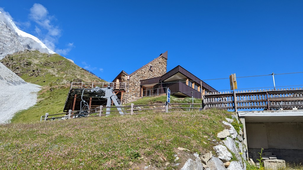
Rifugio K2
A hut above Solda in the Ortler group, reached by the Solda lifts and facing the north side of the Ortler.
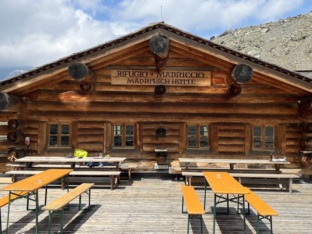
Rifugio Madriccio
A refuge on the pastures below the Passo Madriccio above Solda, on the traverse under the Ortler and Gran Zebrù.
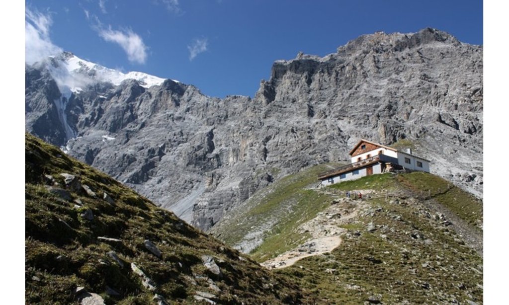
Sterzing, Pfitsch und FreienfeldTabarettahütte/ Rifugio Tabaretta
A refuge on the Tabaretta ridge above Solda, on the way up to the Payer hut and the normal route on the Ortler.
Nothing of this kind in Stelvio/Stilfs.
Routes
Ferrata Tabaretta
One of the harder equipped routes in the Ortler group, steep for most of its length with few places to stop, set opposite the north face of the Ortles.
- 9.6 km
- Distance
- 778 m
- Ascent
- 6 h 24 min
- Duration
- 93
- Check-ins
 Payerhütte - Rifugio Payer 3 029 m
- Tabarettahütte - Rifugio Tabaretta 2 556 m
- Langenstein Hütte 2 350 m
 Tabarettascharte - Passo della Tabaretta 2 903 m
- Bärenkopfscharte - Forcella dell'Orso 2 871 m
Open route Sterzing, Pfitsch und FreienfeldVia ferrata Croda di Cengles
An exposed equipped line onto the Tschenglser Hochwand above the Venosta valley; the summit can also be reached by the ordinary path.
- 2.5 km
- Distance
- 812 m
- Ascent
- 3 h 49 min
- Duration
- 35
- Check-ins
Open route Sterzing, Pfitsch und FreienfeldFerrata Trafoi
A recent climbing site at Trafoi with several graded variants, laid out for beginners and for children learning the technique.
- 1.0 km
- Distance
- 112 m
- Ascent
- 50 min
- Duration
Open route Sterzing, Pfitsch und FreienfeldSolda-Passo del Madriccio-Val Martello
A high crossing from Solda over the Madriccio pass into the Val Martello, in the Stelvio park.
- 10.0 km
- Distance
- 503 m
- Ascent
- 4 h 41 min
- Duration
- 166
- Check-ins
- Zufallhütte - Rifugio Nino Corsi 2 264 m
- Madritschhütte 2 840 m
- Alpengasthof Schönblick - Albergo Alpino Schönblick 2 065 m
- Schlachthaus - Mattatoio 2 266 m
- Rudi's Würstelbude - Chiosco Würstel Rudi 2 065 m
- Alpengasthof Enzian - Albergo Alpino Enzian 2 057 m
- +1
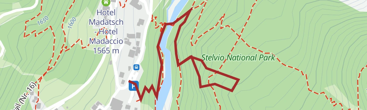
Open route Sterzing, Pfitsch und FreienfeldHis Majesty the Ortles
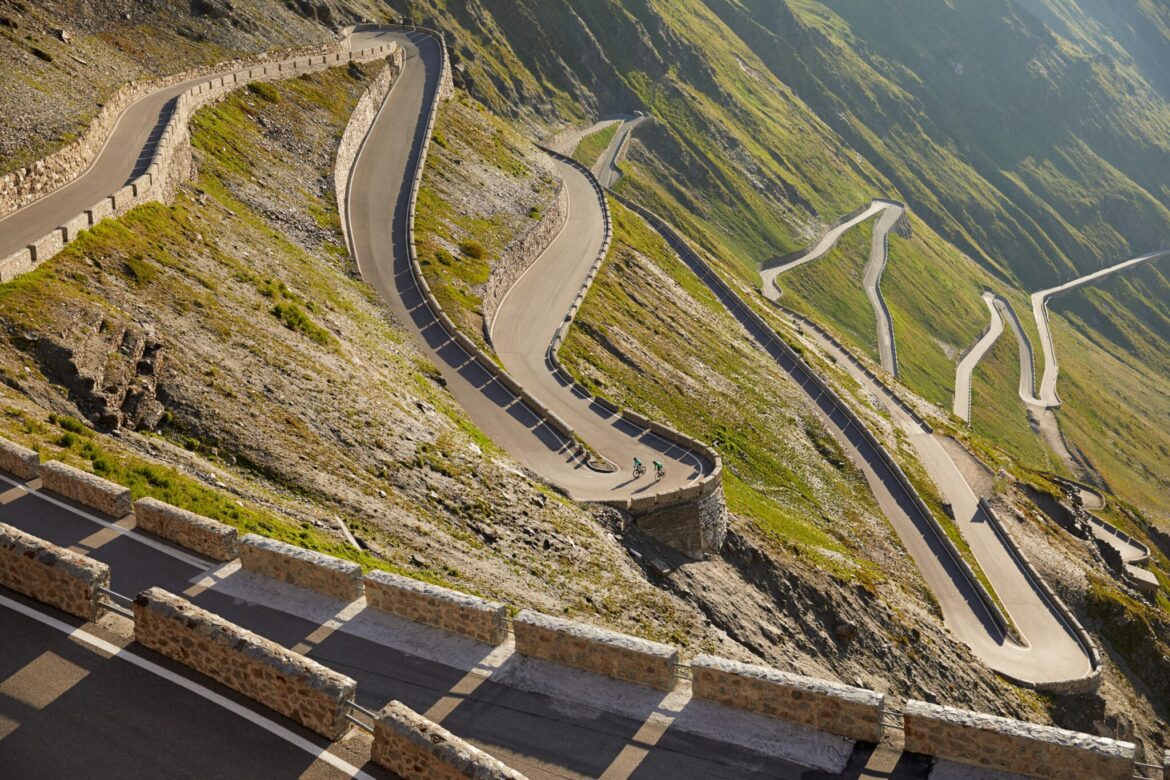
The Venosta side of the road to the Stelvio pass, a stack of hairpins in the final kilometres, under the glaciers of the Ortles.
- 24.9 km
- Distance
- 1 848 m
- Ascent
- 8 h 41 min
- Duration
- 123
- Check-ins
- Stelvio Pass 2 758 m
- Tourism Information 1 268 m
- Casa Cantoniera 2 191 m
- Stelvio Residence 1 508 m
- Geierhof 1 110 m
- Hotel Madatsch - Hotel Madaccio 1 565 m
- +4
Open route Valtellina OutdoorSci alpinismo al rifugio Alfredo Serristori
A ski tour from Sulden up the Zay valley to the Serristori hut at 2,721 m, facing the three main peaks of the Ortler group; the hut is shut in winter.
- 9.7 km
- Distance
- 393 m
- Ascent
- 892 m
- Descent
- 2 h 59 min
- Duration
- 47
- Check-ins
Open route Sterzing, Pfitsch und FreienfeldSci alpinismo al Cevedale
A ski ascent of Monte Cevedale, technically straightforward for so large a peak and one of the standard tours of the Ortles-Cevedale.
- 12.8 km
- Distance
- 1 151 m
- Ascent
- 1 146 m
- Descent
- 4 h 37 min
- Duration
- 97
- Check-ins
 Monte Cevedale 3 769 m
- Langenfernerjoch - Passo del Cevedale 3 256 m
- Rifugio Gianni Casati 3 269 m
- Schaubachhütte - Rifugio Città di Milano 2 581 m
- Rifugio Invernale Alessandro Guasti 3 285 m
- Eisseepass - Passo del Lago Gelato 3 150 m
Open route Sterzing, Pfitsch und FreienfeldStelvio Pass Forcola Pedenolo
A high bike loop from the Stelvio pass over the Dreisprachenspitze, down to the Umbrail pass and along trail 145 to the Bocchetta di Forcola.
- 24.4 km
- Distance
- 563 m
- Ascent
- 3 h 8 min
- Duration
- 127
- Check-ins
- Piz da las Trais Linguas - Dreisprachenspitze - Cima Garibaldi 2 843 m
- Stelvio Pass 2 758 m
- Rifugio Garibaldi - Dreisprachenspitze 2 845 m
- Pass Umbrail - Giogo di Santa Maria 2 501 m
- Bocchetta di Forcola 2 768 m
- Berghaus Astras 2 498 m
- +6
Open route Valtellina OutdoorStilfserjoch - Rötelspitze - Val Costainas - Alp Prasüra - Sta.Maria
A crossing from the Stelvio Pass over the Dreisprachenspitze and the Rötelspitze, then down the Val Costainas by the Alp Prasüra to Santa Maria in the Val Müstair.
- 14.3 km
- Distance
- 269 m
- Ascent
- 5 h 36 min
- Duration
- 105
- Check-ins
- Piz da las Trais Linguas - Dreisprachenspitze - Cima Garibaldi 2 843 m
- Piz Cotschen 3 026 m
- Stelvio Pass 2 758 m
- Rifugio Garibaldi - Dreisprachenspitze 2 845 m
- Sella da Piz Cotschen 2 923 m
Open route Engadin Samnaun Val MüstairAl Cevedale
A long but uncomplicated ascent of Monte Cevedale, a broad viewpoint over the whole of the Ortles-Cevedale group.
- 6.4 km
- Distance
- 1 162 m
- Ascent
- 4 h 22 min
- Duration
- 76
- Check-ins
- Monte Cevedale 3 769 m
- Rifugio Gianni Casati 3 269 m
- Schaubachhütte - Rifugio Città di Milano 2 581 m
- Rifugio Invernale Alessandro Guasti 3 285 m
- Eisseepass - Passo del Lago Gelato 3 150 m
Open route Sterzing, Pfitsch und FreienfeldSci alpinismo alla Cima di Solda
An easy ski tour to the Suldenspitze, looking across at the Gran Zebru, the Ortler and the Cevedale.
- 3.1 km
- Distance
- 778 m
- Ascent
- 0 m
- Descent
- 2 h 2 min
- Duration
- 34
- Check-ins
Open route Sterzing, Pfitsch und FreienfeldSci alpinismo all’Angelo Piccolo
A ski tour from the top of the Pulpito chairlift past the Serristori hut to the Kleine Angelusspitze at 3,318 m, with the Ortler and both Zebru peaks around.
- 13.4 km
- Distance
- 915 m
- Ascent
- 914 m
- Descent
- 4 h 29 min
- Duration
- 47
- Check-ins
- Kleine Angelus Spitze - L'Angelo Piccolo 3 318 m
- Düsseldorfer Hütte (Zaytalhütte) - Rifugio Serristori 2 721 m
- Kanzel 2350 2 351 m
- Zayjoch - Passo Zai 3 224 m
Open route Sterzing, Pfitsch und FreienfeldAl Rifugio Casati
The approach to the Casati hut on the Ortles-Cevedale, above Val Martello and Val Cedec, with three Great War guns twenty minutes away; the hut is currently closed.
- 3.9 km
- Distance
- 661 m
- Ascent
- 2 h 31 min
- Duration
- 72
- Check-ins
- Langenfernerjoch - Passo del Cevedale 3 256 m
- Rifugio Gianni Casati 3 269 m
- Schaubachhütte - Rifugio Città di Milano 2 581 m
- Rifugio Invernale Alessandro Guasti 3 285 m
- Eisseepass - Passo del Lago Gelato 3 150 m
Open route Sterzing, Pfitsch und FreienfeldAscesa dell'Ortles
The summit day on the Ortler from the Payerhutte, over the Wandl and the traverse above the Eisrinne, then by the Barenloch to the Lombardi bivouac.
- 3.3 km
- Distance
- 951 m
- Ascent
- 3 h 30 min
- Duration
- 53
- Check-ins
- Ortler 3 905 m
- Tabarettaspitze 3 128 m
- Payerhütte - Rifugio Payer 3 029 m
- Tschierfeck Biwak am Ortler 3 316 m
Open route Sterzing, Pfitsch und FreienfeldSci alpinismo alla Cima Vertana
A big ski tour above Sulden to the Vertainspitze at 3,545 m, with a descent as long as the climb that earns it.
- 12.4 km
- Distance
- 1 596 m
- Ascent
- 1 591 m
- Descent
- 5 h 41 min
- Duration
- 23
- Check-ins
- Vertainspitze 3 545 m
- Zivilschutzzentrum Sulden - Centro Protezione Civile Solda 1 930 m
- Rosimjoch - Passo di Rosim 3 288 m
Open route Sterzing, Pfitsch und FreienfeldTuckett Peak
A high ascent from the Stelvio Pass lifts over the Vedretta Piana glacier, past the Livrio hut and the summer ski runs, to the Tuckettspitze.
- 5.5 km
- Distance
- 860 m
- Ascent
- 3 h 39 min
- Duration
- 24
- Check-ins
- Tuckettspitze 3 462 m
- Rifugio Piccolo Pirovano 3 025 m
- Hotel Baita Ortler 3 023 m
- Hotel Thöni 3000 3 008 m
Open route Valtellina OutdoorSci alpinismo alla Cima Tuckett
A long ski tour out of Trafoi at 1,570 m to the Tuckettspitze, on the glaciated western edge of the Stelvio park.
- 10.0 km
- Distance
- 1 843 m
- Ascent
- 66 m
- Descent
- 5 h 12 min
- Duration
- 18
- Check-ins
Open route Sterzing, Pfitsch und FreienfeldSpirit Point
A climb from the Stelvio Pass lifts over the Vedretta Piana to the Punta degli Spiriti, on glacier and snow beside the summer ski area.
- 4.5 km
- Distance
- 696 m
- Ascent
- 2 h 41 min
- Duration
- 23
- Check-ins
- Punta del Cristallo 3 470 m
- Rifugio Piccolo Pirovano 3 025 m
- Hotel Baita Ortler 3 023 m
- Hotel Thöni 3000 3 008 m
Open route Valtellina OutdoorSci alpinismo sul Dossobello di Fuori
A ski tour to the Vorderes Schoneck at 2,886 m, moderate in difficulty and set directly opposite the bulk of the Ortler.
- 8.3 km
- Distance
- 1 022 m
- Ascent
- 1 020 m
- Descent
- 3 h 41 min
- Duration
- 12
- Check-ins
- Vorderes Schöneck - Dossobello di Fuori 2 908 m
- Kälberalm - Malga dei vitelli 2 263 m
- Scheanegg 2 249 m
Open route Sterzing, Pfitsch und FreienfeldSci alpinismo al Piz Sielva
A ski tour to the Piz Sielva by way of the Prad alp, passing the Stilfser Hofe farms and the painted sculptures at the entrance to Schmelz.
- 8.4 km
- Distance
- 1 105 m
- Ascent
- 1 105 m
- Descent
- 3 h 55 min
- Duration
Open route Sterzing, Pfitsch und Freienfeld
No routes of this kind in Stelvio/Stilfs yet.
The region's own picks

Featured route
Solda-Passo del Madriccio-Val Martello
A high crossing from Solda over the Madriccio pass into the Val Martello, in the Stelvio park.
Planning a trip to Stelvio/Stilfs?
Everything else Trentino-Alto Adige/Südtirol has, in one place


Take Stelvio/Stilfs with you into the mountains
Every route on this page with 3D terrain, GPX navigation and offline maps — including the valleys with no signal.
Data sources
- Official website: valvenosta.it ↗
- Routes and highlights: Sterzing, Pfitsch und Freienfeld, Valtellina Outdoor, YesAlps, Engadin Samnaun Val Müstair
- Published as open data by the tourist boards named above.
- Region summary generated from the board's own material.
