


Curated by in Lombardia
Gravedona ed Uniti
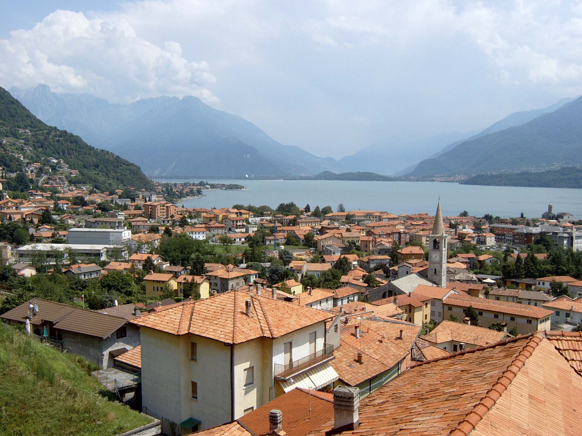
Comune on the upper western shore of Lake Como, with the Romanesque Santa Maria del Tiglio and the Palazzo Gallio above.
Photo: Hamster 3 · CC BY-SA 3.0 licence
- 7Routes
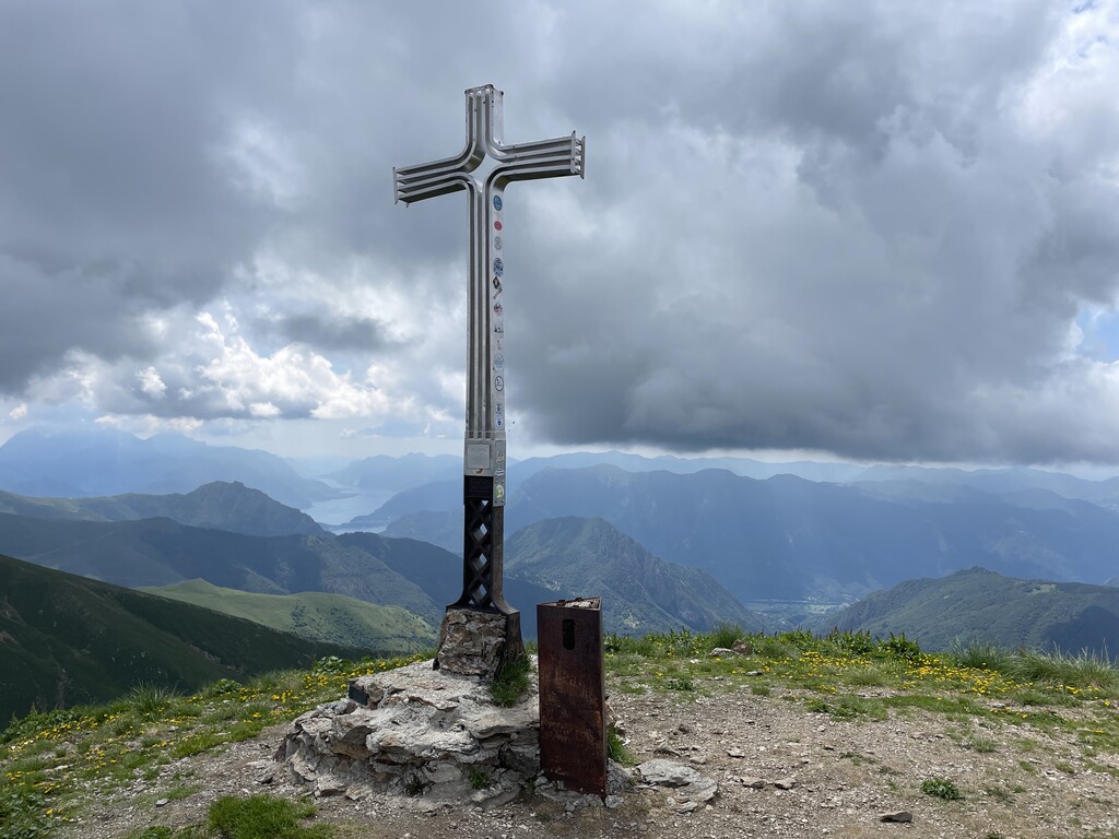
- Featured summit · Pizzo di Gino
Routes
8 from neighbouring places
Dal Passo del Giovo a Sommafiume
An easy walk from the roadhead at the Passo del Giovo across to the Rifugio Sommafiume, on the Como side of the upper Lario.
- 5.1 km
- Distance
- 206 m
- Ascent
- 1 h 38 min
- Duration
- 2
- Check-ins
Dal Passo Giovo al Monte Marmontana
A high traverse from the Passo del Giovo, over the Passo di San Jòrio and past the Capanna delle Aquile, to the top of the Marmontana.
- 8.3 km
- Distance
- 660 m
- Ascent
- 4 h 14 min
- Duration
- 7
- Check-ins
Al Rifugio San Jorio dalla Bocchetta di Germasino
A long climb from the Bocchetta di Germasino past the Alpe di Brent to the pass and refuge at San Jòrio, high above the upper Lario.
- 7.9 km
- Distance
- 1 229 m
- Ascent
- 5 h 8 min
- Duration
- 10
- Check-ins
Santa Croce di Naro
A long climb to Naro, a hamlet under the vertical rock of the Sasso Pelo, on the ridge between the Liro and the Livo above Domaso.
- 14.2 km
- Distance
- 508 m
- Ascent
- 4 h 36 min
- Duration
- 3
- Check-ins
Passo Giovo - Pizzo di Gino
A long climb from the Passo del Giovo by the Rifugio Sommafiume and the Bocchetta di Sengio to one of the high tops of the Lario ridge.
- 15.8 km
- Distance
- 761 m
- Ascent
- 5 h 39 min
- Duration
- 10
- Check-ins
Passeggiata per i borghi intorno a Stazzona
A shaded walk between the hamlets around Stazzona, at the mouth of the Valle Albano, where rye-thatched roofs still survive.
- 8.1 km
- Distance
- 542 m
- Ascent
- 3 h 38 min
- Duration
Sui Monti di Dosso del Liro
A route into the old chestnut woods of the Liro valley, up to the summer pastures of Ciosino and Prennaro above the upper Lake Como.
- 12.6 km
- Distance
- 574 m
- Ascent
- 4 h 21 min
- Duration
Pedalate sul lago
13.5 km away, in Valvarrone
An outing from the hamlet of Bondal above the Lecco shore of Lago di Como, climbing to Monte Legnoncino and the Sella del Legnone.
- 28.6 km
- Distance
- 1 298 m
- Ascent
- 3 h 46 min
- Duration
- 88
- Check-ins
Monte Duria
8 km away, in Peglio
A demanding climb above Peglio over the Sella di Paregna and the pastures of Alpe Paregna, taking in Monte la Motta on the crest.
- 10.6 km
- Distance
- 1 191 m
- Ascent
- 7 h 10 min
- Duration
- 13
- Check-ins
 Monte Duria 2 264 m
- Monte la Motta 1 516 m
 Sella di Paregna 1 470 m
 Alpe Paregna 1 442 m
 Vasca antincendio Loc. Bodone PEGLIO 1 192 m
Da Dasio al Rifugio San Lucio
10.8 km away, in Val Rezzo
A climb out of the Val Rezzo to a pass on the Swiss border, where a former barracks now serves as a refuge that stays open in winter.
- 3.0 km
- Distance
- 420 m
- Ascent
- 1 h 39 min
- Duration
- 32
- Check-ins
Rifugi d'inverno Croce di Campo
8.7 km away, in San Nazzaro Val Cavargna
A steep 900 m climb out of the Val Cavargna to a refuge kept open through the winter, with the rocky top of Il Sasso just above it.
- 4.8 km
- Distance
- 2 271 m
- Ascent
- 10 h 27 min
- Duration
- 5
- Check-ins
Trekking Monte Grona
11.5 km away, in Plesio
A short, steady climb above Plesio to Rifugio Menaggio and on up the rocky crest to the Cima dei Nipoti just above it.
- 4.6 km
- Distance
- 653 m
- Ascent
- 3 h 47 min
- Duration
- 73
- Check-ins
San Bernardo - Musso
8.6 km away, in Musso
A long climb from the Musso lakefront on Lake Como, taking the castle road up to San Bernardo.
- 20.1 km
- Distance
- 900 m
- Ascent
- 6 h 56 min
- Duration
- 11
- Check-ins
Lago Darengo
10 km away, in Livo
A long climb from Livo into a wild side valley, where a clear alpine tarn sits among granite slabs and jagged crests below Capanna Como.
- 16.2 km
- Distance
- 1 638 m
- Ascent
- 10 h 3 min
- Duration
- 22
- Check-ins
Berlinghera - Alpe Gigiai
14 km away, in Gera Lario
A long day above the head of Lake Como, climbing from Sorico to the alp below Monte Berlinghera and back past the Baita dal Vikingo.
- 25.7 km
- Distance
- 1 347 m
- Ascent
- 9 h 41 min
- Duration
- 9
- Check-ins
- Baita dal Vikingo 1 091 m
- Bacino idrico coperto 448 m
No routes of this kind in Gravedona ed Uniti yet.
The region's own picks

Featured route
Dal Passo del Giovo a Sommafiume
An easy walk from the roadhead at the Passo del Giovo across to the Rifugio Sommafiume, on the Como side of the upper Lario.
Planning a trip to Gravedona ed Uniti?
Everything else Lombardy has, in one place


Take Gravedona ed Uniti with you into the mountains
Every route on this page with 3D terrain, GPX navigation and offline maps — including the valleys with no signal.
Data sources
- Official website: lakecomo.is ↗
- Routes and highlights: in Lombardia
- Published as open data by the tourist boards named above.
- Region summary generated from the board's own material.
