
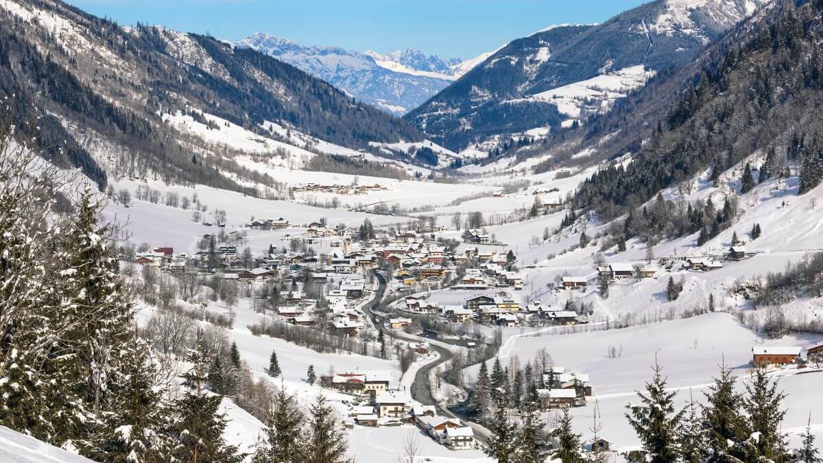
Curated by Zell am See-Kaprun Tourismus
Fusch an der Großglocknerstraße
The village of the Fuscher Tal where the toll section of the Großglockner road begins at Ferleiten, glacier streams and an alpine game park at the foot of the Tauern.
- 5Highlights
- 4Routes
Highlights
10 from neighbouring places
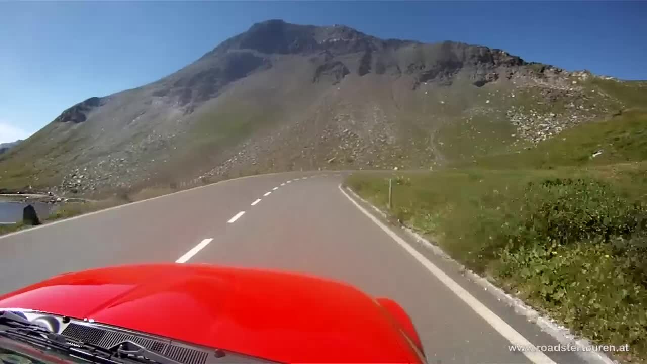
Großglockner Hochalpenstraße
Austria's high alpine road, opened in 1935, climbing from Fusch over the Hochtor at 2,504 m toward the Großglockner, the country's highest peak.
Nationalpark-Ausstellung Leben unter Wasser
A Hohe Tauern National Park exhibition at Fusch an der Glocknerstraße on life in mountain streams and lakes.
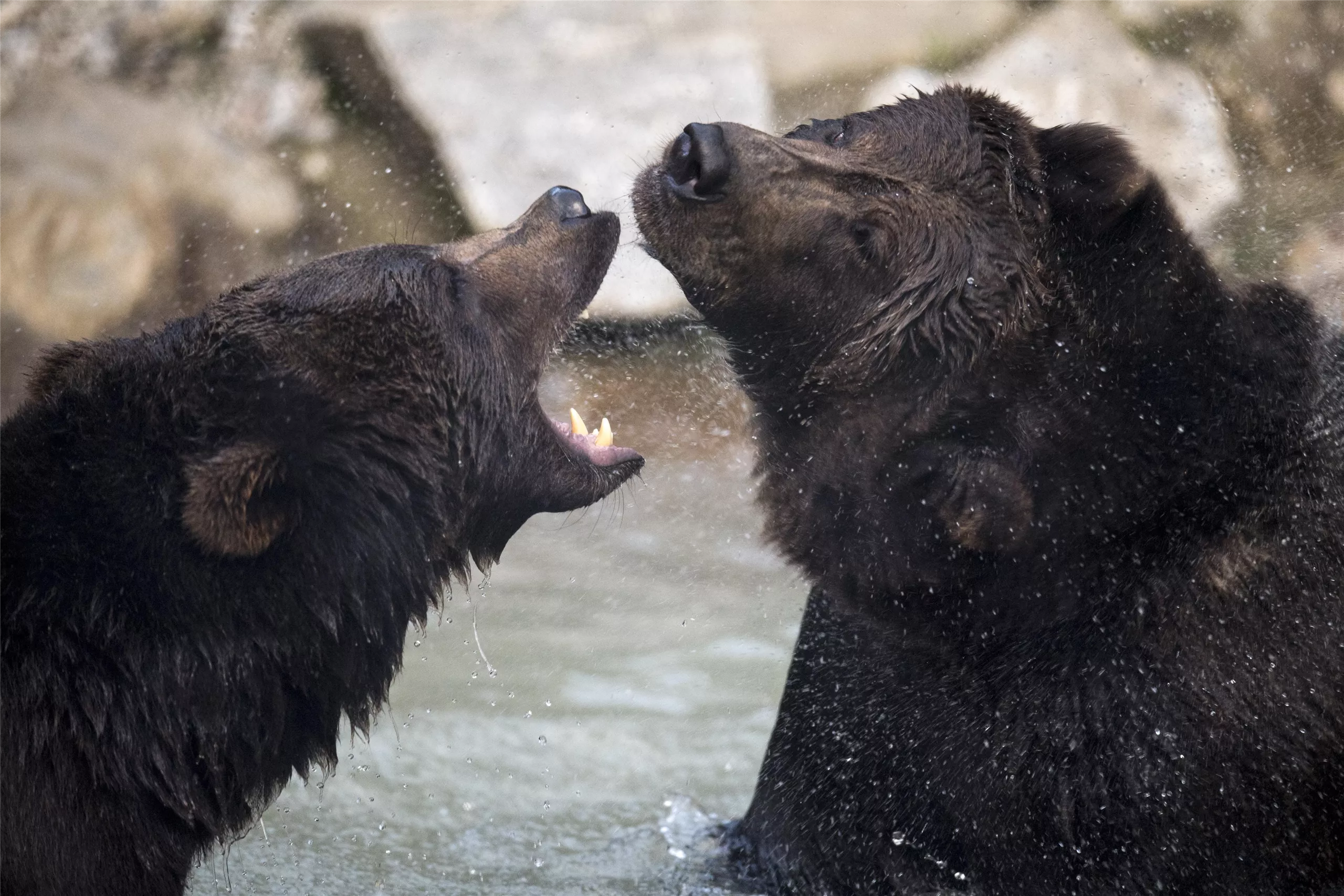
Wild- & Erlebnispark Ferleiten
A game park at Ferleiten near Fusch, at the toll gate of the Grossglockner High Alpine Road, with alpine animals and a play area.
Erlebniswelt HOLZ
A visitor site about timber at the Mühlauer sawmill in Fusch an der Glocknerstraße, in the Hohe Tauern National Park region.
Wild & Erlebnispark Fusch/Ferleiten
A wildlife park at Ferleiten above Fusch, beside the toll gate of the Großglockner High Alpine Road, with native alpine animals.
Kapruner Hochgebirgsstauseen
7.4 km away, in Kaprun
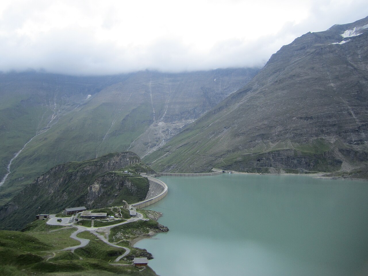
The high-altitude reservoirs Wasserfallboden and Mooserboden above Kaprun, part of the historic hydropower scheme, reached in summer by bus and an inclined lift.
Panoramabahn
8.2 km away, in Kaprun
A gondola stage in the Kitzsteinhorn lift system above Kaprun, part of the ascent from the valley toward the glacier.
National Park Gallery Plattform
9.5 km away, in Kaprun
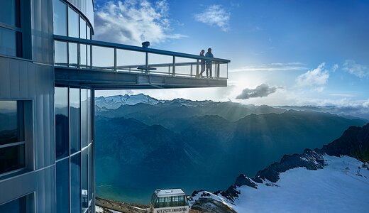
A viewing platform at the end of the Kitzsteinhorn's National Park Gallery tunnel, facing into the Hohe Tauern National Park.
Nationalpark Gallery
9.6 km away, in Kaprun
A tunnel gallery through the Kitzsteinhorn summit ridge with exhibits on the Hohe Tauern National Park, ending at a viewing platform.
ICE CAMP presented by Audi
9.8 km away, in Kaprun
A winter installation of igloo domes on the Kitzsteinhorn glacier with an ice bar and snow lounges, rebuilt each season.
Lechnerberg
9.9 km away, in Kaprun
A lift access point at Lechnerberg on the edge of Kaprun, serving the gentle practice slopes below the Maiskogel.
ICE ARENA im Gletscherschnee
10 km away, in Kaprun
A snow area on the Kitzsteinhorn glacier with slides, a snow beach and play zones, kept open on glacier snow into the summer.
Sigmund Thun Klamm Kaprun
10 km away, in Kaprun
A gorge on the Kapruner Ache below Kaprun, crossed by wooden walkways and steps on the way up towards the reservoirs.
Oldtimer Museum Kaprun
10.5 km away, in Kaprun
A collection of classic cars and motorcycles in Kaprun, in the Pinzgau below the Kitzsteinhorn.
Vötter's Oldtimer Museum Kaprun
10.5 km away, in Kaprun
A private collection of vintage cars and motorcycles displayed at a hotel in Kaprun, spanning several decades of motoring.
 Historic site
 Cable car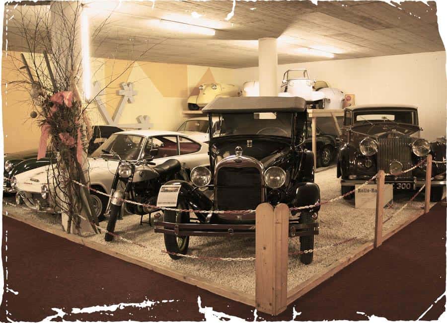
Nothing of this kind in Fusch an der Großglocknerstraße.
Routes
16 from neighbouring places
Großglockner Hochalpenstrasse
A road climb from Fusch past Ferleiten and the Gasthof Piffkar up to the Fuscher Törl at 2,402 m, with the Törlkopf just above.
- 70.3 km
- Distance
- 1 877 m
- Ascent
- 8 h
- Duration
- 93
- Check-ins
 Törlkopf 2 455 m
 Restaurant Fuschertörl 2 410 m
 Fuscher Törl 2 402 m
- Wilfried-Haslauer-Haus 2 268 m
- Gasthof Piffkar 1 632 m
 Tagesspeicher Ferleiten 1 132 m
- +2
Hohe Tauern Bike Trail | ET06 Fusch | Ponyhofalm | Kaprunertal | Kaprun
A stage from Fusch over the Brucker Berg into the Kapruner Tal, past the Sigmund-Thun-Klamm and the Klammsee to the Kesselfall Alpenhaus.
- 36.6 km
- Distance
- 1 184 m
- Ascent
- 4 h 22 min
- Duration
- 60
- Check-ins
Radtour Fusch Ferleiten
A valley ride from Zell am See along the Salzach and up the Fuschertal to the reservoir at Ferleiten, with campsites strung along the way.
- 44.1 km
- Distance
- 570 m
- Ascent
- 4 h 27 min
- Duration
- 16
- Check-ins
- Tagesspeicher Ferleiten 1 132 m
- Tourist Info Fusch 812 m
- Bruck Fusch Besucherzentrum 755 m
- Zell am See Tourist Information 762 m
Gravel Bike Route: Seeblickrunde
A gravel circuit over the Brucker Berg to the Ponyhofalm, with the Zeller See in sight on the descent back to the valley floor.
- 36.3 km
- Distance
- 944 m
- Ascent
- 4 h 7 min
- Duration
- 5
- Check-ins
Staumauerklettersteig MOBO107
7.2 km away, in Kaprun
A via ferrata traversing the crest and face of the Mooserboden dam wall high above Kaprun, an unusual mix of concrete and rock with the reservoir far below.
- 740 m
- Distance
- 72 m
- Ascent
- 34 min
- Duration
- 34
- Check-ins
KA3 | Kesselfall-Tour
8.6 km away, in Kaprun
A valley ride south from Kaprun past the Sigmund Thun-Klamm and the Klammsee to the Kesselfall Alpenhaus at the head of the road.
- 7.9 km
- Distance
- 294 m
- Ascent
- 59 min
- Duration
- 58
- Check-ins
F4 | Wüstlau Trail
9 km away, in Kaprun
A gentle high-level ride under the Kitzsteinhorn lifts, linking the Häuslalm with the Salzburger Hütte and losing height for most of the way.
- 6.5 km
- Distance
- 13 m
- Ascent
- 35 min
- Duration
- 23
- Check-ins
04 | Schneekönigin am Kitzsteinhorn
9.4 km away, in Kaprun
A marked ski-touring route on the Kitzsteinhorn gaining about 470 m from the Alpincenter past the Krefelder Hütte, on secured ground within the glacier ski area.
- 2.0 km
- Distance
- 468 m
- Ascent
- 468 m
- Descent
- 1 h 28 min
- Duration
- 36
- Check-ins
03 | Skitour Maiskogel
10.7 km away, in Kaprun
A ski-touring ascent of nearly 1,000 m on the Maiskogel above Kaprun, passing the Saulochalm on a route that can be started from the village itself.
- 5.0 km
- Distance
- 967 m
- Ascent
- 967 m
- Descent
- 3 h 8 min
- Duration
- 26
- Check-ins
KA7 | Kitzsteinhorn-Uphill
9.3 km away, in Kaprun
A relentless uphill from Kaprun at 769 m to the Alpincenter and Gletschermühle near 2,450 m, by way of the Saulochalm and Salzburger Hütte.
- 23.4 km
- Distance
- 2 059 m
- Ascent
- 4 h 56 min
- Duration
- 74
- Check-ins
KA4 | Schneckenberg-Tour
9.8 km away, in Kaprun
A loop from Kaprun up to the Klammsee, passing the Sigmund Thun-Klamm and the Klammseestüberl before dropping back to the village.
- 9.5 km
- Distance
- 225 m
- Ascent
- 1 h 3 min
- Duration
- 22
- Check-ins
F5 | Geissstein Trail
9.3 km away, in Kaprun
A short ride high on the glacier side above Kaprun, between the Alpincenter and the Gletschermühle at nearly 2,450 m.
- 3.4 km
- Distance
- 21 m
- Ascent
- 19 min
- Duration
- 48
- Check-ins
05 | Eisbrecher am Kitzsteinhorn
9.7 km away, in Kaprun
A longer marked ski route on the Kitzsteinhorn with close to 900 m of climbing up past the Krefelder Hütte, staying within the secured glacier area.
- 3.8 km
- Distance
- 885 m
- Ascent
- 885 m
- Descent
- 2 h 47 min
- Duration
- 11
- Check-ins
Gravel Bike Route: Kitzsteinhorn
9.3 km away, in Kaprun
A hard gravel climb out of the Kaprun valley past the Wirtsalm and the Salzburger Hütte, topping out by the Gletschermühle at almost 2,450 m.
- 22.1 km
- Distance
- 2 073 m
- Ascent
- 4 h 54 min
- Duration
- 53
- Check-ins
KA6 | 3K K-onnection Tour
9.9 km away, in Kaprun
A climb to the Panorama Maiskogel viewpoint and the Wirtsalm, going on past the Salzburger Hütte towards the Häuslalm above Kaprun.
- 10.4 km
- Distance
- 768 m
- Ascent
- 1 h 55 min
- Duration
- 38
- Check-ins
KA2 | Variante Lechnerberg
9.4 km away, in Kaprun
A short village climb at Kaprun, gaining a couple of hundred metres onto the hillside terrace as a variant of the main valley loop.
- 4.4 km
- Distance
- 236 m
- Ascent
- 39 min
- Duration
Maiskogel - Bachler Trail - Tauernradweg
10.2 km away, in Kaprun
A climb to the Wirtsalm above Kaprun and a descent back to the valley, joining the Klammsee and the cycle path along the Salzach.
- 15.4 km
- Distance
- 865 m
- Ascent
- 2 h 19 min
- Duration
- 28
- Check-ins
KA1 | Guggenbichl-Runde
10.3 km away, in Kaprun
A short loop on the slopes above Kaprun, climbing from the village to the Lechnerberg lifts and dropping back past Camping zur Mühle.
- 7.1 km
- Distance
- 205 m
- Ascent
- 50 min
- Duration
- 10
- Check-ins
F3 | Bachler Trail
9.8 km away, in Kaprun
A short, easy run of under two kilometres above Kaprun, starting close to the Wirtsalm at 1,425 m with almost no climbing.
- 1.9 km
- Distance
- 10 m
- Ascent
- 11 min
- Duration
- 1
- Check-ins
KA10 | Bruckerberg-Runde
10.3 km away, in Kaprun
A rolling circuit from the centre of Kaprun onto the wooded hillsides above the village, returning along the floor of the Salzach valley.
- 15.3 km
- Distance
- 402 m
- Ascent
- 1 h 44 min
- Duration
- 3
- Check-ins


No routes of this kind in Fusch an der Großglocknerstraße yet.
Planning a trip to Fusch an der Großglocknerstraße?
Everything else Salzburg (state) has, in one place


Take Fusch an der Großglocknerstraße with you into the mountains
Every route on this page with 3D terrain, GPX navigation and offline maps — including the valleys with no signal.
Data sources
- Official website: zellamsee-kaprun.com ↗
- Routes and highlights: Zell am See-Kaprun Tourismus, Nationalpark, Kitzbühel Tourismus, Großarltal Tourismus
- Published as open data by the tourist boards named above.
- Region summary generated from the board's own material.
