
Curated by Consorzio Val di Zoldo Turismo
Borca di Cadore
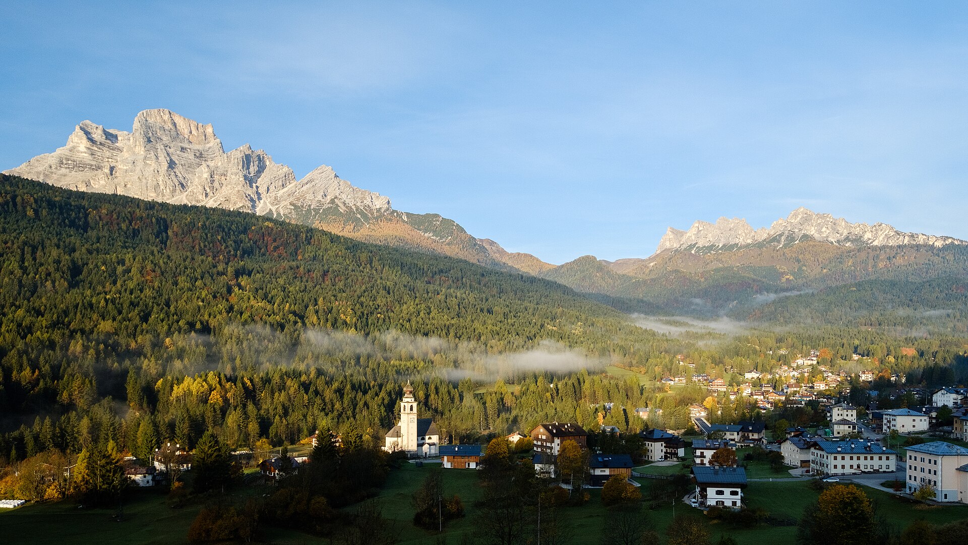
Cadore village below the Antelao and the Pelmo, with the Boite valley floor for gentler walking.
- 1Highlights
- 7Routes
- Featured summit · Col delle Crepe Cavaliere
Highlights
All 1 from neighbouring places
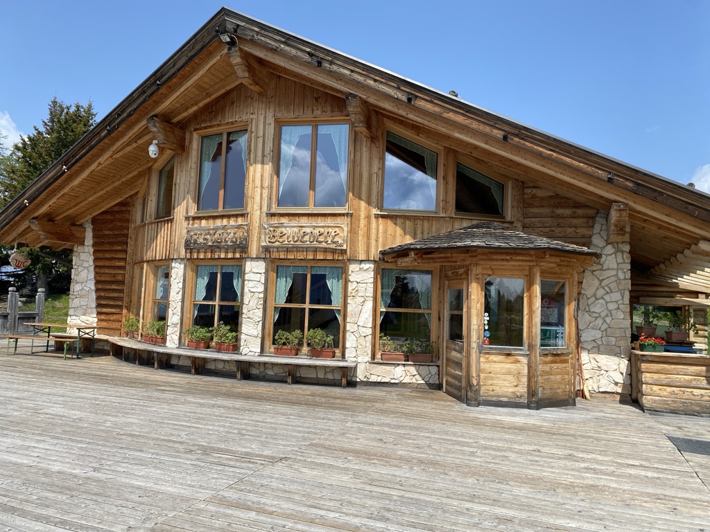
Rifugio Ristoro Belvedere
13.1 km away, in Alleghe
A hut on the lower slopes of the Civetta above Alleghe, reached from the Piani di Pezzè lift and looking across to the lake.
Nothing of this kind in Borca di Cadore.
Routes
13 from neighbouring places
MONDEVAL CROSSING
A traverse of the Mondeval plateau, where a Mesolithic hunter's grave was found, below the Pelmo and the Croda da Lago.
- 12.4 km
- Distance
- 357 m
- Ascent
- 4 h 19 min
- Duration
- 878
- Check-ins
 Passo di Giau 2 236 m
 Berghotel Passo Giau 2 235 m
- Rifugio Città di Fiume 1 917 m
- Forcella Ambrizzola 2 277 m
- Forcella di Giau 2 370 m
- Malga Fiorentina 1 801 m
- +7
Open route Consorzio Val di Zoldo TurismoAlta Via no.1 - Stage 6
A stage from the Città di Fiume hut on the Gino Flaibani path around the Pelmo, over Forcella Foràda and high pasture.
- 11.8 km
- Distance
- 970 m
- Ascent
- 6 h 23 min
- Duration
- 571
- Check-ins
- Rifugio Città di Fiume 1 917 m
- Rifugio Croda da Lago 2 043 m
- Rifugio "Alba Maria De Luca" Venezia 1 936 m
- Forcella Ambrizzola 2 277 m
- Forcella de la Puina 2 034 m
- Forcella Roan 1 999 m
- +5
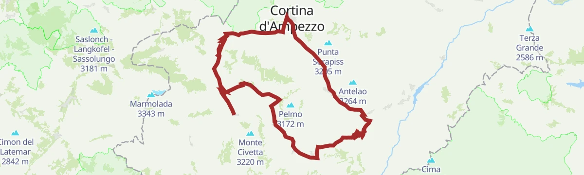
Open route Cortina Marketing Se.Am.Road Bike Alleghe 5 - Pelmo Croda da Lago loop
A big road loop from Alleghe with three Dolomite passes, Staulanza, Cibiana and Falzarego, and a string of valley villages in between.
- 118.4 km
- Distance
- 2 931 m
- Ascent
- 13 h 16 min
- Duration
- 783
- Check-ins
- Falzarego Pass 2 105 m
- Passo Staulanza 1 766 m
- Bar Bazar 2 106 m
- Rifugio Passo Staulanza 1 770 m
- Strobel 2 060 m
- Rifugio Monte Pelmo 1 520 m
- +22
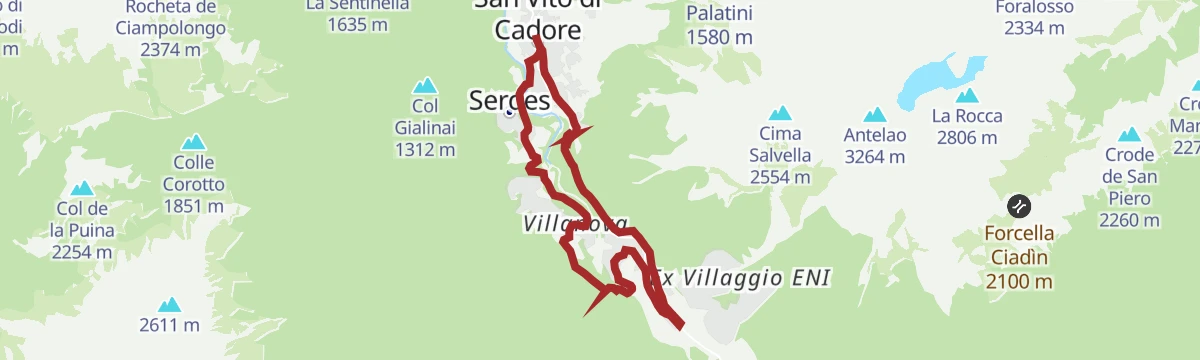
Open route Consorzio Operatori Turistici Alleghe - CaprileBorca-San Vito di Cadore Ring
An easy loop linking Borca di Cadore with San Vito, from the old station down to Villanova, over the Boite and on to the hamlet of Serdes.
- 12.2 km
- Distance
- 158 m
- Ascent
- 3 h 15 min
- Duration
- 15
- Check-ins
Open route Dolomiti Bellunesi - The Mountains of VeniceMonte Pelmo Circuit
A full circuit of Monte Pelmo from the Staulanza pass, round the south walls, the great eastern cirque and the severe north-west face.
- 13.1 km
- Distance
- 960 m
- Ascent
- 6 h 19 min
- Duration
- 342
- Check-ins
 Col delle Crepe Cavaliere 1 900 m
- Passo Staulanza 1 766 m
- Rifugio "Alba Maria De Luca" Venezia 1 936 m
- Rifugio Passo Staulanza 1 770 m
- Passo Rutorto 1 931 m
- Forcella Val d'Arcia 2 474 m
Open route Consorzio Val di Zoldo TurismoRing Vodo - Borca di Cadore
An easy loop between Vodo and Borca di Cadore, under the Pelmo and the Antelao.
- 11.3 km
- Distance
- 289 m
- Ascent
- 3 h 22 min
- Duration
Open route Dolomiti Bellunesi - The Mountains of VeniceRing Vodo - Malga Ciauta - Borca
A loop from Borca di Cadore on the cycle path to Vodo, then by the Talamini farm into the woods and up to Malga Ciauta.
- 17.7 km
- Distance
- 752 m
- Ascent
- 6 h 1 min
- Duration
- 36
- Check-ins
Open route Dolomiti Bellunesi - The Mountains of VeniceTHROUGH TABIA’ AND MAS OF VAL DI ZOLDO
9.1 km away, in Val di Zoldo
A walk past the churches at Brusadaz and the old barns of the lower Val di Zoldo, with cattle grazing at Pra Grant and deer at Mas di Sabe.
- 5.5 km
- Distance
- 324 m
- Ascent
- 2 h 15 min
- Duration
Open route Consorzio Val di Zoldo TurismoPALAFAVERA - COL DEI BALDI by E-BIKE (10)
9.5 km away, in Val di Zoldo
A loop below Monte Civetta with the Pelmo in sight, passing Casera di Pioda and Agriturismo Malga Fontanafreda on the way up.
- 12.6 km
- Distance
- 509 m
- Ascent
- 1 h 36 min
- Duration
- 251
- Check-ins
- Col Dei Baldi 1 918 m
- Casera di Pioda 1 820 m
- Rifugio Palafavera 1 514 m
- Rifugio Col dei Baldi 1 922 m
- Agriturismo Malga Fontanafreda 1 770 m
Open route Consorzio Val di Zoldo TurismoPECOL - BAITA CIVETTA by E-BIKE (11)
10.1 km away, in Val di Zoldo
An easy ride through meadow and larch wood to Le Palanche on the Maè, where a picnic area sits just short of the baita at 1,578 m.
- 5.4 km
- Distance
- 233 m
- Ascent
- 42 min
- Duration
- 41
- Check-ins
Open route Consorzio Val di Zoldo TurismoCIVETTA E-BIKE ROUTE (14)
10.1 km away, in Val di Zoldo
An e-bike loop in the Ski Civetta area up to Cima Fertazza at over 2,000 m, calling at Rifugio Col dei Baldi and Malga Staulanza.
- 24.0 km
- Distance
- 1 084 m
- Ascent
- 3 h 9 min
- Duration
- 394
- Check-ins
- Col Dei Baldi 1 918 m
- Cima dei Viai - Cima Fertazza 2 101 m
- Casera di Pioda 1 820 m
- Ristoro Belvedere - Cima Fertazza 2 076 m
- Rifugio Col dei Baldi 1 922 m
- Ristoro La Ciasela 2 050 m
- +4
Open route Consorzio Val di Zoldo TurismoHikes in Alleghe 8 - From Col dei Baldi to Alleghe
11.5 km away, in Alleghe
From the Col dei Baldi by the Forcella Alleghe to Pian dei Sec, then a steep ramp past two huts, across the Coldai and Civetta pistes and down through wood.
- 10.6 km
- Distance
- 99 m
- Ascent
- 1 h 22 min
- Duration
- 182
- Check-ins
- Col Dei Baldi 1 918 m
- Rifugio Col dei Baldi 1 922 m
- Bierstube 977 m
- Tabià de Checo Padelin 1 761 m
- Tabià de Rico 1 795 m
- Rossella 1 742 m
- +1
Open route Consorzio Operatori Turistici Alleghe - CaprileCortina Bike Park - Firefox
13.7 km away, in Cortina d'Ampezzo
A jump line cut through the woods at Socrepes, seven tabletops and doubles with transfers of more than ten metres.
- 804 m
- Distance
- 0 m
- Ascent
- 6 min
- Duration
- 17
- Check-ins
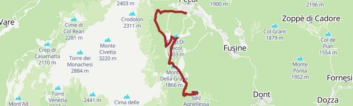
Open route Cortina Marketing Se.Am.SPIZ DE ZUEL in E-BIKE (13)
10.1 km away, in Val di Zoldo
A climb on an old military road through open pasture to Italian wartime defences below a 2,033 m peak facing Civetta and Pelmo.
- 17.0 km
- Distance
- 780 m
- Ascent
- 2 h 15 min
- Duration
- 123
- Check-ins
- Spiz Agnellessa 2 046 m
- Monte Della Grava 1 866 m
- I Spiz 2 033 m
- Ristoro Da Bepi 1 747 m
- Baita Civetta al Casot 1 578 m
- Ristorante Su'n Paradis 1 862 m
- +1
Open route Consorzio Val di Zoldo TurismoRing Vodo - Vinigo - Venas di Cadore
2.9 km away, in Vodo Cadore
A loop from Villa Gaia off the Dolomites cycle path to the Sant'Anna fort, built between 1908 and 1917, and up to the Col Pecolines viewpoint.
- 20.5 km
- Distance
- 714 m
- Ascent
- 6 h 34 min
- Duration
- 1
- Check-ins
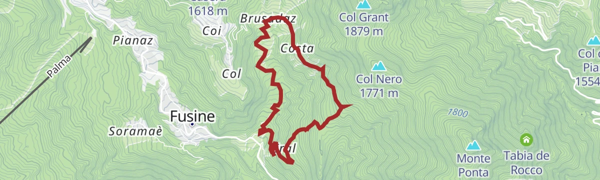
Open route Dolomiti Bellunesi - The Mountains of VeniceMONTE PONTA FROM THE HAMLET OF COSTA
8.1 km away, in Val di Zoldo
Called the navel of Zoldo for its full round view of the valley peaks; an old military road climbs the south side through wood and pasture past war remains.
- 8.3 km
- Distance
- 637 m
- Ascent
- 4 h 8 min
- Duration
- 38
- Check-ins
- Monte Ponta 1 952 m
- Col de Salera 1 629 m
- Col Nero 1 771 m
- La Forzela 1 723 m
- Forcella Tamai 1 715 m
Open route Consorzio Val di Zoldo TurismoFERTAZE POND
9.4 km away, in Val di Zoldo
A short, easy walk to the Fertaze pond on the wooded slopes of the Val di Zoldo.
- 1.7 km
- Distance
- 88 m
- Ascent
- 39 min
- Duration
- 3
- Check-ins
Open route Consorzio Val di Zoldo TurismoPIAN DE LE MANDRATE by E-BIKE (12)
9.9 km away, in Val di Zoldo
A loop from Pecol up to Coi, the highest hamlet in the valley at 1,494 m, with its frescoed old houses, barns and Rifugio Monte Pelmo above.
- 11.1 km
- Distance
- 417 m
- Ascent
- 1 h 23 min
- Duration
- 85
- Check-ins
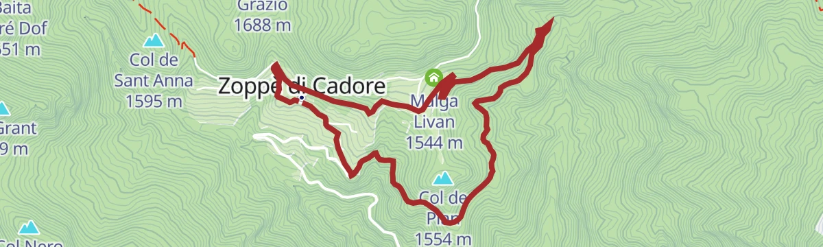
Open route Consorzio Val di Zoldo TurismoZOPPE’ DI CADORE – COL DEL PIAN by E-BIKE (06)
6.2 km away, in Zoppè di Cadore
A short easy loop above the village on the Lizon forest road, past Piol Alto and Malga Livan, with the Laghetto dei Piridei close by.
- 5.4 km
- Distance
- 218 m
- Ascent
- 41 min
- Duration
- 17
- Check-ins
Open route Consorzio Val di Zoldo TurismoTour of the Alpine Pastures of Val Fiorentina
11.2 km away, in Selva di Cadore
A long circuit of the Val Fiorentina pastures below the Pelmo, also ridden on gravel bikes.
- 19.7 km
- Distance
- 843 m
- Ascent
- 2 h 33 min
- Duration
- 128
- Check-ins
- Ristoro Sabe 1 409 m
- Ristoro Fertazza 1 852 m
- Baita Flora Alpina 1 525 m
- Agriturismo Malga Fontanafreda 1 770 m
- Forcella Pécol 1 786 m
- Ristoro-Bar Blanchet 1 409 m
- +1
Open route Dolomiti Bellunesi - The Mountains of Venice









No routes of this kind in Borca di Cadore yet.
The region's own picks

Featured route
MONDEVAL CROSSING
A traverse of the Mondeval plateau, where a Mesolithic hunter's grave was found, below the Pelmo and the Croda da Lago.
Planning a trip to Borca di Cadore?
Everything else Veneto has, in one place


Take Borca di Cadore with you into the mountains
Every route on this page with 3D terrain, GPX navigation and offline maps — including the valleys with no signal.
Data sources
- Official website: borca.visitcadore.com ↗
- Routes and highlights: Consorzio Val di Zoldo Turismo, Dolomiti Bellunesi - The Mountains of Venice, Cortina Marketing Se.Am., Consorzio Operatori Turistici Alleghe - Caprile, YesAlps
- Published as open data by the tourist boards named above.
- Region summary generated from the board's own material.
