Scan the QR code and open PeakVisor on your phone
The Municipal District of Ranchland (MD of Ranchland) is an administrative region located in southwest Alberta, Canada. The MD is situated to the north of the municipality of Crowsnest Pass and the MD of Pincher Creek. There are 61 named mountains in the MD of Ranchland, of which the tallest and most prominent is Tornado Mountain with an elevation of 3,099 m (10,167 ft) and a prominence of 931 m (3,054 ft).
Located in southwestern Alberta, Canada, the MD of Ranchland has no urban municipalities, hamlets, or urban service areas within its borders. The very rural and rugged MD of Ranchland is located about 125 km (75 mi) to the south of Calgary, Alberta and it is the least populated municipal district in Alberta with a population of less than 100 people.
The municipality of Crowsnest Pass and the MD of Pincher Creek are situated to the south of the MD of Ranchland. The MD of Ranchland includes the Porcupine Hills to the east of Highway 22, and its western border is the same as the British Columbia – Alberta border. The northern border of the MD aligns roughly with Highway 532 and Kananaskis Improvement District is located to the north.
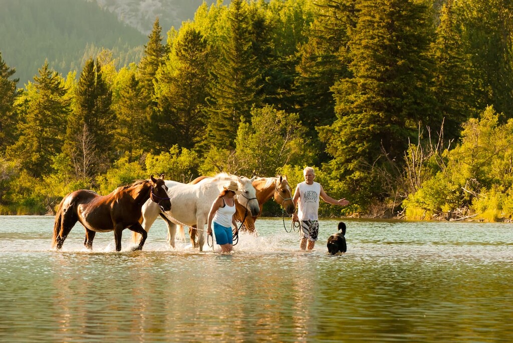
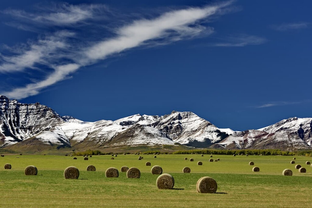
As its name suggests, the MD of Ranchland is dominated by ranchland. In fact, ranching is nearly the sole economic activity in the area and there are vast stretches of rangeland in the district as well as a significant number of protected areas. The MD of Ranchland includes parts of some areas that are commonly associated with Kananaskis Country and many more. The protected areas in the MD of Ranchland are the following:
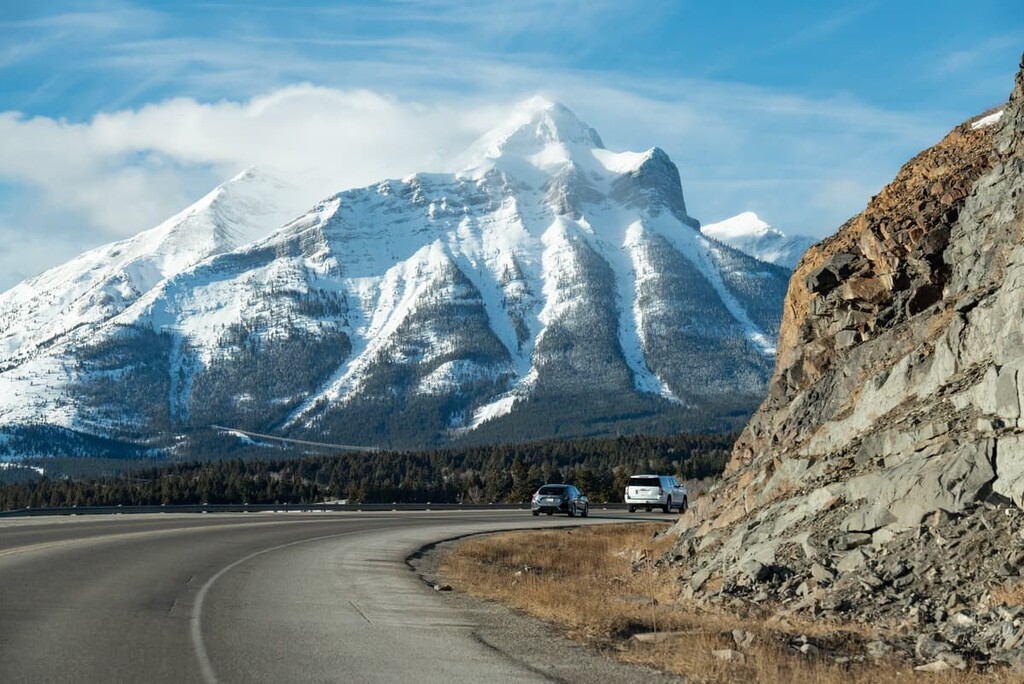
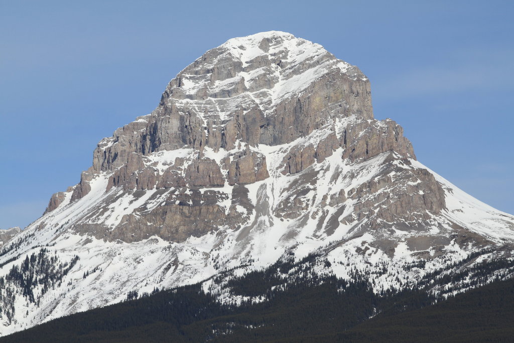
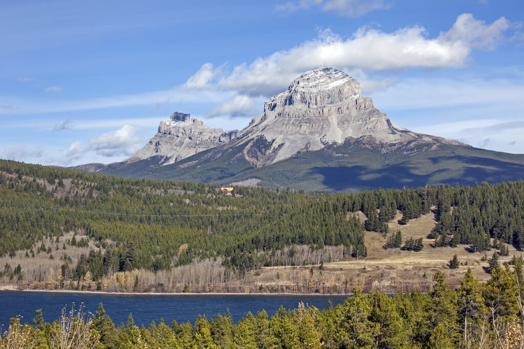
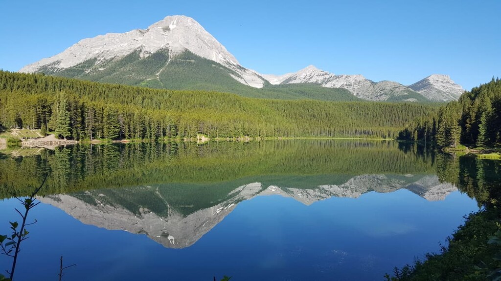
The High Rock Range of the Rocky Mountains is located along the Continental Divide, so it is situated on the western border of the MD of Ranchland. Located to the east of the High Rock Range is the Livingstone Range, which is a front range of the Rockies. Further east of the Livingstone Range are the foothills of the Rockies, which form an area called the Porcupine Hills in the MD of Ranchland.
The Rocky Mountains and the foothills of the MD of Ranchland started uplifting about 75 million years ago during an event called the Laramide orogeny. For about 40 million years, the Rocky Mountains rose many kilometers above sea level, to elevations higher than the current mountains.
After the mountains were created, the foothills were created from the same thrust faulting process; however, only the Cretaceous sandstone and shale was thrust up instead of the older Paleozoic limestone layer. A thick layer of sandstone and shale was broken and uplifted in a pattern that resembles overlapping shingles.
The mountains were covered in a thick layer of ice during the Pleistocene when the Cordilleran ice sheet covered western Canada. During the recession of the ice sheet, significant erosion created the major topography of the ranges. Subsequent glaciers formed in the peaks and valleys carving out U-shaped valleys and cirques on the mountain peaks.
The glaciers were able to affect the topography of the Rocky Mountains so significantly because of the different types of rocks that composed the mountains. The peaks of the Rockies are generally made of limestone and dolomite which are hard and durable, such that they resisted the erosive glaciers. However, the valleys were once filled with softer sandstones and shales that the glaciers scoured away.
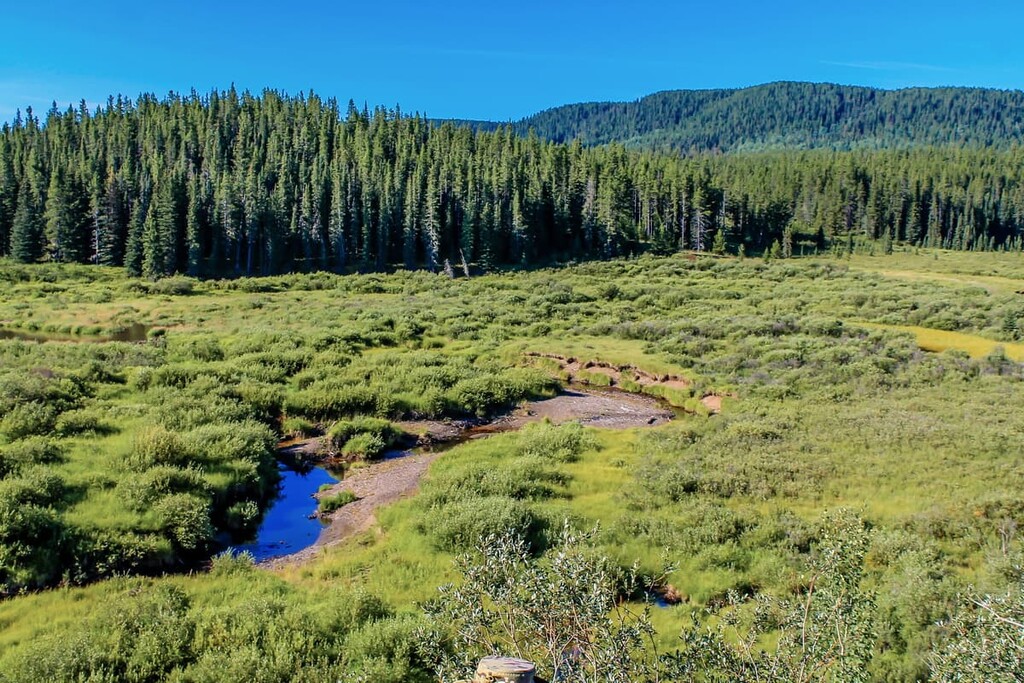
The ecology of the MD of Ranchland represents the entire Rocky Mountain Natural Region and the Foothills Fescue Subregion of the Grassland Natural Region. The regions transition from the alpine in the peaks of the High Rock and Livingstone Range through the subalpine zones on the slopes of the mountains to the montane valleys and hills and finally into the rolling fescue grasslands.
The alpine is generally bare rock with patches of vegetation, sometimes there are alpine meadows covered with heath, sedge, and scattered stands of krummholz. Hoary marmots and pika make burrows in the alpine rocks and feed on the scant vegetation. Mountain goats and bighorn sheep inhabit the peaks to avoid predators, as do several bird species during nesting season.
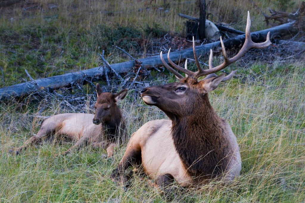
There are significantly more animals in the subalpine and montane habitats of the MD of Ranchland. The subalpine and montane are home to elk, deer, cougars, wolves, grizzly bears, black bears, as well as smaller predators such as wolverines, fishers, martens, and foxes.
The forests in the municipal district transition from a parkland-like mosaic of open grassland and stands of trees to a dense forest as the elevation decreases. Engelmann spruce and subalpine fir dominate the slopes, while lodgepole pine is especially prevalent in the valleys and is one of the first species to grow after a forest fire.
As the forests stretch towards the prairies, the trees start to thin again and the meadows of rough fescue, Parry oat grass, and Idaho fescue become open grassland. The grasslands are better suited for grazing than growing crops, so most of the grassland in the MD of Ranchland is grazing rangeland for the expansive ranches of the region.
Of particular note in the region is the Whaleback area, which lies between the Livingstone Range and the Porcupine Hills. The Whaleback area is located in the Black Creek Heritage Rangeland. It is a relatively undisturbed montane and subalpine habitat that is considered the last remaining area of “wilderness” montane in Alberta.
The MD of Ranchland, which spans from the Continental Divide to the Porcupine Hills, was among the first areas that was freed from the Cordilleran and Laurentide ice sheets over 12,000 years ago. As the ice sheets receded and vegetation grew, many animals migrated into the region, such as giant bison, camels, mastodons, mammoths, horses, and large predator cats.
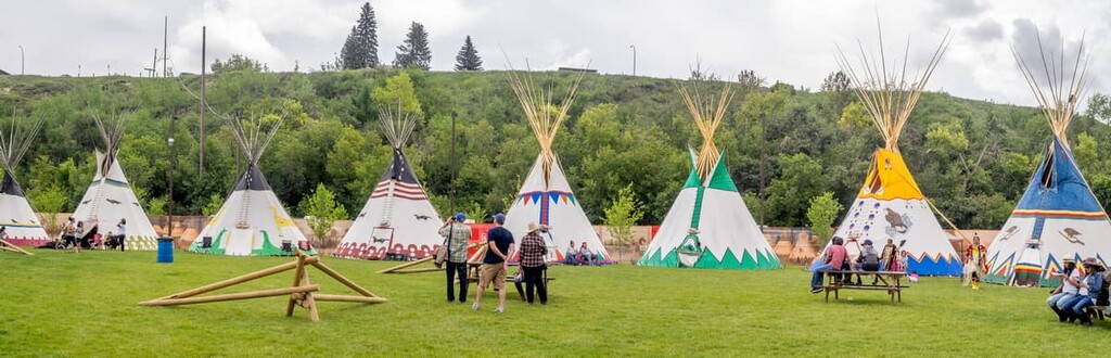
With the influx of animals into the region, groups of humans began to inhabit the area. The area south of the MD of Ranchland in the municipality of Crowsnest Pass and Pincher Creek are especially rich in archaeological sites, as it was a prime hunting area between the mountains and the prairies as well there was a pass though the mountains that facilitated travel and trade.
The Tsuu T’ina, Ktunaxa, Blackfoot, and Métis First Nations have historically inhabited the MD of Ranchland for hunting and gathering, ceremonial uses, and as trade and travel routes. The Tsuu T’ina came from the north of Alberta, originally settling near what is now Edmonton, unitil they were forced to move to the south by hostile neighbors.
The Ktunaxa originally settled the eastern slopes of the Rockies to the Columbia River Valley in British Columbia. However, when the Blackfoot Confederacy moved west from the Great Lakes area centuries ago, hostilities forced the Ktunaxa west of the Rockies, only to return to trade and to hunt bison.
Meanwhile, distinct Métis communities developed along with the expansion of the fur trade to the west. The Métis Homeland includes Manitoba, Saskatchewan, Alberta, and parts of Ontario, British Columbia, the Northwest Territories, and the northern United States.
Currently there are no municipalities or urban service centers in the MD of Ranchland and the population is less than 100 people. The residents of the district typically work in ranching, and there are many large ranches in the area. The district also has areas designated for forestry on either side of the Livingstone Range.
The MD of Ranchland has spectacular scenery and large tracts of relatively undisturbed wilderness area. There are many beautiful locations to hike and explore. The following are some suggestions on where to hike in the district.
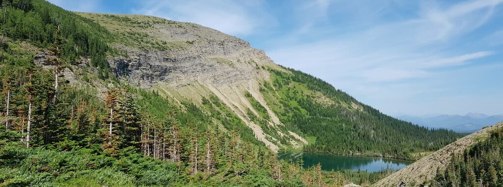
The Beehive Natural Area is a beautiful mountain landscape bordered by the Oldman River to the east and the Continental Divide to the west. There are only three peaks in the natural area; however, there is a hike that allows you to summit two in one trip.
While both Mount Lyall and Beehive Mountain have individual trails that lead to their summits, there is also a trail that connects the two along their common shoulder. The 25 km (15 mi) loop that includes the two summits can be attempted as a backpacking trip over multiple days or as an ambitious day trip.
The Black Heritage Rangeland is home to the “Whaleback Area.” This is a montane wilderness centered around Whaleback Ridge. The terrain is generally easy going across rolling foothills and there are many trails that are worth hiking.
Some of the trails include the loops on Whaleback Ridge, Little Whaleback Ridge, and at Beaverdam Creek. There are also some waterfalls to find along the Camp Creek trails, or you can explore Ridge Creek and White Creek. There is also the Livingstone Fire Lookout which promises panoramic views of the region.
Surrounding the Mount Livingstone Natural Area is part of the Don Getty Wildland Provincial Park. These two areas include the summits of Mount Livingstone and Saddle Mountain with Mount Hornecker and Windy Peak to the north.
All of the mentioned peaks have trails to their summits as well as trails connecting them. It is possible to tackle one or two of the summits such as Mount Livingstone and Saddle Mountain in a single day. For the ambitious peakbagger, it is possible to plan a multi day expedition that could include all the summits of Mounts Livingstone and Hornecker, Saddle Mountain, and Windy Peak.
As mentioned previously, the MD of Ranchland has no municipalities in its borders; however, there are several towns and cities that are located relatively close by. The following are some towns and cities near the MD of Ranchland.
The city of Calgary is located 125 km (75 mi) to the north of the MD of Ranchland. Calgary is the largest city in Alberta and it is a great city to stay in and make day trips to various mountain and wilderness locations. Calgary is relatively close to the incredible wilderness areas of Kananaskis Country, Banff National Park, and some incredible public land use zones.

While staying in Calgary there is a large selection for accommodation and dining choices. There are museums to visit, as well as regular theater productions and concerts. The Calgary Zoo is a fun place to explore and it’s neat to get a view of the city from the Calgary Tower.
Pincher Creek is situated some 100 km (60 mi) from the heart of the MD of Ranchland. Pincher Creek is a community near the Oldman River and it is close to the Oldman Reservoir which has opportunities for camping and boating.
While staying in or visiting Pincher Creek, the Kootenai Brown Historical Village is a great place to check out. There are many historical buildings to enter and explore, to see what life was like when the region was settled in the nineteenth century.
You can visit the old RCMP stables at the village as well as visit the museum to see the thousands of artifacts that represent the lives of the First Nations that have called the region home for thousands of years.
The Municipality of Crowsnest Pass is located about 100 km (60 mi) from the heart of the MD of Ranchland. The municipality comprises several communities that were amalgamated into one district, including Coleman, Blairmore, Frank, Hillcrest, and Bellevue.
The towns were formed in the early twentieth century as settlement for the miners working the many coal mines. The area has a fascinating history that includes bootleggers, train robberies, the worst mining disaster in Canadian history, and a landslide that covered a whole town in less than two minutes.