
Scan the QR code and open PeakVisor on your phone
Black Creek Heritage Rangeland is an outdoor recreation area located in southern Alberta, Canada in the Municipal District of Ranchland. There are two peaks in the Black Creek Heritage Rangeland, the tallest of which is Whaleback Ridge with 1,703m (5,587ft) of elevation and 78 m (256 ft) of prominence. Meanwhile, Black Mountain is the most prominent peak in the rangeland with 1,669 m (5,476 ft) of elevation and 199 m (653 ft) of prominence.
Black Creek Heritage Rangeland is an outdoor recreation area that’s situated on the western side of Highway 22 (Cowboy Trail) in the Municipal District of Ranchland of Alberta. The rangeland is located along the eastern slopes and foothills of the Livingstone Range of the Rocky Mountains.
The rangeland encompasses 77 square kilometers (29 square miles) of land to the east of Whaleback Ridge. Meanwhile, the Oldman River is located to the north and Bob Creek Wildland Provincial Park is situated to the west.
The Municipal District of Ranchland has no municipalities within its borders and the primary use of land for most of the district is for ranching. The MD of Ranchland has the smallest population of any municipal districts in Alberta; however, there are several communities nearby, such as Crowsnest Pass, Pincher Creek, and Lethbridge.
Some of the other provincial parks and protected areas in the region are:
As part of the foothills of the Rocky Mountains, the underlying rocks of Black Creek Heritage Rangeland were formed during the Cretaceous. Whaleback Ridge is a good example of the typical formation of the foothills thanks to its westward trending thrust fault. This fault formed from the tectonic subduction that occurred about 1000 km (600 mi) in the region to the west.
The Alberta foothills formed toward the end of the Laramide orogeny, which was the mountain forming event that formed the Rocky Mountains. As was the case during the formation of the Rockies, the pressure from regional tectonic collision and subduction cracked layers of rock and pushed them upward into mountains.
However, the difference between the Rockies and the foothills is that the faults in the mountains ran deeper than those in the foothills, ultimately stacking layers of Paleozoic limestone as well as the younger Cretaceous sandstone. In the foothills, it was only the Cretaceous sandstone that was thrust up to form the hills. Typically, the foothills flow perpendicularly and to the east from the mountains like waves crashing onto the prairies.
The sandstone that is typical of Black Creek Heritage Rangeland is massive, coarse-grained, light grey sandstone that was deposited about 70 million years ago. The sand and silt found in the region’s rock layers were deposited from continental run-off into the ancient sea that had formed between the uplifting Western Cordillera and the ancient west coast of Canada. At this time, the zone of uplift aligned closely with the current Alberta-British Columbia border.
Starting about 2 million years ago, the Earth began to cool and glaciers started forming in the mountains and polar areas of North America. Many of the glaciers merged to create massive ice sheets that covered the Rockies and another that covered the rest of Canada. The ice sheets were upwards of 3 km (1.8 mi) thick in some locations.
The ice sheets rounded over the hill tops and scoured away softer rocks. As the glaciers retreated, moraines formed and glacial till and sediment was deposited across the rangeland.
Black Creek Wildland Heritage Rangeland is part of the “Whaleback” area, which is described as the largest, relatively unfragmented, and least disturbed montane landscape in Alberta. The montane climate is characterized by cool summers and significant winter snowfall; however, the warm Chinook winds that grace the eastern slopes can quickly clear the snow away.
The subalpine areas of the rangeland are a matrix of grasslands of pine grass and forests of lodgepole pine, Engelmann spruce, and an understory of twin flower and grouseberry. The valleys support stands of Douglas fir, white spruce, limber pine, low willow, and dwarf birch. The understory has thimbleberry, creeping mahonia, buffalo berry, bearberry, and snowberry.
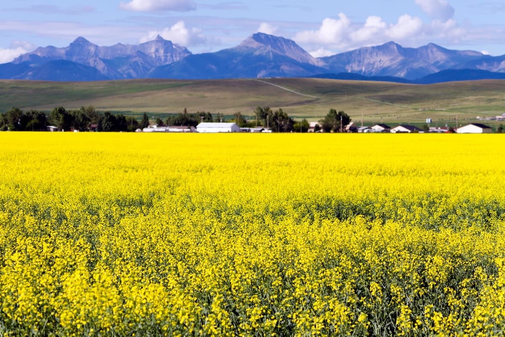
The grasslands cover significant portions of the park and cattle grazing is used to help maintain the native grass species in the range. Rough fescue, Parry oat grass, California oat grass, June grass, slender wheatgrass, northern wheatgrass, and hairy wild rye are the grasses found across the range.
Additionally, the park is host to many rare and uncommon plants. Some of the rare and uncommon plants are the dwarf fleabane, crested beardtongue, conimitella, silvery everlasting, meadow aster, yellow paintbrush, blue camas, Raynold’s sedge, and western sweet cicely.
The area supports a large mule deer population. Additionally, due to the Chinook winds that clear the winter landscape of snow, the area is one of the most important elk wintering ranges in Alberta. Grey wolf, coyote, black bear, grizzly bear, wolverine, cougar, lynx, and bobcat also have a significant presence in the rangeland.
Black Creek Heritage Rangeland is located within the boundaries of the ancient ice-free corridor that once stretched from Yukon and Alaska, through Alberta, connecting the north to the southern half of North America. The ice-free corridor opened several times during the Pleistocene glaciation. The southern end of the corridor opened permanently around 15,000 years ago.
People began to inhabit the grasslands, and the foothills east of the Rockies about 12,000 years ago. The warming effects of the Chinook winds made the region a popular area for winter camps for thousands of years and countless generations.
During the earliest part of this ice-free period, the region was filled with giant bison, mastodons, camels, and many more prehistoric megafauna. More recently, the valleys of the eastern slopes and foothills were prime winter grazing for herds of bison. By the 1880s, the region's bison had been hunted to near extinction.
There are no permanent settlements or municipalities in the Black Creek Heritage Rangeland; however, as settlers arrived from the east during the nineteenth and twentieth centuries, the Black Creek area was used by ranchers for their herds of cattle to graze upon. The heritage rangeland is still used by ranchers for cattle grazing, as it helps maintain the native grass ecology.
There are several trails in the Black Creek Heritage Rangeland that are worth visiting. Due to the Chinooks that regularly blow through the foothills, the trails in the rangeland are often easily accessible all year. The following are the popular trails in Black Creek Heritage Rangeland.
The trail to the summit of Black Mountain starts from the west side of Highway 22 and leads west through the grasslands and forests.
The summit of Black Mountain is about 5 km (3 mi) from the trailhead with about 352 m (1,154 ft) of elevation gain. The trail is lightly trafficked and as such it may be overgrown and difficult to follow in places.
The Whaleback Ridge Loop starts from Township Road 103A. It is an 8.4 km (5 mi) loop with 476 m (1,561 ft) of elevation gain.
The trail reaches to the top of the ridge before it loops back down again. At the top, you’re treated to views of the surrounding foothills and prairies. Plus, it’s likely that you’ll see wildlife along your hike.
The Whaleback Trail is the main route across Whaleback Ridge. The route is about 15 km (9 mi) long, from trailhead to trailhead, traversing part of Bob Creek Wildland Provincial Park and Black Creek Heritage Rangeland.
There is about 550 m (1,800 ft) of elevation gain to reach the ridge along the trail. The route then follows the ridge for a while before descending to the other side.
This hike can be started from either trailhead, and it is popular as a trail ride with horses. Wilderness navigation skills are recommended as the trail is not well defined. As such, it requires good judgment and route finding to follow the route.
Black Creek Heritage Rangeland is one of many beautiful natural areas of southern Alberta. The following are some of the major cities and communities near the provincial park.
Located in the foothills of the Rocky Mountains, Calgary is located only 160 km (96 mi) to the north of Black Creek Heritage Rangeland. Calgary is the largest city in Alberta, and it is often seen as a gateway to the Rocky Mountains. Many tourists come through Calgary on their way to Canmore, Banff, and the parks of southern Alberta.
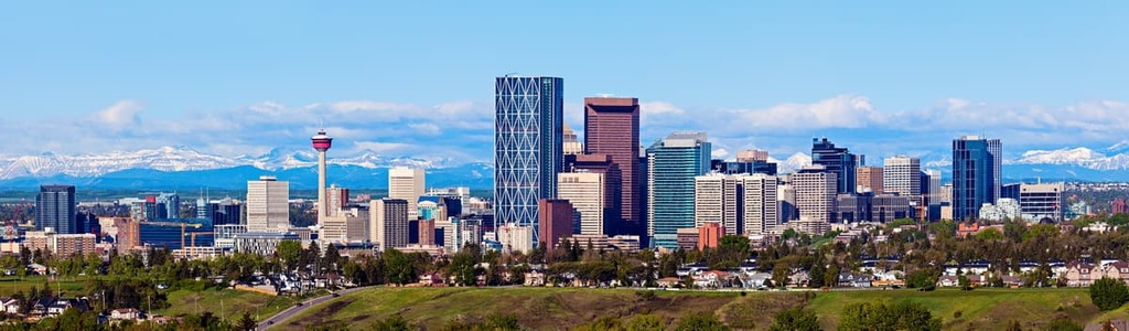
Calgary has many annual events to attend, such as the Calgary Stampede, The Nationals at Spruce Meadows, and a number of local festivals. There is also a vibrant arts and cultural scene with orchestra and theater events regularly occurring throughout the city.
Calgary has a lot to offer; however, its proximity to the Canadian Rockies is a particularly important highlight for many residents. Some of the popular hiking areas near Calgary include Kananaskis Country and Banff National Park. In fact, Kananaskis Country envelopes many provincial parks such as the Peter Lougheed, Bow Valley, Spray Valley Provincial Parks.
The town of Pincher Creek is located about 60 km (36 mi) to the south of Black Creek Heritage Rangeland. The town was named for an incident when in 1868 prospectors lost a pair of pinchers in a creek, which were found again in 1874 by a Mountie patrol who then named the creek Pincher Creek.
In 1876, the North-West Mounted Police established a horse farm in the area and the town slowly grew around this outpost. The town has remained relatively small and many of the current residents are descendants of these homesteaders.
Pincher Creek has several hotels for travelers as well as restaurants and stores to fulfill your needs. Within the town is the historic Kootenai Brown Pioneer Village, which has 27 heritage buildings and over 30,000 artifacts that represent life for the early European settlers of the area.
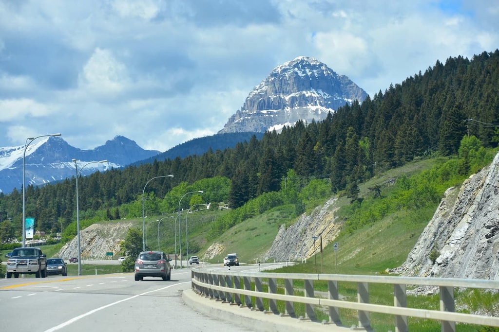
Some of the popular hiking areas around Pincher Creek are Castle Provincial Park, Castle Wildland Provincial Park, Waterton Lakes National Park, and Beehive Natural Area. Further adventures can be found nearby in the historic Crowsnest Pass.
The Municipality of Crowsnest Pass is located about 70 km (42 mi) from Black Creek Heritage Rangeland. The communities of Coleman, Blairmore, Frank, Hillcrest, and Bellevue, and several others were amalgamated into a single municipality to improve services to the communities.
Originally all the communities served the various coal mines in the pass; however, as the mines shut down, many people moved away. Despite the short history of the coal mining era, the communities have a rich and vibrant history.
In fact, the area has a fascinating history that includes bootleggers, train robberies, the worst mining disaster in Canadian history, and a landslide that covered a whole town in less than two minutes.


