Scan the QR code and open PeakVisor on your phone
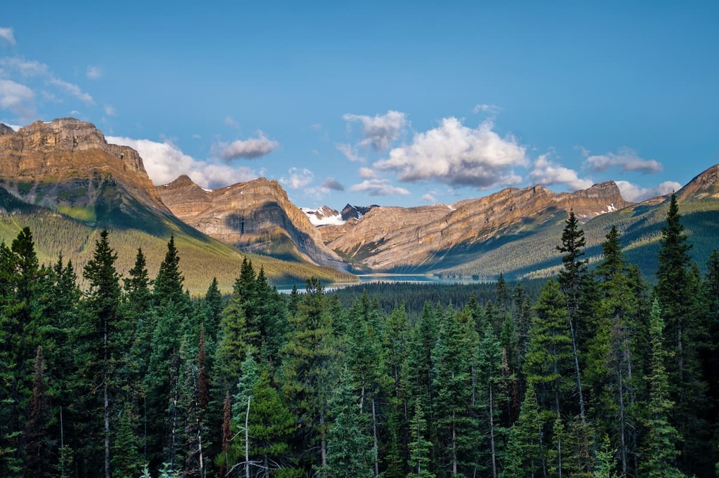
Located in the foothills of the Livingstone Range in southern Alberta, Canada, the Bob Creek Wildland Provincial Park is a protected area that’s home to The Whaleback Area and a number of fun hiking opportunities. The tallest and most prominent of the park’s 3 peaks is Thrift Peak, which is 2,171 m (7,123 ft) tall and has 474 m (1,555 ft) of prominence.
Bob Creek Wildlands Provincial Park is located in southern Alberta, Canada along the foothills of the Livingstone Range of the Rocky Mountains. The park is situated on the eastern side of the Municipal District of Ranchland, which is the least populated municipal district in Alberta with fewer than 1,000 residents.
The Cowboy Trail (Highway 22) runs past the east side of the park while the Kananaskis Trail (Highway 40) runs along the western side of the park. The Oldman River flows along the west and south sides of the park and the Porcupine Hills border it to the east.
There are three primary peaks and ridges in Bob Creek Wildland Provincial Park. Thrift Peak is the tallest and the most prominent peak in the park with 2,171 m (7,123 ft) of elevation and 474 m (1,555 ft) of prominence. The other peaks are Horseshoe Peak and Whaleback Peak.
The Bob Creek Wildland Provincial Park is located at the south end of Kananaskis Country, a multi-use recreational area in the eastern ranges and foothills of the southern Canadian Rocky Mountains. There are many natural areas, public land use zones, and provincial parks in the area, including:
The peaks and ridges of Bob Creek Wildland Provincial Park formed toward the end of the Laramide orogeny, about 55 million years ago. The Laramide orogeny is the event responsible for the formation of the Rocky Mountains and the foothills that dominate Bob Creek Wildland Provincial Park.
Starting about 75 million years ago, the tectonic plates under the Pacific Ocean began sliding under the coastal margin of North America. For the previous 100 million years, the region had undergone substantial mountain building during the Sevier orogeny. This event was responsible for the formation of the western ranges of the Western Cordillera, including the Coast and Columbia Mountains.
The final mountain ranges to form in the Western Cordillera were the Rocky Mountains. After the mountains formed, the foothills to the east of the Rockies started to form, too. The Rocky Mountains formed as the pressure from the subducting tectonic plates pushed layers of Paleozoic limestone on top of younger, Cretaceous sandstones and shales.
It took immense force to create the mountain ranges in the region. While the limestone layers of the front ranges were pushed until they were nearly vertical, the foothills are primarily made of a single layer of thrust-faulted, Cretaceous sandstones and shales.
Looking out from the peaks of the Livingstone Range, the foothills resemble rows of roofing shingles, with a gently sloping western aspect and a steep eastern slope. The western slopes were further altered by extensive glaciation during the Pleistocene.
The Pleistocene ice sheets rounded the hills and removed the softer layers of rock leaving the harder sandstone ridges. The glaciers also left fields of glacial till and the glacial erratics that are now scattered across the foothills and on the nearby prairies.
The primary ecological feature of the Bob Creek Wildland Provincial Park is that it contains “The Whaleback,” the largest intact expanse of montane wilderness in Alberta. The montane regions of Alberta are among the most heavily developed because of their mild climate and desirable proximity to the mountains.
Chinooks occur frequently along the montane ecologies of Front Ranges of the Rocky Mountains, creating an area with warm winters and a low accumulation of snow. The topography of this region has also led to the formation of varied and distinct habitats with frequent and abrupt changes over relatively short distances.
In the montane ecology, lodgepole pine and aspen stands occur on east- and north-facing slopes while grasslands occur on west- and south-facing slopes. At higher elevations in the montane zone, there are dense forests of lodgepole pine alternating in a mosaic with open grasslands.
The diverse vegetation in these areas provide a habitat for a wide variety of wildlife, including approximately 150 bird species, 57 mammal species, 4 amphibian species, and 2 reptile species. The montane ecology is transitional from the Rocky Mountain subalpine ecology to the ecosystems of the foothills, prairies, and the sub-boreal and boreal forests.
The grasslands and meadows are ideal habitat for sagebrush vole, horned lark, and tiger salamander, while the peaks and slopes are preferred by animals such as pika, Clark’s nutcracker, and the American dipper.
The mountain forests are inhabited by species such as the northern bog lemming, snowshoe hare, and willow flycatcher. Also, there are 10 native species of fish that inhabit the rivers and creeks of Bob Creek Wildland Provincial Park, including mountain whitefish, rainbow trout, westslope cutthroat trout and bull trout.
Of the over 150 types of birds found in the park, there are many rare and endangered species. Of the numerous bird species, the following are rare or endangered: the long-billed curlew, short-eared owl, osprey, golden eagle, prairie falcon and the loggerhead shrike.
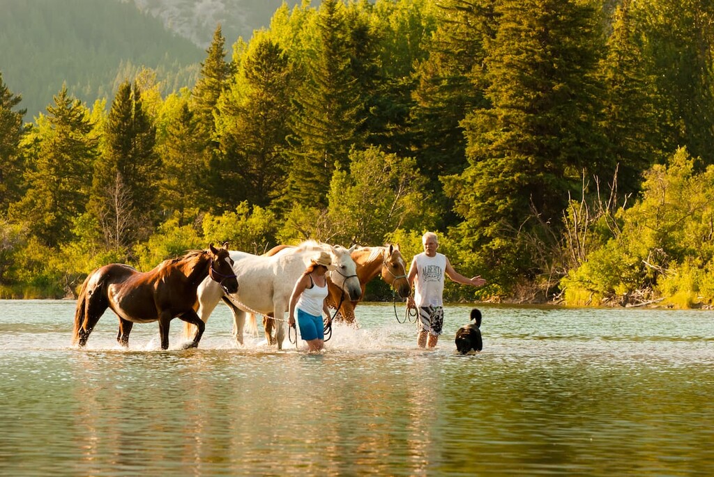
The area has significant mule deer populations throughout the year, and it is one of the two most important elk wintering ranges in Alberta. The region is also a significant elk summer range and calving area. Other mammals inhabiting the park include the grey wolf, coyote, black bear, grizzly bear, wolverine, cougar, lynx, and bobcat.
The Bob Creek Wildland Provincial Park is part of the ice-free corridor that once ran along the eastern slopes of the Rockies, through Alberta, connecting what is now Yukon and Alaska to the southern half of North America.
While there were periods of the Pleistocene when the corridor was closed, it was typically the last area to re-freeze, and it was the first area to become ice-free at the end of the Pleistocene.
There is evidence of a succession of different people and cultures inhabiting the region. Due to the mild winter climate created by the chinooks, the area has been used by Indigenous peoples as an overwintering territory for the past 12,000 years. Peter Fidler, escorted by Peigan guides, was likely the first person of European descent to venture into the area of Bob Creek Wildland Provincial Park.
The First Nations of the Blackfoot Confederacy have traditionally used the area for hunting and gathering food, medicinal plants, and resources for tools and clothing for generations. The populations of many First Nations communities in the region saw significant decline in the 1880s due to the extirpation of the buffalo herds.
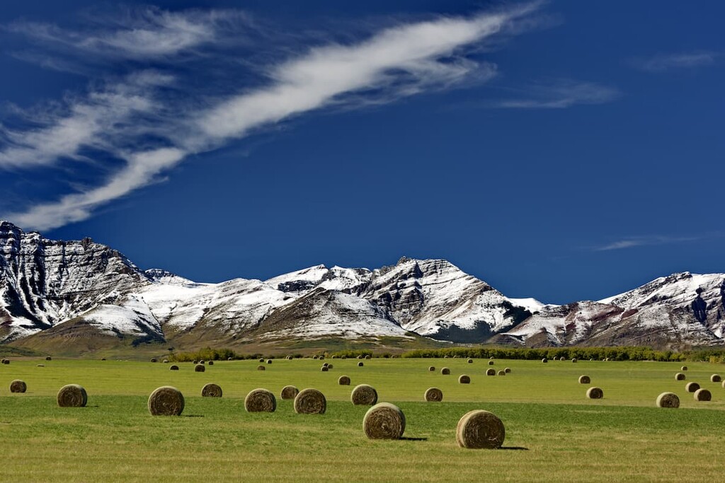
During the late nineteenth and early twentieth centuries, many settlers arrived in southern Alberta and took to ranching and maintaining large herds of cattle.
Thankfully, parts of the Bob Creek Wildland Provincial Park were spared from significant grazing and much of the park has been left as an intact ecology. The Black Creek Heritage Rangeland is still used for ranching; however, measures have been put in place to preserve the integrity of the ecosystem.
The Bob Creek Wildland Provincial Park has extensive open grasslands, rolling hills, and several peaks to summit. The following are some of the trails in the park:
The trail to Horseshoe Peak is a lightly used 8.5 km (5 mi) hike to the summit of Horseshoe Peak. The trail is difficult to find, and wilderness navigation will be required to make it to the summit. From the summit there are incredible views of the Livingstone Range, the Porcupine Hills, and the Whaleback Ridge.
One of the best features of this hike is the ability to tie it into a multi-day expedition through the region. Several nearby peaks that can be part of a backpacking trip include Coffin Mountain, Mount Livingstone, Saddle Peak, and Mount Hornecker.
The Whaleback Trail is a 15 km (9 mi) point-to-point trail that traverses part of Whaleback Ridge and crosses into Bob Creek Wildland Provincial Park. The park is lightly trafficked and as such, the trails are more of a suggestion on where to travel through the grasslands and over the hills as opposed to a hard-packed dirt trail cut into the landscape.
Hiking along Whaleback Ridge is an opportunity to find peace in the rolling landscape of southern Alberta. The views and experience of the trail are relaxing and awe-inspiring, and they will allow your mind to open as you can peacefully travel through this beautiful country.
The trail to the tallest peak in the park is a 13 km (7.8 mi) loop that starts from Township Road 105A. At the start of the trail, you’ll cross the Oldman River almost immediately before climbing a steep slope to the top of the ridge.
Once you have reached the ridge, it’s a straightforward hike to the summit of Thrift Peak where you can continue down the east ridge for a gentle return to the Oldman River and the road. Wilderness navigation skills are required for most hikes in this park because most of the trails are not maintained and there may not be an obvious trail to follow.
From the summit of Thrift Peak you can gaze south along the Livingstone Ridge, east towards the Whaleback, and west toward the Rocky Mountains.
Bob Creek Wildland Provincial Park is one of many beautiful natural areas of southern Alberta. The following are some of the major cities and communities near the provincial park.
Located in the foothills of the Rocky Mountains, Calgary is the largest city in Alberta, and it is often seen as a gateway to the Rocky Mountains. Calgary is only 160 km (96 mi) to the north of Bob Creek Wildland Provincial Park. Many tourists come through Calgary on their way to Canmore, Banff, and the parks of southern Alberta.

Calgary has many worthwhile local events and activities to check out. During the summer, there are many outdoor events ranging from street festivals to The Nationals at Spruce Meadows, and the Calgary Stampede. Year-round productions are hosted by Calgary Philharmonic Orchestra, Calgary Opera, and the many theater companies.
Calgary has a lot to offer; however, its proximity to the Canadian Rockies is appreciated and a highlight for many residents. Some of the popular hiking areas near Calgary are Kananaskis Country and Banff National Park. Kananaskis Country envelopes many provincial parks such as the Peter Lougheed, Bow Valley, Spray Valley Provincial Parks.
The town of Pincher Creek is located about 60 km (36 mi) to the south of Bob Creek Wildland Provincial Park.
Pincher Creek was named for an incident that occurred in 1868. At the time, a group of prospectors lost a pincher (a tool for horse care) in the creek in this area. In 1874, when the North-West Mounted Police came to southern Alberta, one of them found the rusted tool in the creek and named the creek Pincher Creek.
In 1876, the North-West Mounted Police established a horse farm in the area and the town slowly grew around this outpost. The town has remained relatively small and many of the current residents are descendants of these homesteaders.
Pincher Creek has several hotels for travelers as well as restaurants and stores to fulfill your needs. Within the town is the historic Kootenai Brown Pioneer Village, which has 27 heritage buildings and over 30,000 artifacts that represent life for the early European settlers of the area.
Some of the popular hiking areas around Pincher Creek are Castle Provincial Park, Castle Wildland Provincial Park, Waterton Lakes National Park, and Beehive Natural Area. Further adventures can be found nearby in the historic Crowsnest Pass.
The Municipality of Crowsnest Pass is located about 70 km (42 mi) from Bob Creek Wildland Provincial Park. The municipality consists of several communities that were amalgamated into one district, including Coleman, Blairmore, Frank, Hillcrest, and Bellevue.
The towns were formed in the early twentieth century as settlement for the miners working the many coal mines. The area has a fascinating history that includes bootleggers, train robberies, the worst mining disaster in Canadian history, and a landslide that covered a whole town in less than two minutes.