
Share

Scan the QR code and open PeakVisor on your phone
Scan the QR code and open PeakVisor on your phone
Manitoba is the easternmost of the three Prairie Provinces of Canada. It features landscapes that stretch from the arctic tundra along the shores of Hudson Bay through dense boreal forest and massive lakes to the prairie grasslands in the south. The province rises from sea level along the shores of Hudson’s Bay to the top of Baldy Mountain at 816 m (2,677 ft) which is the tallest of the 545 named mountains in Manitoba.
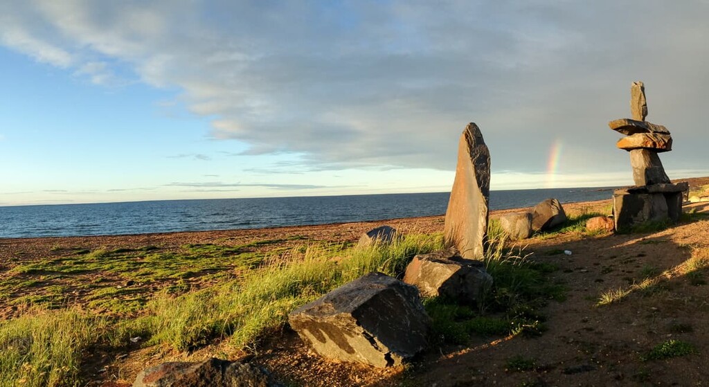
The province of Manitoba is found at the longitudinal center of Canada and is considered part of the Prairie Provinces of the west. The arctic tundra and the polar bears that call it home are found in the north along the shores of Hudson’s Bay. Meanwhile, a vast boreal forest covers most of the interior of the province. There are massive freshwater lakes in Manitoba, of which Lake Winnipeg—the tenth largest freshwater lake in the world—is the largest.
Manitoba is bordered by Saskatchewan to the west, Ontario to the east, and Nunavut to the North. It’s possible that Manitoba shares a quadripoint with Saskatchewan, Nunavut, and the Northwest Territories; however, the remote location has discouraged an official survey of the border. Manitoba also borders the US states of Minnesota and North Dakota to the south.
The province covers an area of 649,950 sq. km (250,900 sq. mi) and has a population of around 1.3 million people. Manitoba is at the center of the Hudson Bay drainage basin and, as such, it receives all the water that flows through Alberta and Saskatchewan.
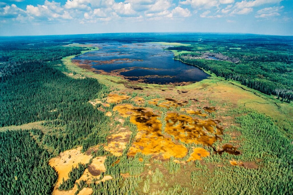
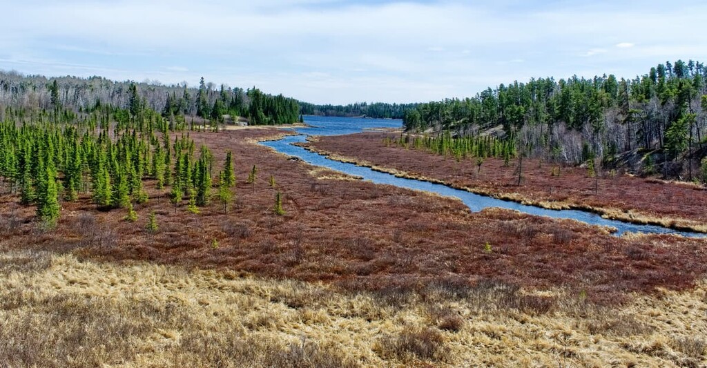
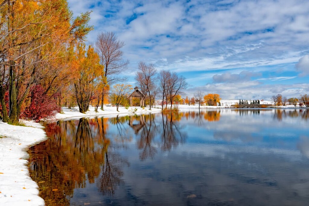
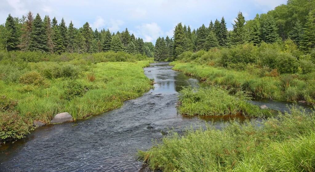
The major rivers in Manitoba include the Red, Nelson, Assiniboine, Hayes, Winnipeg, Whiteshell, and Churchill rivers, which connect the more than 110,000 lakes in Manitoba. The lakes cover over 15 percent of Manitoba’s surface area or 101,593 sq. km (39,225 sq. mi). The rest of Manitoba is tundra, taiga, boreal forest, and fertile prairies in the southwest.
The spectacular Manitoba wilderness is preserved with national and provincial parks while the province’s extensive history is preserved though national historic sites. The national parks in Manitoba are Riding Mountain National Park and Wapusk National Park. While the following historic sites celebrate and educate regarding the growth and development of Canada as a nation.
The rocks of Manitoba date back 3.5 billion to a time when the Earth’s continents as we know them today were just starting to form. The rocks from the Precambrian Shield are mostly igneous in origin and they are made from arcs of volcanic islands; however, there are also areas of metamorphosed volcanic and sedimentary rocks, called greenstone belts, found throughout the province. The greenstone belts are responsible for the productive mining industry in Manitoba.
Nickel, cobalt, copper, zinc, tantalum, cesium, and gold are all mined in Manitoba from the greenstone belts. The metal deposits and veins formed in the greenstone belts as the rocks underwent metamorphosis. Hot fluids containing dissolved metals flowed through the layers of rock and precipitated and hardened as the rocks cooled.
Precambrian volcanism is responsible for the greenstone belts and their mineral wealth in Manitoba. The remainder of the Precambrian Shield was created during the Kenora and Trans-Hudson orogenies, which were the mountain building events that occurred about 2.7 and 1.8 billion years ago, respectively. These orogenies created the granite and gneiss that characterizes the Canadian Shield, which is found across much of the province.
Following the Trans-Hudson orogeny, there was a period of relative geological calm at which time the mountains were eroded down to a flat plain. They were subsequently covered by a sea until about 325 million years ago. However, within 75 million years, Manitoba was once again covered with water.
Paleozoic sediments overlay the Precambrian Shield in the Hudson Bay Lowlands in northeast Manitoba and in the southwest as well. The rocks accumulated in sedimentary basins that are depressions in the Earth’s crust. At the end of the Paleozoic, Manitoba was once again raised above sea level and for 25 million years the Paleozoic layers of southwest Manitoba were eroded.
From the middle of the Triassic until the end of the Mesozoic, shallow seas flooded Manitoba and left a fossil record of the “age of reptiles” in the sedimentary layers in southwest Manitoba. The oil and gas reserves found under Manitoba come from the organic material that was deposited during the Mesozoic.
About 50 million years ago, the province finally rose from the sea and terrestrial flora and fauna began to develop. However, with the onset of the Pleistocene, Manitoba was covered in an ice sheet that was upwards of two kilometers thick. The ice sheet grew and moved across Manitoba for over two million years, until it all finally melted around 12,000 years ago.
The glaciers left their impression on the physiography of contemporary Manitoba. As the glaciers melted and formed massive lakes, icebergs floated across the lakes and left scratch marks that are still visible across the province. Moraines, eskers, and kames are present across Manitoba as well as ancient deltas and spillways that tell the story of the massive glacial lakes which covered the land.
Manitoba has two mountain ranges, both of which are escarpments formed by the prehistoric Lake Agassiz. THe mountain ranges are the Pembina Escarpment and the Manitoba Escarpment. The Manitoba Escarpment has four different sets of mountains, three of which are in Manitoba: the Riding Mountains, the Duck Mountains, and the Porcupine Mountains.
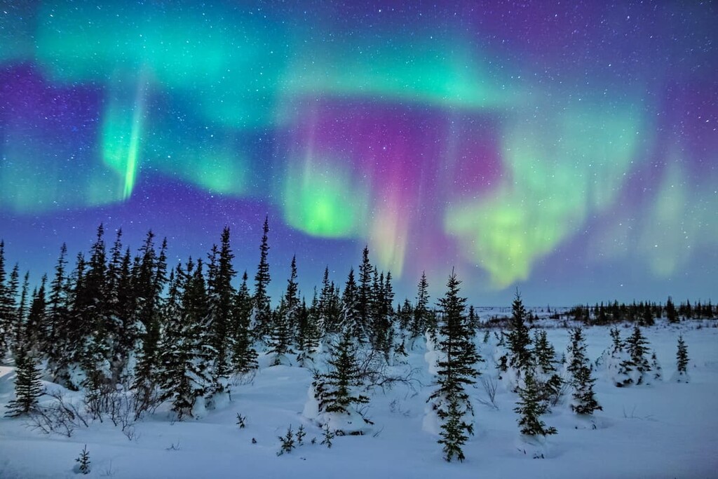
Manitoba has six distinct ecological zones that range from the freezing Southern Arctic Ecozone in the north to the more temperate Prairies Ecozone in the southwest. Between the previously mentioned ecozones are the Taiga Shield, Hudson Plains, Boreal Shield, and the Boreal Plains.
The Southern Arctic Ecozone extends across the northern reaches of mainland Canada and touches the northeast corner of Manitoba. The Southern Arctic is characterized by a vast barren landscape that generally lies above the arctic tree line.
While this zone is typically above the tree line, there are stands of forests to be found within major river valleys in the southern part of the region. The rest of the zone is covered by near continuous vegetation consisting of shrubs, such as dwarf birch, willows, and heath which are found with lichen, mosses, and various herbs. Areas along the coast, outcrops of bedrock, and ground disturbed by frost churning are the only places where vegetation doesn’t grow in the southern Arctic.
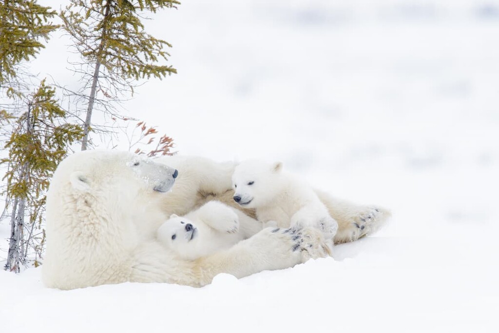
The southern Arctic is home to vast herds of barren-ground caribou, as well as populations of muskox, grizzly bear, and polar bear. Other mammals include arctic wolf, arctic fox, arctic hare, ground squirrels, and lemmings. Walrus, seals, belugas, and narwhals inhabit the bordering marine environments.
The Southern Arctic Ecozone along the Hudson Bay is one of North America’s major breeding areas for snow geese. It is also a major nesting area for the arctic and red-throated loon, old squaw, gyrfalcon, willow and rock ptarmigan, whistling swan, and the snowy owl.
The Taiga Shield Ecozone covers the northwest corner of Manitoba as well as stretches of land across northern Quebec , southern Nunavut and the southern Northwest Territories. The land is predominantly part of the Canadian Shield, which is characterized by shallow soils and a significant number of lakes.
The vegetation of the Taiga Shield is a transitional zone between the dense boreal forests of the south to the shrublands of the southern Arctic, where the vegetation becomes denser further south. The north is characterized by open stands of black spruce, tamarack, and white spruce with dwarf birch, willows, northern Labrador tea, cotton grass, mosses, and lichens as ground cover.
In the south of the Taiga Shield, the forests grow increasingly taller with stands of white spruce, balsam poplar, trembling aspen, and paper birch on the drier sites. The bog vegetation consists of black spruce, Labrador tea, Vaccinium species, bog rosemary, and cloudberry. Meanwhile, the fen vegetation is dominated by sedges and brown mosses.
Several major herds of barren-ground caribou are found in this zone during the winter. Arctic foxes are found in northern areas while polar bears are found along the coast. Moose, wolf, black bear, grizzly bear, brown lemming, and weasel are found throughout most of the Taiga Shield. Birds which are typically encountered are arctic and red-throated loons, tree sparrow, raven, spruce grouse, northern phalarope, northern shrike, osprey, and grey-cheeked thrush.
The Hudson Plains Ecozone follows the southern coast of Hudson Bay from the northeast corner of Manitoba, across northern Ontario and terminating on the eastern shores of James Bay (Baie James/Wînipekw) in Quebec. The climate is significantly influenced by the cold, wet air coming off the bay.
The ecozone is characterized by extensive unvegetated mudflats and associated marine marshes and shallow fens. Peatlands are prominent in the zone and black spruce only grows where the ancient beaches hadn’t been covered in peat. The forests of black spruce become denser as they move further inland. The fens are filled with sedge and moss with varying shrubs and occurrence of tamarack increase further south.
Polar bears are a characteristic animal of the zone. They spend July through November on land while Hudson Bay is free of ice before heading out onto the frozen sea during the winter months. Other animals that are typical of the zone are woodland caribou, moose, black bear, marten, arctic for, and fisher.
The coast is a major part of habitat for significant populations of breeding waterfowl, such as snow geese and Canada geese. Many shore birds inhabit the zone as well as migratory birds during the summer season. Rock ptarmigan and willow ptarmigan are resident birds of the Hudson Plains.
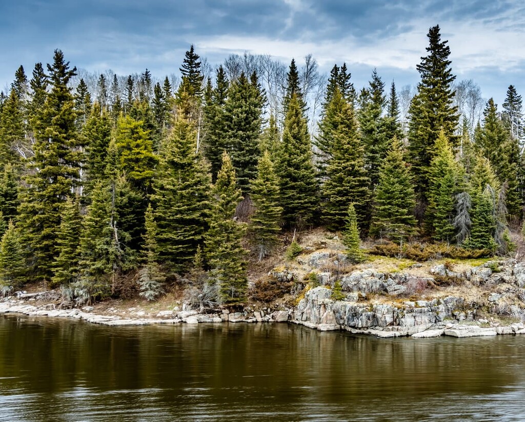
The Boreal Shield Ecozone is the largest ecozone in Canada and it spreads from northern Saskatchewan to Newfoundland and Labrador. It is also the largest ecozone in Manitoba. The contrasting exposed bedrock, mineral soils, and peatlands create a mosaic of landscape elements across the region.
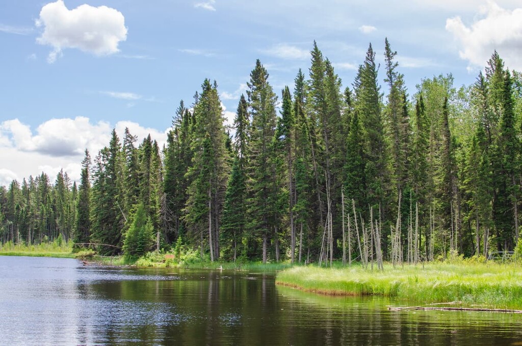
The Boreal Shield is home to extensive single- and mixed-species forests of white spruce, black spruce, balsam fir, tamarack, and jack pine. Further south white birch, balsam poplar, trembling aspen, yellow birch, and sugar maple are present. Forests dominate the areas of soil, while the bedrock outcrops tend to be covered with lichens, shrubs, and forbs.
The typical mammals that inhabit the Boreal Shield are moose, black bear, woodland caribou, racoon, marten, skunk, fisher, lynx, bobcat, and the eastern chipmunk. The boreal owl, great horned owl, evening grosbeak, white-throated sparrow, and the blue jay are the characteristic birds that you’ll encounter.
The Boreal Plains Ecozone extends west from the Peace River area of British Columbia across the Prairie Provinces to the southeastern corner of Manitoba. The forests are dominated by the coniferous species of white spruce, black spruce, jack pine, and tamarack. Deciduous trees, such as white birch, trembling aspen and balsam poplar tend to grow in the transitional area between the boreal forest and the prairies.
The primary animals that are found in the Boreal Plains of Manitoba are woodland caribou, white-tailed deer, moose, wapiti, coyote, black bear, marten, fisher, lynx, and chipmunk. Typical birds include red-tailed hawk, blue jay, boreal owl, great horned owl, rose-breasted grosbeak, evening grosbeak, Franklin’s gull, and brown-headed cowbird. The white pelican, cormorant, herring gull, heron, and tern also have significant populations in the region.
The Prairies Ecozone extends from the foothills of Alberta across Saskatchewan to the Red River Valley in southwest Manitoba. This area is part of the open grasslands of the Great Plains of North America. The topography of the prairies is subdued and the region has been significantly altered for agricultural purposes.
The natural grasslands of the prairies were once dominated by wheat grass, spear grass, and blue gamma grass. Meanwhile, the parkland that exists on the borders of the boreal forest and prairies typically has stands of trembling aspen and balsam poplar. However, the natural vegetation has been mostly supplanted by agricultural crops, except in the driest areas, which have been transformed into rangeland.
The characteristic animals of the prairies include elk, coyote, badger, Richardson’s ground squirrel, northern pocket gopher, badger, and the white-tailed jack rabbit. Pronghorn antelope and mule deer are present in the west and white-tail deer are especially established in Manitoba.
The prairies provide major breeding and nesting habitat for duck, geese, as well as other waterfowl and shorebirds. Great blue heron, black-billed magpie, Baltimore oriole, as well as ferruginous hawk, sage grouse, American avocet and burrowing owl inhabit the prairies; however, some of these species are decreasing in numbers due to habitat loss.
One of the first areas that was released from the grip of the Laurentide ice sheet was the area around Turtle Mountain, which is south of what is now Brandon, Manitoba near the border with the contemporary United States. Archaeological evidence suggests that this area was inhabited by humans as far back as 10,000 years ago.
At a location in Winnipeg, referred to as the Forks, where the Red and Assiniboine Rivers come together, there are sites and artifacts from communities that existed some 6,000 years ago. The Ojibwe, Cree, Dene, Sioux, Mandan, and Assiniboine consider what is now Manitoba to be part of their traditional territories.
Many First Nations founded settlements in what is now Manitoba over the last few thousands years while others came to the region solely to trade. Prior to European contact, many First Nations traditionally farmed corn in the Red River Valley and mined quartz in the north for arrowheads. The First Nations agriculture in Manitoba’s Red River Valley is the earliest known evidence of farming on the Canadian Prairies. It is also conceited to be the northernmost pre-European contact horticulture in North America.
Henry Hudson and his crew were arguably the first people of European descent to visit what is now Manitoba. Hudson sailed into the bay that now bears his name, where he was later abandoned by his crew. A few other expeditions followed Hudon’s, but the arrival of the HBC Nonsuch in Hudson’s bay in 1668 led to the formation of the Hudson's Bay Company.
The subsequent arrival of Europeans in Manitoba began as a result of the fur trade. By 1684, Hudson’s Bay Company built York Factory, a fur trading post on the Manitoba coast of Hudson Bay. York Factory would be used for more than 270 years and would become the headquarters for Hudson’s Bay Company’s Northern Department from 1821 to 1873. In 1936, York Factory was designated as a National Historic Site of Canada.
The expansion of the fur trade defines the post-contact history of Manitoba. There was an intense rivalry between Hudson’s Bay Company and the Quebec-based North West Company as each vied for greater profits. The rivalry between the two companies often escalated to violence and resulted in death.
While the fur trade continued, a turning point in the history of Manitoba occurred in 1812 when the Hudson’s Bay Company gave a land grant to Scotsman Thomas Douglas, Earl of Selkirk, to create the Red River Settlement. Many Métis were deeply opposed to this settlement of Europeans on their traditional territory.
Settlers from a variety of European countries, but mostly Scotland, began arriving in 1812 and the Red River settlement quickly grew and would continue to be a major part of Manitoba’s contemporary history.
During this time in the nineteenth century the Numbered Treaties were signed. These treaties promised land for every First Nation in the region, however many of these lands were never actually returned to First Nations. There are a number of ongoing land claims in the province.
Both Gabriel Dumont and Louis Riel were born in the Red River Settlement. They would both play key roles in trying to maintain their rights as Métis as well as their independence despite the formation of the nation of Canada. The Red River Rebellion occurred from 1869 to 1870 and led to the creation of the province of Manitoba on July 15, 1870.
Manitoba’s borders were expanded in 1881 as the province was given some land from the Northwest Territories. The province had its borders shifted multiple times over the next few decades until it gained its current borders in 1912.
Interestingly, Winnipeg was once the third largest city in all of Canada until it lost that status to Vancouver in the 1920s. The province was hit hard during the Great Depression, but its economy has since recovered. These days, Manitoba’s economy is mostly reliant on natural resource extraction and agriculture, though tourism is also on the rise in the province.
While the mountains and hills of Manitoba are not comparable to the majestic Rocky Mountains, the vast boreal forest and granite and gneiss outcrops of the Canadian Shield hold immense wonder and adventure. The following are some incredible places in Manitoba that offer opportunities for unique and exciting adventures.
Riding Mountain National Park is found in the southwest corner of Manitoba, about 100 km (60 mi) north of Brandon. There are five peaks within the park to hike as well as numerous large lakes. With over 250 km (150 mi) of trails in the park, there is something for everyone.
Some of the popular hikes are the Gorge Creek Trail which offers panoramic views of the forest and gorge. Also, Brule Trail and Kinosao Trail lead through the forests to some of Manitoba’s beautiful lakes.
The 11,475 sq. km (4,447 sq. mi) Wapusk National Park is at the transition between the arctic tundra and boreal forest. It protects one of the largest polar bear maternity denning areas in the world. The park is part of the range of the Western Hudson Bay population of polar bears, which is home to approximately 1,000 bears.
Wapusk has opportunities for aerial wildlife viewing as well as guided tours. In addition to the polar bears, you can see arctic foxes, arctic hares, wolves, caribou, wolverine, and over 200 bird species.
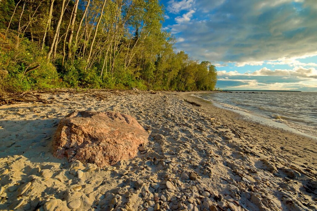
The Hecla/Grindstone Provincial Park features many trails that range from an easy stroll to a multi-day backpacking adventure. On the easy side is the 1.5 km (1 mi) Lighthouse Trail, and then there is the 10 km (6 mi) West Quarry Trail. If you have a couple days, the 44 km (26.4 mi) Black Wolf Trail will lead you through some spectacular wilderness and leave you with an unforgettable experience.
While visiting these unique islands in Lake Winnipeg, don’t forget to tour Hecla Village and visit the white sand of Sunset Beach. The park is a 90 minute drive from Winnipeg and it is worthwhile to camp or stay at one of the other accommodations and take some time to explore the region.
For skiing and snowboarding enthusiasts, there are 8 ski resorts in Manitoba, which are located mostly in the south of the region.
The largest ski resort in Manitoba is Asessippi with more than 10 km (6 mi) of slopes and more than 3 ski lifts. Other major areas for skiing in Manitoba with more than 5 km (3 mi) of slopes and more than 2 ski lifts each include Thunderhill–Benito, Minnedosa Ski Valley, and Mystery Mountain. The latter resort is the only one in the center of the region, at a distance from the others, which, in turn, are the closest to Winnipeg, the region's capital, and the largest city.
Check the Manitoba ski resorts map as well as the larger Canada ski resorts map in the World Mountain Lifts section of the site. It includes information about open ski lifts / slopes in Manitoba in real-time with opening dates and hours. There are also year-round cable cars, funiculars, cog railways, aerial tramways, and all other types of mountain lifts.
Manitoba is a vast province covered with over 100,000 lakes, vast boreal forest, and the historical settlements in the Red River Valley. The following are some places from where you can start your adventures in the province.
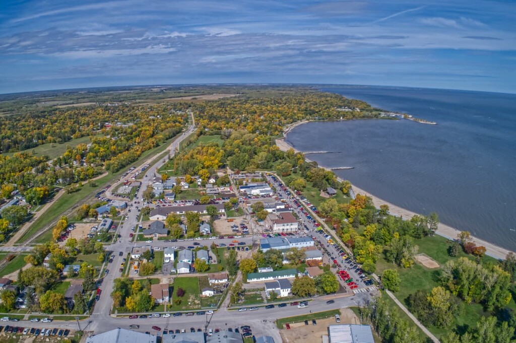
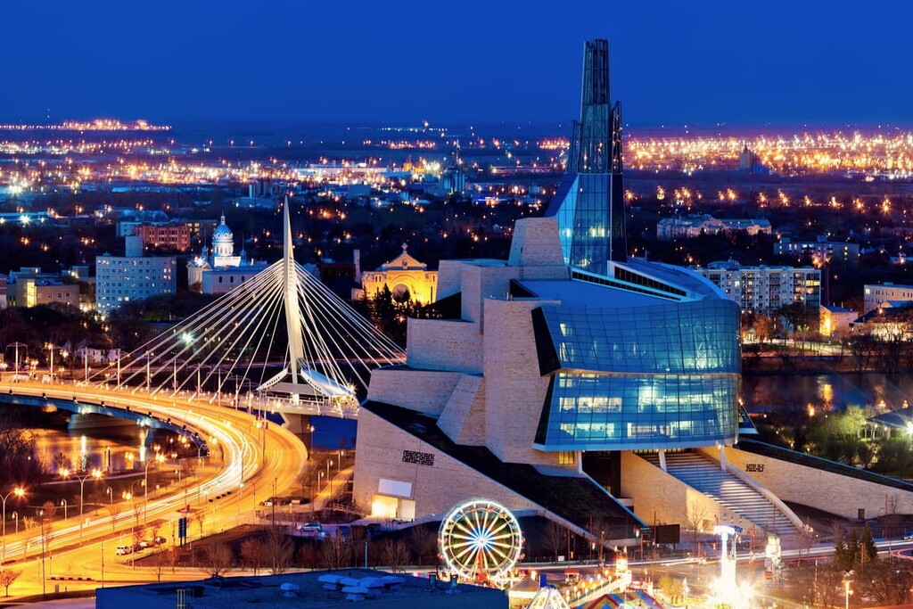
Centered on the confluence of the Red and Assiniboine Rivers, Winnipeg is the capital and most populous city of Manitoba with a population over 700,000 people. The city is named after the nearby Lake Winnipeg, which comes from the Western Cree words for “muddy waters.”
The first European Fort was built in 1738 by the French; however, the area had been used for generations by the local First Nations. It’s estimated that the first settlements in the area were around 11,500 years ago for a site south of Winnipeg, while there is evidence of habitation from 6,000 years ago in Winnipeg.
There are several hiking areas around Winnipeg that allow locals and visitors to explore the rivers, lakes, and wilderness. Oak Hammock Marsh is only 20 km (12 mi) north of Winnipeg and has 30 km (18 mi) of hiking trails through the wilderness. Also, Bannock Point is a good day trip at which you can see the centuries old petroforms.
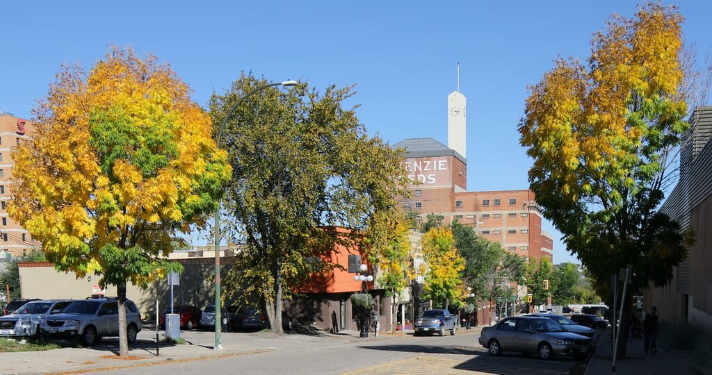
Located on the banks of the Assiniboine River, Brandon is the second largest city in Manitoba. It is located approximately 214 km (133 mi) from Winnipeg. The history of Brandon is rooted in the fur trade, for which the city was originally established in 1882.
Riding Mountain National Park is less than 100 km (60 mi) north of Brandon, Manitoba. Within Riding Mountain National Park are lakes and rivers to explore by boat, dozens of hiking trails for all skill levels, as well as a campground at which families and individuals can enjoy spending time in the wilderness.
Thompson is the largest city in northern Manitoba and is considered the “hub of the north”. Originally founded in 1956 as a mining town, Thompson is 761 km (473 mi) north of the capital city of Winnipeg. Being situated in the middle of the remote boreal forest while having the amenities of a city, makes Thompson a popular community for outdoor enthusiasts.
The area around Thompson has the largest marina in Manitoba, Paint Lake Provincial Park, hundreds of kilometers of snowmobile trails, and regular sightings of the northern lights. While isolated in the middle of the forest, Thompson has the best of the wilderness and modern amenities.

Explore Manitoba with the PeakVisor 3D Map and identify its summits.


