Rock climbing at Monts Rouges de Triolet - Placche della Contea, Punta Nord, Punta Nord- Le Fond de l’Air in Aosta Valley, Italy — 5 routes, 2 sectors, grades French 6b–6c. Grades, topo links and photos on the PeakVisor hiking map.
Show more
Climbing
5 routes6b–6c Fr2 sectorsS
Monts Rouges de Triolet – Placche della Contea
2 routes · 6b Fr · S
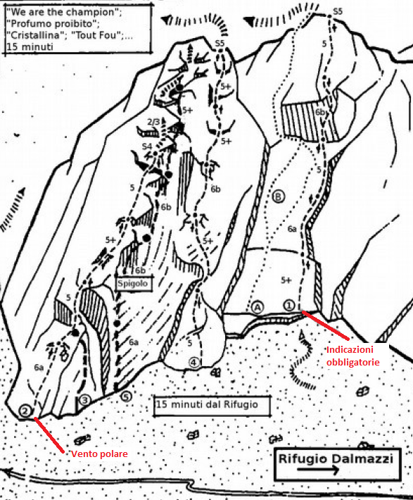
Indicazioni Obbligatorie6b (obl. 5c) · 400 m · S via veramente bella e facile fattibile in un paio d'ore roccia stupenda in un ambiente unico volendo dopo l'uscita si puo' proseguire a piedi e raggiungere Cristallina Profumo proibito etcc etcc.... - L1: placca… gulliver.it ↗
A Loba Loba6b (obl. 6a) · 170 m · S Itinerario breve e simpatico. Può essere utile per impegnare una mezza giornata oppure lo si può concatenare alle vie del Mont Rouge onde ottenere itinerari di 500 metri. L'avvicinamento è breve e facile. Dal rifugio… gulliver.it ↗
Monts Rouges de Triolet – Punta Nord
2 routes · 6b–6b+ Fr · SW–NW
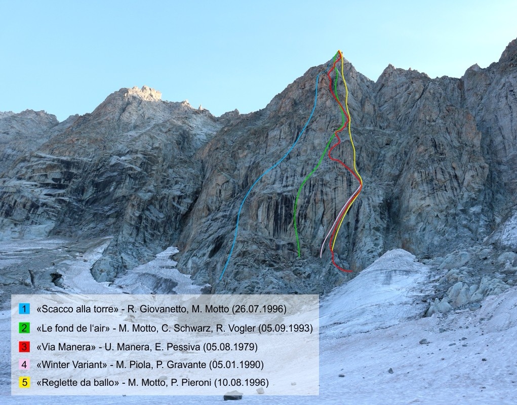
Reglette da Ballo6b (obl. 6a) · 360 m · NW Via che alterna tiri abbastanza sotenuti generalmente in placca a sezioni più semplici su roccia molto buona e lavorata. Chiodatura distanziata ma mai pericolosa. Portare una serie completa di friend (fino al 3 BD) ed… gulliver.it ↗
Scacco alla Torre6b+ (obl. 6b) · 350 m · SW Via molto bella in ambiente strepitoso. Un po' più sostenuta della vicina Le Fond De L'Air, ma forse meno elegante complessivamente. Dal Rifugio Dalmazzi seguire il sentiero a mezza costa fino a guadagnare il ghiacciaio… gulliver.it ↗
Other routes
1 route · SW
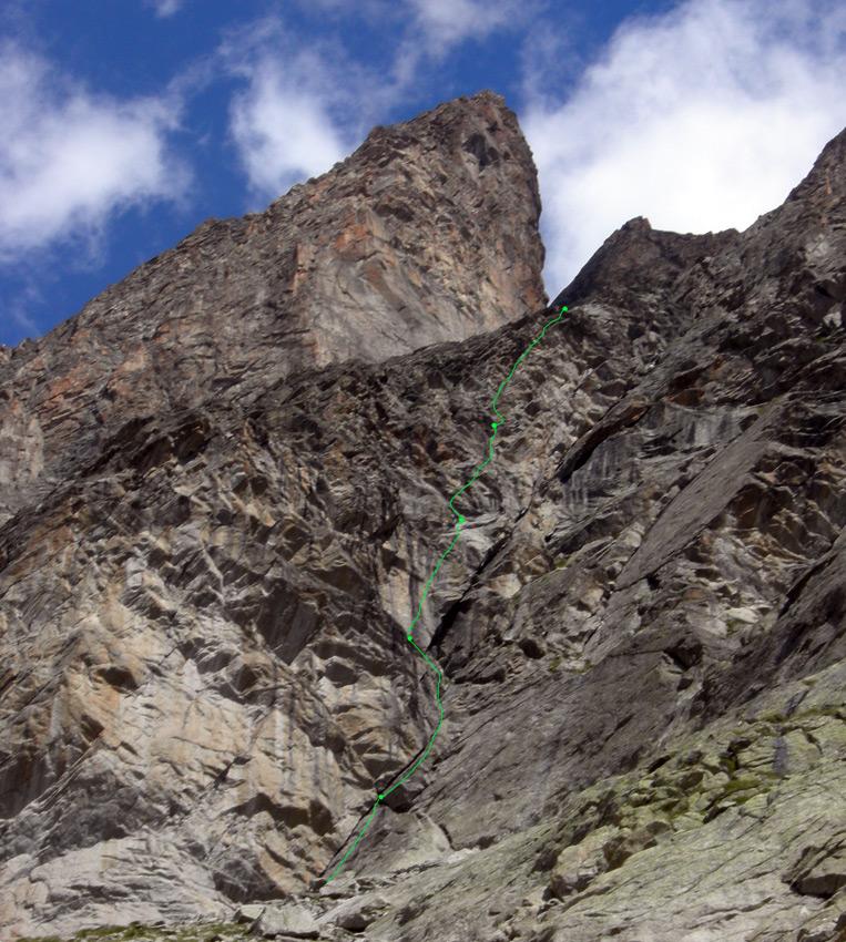
Triolet (Monts Rouges de), Punta Nord- Le Fond de l’Air6c (obl. 6a+) · 330 m · SW Bella via di ottima roccia e ambiente superbo. Impegnativo il primo tiro 50 mt in fessura con 4 spit e il resto della lunghezza da proteggere. A seguire placche e spigolini ben chiodati. Utili friends e dadi sopratutto… gulliver.it ↗
We use GPS information embedded into the photo when it is available.
3D mountains overlay
Adjust mountain panorama to perfectly match your photos because recorded by camera photo position might be imprecise.
Move tool
Rotate tool
Zoom
More customization
Choose which peak labels should make into the final photo and what photo title should be.
Next
Photo Location
Coordinates work here too — paste them as 69.72728, 20.61890 and press Enter
Satellitte
Flat map
Relief map
Latitude
Longitude
Altitude
OR
Latitude
°'''
Longitude
°'''
Apply
Register Peak
Peak Name
Latitude
Longitude
Altitude
Register
Teleport
PeakVisor
This 3D model of Sagarmatha National Park in Nepal was made using the PeakVisor app topographic data. The mobile app features higher precision models worldwide, more topographic details, and works offline. Download PeakVisor maps today.
Download OBJ model
PeakVisor
The download should start shortly. If you find it useful please consider supporting the PeakVisor app.
PeakVisor for iOS and Android
Be a superhero of outdoor navigation with state-of-the-art 3D maps and mountain identification in the palm of your hand!