
Scan the QR code and open PeakVisor on your phone
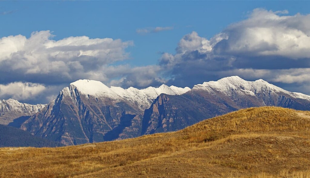
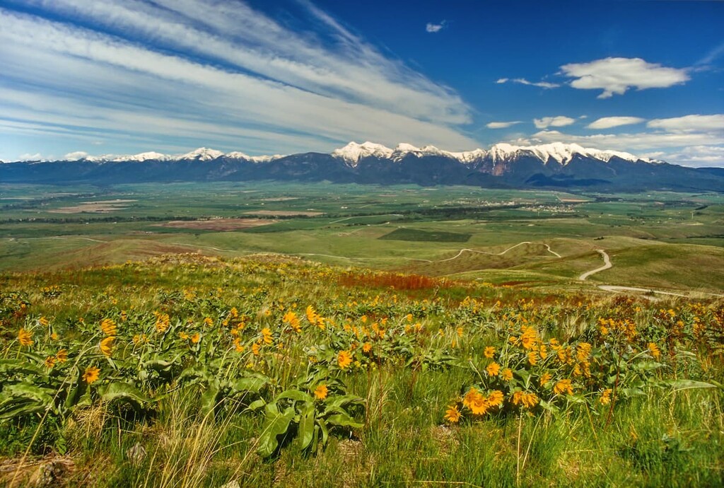
Home to jagged peaks, raging rivers, and dense forests, the Mission Mountains Tribal wilderness is a protected area located on the lands of the Confederated Salish and Kootenai Tribes of the Flathead Reservation. The tribal wilderness is situated in the northwestern part of the US state of Montana and it is managed by the tribal nation. It contains 22 named mountains, the highest and most prominent of which is McDonald Peak (9,787 ft/2,983 m).
The Mission Mountains Tribal Wilderness is a protected area located on the territory of the Confederated Salish and Kootenai Tribes of the Flathead Reservation. It is distinct from the Mission Mountains Wilderness Area, which is located directly to the east and is managed by the US Forest Service as part of the Flathead National Forest.
Both wilderness areas are located in the northwestern part of the US state of Montana in Lake and Missoula counties. However, the tribal wilderness is wholly managed by the Confederated Salish and Kootenai Tribes, which are a sovereign tribal nation.
Do note that all recreational visitors to the Flathead Reservation (including the tribal wilderness) that are not members of the Confederated Salish and Kootenai Tribes are required to purchase a Tribal Conservation Permit. You can get a permit at many local outdoor gear stores.
The Mission Mountains Tribal Wilderness is approximately 34 miles (55 km) long and 5 miles (8 km) wide. It encompasses an area of approximately 91,778 acres (27,141 ha) and it includes elevations that range from 4,000 feet (1,219 m) to the summit of McDonald Peak (9,787 ft/2,983 m)—one of the most prominent peaks in the state.
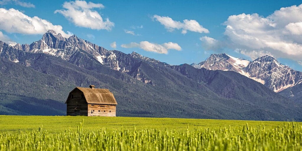
Aptly named, the Mission Mountains Tribal Wilderness contains the western half of the Mission Range (the other half is in the Mission Mountains Wilderness). The tribal wilderness is also located in close proximity to a number of other protected areas, including the Jocko Tribal Primitive Area, the Bob Marshall Wilderness, the Scapegoat Wilderness, the Great Bear Wilderness, and Lolo National Forest.
The peaks within the Mission Mountains Tribal Wilderness are part of the Mission Range, which is a subrange of the Central Montana Rocky Mountains.
These peaks are mostly comprised of sedimentary and igneous rocks of the Belt Supergroup, which is a large collection of rock some 10 miles (15 km) thick that extends throughout much of the northern US rockies.
The sedimentary and igneous rocks in the Belt Supergroup date back to the Mesoproterozoic, so they are approximately 1.6 to 1 billion years old. This area is considered to be one of the best exposed regions of Mesoproterozoic rocks on the planet. The supergroup is named after the Big Belt Mountains.
It can also be found in parts of Idaho, Washington, Wyoming, and even the provinces of Alberta and British Columbia in Canada. However, the Canadian part of the supergroup is called the Purcell Supergroup.
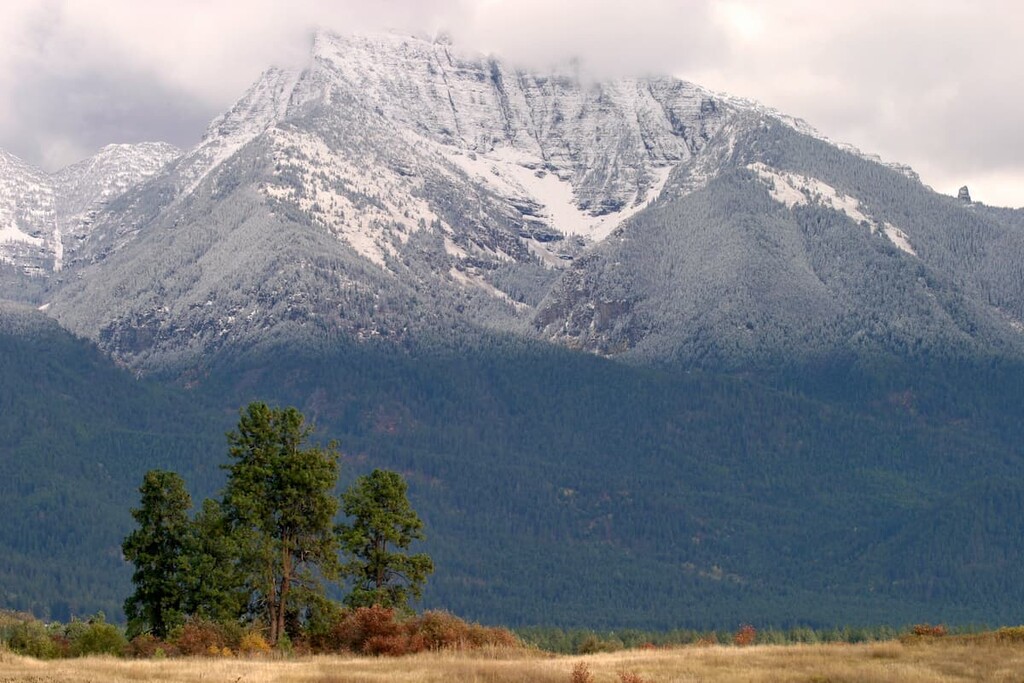
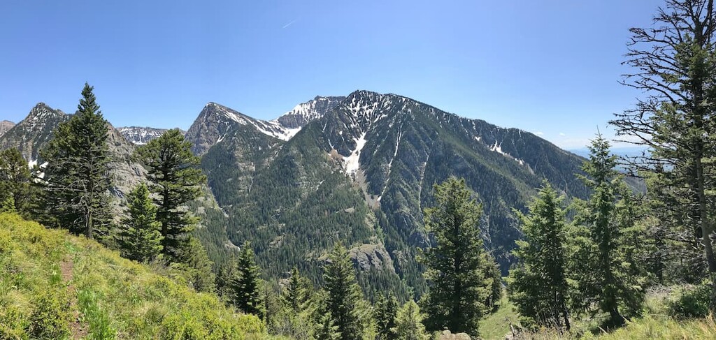
The Mission Range started to form during the Cenozoic as part of the Laramide and Sevier orogenies. However, the current shape and topography of the range is the result of repeated glaciation over the last few million years. These glacial processes helped carve out many of the pyramidal peaks that we see in the range today.
Major peaks in the Mission Mountains Tribal Wilderness include McDonald Peak, Glacier Peaks, Lowary Peak, Mountaineer Peak, Mount Calowahcan, and East Saint Marys Peak.
The Mission Mountains Tribal Wilderness is a land of dense forests and rich biodiversity. The Confederated Salish and Kootenai Tribes have a management plan for the wilderness that’s distinct from that of the neighboring national forest. This management plan strives to protect and preserve the area to prevent degradation and to restore impacted areas for ecological, spiritual, and cultural reasons.
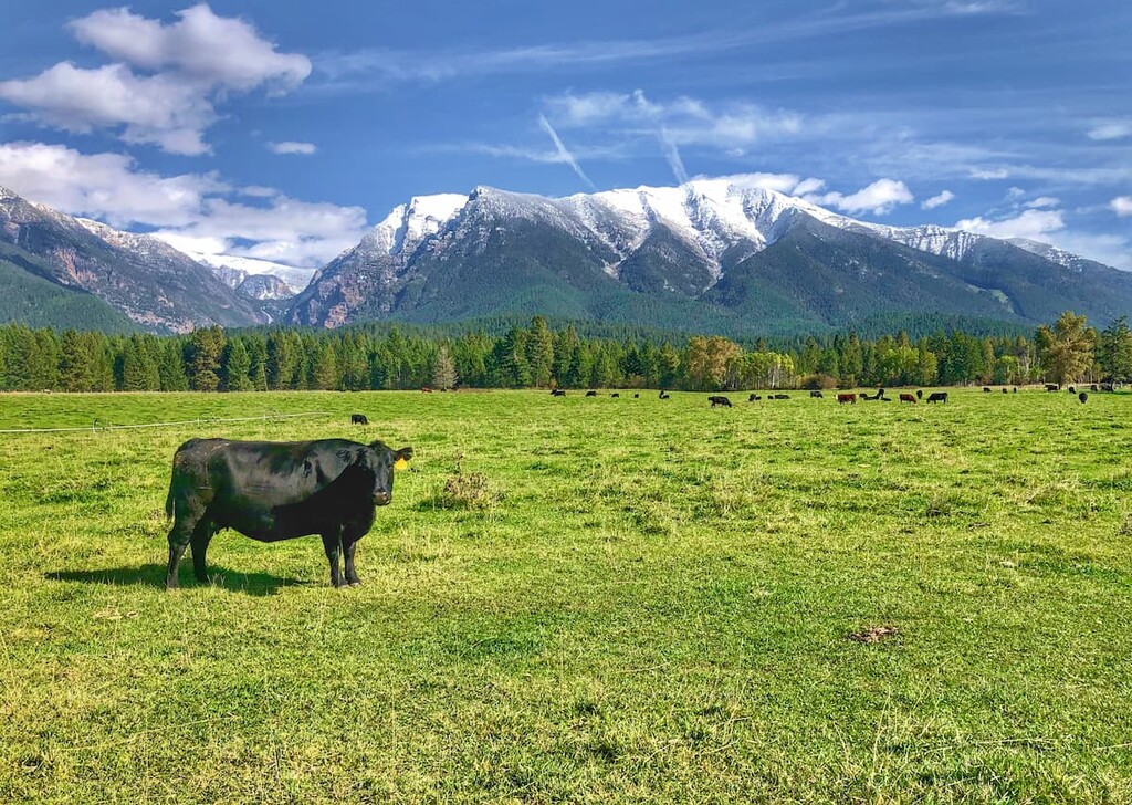
On the tribal wilderness side of the Mission Range, the land is dominated by dense forests of subalpine fir, Douglas fir, larch, cedar, ponderosa pine, lodgepole pine, and various spruce species. There are large streams and approximately 113 lakes throughout the tribal wilderness that support the region’s rich wildlife.
Some of the many species that call the land home include elk, mule deer, white-tailed deer, mountain goats, black bears, wolverines, bobcats, Canada lynxes, multiple marmot species, pika, muskrat, and grizzly bears.
Furthermore, the waterways in the tribal wilderness contain various fish species, most notably bull trout and the west slope cutthroat trout. The west slope cutthroat trout is the Montana state fish, however it is threatened by the introduction of nonnative fish species and habitat degradation.
The land that is now managed as part of the Mission Mountains Tribal Wilderness has been home to humans since time immemorial. The contemporary Confederated Salish and Kootenai Tribes that manage the land are the descendants of the Kootenai, Pend d’Oreille, and the Bitterroot Salish, who traditionally lived throughout a massive area that stretched from what is now eastern Washington to central Montana and north to southern Canada.
It’s believed that the first peoples of European descent to travel through the area were fur trappers, such as David Thompson, or with members of the Lewis and Clark Expedition in the early nineteenth century.
In 1855, the signing of the Hellgate Treaty ceded much of the Tribes’ vast traditional territory and ancestral lands to the United States. In return, the Tribes received a parcel of land that was approximately 1.2 million acres (485,600 ha) in size that is now the Flathead Reservation, which represents just a fraction of their ancestral homelands.
The Tribes first collectively moved to protect the portion of the Mission Range within the Flathead Reservation in 1936. During this time, the Civilian Conservation Corps Indian Division constructed a slew of trails through the region.
Later that same year, the Tribal Council decided to designate approximately 100,000 acres of the western slope of the Mission Mountains as a national park that remained under Tribal management. However, no park was ever created, yet the Bureau of Indian Affairs (BIA) decided to classify the region as a roadless area without the consent of the Tribes.
Since this designation was made without Tribal consent, the Tribes lobbied to have this designation removed, which it was in 1959. In the 1970s, the BIA drafted a proposal to log portions of the western part of the Mission Mountains for the Tribes. However, this simply led to renewed Tribal interest in further protecting the region.
During this time, Thurman Trosper, a Tribal member, past president of the Wilderness Society, and retired employee of the US Forest Service suggested that the Tribes establish a tribal wilderness.
There was contention within the Tribes over whether they should establish a wilderness or log the land. During a meeting to vote on the proposed tribal wilderness, three YaYas (highly respected grandmothers) persuaded the Tribal Council to create the tribal wilderness. The tribal wilderness was informally established in 1979 and it was formally designated in 1982 with management planning help from the Wilderness Institute of the University of Montana.
The Mission Mountains Tribal Wilderness became the very first tribal wilderness with its designation in 1982. It remains under the sole purview of the Tribal Council of the Confederated Salish and Kootenai Tribes who have their own management plan for the region.
Due to the shared border between the tribal wilderness and the federal wilderness, there is also a lot of cooperation between the Tribal Council and the US Forest Service, though the land management plans differ greatly on either side of the border.
The Tribal Wilderness Ordinance, which was approved in 1982 states that the tribal wilderness is a vital part of the people and culture of the Confederated Salish and Kootenai Tribes. It is a place to gather medicinal herbs and hunt as much as it is a sanctuary and a vision seeking ground.
The ordinance further states that the land is to be preserved in its natural condition in perpetuity. It leaves open the opportunities for recreation, education, conservation, and scientific research, but only within the spirit of the Ordinance and within the bounds of the traditional Tribal spiritual, cultural, and religious uses of the land.
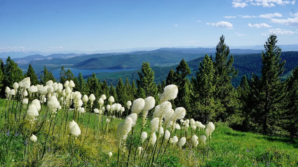
The primary purpose of the Mission Mountains Tribal Wilderness is to protect and preserve the land in perpetuity. As such, it has few designated trails and maintained facilities, particularly when compared to the Mission Mountains Wilderness.
Therefore, anyone venturing into the Mission Mountains Tribal Wilderness first needs to get a Tribal Conservation Permit and needs to be prepared for significant off-trail travel. The tribal wilderness is not managed as a recreation paradise, so, while some trails do exist, self-sufficiency, and navigation skills are essential.
Most of the trailheads to the tribal wilderness are located near the tribal wilderness’ boundaries in the Wilderness Buffer Zone. There are approximately 9 developed trailheads and 12 primary trails, alongside a slew of lesser-used trails throughout the tribal wilderness, but some may be difficult to follow in places.
Potential hiking areas include trips to Ashley Lakes, McDonald Peak, and Mission Falls. You can also enter the tribal wilderness from the federal wilderness, but you will need to purchase a Tribal Conservation Permit before doing so.
Many of the regulations within the Mission Mountains Tribal Wilderness are similar to what you might find at federal wildernesses, however, the Tribes have some unique requirements for their land in addition to the required Tribal Conservation Permit. These include:
Keep in mind that these rules can change at any time and area closures can happen. Be sure to check local closures and regulations before venturing into the tribal wilderness.
The Mission Mountains Tribal Wilderness is a remote, roadless area. However, it is located close to a number of great towns and cities that you can check out before your trip. Here are some of the best places to stay during your next venture into the Mission Mountains Tribal Wilderness:
As we’ve mentioned, the Mission Mountains Tribal Wilderness is a development-free area. There are no roads in the tribal wilderness and future development is highly regulated. However, in the Wilderness Buffer Zone around the tribal wilderness, there are a number of campgrounds that are great places to start your journey.
Some of the campgrounds in and around the Mission Mountains Tribal Wilderness include:
Do note that these campgrounds are located on the Flathead Reservation so you will need a Tribal Conservation Permit to stay there, even if you don’t plan on venturing deep into the wilderness itself. Most of the campgrounds are available on a first come, first served basis and they are generally only suitable for tent and trailer camping.
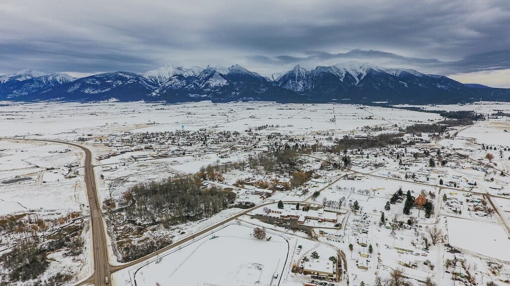
The community of Pablo (Xʷeyʔilqsálqʷ) is home to approximately 2,300 people who live just to the south of the Pablo Reservoir on US Route 93. Pablo is the seat of the government of the Confederated Salish and Kootenai Tribes of the Flathead Reservation and the home of the Salish Kootenai College.
Pablo isn’t as populous as nearby Polson, which offers a number of hotels for visitors to choose from. However, it is also the headquarters of the Pablo National Wildlife Refuge. The Salish Kootenai College also maintains the Silver Fox Golf Course, which is a public course that all are welcome to enjoy.
The town of St. Ignatius (snyél̓mn or ʔa·kikqǂaǂaǂuk̓pǂiʔit) is home to approximately 900 people.
It was once the site of the St. Ignatius Mission, which was established by Belgian Jesuit missionary Pierre-Jean De Smet in the 1800s. The mission still exists, though the rest of the original townsite was destroyed by a forest fire in 1919. Visitors are welcome to tour the mission every day or to take part in mass.
Home to approximately 75,000 residents, Missoula is the largest city in the region. It is actually the second-largest city in the state after Billings and it is the home of the University of Montana.
Missoula is not located on the Flathead Reservation, however it is a transportation hub for the region. It is situated along I-90 and it has the largest airport in the western part of the state. Plus, Missoula has a host of shops, restaurants, and hotels for visitors to enjoy.


