
Scan the QR code and open PeakVisor on your phone
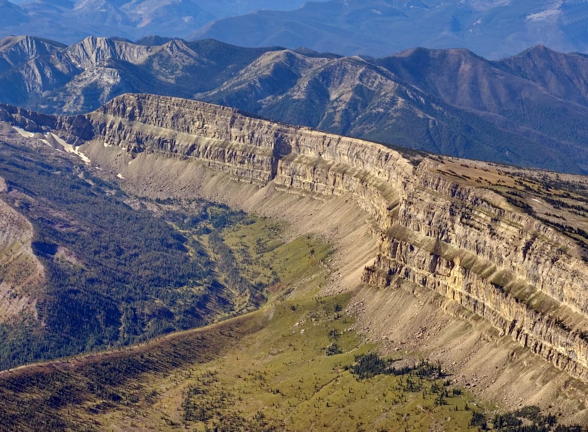
The Bob Marshall Wilderness is located in western Montana in the United States. This section of land was established in 1964 and stretches along the Continental Divide within the state. In total, the wilderness spans 1,009,364 acres across the western region of the state. There are 188 named mountains in the Bob Marshall Wilderness Area. Rocky Mountain is the highest point at 9,380 feet. The most prominent mountain is Holland Peak. Elevation within the wilderness ranges from 4,000 feet up to the summit of Rocky Mountain. The Chinese Wall, a distinct feature of the wilderness, stands 1,000 feet tall, abruptly protruding from the land and spanning 22 miles.
The high altitudes, mixed with dense forest, alpine lakes, and rivers, makes the wilderness an ideal habitat for Grizzly Bears. It is thought that the population of bears is higher in this region than anywhere else in the lower 48 states, excluding the Yellowstone ecosystem. Other animals that populate the area include bighorn sheep, elk, moose, wolves, cougar, and bald eagle. Large sections of the forested regions have been drastically affected by forest fires in recent years. The wilderness sits next to both the Scapegoat and Great Bear Wildernesses. Together the three separate regions create what is known as the Bob Marshall Wilderness Complex which in total cover over 1.5 million acres. A majority of the Bob Marshall Wilderness lies within the Flathead National Forest. A smaller section of the wilderness stretches into the nearby Lewis and Clark National Forest.
The Bob Marshall Wilderness was named after Bob Marshall who was a forester, conservationist, and one of the founders of the Wilderness Society. His work focused on ensuring that large sections of land would be preserved and protected from further production. Today the Bob Marshall Wilderness is the fifth largest in the lower 48 states. The wilderness does not allow any motorized vehicles.
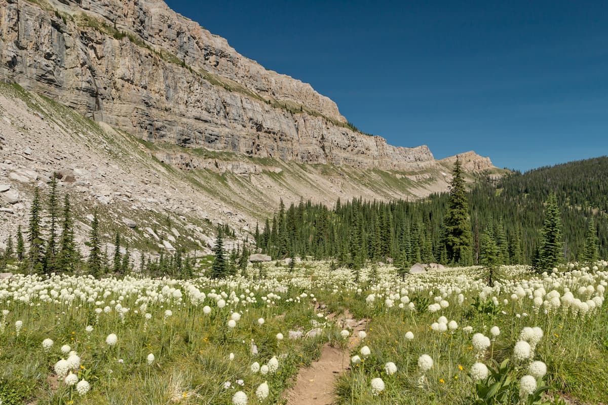
Chinese Wall Trail: This multi-day point to point hike totals 53 miles with 7,814 feet of elevation gain. This breathtaking route follows along the iconic wall throughout the forest. Mountain goats perch themselves along the wall with numerous river crossings throughout the trail. Wildlife is abundant in the wilderness, so be prepared for animal sightings.
George Lake: This remote lake is tucked within the wilderness. The hike is just under 13 miles out and back with 3,300 feet of elevation gain. The trail winds through lightly forested sections and open fields, crossing creeks and streams along the way. George Lake is a great place to camp and take in the crystal-clear waters. The lake itself is surrounded by rocky buttes and forested hills, making for a secluded and serene hiking destination.
Morrell Fire Lookout: Deep in the wilderness lies the Morrell Fire Lookout. The trail is 17 miles out and back with just under 3,000 feet of elevation gain. From the fire lookout, hikers have unobstructed panoramic views of the wilderness. A long trek to the summit that can also be accessed by driving up the forest service road, when conditions allow.
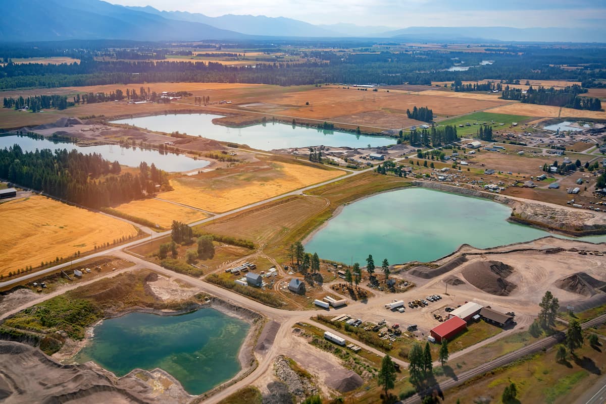
Kalispell is located near the Bob Marshall Wilderness and is located in the northwestern section of Montana. The population is approximately 25,000 with a metropolitan area of almost 100,000. The name of the city comes from the Salish word meaning “flat land above the lake”. Kalispell is located just 7 miles north of Flathead Lake, the largest natural and freshwater lake located in the western United States. The downtown section of the city is home to local shops, craft breweries, distilleries, restaurants, and outdoor recreation opportunities.
Just east of the Idaho-Montana border, is the city of Missoula, Montana. Located in western Montana, this city sits at the convergence of five mountain ranges and is known as the “hub of five valleys”. The population is approximately 75,000 and is the second largest city within the state. Due to the proximity to mountains, rivers, and public lands, the city is known for its outdoor spaces. Within the city lie 22 miles of trails and 5,000 acres of conserved open space. Sitting at the confluence of the Clark Fork, Bitterroot, and Blackfoot rivers makes the city a popular white-water rafting destination. During the winter months, snow sports take center stage in the surrounding mountains, cross country skiing trails, and snowmobile routes.


