Scan the QR code and open PeakVisor on your phone
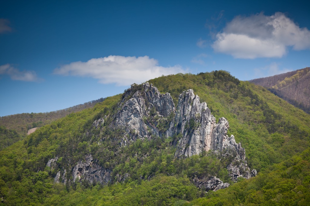
The Little River Wildlife Management Area (WMA) is an outdoor recreation destination located within the US state of West Virginia. The WMA lies within the Monongahela National Forest. The tallest peak in the region is Bald Knob at 4,842 feet (1,476 m) tall while Elleber Knob is the most prominent with 997 feet (304 m) of prominence.
The Little River WMA is situated in eastern stretches of West Virginia within the Monongahela National Forest, along the states’ border with Virginia. This managed area spans 121,552 acres (49,190 ha) of national forest land.
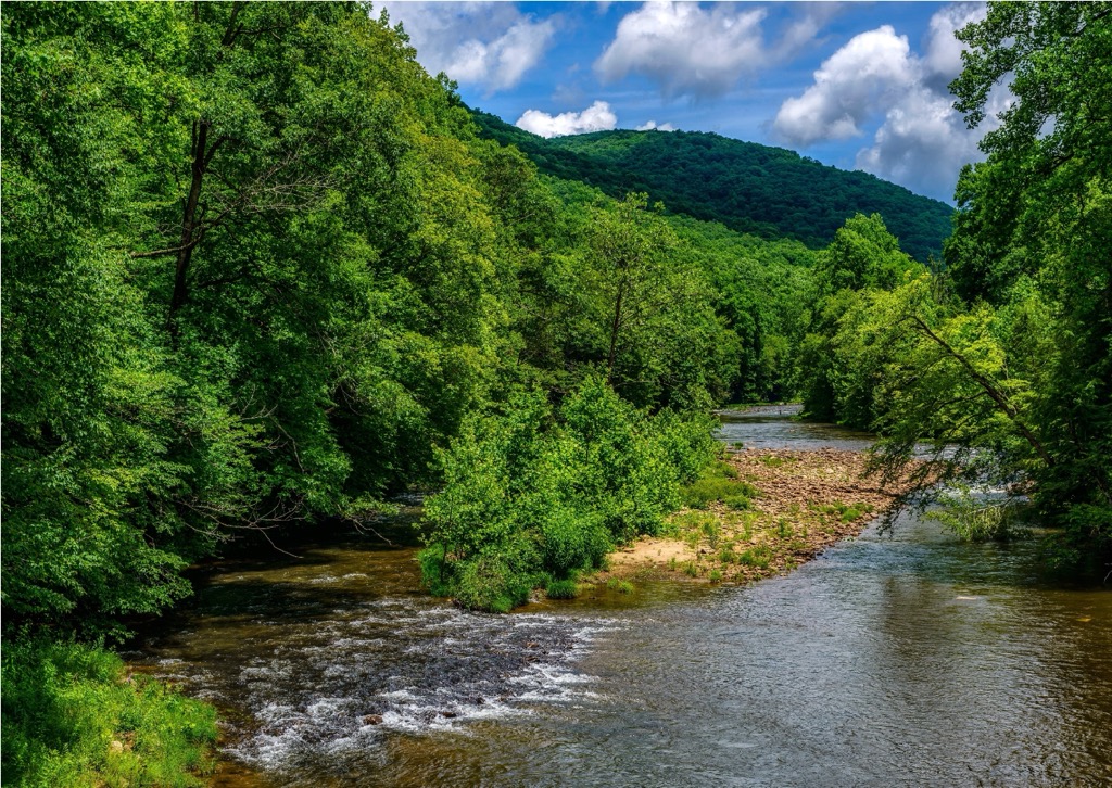
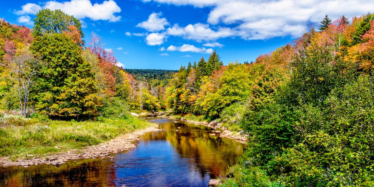
The WMA covers land in Pocahontas county which extends to the northeast and southwest. US Route 250 cuts across the WMA in a northwest to southeast fashion. The Greenbrier River begins in the northern stretches of the protected area before traveling south to mark the western boundary of the WMA.
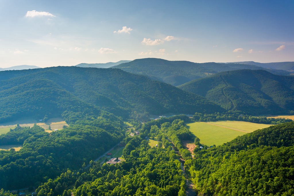
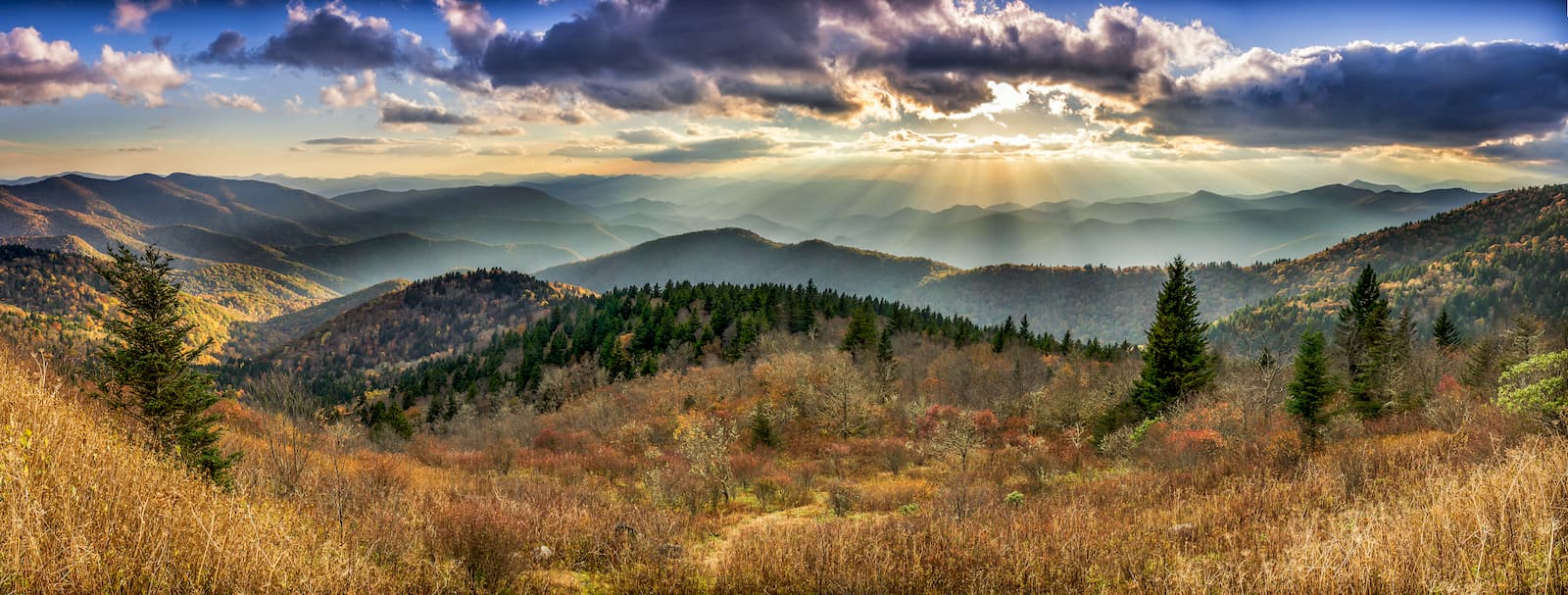
The lowest elevation in the WMA is around 2,500 feet (762 m) while the highest is marked by the summit of Bald Knob. A majority of the landscape is marked by forested rolling hills, ridgelines, and valleys.

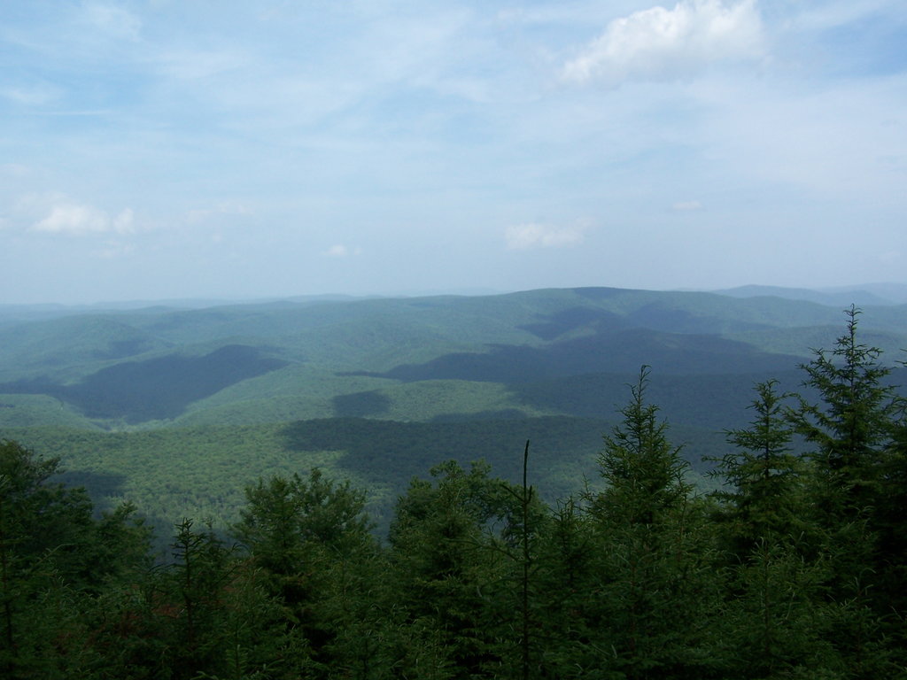
There are little to no flat sections of terrain found in the region. Elevation changes are gradual and feature alternating valleys and ridgelines which primarily run in a northeast to southwest direction.
Densely forested hillsides make it difficult to find sweeping viewpoints in the region. Other nearby bodies of water include Shavers Fork along with various seasonal creeks and streams.
The Little River WMA lies within the Monongahela National Forest and is surrounded by various other protected areas. The Cheat Wildlife Management Area lies directly west while the Beaver Dam Wildlife Management Area is situated to the north. The Spruce Knob-Seneca Rocks National Recreation Area is to the northeast while the Warm Springs District of George Washington National Forest lies to the east. The Tea Creek Wildlife Management Area lies to the southwest.
All of the peaks and ridgelines found in the WMA, along with those found throughout the surrounding Monongahela National Forest, are part of the Appalachian Mountains. This major range spans from the US state of Alabama northward to the Canadian province of Newfoundland and Labrador.
Peaks found in this region of West Virginia are part of the Allegheny Mountains, which mark a subrange of the larger Appalachian Mountains. The Allegheny Mountains span roughly 400 miles (644 km), covering land in both eastern West Virginia and southwestern Maryland.
The Allegheny Mountains mark one of the most rugged subranges of the greater Appalachian Mountains and one of the most rugged sections of terrain in the eastern US. West of the range lies the Allegheny Plateau while the Blue Ridge Mountains are situated to the east.
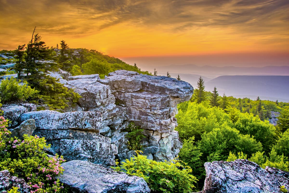
The peaks in the WMA began forming during Alleghanian orogeny, for which this subrange is named after. A series of thrust faulting and folding forced the land upwards, creating a series of alternating ridgelines and valleys. This major mountain building event helped form a majority of the Appalachian Mountains.
Westward folds of sedimentary rock can be seen throughout the WMA. Exposed native bedrock can be spotted at higher elevations where outer layers of rock have been worn down by periods of glaciation and glacial melting.
Major peaks found within the Little River WMA include Bald Knob, Elleber Knob, Tygart Valley North, Chestnut Ridge, and Gaudineer Knob.
Flora and fauna found in the WMA is similar to that found throughout the surrounding national forest and Allegheny Mountains.
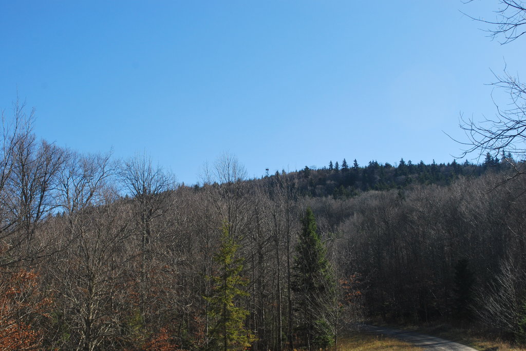
The forested landscape primarily features northern hardwoods. Common tree species include oak hickory, white pine, red pine, and black cherry along with eastern hemlock, red maple, and mountain ash.
The surrounding network of Wildlife Management Areas and national forest lands allow for a variety of animals to thrive. Some larger animals that inhabit the region include white-tailed deer, bobcat, red fox, and black bear.

Smaller animals include squirrel, chipmunk, rabbit, grouse, dove, snow hare, muskrat, mink, beaver, and opossum. The waterways in the region are populated by numerous species of trout.
The land in and surrounding the Little River WMA has a long and rich human history dating back thousands of years. This region of land marks part of the ancestral homelands of the Shawnee Tribe.
The first people of European descent to explore the region arrived during the early seventeenth century. General Abraham Wood sent a party to explore present-day West Virginia in 1671 which followed along the New River.
After this exploration, groups of settlers began traveling and settling throughout the region. By the 1730s, people of European descent were establishing settlements throughout the nearby Shenandoah Valley.
The Shawnee Tribe fought for decades to protect and preserve their native homelands and traditional ways of life. Settlers, often backed by the US government, repeatedly attacked, harassed, displaced, and killed the Indigenous peoples of the region, forcing them onto less fertile land.
The French and Indian War occurred from 1754 to 1763, which further forced the Shawnee people from the region. Some members of the Tribe were able to stay in the region though a majority were forced to leave.
Tribal numbers were drastically reduced following the arrival of diseases such as smallpox and measles, which the Indigenous peoples had no natural immunity to. The Shawnee Tribe were ultimately forced to sign the Treaty of Fort Meigs in 1817, which resulted in them being placed into three reservations in present-day Ohio.
In 1911, the Monongahela National Forest, which the WMA lies within, was established due to the passage of the Weeks Act. Over the following decades the forest was expanded to its current size.
There are minimal amounts of established hiking trails within the WMA. Here are a few of the popular routes in the surrounding region to check out on your next visit:
This short loop trail takes hikers along the summit of Gaudineer Knob, situated along the western stretches of the WMA. A forest road allows hikers to reach the summit of the peak with a small trail leading to an overlook. From the viewpoint, hikers can look out over the surrounding Allegheny Mountains of West Virginia. This loop trail is 0.3 miles (0.5 km) and features just 19 feet (6 m) of elevation gain.
Burner Mountain is located in the northern stretches of the WMA. The trail begins with a short and steep climb up to the summit of the peak which offers a small view of the surrounding terrain. The trail then features many short descents and climbs as it follows along the main ridgeline. The out and back route is 6.6 miles (10.6 km) and features 856 feet (261 m) of elevation gain.
This loop trail lies just west of the WMA within the Cheat Wildlife Management Area. The trail climbs steadily throughout, offering sweeping views of the lush and forested hillsides that define the region. During the summer months hikers can pass through fields of wildflowers as they loop back to the trailhead. This loop is 2.7 miles (4.3 km) long and features 288 feet (88 m) of elevation gain.
Looking for a place to stay near the Little River Wildlife Management Area? Here are some of the best cities and villages to check out in the region:
Marlinton lies southwest of the WMA and is situated along the Greenbrier River. Surrounded by Monongahela National Forest, the town is home to around 1,000 residents. Each year Marlington hosts the Hudson Cream West Virginia Biscuit Bake Off and the Roadkill Cook-Off.
The Pocahontas County Opera House is located in the town along with a few local shops and restaurants. Nearby attractions include the Cranberry Glades Botanical Area, Highland Scenic Highway, Beartown State Park, and the Cranberry Mountain Nature Center which features information on the history and ecology of the region.
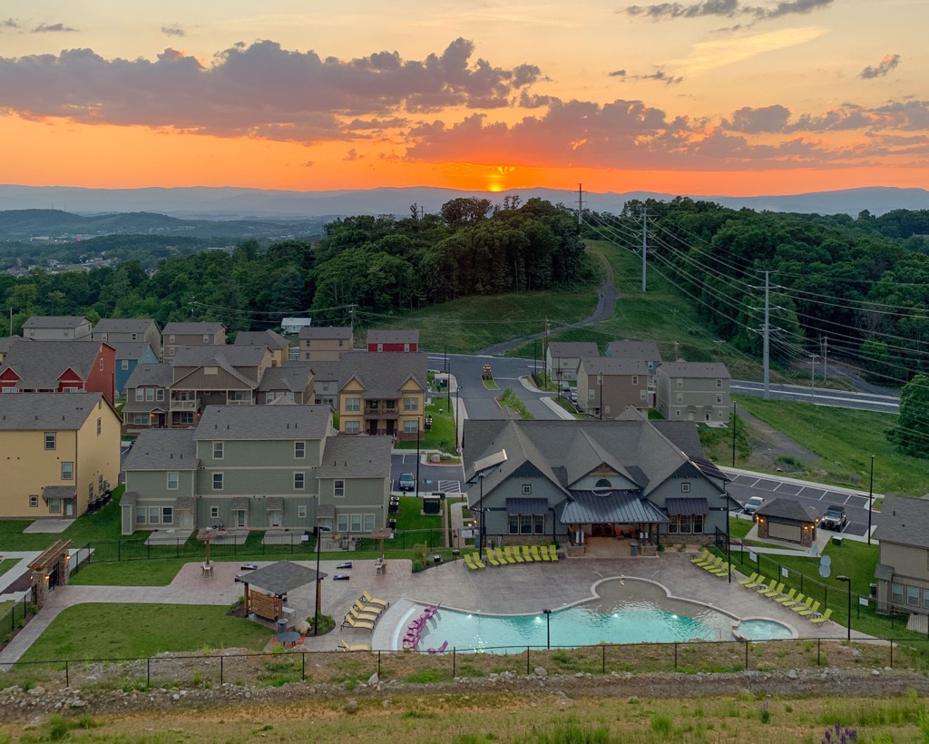
The city of Harrisonburg, Virginia, lies an hour and half drive west of the WMA. Situated in Virginia’s Shenandoah Valley, the city is nestled between the Blue Ridge Mountains to the east and the Allegheny Mountains to the west.
Home to 51,000 residents, Harrisonburg is home to James Madison University and Eastern Mennonite University. Nearby spots for outdoor recreation include George Washington National Forest, Jefferson National Forest, and Shenandoah National Park.
Each year the city hosts events such as the Shenandoah Mountain Bike Festival, Harrisonburg International Festival, and Rocktown Beer & Music Festival. The downtown streets offer dozens of restaurants along with five craft breweries.