Scan the QR code and open PeakVisor on your phone
The Citico Creek Wilderness is situated in Cherokee National Forest in the eastern portion of the US state of Tennessee. The wilderness features rolling ridgelines and various creeks. The tallest peak is Strawberry Knob at 4,656 feet (1,419 m) tall and Hemlock Knob is the most prominent with 559 feet(170 m) of prominence.
The Citico Creek Wilderness is situated in Cherokee National Forest in the eastern stretches of the US state of Tennessee, along the states’ border with North Carolina. The wilderness covers 16,226 acres (6,566 ha) of land across Monroe County.
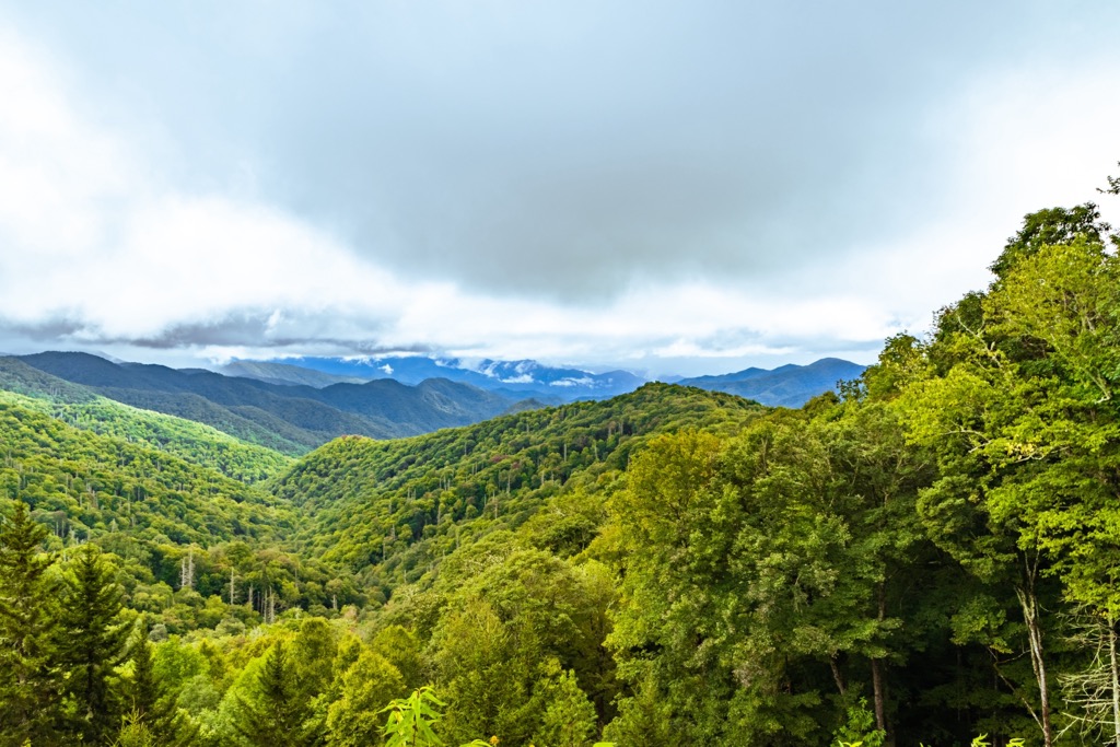
Situated within Unicoi Mountains, three major ridgelines extend westward from the range into the rest of the wilderness. Amidst these three ridgelines lie numerous smaller ridges, valleys, and creeks.
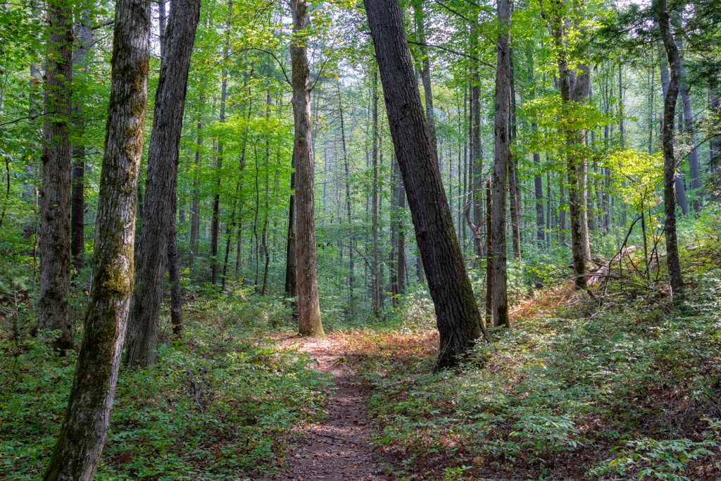
Elevations range between 1,400 to 4,600 feet (427 to 1,402 m) with a majority of the slopes being at or above an incline of 30 degrees. These steep slopes are densely forested while various creeks wind through the rugged terrain.
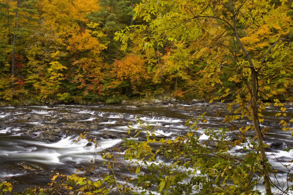
The upper drainage of Citico Creek is located in the wilderness while the North River and Tellico River are situated just south of the wilderness. The Little Tennessee River lies north of the Citico Creek Wilderness while the Cheoah River is located to the northeast.
Though a majority of the wilderness is second-growth forest, there are two sections of old growth forest. One covers 187 acres (76 ha) and is populated by beech and maple trees, while the second covers roughly 200 acres (81 ha) and is populated by old growth hemlock.
Additionally, the Citico Creek Wilderness is surrounded by other popular outdoor recreation areas. The Great Smoky Mountains National Park lies to the north while the Joyce Kilmer-Slickrock Wilderness is to the east in North Carolina. The Bald River Gorge Wilderness lies to the southwest while portions of Nantahala National Forest extend to the southeast.
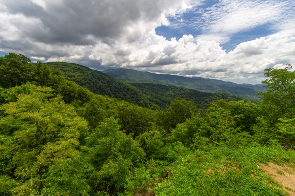
The peaks and ranges found within the wilderness, and the surrounding national forest, are part of the Unicoi Mountains. This range extends along the border between the states of Tennessee and North Carolina.
These peaks are part of the Blue Ridge Mountains, a subrange of the Appalachian Mountains. The entire Blue Ridge Mountain Range runs from the US state of Georgia northward to Maryland and Pennsylvania.
The surrounding region lies within the greater Blue Ridge Mountain geological province. This region is known for its series of continuous rigelines and valleys. Metamorphic and igneous rock can be found throughout the peaks in the wilderness.
Rocks in the region date back to the Precambrian through to the Paleozoic. These mountains began forming around 1 billion to 250 million years ago, being slowly thrust upwards during the Grenville and Alleghenian orogenies.
Once part of an ancient seabed, mineral deposits were continually folded before being thrust upwards to form the range. Millions of years of erosion carved out the landscape, leaving behind the steep slopes visible today.
Dating back hundreds of millions of years, the Blue Ridge Mountains are much older than prominent ranges such as the Alps or Himalaya, both of which were formed around 65 million years ago during the Alpine orogeny. The range is still being eroded today with sediment being carried away by the various creeks, streams, and rivers within the region.
Major peaks within the Citico Creek Wilderness include Strawberry Knob, Hemlock Knob, Big Fodderstack, Little Fodderstack, and Rockstack.
The Citico Creek Wilderness is part of the larger Blue Ridge ecoregion, which encompasses the surrounding national forests. Flora and fauna in the national forest are similar to that which is found throughout eastern Tennessee.
The landscape near creeks and streams are populated by white oak, red oak, yellow poplar, and hemlock. Ridgelines in the wilderness feature a mixed hardwood-pine forest containing hickory, white oak, and red oak. Hikers are also likely to spot pitch pine, white pine, and shortleaf pine.
Mammals commonly found in the wilderness include white-tailed deer, porcupines, coyotes, bobcats, and black bears. River otters and beavers are common amidst the various waterways in the area.
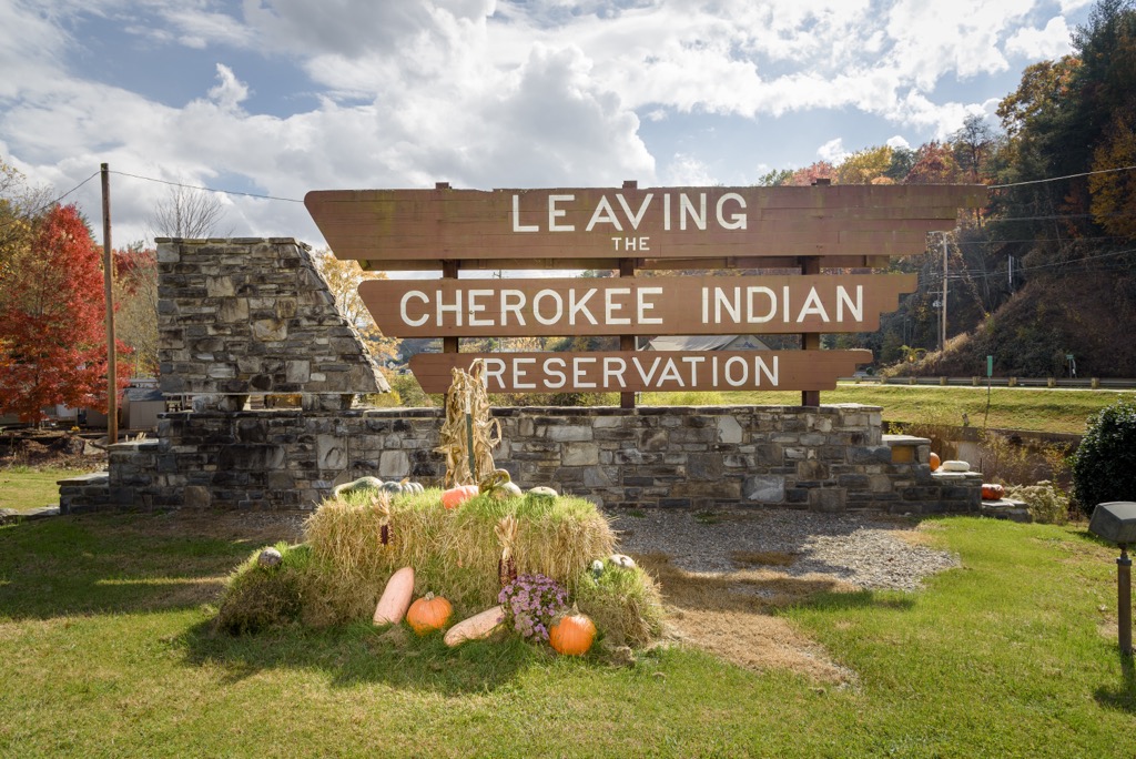
The land within and surrounding Citico Creek Wilderness has a long and rich human history dating back thousands of years. This portion of land marks part of the ancestral homelands of the Cherokee people.
Additionally, present-day Tennessee, Georgia, and North Carolina are part of the traditional territory of the Cherokee Nation and the Eastern Band of Cherokee Indians. The Cherokee people lived in the area for thousands of years, working with the land as hunters and gatherers.
In 1540, a Spanish expedition led by Hernando de Soto, traveled through what is now the southeastern US, marking the first recorded contact between Europeans and the Indigenous peoples. Over the following century, settlers began to move into the region. The Cherokee formed treaties and trade agreements with many of the early Irish, English, and Scottish immigrants
During the 1700s, the various bands of Cherokee people formed an organized and unified national government. Gold was discovered in nearby Georgia during the early 1800s, leading to a large influx of settlers arriving in the region.
As populations continued to grow, the Cherokee people fought to protect and preserve their native homelands. Settlers, often backed by the US government, repeatedly attacked, harassed, murdered, and displaced the Cherokee people. The US government tried to force the Cherokee Nation to sign over their land via the Treaty of Echota.
The treaty was never signed by the Cherokee Nation yet the US government began to forcibly remove them from their homelands. The Indian Removal Act of 1830 forced the Indigenous peoples of the eastern US to relocate to land west of the Mississippi River. This treacherous journey would later be referred to as the Trail of Tears, resulting in the death of thousands of Indigenous peoples.
A small band of Cherokee remained on their native homelands before being found by the US government. The remaining Cherokee people were allowed to stay in the region but forced to assimilate to western culture and customs. Today, descendants of these Cherokee peoples are part of the Eastern Band of Cherokee Indians, located on the Qualla Boundary.
During the 1920s, a vast majority of the region was logged with other portions being destroyed by a forest fire in 1925. The land was purchased by the US Forest Service and officially designated as Cherokee National Forest during the 1930s. The Citico Creek Wilderness was established in 1984.
The wilderness is named after the Cherokee village of Citico. The village was destroyed with the creation of the Tellico Reservoir in 1979.
The Citico Creek Wilderness is home to 57 miles (92 km) of hiking trails. Here are some of the most popular trails in the wilderness to check out during your next visit.
This hiking route lies along the southern edge of the wilderness. The out and back route slowly decreases in elevation through the forested landscape. After descending the route opens up to the Falls Branch which features the Falls Branch waterfall.
The waterfall cascades down the rugged landscape and features a small pool at its base. This route can be hiked throughout the year and hikers can witness the frozen falls during the winter months. Round trip the trail is 2.3 miles (3.7 km) and features 531 feet (162 m) of elevation gain.
The Grassy Branch Trail is located in the southwestern portion of the wilderness and follows along the Grassy Branch and Eagle Branch, with the forested hillsides rising steeply on either side of the trail.
The out and back trail features numerous bridges and small waterfall features. The proximity to creeks can make this trail quite muddy so hikers should wear appropriate footwear. The trail is 4.1 miles (6.6 km) in length and features 1,286 feet (392 m) of elevation gain.
Bearing the same name as the wilderness, Citico Creek is located along the western edge of the protected region. The route features numerous short climbs and descents while following along Citico Creek.
The creek flows westward out of the wilderness before traveling northwards into the Little Tennessee River. During the warmer months this route features various wildflowers and offers hikers numerous spots to relax by the creek. The out and back trail is 2.4 miles (3.9 km) long and features 321 feet (98 m) of elevation gain.
Looking for a place to stay near the Citico Creek Wilderness? Here are some of the best cities and villages to check out in the region:
The small town of Robbinsville lies east of the wilderness, located near the center of the Cheoah District of Nantahala National Forest. Home to just 620 residents, Robbinsville is located within Graham County.

Despite its small size, Robbinsville marks an ideal location for exploring portions of both Cherokee and Nantahala National Forests. The town also lies a short drive from Great Smoky Mountains National Park.
The small downtown features a few local shops, restaurants, and historical sites. Every year, the town also hosts a July Heritage Festival and a Ramp Festival.
The city of Knoxville lies less than a two hours drive north of the wilderness. Situated along the Tennessee River, the city is home to 190,000 residents, making it the third largest city in the state after Nashville and Memphis.
Knoxville boasts thriving music, food, and nightlife scenes all while being in close proximity to outdoor recreation. The city has played a vital role in both country and bluegrass music with numerous live music venues throughout the downtown streets.
Visitors can also explore the Museum of East Tennessee History, World’s Fair Park, Knoxville Museum of Art, and Ijams Nature Center. Great Smoky Mountains National Park lies in the mountains southeast of the city.