
 Historic site











Curated by Garda Trentino
Tenno
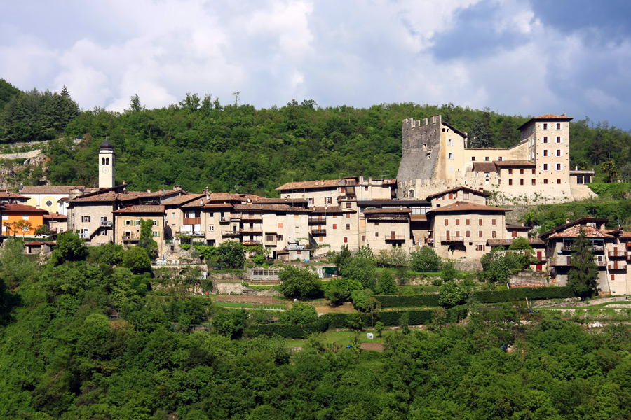
A village above Riva del Garda with a castle and the turquoise Lago di Tenno, beside the medieval hamlet of Canale.
- 4Highlights
- 41Routes
- Featured summit · Monte Misone
Highlights
All 4 from neighbouring places
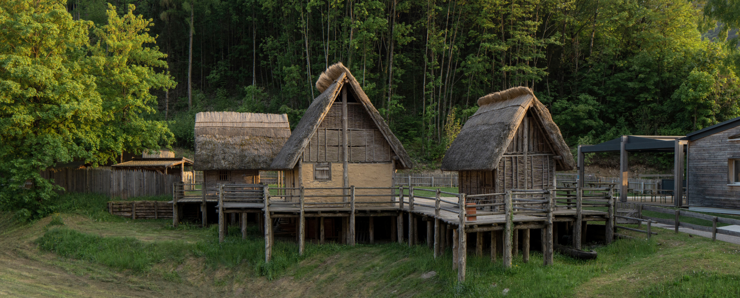
Museo delle Palafitte del Lago di Ledro
7.9 km away, in Ledro
A museum on the Bronze Age pile dwellings found in Lake Ledro, built over part of the excavated site.
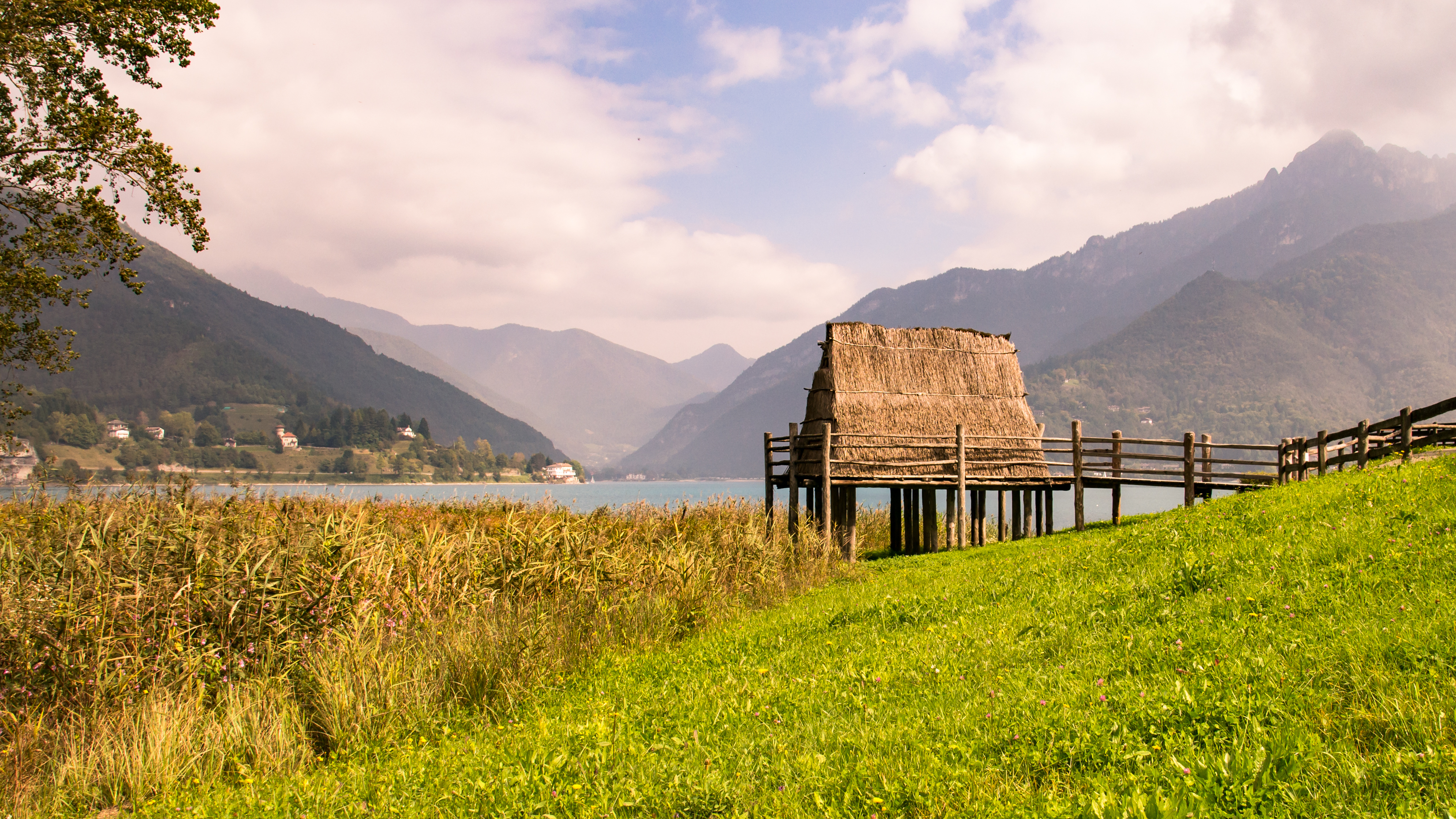
Lago di Ledro
8.1 km away, in Ledro
A lake at 655 m in the Ledro valley west of Riva del Garda, with a Bronze Age pile-dwelling site on its shore.
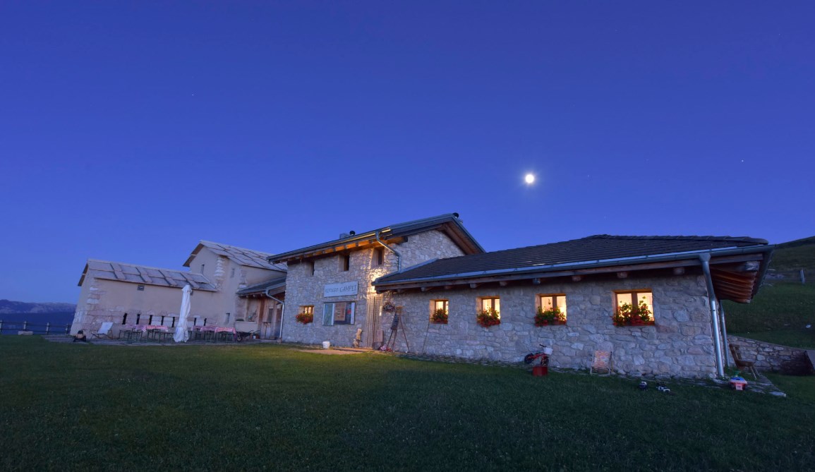
Rifugio Malga Campei
14.3 km away, in Brentonico
A hut on the Campei pastures of Monte Baldo, on the path from Brentonico to the Altissimo.
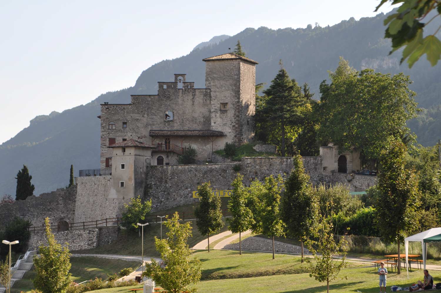
Die Burg von Castellano
14.9 km away, in Villa Lagarina
Castel Castellano above Villa Lagarina, a Vallagarina castle on its rock spur.
Nothing of this kind in Tenno.
Routes
Dal lago di Tenno agli scavi di San Martino di Campi
A short uphill route from the Tenno lake to the hidden hamlet of Campi and the archaeological dig on Monte San Martino.
- 6.0 km
- Distance
- 300 m
- Ascent
- 1 h 55 min
- Duration
- 15
- Check-ins
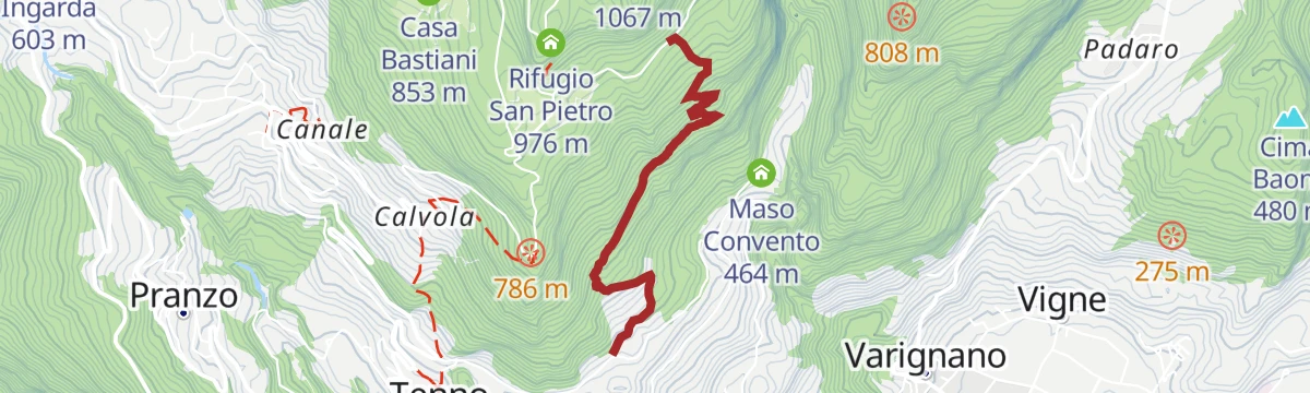
GardaTrek - TopLoop 2: descent to Lake Tenno (Alternative route)
An alternative descent from the Pernici hut by Bocca di Trat and Malga Grassi to Tenno and the stone village of Canale, ending at the San Pietro hut; the waymarks still show the old line.
- 12.3 km
- Distance
- 582 m
- Ascent
- 5 h 31 min
- Duration
- 84
- Check-ins
 Rifugio San Pietro 976 m
- Rifugio Bocca di Trat "Nino Pernici" 1 600 m
- Casa Bastiani 853 m
 Bocca di Trat 1 581 m
- Malga Pranzo 1 039 m
- Malga Dosso dei Fiori 1 355 m
Open route Garda TrentinoGardaTrek - Top Loop 3: a long descent to the River Sarca
A long stage over Monte Biaina and down through changing woodland to the Roman bridge at Ceniga on the Sarca.
- 20.2 km
- Distance
- 1 369 m
- Ascent
- 10 h 47 min
- Duration
- 52
- Check-ins
 Monte San Pietro 1 067 m
- Doss del Clef 769 m
- Rifugio San Pietro 976 m
- Malga San Giovanni al Monte 1 056 m
- Bed & Breakfast Maso Mandrea 615 m
- Bocchetta di Padaro 418 m
- +4
Open route Garda TrentinoGardaTrek - Medium Loop 2: from the Rifugio San Pietro hut to Ceniga
A largely downhill stage from the Rifugio San Pietro to Ceniga in the Sarca valley, over Monte Biaina and the Croce di Bondiga lookout.
- 12.9 km
- Distance
- 888 m
- Ascent
- 2 h 51 min
- Duration
- 44
- Check-ins
- Monte San Pietro 1 067 m
- Cima Nanzone 1 134 m
- Rifugio San Pietro 976 m
- Bocchetta di Padaro 418 m
- Malga Tovo 953 m
- Baita Ida 927 m
- +2
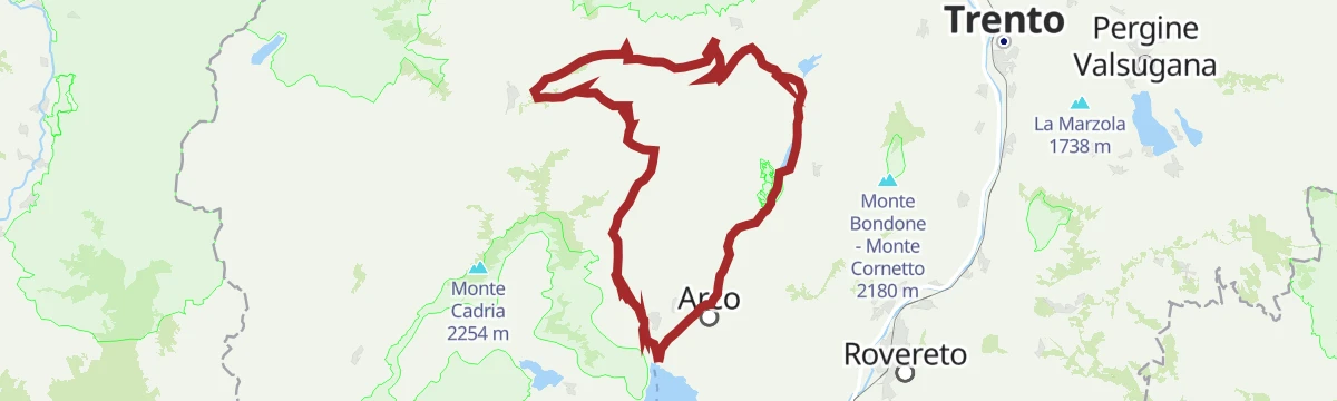
Open route Garda TrentinoAnello Garda Sarca
A round above Riva del Garda between the lake and the Sarca, topping the Dos dele Strie.
- 67.5 km
- Distance
- 1 396 m
- Ascent
- 7 h 18 min
- Duration
- 155
- Check-ins
From Lake Tenno to San Martino archeological site in Campi
An easy road climb from the lake up provincial road 37 to Campi and the archaeological site on Monte San Martino.
- 6.0 km
- Distance
- 300 m
- Ascent
- 44 min
- Duration
- 15
- Check-ins
Open route Garda TrentinoLake Tenno Tour
A ride marked 736 from Tenno on gravel lanes through vines and olives by way of Canale di Tenno, climbing towards the lake without quite reaching the shore.
- 10.5 km
- Distance
- 238 m
- Ascent
- 1 h 9 min
- Duration
- 12
- Check-ins
Open route Garda TrentinoDolomiti-Garda Alpine Cycling / Male - Riva del Garda
The full Dolomiti-Garda route through four Trentino valleys, from the Adamello Brenta park down to Lake Garda.
- 109.5 km
- Distance
- 3 039 m
- Ascent
- 12 h 49 min
- Duration
- 230
- Check-ins
- Falesia Fontanella 1 384 m
- Fortini 1 629 m
- LAB Après-Ski 1 632 m
 Laghetto Conca Verde 1 496 m
- La Cantina di Suisse 1 506 m
- Condominio Villa Golf 1 646 m
- +24
Open route APT Madonna di Campiglio, Pinzolo, Val RendenaLago di Tenno
A short circuit above the Lago di Tenno, largely on surfaced lanes, with the turquoise water below.
- 10.5 km
- Distance
- 242 m
- Ascent
- 3 h 3 min
- Duration
- 12
- Check-ins
Sentiero della Pace 8: Bivacco Malga Casinot to Rifugio Pernici
A ridge stage of the peace trail over the Bocca dell'Ussol and Corno di Pichea, with fixed ropes at the Bochet de Slavazi, down to Bocca di Trat.
- 9.1 km
- Distance
- 785 m
- Ascent
- 5 h 7 min
- Duration
- 62
- Check-ins
- Corno di Pichea 2 142 m
- Monte Tofino 2 151 m
- Doss dela Torta 2 156 m
- Gavardina 2 047 m
- Rifugio Bocca di Trat "Nino Pernici" 1 600 m
- Bocca di Trat 1 581 m
- +5
Open route APT Madonna di Campiglio, Pinzolo, Val RendenaGardaTrek Medium Loop 1: from Riva del Garda to Rifugio San Pietro
The first Medium Loop stage, climbing north from the lake through woods and farmland by the San Martino site above Campi to the San Pietro hut.
- 17.1 km
- Distance
- 1 439 m
- Ascent
- 7 h 32 min
- Duration
- 41
- Check-ins
Open route Garda TrentinoGarda Dolomiti Tour
A long route from Arco into the Garda Dolomites, easier than its length suggests, by the Capanna Alpini.
- 66.6 km
- Distance
- 1 195 m
- Ascent
- 7 h 2 min
- Duration
- 112
- Check-ins
- Capanna Alpini 100 m
- Garda Dolomiti Azienda per il turismo S.p.A. 69 m
- Casa Bastiani 853 m
- Info Point Riva del Garda 69 m
- Agritur Maso Lizzone 126 m
- Malga Lomasone 539 m
- +3
Open route Garda TrentinoComano Gravel Tour
A long gravel run from the Garda shore to the edge of the Brenta Dolomites, through the Limarò gorge and over the Passo del Ballino to Comano.
- 68.7 km
- Distance
- 1 182 m
- Ascent
- 7 h 13 min
- Duration
- 187
- Check-ins
- Dos dele Strie 401 m
- Capanna Alpini 100 m
- Bike Farm Linfano 74 m
- Agritur Maso Lizzone 126 m
- Centrale di Fies 191 m
- Ingarda 603 m
- +5
Open route Garda TrentinoFrom Lake Tenno to Canale, a stroll through the countryside
An easy stroll between the Lago di Tenno, whose water turns from turquoise to green with the season, and the stone village of Canale di Tenno.
- 4.5 km
- Distance
- 61 m
- Ascent
- 1 h 12 min
- Duration
- 7
- Check-ins
Open route Garda TrentinoHiking to the mountain hut San Pietro on Monte Calino
A climb from the medieval village of Canale di Tenno through the woods of Monte Calino to the Rifugio San Pietro on its terrace above upper Lake Garda.
- 9.1 km
- Distance
- 479 m
- Ascent
- 3 h 26 min
- Duration
- 41
- Check-ins
Open route Garda TrentinoSentiero Frassati - Leg 2
The second leg of the Trentino Frassati path, running from the Rifugio San Pietro below Biaina and Misone across the Lomaso and Bleggio farmland to Villa Banale.
- 23.3 km
- Distance
- 791 m
- Ascent
- 7 h 49 min
- Duration
- 40
- Check-ins
- Monte San Pietro 1 067 m
- Rifugio San Pietro 976 m
- Malga Vigo 1 087 m
- Baita Ida 927 m
- Pipol Home 935 m
- la me baita 589 m
Open route Garda TrentinoMalga Grassi Trail-Tour
A bike tour from Riva del Garda by Pranzo and Campi to Malga Grassi, over minor roads, gravel cart tracks and a little main road.
- 24.2 km
- Distance
- 1 098 m
- Ascent
- 3 h 11 min
- Duration
- 42
- Check-ins
- Monte San Martino 832 m
- Garda Dolomiti Azienda per il turismo S.p.A. 69 m
- Info Point Riva del Garda 69 m
- Capanna Grassi 1 056 m
- Malga Pranzo 1 039 m
Open route Garda TrentinoFrom the Dolomites to Lake Garda
A hundred-kilometre run down from the Brenta to the shore of Garda, back over the Passo Ballino and through the Limarò gorge.
- 106.4 km
- Distance
- 2 385 m
- Ascent
- 11 h 41 min
- Duration
- 131
- Check-ins
- Fontanella 845 m
- Lago Park Hotel 826 m
- Grand Hotel Molveno 838 m
- Sella di Andalo 1 042 m
- APT Dolomiti Paganella 1 021 m
- Centrale di Fies 191 m
- +10
Open route APT Dolomiti di Brenta e PaganellaDalla chiesa di San Lorenzo al colle Bussè
A brief walk joining the Grom hill at Frapporta with the nature trail on the Bussè, two lookouts over the Tenno countryside.
- 3.0 km
- Distance
- 117 m
- Ascent
- 60 min
- Duration
Giro del Monte Calino, la "montagna di Tenno"
A circuit of Monte Calino, the hill of Tenno, a natural balcony over the basin at the head of Lake Garda.
- 11.0 km
- Distance
- 702 m
- Ascent
- 4 h 47 min
- Duration
- 34
- Check-ins
Sentiero Frassati - Leg 1
The first Frassati leg, from the Madonna delle Grazie church through Varone and up by Tenno and Calvola to the San Pietro hut below Monte Calino.
- 6.5 km
- Distance
- 896 m
- Ascent
- 3 h 34 min
- Duration
- 29
- Check-ins
Open route Garda TrentinoSan Giovanni Trail-Tour
A climb from Arco to San Giovanni al Monte over the Sella di Calino, with a long descent back.
- 37.2 km
- Distance
- 1 320 m
- Ascent
- 4 h 33 min
- Duration
- 29
- Check-ins
- Doss del Clef 769 m
- Casa Bastiani 853 m
- Malga San Giovanni al Monte 1 056 m
- Sella di Calino 966 m
- Bed & Breakfast Maso Mandrea 615 m
- Bocchetta di Padaro 418 m
- +1
Open route Garda TrentinoLago di Tenno Gravel Tour
A mixed-surface loop from the Garda campsites through woods and medieval villages up to the turquoise lake at Tenno, then back among vineyards.
- 45.5 km
- Distance
- 1 013 m
- Ascent
- 4 h 59 min
- Duration
- 131
- Check-ins
Open route Garda TrentinoFrom the church of San Lorenzo to Bussè hill
A short walk from San Lorenzo at Frapporta, whose frescoes are the oldest in Trentino, up to the Bussè hill through terraces of vine and olive below Tenno castle.
- 3.0 km
- Distance
- 126 m
- Ascent
- 1 h 1 min
- Duration
Open route Garda TrentinoHike to Rifugio San Pietro
A direct climb to the Rifugio Monte Calino San Pietro, built out of the hermitage beside its medieval church, on a meadow above the upper Garda.
- 5.2 km
- Distance
- 509 m
- Ascent
- 3 h 9 min
- Duration
- 29
- Check-ins
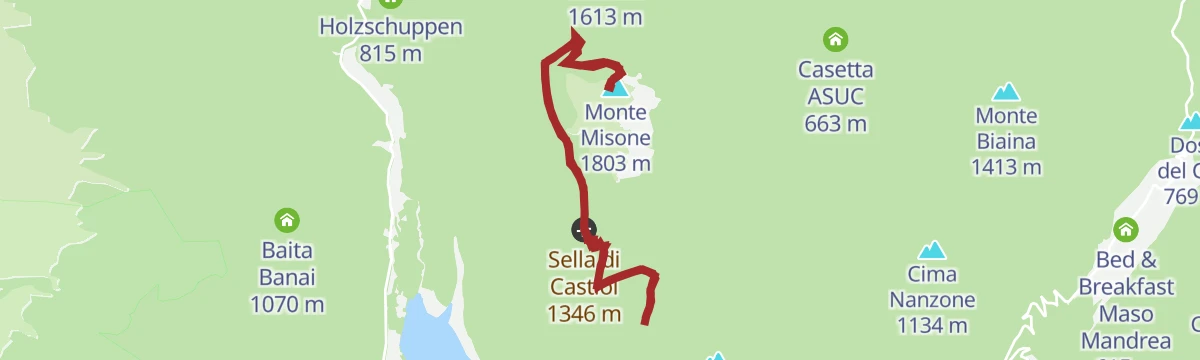
Open route Garda TrentinoMonte Misone
A long tour from Fiavè over the Ballino pass and above Lake Tenno, then along the warm southern side of Monte Misone on forest tracks.
- 25.5 km
- Distance
- 593 m
- Ascent
- 7 h 27 min
- Duration
- 23
- Check-ins
- Casa Bastiani 853 m
- Sella di Calino 966 m
- Malga Lomasone 539 m
- Passo Del Ballino 750 m
- Residence Paradiso Parolari 803 m
Open route Garda TrentinoBocca di Tovo Trail-Tour
A climb above Arco to the Bocca di Tovo and Malga Tovo, under the Doss del Clef and Cima Nanzone.
- 33.2 km
- Distance
- 1 154 m
- Ascent
- 4 h 2 min
- Duration
- 22
- Check-ins
Durone - Valle del Chiese - Valle di Ledro
A demanding day from Riva del Garda over the Passo Ballino and on through Tione, five lakes along the way and a constant up and down on quiet roads.
- 91.7 km
- Distance
- 2 309 m
- Ascent
- 10 h 12 min
- Duration
- 112
- Check-ins
- Garda Dolomiti Azienda per il turismo S.p.A. 69 m
- Info Point Gardatrentino 657 m
- Info Point Riva del Garda 69 m
- Ingarda 603 m
- Bar Ristorante Passo Durone 995 m
- Passo dell'Ampola 747 m
- +13
Open route Garda TrentinoHidden Treasures: Pranzo, a village and its crafts
A short village circuit at Pranzo about its old trades, with carved wooden panels made by the local woodworking school marking the former workshops.
- 1.3 km
- Distance
- 57 m
- Ascent
- 26 min
- Duration
Open route Garda TrentinoOn the summit of Monte Misone
A steep start and then easier ground to the top of Monte Misone, with the blue of the Lago di Tenno below and Canale di Tenno on the way back.
- 8.2 km
- Distance
- 876 m
- Ascent
- 5 h 19 min
- Duration
- 15
- Check-ins
Open route Garda TrentinoVespana - Tour
A mountain bike round marked 740, climbing to Canale di Tenno and the lake, then up the wooded flank of Monte Misone on constantly changing surfaces.
- 20.5 km
- Distance
- 694 m
- Ascent
- 2 h 28 min
- Duration
- 16
- Check-ins
Open route Garda TrentinoBallino - Durone - Stenico
A road circuit from Riva over the Ballino and Durone passes, holding height across to Stenico.
- 87.5 km
- Distance
- 2 198 m
- Ascent
- 9 h 50 min
- Duration
- 71
- Check-ins
- Garda Dolomiti Azienda per il turismo S.p.A. 69 m
- Info Point Riva del Garda 69 m
- Ingarda 603 m
- Bar Ristorante Passo Durone 995 m
- Casa sociale 248 m
- Info Point - Garda Trentino - Arco 90 m
- +7
Open route Garda TrentinoVariant for Elisa - Trail
A short flat link marked 743c on the Tenno trail network, joining two arms of the main route.
- 1.7 km
- Distance
- 0 m
- Ascent
- 53 min
- Duration
Open route Garda TrentinoGardaTrek - Low Loop 1: from Riva del Garda to Arco
A semicircle across the slopes above the lower Sarca from Riva del Garda to Arco, with a short detour to the Venetian Bastione near the start.
- 14.0 km
- Distance
- 684 m
- Ascent
- 5 h 1 min
- Duration
- 9
- Check-ins
Open route Garda TrentinoTenno - Ballino - Comano
A circuit from Riva over the Ballino pass to Comano, without a level metre and almost traffic-free.
- 59.4 km
- Distance
- 1 400 m
- Ascent
- 6 h 35 min
- Duration
- 48
- Check-ins
- Garda Dolomiti Azienda per il turismo S.p.A. 69 m
- Info Point Riva del Garda 69 m
- Ingarda 603 m
- APT Terme di Comano 399 m
- Passo Del Ballino 750 m
- Hotel La Pineta - Ristorante Bar Pizzeria 660 m
- +2
Open route Garda TrentinoVariante Rancion - Trail
A variant marked 743b that branches off at Rancion, beginning as forest road and narrowing to a path, steep in places but firm underfoot.
- 2.3 km
- Distance
- 0 m
- Ascent
- 56 min
- Duration
Open route Garda TrentinoGrotta Camerona e Lago di Tenno
A walk to the Camerona cave and on to Lake Tenno, a small deep-blue mountain lake in the hills above Fiavè.
- 10.6 km
- Distance
- 379 m
- Ascent
- 3 h 24 min
- Duration
- 1
- Check-ins
Tour del Lago di Tenno
A short, intense climb from Riva by Pranzo to the Tenno lake, returning through Ville del Monte.
- 22.0 km
- Distance
- 577 m
- Ascent
- 2 h 30 min
- Duration
- 38
- Check-ins
Open route Garda TrentinoVarone H
A level route at Varone below Tenno, near the gorge where the waterfall drops towards the Sarca plain.
- 4.3 km
- Distance
- 0 m
- Ascent
- 1 h 11 min
- Duration
Open route Trentino FishingRio Varoncello I
A long, almost flat route along the Varoncello stream on the Tenno side of the Sarca valley.
- 9.8 km
- Distance
- 10 m
- Ascent
- 3 h 24 min
- Duration
Open route Trentino FishingDolomiti-Garda Alpine Cycling 3 - Ponte Arche - Riva del Garda
A stage of the DoGa cycle route dropping from the Giudicarie valleys to Lake Garda over the Passo del Ballino, with the Lago di Tenno on the way.
- 29.8 km
- Distance
- 529 m
- Ascent
- 3 h 16 min
- Duration
- 15
- Check-ins
Open route APT Madonna di Campiglio, Pinzolo, Val Rendena
No routes of this kind in Tenno yet.
The region's own picks

Featured route
Dal lago di Tenno agli scavi di San Martino di Campi
A short uphill route from the Tenno lake to the hidden hamlet of Campi and the archaeological dig on Monte San Martino.
Planning a trip to Tenno?
Everything else Trentino-Alto Adige/Südtirol has, in one place


Take Tenno with you into the mountains
Every route on this page with 3D terrain, GPX navigation and offline maps — including the valleys with no signal.
Data sources
- Official website: gardatrentino.it ↗
- Routes and highlights: Garda Trentino, Visit Trentino, APT Madonna di Campiglio, Pinzolo, Val Rendena, Italia.it, Visitrovereto, Trentino Fishing, APT Dolomiti di Brenta e Paganella
- Published as open data by the tourist boards named above.
- Region summary generated from the board's own material.
