
 Viewpoint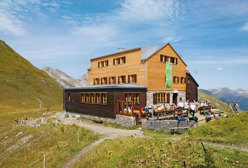
 Via ferrata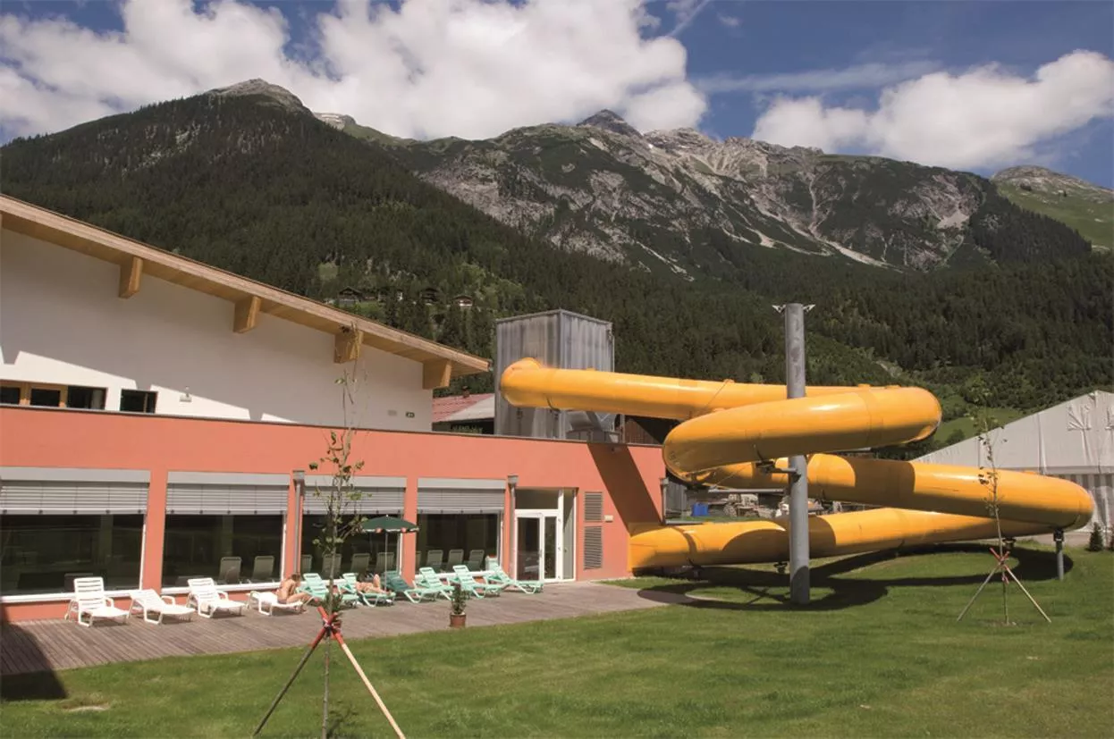
 Historic site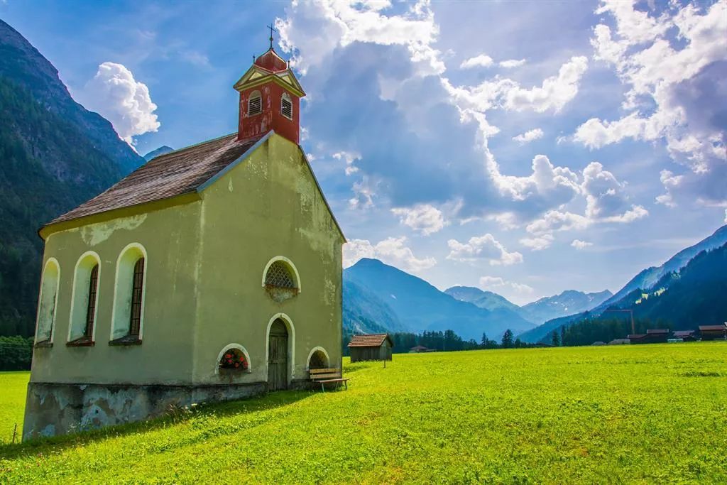















Curated by Lechtal Tourismus
Steeg
The uppermost municipality of the Tiroler Lechtal at about 1110 m, its hamlets scattered toward the Arlberg passes and the sources of the young Lech.
- 33Highlights
- 70Routes
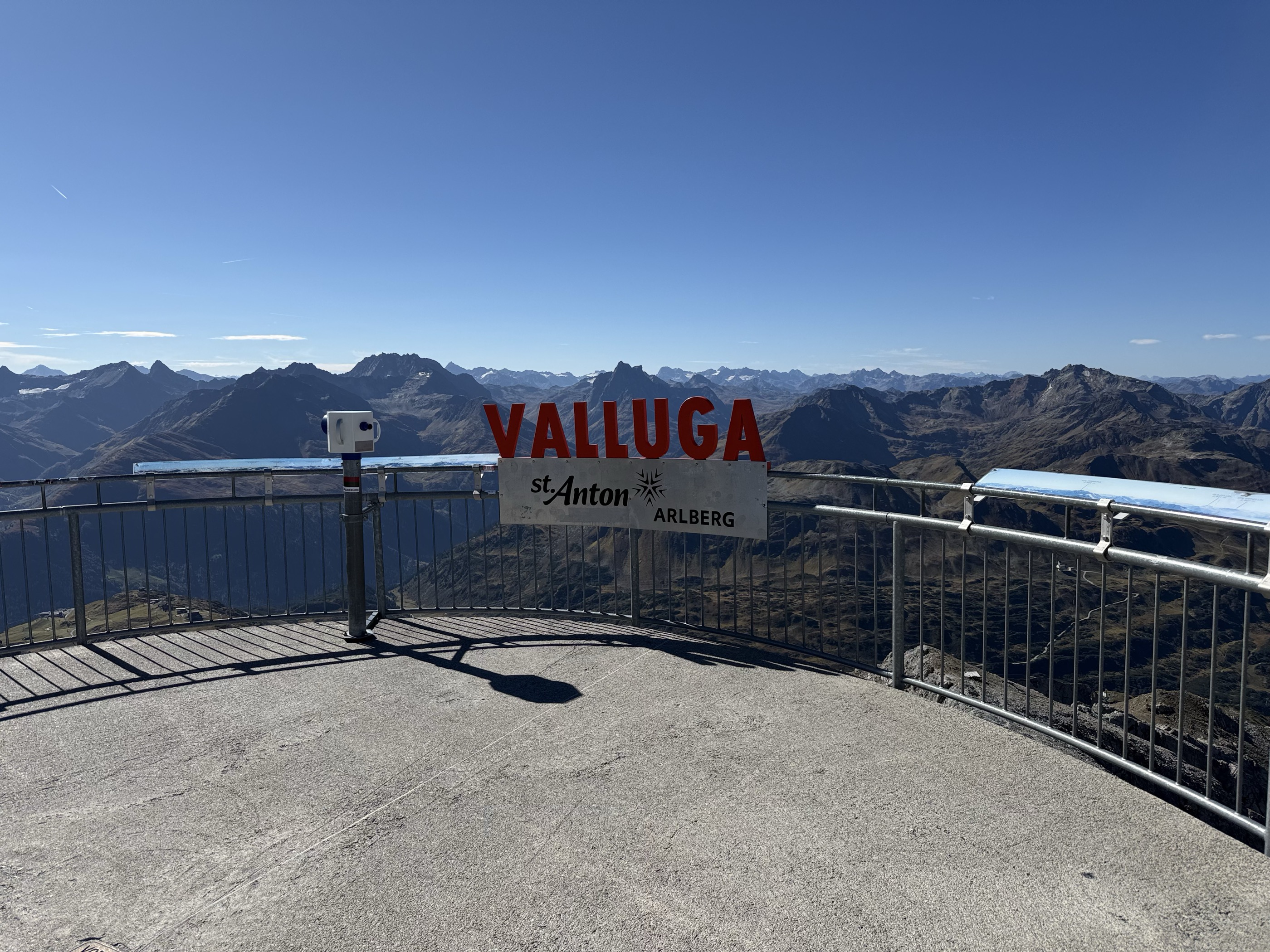
- Featured summit · Valluga
Highlights
The 20 highest-rated · see the rest on lechtal.at ↗
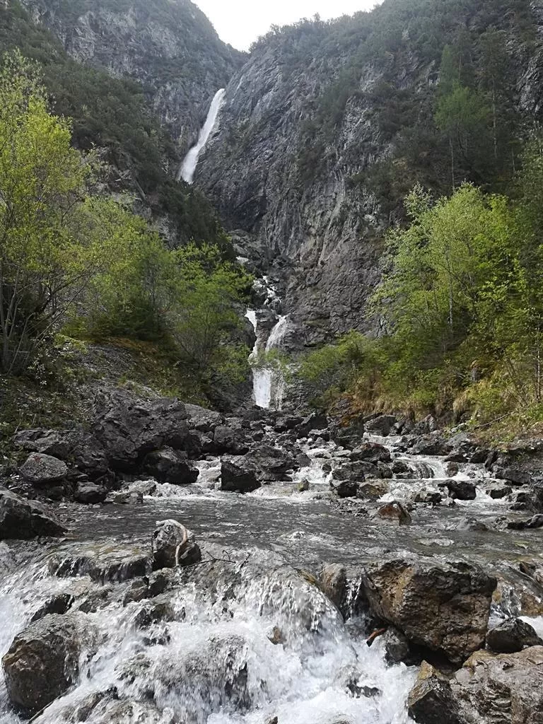
Hägerauer Wasserfall
A waterfall at Hägerau near Steeg in the upper Lechtal, dropping from the mountainside above the valley floor at about 1,100 m.
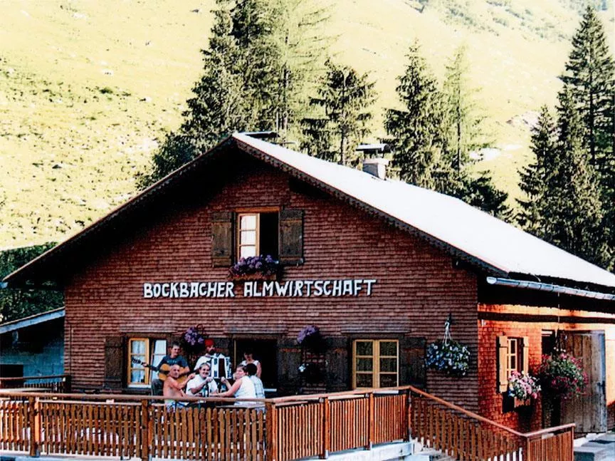
Bockbachalm 1.467 m
An alpine pasture at 1,467 m in the Bockbach valley near Steeg, serving regional dishes to walkers heading toward the Allgäu ridge.
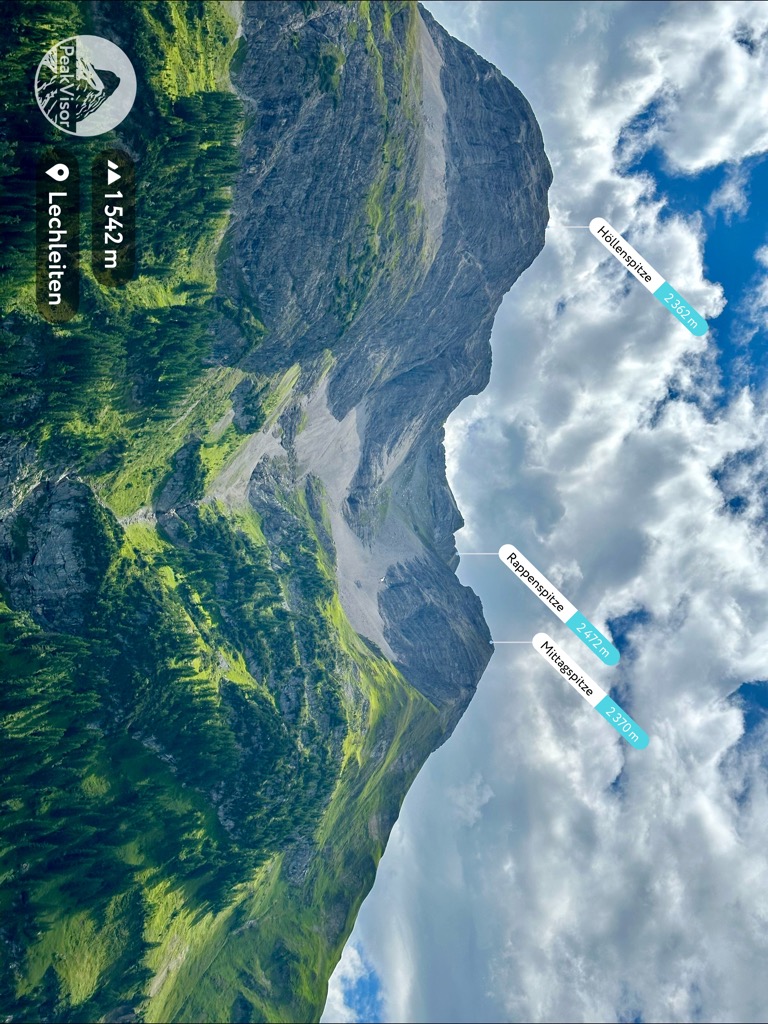
Höllenspitze
A 2,362 m summit three and a half kilometres south-east of the village, above the Lech valley.
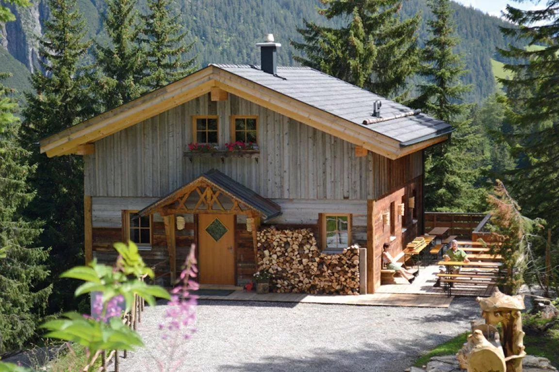
Postalm 1.350 m
An alm restaurant at 1,350 m above Steeg in the upper Lechtal, serving regional dishes on the walking routes toward the Allgäu ridge.
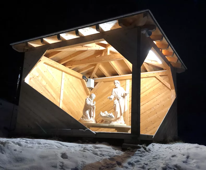
Krippe Steeg
A nativity scene at Steeg in the upper Lechtal, reflecting the valley's long tradition of wood carving and folk art.
Klettergebiet Roggspitze 2747 m
Alpine rock climbing on the Roggspitze, a 2,747 m summit near the Arlberg reached from the Steeg side of the Lechtal.
Erlebnisbad Aqua Nova
An indoor family pool at Steeg in the upper Lechtal, offering warm-water swimming for visitors to the valley at 1,124 m.
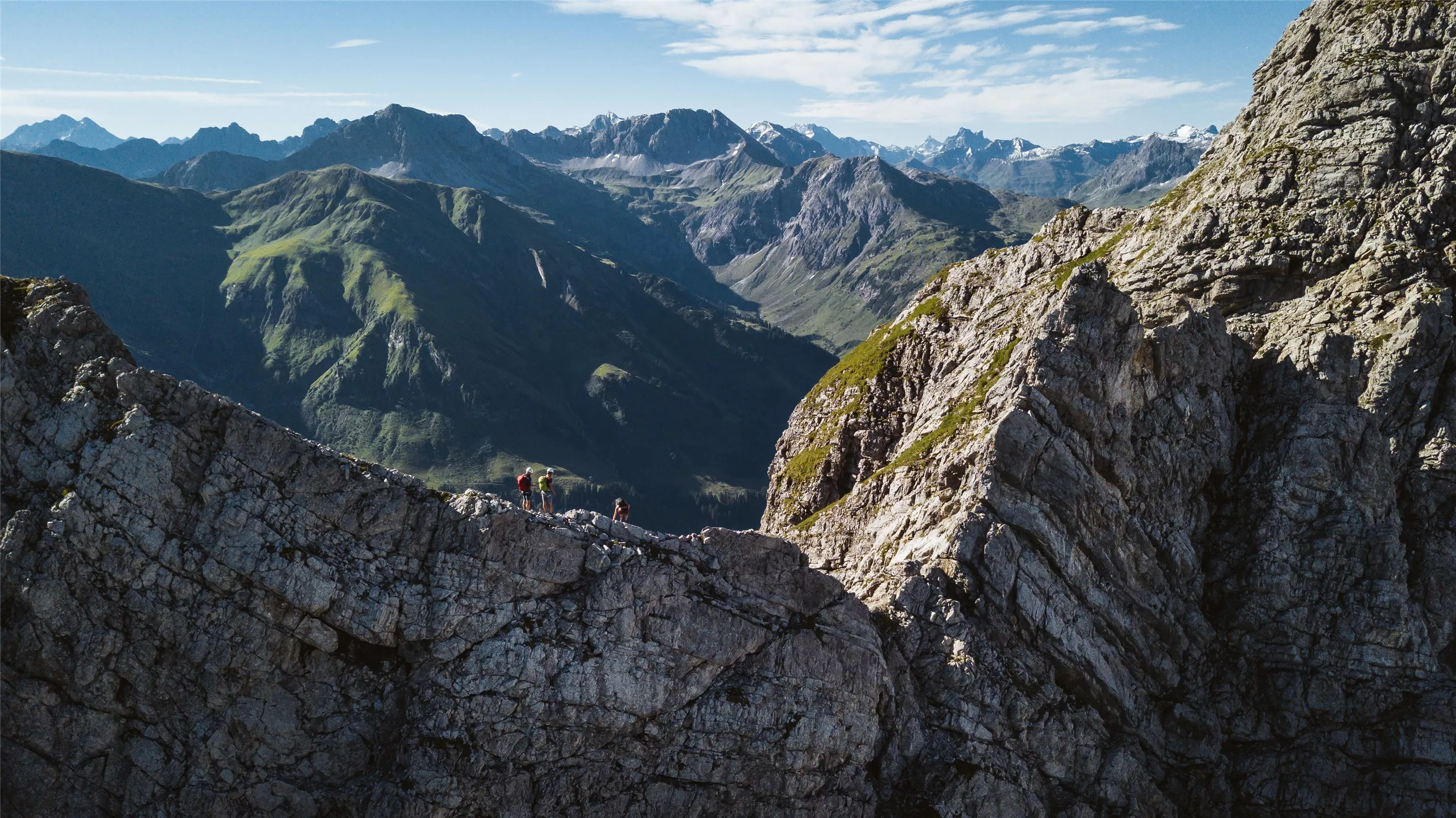
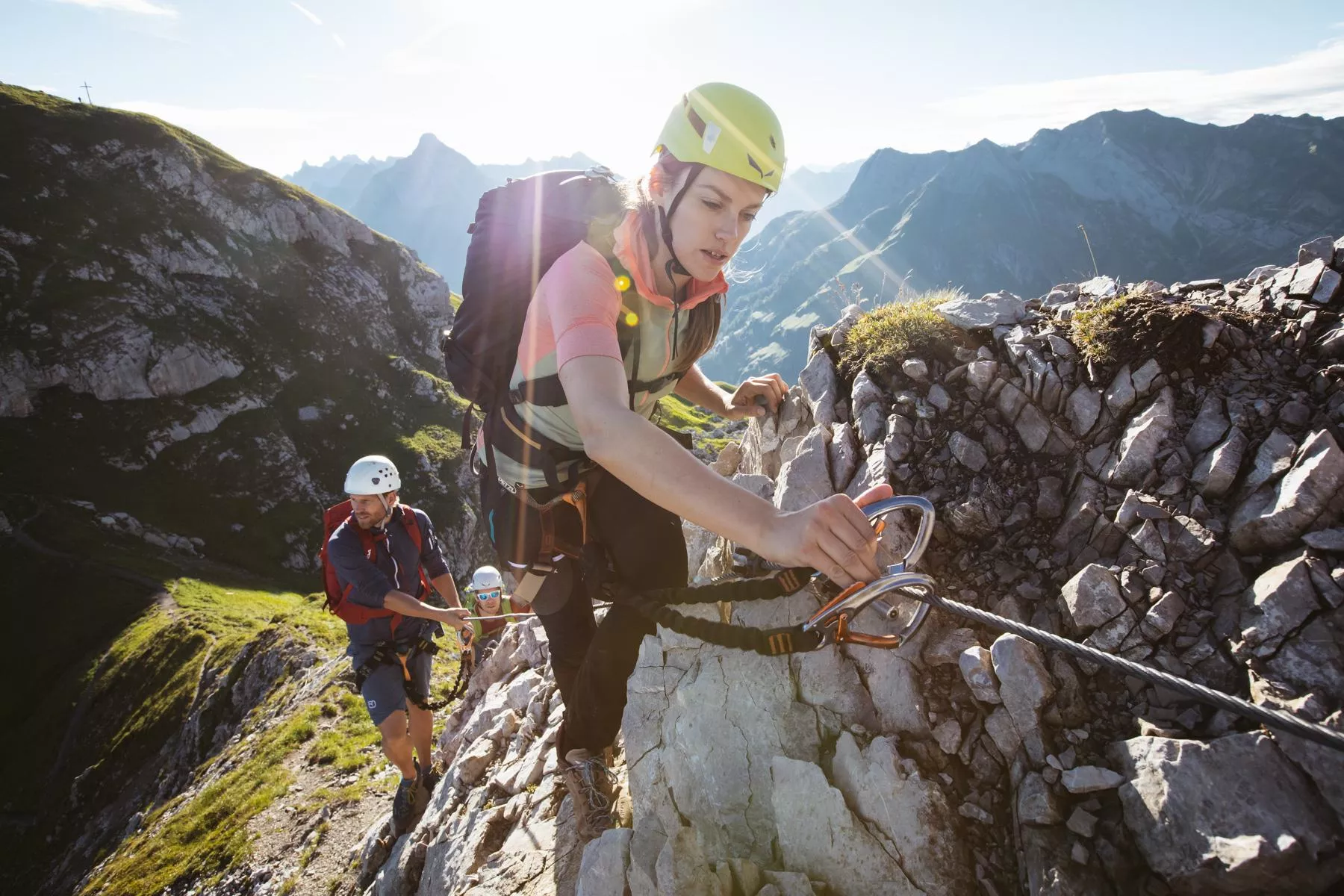
Karhorn Klettersteig
A ridge via ferrata on the Karhorn above Warth am Arlberg, a protected scramble with views over the upper Lech valley and the Arlberg.
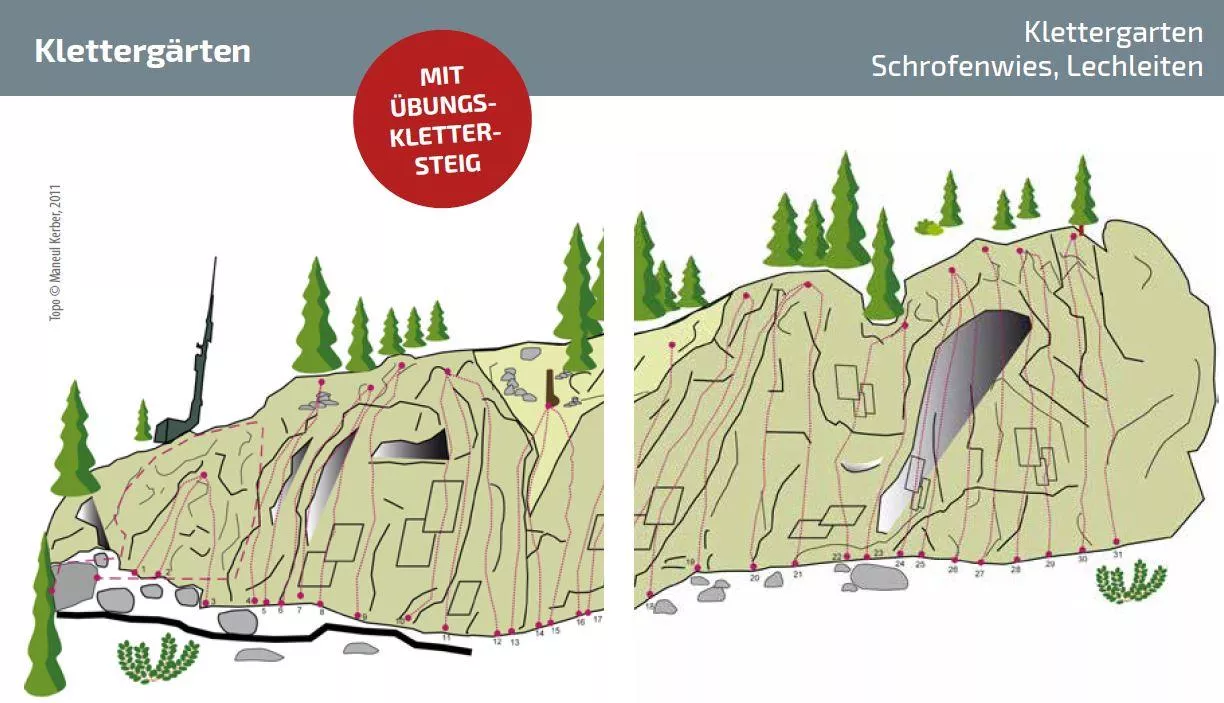
Klettergarten Schrofenwies
A climbing garden at Schrofenwies near Warth am Arlberg, with bolted routes on rock at the upper end of the Lech valley.
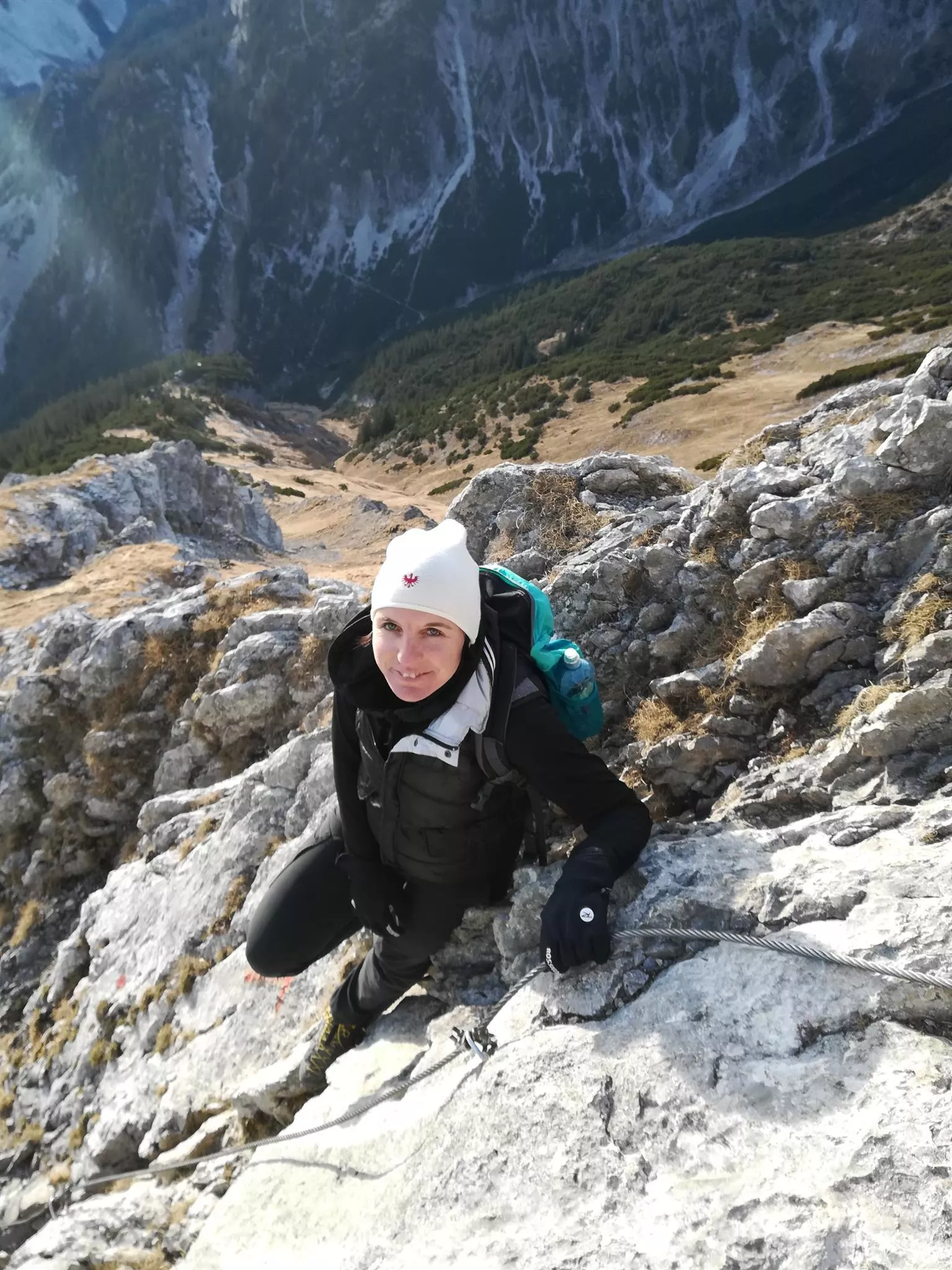
Panorama Klettersteig
A via ferrata above Warth am Arlberg laid out for wide views over the upper Lech valley, with cable-protected rock passages.
Spiderman Klettersteig
A short climbing route for children at Warth am Arlberg, part of the village's family climbing offer near the Steffisalp.
Wanderführerin Daniela Pfefferkorn
Daniela Pfefferkorn, a certified walking guide based at Steeg, leading group and family hikes in the upper Lechtal.
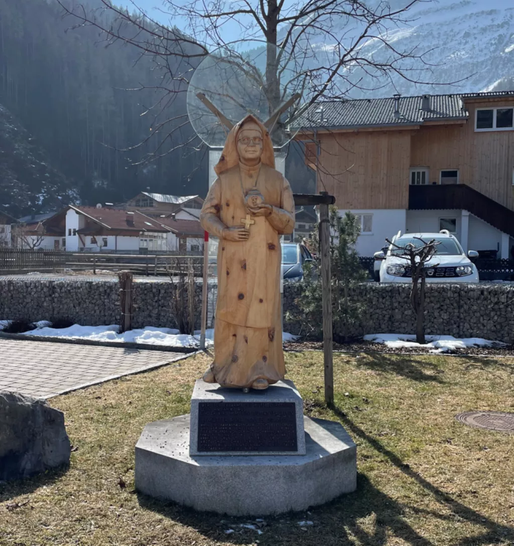
Anna Dengel Statue
A statue at Steeg honouring Anna Dengel (1892-1980), the Lechtal-born physician who founded the Medical Mission Sisters.
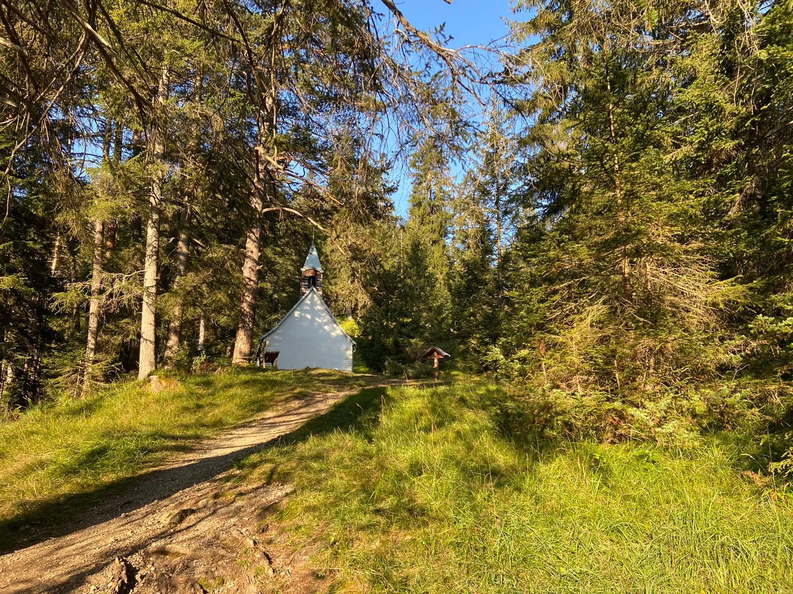
Dreifaltigkeitskapelle, Feldkapelle
A field chapel dedicated to the Holy Trinity at Holzgau, a small historic devotional building among the meadows of the upper Lechtal.
Gebeinhaus | Martinskapelle Elbigenalp
The Martinskapelle at Elbigenalp with its attached charnel house, a small historic burial chapel in the village churchyard.
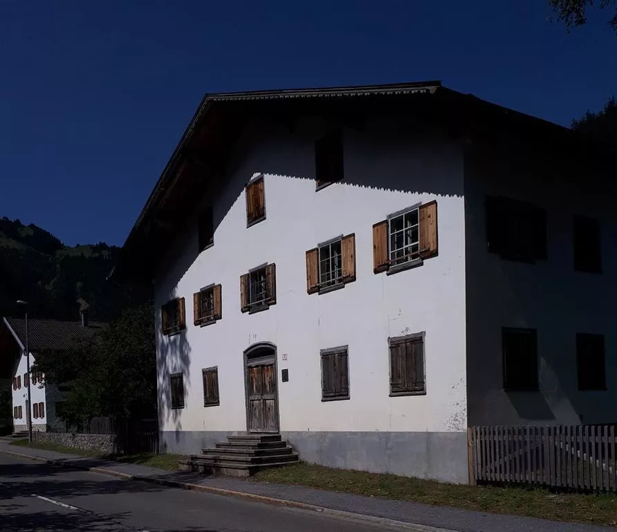
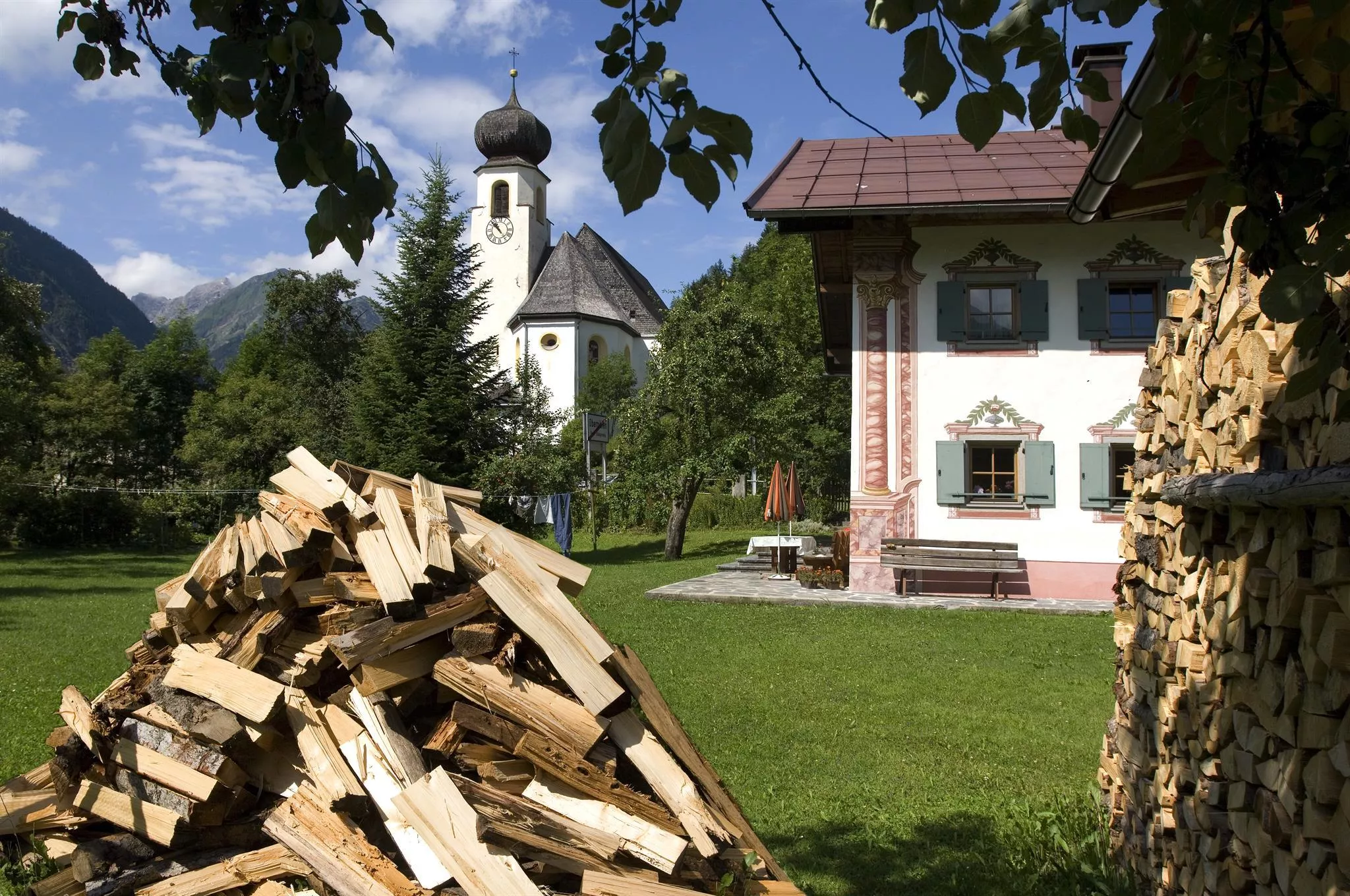
Geburtshaus - Anna Dengel
The birthplace of Anna Dengel at Steeg, marked as a memorial to the physician who founded the Medical Mission Sisters.
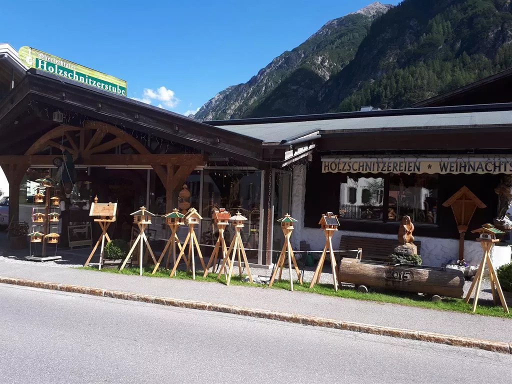
Holzschnitzerei Lorenz
A wood-carving workshop at Steeg that welcomes visitors, continuing the carving craft long practised in the Lechtal.
Kapelle Seesumpf | Mariahilf
The Mariahilf chapel at Seesumpf near Bach, a small devotional building among the meadows of the central Lechtal.
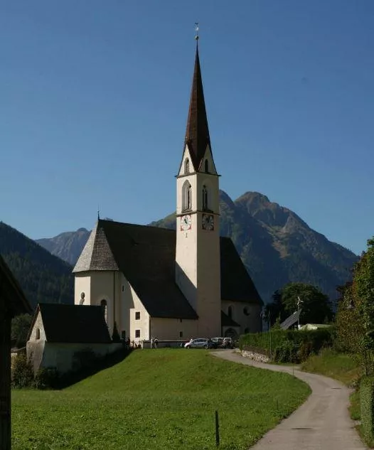
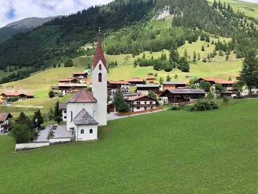
Kirche Bach
The parish church of Bach in the Lechtal, standing with its churchyard in the village at 1,070 m above the river.
Kirche Gramais
The church of Gramais with its small churchyard, the spiritual centre of a tiny mountain municipality at 1,321 m.
Nothing of this kind in Steeg.
Routes
50 routes, an even mix of activities · see the rest on lechtal.at ↗
Valluga - Stuttgarter Hütte 2.310m
From the Vallugagrat station a high path leads across to the Stuttgarter Hütte at 2,310 m — an easy way to reach a genuine alpine hut, with the summit lifts doing the climbing.
- 4.5 km
- Distance
- 248 m
- Ascent
- 1 h 45 min
- Duration
- 27
- Check-ins
Alpine Hüttenwanderung Bregenzerwald | Widdersteingebiet (Etappe 3)
Final day of the three-day Widderstein hut walk, linking the Widdersteinhütte and the Mindelheimer Hütte over three passes: the Gemstelpass, the Koblatpass and the Schrofenpass.
- 13.7 km
- Distance
- 563 m
- Ascent
- 5 h 22 min
- Duration
- 64
- Check-ins
Arlberg Trail Etappe Lech - St. Anton (Originalroute)
The original long stage between Lech and St. Anton, climbing from the Rüfikopf cable car's terrain over the Valfagehrjoch — a marathon-feeling day with more than 2,000 m of ascent.
- 20.1 km
- Distance
- 2 194 m
- Ascent
- 13 h 17 min
- Duration
- 103
- Check-ins
Prenten - Nördliche Wösterspitze
The northern of the two Wösterspitzen from Prenten, as long and as steep as its neighbour.
- 7.6 km
- Distance
- 0 m
- Ascent
- 0 m
- Descent
- 1 h 51 min
- Duration
Open route PeakVisor tTRL (OpenStreetMap piste_type=skitour)Skitour auf den Horlemannskopf
Climb of a north-east ridge above Steeg, where the Lech enters its gorges; the wooded steep step low down needs good snow cover, and the view runs down-valley to Elmen.
- 3.7 km
- Distance
- 1 035 m
- Ascent
- 22 m
- Descent
- 2 h 41 min
- Duration
- 3
- Check-ins
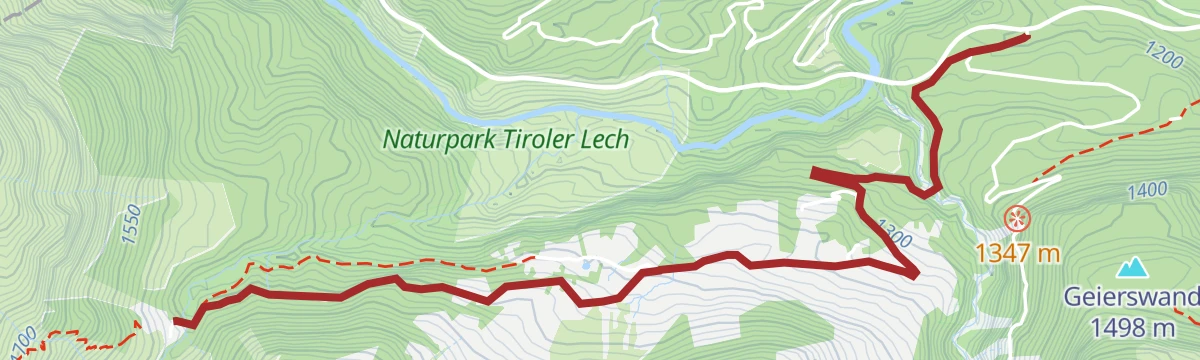
Bockbach Tour
A short, steep forest-road climb from the Lechtal to the Postalm and the Birchetsgump Alm, 300 m of gain in barely 4 km.
- 4.3 km
- Distance
- 306 m
- Ascent
- 35 min
- Duration
- 7
- Check-ins
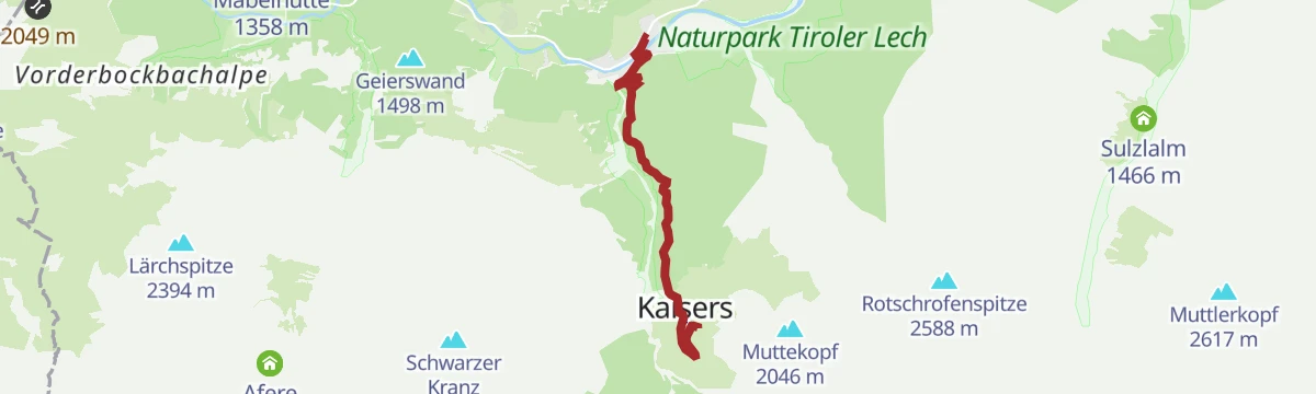
Ins Auszeitdorf Kaisers
A short climb on the side road up to the hamlet of Kaisers, gaining over 400 m in five kilometres and ending by the Edelweißhaus.
- 5.1 km
- Distance
- 417 m
- Ascent
- 43 min
- Duration
- 8
- Check-ins
Warth | Von Oberstdorf nach Warth mit dem Mountainbike
A crossing from Oberstdorf up the Rappenalptal to Warth, on the old alp roads over the border.
- 24.4 km
- Distance
- 988 m
- Ascent
- 2 h 51 min
- Duration
- 48
- Check-ins
Bike Trail Tirol Etappe 31
A stage linking the upper Lechtal with the Arlberg, crossing the Flexenpass above Lech and finishing high on the pass road.
- 34.7 km
- Distance
- 1 249 m
- Ascent
- 4 h 15 min
- Duration
- 89
- Check-ins
Warth | Rundwanderung nach Gehren & Lechleiten
Easy round from the village square in Warth out to the hamlets of Gehren and Lechleiten, with a path back along the valley.
- 6.3 km
- Distance
- 204 m
- Ascent
- 1 h 60 min
- Duration
- 18
- Check-ins
Stuttgarter Hütte - Ulmer Hütte
Short hut-to-hut link on the Robert-Bosch-Weg, traversing under the walls of the Roggspitze to the Trittscharte at 2,580 m and down to the Ulmer Hütte below the Valluga.
- 6.6 km
- Distance
- 445 m
- Ascent
- 3 h 2 min
- Duration
- 50
- Check-ins
Heilbronner Höhenweg
A 29 km high route with 2,627 m of climbing, linking the Rappenseehütte and the Mädelejoch by way of the Wilder Mann and the Krottenkopfscharte.
- 29.0 km
- Distance
- 2 627 m
- Ascent
- 17 h 25 min
- Duration
- 102
- Check-ins
Prenten - Südliche Wösterspitze
The long climb from Prenten to the Südliche Wösterspitze — nearly 1,400 m of ascent in one push.
- 9.4 km
- Distance
- 0 m
- Ascent
- 0 m
- Descent
- 2 h 17 min
- Duration
Open route PeakVisor tTRL (OpenStreetMap piste_type=skitour)Bodenalpe
A forest-road climb out of the Lechtal at Steeg, gaining height steadily to the alpine pasture on the slopes above the village.
- 9.8 km
- Distance
- 481 m
- Ascent
- 1 h 10 min
- Duration
- 3
- Check-ins
Lechradweg von Steeg bis Reutte
A long, nearly level run down the Lech valley to Reutte, following the river past the campsite at Vorderhornbach and the Baggersee.
- 53.2 km
- Distance
- 32 m
- Ascent
- 4 h 50 min
- Duration
- 29
- Check-ins
Steeg-Kaisers
A very long day on the road from the Lechtal into the Tannheimer Tal, over the Vils/Lech watershed and past the Haldensee.
- 118.1 km
- Distance
- 1 951 m
- Ascent
- 12 h 19 min
- Duration
- 76
- Check-ins
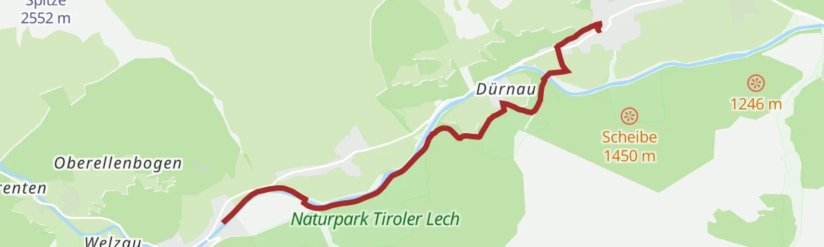
Lechweg Abschnitt: Steeg - Holzgau
A short, level Lechweg leg following the young river downstream from Steeg to Holzgau, village to village; shaded stretches make it workable even on hot summer days.
- 5.2 km
- Distance
- 29 m
- Ascent
- 1 h 18 min
- Duration
- 8
- Check-ins
Warth | 3 Pässe Tour (Koblat-, Gemstel- und Hochalppass)
Three passes in one day from Gehren: first the Koblatpass, then the Gemstelpass, and after the Widdersteinhütte the Hochalppass with its lake, finishing at the Hochtannbergpass.
- 12.1 km
- Distance
- 823 m
- Ascent
- 5 h
- Duration
- 48
- Check-ins
Lechweg - Gemütliche Variante - Etappe 4 - Steeg bis Bach
Long valley stage of the Lechweg's gentler variant, tracing the river from Steeg through Holzgau to Bach and passing the Holzgau hydropower weir and the Lechtaler Hexenkessel.
- 15.4 km
- Distance
- 459 m
- Ascent
- 4 h 47 min
- Duration
- 24
- Check-ins
 Cafe Uta 1 237 m
- Lechtal Tourismus 1 099 m
- Lechtaler Hexenkessel 1 210 m
- Tourismusinformation 1 114 m
 Wehr Wasserkraftkwer Holzgau 1 159 m
Zur Alpe Kaisers (Kaiseralm)
A steady forest-road ascent from the Lechtal up to the pasture above the hamlet of Kaisers, roughly 600 m of climbing.
- 8.5 km
- Distance
- 584 m
- Ascent
- 1 h 6 min
- Duration
- 3
- Check-ins
Gravelbike Tour 2.4 - Drei Almen Tour
A long day on forest roads and valley tracks linking three high pastures: the Postalm, the Birchetsgump Alm and the Alpe Kaisers.
- 41.4 km
- Distance
- 1 152 m
- Ascent
- 4 h 45 min
- Duration
- 16
- Check-ins
Gravelbike Tour 2.4 - Drei Almen Tour
A long gravel loop in the Lechtal linking three high pastures, from the Postalm and Birchetsgump Alm up to the Alpe Kaisers at 1,695 m.
- 41.4 km
- Distance
- 1 692 m
- Ascent
- 5 h 16 min
- Duration
- 16
- Check-ins
Steeg - Bockbacher Almwirtschaft
Short family climb from Steeg into the Bockbachtal to working alm pastures, with the Postalm and the Birchetsgump Alm offering refreshment along the way.
- 3.9 km
- Distance
- 279 m
- Ascent
- 1 h 21 min
- Duration
- 7
- Check-ins
Lech Rüfikopfbahn - Stuttgarter Hütte
From the Rüfikopf cable car above Lech over the Monzabonjoch and the Rauekopfscharte to the Stuttgarter Hütte, just across the border in Tirol.
- 10.4 km
- Distance
- 273 m
- Ascent
- 3 h 43 min
- Duration
- 45
- Check-ins
Biberkopf
Steep ascent past the Hundskopfhütte toward the border summit above the upper Lechtal; a landslide tore away part of the path, and the Alpenverein rates the worn-in trace passable only with alpine experience, at your own risk.
- 3.8 km
- Distance
- 1 046 m
- Ascent
- 3 h 42 min
- Duration
- 19
- Check-ins
Zur Mahdbergalpe
A forest-road climb from the valley floor near Steeg up to the Mahdberg-Alpe at 1,825 m, about 740 m of ascent.
- 11.0 km
- Distance
- 740 m
- Ascent
- 1 h 26 min
- Duration
- 3
- Check-ins
Steeg - Zur Gamsvroni
A short family climb from Steeg toward the Bockbachtal alms, with a large playground at the destination and the Postalm close by for a stop.
- 4.0 km
- Distance
- 250 m
- Ascent
- 1 h 19 min
- Duration
- 7
- Check-ins
Warth | Mindelheimer Hütte
Long day from Hochkrumbach across the Tschirggen to the Mindelheimer Hütte, returning through the Rappenalptal and over the Schrofenpass to Lechleiten.
- 13.2 km
- Distance
- 787 m
- Ascent
- 5 h 49 min
- Duration
- 39
- Check-ins
Lechweg - Gemütliche Variante - Etappe 3 - Warth bis Steeg
Stage 3 of the Lechweg in its gentler variant, following the young Lech downstream from Warth to Steeg with broad views over the upper Lechtal and stops such as the Walserstube.
- 15.5 km
- Distance
- 283 m
- Ascent
- 4 h 40 min
- Duration
- 18
- Check-ins
Steeg nach Bockbach
Gentle family route from Steeg up to the hamlet of Bockbach, crossing mountain hay meadows known for their variety of alpine flowers and herbs, with the Postalm nearby for a break.
- 4.3 km
- Distance
- 292 m
- Ascent
- 1 h 29 min
- Duration
- 7
- Check-ins
Stuttgarter Hütte - Leutkircher Hütte
Opening leg of the Lechtaler Höhenweg: from the Stuttgarter Hütte over the 2,430 m Erlijoch and past the Erlachalpe below the Valluga to the Leutkircher Hütte on the Almajurjoch; the Stapfe-Tobel section is risky when wet or snowy.
- 8.7 km
- Distance
- 529 m
- Ascent
- 3 h 45 min
- Duration
- 16
- Check-ins
Steeg/Bockbach - Stuttgarter Hütte
Demanding approach from Bockbach over the Krabachjoch to the Stuttgarter Hütte, a Sektion Schwaben refuge perched near the Tyrol-Vorarlberg border; passes the Afere Häusle and the Schöneggerhütte on the way up.
- 12.3 km
- Distance
- 1 124 m
- Ascent
- 4 h 59 min
- Duration
- 10
- Check-ins
Steeg/Prenten - Alter Bockbacherweg - Bockbachalmen
Family walk from Prenten on the old mule path into the Bockbachtal, reaching the alm pastures around the Birchetsgump Alm and Postalm in under two hours.
- 4.0 km
- Distance
- 268 m
- Ascent
- 1 h 21 min
- Duration
- 7
- Check-ins
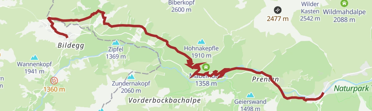
Holzgau über Hager Höhenweg und Ebene nach Steeg
From Holzgau along the Hager high path and across the Ebene meadows to Steeg, skirting the mouth of the Höhenbachtal gorge with its Simms waterfall.
- 7.7 km
- Distance
- 374 m
- Ascent
- 2 h 44 min
- Duration
- 8
- Check-ins
Lechweg - Klassische Variante - Etappe 3 - Lechleiten bis Holzgau
Classic Lechweg stage that follows the balcony-like Panoramaweg from Lechleiten high above the river before dropping to Steeg and continuing along the valley floor to Holzgau.
- 16.9 km
- Distance
- 238 m
- Ascent
- 4 h 57 min
- Duration
- 8
- Check-ins
Hägerau über Winkel/Gföll nach Holzgau
Short link-up from Hägerau through the hamlets of Winkel and Gföll to Holzgau, on quiet lanes and meadow paths along the sunny side of the valley.
- 3.8 km
- Distance
- 176 m
- Ascent
- 1 h 21 min
- Duration
- 5
- Check-ins
Von Steeg nach Kaisers
A steady climb from Steeg up to the mountain hamlet of Kaisers, one of the highest villages in the Lechtal, ending near the Edelweißhaus; also groomed as a winter walking route.
- 5.0 km
- Distance
- 427 m
- Ascent
- 1 h 55 min
- Duration
- 8
- Check-ins
Höllenspitze
Strenuous summit route from Steeg past the Birchetsgump Alm, gaining more than 1,100 m on its way to a rocky Lechtaler Alpen peak with a wide panorama of the upper valley.
- 7.3 km
- Distance
- 1 156 m
- Ascent
- 4 h 27 min
- Duration
- 8
- Check-ins
Steeg - Ebene Rundweg
Small loop above Steeg onto the sunny Ebene terrace, an easy round with open views across the valley floor and the surrounding Lechtal Alps.
- 3.1 km
- Distance
- 104 m
- Ascent
- 59 min
- Duration
- 3
- Check-ins
Steeg - Älpele Runde
Hut-to-hut loop through the front part of the Bockbachtal above Steeg, linking the Birchetsgump Alm and the Postalm on a half-day round at moderate grades.
- 11.4 km
- Distance
- 623 m
- Ascent
- 4 h 24 min
- Duration
- 7
- Check-ins
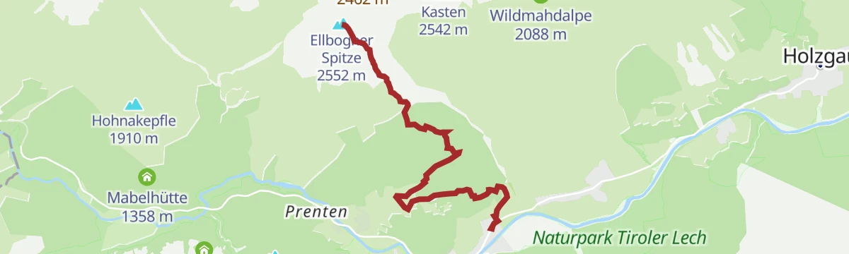
Ellbogener Spitze
Long, steep summit hike from the valley near Steeg, gaining almost 1,450 m to a quiet grass-and-rock peak; a full day for fit hikers with a big Lechtal Alps panorama.
- 5.9 km
- Distance
- 1 447 m
- Ascent
- 5 h 14 min
- Duration
- 3
- Check-ins
Steeg - Stierbichlrunde
A short, flat stroll on both banks of the young Lech at Steeg — an after-dinner round rather than a hike, with river gravel banks and village views.
- 2.3 km
- Distance
- 0 m
- Ascent
- 33 min
- Duration
- 3
- Check-ins
Mäuerle Rundweg
Loop above Steeg that tops the Hohnakepfle and links the Mäuerleshütte with the Hundskopfhütte, climbing through forest to open ridge meadows with views over the upper Lechtal.
- 8.7 km
- Distance
- 652 m
- Ascent
- 4 h 16 min
- Duration
- 4
- Check-ins
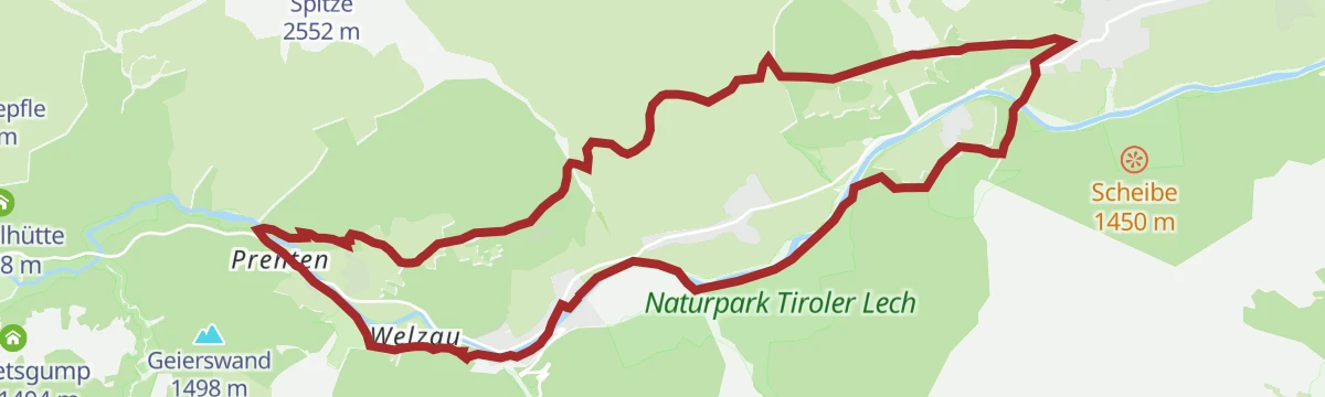
Lechwegschleife "Durch Wald und Wiesen"
Long Lechweg side loop around Steeg that alternates between shaded forest and open hay meadows, a quiet half-day round away from the main riverside route.
- 15.8 km
- Distance
- 466 m
- Ascent
- 4 h 51 min
- Duration
- 3
- Check-ins
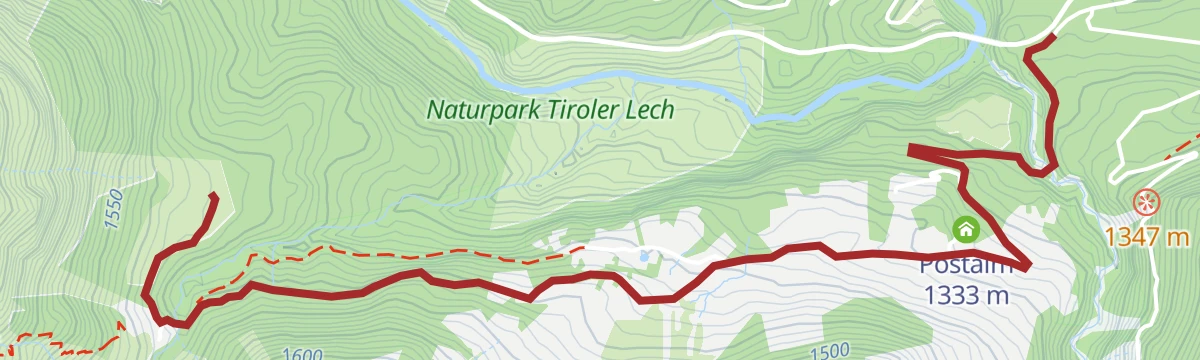
Steeg/Bockbach - Zur Postalm
The shortest way up to the Postalm from Bockbach, a brief climb to a snug alm inn; in winter the track doubles as a walking route with a toboggan run back down.
- 1.9 km
- Distance
- 154 m
- Ascent
- 42 min
- Duration
- 3
- Check-ins
Lechweg Abschnitt: Lechleiten - Steeg
Lechweg section running from Lechleiten along the Panoramaweg high above the river toward Steeg, with long views down into the upper Lechtal for most of the way.
- 11.0 km
- Distance
- 160 m
- Ascent
- 3 h 22 min
- Duration
- 3
- Check-ins
Steeg auf den Muttekopf
Committed ascent from Steeg past the Wildmahdalpe onto a high grass summit of the Lechtal Alps, gaining some 1,300 m on mostly quiet alm and ridge paths.
- 6.8 km
- Distance
- 1 302 m
- Ascent
- 4 h 51 min
- Duration
- 3
- Check-ins
Steeger Kneipprunde
Flat riverside round at Steeg built around a Kneipp water-treading station on the cold Lech; more a restorative stroll than a hike, and easily done in trainers.
- 6.2 km
- Distance
- 22 m
- Ascent
- 1 h 30 min
- Duration
- 3
- Check-ins
Pimigrundweg
Circuit around the base of the Pimig, Steeg's local mountain, climbing through forest to clearings that look down the length of the upper Lechtal.
- 8.3 km
- Distance
- 494 m
- Ascent
- 3 h 26 min
- Duration
- 3
- Check-ins
Wildmahdspitze
Big day out of Steeg by way of the Wildmahdalpe to an airy grass peak nearly 1,400 m above the valley; steep, sustained hiking for experienced mountain walkers.
- 5.6 km
- Distance
- 1 361 m
- Ascent
- 4 h 54 min
- Duration
- 3
- Check-ins
No routes of this kind in Steeg yet.
The region's own picks

Featured route
Valluga - Stuttgarter Hütte 2.310m
From the Vallugagrat station a high path leads across to the Stuttgarter Hütte at 2,310 m — an easy way to reach a genuine alpine hut, with the summit lifts doing the climbing.
Planning a trip to Steeg?
Everything else Tyrol has, in one place


Take Steeg with you into the mountains
Every route on this page with 3D terrain, GPX navigation and offline maps — including the valleys with no signal.
Data sources
- Official website: lechtal.at ↗
- Routes and highlights: Lechtal Tourismus, Warth-Schröcken Tourismus, St. Anton am Arlberg, PeakVisor tTRL (OpenStreetMap piste_type=skitour), PeakVisor / OpenStreetMap, Tannheimer Tal, Naturparkregion Reutte
- Published as open data by the tourist boards named above.
- Region summary generated from the board's own material.
