
Curated by Falcade Dolomiti
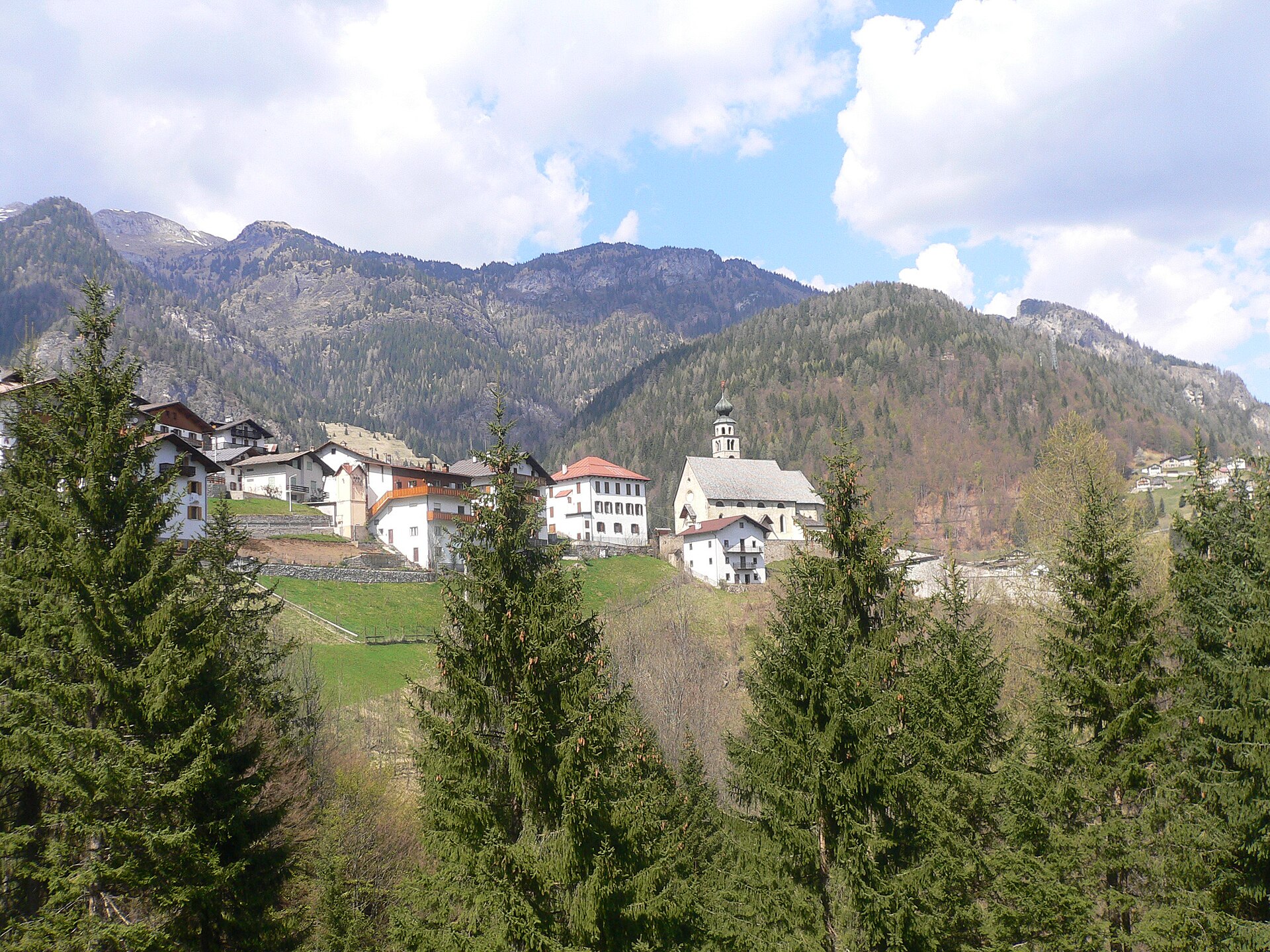
San Tomaso Agordino
Agordino village on the slope above the Cordevole, between the Civetta and the Pelmo.
Photo: Gere72 · CC BY-SA 3.0 licence
- 5Highlights
- 16Routes
- Featured summit · Piz Croce
Highlights
All 5 from neighbouring places
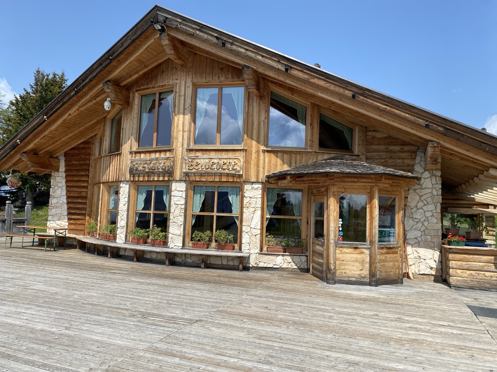
Rifugio Ristoro Belvedere
6.9 km away, in Alleghe
A hut on the lower slopes of the Civetta above Alleghe, reached from the Piani di Pezzè lift and looking across to the lake.
Rifugio Fuciade
11 km away, in Soraga di Fassa
A refuge in the Fuciade basin below the Passo San Pellegrino, in the comune of Soraga di Fassa, under the Cima Uomo.
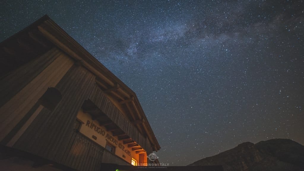
Rifugio Averau
13.5 km away, in Colle Santa Lucia
A hut below the Averau in the Cinque Torri group, a dark-sky site above the Giau pass.
Museo/galleria del Lagazuoi
14.8 km away, in Cortina d'Ampezzo
Tunnels driven into the Lagazuoi by Italian and Austrian sappers between 1915 and 1917, now an open-air museum reached from the cable car.
Cesa del Louf
14.9 km away, in Livinallongo del Col di Lana
A restored Ladin farmhouse at Arabba, kept as a museum of the valley's building and farming.
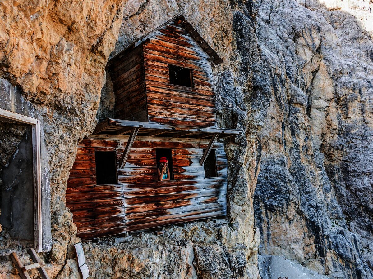
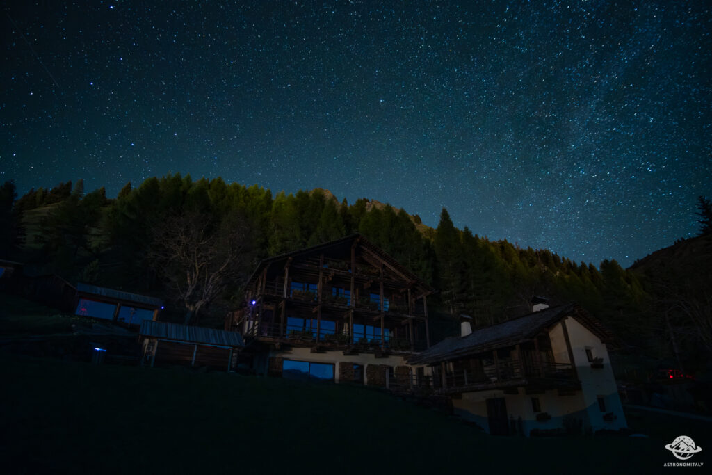
Nothing of this kind in San Tomaso Agordino.
Routes
Genuine Dolomites Path - Stage n°6 - San Tomaso Agordino - Cencenighe
A short descending stage from San Tomaso Agordino by way of the hamlets Tocol and Fontanelle down to Cencenighe.
- 4.0 km
- Distance
- 13 m
- Ascent
- 1 h 15 min
- Duration
Open route Falcade DolomitiGenuine Dolomites Path - Stage no. 4 - Caviola - San Tomaso
A stage from Caviola across the Forcella di San Tomaso, by way of the hamlet of Carfon and the ancient church of San Simon.
- 13.5 km
- Distance
- 772 m
- Ascent
- 5 h 26 min
- Duration
- 12
- Check-ins
 Piz Croce 1 627 m
 Forcella di San Tomaso 1 367 m
 Pro Loco Caviola 1 084 m
- Oratorio Confraternita dei Battuti 1 139 m
Open route Falcade DolomitiGenuine Dolomites Path - Stage No. 5 - Sasso Bianco Refuge
The fifth stage of the Dolomiti Autentiche route, leaving the valley villages to climb to the Sasso Bianco hut at 1,840 m; passable from June to October.
- 11.5 km
- Distance
- 994 m
- Ascent
- 6 h 18 min
- Duration
- 23
- Check-ins
Open route Falcade DolomitiMtb Alleghe 6 - Little Roubaix in Biois Valley
A ride along the Biois valley floor cycle path, then trails and lanes linking the upper hamlets and San Tomaso Agordino, on mixed dirt surfaces.
- 42.8 km
- Distance
- 1 512 m
- Ascent
- 5 h 13 min
- Duration
- 137
- Check-ins
- Bierstube 977 m
- Alla Caminada 970 m
- Water inlet for Ghirlo powerplant 971 m
- Pizzeria Al Fornel 934 m
- Rifugio Lagazzon 1 361 m
- Pro Loco Canale d'Agordo APS 978 m
- +3
Open route Consorzio Operatori Turistici Alleghe - CaprileMarmolada Tour
A long road circuit from Predazzo over Passo San Pellegrino and up Passo Fedaia, whose final ramps run into double-digit gradients.
- 105.6 km
- Distance
- 2 679 m
- Ascent
- 11 h 54 min
- Duration
- 780
- Check-ins
- Rifugio Marmolada Castiglioni 2 055 m
- Passo Fedaia 2 057 m
- Rifugio Fedaia 2 057 m
- Passo San Pellegrino 1 918 m
- Chalet Isabella 1 914 m
- Azienda Turistica 1 307 m
- +27
Open route APT Fiemme CembraThe Miniature Dolomites of San Tomaso Agordino
A circular forest path from Celat climbing to the Forcella di San Tomaso, set with carved models of the main Dolomite groups by various artists.
- 5.2 km
- Distance
- 381 m
- Ascent
- 2 h 30 min
- Duration
- 5
- Check-ins
Open route Consorzio Operatori Turistici Alleghe - CaprileMTB Alleghe 2 - Gares San Tomaso Pass Alleghe
A long crossing from the Val Cordevole into the Valle del Biois through forest and clearings, reaching Capanna Cima Comelle above Canale d'Agordo.
- 43.6 km
- Distance
- 1 362 m
- Ascent
- 5 h 9 min
- Duration
- 136
- Check-ins
- Bierstube 977 m
- Alla Caminada 970 m
- Water inlet for Ghirlo powerplant 971 m
- Capanna Cima Comelle 1 337 m
- Pizzeria Al Fornel 934 m
- Pro Loco Canale d'Agordo APS 978 m
- +2
Open route Consorzio Operatori Turistici Alleghe - CaprilePozza di Fassa - Moena - San Pellegrino Pass - Cencenighe - Caprile - Fedaia Pass - Canazei - Pozza di Fassa
A long road circuit from Pozza di Fassa over the San Pellegrino pass, returning across the Fedaia below the Marmolada.
- 88.1 km
- Distance
- 2 276 m
- Ascent
- 9 h 58 min
- Duration
- 761
- Check-ins
- Rifugio Marmolada Castiglioni 2 055 m
- Passo Fedaia 2 057 m
- Rifugio Fedaia 2 057 m
- Passo San Pellegrino 1 918 m
- Chalet Isabella 1 914 m
- Azienda Turistica 1 307 m
- +24
Open route APT Val di FassaForcella San Tomaso - Route no.3 - Falcade Bike Trail
A ride from Falcade by the Lagazzon hut to the Forcella di San Tomaso, on asphalt and then gravel.
- 35.2 km
- Distance
- 1 225 m
- Ascent
- 4 h 17 min
- Duration
- 43
- Check-ins
- Rifugio Lagazzon 1 361 m
- Pro Loco Canale d'Agordo APS 978 m
- Forcella di San Tomaso 1 367 m
- Ufficio Informazioni Falcade 1 144 m
- Vivaio Forestale 1 273 m
- Forzela L'Agazon 1 356 m
- +1
Open route Falcade DolomitiRoad Bike Alleghe 2 - Marmolada Loop
A road circuit from Alleghe right around the Marmolada, crossing Passo Fedaia and Passo San Pellegrino to join Agordino to the Val di Fassa.
- 88.5 km
- Distance
- 2 124 m
- Ascent
- 9 h 52 min
- Duration
- 761
- Check-ins
- Rifugio Marmolada Castiglioni 2 055 m
- Passo Fedaia 2 057 m
- Rifugio Fedaia 2 057 m
- Passo San Pellegrino 1 918 m
- Chalet Isabella 1 914 m
- Azienda Turistica 1 307 m
- +24
Open route Consorzio Operatori Turistici Alleghe - CaprileRoad Bike Alleghe 3 - Pale di San Martino Loop
A three-climb road circuit from Alleghe, crossing Passo Valles and the Rolle Pass on the ring around the Pale group above Paneveggio.
- 112.0 km
- Distance
- 2 990 m
- Ascent
- 12 h 46 min
- Duration
- 520
- Check-ins
- Rolle Pass 1 971 m
- Passo Valles 2 032 m
- Malga Rolle 1 905 m
- Rifugio Capanna Passo Valles 2 037 m
- Bierstube 977 m
- Hotel Venezia 1 957 m
- +18
Open route Consorzio Operatori Turistici Alleghe - CaprileRoad Bike Alleghe 1 - The Civetta Loop
A long road circuit out of Alleghe over Passo Duran and Passo Staulanza, two Dolomite climbs that the Giro d'Italia has used.
- 77.3 km
- Distance
- 2 029 m
- Ascent
- 8 h 46 min
- Duration
- 516
- Check-ins
- Passo Staulanza 1 766 m
- Rifugio Passo Staulanza 1 770 m
- Rifugio Monte Pelmo 1 520 m
- Passo Duran 1 605 m
- Rifugio San Sebastiano 1 596 m
- Bierstube 977 m
- +13
Open route Consorzio Operatori Turistici Alleghe - CaprileFalcade - Alleghe Bike Tour : tour intervallivo tra i più bei panorami, i boschi e i borghi delle Dolomiti
A valley-to-valley Dolomite tour from the Molino lifts up to Cima Pradazzo and Col Margherita, then down by cable car and dirt road towards Somor.
- 64.5 km
- Distance
- 2 694 m
- Ascent
- 8 h 16 min
- Duration
- 274
- Check-ins
- Rifugio Laresei 2 260 m
- Rifugio Flora Alpina 1 802 m
- Le Buse 1 900 m
- Alla Caminada 970 m
- Water inlet for Ghirlo powerplant 971 m
- Pizzeria Al Fornel 934 m
- +11
Open route Falcade DolomitiForca Rossa Route - Route n°6 - Falcade Bike Trail
A long ride from Falcade by the Flora Alpina hut to the Forca Rossa at 2,482 m, then down to Malga Ciapela.
- 50.9 km
- Distance
- 2 035 m
- Ascent
- 6 h 26 min
- Duration
- 245
- Check-ins
- Rifugio Flora Alpina 1 802 m
- Forca Rossa 2 482 m
- Malga Ciapela Marmolada 1 455 m
- Alla Caminada 970 m
- el Morbin 1 455 m
- Water inlet for Ghirlo powerplant 971 m
- +5
Open route Falcade DolomitiRoad-Bike Alleghe 8 Monti del Sole Route
A long road ride down the Valle del Cordevole to Ponte Mas, then up the Valle del Mis past Lago del Ghirlo before the climb to Gosaldo.
- 102.4 km
- Distance
- 1 682 m
- Ascent
- 10 h 40 min
- Duration
- 152
- Check-ins
- Bierstube 977 m
- Alla Caminada 970 m
- Water inlet for Ghirlo powerplant 971 m
- Pizzeria Al Fornel 934 m
- Ristorante alla Stanga 436 m
 Polane 563 m
- +5
Open route Consorzio Operatori Turistici Alleghe - CaprileFedèr, Cogul , Fontanelle... un giro completo nella valle del Biois
A round from Falcade by Caviola to Feder and the Lagazzon hut, over the Forcella di San Tomaso.
- 31.7 km
- Distance
- 1 002 m
- Ascent
- 3 h 45 min
- Duration
- 41
- Check-ins
- Rifugio Lagazzon 1 361 m
- Pro Loco Canale d'Agordo APS 978 m
- Forcella di San Tomaso 1 367 m
- Vivaio Forestale 1 273 m
- Forzela L'Agazon 1 356 m
- Pro Loco Caviola 1 084 m
- +1
Open route Falcade Dolomiti


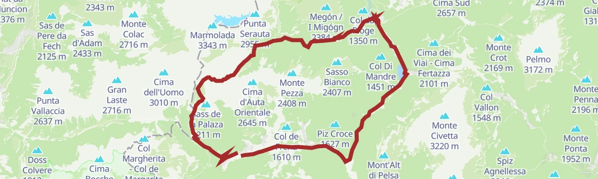

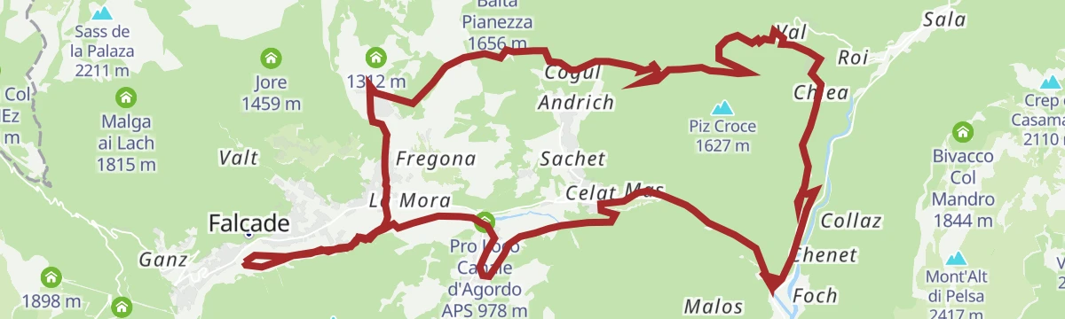
No routes of this kind in San Tomaso Agordino yet.
The region's own picks

Featured route
Genuine Dolomites Path - Stage n°6 - San Tomaso Agordino - Cencenighe
A short descending stage from San Tomaso Agordino by way of the hamlets Tocol and Fontanelle down to Cencenighe.
Planning a trip to San Tomaso Agordino?
Everything else Veneto has, in one place


Take San Tomaso Agordino with you into the mountains
Every route on this page with 3D terrain, GPX navigation and offline maps — including the valleys with no signal.
Data sources
- Official website: agordinodolomiti.it ↗
- Routes and highlights: Falcade Dolomiti, Consorzio Operatori Turistici Alleghe - Caprile, YesAlps, Astrotourism, Sterzing, Pfitsch und Freienfeld, APT Fiemme Cembra, APT Val di Fassa
- Published as open data by the tourist boards named above.
- Region summary generated from the board's own material.
