
 Historic site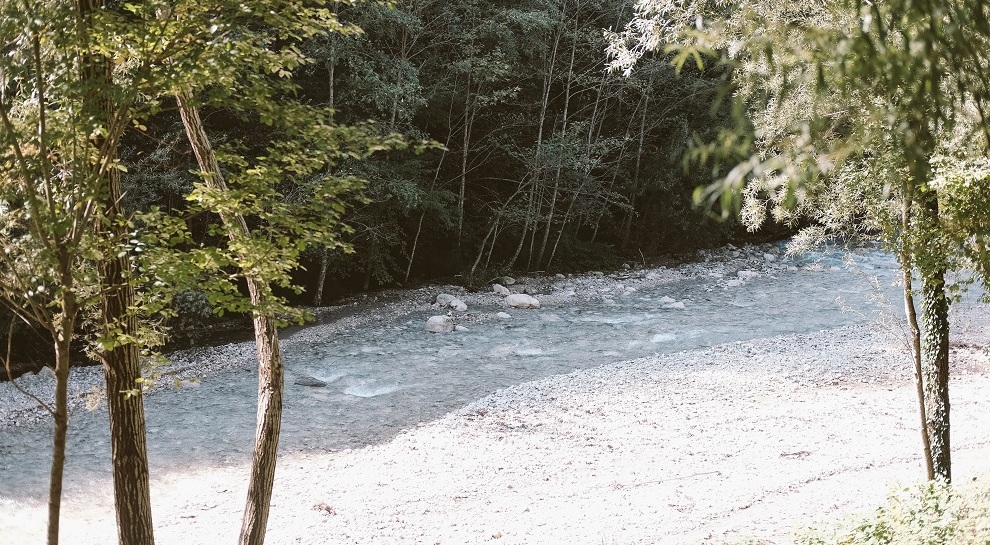
 Viewpoint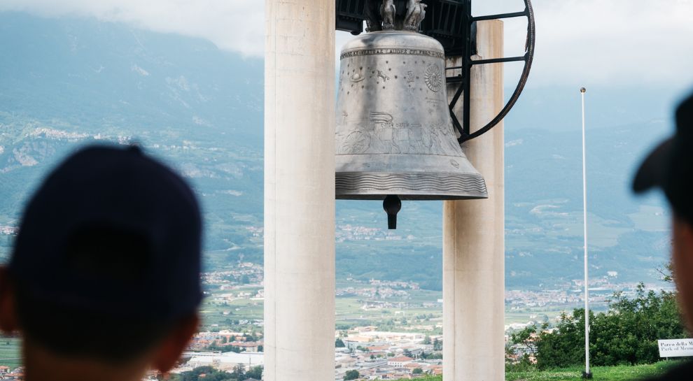















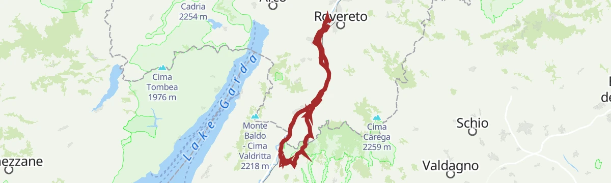


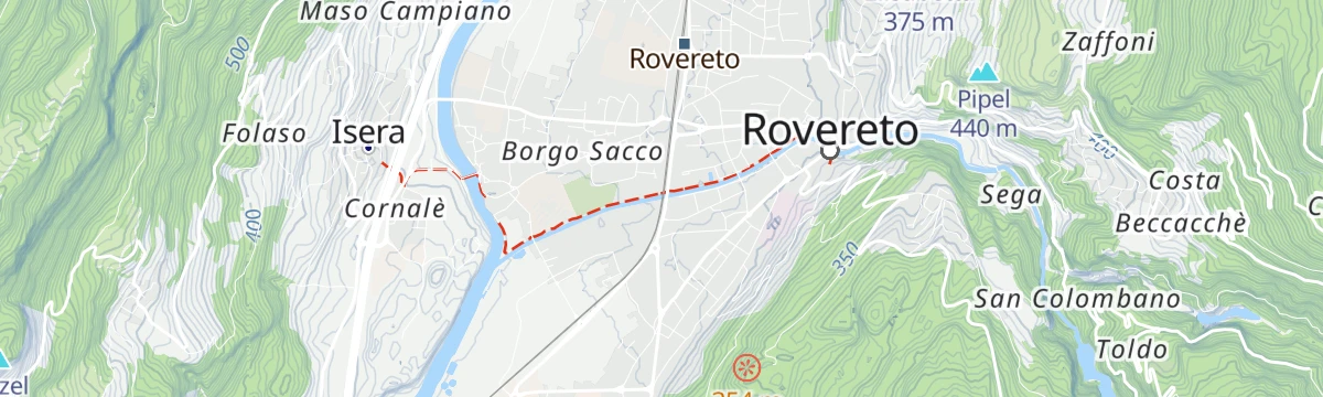

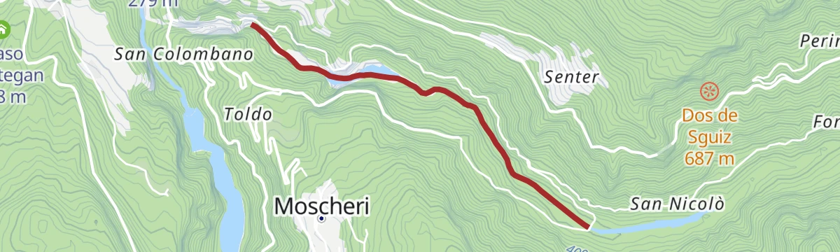

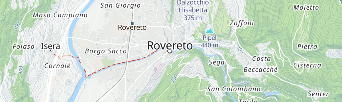


- 21Highlights
- 53Routes
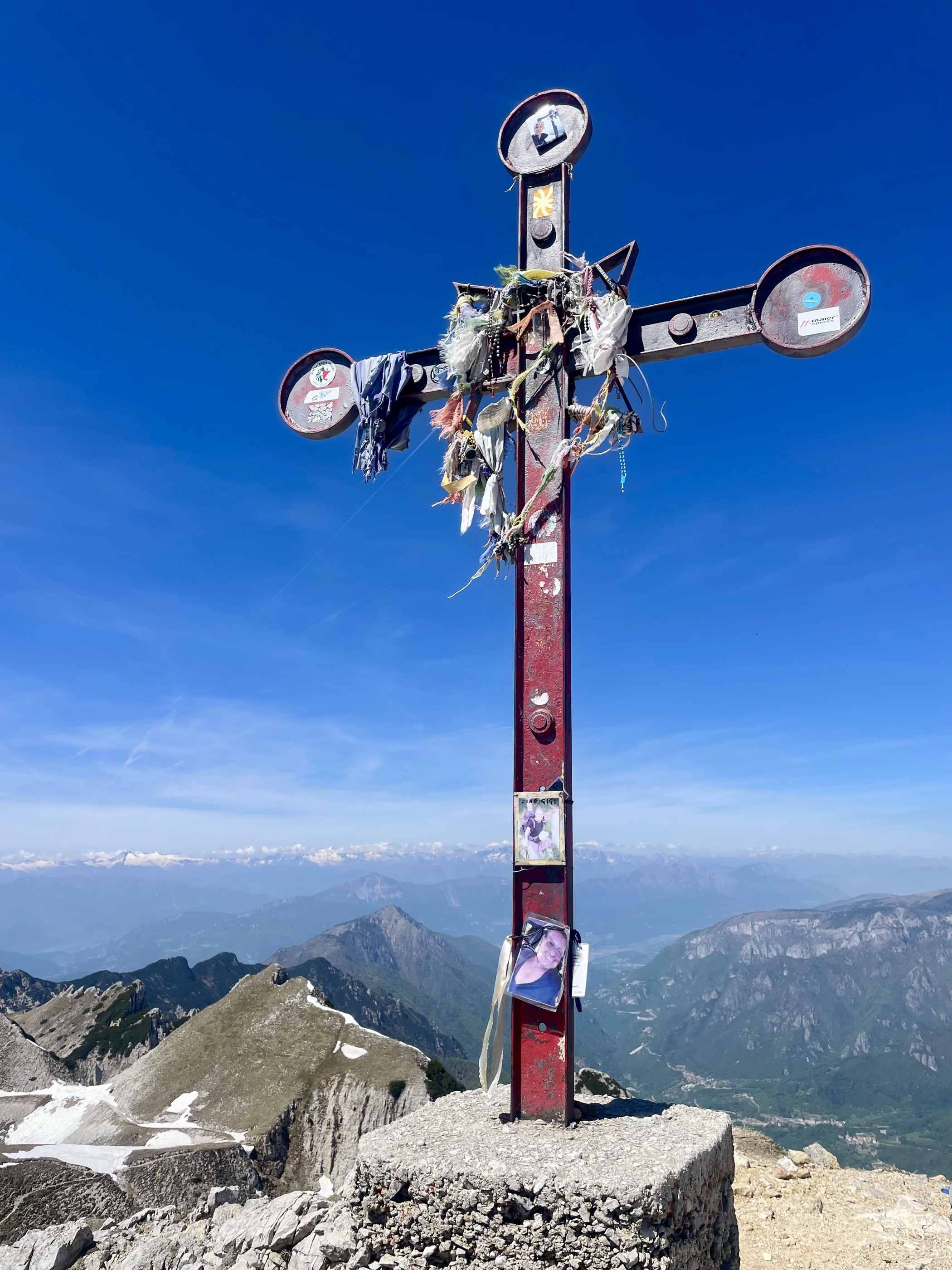
- Featured summit · Cima Carega
Highlights
The 20 highest-rated · see the rest on italia.it ↗
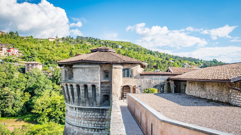
Die Burg von Rovereto
Rovereto's Venetian castle, now the Italian war museum, standing above the old town.
Die Leno Bergseen
Pools in the Leno gorge above Rovereto, reached by a path along the stream.
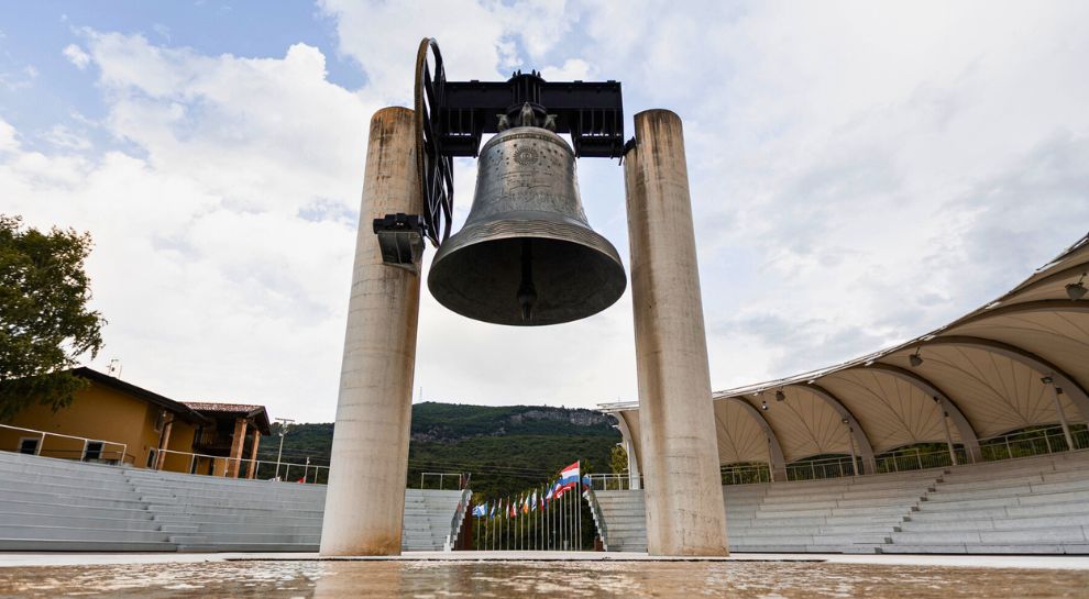
Campana dei Caduti
A bell cast from the bronze of First World War guns, rung each evening above Rovereto for the fallen.
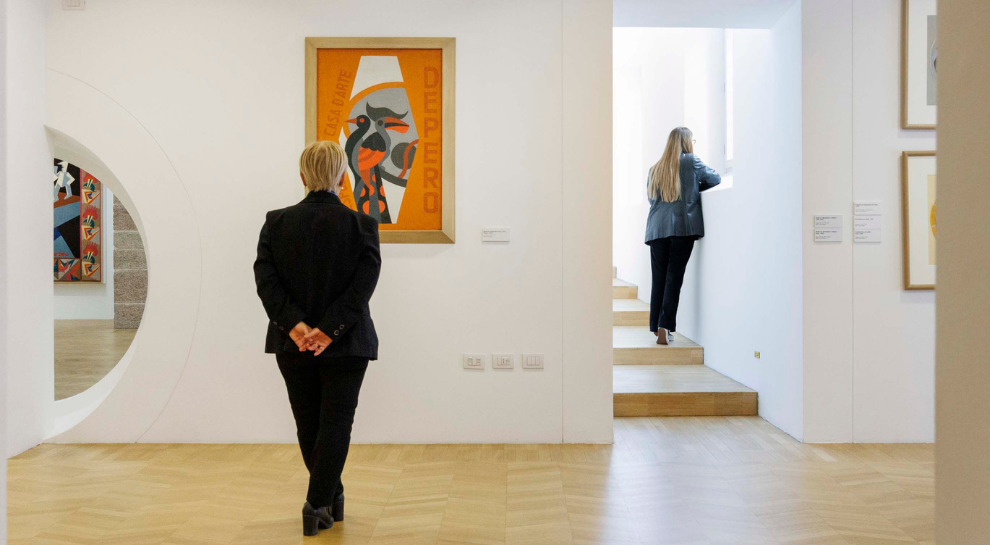
Casa d’Arte Futurista Depero
The house and museum of Fortunato Depero in Rovereto, holding the Futurist painter's work in rooms he laid out himself.
Friedensglocke
The Bell of the Fallen above Rovereto, cast from wartime cannon and tolled at nightfall.
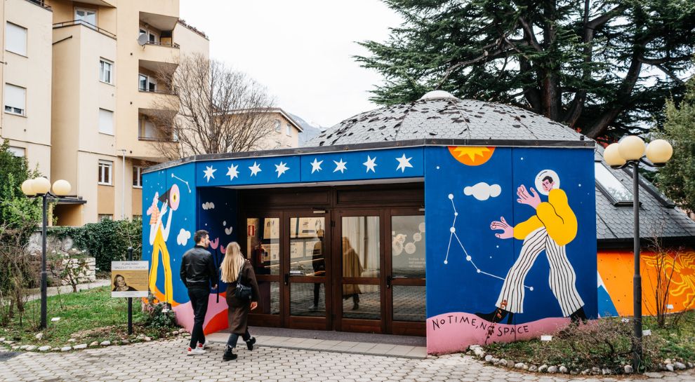
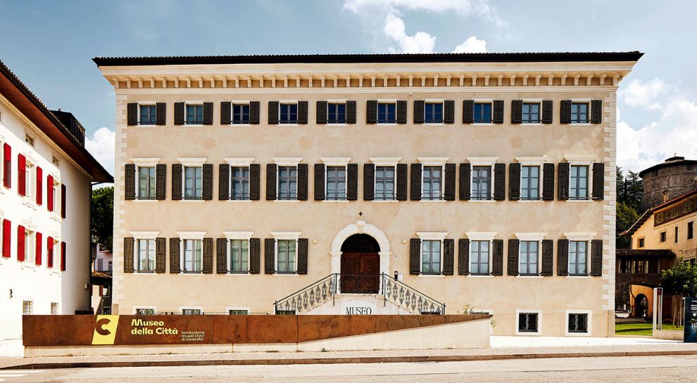
Il Planetario di Rovereto
Rovereto's planetarium, part of the town's civic museum foundation.
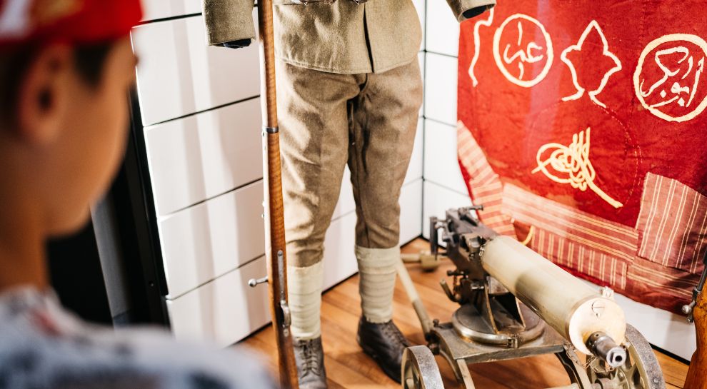
MITAG Italienisches Kriegsmuseum
The Italian war museum in Rovereto's castle, covering the mountain front of 1915-18.
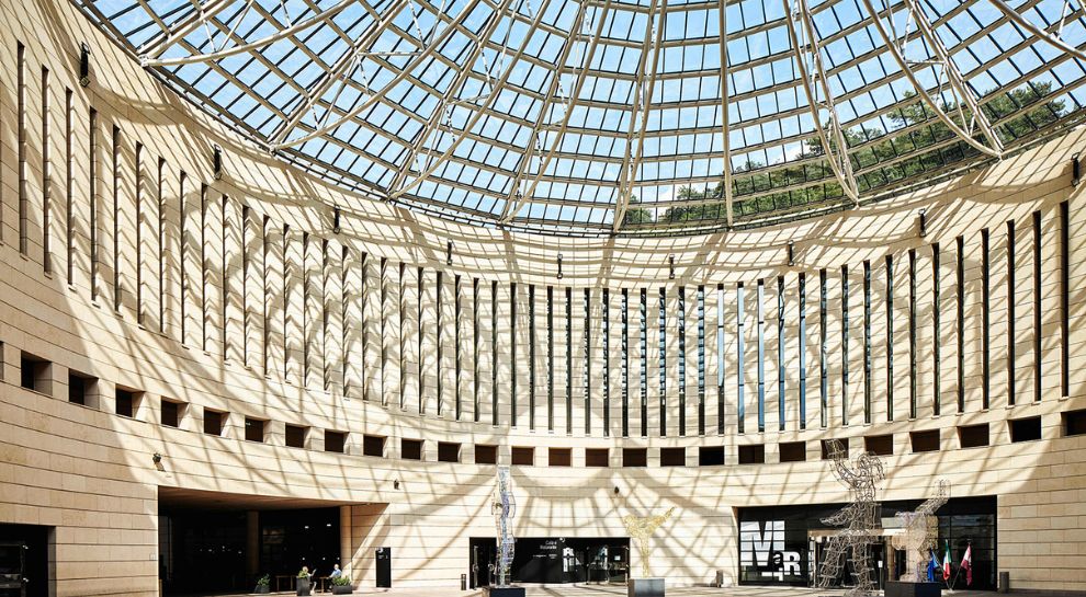
Mart
A museum of modern and contemporary art at Rovereto, under Mario Botta's glass-domed rotunda.
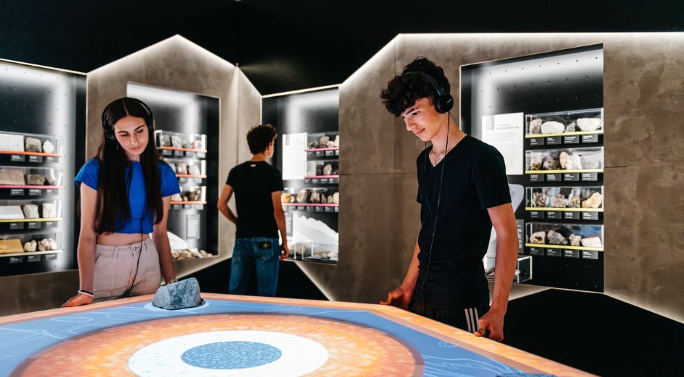
Museo di Scienze e Archeologia
Rovereto's science and archaeology museum, with dinosaur trackways found on Monte Zugna.
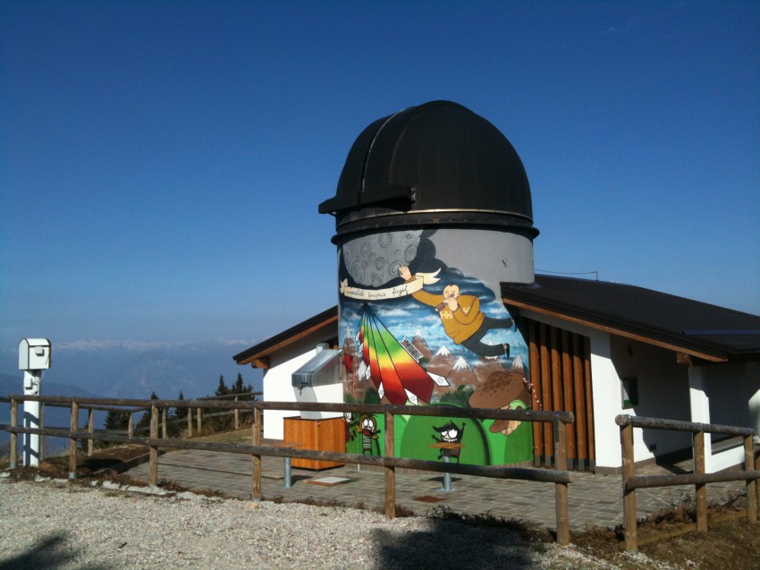
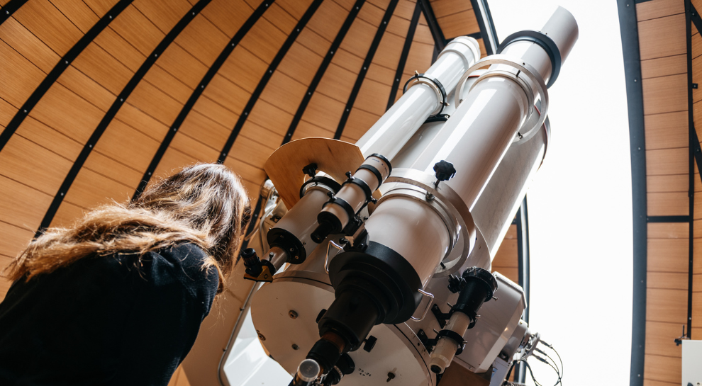
Osservatorio astronomico
An astronomical observatory on the ridge above Rovereto, run as part of the town's civic museum foundation.
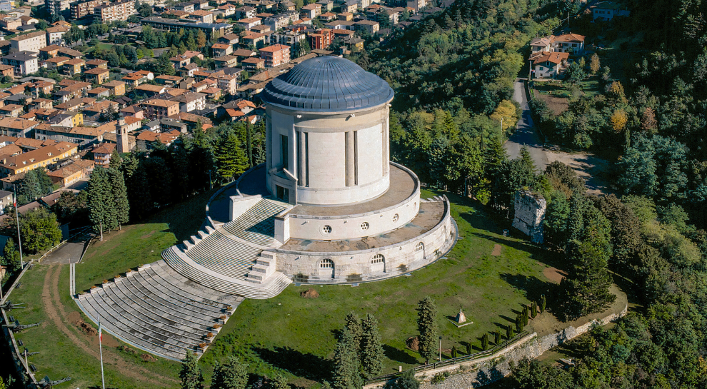
Sacrario monumentale di Castel Dante
A First World War ossuary on the Castel Dante hill in Rovereto, holding the remains of Italian and Austro-Hungarian soldiers.
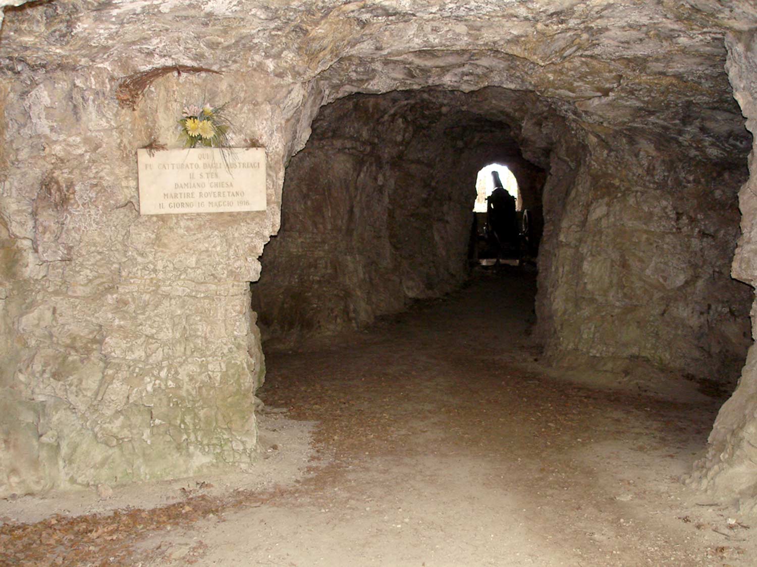
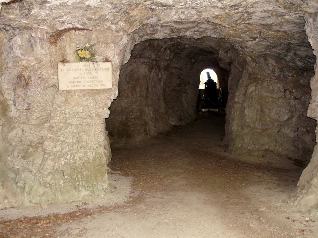
Caverna Damiano Chiesa
A wartime gallery cut into the rock near Rovereto, named for the Trentino irredentist executed in 1916.
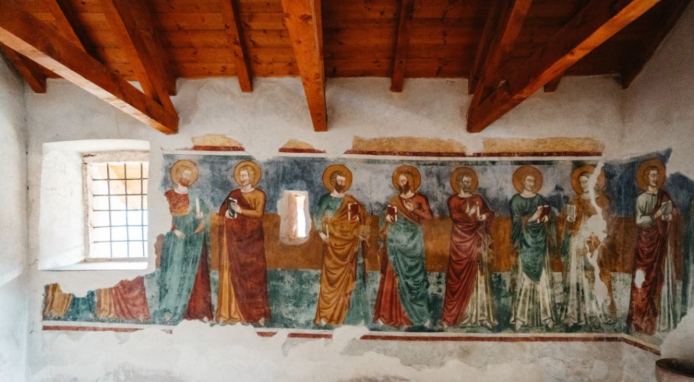
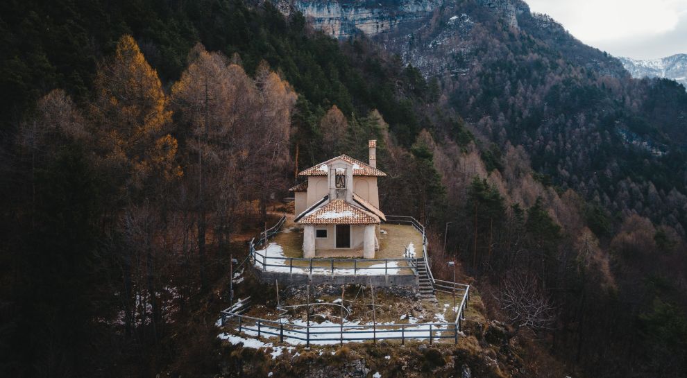
Chiesa di Santa Maria Maddalena
A church above Rovereto, on the path up towards the Monte Zugna ridge.
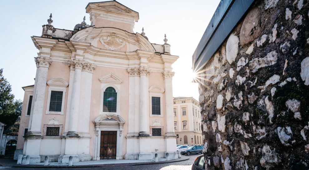
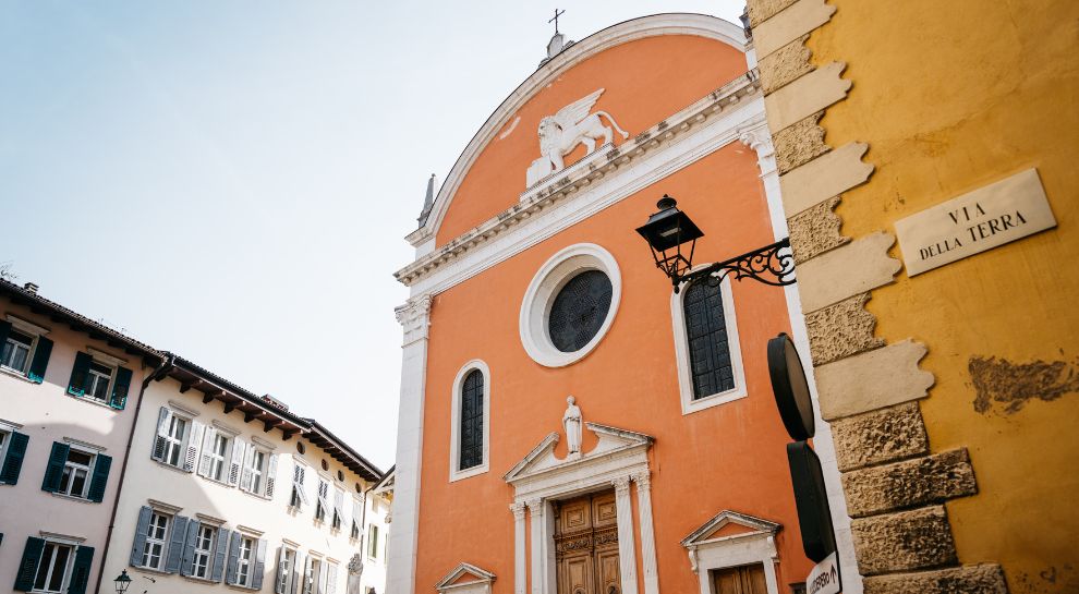
Die Kirche von San Marco
The church of San Marco in Rovereto, where Mozart played the organ as a boy in 1769.
Höhle Damiano Chiesa
A First World War cavern in the hills above Rovereto, named after Damiano Chiesa, the Rovereto artillery officer executed in 1916.
Santa Maria Maddalena Kirchlein
A small church on the hillside above Rovereto, on the Zugna path.
Nothing of this kind in Rovereto.
Routes
50 routes, an even mix of activities · see the rest on italia.it ↗
Monte Zugna
A walk from the Monte Zugna hut past Great War trenches and fortifications, with Rovereto, the Vallagarina and the Pasubio in view.
- 3.9 km
- Distance
- 222 m
- Ascent
- 1 h 33 min
- Duration
- 28
- Check-ins
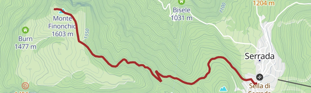
Open route APT Rovereto Vallagarina Monte BaldoSAT / E104 - Serrada - Monte Finonchio
A steady climb from Serrada up the shaded north flank on an old military road, trail 104, through spruce and larch to the Fratelli Filzi refuge.
- 4.4 km
- Distance
- 339 m
- Ascent
- 1 h 35 min
- Duration
- 38
- Check-ins
 Monte Finonchio 1 603 m
 Rifugio Finonchio Fratelli Filzi 1 603 m
 Sella di Serrada 1 250 m
- Zanna Bianca 1 307 m
Open route Azienda per il Turismo Alpe CimbraSentiero della Pace 17: Rifugio Coni Zugna to Rifugio Mario Fraccaroli
A ridge stage of the Peace Path from the Coni Zugna hut over Passo Buole and its war cemetery, then up the Val di Gatto to Cima Carega.
- 16.0 km
- Distance
- 1 085 m
- Ascent
- 6 h 9 min
- Duration
- 181
- Check-ins
- Cima Carega 2 259 m
- Guglia Paolo Lioy 2 226 m
- Guglia Adriano 2 084 m
- Cima Innominata 2 151 m
- Cima Posta 2 210 m
- Cima del Cherlong 2 209 m
- +16
Open route APT Rovereto Vallagarina Monte BaldoCycling around Rovereto
A flat town circuit from the railway station through the centre, past the Mart museum and the palaces of Corso Bettini and Corso Rosmini.
- 11.5 km
- Distance
- 31 m
- Ascent
- 1 h 3 min
- Duration
- 17
- Check-ins
Open route APT Rovereto Vallagarina Monte BaldoVallarsa Ring: in the shadow of Piccole Dolomiti
A hard circuit up the Vallarsa hairpins to Pian delle Fugazze and Passo di Campogrosso, finishing at the refuge under the Piccole Dolomiti.
- 93.3 km
- Distance
- 3 527 m
- Ascent
- 11 h 36 min
- Duration
- 228
- Check-ins
- Rifugio Campogrosso 1 456 m
- Pian delle Fugazze 1 163 m
- Passo di Campogrosso 1 453 m
- Albergo al Passo 1 170 m
- Miramonti 1 160 m
- MB Ristoro "Magna & bevi" 1 182 m
- +14
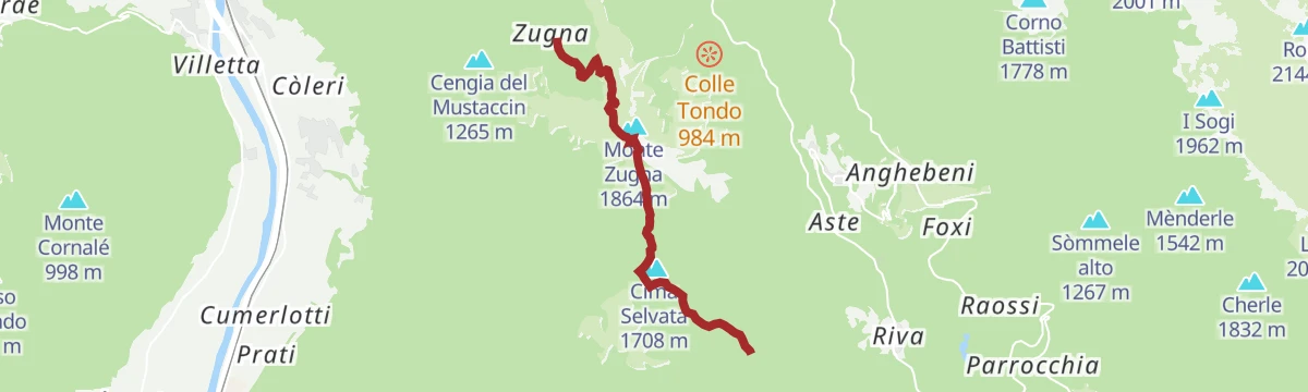
Open route APT Rovereto Vallagarina Monte BaldoFrom Monte Zugna to Passo Buole
An easy ridge walk from the summit of Monte Zugna along the crest down to the Passo Buole above the Vallarsa.
- 5.4 km
- Distance
- 191 m
- Ascent
- 1 h 52 min
- Duration
- 21
- Check-ins
- Rifugio Coni Zugna 1 628 m
- Rifugio Forestale 1 613 m
- Baita Quinto pezzo 1 803 m
- Passo Buole 1 460 m
- Baita Passo Buole 1 460 m
- Baita Selvata 1 671 m
- +1
Open route APT Rovereto Vallagarina Monte BaldoTrekking to Rifugio Finonchio
A forest-road ascent from Serrada to a refuge opened in 1930, sitting on top of Monte Finonchio high above the Adige valley.
- 8.4 km
- Distance
- 362 m
- Ascent
- 2 h 52 min
- Duration
- 31
- Check-ins
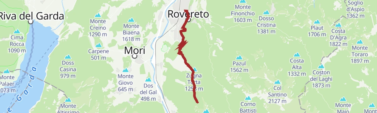
Open route Azienda per il Turismo Alpe CimbraRovereto - Zugna | 2901
A long climb from Rovereto by way of the Castel Dante ossuary, the dinosaur footprints and the Austro-Hungarian military road to Monte Zugna.
- 22.7 km
- Distance
- 1 523 m
- Ascent
- 7 h 45 min
- Duration
- 32
- Check-ins
- Castel Pagan 458 m
- Rifugio Coni Zugna 1 628 m
- Rifugio Forestale 1 613 m
- Baita operatori e materiale 185 m
- Baita principale 186 m
- Malga Tof 1 066 m
- +3
Open route APT Rovereto Vallagarina Monte BaldoAlong the Marzemino wine route
A short ride from Borgo Sacco through the Isera vineyards up to the Montalbano sanctuary, a terrace above the town of Mori.
- 11.5 km
- Distance
- 233 m
- Ascent
- 1 h 14 min
- Duration
Open route APT Rovereto Vallagarina Monte BaldoTour of Monte Baldo
A high traverse of the Baldo ridge by Corno della Paura, Passo di San Valentino and Bocca del Creer, ending on the balcony at Bocca di Navene.
- 84.4 km
- Distance
- 2 093 m
- Ascent
- 9 h 28 min
- Duration
- 187
- Check-ins
- Albergo Rifugio Graziani 1 626 m
- Bocca del Creer 1 617 m
- Bocca di Navene 1 425 m
- Malga Canalece 1 574 m
- Passo di San Valentino 1 314 m
- Bocca di Navene 1 427 m
- +14
Open route APT Rovereto Vallagarina Monte BaldoFrom Mount Zugna to Passo Buole
A mule track from the top of Zugna to Passo Buole, the pass held against the Austrian offensive of 1916 and marked by a chapel to the dead.
- 5.3 km
- Distance
- 203 m
- Ascent
- 1 h 58 min
- Duration
- 21
- Check-ins
- Cima Selvata 1 708 m
- Rifugio Coni Zugna 1 628 m
- Rifugio Forestale 1 613 m
- Baita Quinto pezzo 1 803 m
- Passo Buole 1 460 m
- Baita Passo Buole 1 460 m
- +2
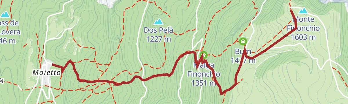
Open route APT Rovereto Vallagarina Monte BaldoTrekking from Moietto to Mount Finonchio
A climb from Moietto through pine wood and past Malga Finonchio to the meadows on top of Monte Finonchio, over the Vallagarina.
- 3.8 km
- Distance
- 651 m
- Ascent
- 2 h 28 min
- Duration
- 22
- Check-ins
Open route APT Rovereto Vallagarina Monte BaldoSentiero della Pace 16: Rovereto to Rifugio Coni Zugna
The Peace Path stage from Rovereto up Monte Zugna to the Coni Zugna hut, passing the Maria Dolens bell of the fallen on the lower slopes.
- 13.7 km
- Distance
- 1 499 m
- Ascent
- 6 h 26 min
- Duration
- 28
- Check-ins
- Castel Pagan 458 m
- Val Scodella 358 m
- Rifugio Coni Zugna 1 628 m
- Rifugio Forestale 1 613 m
- VisitRovereto 198 m
- Malga Tof 1 066 m
- +2
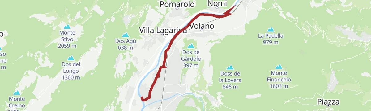
Open route APT Rovereto Vallagarina Monte BaldoFrom Rovereto to Nomi with your bicycle
An easy family run on the Vallagarina cycle lane, leaving Borgo Sacco by the stone drinking fountain and rolling through vineyards to Nomi.
- 8.8 km
- Distance
- 10 m
- Ascent
- 47 min
- Duration
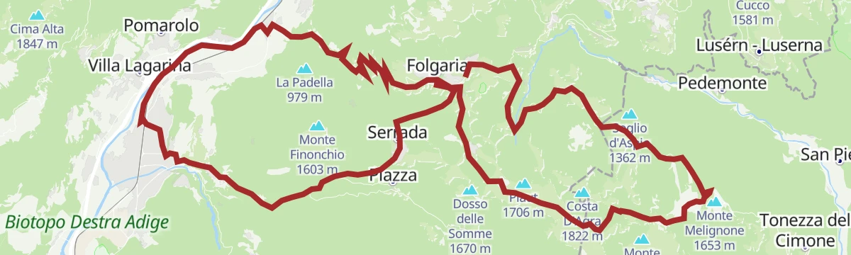
Open route APT Rovereto Vallagarina Monte BaldoFolgaria - Arsiero - Posina - Xomo Pass - Pian delle Fugazze Pass - Vallarsa - Noriglio - Terragnolo - Serrada
A very long road circuit from Folgaria over the Sommo, Xomo and Pian delle Fugazze passes, back by Terragnolo.
- 105.2 km
- Distance
- 3 492 m
- Ascent
- 12 h 37 min
- Duration
- 183
- Check-ins
- Pian delle Fugazze 1 163 m
- Albergo al Passo 1 170 m
- Miramonti 1 160 m
- MB Ristoro "Magna & bevi" 1 182 m
- Rifugio Passo Xomo 1 062 m
- Passo Sommo 1 341 m
- +16
Open route Azienda per il Turismo Alpe CimbraFrom Rovereto to Mori for everyone
A flat town-to-town walk on the cycleways beside the Leno and then the Adige, from Rovereto station to Mori, with a train back.
- 6.7 km
- Distance
- 21 m
- Ascent
- 1 h 38 min
- Duration
- 17
- Check-ins
Open route APT Rovereto Vallagarina Monte BaldoCity Trek of the Woods
A walk from the centre of Rovereto on easy paths up to the Bosco della Città, the town's own hillside wood.
- 7.1 km
- Distance
- 184 m
- Ascent
- 2 h 6 min
- Duration
- 10
- Check-ins
Open route APT Rovereto Vallagarina Monte Baldo#15) From Ronzo Chienis to Rovereto
A long stage over Monte Biaena, with Capanna Biaena and the whole Vallagarina below, then a steep drop by Passo di Monte Faè into Rovereto.
- 18.2 km
- Distance
- 698 m
- Ascent
- 7 h 4 min
- Duration
- 18
- Check-ins
- Monte Biaena 1 618 m
- Carzel 1 020 m
- VisitRovereto 198 m
- Baita operatori e materiale 185 m
- Baita principale 186 m
- Capanna Biaena 1 580 m
- +3
Open route Garda TrentinoFrom Pasubio to Lake Garda
A descent from the Pian delle Fugazze below the Pasubio, through the Vallarsa to Rovereto and Torbole.
- 53.5 km
- Distance
- 599 m
- Ascent
- 5 h 42 min
- Duration
- 181
- Check-ins
- Pian delle Fugazze 1 163 m
- Albergo al Passo 1 170 m
- Miramonti 1 160 m
- MB Ristoro "Magna & bevi" 1 182 m
- Malga Fratte /Malga Frate 1 195 m
- Malga Morbi 1 211 m
- +13
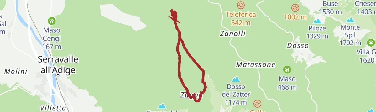
Open route APT Rovereto Vallagarina Monte BaldoTrincerone dello Zugna and Sinel Trail
A woodland loop over the Zugna trenches, visiting concrete positions and tunnels left by both armies in the First World War.
- 6.0 km
- Distance
- 233 m
- Ascent
- 1 h 59 min
- Duration
- 13
- Check-ins
Open route APT Rovereto Vallagarina Monte BaldoFiume Adige A
A level riverside route along the Adige at Rovereto, keeping to the floor of the Vallagarina below the Zugna slopes.
- 9.1 km
- Distance
- 24 m
- Ascent
- 2 h 12 min
- Duration
- 5
- Check-ins
 Mori - Ala 167 m
Open route Trentino FishingMonte Finonchio - Rovereto | 2905
A gentle ascent through conifer woods to the meadows below the Finonchio refuge, then a long descent on dirt tracks to Noriglio and into town.
- 20.2 km
- Distance
- 376 m
- Ascent
- 6 h 38 min
- Duration
- 6
- Check-ins
- Pescicoltura 211 m
- Zanna Bianca 1 307 m
- Burn 1 477 m
- Casa del Don 1 082 m
- Bar 1 073 m
- Colonia piccola 1 068 m
- +2
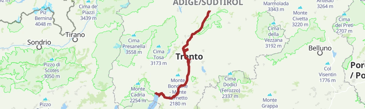
Open route APT Rovereto Vallagarina Monte BaldoCastelfeder – Trento – Garda
A cycle-path route down the Adige from Ora to Lake Garda, through orchards, vineyards and the old river towns.
- 92.1 km
- Distance
- 198 m
- Ascent
- 8 h 25 min
- Duration
- 172
- Check-ins
- Prati Del Diavolo 208 m
- Taio 189 m
- Garda Dolomiti Azienda per il turismo S.p.A. 69 m
- Soardi Center 212 m
- cappella di San Rocco 213 m
- Passo San Giovanni 272 m
- +15
Open route Sterzing, Pfitsch und FreienfeldCity Trek of Peace
A walk from central Rovereto up to the Maria Dolens bell on Colle di Miravalle, above the Val Scodella.
- 5.9 km
- Distance
- 185 m
- Ascent
- 1 h 50 min
- Duration
- 8
- Check-ins
Open route APT Rovereto Vallagarina Monte BaldoTrail of the "Teragnòle"
A climb from Rovereto on the old road to Noriglio, the way the women of the Terragnolo valley once carried produce down to the city markets.
- 8.4 km
- Distance
- 650 m
- Ascent
- 3 h 25 min
- Duration
- 5
- Check-ins
- Pescicoltura 211 m
- Agritur Masi Brenta 574 m
- Osteria del Nazio 681 m
Open route APT Rovereto Vallagarina Monte BaldoDiscovery tour of the Altipiani
A demanding climb from the valley floor through Terragnolo to the Cimbrian highlands, over Passo Sommo and Passo Coe with Malga Coe on top.
- 88.4 km
- Distance
- 2 328 m
- Ascent
- 10 h 2 min
- Duration
- 126
- Check-ins
- Passo Coe 1 610 m
- Passo Sommo 1 341 m
- eghel pause 1 609 m
- Hotel Forte Cherle 1 417 m
- Hangar Bar Lago Coe 1 541 m
- Malga Coe 1 609 m
- +23
Open route APT Rovereto Vallagarina Monte BaldoCity Trek of History
From the old centre of Rovereto a mule track climbs toward the Terragnolo valley to Noriglio, the route village women once took down to market.
- 6.0 km
- Distance
- 225 m
- Ascent
- 1 h 57 min
- Duration
- 7
- Check-ins
- VisitRovereto 198 m
- Pescicoltura 211 m
Open route APT Rovereto Vallagarina Monte BaldoFolgaria - Serrada - Terragnolo - Rovereto - Calliano - Passo Coe - Fiorentini
A long circuit from Folgaria down the Terragnolo to the Adige, then the long climb back to the Passo Coe.
- 74.5 km
- Distance
- 2 267 m
- Ascent
- 8 h 44 min
- Duration
- 118
- Check-ins
- Passo Coe 1 610 m
- Passo Sommo 1 341 m
- eghel pause 1 609 m
- Hotel Forte Cherle 1 417 m
- Hangar Bar Lago Coe 1 541 m
- Malga Coe 1 609 m
- +18
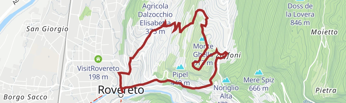
Open route Azienda per il Turismo Alpe CimbraComplete tour of Monte Ghello (long version)
A loop above Rovereto castle on the cobbled Strada Vecia, past the hamlets of Valteri, Campolongo and Zaffoni to a wartime tunnel and gun post on Monte Ghello.
- 7.0 km
- Distance
- 310 m
- Ascent
- 2 h 24 min
- Duration
- 5
- Check-ins
- Monte Ghello 513 m
- Pescicoltura 211 m
Open route APT Rovereto Vallagarina Monte BaldoRing tour Mori-Val di Gresta-Cei
A loop up from the Garda end of the valley over Passo San Giovanni and Santa Barbara, crossing the Val di Gresta to Passo Bordala and Lago di Cei.
- 69.1 km
- Distance
- 2 042 m
- Ascent
- 8 h 3 min
- Duration
- 116
- Check-ins
- Sesto Grado 177 m
- Passo Bordala 1 250 m
- Passo Santa Barbara 1 169 m
- Hotel Passo Bordala 1 255 m
- Soardi Center 212 m
- cappella di San Rocco 213 m
- +14
Open route APT Rovereto Vallagarina Monte BaldoTorrente Leno M
A short streamside walk along the Leno at Trambileno, below Rovereto.
- 1.9 km
- Distance
- 17 m
- Ascent
- 32 min
- Duration
- 5
- Check-ins
- Pescicoltura 211 m
- Genovesa 279 m
Open route Trentino FishingCastelfeder – Trient – Garda
The same Adige descent to Lake Garda on well-signed paths, at a gradient that suits riders of any standard.
- 91.6 km
- Distance
- 125 m
- Ascent
- 8 h 18 min
- Duration
- 110
- Check-ins
- Garda Dolomiti Azienda per il turismo S.p.A. 69 m
- cappella di San Rocco 213 m
- Passo San Giovanni 272 m
- Chiesa di Sant'Antonio 223 m
- Villa Eleganza 228 m
- Mori - Ala 167 m
- +7
Open route Südtirols SüdenCity Trek of Art
A short circuit of Rovereto linking the MART gallery and Casa Depero, taking in the old centre from the outside.
- 3.3 km
- Distance
- 78 m
- Ascent
- 58 min
- Duration
- 4
- Check-ins
Open route APT Rovereto Vallagarina Monte BaldoTour to the Garda Lake
A long, nearly level ride down to the north end of Lake Garda and the villages along its shore.
- 96.2 km
- Distance
- 166 m
- Ascent
- 8 h 45 min
- Duration
- 110
- Check-ins
- Garda Dolomiti Azienda per il turismo S.p.A. 69 m
- cappella di San Rocco 213 m
- Passo San Giovanni 272 m
- ENI 197 m
- Villa Eleganza 228 m
- Visitrovereto.it 190 m
- +7
Open route Südtirols SüdenWalking in Peace - Nobel Peace Prize Trail
A short climb from the Castel Dante ossuary over Colle di Miravalle to the Maria Dolens bell, rung each evening for the war dead.
- 1.6 km
- Distance
- 76 m
- Ascent
- 34 min
- Duration
- 4
- Check-ins
Open route APT Rovereto Vallagarina Monte BaldoGita giornaliera al Lago di Garda
A road-bike day out to Lake Garda over the Passo San Giovanni, almost flat for its whole length.
- 98.6 km
- Distance
- 131 m
- Ascent
- 8 h 56 min
- Duration
- 98
- Check-ins
- Prati Del Diavolo 208 m
- Soardi Center 212 m
- cappella di San Rocco 213 m
- Passo San Giovanni 272 m
- Chiesa di Sant'Antonio 223 m
- ENI 197 m
- +12
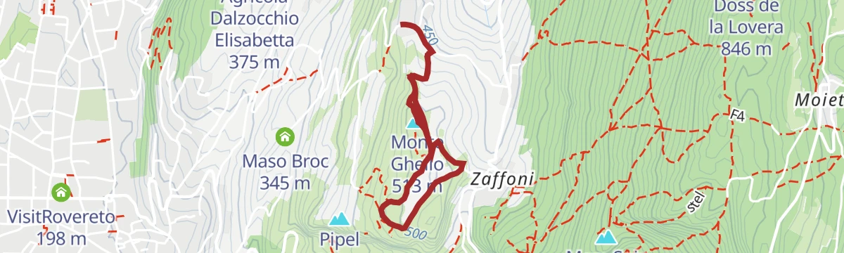
Open route Sterzing, Pfitsch und FreienfeldTour of Monte Ghello (short)
A family loop through woods and clearings on Monte Ghello above Rovereto, passing a First World War tunnel cut into the rock.
- 2.8 km
- Distance
- 63 m
- Ascent
- 49 min
- Duration
- 2
- Check-ins
Open route APT Rovereto Vallagarina Monte BaldoCiclovia della Valle dell'Adige
The Adige valley cycleway the length of Trentino, linking Bolzano province with Verona.
- 81.3 km
- Distance
- 41 m
- Ascent
- 7 h 16 min
- Duration
- 42
- Check-ins
Albaredo Mushroom Trail
A loop on Monte Zugna to the Albaredo mushroom rock, a pillar left standing by erosion, then on to the Pra spring and the Damiano Chiesa cave.
- 6.6 km
- Distance
- 316 m
- Ascent
- 2 h 21 min
- Duration
- 1
- Check-ins
Open route APT Rovereto Vallagarina Monte BaldoClimbing to Lessinia
A road ascent that leaves the Adige at Ala for Sega di Ala, climbing past Malga Riondera to Passo Fittanze on the Lessinia edge.
- 83.1 km
- Distance
- 1 747 m
- Ascent
- 9 h 1 min
- Duration
- 38
- Check-ins
- Col di Pealda Bassa 1 471 m
- Pealda bassa 1 451 m
- Dimora storica Tabarelli De Fatis 1 226 m
- GIULIO Mountain B&B 1 229 m
- Mori - Ala 167 m
- Agritur Malga Riondera 811 m
Open route APT Rovereto Vallagarina Monte BaldoDinosaur Footprints
A walk to the slabs south of Rovereto where trackways left by dinosaurs some 200 million years ago were identified in 1990.
- 4.2 km
- Distance
- 259 m
- Ascent
- 1 h 46 min
- Duration
- 1
- Check-ins
Open route APT Rovereto Vallagarina Monte BaldoCycling among wineries and castles
A long Vallagarina loop between vineyards and hill fortresses, with Castel Beseno and cellar stops strung along the way.
- 91.2 km
- Distance
- 821 m
- Ascent
- 8 h 52 min
- Duration
- 17
- Check-ins
- Mori - Ala 167 m
- Baita operatori e materiale 185 m
- Baita principale 186 m
- Al Casot 127 m
- Locanda al Castello 275 m
- Maso Pozze 172 m
- +6
Open route APT Rovereto Vallagarina Monte BaldoTorrente Leno M bassa
A short level path along the lower Leno where the stream runs through Rovereto to join the Adige.
- 1.1 km
- Distance
- 0 m
- Ascent
- 16 min
- Duration
Open route Trentino FishingFolgaria - Calliano - Rovereto - Terragnolo
A descent from Folgaria to Rovereto, returning up the Val di Terragnolo over the Sella di Serrada.
- 48.7 km
- Distance
- 1 441 m
- Ascent
- 5 h 40 min
- Duration
- 14
- Check-ins
- Sella di Serrada 1 250 m
- Pescicoltura 211 m
- Genovesa 279 m
- Agritur Masi Brenta 574 m
- Osteria del Nazio 681 m
Open route Azienda per il Turismo Alpe CimbraTorrente Leno NKE
A short easy walk beside the Leno stream at Trambileno, on the valley floor below the slopes of the Pasubio.
- 2.2 km
- Distance
- 65 m
- Ascent
- 37 min
- Duration
Open route Trentino FishingVallagarina Experience Bike Tour
A ride through the Vallagarina from Rovereto, among vineyards and the Taio wetland with its watchtower.
- 28.2 km
- Distance
- 292 m
- Ascent
- 2 h 47 min
- Duration
- 13
- Check-ins
- VisitRovereto 198 m
- Baita operatori e materiale 185 m
- Baita principale 186 m
- Azienda Agricola Balter 352 m
Open route APT Rovereto Vallagarina Monte BaldoTorrente Leno NKM
A brief streamside stretch beside the Leno in Rovereto, on the valley floor under the Zugna ridge.
- 1.1 km
- Distance
- 0 m
- Ascent
- 17 min
- Duration
Open route Trentino FishingVia Claudia Augusta - cycle path on the Adige in Vallagarina
A flat cycle path beside the Adige through Vallagarina, running from Besenello down the valley past vineyards, villages and hillside castles.
- 40.2 km
- Distance
- 22 m
- Ascent
- 3 h 36 min
- Duration
- 5
- Check-ins
- Mori - Ala 167 m
Open route APT Rovereto Vallagarina Monte BaldoTorrente Leno di Terragnolo E bassa
A short streamside walk along the lower Leno di Terragnolo, on the valley floor at Trambileno below the Pasubio.
- 2.8 km
- Distance
- 148 m
- Ascent
- 56 min
- Duration
Open route Trentino FishingTour of the abandoned places of Pinteri, Manfrin and Gerosa
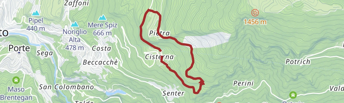
A short circuit above Cisterna on the old link road to Pinteri and Gerosa, hamlets empty for decades, past the vaulted Fontanei spring and a lime kiln.
- 4.6 km
- Distance
- 253 m
- Ascent
- 1 h 47 min
- Duration
Open route APT Rovereto Vallagarina Monte Baldo
No routes of this kind in Rovereto yet.
The region's own picks

Featured route
Monte Zugna
A walk from the Monte Zugna hut past Great War trenches and fortifications, with Rovereto, the Vallagarina and the Pasubio in view.
Planning a trip to Rovereto?
Everything else Trentino-Alto Adige/Südtirol has, in one place


Take Rovereto with you into the mountains
Every route on this page with 3D terrain, GPX navigation and offline maps — including the valleys with no signal.
Data sources
- Official website: italia.it ↗
- Routes and highlights: APT Rovereto Vallagarina Monte Baldo, Visitrovereto, Trentino Fishing, Azienda per il Turismo Alpe Cimbra, Sterzing, Pfitsch und Freienfeld, Südtirols Süden, Garda Trentino, Visit Trentino
- Published as open data by the tourist boards named above.
- Region summary generated from the board's own material.
