
Curated by APT Valsugana e Lagorai
Pieve Tesino
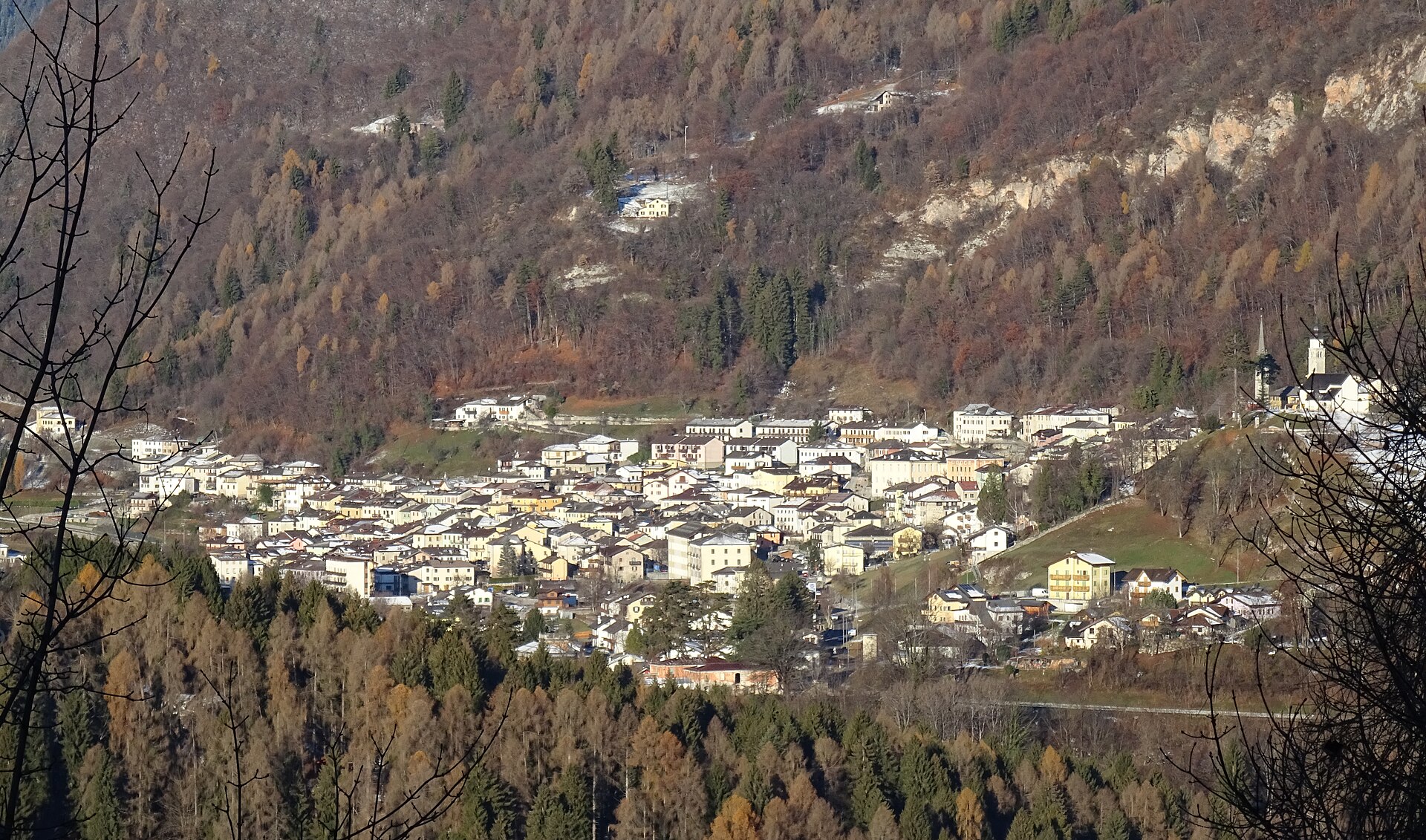
One of the three Tesino villages on a high basin between the Valsugana and the Vanoi, birthplace of Alcide De Gasperi.
Photo: Syrio · CC BY-SA 4.0 licence
- 1Highlights
- 48Routes
- Featured summit · Grünbergspitze
Highlights
All 1 from neighbouring places
Malga Valmaggiore
12.2 km away, in Predazzo
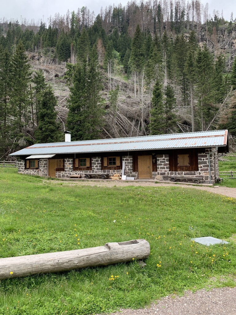
A dairy hut at the head of the Val Travignolo above Predazzo, a base for the walks and climbs on the Lagorai side.
Nothing of this kind in Pieve Tesino.
Routes
Lago Sorgazza V
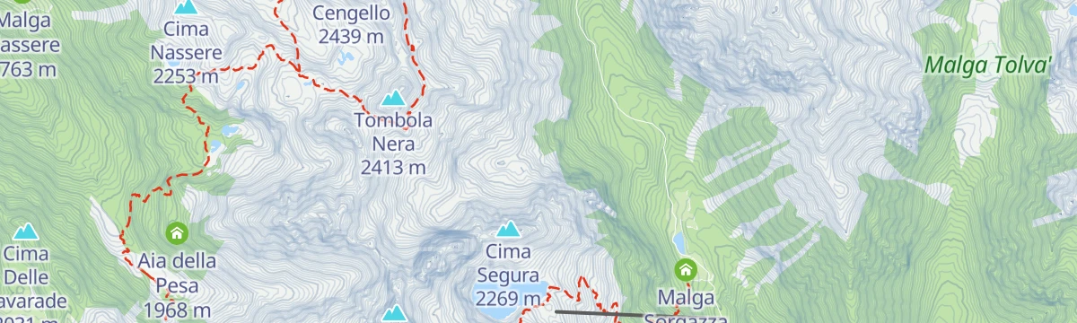
A few minutes' walk to the Sorgazza lake at the head of the Tesino valley.
- 382 m
- Distance
- 10 m
- Ascent
- 7 min
- Duration
- 31
- Check-ins
Open route Trentino FishingHiking trail - Forcella Magna
A climb on mule track to the military positions at Forcella Magna, with a short further rise to a small heart-shaped lake.
- 11.8 km
- Distance
- 677 m
- Ascent
- 4 h 45 min
- Duration
- 105
- Check-ins
 Rifugio Malga Sorgazza 1 450 m
 Bacino di Sorgazza 1 433 m
- Malga Sorgazza 1 453 m
 Forcella Magna 2 117 m
Open route APT Valsugana e LagoraiAlpine tour - Alta Via del Granito
A three-day high route on old paths and wartime mule tracks in the Lagorai, with two huts to sleep in, shepherds' cabins and summer pasture along the way.
- 28.7 km
- Distance
- 2 405 m
- Ascent
- 15 h 20 min
- Duration
- 271
- Check-ins
 Cima Lasteati 2 408 m
- Rifugio Malga Sorgazza 1 450 m
- Rifugio Cima d'Asta Ottone Brentari 2 476 m
- Bacino di Sorgazza 1 433 m
- Bivacco Caldenave 1 800 m
- Malga Sorgazza 1 453 m
- +11
Open route APT Valsugana e LagoraiMTB - Tesino Bike - Lefre 2308
A circular ride from Pradellano climbing in hairpins to Rifugio Monte Lefre, then on to Malga Valle before a gravel descent back to the lake.
- 13.4 km
- Distance
- 720 m
- Ascent
- 1 h 57 min
- Duration
- 19
- Check-ins
- Rifugio Monte Lefre 1 300 m
- Passo della Forcella 910 m
- Bacino di Pradellano 872 m
- Maso Adelina 873 m
- Maso Tranquillo 885 m
- Baita Alpina 1 309 m
- +2
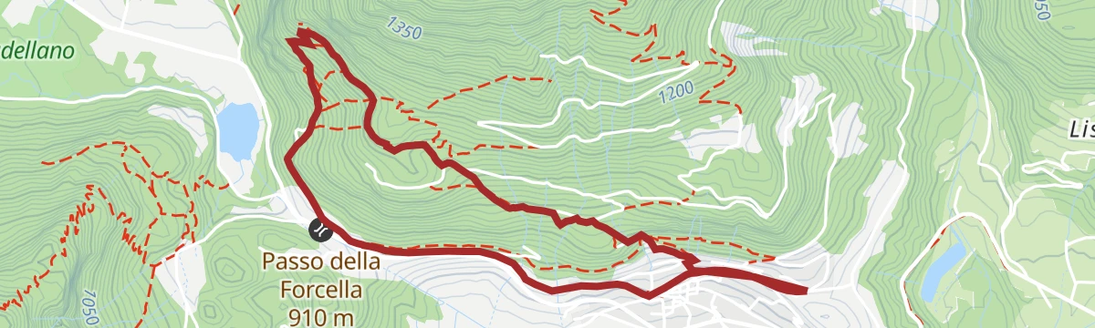
Open route APT Valsugana e LagoraiMTB - Tesino Bike - Fierollo 2307
A forest-road circuit through Val Malene above Pieve Tesino, dropping to Pradellano and closing over the Passo della Forcella on the Via Claudia.
- 27.6 km
- Distance
- 869 m
- Ascent
- 3 h 16 min
- Duration
- 13
- Check-ins
- Cascata del Chieppena 872 m
- Passo della Forcella 910 m
- Bacino di Pradellano 872 m
- Maso Tranquillo 885 m
- Betty's Hill 879 m
- Maso dei Caffi 911 m
- +2
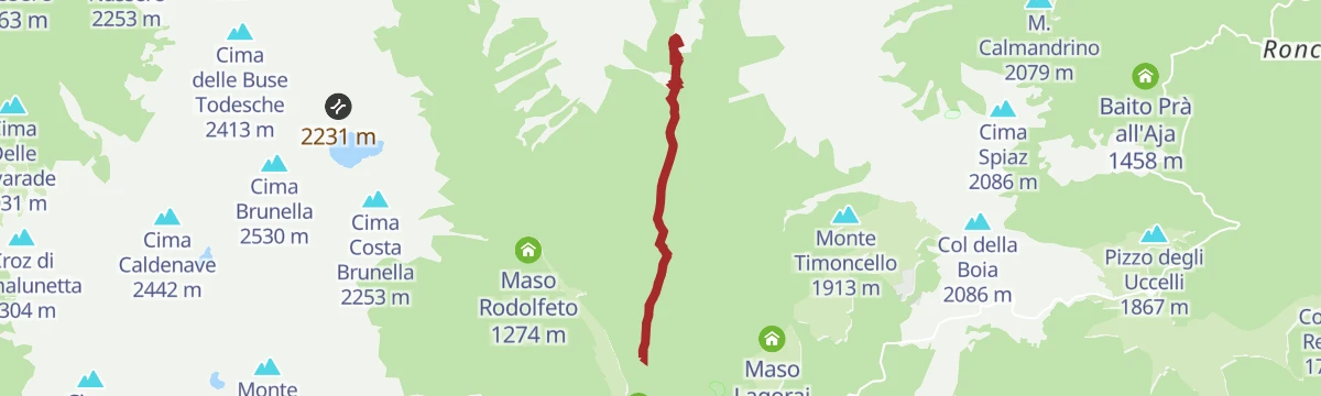
Open route APT Valsugana e LagoraiPieve Tesino - Val Malene - Passo Brocon
A steady road climb of 800 m from the Tesino plateau to the pass at 1,616 m, passing Villaggio Degasperi and Maso Lagorai on the way up.
- 14.5 km
- Distance
- 792 m
- Ascent
- 1 h 45 min
- Duration
- 11
- Check-ins
- Passo Brocon 1 616 m
- Hotel Pizzo degli Uccelli 1 620 m
- Albergo Passo Brocon 1 617 m
- Casa Anselmi 1 604 m
- Villaggio Degasperi 1 071 m
- Maso Lagorai 1 492 m
- +1
Open route APT Valsugana e LagoraieBike - Along the Claudia Augusta road
An e-bike ride down the Valsugana cycle path to the Ivano castle, then up the Chieppena towards Castello Tesino and Passo della Forcella.
- 39.9 km
- Distance
- 703 m
- Ascent
- 4 h 5 min
- Duration
- 33
- Check-ins
- Cascata del Chieppena 872 m
- Parc Hotel Du Lac 454 m
- Visitvalsugana 491 m
- Lagorai Valsugana Orientale 383 m
- APT Valsugana 386 m
- Passo della Forcella 910 m
- +7
Open route APT Valsugana e LagoraiNordic Walking - Spiado Tour
A circular forest-road track above Pieve Tesino through spruce and beech, with openings onto the Valsugana; dirt at first and tarmac at the end.
- 6.8 km
- Distance
- 207 m
- Ascent
- 2 h 6 min
- Duration
- 8
- Check-ins
Open route APT Valsugana e LagoraiHiking trail - The 5 Croci Pass
A climb from Val Campelle to the Passo Cinque Croci, worth doing in any season: rhododendrons in summer, grass and larch turning red from September.
- 8.4 km
- Distance
- 564 m
- Ascent
- 3 h 47 min
- Duration
- 104
- Check-ins
- Grünbergspitze 1 976 m
- Rifugio Malga Consèria 1 848 m
- Bivacco Rifugio Consèria 1 824 m
- Passo Cinque Croci 2 023 m
- Malga Conseria 1 821 m
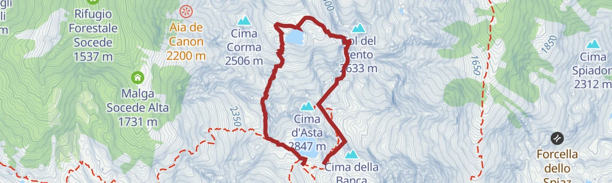
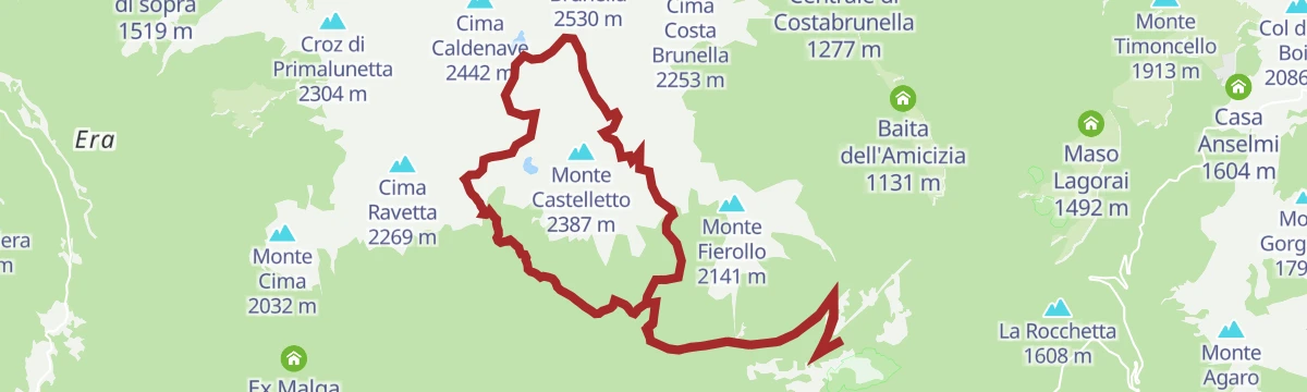
Open route APT Valsugana e LagoraiTrekking
A ring traverse of the granite island formed by the Cima d'Asta and the Cime di Rava, an outlier within the Lagorai chain.
- 28.7 km
- Distance
- 2 402 m
- Ascent
- 15 h 19 min
- Duration
- 271
- Check-ins
MTB - Tesino Bike - Brocon Malene 2306
A long downhill run off the pass into the Val Malene, following forest roads beside the Grigno stream to the bike grill at Castello Tesino.
- 14.6 km
- Distance
- 35 m
- Ascent
- 1 h 37 min
- Duration
- 11
- Check-ins
- Passo Brocon 1 616 m
- Hotel Pizzo degli Uccelli 1 620 m
- Albergo Passo Brocon 1 617 m
- Casa Anselmi 1 604 m
- Villaggio Degasperi 1 071 m
- Maso Lagorai 1 492 m
- +1
Open route APT Valsugana e LagoraiMTB - Monte Agaro Tour 253
A marked long-distance route across four Tesino municipalities, climbing to Passo Brocon and passing old masi such as Maso Lagorai.
- 35.6 km
- Distance
- 1 097 m
- Ascent
- 4 h 12 min
- Duration
- 11
- Check-ins
- Passo Brocon 1 616 m
- Hotel Pizzo degli Uccelli 1 620 m
- Albergo Passo Brocon 1 617 m
- Casa Anselmi 1 604 m
- Villaggio Degasperi 1 071 m
- Maso Lagorai 1 492 m
- +3
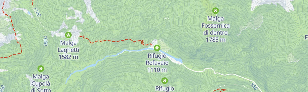
Open route APT Valsugana e LagoraiRifugio Refavaie (Caoria) PS
A very short approach at the Refavaie hut in the Vanoi valley, on the way into the Cima d'Asta group.
- 212 m
- Distance
- 3 m
- Ascent
- 3 min
- Duration
- 8
- Check-ins
Open route Trentino FishingHiking trail - Tour of Zimon
A demanding round over passes and through valleys under Cima Diavoli, on the granite ridges above Pieve Tesino.
- 6.6 km
- Distance
- 718 m
- Ascent
- 4 h 17 min
- Duration
- 77
- Check-ins
- Cima Diavoli 2 806 m
- Rifugio Cima d'Asta Ottone Brentari 2 476 m
- La Forzeleta 2 680 m
- Passo Socede 2 518 m
- Forcella Col del vento 2 495 m
- Forcella de meso 2 534 m
- +2
Open route APT Valsugana e LagoraiHiking trail - Rifugio Cima D'Asta
A long climb to the Cima d'Asta hut, which stands by its lake under the granite summit above Pieve Tesino.
- 13.9 km
- Distance
- 1 069 m
- Ascent
- 6 h 56 min
- Duration
- 132
- Check-ins
- Rifugio Malga Sorgazza 1 450 m
- Rifugio Cima d'Asta Ottone Brentari 2 476 m
- Bacino di Sorgazza 1 433 m
- Malga Sorgazza 1 453 m
Open route APT Valsugana e LagoraiMTB - Tesino Bike - Tesino Villages 2310
A mixed-surface ride linking the three villages of the Tesino plateau over Passo della Forcella and past the Grigno reservoir.
- 21.6 km
- Distance
- 564 m
- Ascent
- 2 h 27 min
- Duration
- 6
- Check-ins
- Passo della Forcella 910 m
- Bacino artificiale Grigno 773 m
- Pro Loco di Pieve Tesino 839 m
- Visitor center 823 m
Open route APT Valsugana e LagoraiTorrente Vanoi E2
A short, flat walk beside the Vanoi torrent on the valley floor below Pieve Tesino.
- 1.7 km
- Distance
- 11 m
- Ascent
- 30 min
- Duration
- 8
- Check-ins
Open route Trentino FishingWalk - Over the waterfalls of Forra di Sorgazza Cengello
A walk on boardwalks and bridges hung over the gorges of the Grigno torrent, where the cut rock and the water are the point of the outing.
- 9.5 km
- Distance
- 441 m
- Ascent
- 3 h 19 min
- Duration
- 61
- Check-ins
Open route APT Valsugana e LagoraiThe marmots of Cima d'Asta
A steep themed trail from the Malga Sorgazza car park up to the Cima d'Asta hut, which can also be walked in part and retraced.
- 6.9 km
- Distance
- 1 044 m
- Ascent
- 4 h 6 min
- Duration
- 132
- Check-ins
- Rifugio Malga Sorgazza 1 450 m
- Rifugio Cima d'Asta Ottone Brentari 2 476 m
- Bacino di Sorgazza 1 433 m
- Malga Sorgazza 1 453 m
Open route APT Valsugana e LagoraiLago di Costa Brunella R
A short walk at the Costa Brunella lake, a dammed basin in the granite above the Tesino plateau.
- 1.5 km
- Distance
- 62 m
- Ascent
- 30 min
- Duration
- 7
- Check-ins
Open route Trentino FishingSentiero della Pace 30: from Rifugio Brentari to Caoria
Stage 30 of the Peace Path, from the Brentari hut on trail 386 to Forcella del Passetto, then the Negrelli trail 387 over the Cresta pass and down towards Caoria.
- 12.1 km
- Distance
- 62 m
- Ascent
- 4 h 46 min
- Duration
- 50
- Check-ins
- Rifugio Cima d'Asta Ottone Brentari 2 476 m
- Forcella del Passetto 2 490 m
- Forcella di Val Regana 2 047 m
Open route APT Valsugana e LagoraiHiking trail - Laghetti delle Buse Basse or di Rocco
A long route into the emptiest part of the Lagorai, past abandoned herders' shelters to the small lakes of the Buse Basse.
- 16.2 km
- Distance
- 1 053 m
- Ascent
- 7 h 8 min
- Duration
- 127
- Check-ins
- Rifugio Malga Consèria 1 848 m
- Bivacco Rifugio Consèria 1 824 m
- Passo Cinque Croci 2 023 m
- Malga Conseria 1 821 m
- Forcella Valsorda 2 256 m
- Passo Val Cion 2 076 m
- +3
Open route APT Valsugana e LagoraiLago di Pradellanno P
A very short walk at the Pradellanno lake on the Tesino plateau above Pieve Tesino.
- 534 m
- Distance
- 14 m
- Ascent
- 9 min
- Duration
- 4
- Check-ins
Open route Trentino FishingMaso di Spinelle I1
A level route through the fields and farmsteads around Maso di Spinelle on the Tesino plateau.
- 9.8 km
- Distance
- 28 m
- Ascent
- 3 h 40 min
- Duration
- 22
- Check-ins
Open route Trentino FishingHiking trail - Cresta del Frate and Tombolin di Rava
A little-walked route to Cima del Frate on works cut by Italian troops in 1916; nowhere serves food, though the huts hold bivouac rooms.
- 18.9 km
- Distance
- 1 262 m
- Ascent
- 8 h 29 min
- Duration
- 48
- Check-ins
- Cima del Frate 2 361 m
- Malga Fierollo di Sotto 1 542 m
- Malga Fierollo di Sopra 1 747 m
- Rifugio Spiado 1 331 m
- Baita dei cacciatori 1 562 m
- Baita Bella Venezia 2 039 m
- +6
Open route APT Valsugana e LagoraiWalk - Drio Castello to Pieve Tesino
An easy walk from Drio Castello into Pieve Tesino, across the meadows of the Tesino plateau.
- 6.6 km
- Distance
- 166 m
- Ascent
- 1 h 59 min
- Duration
- 4
- Check-ins
Open route APT Valsugana e LagoraiBack- country skiing in Tolvà valley
A winter route on snow up the Tolvà valley above Pieve Tesino, ending at the Malga Tolvà pasture.
- 7.4 km
- Distance
- 419 m
- Ascent
- 2 h 57 min
- Duration
- 10
- Check-ins
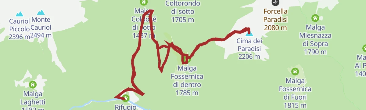
Open route APT Valsugana e LagoraiRifugio Refavaie – Malga Fossernica di dentro – Cima dei Paradisi
A climb from the Refavaie hut on the Coldose forest road along the Rio di Coltorondo, then by Malga Fossernica di dentro to Cima dei Paradisi.
- 16.9 km
- Distance
- 1 090 m
- Ascent
- 7 h 25 min
- Duration
- 23
- Check-ins
Open route APT San Martino di Castrozza, Primiero e VanoiWalk - the Cannoniere
A walk from Pieve Tesino past the church of Santa Maria Assunta and an old washhouse, then steeply up through beech and hornbeam to Le Cannoniere.
- 4.9 km
- Distance
- 320 m
- Ascent
- 2 h 10 min
- Duration
- 4
- Check-ins
Open route APT Valsugana e LagoraiRio Tolvà B1
A climb beside the Rio Tolvà above Pieve Tesino, on the way up towards the Tolvà pastures.
- 5.1 km
- Distance
- 439 m
- Ascent
- 2 h 55 min
- Duration
- 9
- Check-ins
Open route Trentino FishingThe Path of Listening
A route above Pieve Tesino, the birthplace in 1881 of Alcide De Gasperi, crossing Monte Silana on the plateau that shaped him.
- 13.1 km
- Distance
- 959 m
- Ascent
- 6 h 17 min
- Duration
- 3
- Check-ins
Open route APT Valsugana e LagoraiRio Quarazza B4
A flat walk beside the Rio Quarazza in the Tesino, on the valley floor near Pieve Tesino.
- 1.8 km
- Distance
- 10 m
- Ascent
- 59 min
- Duration
- 3
- Check-ins
Open route Trentino Fishingtrekking lago dei aseni
A climb from above the Val Malene campsite up the Tolvà valley, then a stepped mule track of logs and stone in hairpins to the Aseni lake at 1,930 m.
- 11.9 km
- Distance
- 797 m
- Ascent
- 5 h 22 min
- Duration
- 8
- Check-ins
- Baita del pastore 1 549 m
- Laghetto degli Asini 1 931 m
Open route APT Valsugana e LagoraiTorrente Chieppena D
A streamside stretch along the Chieppena at Bieno, passing its waterfall in the Valsugana.
- 3.3 km
- Distance
- 132 m
- Ascent
- 1 h 50 min
- Duration
- 2
- Check-ins
Open route Trentino FishingTorrente Valsorda M2
A steep climb beside the Valsorda torrent in the woods above Pieve Tesino.
- 2.8 km
- Distance
- 452 m
- Ascent
- 1 h 44 min
- Duration
- 7
- Check-ins
- Laghetto effimero 2 039 m
Open route Trentino FishingNordic Walking - Arboreto Tour
A short dirt-road loop on the Tesino arboretum trail, over a natural peat bog and past the Garden of Europe, which opened in 2011.
- 1.9 km
- Distance
- 20 m
- Ascent
- 30 min
- Duration
- 1
- Check-ins
Open route APT Valsugana e LagoraiTorrente Grigno A2
A walk beside the Grigno torrent on the valley floor below Pieve Tesino.
- 9.1 km
- Distance
- 259 m
- Ascent
- 3 h 23 min
- Duration
Open route Trentino FishingTorrente Grigno A1
A flat path beside the Grigno torrent below Cinte Tesino, on the Valsugana side of the plateau.
- 4.9 km
- Distance
- 0 m
- Ascent
- 1 h 33 min
- Duration
- 1
- Check-ins
Open route Trentino FishingTorrente Grigno A4
A climb beside the Grigno torrent above Cinte Tesino, gaining height through the gorge.
- 3.4 km
- Distance
- 435 m
- Ascent
- 1 h 54 min
- Duration
Open route Trentino FishingWalk - Tesino Arboretum and Garden of Europe
An hour's round near the visitor centre through meadow, wet ground and stands of forest, ending at the Giardino d'Europa laid out in De Gasperi's name.
- 1.0 km
- Distance
- 10 m
- Ascent
- 16 min
- Duration
- 1
- Check-ins
Open route APT Valsugana e LagoraiWalk - The fountains path
A gentle descent from Pieve Tesino to the Grigno stream, fed by the Cima d'Asta lake and cold even in high summer.
- 2.5 km
- Distance
- 84 m
- Ascent
- 48 min
- Duration
- 1
- Check-ins
- Bacino artificiale Grigno 773 m
Open route APT Valsugana e LagoraiRio Acqua Sorda B2
A flat walk beside the Rio Acqua Sorda on the Tesino plateau near Pieve Tesino.
- 1.7 km
- Distance
- 0 m
- Ascent
- 44 min
- Duration
Open route Trentino FishingRio Val Vendrame B1
A very short level walk along the Rio Val Vendrame in the Tesino, close to Pieve Tesino.
- 637 m
- Distance
- 0 m
- Ascent
- 21 min
- Duration
Open route Trentino FishingRio Val Vendrame B3
A brief level stretch beside the Rio Val Vendrame on the Tesino plateau.
- 340 m
- Distance
- 0 m
- Ascent
- 24 min
- Duration
Open route Trentino FishingRio Valsorda M1
A short, steep line up the Valsorda stream on the slopes above Scurelle in the Valsugana.
- 2.4 km
- Distance
- 308 m
- Ascent
- 1 h 15 min
- Duration
Open route Trentino FishingTorrente Grigno A3
A short flat walk on the bank of the Grigno torrent below Pieve Tesino.
- 1.6 km
- Distance
- 0 m
- Ascent
- 26 min
- Duration
Open route Trentino FishingWalk - Masi Caretta
A gentle round at about 1,200 m on dirt roads and paths through meadow, wood and scattered farmsteads, easy enough with children along.
- 2.8 km
- Distance
- 75 m
- Ascent
- 51 min
- Duration
Open route APT Valsugana e LagoraiWalk - Natural path I Mughi
A short loop in the I Mughi reserve, a basin of 21 hectares under spruce, silver fir and beech, where mountain pine grows unusually low down.
- 2.2 km
- Distance
- 57 m
- Ascent
- 39 min
- Duration
Open route APT Valsugana e Lagorai















No routes of this kind in Pieve Tesino yet.
The region's own picks

Featured route
Lago Sorgazza V
A few minutes' walk to the Sorgazza lake at the head of the Tesino valley.
Planning a trip to Pieve Tesino?
Everything else Trentino-Alto Adige/Südtirol has, in one place


Take Pieve Tesino with you into the mountains
Every route on this page with 3D terrain, GPX navigation and offline maps — including the valleys with no signal.
Data sources
- Official website: visitvalsugana.it ↗
- Routes and highlights: APT Valsugana e Lagorai, Trentino Fishing, YesAlps, Valsugana, APT San Martino di Castrozza, Primiero e Vanoi
- Published as open data by the tourist boards named above.
- Region summary generated from the board's own material.
