













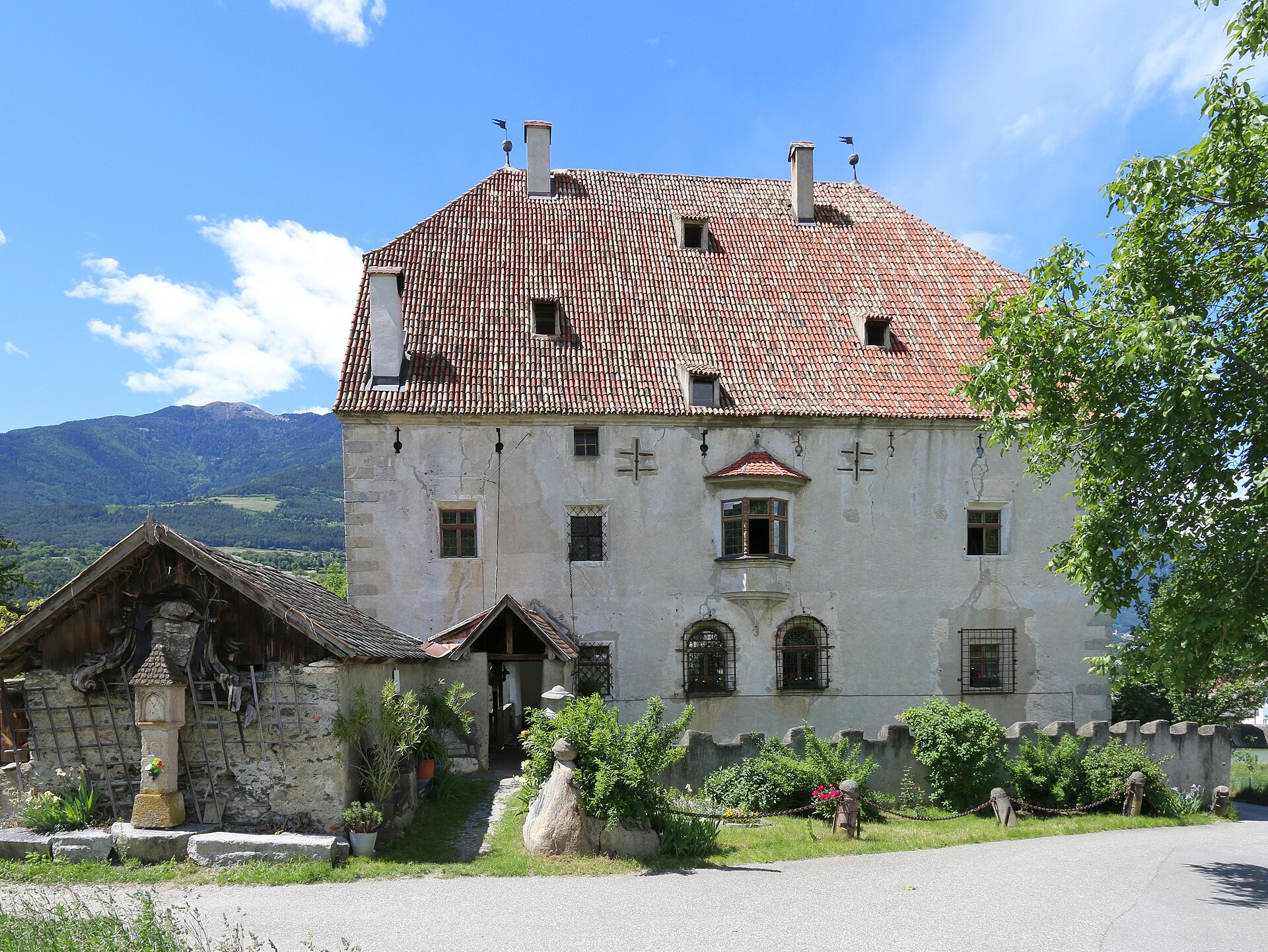
Curated by Brixen
Bressanone/Brixen
South Tyrol's oldest town at the meeting of Isarco and Rienza, with the prince-bishops' Hofburg and the Plose above.
- 2Highlights
- 82Routes
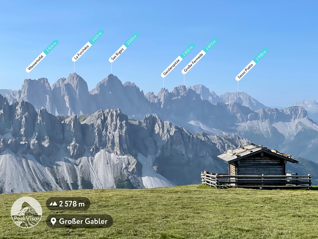
- Featured summit · Großer Gabler - Monte Forca Grande
Highlights
13 from neighbouring places
Albergo Rossalm
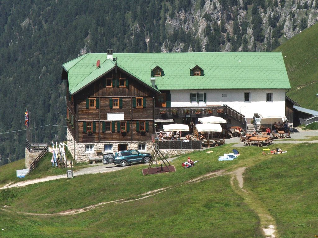
A pasture inn on the Plose above Bressanone, among the open ridge walks that run south from the Plose lifts toward the Aferer Geisler.
Rifugio Schatzerhütte
A refuge on the wooded terraces of the Plose above Bressanone, on the traverse between the Plose slopes and the Aferer Geisler, in the Eisacktal.
Rifugio Plose
5.3 km away, in Luson/Lüsen
A refuge on the Plose above Luson, on the broad ridge east of Bressanone that carries the ski runs and summer paths.
Sterzing, Pfitsch und FreienfeldEdelweißhütte
8.9 km away, in Funes/Villnöß
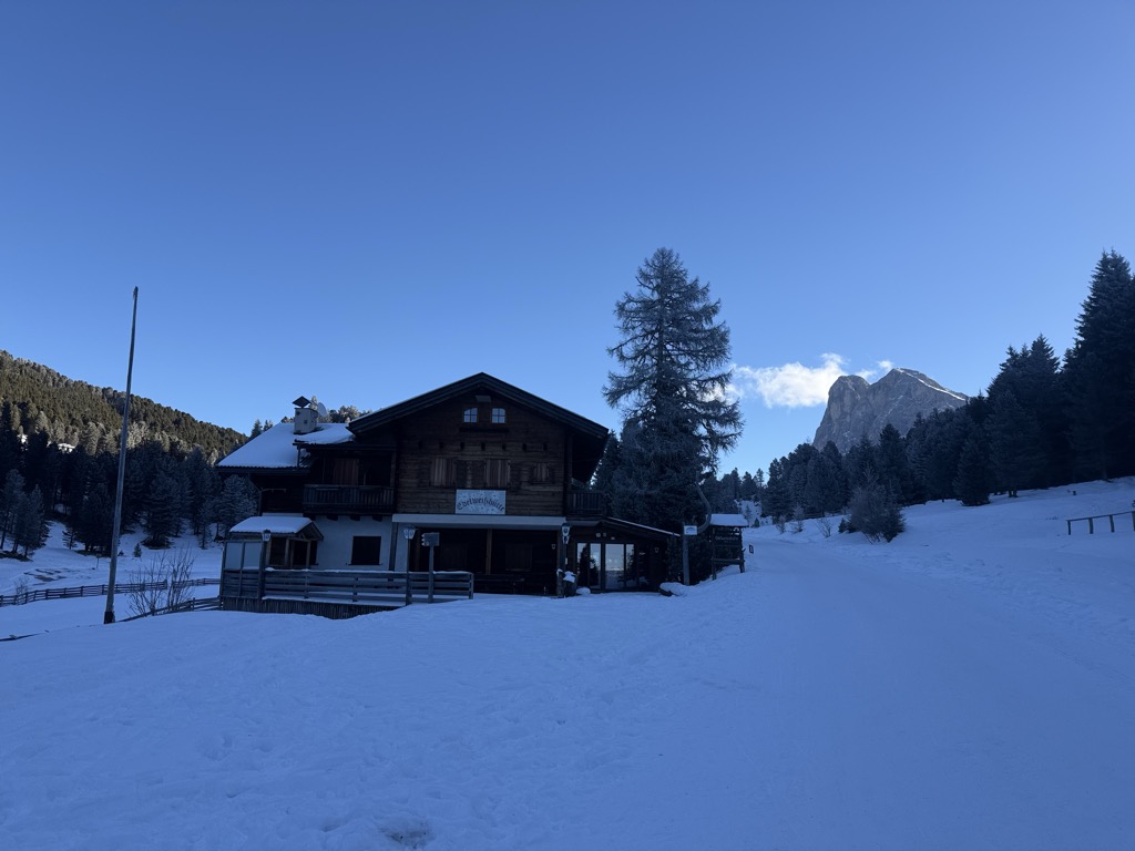
A hut at 1,841 m at the foot of the Sass de Putia, standing directly on the road over the Passo delle Erbe above Funes.
Zirmaitalm
9 km away, in Varna/Vahrn
A dairy hut on the pastures above Varna, north of Bressanone in the Val Isarco.
Sterzing, Pfitsch und FreienfeldAlbergo Halslhütte
9 km away, in Funes/Villnöß
A guest house at 1,866 m above Funes on the western edge of the Puez-Odle park, its kitchen known for stew and dumplings, game, and Kaiserschmarrn.
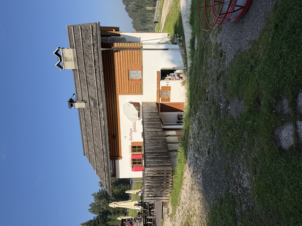
Halslhütte
9 km away, in Funes/Villnöß
A Tyrolean mountain inn at 1,866 m above Funes, with terrace, garden and playground, on the way from S. Maddalena over the Halsl to the Passo delle Erbe.
Malga Dusler
11 km away, in Funes/Villnöß
A pasture hut at 1,800 m above Funes looking across to the Odle, on the Geisler circular hike, its menu built on the local Tyrolean kitchen.
Sterzing, Pfitsch und FreienfeldRifugio delle Odle
11.1 km away, in Funes/Villnöß
A hut at 1,996 m under the walls of the Odle in the Val di Funes, at the top of the pastures on the western edge of the Puez-Odle park.
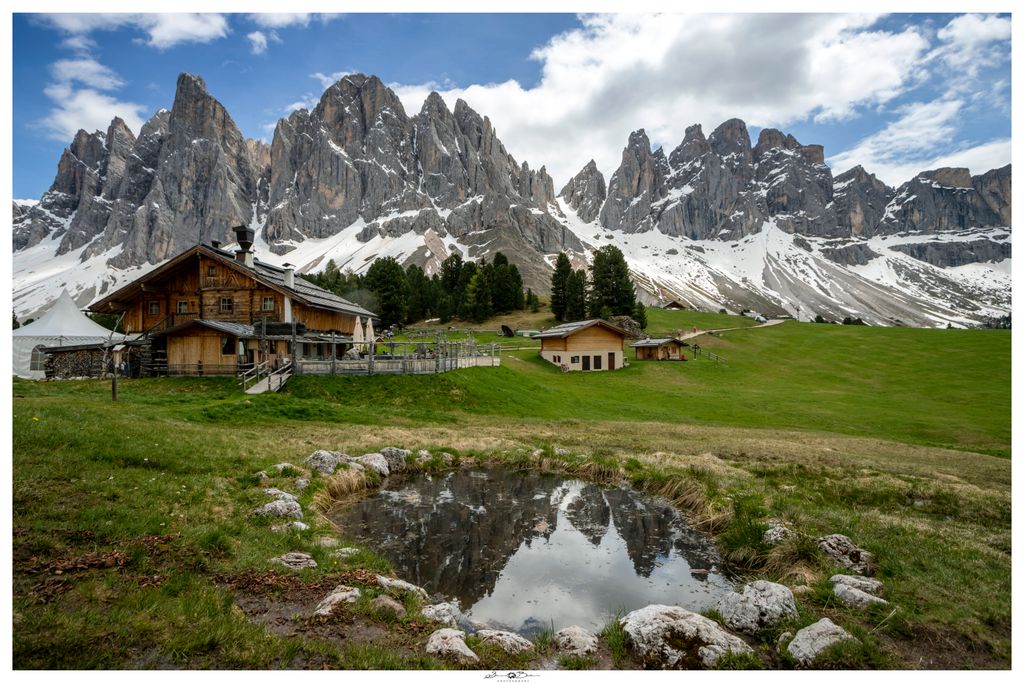
Malga Geisleralm
11.2 km away, in Funes/Villnöß
A family hut at 1,996 m below the Odle above Funes, with a Tyrolean stube, a wide terrace and its own Geisler cinema.
Malga Casnago
11.3 km away, in Funes/Villnöß
A pasture hut at 2,006 m on the Funes side of the Odle, on the Dolorama trail, cooking traditional Tyrolean dishes from the produce of local farms.
Malga Glatsch
11.4 km away, in Funes/Villnöß
A quiet hut at 1,906 m among the firs at the foot of the Odle above Funes, standing on the Adolf Munkel trail and cooking with herbs from its own garden.
Malga Kaserill
11.8 km away, in Funes/Villnöß
A pasture hut at 1,929 m above Funes with a dairy of its own, selling cheese alongside home-made cakes, yoghurt and fruit juices.
Rifugio Cir
11.9 km away, in San Martino in Badia/St. Martin in Thurn
A mountain refuge in the hills above San Martino in Badia, on the Ladin side of the Val Badia.
Sterzing, Pfitsch und FreienfeldRifugio Genova
13.1 km away, in Funes/Villnöß
A hut at 2,306 m above Funes in the Puez-Odle park, on the Alta Via delle Dolomiti n. 8 and the climb to the Sass de Putia, open mid-June to mid-October.
Nothing of this kind in Bressanone/Brixen.
Routes
50 routes, an even mix of activities · see the rest on suedtirol.info ↗
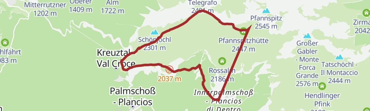
Kreuztal - Rossalm
A short walk from Kreuztal to the Rossalm dairy on the Plose slopes above Bressanone.
- 2.7 km
- Distance
- 147 m
- Ascent
- 52 min
- Duration
- 69
- Check-ins
Open route BrixenThree Summits Tour on the Plose above Bressanone/Brixen
A hike on the Plose above Brixen taking in three summits: the Große Gabler, the Telegraph and the Pfannspitz.
- 14.2 km
- Distance
- 693 m
- Ascent
- 5 h 7 min
- Duration
- 175
- Check-ins
 Großer Gabler - Monte Forca Grande 2 576 m
- Telegraph - Monte Telegrafo 2 491 m
- Pfannspitz 2 545 m
- Schönjöchl 2 301 m
- Pfannspitz - Monte Fana 2 545 m
- Tatschöchl - Il Montaccio 2 444 m
- +7
Open route BrixenAlpine Path of the Dolomites no. 2 - stage 2 & 3
Two stages of the 180-kilometre high route from Brixen to Feltre, from the Plose hut to the Genova hut through the Puez-Odle park, with Sasso Putia in sight throughout.
- 23.6 km
- Distance
- 1 317 m
- Ascent
- 9 h 16 min
- Duration
- 437
- Check-ins
 Peitlerscharte - Forcella de Putia 2 357 m
 Schlüterhütte - Rifugio Genova 2 306 m
- Utia de Puez 2 475 m
- Cësa de Puez 2 478 m
- Kreuzjoch - Furcela de Munt de Furćia - Forcella di San Zenòn 2 293 m
- Ju dla Crusc - Kreuzkofeljoch - Passo Poma 2 340 m
- +8
Open route San Vigilio DolomitesSki alpinismo Gabler
An easy ski tour above the Funes valley to the Grosser Gabler, a top that repays the climb.
- 12.2 km
- Distance
- 924 m
- Ascent
- 926 m
- Descent
- 4 h 11 min
- Duration
- 66
- Check-ins
- Großer Gabler - Monte Forca Grande 2 576 m
- Gasthaus Halslhütte 1 866 m
- Gabler Biwak - Bivacco Gabler 2 570 m
- Edelweißhütte 1 841 m
- Egarter-Gampen-Alm 1 993 m
- Tschageralm 1 852 m
Open route Sterzing, Pfitsch und FreienfeldBrixen Bikepark: Sky Line
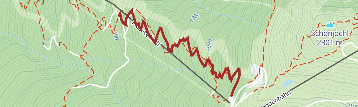
The oldest and fastest descent in the Brixen bike park, running from the top of the Plose gondola past La Finestra to the middle station.
- 2.4 km
- Distance
- 0 m
- Ascent
- 24 min
- Duration
- 19
- Check-ins
Open route BrixenKreuztal/Valcroce - rifugio Pfannspitz Hütte
A gravel track from Kreuztal on trail 14, turning off after about 1.5 kilometres and climbing straight to the Pfannspitz hut; ridden as much as walked.
- 4.0 km
- Distance
- 412 m
- Ascent
- 40 min
- Duration
- 27
- Check-ins
Open route Brixen457 Dalle alture pittoresche al fascino delle città medievali: Da Castelrotto a Vipiteno
An e-bike traverse dropping from Castelrotto into the Eisacktal, then following the valley north to Vipiteno largely on surfaced roads.
- 65.4 km
- Distance
- 762 m
- Ascent
- 6 h 33 min
- Duration
- 80
- Check-ins
- Paterbichl 559 m
- Klammwirt 559 m
- Tourist Information 1 069 m
- Senfter 532 m
- Fürholz 554 m
- Hilm 488 m
- +10
Open route Seis am SchlernKreuztal/Valcroce - Rossalm
A short gravel track shared with cyclists, from the Plose cable car top station to the Rossalm and back the same way.
- 2.4 km
- Distance
- 152 m
- Ascent
- 18 min
- Duration
- 36
- Check-ins
Open route BrixenEisacktal Valley Bike Route: Brenner - Bozen
A long, almost entirely downhill valley ride from the Brenner border to Bozen, following the Eisack river the whole way.
- 96.5 km
- Distance
- 313 m
- Ascent
- 9 h 14 min
- Duration
- 185
- Check-ins
- Paterbichl 559 m
- Mila Bistro 282 m
- Klammwirt 559 m
- Hiasele 312 m
- Agrocenter Bozen OHG 296 m
- Senfter 532 m
- +22
Open route Gitschberg - JochtalWoodyWalk: The fun-filled family hike on the Plose mountain
A short educational trail on the Plose with play stations, suitable for prams, looking across to the Peitlerkofel and the peaks of the Geisler group.
- 5.5 km
- Distance
- 162 m
- Ascent
- 1 h 42 min
- Duration
- 69
- Check-ins
Open route BrixenThe Three-Peaks Tour on the Plose near Brixen
A round of the Große Gabler, the Telegraph and the Pfannspitz on the Plose, the mountain above Brixen in the Eisack valley.
- 12.9 km
- Distance
- 755 m
- Ascent
- 5 h 17 min
- Duration
- 165
- Check-ins
- Großer Gabler - Monte Forca Grande 2 576 m
- Telegraph - Monte Telegrafo 2 491 m
- Pfannspitz 2 545 m
- Pfannspitz - Monte Fana 2 545 m
- Rossalm 2 186 m
- Plosehütte - Rifugio Plose 2 452 m
- +4
Open route Valle Isarco - EisacktalThree Summits Tour on the Plose above Brixen
A longer version of the Plose three-summit round above Brixen, over the Große Gabler, the Telegraph and the Pfannspitz.
- 19.8 km
- Distance
- 997 m
- Ascent
- 6 h 50 min
- Duration
- 175
- Check-ins
- Großer Gabler - Monte Forca Grande 2 576 m
- Telegraph - Monte Telegrafo 2 491 m
- Pfannspitz 2 545 m
- Schönjöchl 2 301 m
- Pfannspitz - Monte Fana 2 545 m
- Tatschöchl - Il Montaccio 2 444 m
- +7
Open route BrixenBrixen Bikepark: Jerry Line
A green-graded park line from Schönboden down to Palmschoß, 300 m of descent over soft bends with no jumps, built for beginners and children.
- 4.2 km
- Distance
- 0 m
- Ascent
- 29 min
- Duration
- 14
- Check-ins
Open route BrixenFrom Lüsen around the Plose-Massive
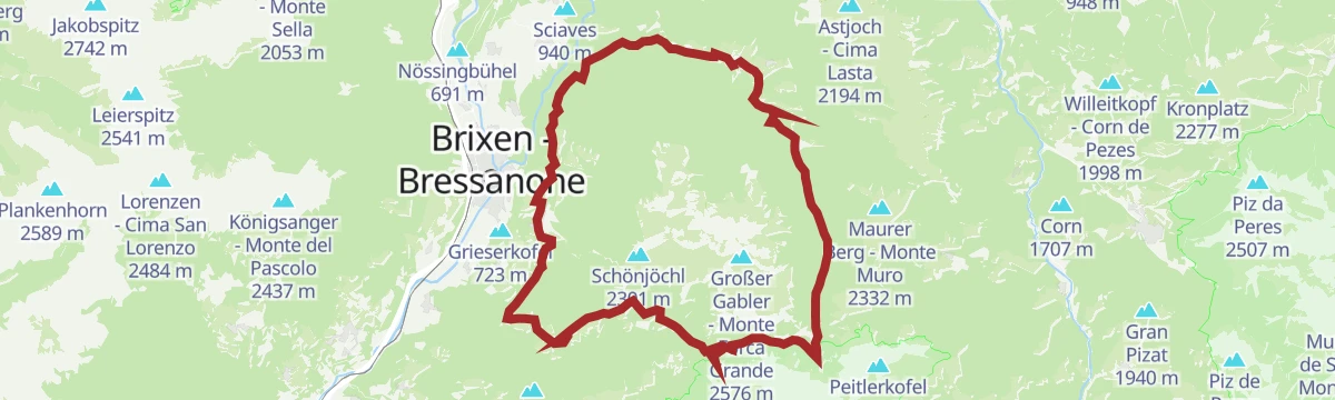
A full circuit of the Plose from Luson, over the Passo Eores at 1,863 m by the Halslhütte and back down the Hintere Lüsnertal.
- 46.2 km
- Distance
- 1 422 m
- Ascent
- 5 h 27 min
- Duration
- 70
- Check-ins
- Gasthaus Halslhütte 1 866 m
- Rodelalm 1 874 m
- Passo Eores (Halsl) 1 863 m
- Edelweißhütte 1 841 m
- Goller 1 310 m
- Zimmerer 1 596 m
- +12
Open route VillnössCastelfeder – Bolzano – Valle Isarco
The Adige cycle path from the Bolzano basin up the Isarco valley by Chiusa toward Bressanone.
- 76.1 km
- Distance
- 617 m
- Ascent
- 7 h 12 min
- Duration
- 183
- Check-ins
- Paterbichl 559 m
- Mila Bistro 282 m
- Kampill Center 270 m
- Klammwirt 559 m
- Hiasele 312 m
- Agrocenter Bozen OHG 296 m
- +17
Open route Südtirols SüdenWoodyWalk – a panoramic circular trail on the Plose mountain
A short circular family trail at the top of the Plose cable car, with play stations and views across to the Geisler group.
- 5.0 km
- Distance
- 164 m
- Ascent
- 1 h 35 min
- Duration
- 36
- Check-ins
Open route Valle Isarco - EisacktalAdventure circular hiking route Lorggen on the Plose
A circuit from the top of the Plose cable car, first on the WoodyWalk, then off at the viewing platform into dense old forest with carved forest guardians, returning by the Pfannspitz lift.
- 8.1 km
- Distance
- 656 m
- Ascent
- 4 h 12 min
- Duration
- 102
- Check-ins
- Plosehütte - Rifugio Plose 2 452 m
- La Finestra 2 040 m
- S' Stuebele 2 020 m
- Lüsner Scharte - Forcella Luson 2 373 m
- Pfannspitzhütte 2 447 m
- Skihütte 1 900 m
Open route BrixenDolomites Panorama Trail on the Plose
A long panorama trail on the Plose looking out over the ranges of the western Dolomites.
- 15.4 km
- Distance
- 547 m
- Ascent
- 4 h 59 min
- Duration
- 102
- Check-ins
- Rossalm 2 186 m
- La Finestra 2 040 m
- S' Stuebele 2 020 m
- Skihütte 1 900 m
- Schatzerhütte - Rifugio Schatzer 1 986 m
- Egarter-Gampen-Alm 1 993 m
- +2
Open route BrixenBrixen Bikepark: Palm Pro Line
A hand-built line dropping from Schönboden at 2,017 m past Forestis, the hardest in the park, with jumps, features and steeper sections.
- 2.4 km
- Distance
- 0 m
- Ascent
- 18 min
- Duration
- 7
- Check-ins
Open route BrixenE-Bike Tour Albeins-Nafen-St. Peter-Ranui
An e-bike climb out of the Eisack valley into Villnöß, passing the Filler Tenne and the Waldschenke below the Geisler peaks.
- 23.0 km
- Distance
- 988 m
- Ascent
- 2 h 42 min
- Duration
- 63
- Check-ins
- Waldschenke 1 391 m
- Klammwirt 559 m
- Fürholz 554 m
- Filler Tenne 1 248 m
- Tourist Info Villnöß 1 139 m
- Senfter 546 m
- +5
Open route Villnöss457 From picturesque heights to medieval town flair - from Kastelruth to Sterzing
A long valley ride from the terrace above the Eisack down to the river, then north past Paterbichl to Sterzing, mostly on paved paths.
- 65.0 km
- Distance
- 758 m
- Ascent
- 6 h 31 min
- Duration
- 76
- Check-ins
- Paterbichl 559 m
- Klammwirt 559 m
- Tourist Information 1 069 m
- Senfter 532 m
- Fürholz 554 m
- Hilm 488 m
- +9
Open route SterzingCircular Hike North From S. Andrä to S. Leonhardo
A short walk uphill from St Andrä to the church of St Johann in Karnol, on to St Leonhard and back down.
- 6.9 km
- Distance
- 231 m
- Ascent
- 2 h 12 min
- Duration
- 12
- Check-ins
- Schuster 1 043 m
- Wiesmair 1 067 m
- Höllrigl 1 068 m
- Bad Burgstall 1 053 m
- Burgerhof 1 041 m
- Burger 1 042 m
Open route BrixenCinema on the Plose: Sunrise Spectacle From the Große Gabler Summit
A pre-dawn climb from the Skihütte by the Rossalm pasture to the Große Gabler at 2,575 metres, timed for the sun coming up over the Geisler and the Peitlerkofel.
- 9.9 km
- Distance
- 689 m
- Ascent
- 4 h 36 min
- Duration
- 86
- Check-ins
- Großer Gabler - Monte Forca Grande 2 576 m
- Rossalm 2 186 m
- Gabler Biwak - Bivacco Gabler 2 570 m
- Skihütte 1 900 m
- Schatzerhütte - Rifugio Schatzer 1 986 m
Open route BrixenColle Libero – Valcroce Hike
Trail 5 to the cable car car park and the Niederrutzner hut, then steep forest above Mellaun to the Freienbühel and along the ridge north-east to the Kreuztal station.
- 7.8 km
- Distance
- 1 124 m
- Ascent
- 4 h 30 min
- Duration
- 48
- Check-ins
- Freienbühel 1 773 m
- La Finestra 2 040 m
- S' Stuebele 2 020 m
- Trametschhütte 1 121 m
- P3 1 060 m
- Plosestodl 1 062 m
Open route BrixenBrixen Bikepark: Hammer Line
A blue-graded bike-park line of just under 2 km and 165 m of descent, with jumps and rolling turns, named after the landowner whose woods it crosses.
- 1.9 km
- Distance
- 0 m
- Ascent
- 14 min
- Duration
Open route BrixenBike Tour Brixen - Villnöß
A climb from Albeins on the valley floor up into Villnöß on road, gravel and forest tracks, towards the Odle peaks and their alpine huts.
- 20.5 km
- Distance
- 981 m
- Ascent
- 2 h 27 min
- Duration
- 43
- Check-ins
- Waldschenke 1 391 m
- Filler Tenne 1 248 m
- Tourist Info Villnöß 1 139 m
- Gufelfelderhof 896 m
- Work & Office Center Kampan 572 m
- Fäckl 981 m
- +4
Open route BrixenCircular hike north from St. Andrä to St. Leonhard
A short hill walk from St Andrä past the church of St Johann in Karnol to St Leonhard, returning to the start.
- 6.9 km
- Distance
- 241 m
- Ascent
- 2 h 14 min
- Duration
- 12
- Check-ins
- Schuster 1 043 m
- Wiesmair 1 067 m
- Höllrigl 1 068 m
- Bad Burgstall 1 053 m
- Burgerhof 1 041 m
- Burger 1 042 m
Open route Brixen(CAI mountain hut)
A short climb from the Kreuztal cable car station on the Plose to the Plosehütte, the CAI hut on the ridge above Brixen.
- 4.6 km
- Distance
- 414 m
- Ascent
- 1 h 49 min
- Duration
- 77
- Check-ins
- Plosehütte - Rifugio Plose 2 452 m
- La Finestra 2 040 m
- S' Stuebele 2 020 m
- Lüsner Scharte - Forcella Luson 2 373 m
Open route BrixenFrom St. Leonhard to Kreuztal along the Brixen High Alpine Trail
From St Leonhard above Brixen, reached by the 322 bus, through forest and pasture to the Ackerbodenalm and on by the high trail to the Kreuztal cable car station.
- 10.7 km
- Distance
- 1 027 m
- Ascent
- 4 h 41 min
- Duration
- 35
- Check-ins
- La Finestra 2 040 m
- Ochsenalm - Malga Buoi 2 085 m
- Gasser 1 266 m
- Flöterbödel 2 064 m
- Peniederhof 1 317 m
- Prast 1 380 m
- +1
Open route BrixenBrixen Bikepark: Rock Line
A steep, demanding line split off in 2024 from the lower half of its older neighbour, dropping from the Plose mid-station to just above the valley.
- 2.4 km
- Distance
- 0 m
- Ascent
- 27 min
- Duration
Open route BrixenTour in bicicletta da Vipiteno a Chiusa
A ride down the valley from Vipiteno to Chiusa, passing the Habsburg fortress at Fortezza and the old town centres on the way.
- 48.6 km
- Distance
- 137 m
- Ascent
- 4 h 35 min
- Duration
- 41
- Check-ins
- Paterbichl 559 m
- Klammwirt 559 m
- Senfter 532 m
- Fürholz 554 m
- Klausen Informationsbüro - Chiusa 533 m
- Tourismusverein Sterzing - Associazione Turistica 957 m
- +2
Open route Sterzing, Pfitsch und FreienfeldS. Andrea – Cornale Way of the Cross
An easy circuit from St Andrä by forest paths to Karnol, up field track 6 to Burgstall and back south through the woods on trail 12.
- 5.4 km
- Distance
- 208 m
- Ascent
- 1 h 47 min
- Duration
- 12
- Check-ins
- Schuster 1 043 m
- Wiesmair 1 067 m
- Höllrigl 1 068 m
- Bad Burgstall 1 053 m
- Burgerhof 1 041 m
- Burger 1 042 m
Open route BrixenThe Brixen High Mountain Trail on the Plose Mountain
From the Kreuztal station, path 30 along the treeline to the Ochsenalm, then path 6 to the Plosescharte, the Leonhard cross, the Telegraph summit and the Plose hut.
- 10.8 km
- Distance
- 548 m
- Ascent
- 3 h 59 min
- Duration
- 75
- Check-ins
- Telegraph - Monte Telegrafo 2 491 m
- Schönjöchl 2 301 m
- Plosehütte - Rifugio Plose 2 452 m
- La Finestra 2 040 m
- Ochsenalm - Malga Buoi 2 085 m
- Flöterbödel 2 064 m
- +1
Open route BrixenRadlsee und Königsanger
From the Perlung car park, path 8 up through forest to the Bärengraben, then the ridge and forest tracks to the Radlseehaus and the north-east crest of the Königsanger.
- 5.8 km
- Distance
- 1 038 m
- Ascent
- 3 h 55 min
- Duration
- 24
- Check-ins
- Königsanger - Monte del Pascolo 2 437 m
- AVS Notraum - AVS Bivacco di emergenza 2 290 m
- Radelsee-Haus - Rifugio Lago Rodella 2 280 m
Open route BrixenFrom Klausen to Brixen
An almost level family ride along the Isarco from Chiusa up to Bressanone, whose old centre and Hofburg sit at the far end.
- 25.3 km
- Distance
- 41 m
- Ascent
- 2 h 17 min
- Duration
- 31
- Check-ins
Open route Klausen, Barbian, Villanders, FeldthurnsS. Andrea|St. Andrä Circuit Trail
An easy circuit around the village of St Andrä on the lower slopes of the Plose above Brixen.
- 5.3 km
- Distance
- 186 m
- Ascent
- 1 h 42 min
- Duration
- 12
- Check-ins
- Schuster 1 043 m
- Wiesmair 1 067 m
- Höllrigl 1 068 m
- Bad Burgstall 1 053 m
- Burgerhof 1 041 m
- Burger 1 042 m
Open route Valle Isarco - EisacktalKreuztal - Pfannspitzhütte
A short climb from the Kreuztal cable car station on the Plose to the Pfannspitz hut on the ridge below the summit.
- 4.3 km
- Distance
- 412 m
- Ascent
- 1 h 47 min
- Duration
- 60
- Check-ins
- La Finestra 2 040 m
- S' Stuebele 2 020 m
- Lüsner Scharte - Forcella Luson 2 373 m
- Pfannspitzhütte 2 447 m
Open route BrixenThe Keschtnweg Chestnut Trail form Brixen to Klausen
A section of the chestnut trail from Brixen to Klausen, through sweet chestnut groves and the worked terraces of the Eisack valley.
- 15.6 km
- Distance
- 685 m
- Ascent
- 5 h 23 min
- Duration
- 21
- Check-ins
- Säbener Berg 735 m
- Klausen Informationsbüro - Chiusa 533 m
- Saderhof 912 m
- Breitwieser 814 m
- Zimmermandl 791 m
- Buschenschank Moar Zur Viersch 869 m
- +2
Open route BrixenCycle tour from Sterzing to Klausen
A long valley run from the medieval centre of Sterzing past the fortress of Franzensfeste down to Klausen, dropping over 400 m overall.
- 48.5 km
- Distance
- 128 m
- Ascent
- 4 h 34 min
- Duration
- 28
- Check-ins
- Paterbichl 559 m
- Senfter 532 m
- Fürholz 554 m
- Klausen Informationsbüro - Chiusa 533 m
- Tourismusverein Sterzing - Associazione Turistica 957 m
- Work & Office Center Kampan 572 m
- +1
Open route Klausen, Barbian, Villanders, FeldthurnsS. Leonhardo Circular Hiking Trail – Direction South
From the Plansoler inn, trail 6 down past the church to the lower road for Burgstall, forest road 12 to St Andrä, then back north by the Kreuzweg through Karnol.
- 6.7 km
- Distance
- 294 m
- Ascent
- 2 h 18 min
- Duration
- 12
- Check-ins
- Schuster 1 043 m
- Wiesmair 1 067 m
- Höllrigl 1 068 m
- Bad Burgstall 1 053 m
- Burgerhof 1 041 m
- Burger 1 042 m
Open route BrixenOn the Dolomites High Route and Brixen High Route to Ochsenalm
From the cable car station, path 7 across the south-east flank of the Schönjöchl to its saddle, then the Plose hut and the Telegraph with its panorama table, back on the Zirm high path.
- 10.5 km
- Distance
- 515 m
- Ascent
- 3 h 47 min
- Duration
- 58
- Check-ins
- Plosehütte - Rifugio Plose 2 452 m
- La Finestra 2 040 m
- Ochsenalm - Malga Buoi 2 085 m
- Flöterbödel 2 064 m
- Plosescharte - Forcella Plose 2 220 m
Open route BrixenThe Keschtnweg chestnut trail from Brixen to Klausen
The Keschtnweg from Brixen down the Eisack valley to the artists' town of Klausen, through old sweet chestnut groves and cultivated hillside.
- 15.7 km
- Distance
- 688 m
- Ascent
- 5 h 25 min
- Duration
- 21
- Check-ins
- Säbener Berg 735 m
- Klausen Informationsbüro - Chiusa 533 m
- Saderhof 912 m
- Breitwieser 814 m
- Zimmermandl 791 m
- Buschenschank Moar Zur Viersch 869 m
- +2
Open route BrixenCircular Hike to St. Andrä on mount Plose (in southerly direction)
An easy circuit from Klerant across to St Andrä on the low hills below the Plose.
- 6.0 km
- Distance
- 224 m
- Ascent
- 1 h 58 min
- Duration
- 5
- Check-ins
Open route BrixenKreuztal/Valcroce - CAI mountain hut
A gravel track from Kreuztal up to the Plosehütte at about 2,450 metres, where a panorama table at the Telegraph names the peaks in view.
- 4.3 km
- Distance
- 417 m
- Ascent
- 1 h 48 min
- Duration
- 44
- Check-ins
Open route BrixenFrom Gereuth on Pfeffersberg mountain to the Hundskopf summit and Radlseehütte mountain hut
A climb on the Pfeffersberg to the alpine club hut by the Radlsee, with an easy scramble onto the Hundskopf above it.
- 9.4 km
- Distance
- 965 m
- Ascent
- 5 h 55 min
- Duration
- 14
- Check-ins
- Hundskopf - Cima Cane 2 356 m
- AVS Notraum - AVS Bivacco di emergenza 2 290 m
- Radelsee-Haus - Rifugio Lago Rodella 2 280 m
Open route BrixenFrom Natz to the Historic Brixen
A level walk from Naz by way of Elvas and then down into Bressanone, on the plateau above the Isarco.
- 5.3 km
- Distance
- 12 m
- Ascent
- 1 h 35 min
- Duration
- 5
- Check-ins
Open route Natz–SchabsAckerboden – Ochsenalm Farm – Kreuztal Hiking Tour
Trail 6 up to the Ackerboden meadows at 1,753 metres and the Ochsenalm at 2,085, then south on the Brixen high trail to the Kreuztal cable car station.
- 10.2 km
- Distance
- 720 m
- Ascent
- 3 h 40 min
- Duration
- 26
- Check-ins
Open route BrixenEisacktal Valley Wine and Apple Trail
A long circuit on the Archeopfad from Brixen through vineyards and orchards up to the apple country of the Natz-Schabs plateau, passing two biotopes and the Neustift monastery.
- 17.1 km
- Distance
- 436 m
- Ascent
- 5 h 5 min
- Duration
- 3
- Check-ins
Open route BrixenOn the archaeological trail between Brixen and Elvas
An easy trail on the terraces between Brixen and Elvas, following the archaeological route above the Eisack valley.
- 5.1 km
- Distance
- 283 m
- Ascent
- 2 h
- Duration
- 5
- Check-ins
- Pinatzbühel - Colle Pinatz 855 m
- Krückelhuben 735 m
- Laurin 688 m
- Untertörggeler 713 m
- Obertörggeler 719 m
- Guggerhof 715 m
Open route Valle Isarco - EisacktalHistorical Tour from Bressanone/Brixen to Fortezza|Franzensfeste
A themed valley walk from Brixen north to Franzensfeste, following the history trail along the Eisack.
- 11.8 km
- Distance
- 359 m
- Ascent
- 3 h 27 min
- Duration
- 23
- Check-ins
- Sandgrube Neuhäusler 637 m
- Nuevo Foodland 607 m
- Neuhäusler Hof 620 m
- Gasthaus zum See 695 m
- Wachhaus 827 m
- Pulvermagazin - Polveriera 833 m
- +2
Open route Valle Isarco - Eisacktal
No routes of this kind in Bressanone/Brixen yet.
The region's own picks

Featured route
Kreuztal - Rossalm
A short walk from Kreuztal to the Rossalm dairy on the Plose slopes above Bressanone.
Planning a trip to Bressanone/Brixen?
Everything else Trentino-Alto Adige/Südtirol has, in one place


Take Bressanone/Brixen with you into the mountains
Every route on this page with 3D terrain, GPX navigation and offline maps — including the valleys with no signal.
Data sources
- Official website: suedtirol.info ↗
- Routes and highlights: Brixen, Sterzing, Pfitsch und Freienfeld, Valle Isarco - Eisacktal, Villnöss, Klausen, Barbian, Villanders, Feldthurns, YesAlps, San Vigilio Dolomites, Seis am Schlern, Gitschberg - Jochtal, Südtirols Süden, Sterzing, Natz–Schabs
- Published as open data by the tourist boards named above.
- Region summary generated from the board's own material.
