






Curated by APT Valsugana e Lagorai
Asiago
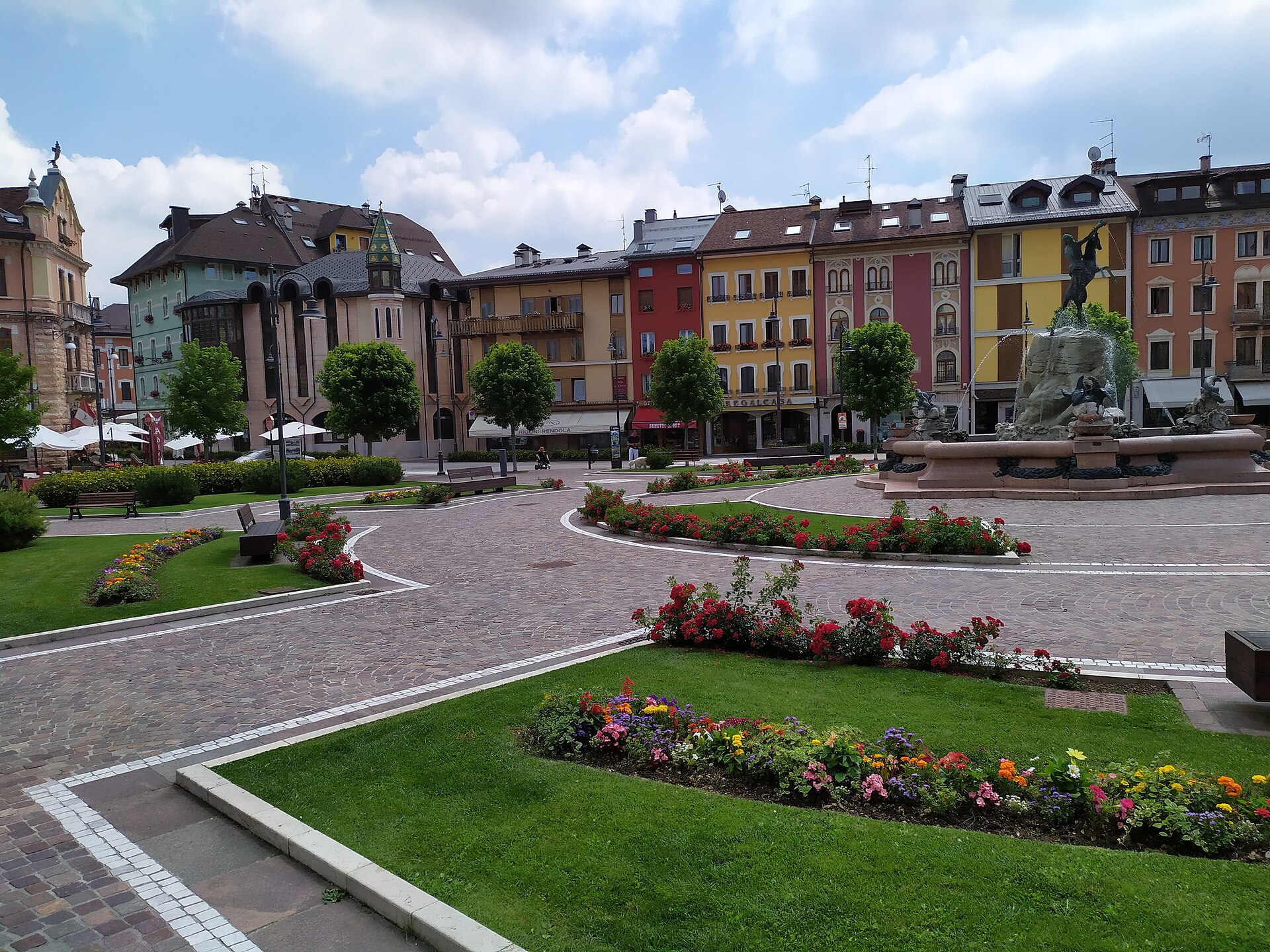
Main town of the Sette Comuni plateau, once capital of its own self-governing federation and rebuilt after being left in no-man's-land in 1916.
Photo: Nordavind · CC BY-SA 4.0 licence
- 1Highlights
- 8Routes
- Featured summit · Monte Ortigara
Highlights
1 from neighbouring places
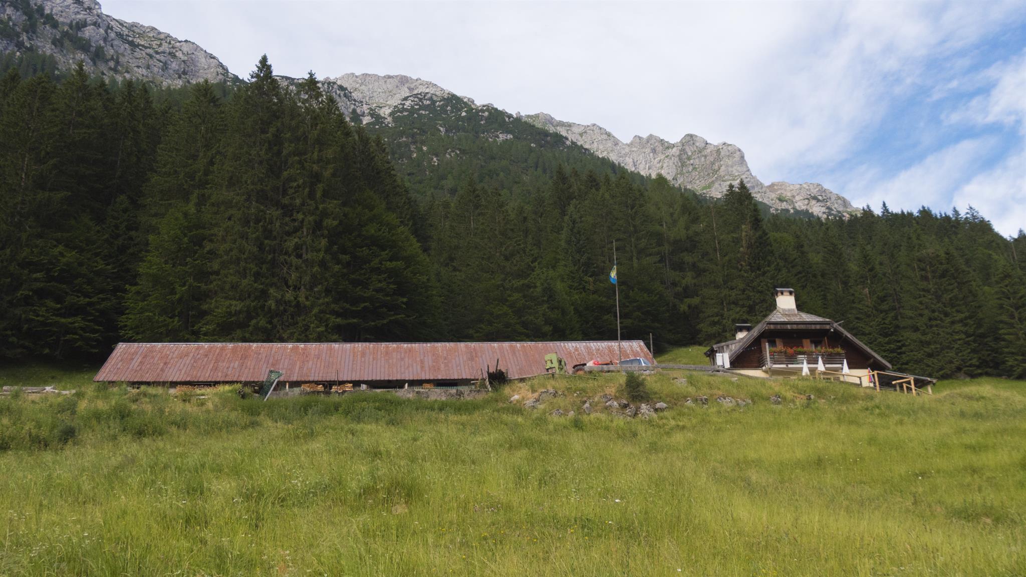
Malga Rio Secco
A working dairy hut on the Asiago plateau, on the trails through the Val Rio Secco.
Chiesetta di Santa Zita
13 km away, in Levico Terme
A small chapel above Levico Terme, on the path up towards the Panarotta.
Nothing of this kind in Asiago.
Routes
12 from neighbouring places
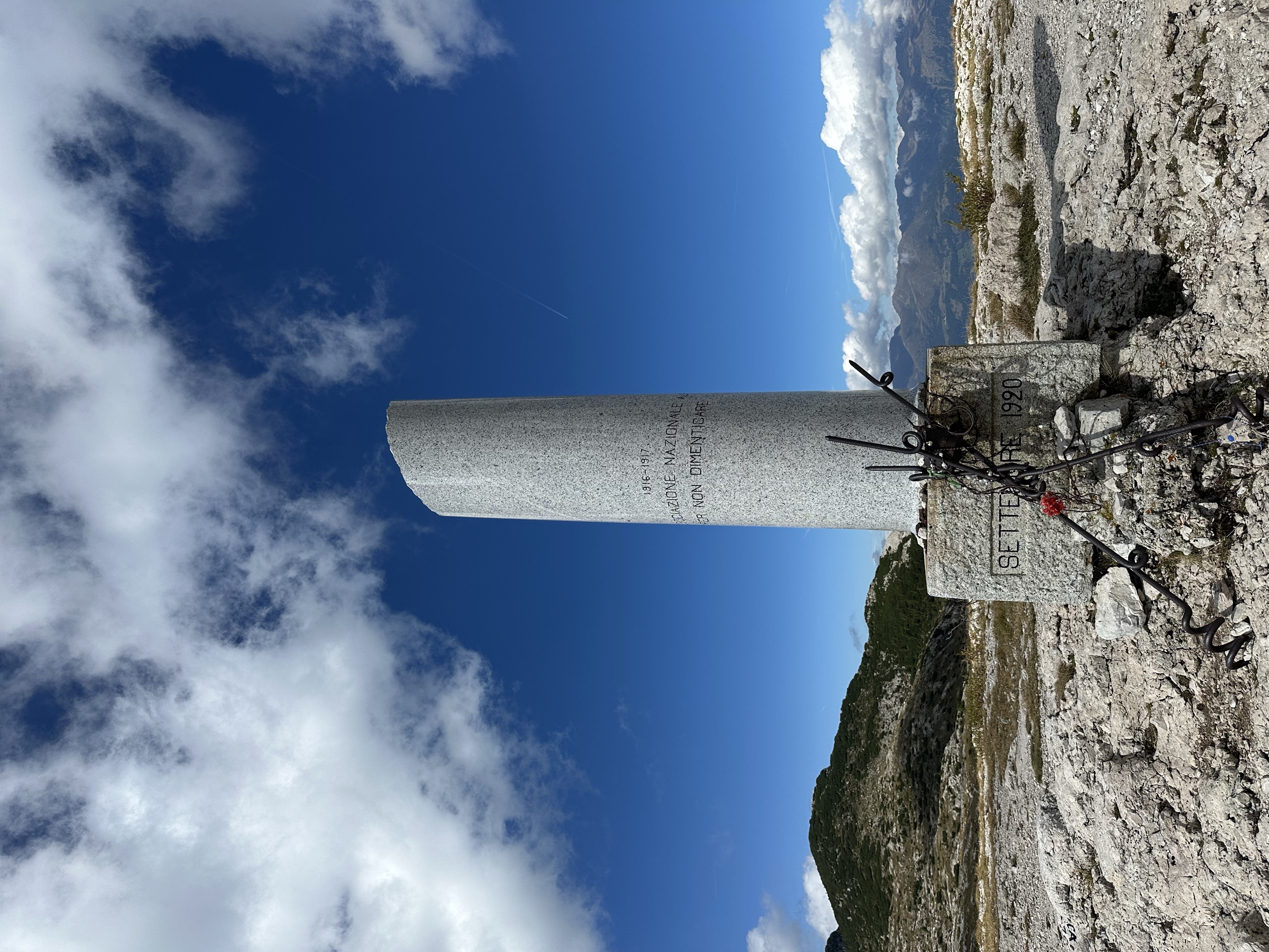
Hiking trail - Monte Ortigara and Caldiera Peak
The best-known summit on the Asiago plateau, climbed past the trenches and monuments of the 1916 battle.
- 8.8 km
- Distance
- 504 m
- Ascent
- 3 h 33 min
- Duration
- 57
- Check-ins
 Monte Ortigara 2 106 m
- Osservatorio Torino 2 102 m
- Cima della Campanella 1 991 m
 Rifugio Cecchin 1 900 m
 Passo dell'Agnella 2 008 m
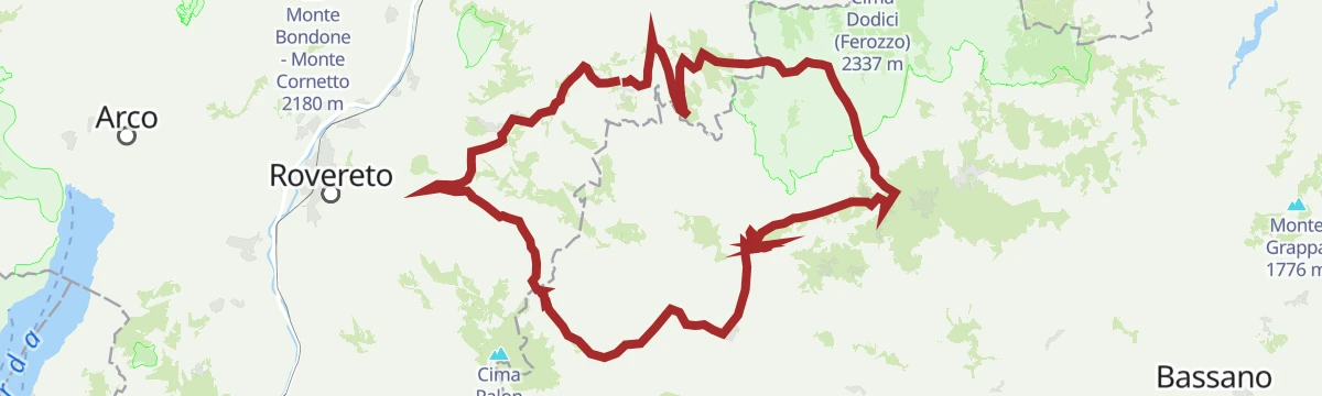
Open route APT Valsugana e LagoraiLavarone - Serrada - Passo Borcola - Arsiero - Pedescala - Rotzo - Luserna - Gionghi
A very long day along the Trentino-Veneto boundary, taking in the Sella di Serrada, the Passo Borcola and the Passo Vezzena.
- 116.2 km
- Distance
- 3 247 m
- Ascent
- 13 h 22 min
- Duration
- 80
- Check-ins
- Passo Vezzena 1 402 m
- Passo del Cost 1 290 m
- Passo Sommo 1 341 m
- Chalet Passo Sommo 1 348 m
- Sella di Serrada 1 250 m
- Ristorante all'Antico Termine 1 295 m
- +5
Open route Azienda per il Turismo Alpe CimbraWalk - Eagle Vaia from the Valmaron Refuge
A walk over the Marcesina plateau past the dairy huts of Malga Val Bella and Malga Monte Cucco to the wooden eagle carved after storm Vaia.
- 11.4 km
- Distance
- 231 m
- Ascent
- 3 h 15 min
- Duration
- 36
- Check-ins
- Monte Cucco 1 387 m
- Malga II° Lotto Valmaron - Malga Val Bella 1 381 m
- Passo della Forcellona 1 435 m
- Malga Marcesina di Sopra 1 364 m
- Rifugio Valmaron 1 352 m
- Malga Monte Cucco 1 372 m
Open route APT Valsugana e LagoraiFolgaria - Val d'Astico - Pedescala - Roana - Roana small lake - Vezzena Pass - Lavarone
A long road circuit from Folgaria over the Sommo pass into the Astico valley, returning by the Vezzena pass.
- 87.3 km
- Distance
- 2 240 m
- Ascent
- 9 h 51 min
- Duration
- 77
- Check-ins
- Passo Vezzena 1 402 m
- Passo del Cost 1 290 m
- Passo Sommo 1 341 m
- Chalet Passo Sommo 1 348 m
- Ristorante all'Antico Termine 1 295 m
- Malga Rivetta 1 355 m
- +4
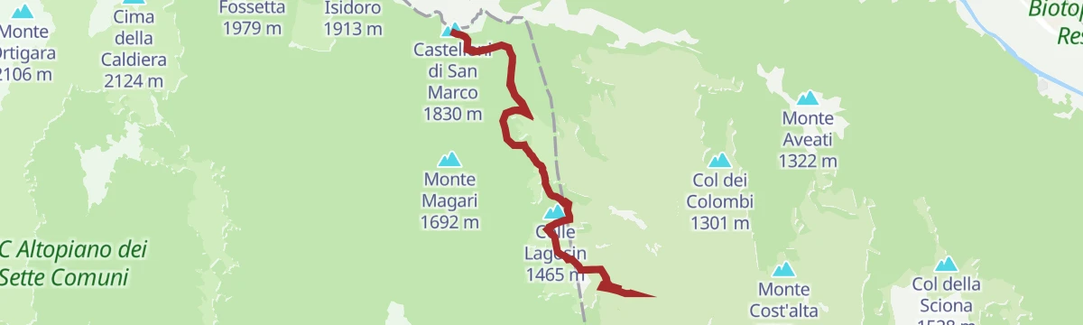
Open route Azienda per il Turismo Alpe CimbraHiking trail - Castelloni di San Marco Labyrinth
A route to the Castelloni di San Marco, a maze of limestone towers and passages above the Valsugana, drained underground towards the Bigonda cave.
- 13.3 km
- Distance
- 639 m
- Ascent
- 4 h 50 min
- Duration
- 24
- Check-ins
- Castelloni di San Marco 1 830 m
- Monte Aste Alte m. 1745 1 785 m
- Selletta dei Castelloni 1 818 m
- Rifugio Barricata 1 351 m
- Centro Visitatori Riparo Dalmeri 1 338 m
- Malga Campo Capra di Sotto 1 288 m
Open route APT Valsugana e LagoraiLavarone - Luserna - Rotzo - Pedescala - Nosellari - Gionghi
A long ride over the Passo Vezzena with a gentle drop down the Val d'Assa through pasture and fir forest, then the climb back to the plateau.
- 80.0 km
- Distance
- 1 841 m
- Ascent
- 8 h 50 min
- Duration
- 59
- Check-ins
- Passo Vezzena 1 402 m
- Passo del Cost 1 290 m
- Ristorante all'Antico Termine 1 295 m
- Ristorante Ghertele 1 135 m
- Baita Laghetto 1 105 m
- Chalet Spitz 1 420 m
- +1
Open route Azienda per il Turismo Alpe CimbraHike from Rifugio Barricata to Castelloni di San Marco
From the Barricata hut on the Marcesina plateau across the pastures to the rock maze of the Castelloni di San Marco.
- 10.3 km
- Distance
- 493 m
- Ascent
- 3 h 40 min
- Duration
- 17
- Check-ins
- Castelloni di San Marco 1 830 m
- Monte Aste Alte m. 1745 1 785 m
- Rifugio Barricata 1 351 m
- Centro Visitatori Riparo Dalmeri 1 338 m
Open route APT Valsugana e LagoraiLavarone - Carbonare - Pedescala - Rotzo - Roana - Passo Vézzena - Luserna - Gionghi
A long road circuit down to the Astico valley and back across the Asiago plateau, returning by the Passo Vezzena and Luserna.
- 73.5 km
- Distance
- 1 728 m
- Ascent
- 8 h 9 min
- Duration
- 58
- Check-ins
- Passo Vezzena 1 402 m
- Passo del Cost 1 290 m
- Ristorante all'Antico Termine 1 295 m
- Malga Rivetta 1 355 m
- Ristorante Ghertele 1 135 m
- Baita Laghetto 1 105 m
- +2
Open route Azienda per il Turismo Alpe CimbraWalk - the Villa Strobele garden
12.6 km away, in Borgo Valsugana
A short circuit of the Villa Strobele garden, where Arte Sella began in 1986 and recent works now stand among the trees.
- 438 m
- Distance
- 0 m
- Ascent
- 6 min
- Duration
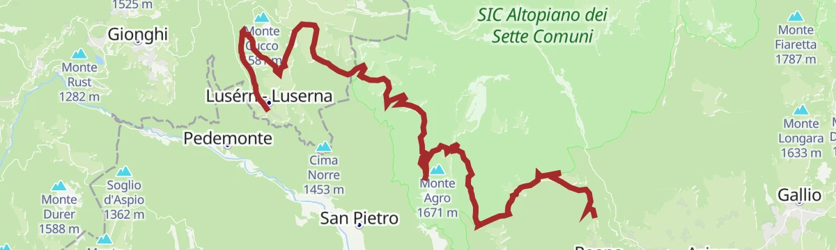
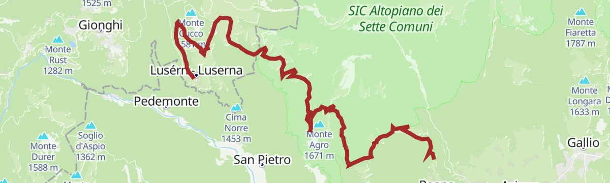
Open route APT Valsugana e LagoraiFat Bike Lavarone - Millegrobbe - Forte Lusérn
14.3 km away, in Lavarone
An easy tour across the open pastures at Millegrobbe, climbing gently past the malga on the way up towards the fort above Luserna.
- 5.7 km
- Distance
- 136 m
- Ascent
- 38 min
- Duration
- 8
- Check-ins
Open route Azienda per il Turismo Alpe CimbraWalk - Mountain Huts Route "Vezzena Plateau"
14.3 km away, in Levico Terme
A longer plateau circuit used for running and mountain biking, across pasture and wood past several dairies, in country held by marmots and deer.
- 13.9 km
- Distance
- 359 m
- Ascent
- 1 h 34 min
- Duration
- 33
- Check-ins
- Passo Vezzena 1 402 m
- Malga Marcai di Sopra 1 657 m
- Chalet Spitz 1 420 m
- Malga Costa di sotto 1 547 m
- Malga Costa di sopra 1 667 m
- Malga Fratte 1 400 m
Open route APT Valsugana e LagoraiHiking trail - Along the path of Pertega
14.6 km away, in Grigno
An old track used since the nineteenth century by the people of Grigno and Tezze, climbing to the Marcesina pastures and their herders' huts.
- 14.3 km
- Distance
- 1 385 m
- Ascent
- 8 h 33 min
- Duration
- 8
- Check-ins
- Rifugio Barricata 1 351 m
- Centro Visitatori Riparo Dalmeri 1 338 m
- Malga Campo Capra di Sotto 1 288 m
Open route APT Valsugana e LagoraiMTB - Tour of the Val di Sella 2344
14.8 km away, in Borgo Valsugana
A mountain-bike loop from Borgo Valsugana through Olle and up the Val di Sella, passing Malga Costa and Arte Sella, with a dirt-road descent to Barco.
- 30.1 km
- Distance
- 740 m
- Ascent
- 3 h 22 min
- Duration
- 17
- Check-ins
- Malga Costa 991 m
- La Casina 678 m
- Lagorai Valsugana Orientale 383 m
- APT Valsugana 386 m
- Sez A.N.A. Trento - Gruppo Borgo 959 m
- Bicigrill Energy Bar 435 m
Open route APT Valsugana e LagoraiLuserna - Roana Cycle and Pedestrian Path
3.8 km away, in Roana
A long ride across the Millegrobbe pastures on the Asiago plateau, past a string of working malghe and the trench lines of the Great War.
- 30.8 km
- Distance
- 790 m
- Ascent
- 3 h 24 min
- Duration
- 16
- Check-ins
- Malga Millegrobbe 1 424 m
- Malga Millegrobbe di sopra 1 469 m
- Baita Laghetto 1 105 m
- Malga Busa Biseletto 1 416 m
- Baito 1 412 m
- Malga Trugole 1 501 m
- +1
Open route Azienda per il Turismo Alpe CimbraThe Path of Responsibility
12 km away, in Borgo Valsugana
A wooded loop in the Val di Sella from the old Hotel Legno by the Lanzola huts and the Erba and Togna side valleys, with listening points on the way.
- 10.9 km
- Distance
- 551 m
- Ascent
- 4 h 2 min
- Duration
- 13
- Check-ins
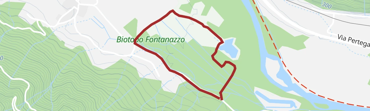
Open route APT Valsugana e LagoraiWalk - the provincial nature reserve Fontanazzo
13.9 km away, in Grigno
A flat tourist route through the Fontanazzo reserve at Grigno, around valley-floor springs fed by the karst plateau above.
- 1.9 km
- Distance
- 0 m
- Ascent
- 27 min
- Duration
Open route APT Valsugana e LagoraiMTB - The peak Pizzo and the trenches of the Great War 2340
14.3 km away, in Levico Terme
A ride up from Passo Vezzena to the old Habsburg fort on Cima Vezzena, whose terrace looks down on the Levico and Caldonazzo lakes.
- 12.6 km
- Distance
- 519 m
- Ascent
- 1 h 36 min
- Duration
- 84
- Check-ins
Open route APT Valsugana e LagoraiSentiero della Pace 24: Luserna to Monterovere
13.4 km away, in Luserna
A stage of the peace path from Luserna over Cima Vezzena and the Passo Vezzena, passing Malga Campo on the way to Monterovere.
- 21.8 km
- Distance
- 809 m
- Ascent
- 7 h 12 min
- Duration
- 103
- Check-ins
- Cima Vezzena 1 908 m
- Passo Vezzena 1 402 m
- Khesar von Kåmp - Malga Campo 1 455 m
- Baita SAT Cangi 1 370 m
Open route Azienda per il Turismo Alpe Cimbra844 - 100 Km dei Forti - Lusern
13.7 km away, in Luserna
A long round on the tracks and dirt roads of the Luserna terrace, over the Vezzena pass and Malga Campo.
- 38.9 km
- Distance
- 1 079 m
- Ascent
- 4 h 28 min
- Duration
- 77
- Check-ins
- Cima Norre 1 453 m
- Monte Cucco 1 581 m
- Passo Vezzena 1 402 m
- Khesar von Kåmp - Malga Campo 1 455 m
- Baita del Neff 1 549 m
- Malga Millegrobbe 1 424 m
- +4
Open route Azienda per il Turismo Alpe CimbraCycle path Luserna-Roana
3.8 km away, in Roana
A path from Luserna past the Millegrobbe dairies to the Roana lake, the first leg of a longer link.
- 30.7 km
- Distance
- 790 m
- Ascent
- 3 h 24 min
- Duration
- 16
- Check-ins
- Malga Millegrobbe 1 424 m
- Malga Millegrobbe di sopra 1 469 m
- Baita Laghetto 1 105 m
- Malga Busa Biseletto 1 416 m
- Baito 1 412 m
- Malga Trugole 1 501 m
- +1
Open route Azienda per il Turismo Alpe Cimbra
No routes of this kind in Asiago yet.
The region's own picks

Featured route
Hiking trail - Monte Ortigara and Caldiera Peak
The best-known summit on the Asiago plateau, climbed past the trenches and monuments of the 1916 battle.
Planning a trip to Asiago?
Everything else Veneto has, in one place


Take Asiago with you into the mountains
Every route on this page with 3D terrain, GPX navigation and offline maps — including the valleys with no signal.
Data sources
- Official website: italia.it ↗
- Routes and highlights: APT Valsugana e Lagorai, Azienda per il Turismo Alpe Cimbra, Tarvisiano, Astrotourism
- Published as open data by the tourist boards named above.
- Region summary generated from the board's own material.
