
Scan the QR code and open PeakVisor on your phone
The Peale Mountains include 33 named peaks. The highest is Meade Peak at 3,029 m. Other notable peaks include Bald Mountain, Threemile Peak and Draney Peak.
The Peale Mountains are situated in the southeastern part of the US state of Idaho. The tallest and most prominent peak in the range is Meade Peak at 9,938 ft (3,029 m) in elevation and with 2,467 ft (752 m) of prominence.
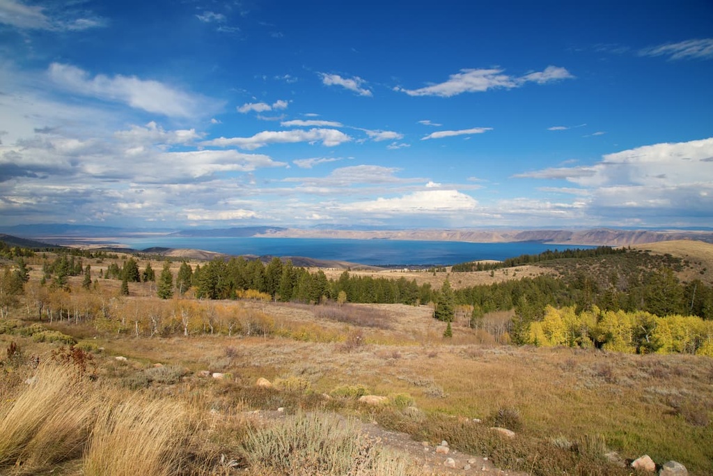
The Peale Mountains stretch from north to south through southeastern Idaho along the state’s border with Wyoming. Here, rolling foothills give rise to the rugged ridgelines that define the dry range.
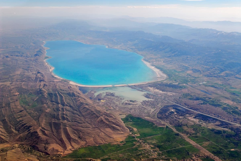
The ridgelines within the Peale Mountains are often separated by alpine meadows and basins. The Bear River runs along the southern and western edges of the range, separating the peaks from the Bear River Range to the southwest.
As the largest tributary leading into the Great Salt Lake, the Bear River is also the longest river in the United States that doesn’t eventually lead to an ocean. The Bear Lake Valley, which is home to Bear Lake, also extends along the southwestern edge of the range.
With numerous peaks reaching above 9,000 ft (2,743 m), the Peale Mountains offer rugged and remote views of Idaho, Wyoming, and Utah. Many of the ridges in the range run east to west, creating massive natural barriers between the northern and southern Peale Mountains.
While the geography of the Peale Mountains is similar to that of other nearby ranges, the Wilson and Pelican Ridges offer a distinctively different landscape. These ridgelines are surrounded by a lava field with minimal shrub coverage when compared to other ridges in the range.
The Peale Mountains lie within the Caribou-Targhee National Forest and are surrounded by other parks and forests. To the southwest lies the Mount Naomi Wilderness Area, which is part of the Uinta-Wasatch-Cache National Forest. The Bridger-Teton National Forest is also located to the east while Gros Ventre Wilderness Area and Grand Teton National Park are situated to the northeast.
The peaks within the Peale Mountains are a subrange of the Western Rocky Mountains. The Western Rockies themselves are a part of the larger Rocky Mountains, which span from the Canadian province of British Columbia, down to the US state of New Mexico.
The Peale Mountains formed around 80 to 55 million years ago during the Laramide orogeny. This orogeny also created all the other major ranges within the Western Rocky Mountains. However, although they are close to the Wasatch Range, the peaks with the Peale Mountains are not part of the Wasatch Fault system.
The bedrock in the region consists primarily of limestone along with dolomites and quartzites. Both the Peale Mountains and Bear River Range have been used to mine copper, zinc, and limestone.
The rugged ridgelines found throughout the range formed as a result of widespread erosion in the region. Indeed, continual erosion and glacial retreat over the course of millions of years left behind these distinctive peaks and their numerous cave systems.
Major peaks within the Peale Mountains include Meade Peak, Henry Peak, Draney Peak, Harrington Peak, and Hawks Peak.
The landscape within the Peale Mountains is similar to that of much of the Caribou-Targhee National Forest. While dense sections of forests can be found at lower elevations in the range, the peaks are often quite barren.
Patches of forest in the range often consist of lodgepole pine, Douglas fir, Colorado blue spruce, quaking aspen, and Engelmann spruce. Groups of pine, aspen, and fir trees are most common throughout the Peale Mountains.
Meanwhile, the higher elevations are home to a mixture of grasses and sagebrush. Wildflowers can be found along the foothills during the early summer months, though a general lack of rainfall shortens their blooming season.
Populations of moose, elk, and deer thrive throughout the Peale Mountains. Black bears, wolves, cougars, and pronghorns are also common. The waterways, including Bear Lake, are home to various species of fish. Numerous endemic species of trout and whitefish can also be found amidst the blue waterways of the range.
The rugged and rocky hillsides in the Peale Mountains are home to groups of marmots and pikas. Meanwhile, beavers are occasionally found near the waterways within the range.
The Peale Mountains and the surrounding land have been inhabited by humans for thousands of years. Indeed, the range is part of the ancestral homelands of many Indigenous peoples, particularly the Shoshone. Many other tribes also have ancestral ties in the region, including the Bannock, Blackfoot, Crow, Gros Ventre, and Nez Perce.
Brigham Young became one of the first settlers of European descent to venture into the region when he sent a group of his Mormon followers to travel around the area in the early 1800s. Some of these missionaries later went on to establish many of the small towns and cities that are still present today.
In the years that followed, disputes often broke out between the Shoshone and the missionaries as the tribe fought to defend its ancestral lands. In 1863, during the Bear River Massacre, US troops attacked a group of Shoshone, killing hundreds of tribal members in the process.
After the Bear River Massacre, the Shoshone allied with the Bannock tribe in another effort to take back their land. This partnership later led to the Snake War, after which, US troops forcibly removed the tribes from their homelands.
Communities in the region began to grow as fur trappers, missionaries, and railroad workers settled in the area. By the end of the nineteenth century, the Shoshone were forced to move to reservations in Idaho and Wyoming.
The Caribou-Targhee National Forest was established in 1903. It was expanded multiple times over the following decades and came to include most of the Peale Mountains.
The Peale Mountains are home to numerous hiking trails. Here are some of the most popular hiking areas in the region:
Just off of Highway 34 lies the South Fork of Tin Cup Creek trail. This out-and-back hike is 10 miles (16 km) long round trip with 967 ft (295 m) of elevation gain.
The trail travels through dense sections of forest while following along a quaint creek. At higher elevations, the forest begins to thin, revealing rolling hillsides covered in shrubs and grasses.
Located near the middle of the range, the Draney Peak Loop offers hikers one of the best viewpoints in the entire range. The loop trail is 7.4 miles (12 km) long with 2,312 ft (705 m) of elevation gain. Much of the trail is forested until reaching the summit of Draney Peak. From here hikers can look out towards the Blackfoot Reservoir.
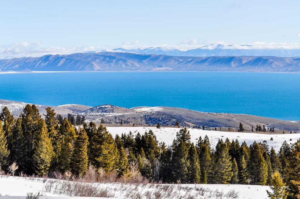
Along the eastern shores of Bear Lake lies Bee Hunt Peak. This short trail travels through the western foothills of the range. The route is 2.2 miles (3.5 km) with 1,118 ft (341 m) of elevation gain. Though short, the trail offers impeccable views of Bear Lake and the Bear River Range to the west.
Looking for a place to stay near the Bear River Range? Here are some of the best cities and villages to check out in the region:
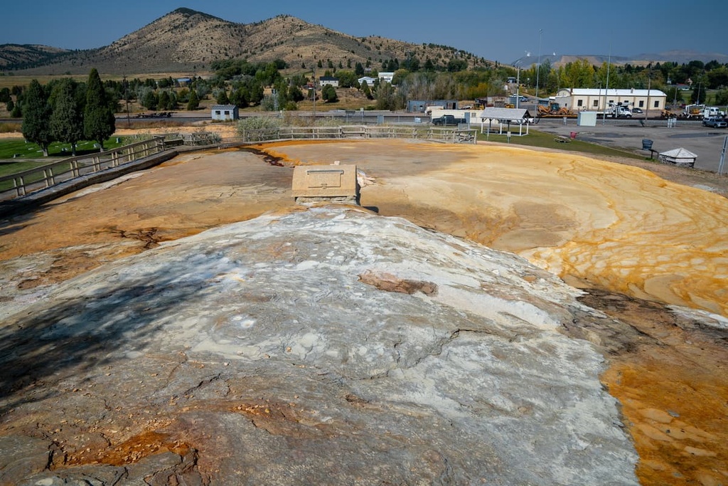
Situated along the western edge of the Peale Mountains lies the city of Soda Springs. The city has a population of around 3,000 people and is named after the hundreds of natural carbonated water springs in the region.
This includes the Soda Springs Geyser, which today acts as a tourist attraction. Though small, the city provides easy access to both the Peale Mountains and the Bear River Range.
To the northeast of the Peale Mountains lies the town of Jackson, Wyoming. This small mountain town has a population of just 10,000 people, yet it is known around the world for its plethora of outdoor activities. Situated in the Jackson Hole Walley in Teton County, Jackson provides the ideal mountain getaway for outdoor enthusiasts.
As it is surrounded by the Jackson Hole Mountain Resort, Grand Teton National Park, Yellowstone National Park, and Snow King Mountain, the town is an outdoor hub throughout the year.
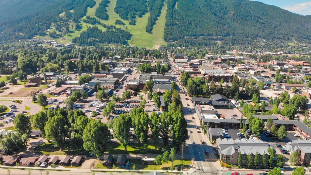
Popular activities include hiking, biking, trail running, and skiing. Additionally, there are dozens of restaurants, gear rental shops, and art galleries that line the streets of downtown Jackson.


The highest peak in the Peale Mountains is Meade Peak, at 3,029 m.
The Peale Mountains have 33 named peaks.


