Scan the QR code and open PeakVisor on your phone
The Bear River Range is situated in southeastern Idaho and northern Utah within the United States of America. The tallest and most prominent peak is Sherman Peak at 9,695 ft (2,955 m) of elevation, with 2,303 ft (702 m) of prominence.
The Bear River Range spans north to south across southeastern Idaho and northern Utah. The range is home to rolling foothills along with rugged mountain tops, covering 1,615 sq. miles (4,180 sq. km).
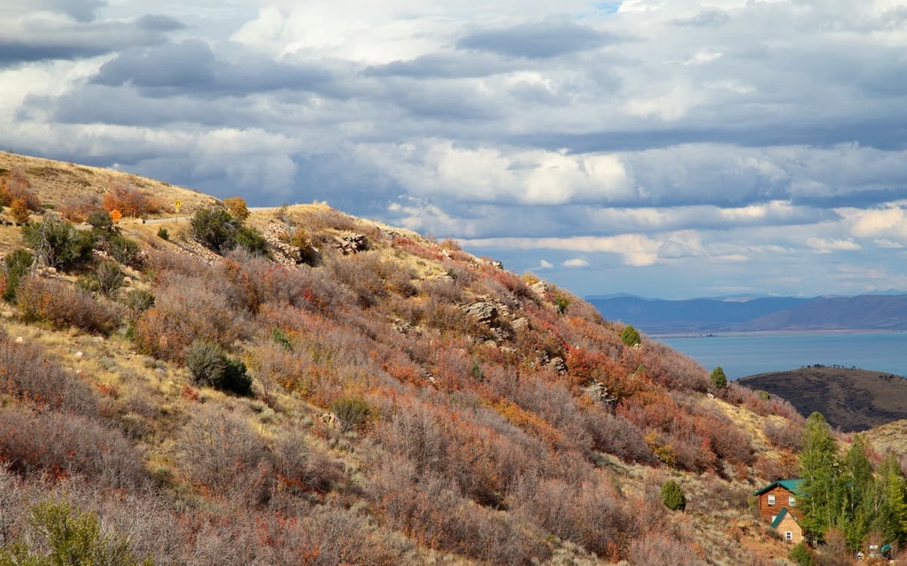
Numerous lakes are dotted throughout the range amidst the alpine meadows. Several peaks in the range stand above 9,000 ft (2,743 m), allowing for breathtaking views of the region.
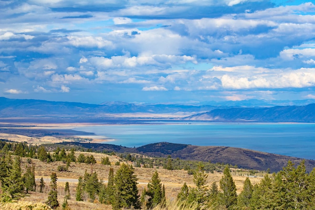
The Bear River Range is named after the Bear River which runs along the north, west, and east sides of the range. The Bear River is the largest tributary leading into Great Salt Lake as well as the longest river in the United States that doesn’t lead directly into an ocean. Bear Lake is situated on the southeastern side with the Cache Valley marking the range’s western border.
The range is a subrange of the Wasatch Range, whose main peaks lie to the south. The Wasatch Range is also a subrange of the Rocky Mountains. While the ridgelines in the range are quite rugged, the major peaks are often marked by rounded summit domes.
The hills and mountain slopes provide the ideal setting for a plethora of wildflowers to thrive, creating a popular attraction during the summer months.
The Bear River Range lies within the Caribou-Targhee National Forest and is surrounded by other parks and forests. To the south lies the Mount Naomi Wilderness Area which is part of the Uinta-Wasatch-Cache National Forest. The Bridger-Teton National Forest is located to the northeast.
The peaks within the Bear River Range are part of the Wasatch Range which is a subrange of the Western Rocky Mountains.
Though the Bear River Range is located at the northern edge of the Wasatch Range, it still shares a close geological history with the other peaks in the range. The Wasatch Range lies along numerous geological faults which together form the Wasatch Fault.
The bedrock within the range consists primarily of dolomites, limestones, and quartzites, many of which date back to the Precambrian period. Historically the region has been used for mining of limestone, copper, zinc, and occasionally lead.
Due to the high amounts of limestone within the peaks, there are numerous caves throughout the range, including Minnetonka Cave, one of the largest limestone caves in the state. Hikers should be cautious where they are walking as many of the caves are simply large holes in the ground.
The Bear River helped carve out the landscape that is apparent today, also forming the Cache Valley which lies west of the range. Glacial cirque and valleys amidst the peaks are the result of the continual erosion over millions of years.
Major peaks within the Bear River Range include Sherman Peak, Paris Peak, Soda Peak, Midnight Mountain, and Bloomington Peak.

Landscape within the Bear River Range is similar to much of the Caribou-Targhee National Forest and Uinta-Wasatch-Cache National Forest. Dense sections of forest are met with rolling alpine fields and meadows.
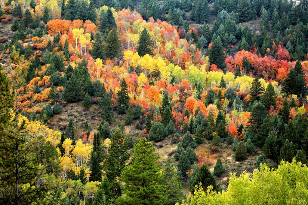
Coniferous forests are found throughout the range. These forested sections are populated with groups of Douglas fir, lodgepole pine, Colorado blue spruce, and Engelmann spruce. Though quaking aspen can be found within the range, large patches of it are uncommon.
The foothills of the Bear River Range are known for their plethora of rolling meadows of wildflowers during the warmer months of the year. Many of the flower species are unique to the region.
Large populations of deer, elk and moose can be found within the range. The rocky hillsides within the range provide the ideal habitat for marmots and pikas while beavers can be found near the many rivers and streams of the region.
The land surrounding the Bear River Range has been inhabited by humans for thousands of years, prior to the arrival of the European colonizers. The major indigenous group of the land is the Shoshone tribe.
However, other groups such as the Gros Ventre, Nez Perce, Bannock, Blackfoot, and Crow people also lived nearby, migrating throughout the surrounding land. The Shoshone people migrated throughout the region often hunting in the mountains during the summer months.
The first European settlements in the region arrived in the mid 1800s. Continual disputes eventually led to the Bear River Massacre, where US troops attacked a Shoshone encampment in 1863.
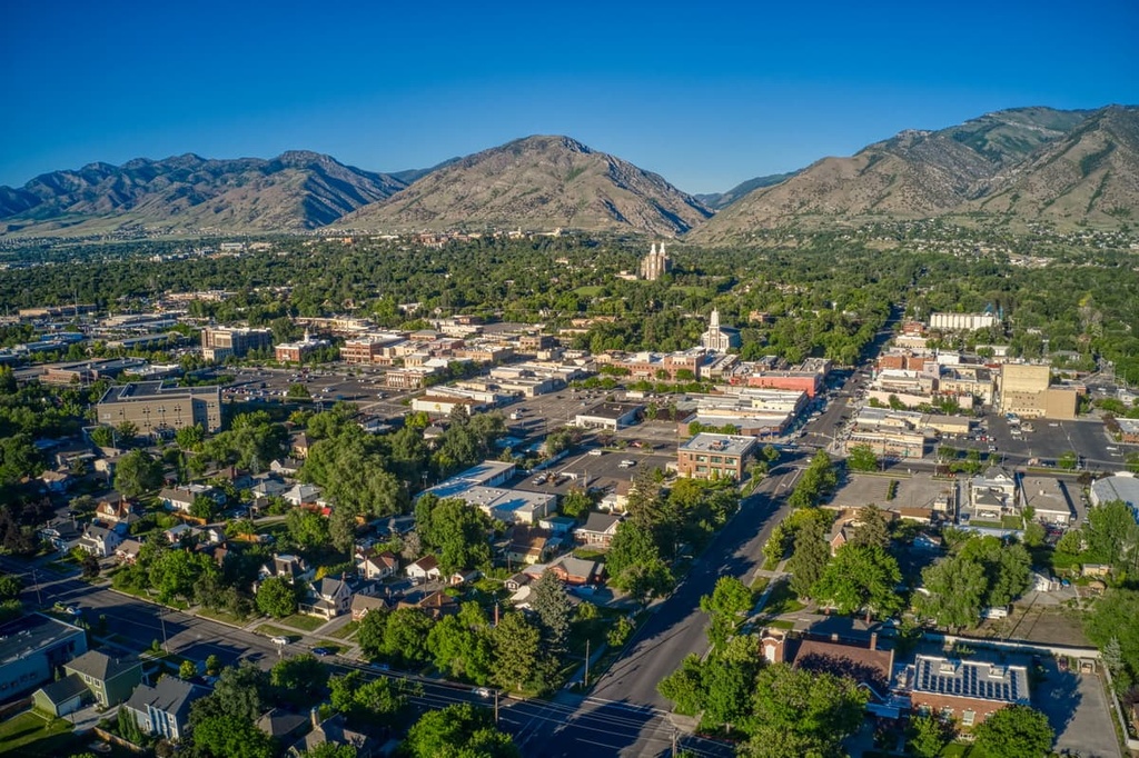
Around the same time, Brigham Young sent a group of the people to the region who came to establish many cities. The city of Preston lies to the west of the range while Logan is southwest of the Bear River Range.
Populations began to rise in the region as fur trappers entered the area. Yet, despite continual resistance the indigenous groups were being forcibly removed from their ancestral lands.
Following the Bear River Massacre, the Shoshone joined forces with the Bannock tribe in an effort to take back their sacred land in what was known as the Snake War. Towards the end of the 19th century, the Shoshone people were moved to reservations located in Idaho and Wyoming.
Parts of the Caribou - Targhee National Forest were first established in 1903. Over the following decades the population of Latter Day Saints grew rapidly surrounding Great Salt Lake. Today the mountains are used primarily for hiking.
The Bear River Range is home to numerous hiking trails. Here are some of the most popular hiking areas in the region:
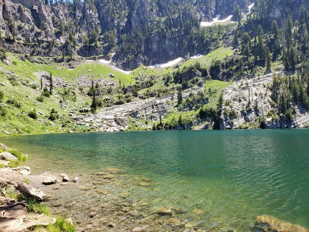
The Bloomington Lake Trail is the most popular hiking route in the range. The short trail is just 1.6 miles (2.6 km) with 187 ft (57 m) of elevation gain. The trail winds through forested sections and open meadows before making it to a small body of water.
Just a short way further up the trail, hikers will be greeted by the alpine lake. Dramatic rock faces and formations surround the clear waters of the lake along with grassy shores perfect for a mid-hike break.
Though just a half mile long, the route within Minnetonka Cave is one of the most breathtaking experiences in the region. The cave has nine distinct rooms which can be accessed with a partially guided tour.
The North Fork Trail to Snowslide Trail is 4 miles (6.4 km) long with 606 ft (185 m) of elevation gain. The trail follows along a nearby stream before climbing to the viewpoint. From there hikers have more open views of the surrounding landscape. The route can also be accessed via snowmobile in the winter.
Looking for a place to stay near the Bear River Range? Here are some of the best cities and villages to check out in the region:
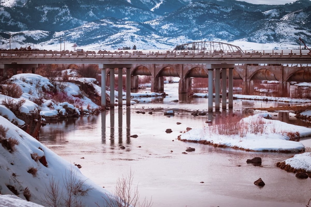
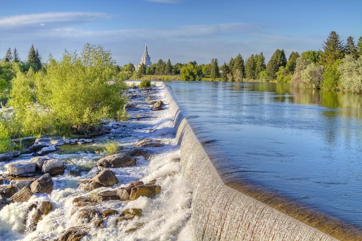
North of the Bear River Range lies Idaho Falls. The city has a population of 65,000, making it the most populous city in the state outside of the Boise metropolitan region. The Snake River runs through the city along with a greenbelt.
The Art Museum of Eastern Idaho and the Museum of Idaho are located within the city, helping it become a cultural and historical hub for eastern Idaho. Caribou - Targhee National Forest, home to hundreds of miles of hiking trails, is located to the east and to the south of the city.
Situated in Utah, Logan lies southwest of the Bear River Range. Utah State University is located within the city and has a metropolitan population of 125,000 people. The college town is home to cultural events and numerous local restaurants.
The close proximity to the Bear River Range allows Logan to be a hub for outdoor activities. This includes hiking, biking, camping, and hunting, as well as exploring the region's many hot springs and caves.