Scan the QR code and open PeakVisor on your phone
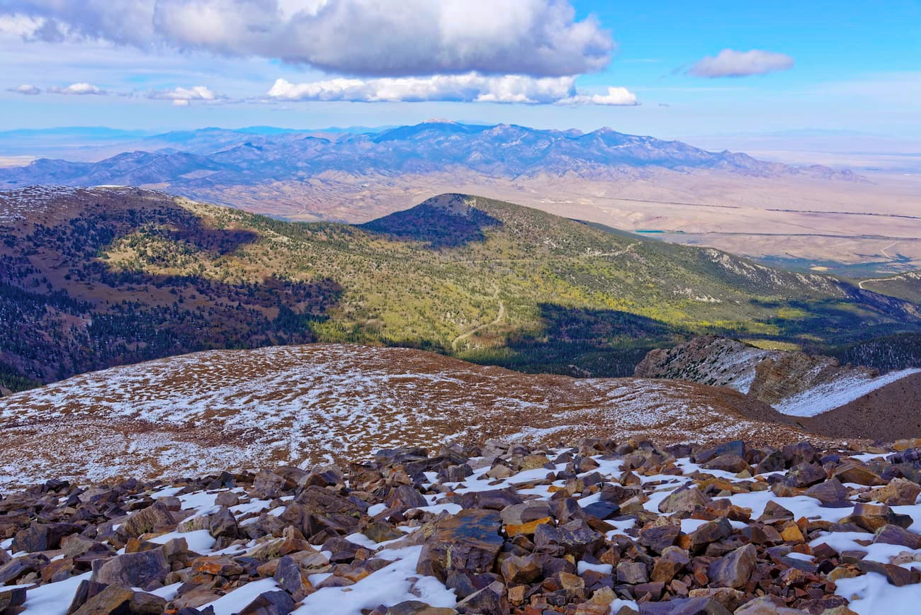
The Black Mountains are an east-to-west aligned mountain range situated in the southwestern portion of the US state of Utah. The range borders the Escalante Desert, and the tallest and most prominent peak is Jack Henry Knoll at 7,979 feet (2,432 m) with 1,457 feet (444 m) of prominence.
The Black Mountains are in southwestern Utah, near the states’ border with Nevada and Arizona. The range spans 28 miles (45 km) from east to west and roughly 30 miles (48 km) from north to south.
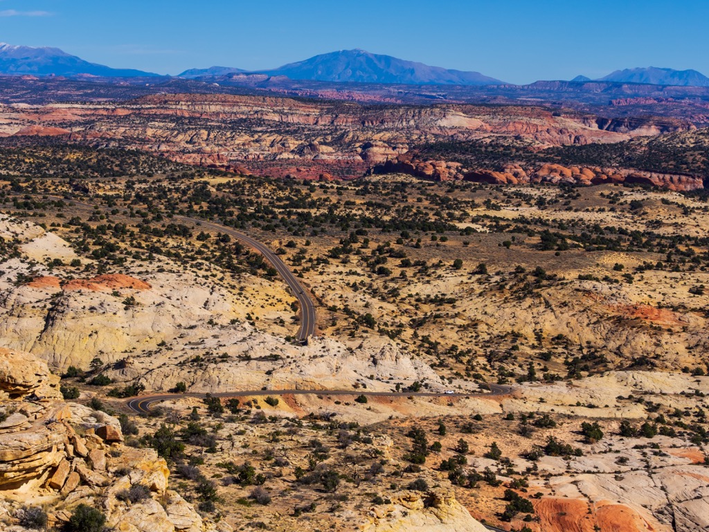
The range consists of two prominent ridgelines. The northeastern rim marks the edge of the Escalante Desert, while peaks in the southeastern section taper to the nearby Hurricane Cliffs and Parowan Valley.
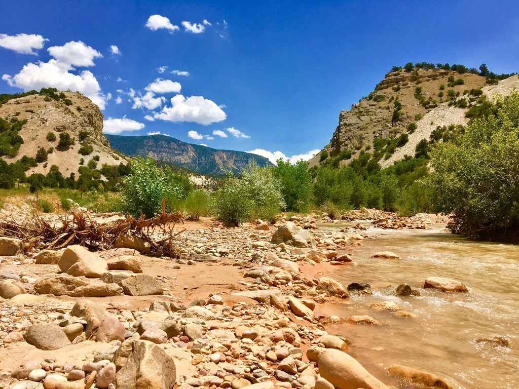
The Black Mountains extend into both Iron and Beaver counties. Cedar City lies at the southern flank of the main ridgeline, while the Beaver River flows to the northeast. Directly to the north lies the Minersville Reservoir, situated along a dammed section of the Beaver River. However, being a desert range, the Black Mountains contain no major water bodies.
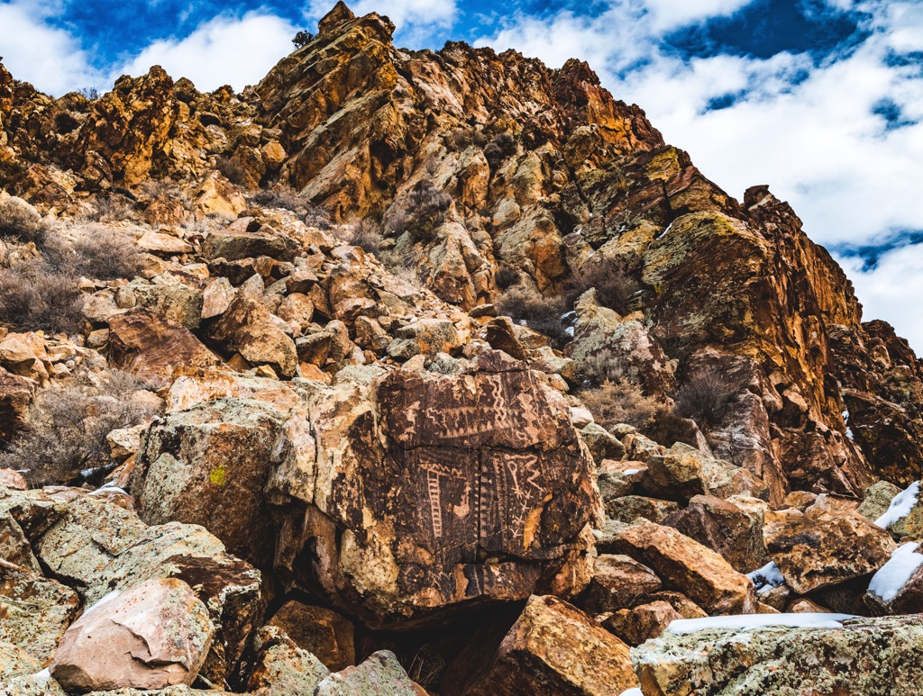
A section of the Old Spanish National Historic Trail cuts through the range. Directly south of the Black Mountains lie the Red Hills Range which features the Parowan Gap Petroglyphs.
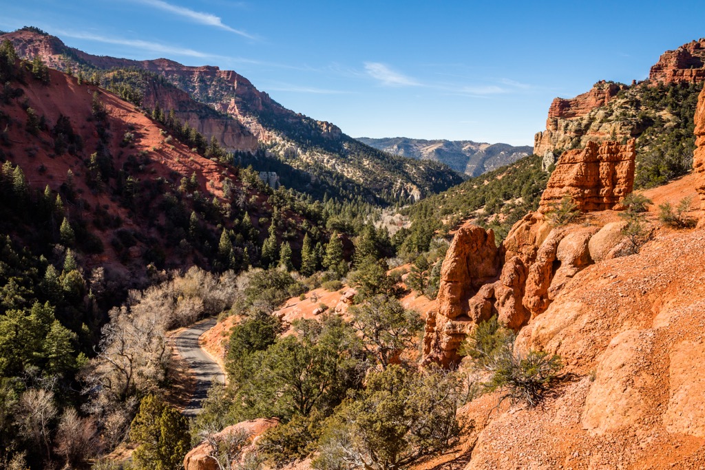
Numerous outdoor recreation areas surround the Black Mountains. To the east lies Fishlake National Forest and Dixie National Forest. To the south, visitors will find the stunning Zion National Park and various other wilderness areas. Finally, to the southwest, another large portion of the Dixie National Forest dominates the landscape.
The Black Mountains mark one of the easternmost sections of the Great Basin Ranges. These ranges extend throughout much of Utah, Nevada, Idaho, Oregon, and California.
The Black Mountains lie between the Great Basin Ranges and the Colorado Plateau. Wide-spread tectonic extension formed alternating peaks and ridgelines that define the Basin and Range Province. The Rocky Mountains, found in the eastern stretches of Utah, feature more prominent mountains and fewer valleys.
Despite geologically being part of the Basin and Range Province, the Black Mountains are a relatively wide range. Similarly to much of the rest of southern Utah, this region has been geologically stable, experiencing less folding and thrusting than land to the west.
The region contains rock from the Pine Valley Laccolith. Widespread volcanic activity dominated the surrounding landscape 20 million years ago. These eruptions led to thousands of feet of magma deposits in the Claron Formation.
Magma was sealed off and forced along a seam of the Claron Formation, forming the geological base for other nearby ranges. Volcanic cinder cones found in the region date back roughly 20,000 years.
Lava flows eventually dammed the Santa Clara River, causing a lake to form. As it slowly evaporated, Lake Claron left large mineral deposits throughout the region.
Major peaks within the Black Mountains include Jack Henry Knoll, Dry Willow Peak, The Three Peaks, Jackrabbit Mountain, and Mahogany Knoll.
The ecology of the Black Mountains is unique due to the ranges’ proximity to the Escalante Desert.
While there are trees throughout the range, there are few large stands of wooded forest. Some Conifer trees exist, though nearby portions of Dixie National Forest contain much more significant sections.
Sagebrush, low-growing grasses, lichen, and rock fields are common throughout the range. The dry climate and harsh weather conditions make it difficult to sustain large plants.
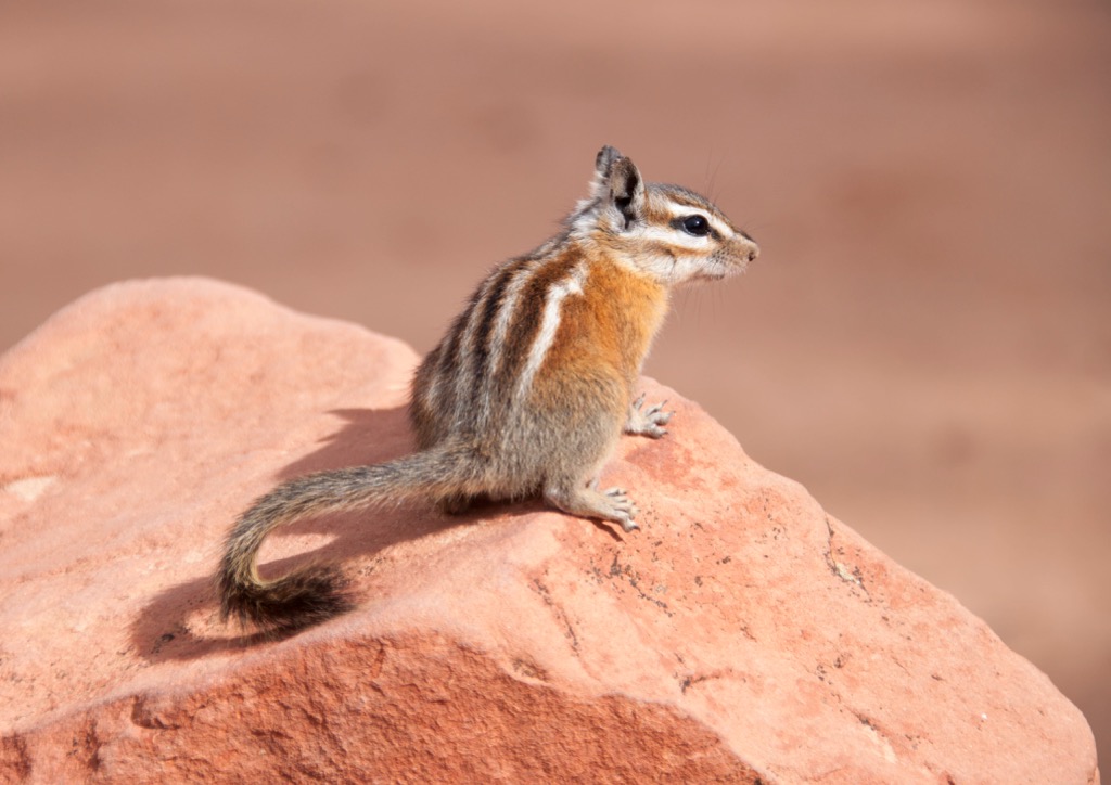
Nearby national forests and parks allow animal species to thrive in the surrounding region. Some common animal species include dusky grouse, deer, Uinta chipmunk, red squirrel, and yellow-bellied marmot at higher elevations.
Human history in the surrounding region dates back as early as 10,000 years ago. Before the arrival of Europeans, numerous tribes of Indigenous Peoples inhabited the land.
The modern-day Black Mountains are part of the traditional territory of the Paiute Indian Tribe of Utah. The Paiute Indian Tribe consists of five historically independent bands—Koosharem, Kanosh, Cedar, Indian Peaks, and Shivwits—all of which have lived in the region since time immemorial. Nearby Rock Art dates back to around 1000 CE.
The Ute people, including the ancestors of the Ute Indian Tribe, inhabited land east of the range. These groups traditionally lived throughout what is now Utah and Colorado and originally consisted of 12 bands, though only three distinct tribes remain.
The first people of European descent arrived in the region during the 1776 Domínguez–Escalante expedition. However, by the mid-1800s, many people began passing through. Many of the earliest settlers were miners and fur trappers. The Old Spanish Trail, which passes through the range, marks part of a historical trade route connecting Santa Fe, New Mexico, to Los Angeles, California.
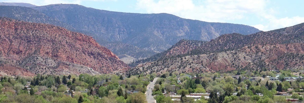
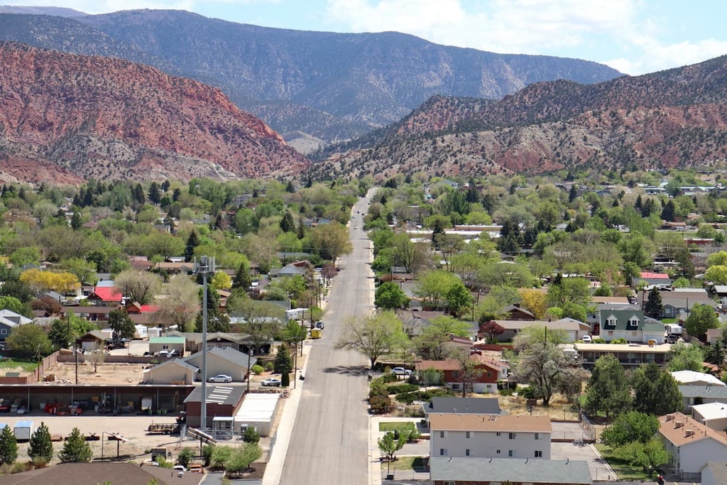
Believing that the region marks part of their “holy land,” Mormon pioneers settled throughout present-day Utah in the 1800s. Cedar City, which lies just south of the range, was established in 1851.
The increased population of settlers led to numerous conflicts and battles between the Mormons and Indigenous Peoples. The arrival of infectious diseases such as measles and smallpox further decimated the Indigenous population, who had no natural immunity to these illnesses. Those who remained were forcibly removed from their homelands and placed on reservations.
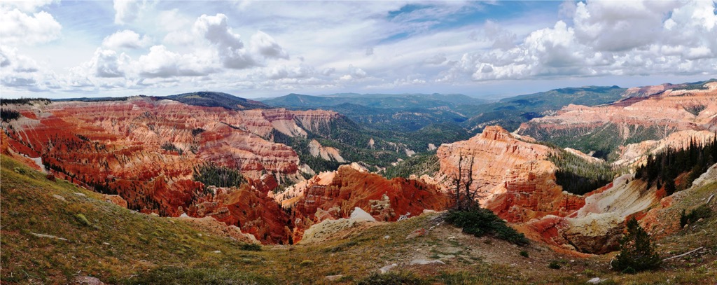
Populations continued to swell in Cedar City and St. George, which became the largest cities in southwestern Utah. The establishment of Zion National Park, Grand Canyon National Park, Bryce Canyon National Park, and the Cedar Breaks National Monument helped promote Cedar City as a gateway to the region’s natural beauty.
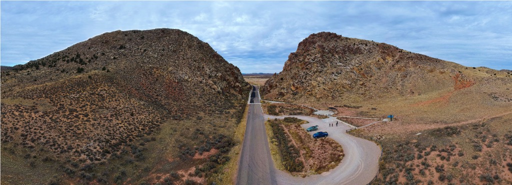
The Black Mountains do not feature any designated hiking trails. Hikers may spot some primitive trails and service roads in the region. Here are some popular hiking areas near the range:
The community of Parowan lies southeast of the range. Just outside the city, along the eastern edge of the Black Mountains, lie a few short trails that showcase the rich history of the region:
Three Peaks Recreation Area lies just south of the Black Mountains, on the outskirts of Cedar City. The area features numerous trails for hiking, running, and biking. Here are a few paths in the area:
Looking for a place to stay near the Black Mountains? Here are some of the best cities and villages to check out in the region:
Cedar City lies just south of the Black Mountains. Home to 35,000 residents, the city is host to Southern Utah University. Just outside the city limits lies Zion National Park, one of the most inspirational landscapes in the U.S. Zion is a must for any of the region’s visitors.
Other nearby spots for outdoor recreation include the Cedar Breaks National Monument and Pine Valley Mountains Wilderness Area. During the winter months, visitors can explore Brian Head Ski Resort. The city hosts the Utah Shakespeare Festival and the Utah Summer Games each year.
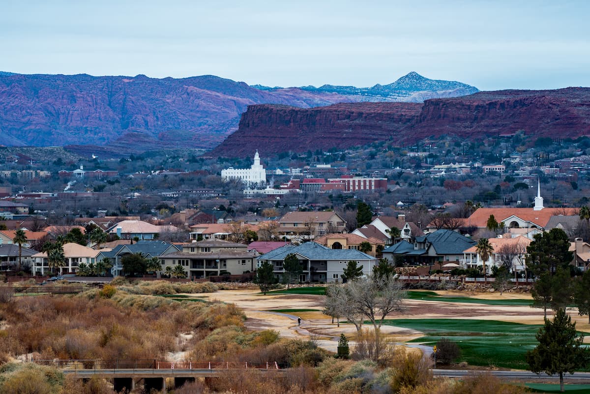
Less than an hour's drive south of Cedar City lies St. George. Situated along the southern edge of Dixie National Forest, St. George is home to Dixie State University and 70,000 residents. The Virgin River starts in Zion National Park and flows through the city’s heart.
Besides proximity to Dixie National Forest, St. George is a short drive from Snow Canyon State Park and Zion National Park. The Red Cliffs National Conservation Area, directly north of the city, features famous red rock formations.
Visitors and locals alike can enjoy year-round outdoor recreation. Nearby trails offer hiking, mountain biking, and trail running, and canyoneering is also popular in the region's extensive canyon networks. The Tuacahn Amphitheater, the Southwest Symphony Orchestra, and many local shops and restaurants are located in the downtown area.