Scan the QR code and open PeakVisor on your phone
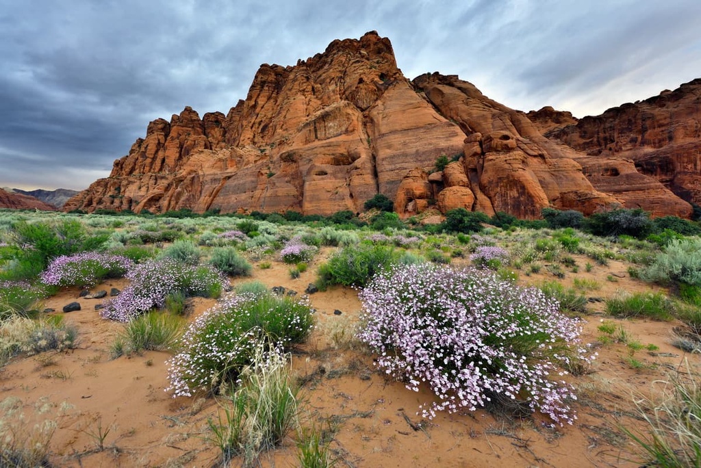
The Red Cliffs National Conservation Area is a 45,600-acre (18,450-ha) protected area located at the northeastern edge of the Mojave Desert in the southwestern part of the US state of Utah. There are 11 named mountains in the Red Cliffs National Conservation Area, the highest and most prominent of which is Twin Peaks (5,354 ft/1,632 m).
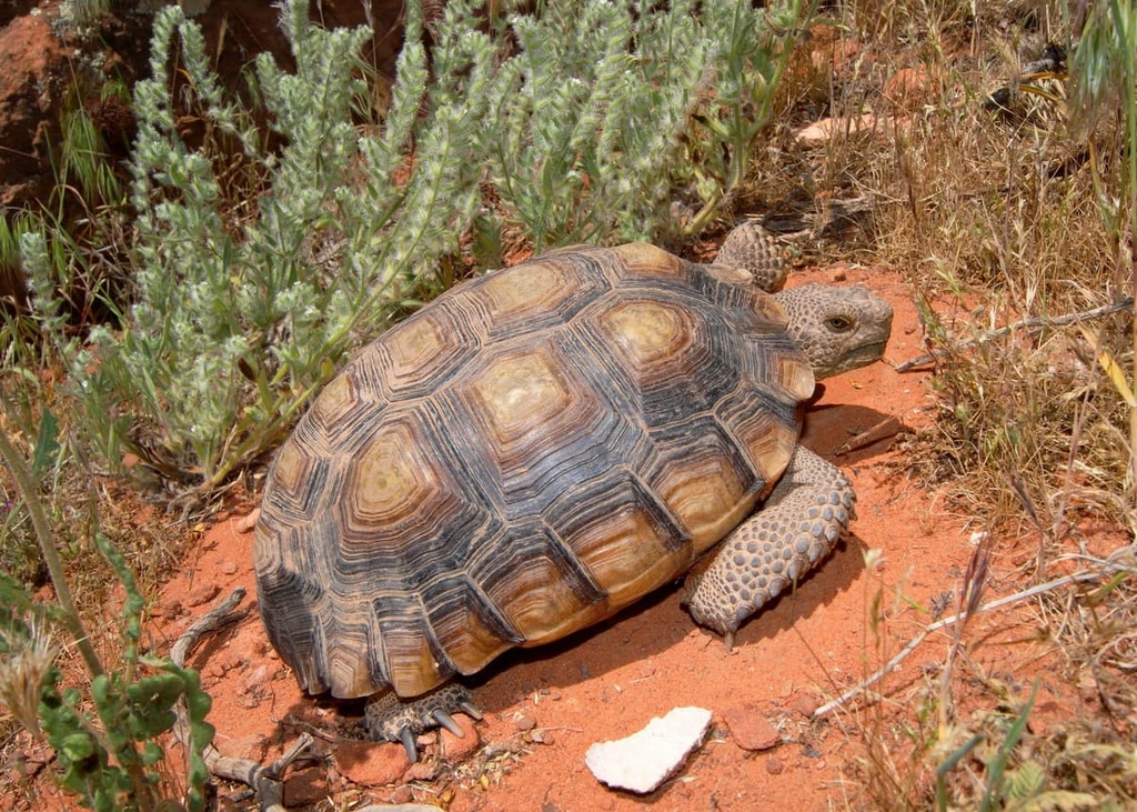
The Red Cliffs National Conservation Area (NCA) consists of about 45,600 acres (18,454 ha) of BLM-administered land in south-central Washington County, Utah. It lies within the 62,000-acre (25,090-ha) Red Cliffs Desert Reserve, a multi-jurisdictional land base that was established to safeguard populations and habitat of the threatened desert tortoise (Gopherus agassizii) as well as other at-risk native plant and animal species.
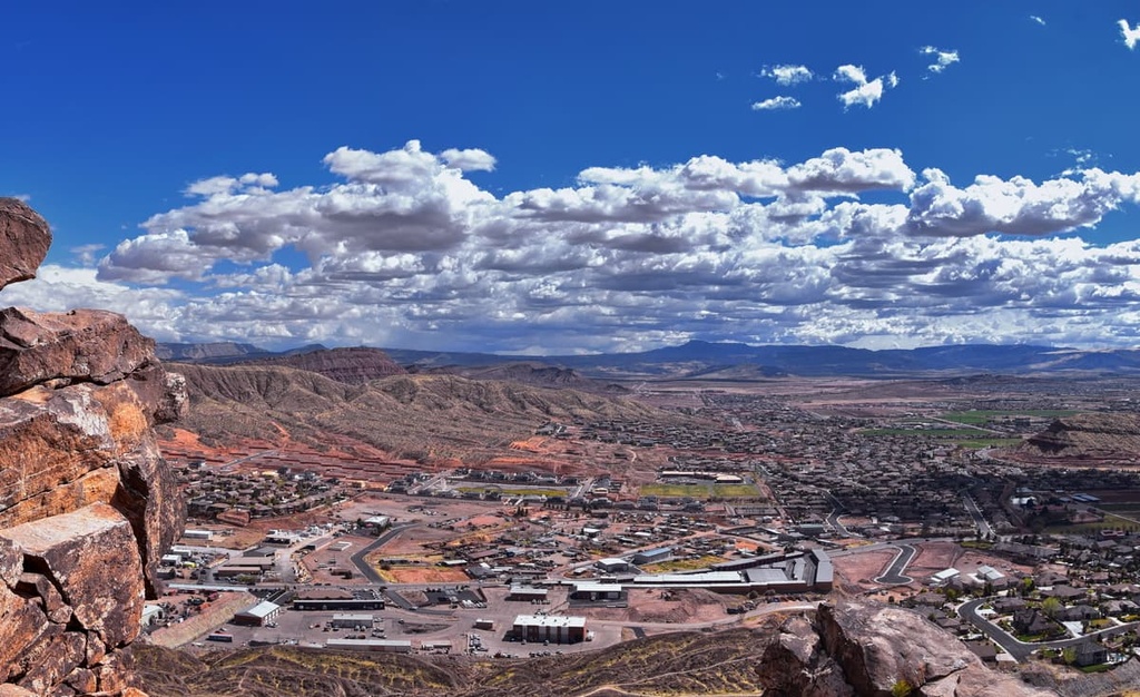
The lofty Pine Valley Mountains and Dixie National Forest lie just to the north of the conservation area, while the communities of Ivins, Santa Clara, St. George, and Washington encircle the southern region of the park. Zion National Park, one of Utah’s most popular outdoor recreation destinations, is located just 45 miles (72 km) to the east of the conservation area.
There are two designated wilderness areas in the Red Cliffs NCA, both of which are located just minutes from urban areas of Washington County.
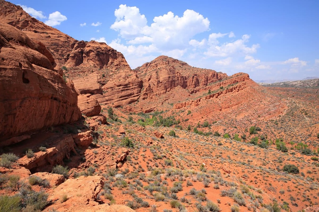
The 11,667-acre (4,721-ha) Cottonwood Canyon Wilderness lies at the northern end of the conservation area and shares a common boundary with the Cottonwood Forest Wilderness in the Dixie National Forest.
Meanwhile, the 8,321-acre (2,267-ha) Red Mountain Wilderness is located in the northwest corner of the conservation area and shares a boundary with Snow Canyon State Park.
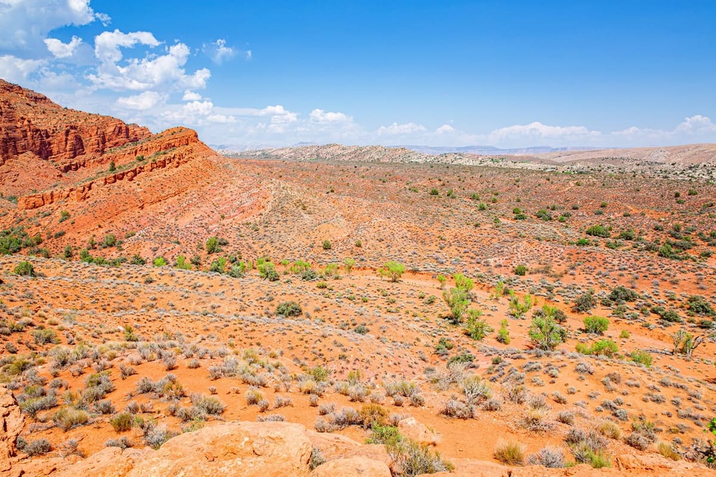
The Hurricane Fault, a north-south striking fault that stretches for 155 miles (249 km) from the southern part of the Grand Canyon to Cedar City, has played a critical role in creating the landscape of the Red Cliffs NCA.
Many of the cinder cones and lava flows in the area were created by faulting along the Hurricane Fault. Erosion has also played a key role in shaping the region’s dramatic canyons and sandstone rock formations.
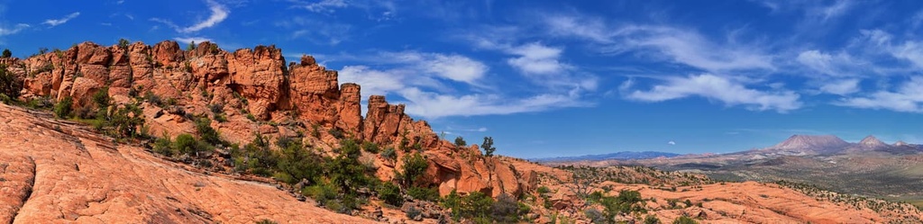
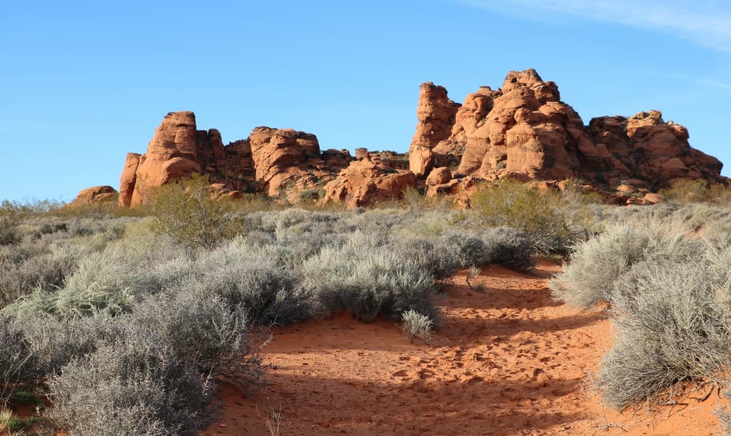
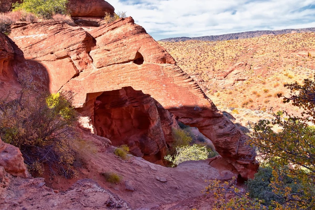
The Red Cliffs NCA contains massive exposures of the Jurassic-age Kayenta Formation and Navajo Sandstone. Both of these formations preserve dinosaur tracks and trackways, bone beds, plant fossils, and silicified wood.
Deep canyons, like Cottonwood Canyon, are cut into 2,000-foot-thick (610-meter) outcrops of Navajo Sandstone that date back to the Triassic and Jurassic. Other rocks in the area include mudstone, sandstone, and limestone of Mesozoic age and late Cenozoic basaltic andesite flows.
Navajo Sandstone, which is one of the most striking natural features in the Red Cliffs NCA, is found in many of southern Utah’s national and state parks. It originated from an ancient sea that formed during the Early Jurassic. Navajo Sandstone can exist in a range of colors, from wihte to red, and it is one of the most iconic features of southern Utah’s landscape.
The Red Cliffs NCA is located at the convergence of three ecoregions—the Mojave Desert, Colorado Plateau, and Great Basin. This merging of ecosystems, referred to as an “ecotone,” contains plant and animal species from each contributing region, including many at-risk and endemic species that are not found anywhere else in the world.
For example, the vegetation in the Red Cliffs NCA, which includes blackbrush, creosote, and shrub live oak, are often associated with the Great Basin Desert. Populations of Gila monsters, sidewinder rattlesnakes, and chuckwallas are also found in the Red Cliffs NCA but these reptiles are typically associated with the southern Mojave Desert.
Many of the plants and animals in the Red Cliffs NCA have adapted to the shallow soil and negligible precipitation in the area.
Larger mammals, including mountain lions, bobcats, coyotes, racoons, and kit foxes, are known to move around seasonally in the region, escaping the summer heat by traveling to higher elevations. Meanwhile, smaller mammals and reptiles, like the desert tortoise and kangaroo rat, have adapted their behaviors and physiology to survive in lowland desert environments.
That being said, desert tortoise populations have declined dramatically in the region during the last 100 years. The Red Cliffs NCA is a critical habitat for the desert tortoise in southern Utah. Today, it’s estimated that roughly 2,000 adult desert tortoises live in the greater Red Cliffs Desert Reserve.
Archeological records of more than 10,000 years of human activity are preserved in the present-day Red Cliffs National Conservation Area.
For more than 700 years, Ancestral Puebloans intermittently occupied the region. These early inhabitants were mostly sedentary farmers that utilized the land to harvest maize and other crops, including squash and beans. It is theorized that the Ancestral Puebloans abandoned the area around 1200 CE, possibly due to prolonged drought periods and climate change.

A number of contemporary Tribal nations have ancestral ties to the region that is now Red Cliffs National Conservation Area, including the Shivwits Band of Paiutes, Paiute Indian Tribe of Utah, and Kaibab Paiute Tribe, among others.
The first recorded contact between European-Americans and Indigenous peoples in the area occurred in 1776, when the Domínguez-Escalante Party encountered the Southern Paiute while seeking an overland route from Santa Fe, New Mexico, to Spanish missions in California.
In the following decades, groups of fur trappers and Euro-American pioneers continued to traverse through southern Utah en route to California, but few settled in the area.
In the mid nineteenth century, however, Brigham Young, leader of the Church of Jesus Christ of Latter-day Saints, sent a group of Mormon pioneers to investigate and occupy the arid and isolated Salt Lake Valley. Shortly thereafter, thousands of Mormon immigrants and California-bound prospectors funneled into the area.
Early Mormon occupants established many of the communities that surround the present-day Red Cliffs NCA, including St. George, Fort Harmony, Santa Clara, Washington, Tocqueville, and Grafton.
The Red Cliffs Desert Reserve was created in 1996 to protect populations of the at-risk desert tortoise, as well as other native species. In 2009, the Red Cliffs NCA was established as part of the Omnibus Public Land Management Act to permanently protect an additional 45,600 acres (18,454 ha) of critical Mojave Desert tortoise habitat.
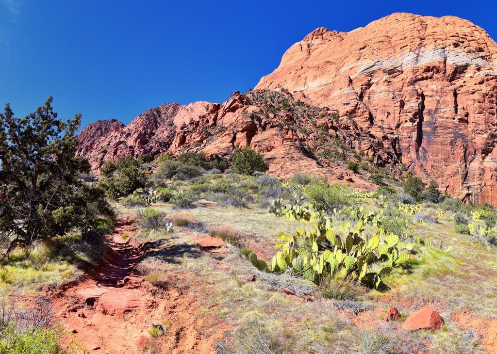
More than 130 miles (209 km) of designated hiking, mountain biking, and equestrian trails are available for public use in the Red Cliffs NCA. Here are some of the best trails in the area to check out during your next trip to the region.
Owen’s Loop is a well-maintained, family-friendly trail that skirts a cliffside above downtown St. George. It boasts expansive views of St. George, Santa Clara, and the Red Hills Golf Course.
Owen’s Loop can be accessed from three well-marked trailheads—the Brooks Nature Park Trailhead, Pioneer Hills Trailhead, and Owen’s Loop Trailhead off Red Hills Parkway.
Located just outside Washington City, Elephant Arch is a beautiful natural sandstone arch that was named for its resemblance to the trunk and eye of an elephant. The beginning of the trail follows a dirt road before transitioning to the very sandy Bone Wash.
Hikers can appreciate a variety of wildflowers and Navajo sandstone hills on this trek. Though the trail only climbs about 180 feet (55 km) in elevation, hikers may find the deep, soft sand in Bone Wash moderately difficult to traverse.
Tucked in the midst of the Cottonwood Canyon Wilderness, the Red Reef Trail (also referred to as Red Cliff Trail) wanders through a stunning slot canyon and passes by dozens of slickrock bowls that are filled with water from Quail Creek.
Most visitors to the Red Reef Trail will traverse the lower portion of the hike from the Red Cliffs Recreation Area Campground to the pools and back. To reach the final portion of the trail, hikers will need to climb a small rock wall using ‘moki step’ and a hand rope.
Looking to explore the Red Cliffs National Conservation Area? These are some of the best nearby cities to check out during your travels.
Located just 20 miles (32 km) to the east of Saint George, the community of Hurricane serves as a gateway to many of Utah’s most beloved parks and outdoor spaces, including Zion National Park, Snow Canyon State Park, Lake Powell, and the north rim of the Grand Canyon.
The city is known for its historic peach and pecan orchards and small-town charm. It also boasts a wide variety of hotels, restaurants, and amenities for travelers to enjoy.
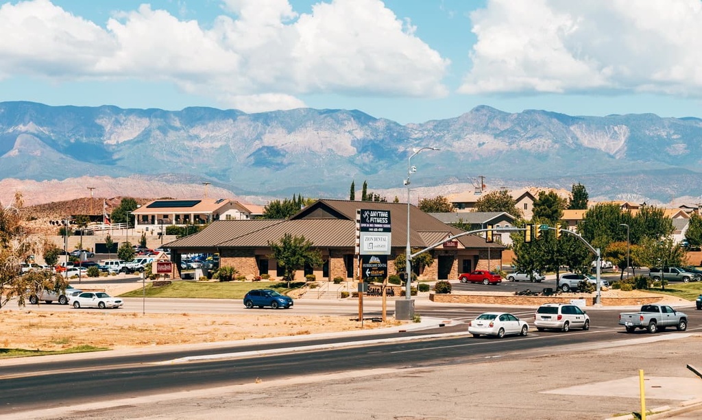
Located just to the south of the Red Cliffs NCA, St. George is a rapidly growing city that is central to many of southern Utah’s famed parks and natural attractions, including Zion National Park, Bryce Canyon National Park, Snow Canyon State Park, Grand Canyon National Park, Grand Staircase-Escalante National Monument, and Vermilion Cliffs National Monument.
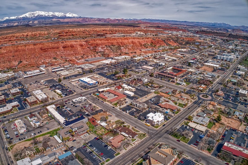
In addition to its proximity to world-class outdoor recreation destinations, St. George hosts dozens of historic buildings and museums and a wide range of hotels, restaurants, and amenities. It is one of the largest communities in the region, so it’s a must visit for any trip to the Red Cliffs NCA.
Named after US president George Washington, Washington is a family-friendly suburb of St. George. Although it is home to fewer than 30,000 residents, Washington is best-known for its beautiful parks, golf courses, and proximity to the state’s most popular natural attractions.
There are plenty of great places to check out in Washington itself, including the city’s many museums. Washington also offers easy access to many of southwestern Utah’s best outdoor recreation areas, including the Red Cliffs NCA.