Scan the QR code and open PeakVisor on your phone
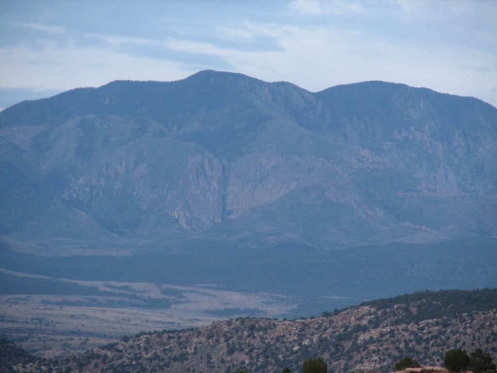
The Pine Valley Mountain Wilderness Area is a protected area that encompasses the Pine Valley Mountains in the southwestern corner of the US state of Utah. The tallest and most prominent peak in the wilderness is Signal Peak at 10,371 ft (3,161 m) in elevation and with 4,508 ft (1,374 m) of prominence.
The Pine Valley Mountain Wilderness Area is located in southwestern Utah, near the state’s border with Nevada and Arizona. It encompasses 50,232 acres (203.28 sq. km) of land, making it the fourth largest wilderness area in the state.
The wilderness is home to numerous lush meadows that contrast heavily with the desert landscape that surrounds it. Its primary feature is the Pine Valley Mountains.
The peaks within the wilderness mark the eastern border of the Great Basin Ranges. They are isolated from the rest of the Wasatch Range. Many seasonal creeks run through the forested range during the spring and summer months.
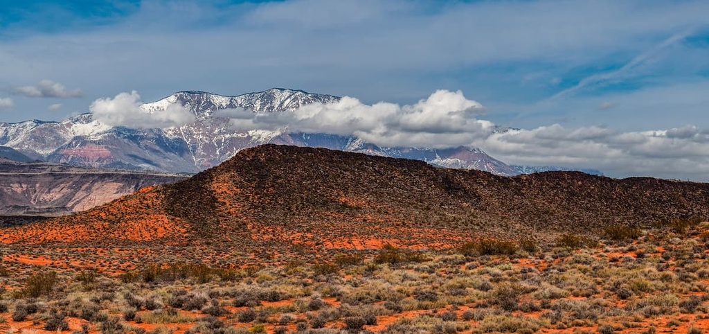
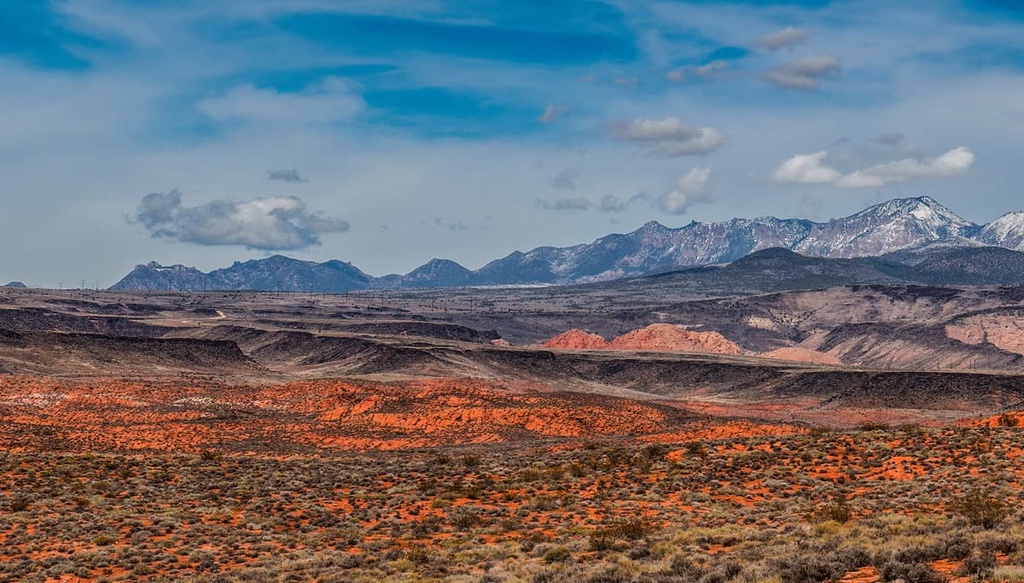
The mountainous landscape within the wilderness is part of the Pine Valley Laccolith, which is one of the largest laccoliths (dome-shaped igneous intrusions) within the US. The Pine Valley Mountains are arguably best characterized as a large rocky outcrop that’s surrounded by desert.
The main ridgeline of the range dominates much of the landscape within the Pine Valley Mountain Wilderness. Meanwhile, there are a number of meadows in the wilderness that can be found in Pine Valley, Grass Valley, and Grassy Flat. Elevations in the wilderness range from 6,000 ft (1,800 m) up to the summit of Signal Peak.
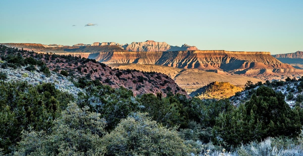
The Pine Valley Mountain Wilderness is located near numerous national forests, parks and wilderness areas. The wilderness is part of the Dixie National Forest. To the east of the wilderness area lies the Blackridge Wilderness, Zion National Park and Grand Staircase-Escalante National Monument. Directly to the south of the wilderness lies the Red Cliffs National Conservation Area.
The peaks within the Pine Valley Mountain Wilderness Area are part of the larger Great Basin Ranges, which extend throughout much of Utah, Nevada, Idaho, Oregon, and California.
The topography of the Great Basin Ranges is unique compared to that of the Rocky Mountains, which can be found throughout eastern Utah. The region features a series of alternating basins and ranges (hence the name).
The primary geological feature of the Pine Valley Mountain Wilderness Area is the Pine Valley Laccolith. The laccolith was created over the course of 20 million years of volcanic activity.
Over the course of millions of years, volcanic magma was deposited along the Claron Formation. This thick layer of magma sealed off the volcanic vents that once released this magma. New magma was then forced along the edge of the Claron Formation, giving rise to the laccolith that we see today.
Millions of years of erosion further exposed the laccolith while major volcanic activity continued throughout the region. Volcanic cinder cones can be found throughout the wilderness, many of which formed during the last 20,000 years.
Continual pressure from the lava beneath the surface eventually dammed the Santa Clara River. Mineral deposits continued to fill in the lake before overflowing and spreading the deposits throughout the region.
Major peaks within the Pine Valley Mountain Wilderness include Signal Peak, Big Point, Mount Baldy, Burger Peak, and Pine Ridge.
The ecology of the Pine Valley Mountain Wilderness is marked by both forests and vast meadows, all of which are surrounded by a desert landscape.
The forest covers much of the hillsides of the wilderness. It consists primarily of Engelmann spruce and fir trees. All of the conifer species found in Utah grow within the wilderness, with the exception of the lodgepole pine.
The southern half of the wilderness is marked by old-growth Engelmann spruce. This region is also home to a stand of bristlecone pine. The northern half of the wilderness is home to spruce, Douglas fir, limber pine, aspen and subalpine fir.
The wilderness is home to nearly 1,000 plant species, including alpine timothy, subalpine needlegrass, mat muhly, yarrow, and snowberry.
There are also a number of rare and endangered species in the wilderness area. Some threatened and endangered species that live in the region include bald eagles, pygmy rabbits, Bonneville cutthroat trout, Arizona toads, and Towsend’s big-eared bats, among others.
Meanwhile, common animal species in the region include dusky grouse, deer, Uinta chipmunk, red squirrel, and the yellow-bellied marmot.
Humans have inhabited the region surrounding the Pine Valley Mountain Wilderness Area for over 10,000 years. Over the course of millennia, the Great Basin region has been inhabited by numerous Indigenous groups and tribes.
Many tribal nations, including the Ute Indian Tribe, Eastern Shoshone Tribe, Confederated Goshute Tribes of the Goshute Reservation, Skull Valley Band of Goshute, and Shoshone-Bannock Tribes consider the region to be part of their ancestral homelands.
In particular, the Ute made contact with Spanish conquistadors during the end of the sixteenth century. The first settlers of European descent to come to the region arrived in the 1800s.
A majority of these European settlers were fur trappers who frequently ventured into the nearby mountain ranges. During the 1800s, Brigham Young sent a group of Mormons to the region in order to claim what they believed to be their promised land.
The Ute Indian Tribe, among other Tribal Nations, continually resisted the presence of these settlers in their homelands. Conflict frequently broke out between the settlers and Tribal Nations during the 1850s, especially as settler communities began to grow in size.
Numerous wars were fought between the Ute and the Mormon settlers, the latter of whom were often supported by American troops. As a result of these wars, many Indigenous peoples were forced off of their homelands and onto reservations that represent just a tiny fraction of their traditional territory.
By the turn of the century, a large push toward forestry conservation was happening across the United States. As a result, the Dixie National Forest was established in 1905, followed by the Pine Valley Mountain Wilderness in 1984.
The Pine Valley Mountain Wilderness is home to numerous hiking trails. Here are some of the most popular hiking trails to check out in the wilderness area.
Whipple Trail is the most popular route within the wilderness. This out and back trail winds its way through gorgeous forests and has a total length of 10.6 miles (17 km) with 2,384 ft (864 m) of elevation gain.
After climbing through the forest, the landscape surrounding the trail opens up and offers views of the Pine Valley Mountains along with the surrounding valleys. Though the route is used primarily during the summer, it can be hiked using snowshoes during the late spring.
Burger Peak is one of the most prominent peaks within the wilderness. From the summit, the peak offers unobstructed views of the region. This out and back route is 11 miles (17.7 km) long with 3,490 ft (1,064 m) of elevation gain.
The first half of the hike climbs gradually and follows a small creek. The last few miles of the climb to the summit consists of steep switchbacks. Once at the summit, hikers have views of the surrounding mountains, valleys, and rolling foothills.
As it takes you to the tallest peak in the wilderness, the trail up Signal Peak shouldn’t be missed. Roundtrip, the trail is 9.1 miles (14.6 km) long with 4,484 feet (1,367 m) of elevation gain. Hikers will enjoy views throughout this hike and while climbing to the summit.
Unique rock formations can be found throughout the length of the trail. Once at the summit, hikers can see sweeping views of both the Colorado Plateau and Hurricane Valley below.
Looking for a place to stay near the Pine Valley Mountain Wilderness? Here are some of the best cities and villages to check out in the region:
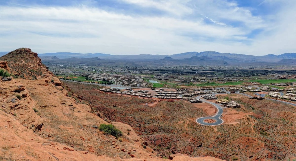
The community of Hurricane is located directly to the east of the Pine Valley Mountain Wilderness, and it has a population of around 17,000 people. First established in 1896, the town of Hurricane is home to the Hurricane Canal, which is situated within the Hurricane Valley.
Geographical features in the region around the town include Sand Hollow State Park, Quail Creek State Park, and the Virgin River. Hurricane provides easy access to both the Pine Valley Mountain Wilderness and Zion National Park.
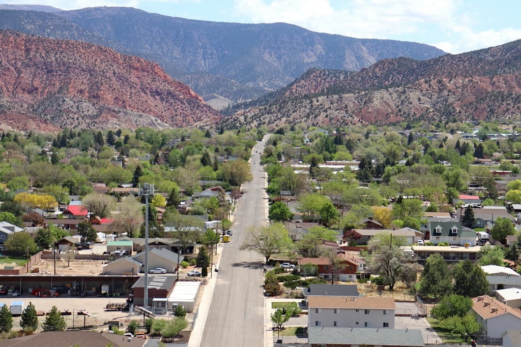
Cedar City is a mid-sized community located to the northeast of the Pine Valley Mountain Wilderness. With a population of around 35,000 people, Cedar City is one of the most populous cities in southern Utah.
The city is home to numerous annual festivals such as the Utah Shakespeare Festival, and the Utah Summer Games, among others. Locals and visitors alike can explore Brian Head Ski Resort, Cedar Breaks National Monument, and the Pine Valley Mountains Wilderness Area when in Cedar City.
The closest major city to the Pine Valley Mountain Wilderness is Las Vegas, Nevada, which is situated two hours to the southwest of the Pine Valley Mountain Wilderness. The city has a metro population of 2.2 million people, making it the most populous region in the state.
Often referred to as the Entertainment Capital of the World, Las Vegas is home to a number of massive casinos and resorts. Las Vegas is located in close proximity to a handful of exceptional national forests, wilderness areas, and national parks that are well worth checking out.