Scan the QR code and open PeakVisor on your phone
The Blue Ridge Wildlife Management Area (WMA) is a protected region within Chattahoochee- Oconee National Forest that’s located in the northern part of the US state of Georgia. The WMA lies within the Blue Ridge District of the forest and contains 26 named peaks. The tallest peak is Ball Mountain at 3,645 ft (1,111 m) tall while the most prominent is Frozen Knob with 591 ft (180 m) of prominence.
The Blue Ridge WMA lies in northern Georgia within the Chattahoochee- Oconee National Forest, which extends across the northern portion of the state. The WMA encompasses 20,900 acres (8,458 ha) of land within the Blue Ridge District of the forest within Fannin, Union, and Lumpkin counties.
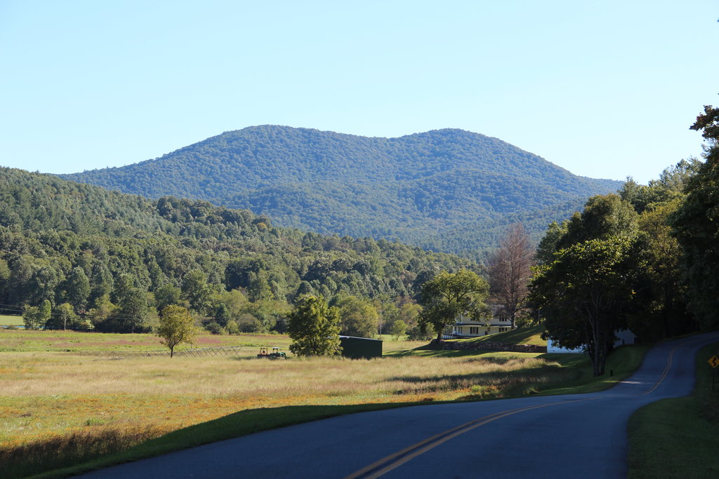
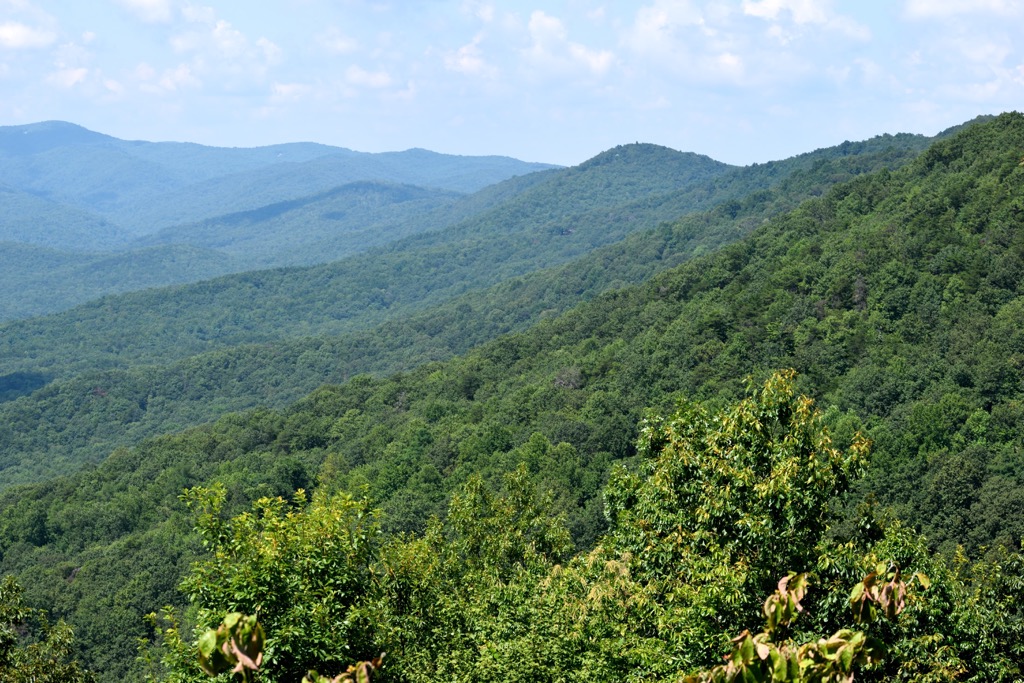
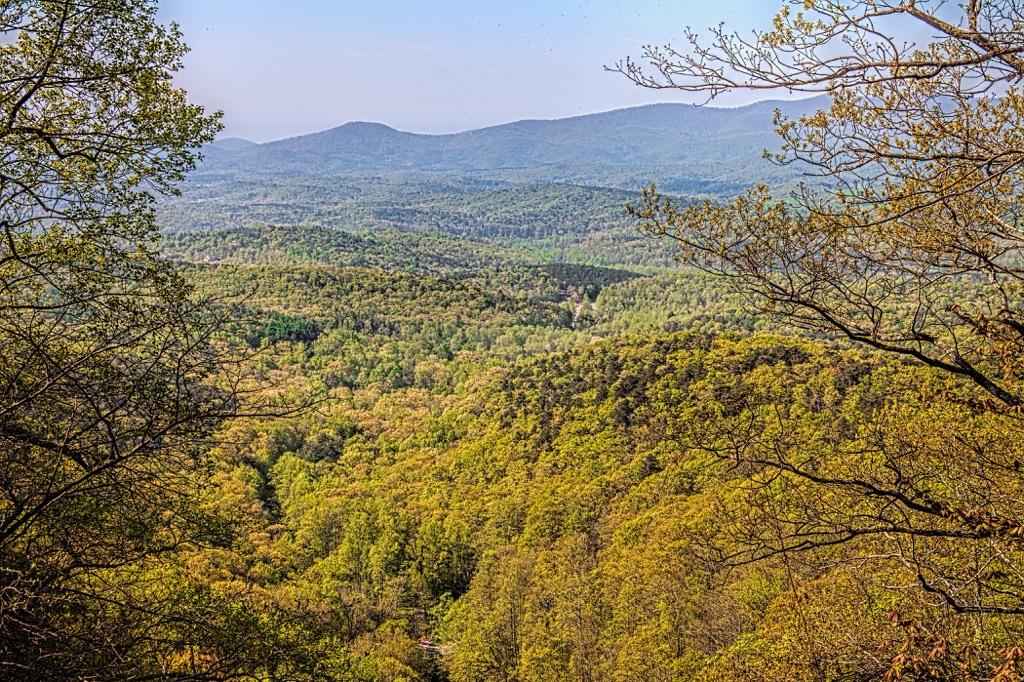
The landscape in the WMA is similar to that of the surrounding national forest. A series of alternating forested ridges and valleys define the region. Despite the relatively low peaks, the terrain is known for being rugged with steep ridgelines and dense forests.
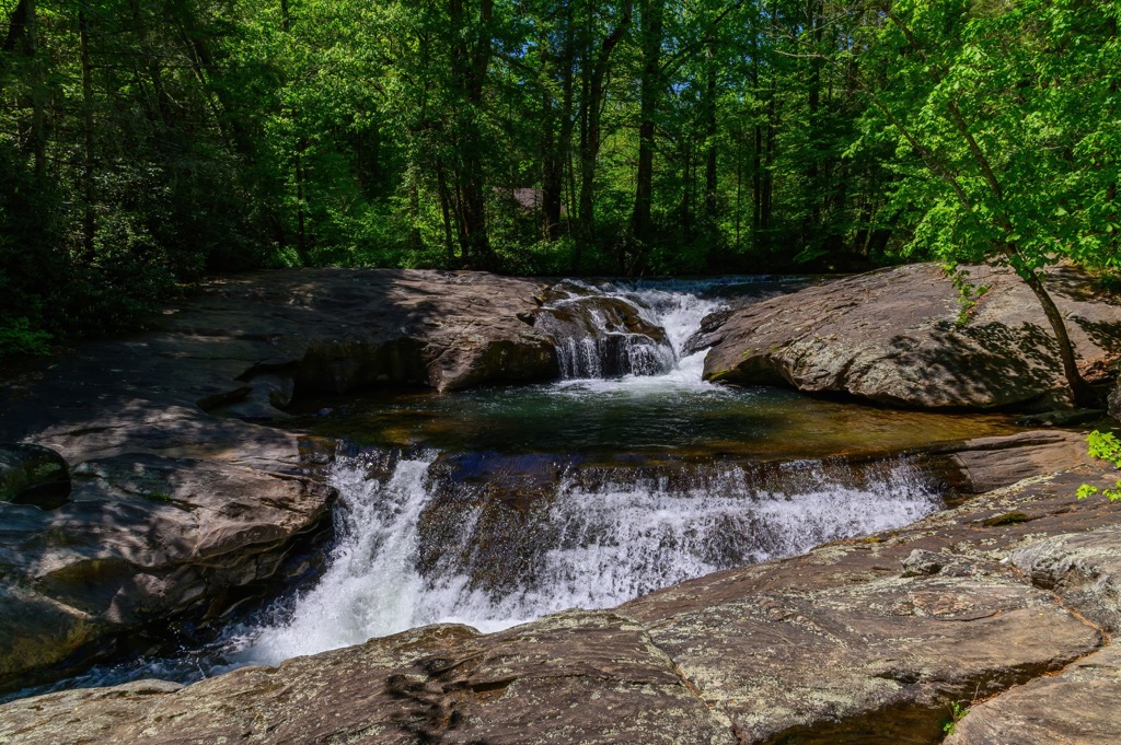
Seasonal creeks and streams wind through the forested hills. The Toccoa River marks the northern and eastern boundaries of the WMA while numerous small ponds and lakes are scattered throughout the region.
The densely forested hillsides provide minimal amounts of view points as most of the ridgelines are covered in trees. Some rocky buttes provide hikers with sweeping views of the surrounding national forest.
The peaks within the Blue Ridge WMA are part of the Blue Ridge Mountains, a subrange of the larger Appalachian Mountains. These peaks mark some of the most southern stretches of the Appalachian Mountains. The start of the Appalachian Trail lies on Springer Mountain which is situated within the WMA.
Additionally, the Blue Ridge WMA is surrounded by popular outdoor recreation areas. The Blue Ridge District of the Chattahoochee-Oconee National Forest surrounds the region while the Chattooga District is situated to the east. The Dawson Forest WMA is to the southwest along with Talking Rock Nature Preserve.
The peaks within the Blue Ridge WMA are part of the Blue Ridge Mountains system, which the region is named after. This portion of the Appalachian Mountains mark a physiographic province known for its distinct landforms.
Some rocks found within the wilderness date back to the Precambrian and Paleozoic eras. The Appalachian Mountains began forming as early as 1 billion years ago during the Grenville and Alleghenian orogenies.
The geological history of the region showcases how much older the Appalachian Mountains are compared to other notable ranges across the globe. Major ranges, such as the Alps and the Himalaya, were formed during the Alpine orogeny around 65 million years ago.
Common types of rock found in the WMA include schists, granites, gneisses, and metagraywacke. Over the course of millions of years, the peaks and ridgelines eroded, leaving behind the series of valleys visible today.
Major peaks within the Blue Ridge WMA include Ball Mountain, Frozen Knob, Hawk Mountain, Rocky Mountain, and Big John Dick Mountain.
The Blue Ridge WMA is part of the larger Blue Ridge Mountains ecoregion, which spans across sections of Georgia, North Carolina, South Carolina, Tennessee, and Virginia. The varied topography and ecosystems allow for an array of both fauna and flora to thrive.
Forested terrain in the region primarily consists of mixed pine-hardwood forests. Hikers are also likely to spot hickory, oak, pine, and loblolly trees throughout. Sections of spruce-fir forests are more common at higher elevations found north of the WMA.
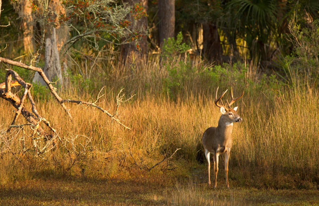
This WMA is used for hunting deer, turkey, bear, and smaller game. Bobcats inhabit parts of the region though they are rarely spotted by hikers or hunters. Birds of prey such as eagles and hawks are also common along with sparrows and hummingbirds.
The land that is now the Chattahoochee-Oconee National Forest marks part of the ancestral homelands of the Muscogee (Creek) and Cherokee Nations. Indigneous peoples have lived in this region for thousands of years, long before the arrival of European colonizers.
Following the Indian Removal Act in the 1830s, the Indigenous Tribes were forcibly removed from their ancestral homelands. These tribes were forced to travel to present-day Oklahoma in what would later be referred to as the Trail of Tears. Other Indigneous people of the region relocated throughout present-day Louisiana, Texas, Alabama, and North Carolina.
The first recorded contact between the Indigneous peoples and Europeans was in the mid-sixteenth century. During this time Hernando de Soto of Spain led an expedition throughout the southeastern US and made contact with multiple Tribal Nations.
The Cherokee made trade deals and treaties with some of the early English, Irish, and Scottish immigrants who began settling in the region. By the early 1700s, the Cherokee had united to form a national government.
Georgia became a British colony in the 18th century which quickly led to a rise in population. By the end of the 18th century, Georgia had an economy centered around agriculture reliant on slavery and large plantations.
The nearby city of Dahlonega was the site of the first major gold rush in the country during the 1820s. Discovery of gold in the Blue Ridge Mountains resulted in the US government attacking, killing, and forcibly removing the Indigenous people from the region.
Those who survived the journey on the Trail of Tears later went on to form the Cherokee Nation. The Cherokee people who managed to stay on their native land formed the Eastern Band of Cherokee Indians, whose headquarters are now located in North Carolina on the Qualla Boundary.
In 1911 the United States Forest Service purchased land in northern Georgia that later became the Chattahoochee National Forest. In 1959, 96,000 acres (38,850 ha) of federal land was established as the Oconee National Forest and the two were later administratively combined.
Today the Blue Ridge WMA is used for hunting and contains over 30 miles (48 km) of hiking trails that are open to the public.
The Blue Ridge WMA is home to numerous trails for hiking and other outdoor adventures. The start of the Appalachian Trail lies within the WMA. Here are a few popular trails to check out on your next visit:
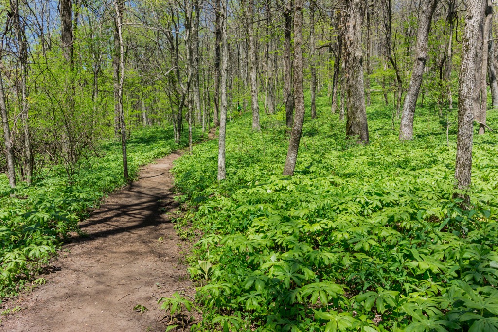
The route to Springer Mountain passes along a portion of the Appalachian Trail. This trail climbs steadily at the beginning through the forested landscape before following along Davis Creek. Along the route hikers pass by the summits of Rich Mountain, Springer Mountain, and Ball Mountain.
Hikers have partial viewpoints throughout along with numerous designated campgrounds. The loop trail is 10 miles (16 km) long and features 1,860 feet (567 m) of elevation gain.
This shorter loop offers stunning views of the surrounding Blue Ridge District of the national forest. The route begins near Springer Mountain and passes through the forested landscape.
From the summit of the peak hikers have sweeping views of the surrounding terrain.
This loop trail is 4.1 miles (6.6 km) long and features 846 feet (258 m) of elevation gain. Completing the loop in a counterclockwise direction helps break up some of the major climbs.
This point to point trail begins at the southern edge of the WMA. The trail features gradual climbs and descents throughout before exiting the WMA and entering Amicalola Falls State Park.
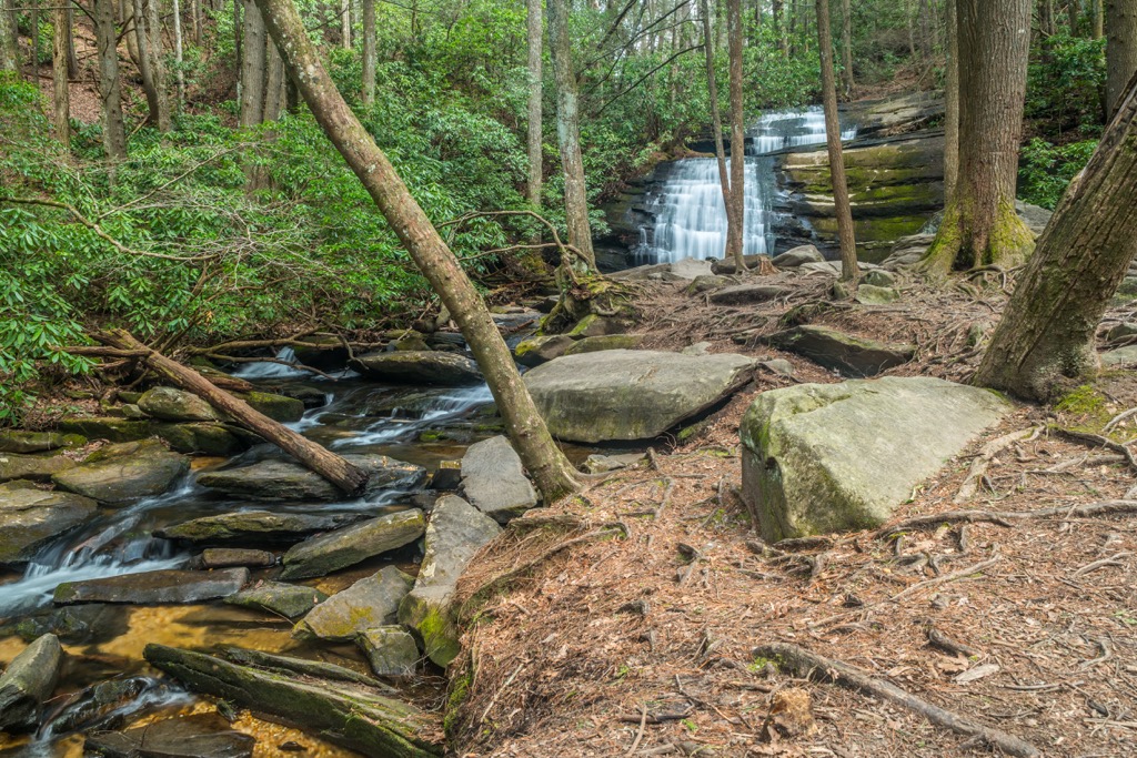
The main feature of the trail is the stunning falls which cascade down the rock face over a series of jagged outcroppings. This route can also be used as an out and back starting at the falls. The route is 5 miles (8 km) one way and features 984 feet (300 m) of elevation gain.
Looking for a place to stay near the Blue Ridge WMA? Here are some of the best cities and villages to check out in the region.
Dahlonega is the closest city to the WMA, situated along the southern border of the protected region. The small city is home to around 7,000 residents and was originally established as a gold mining town. In 1829, Dahlonega marked the beginning of the first gold rush in the United States.

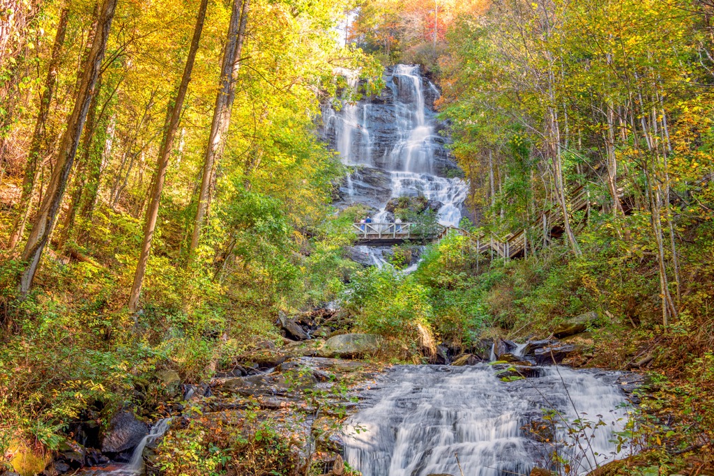
Visitors can take a look into the history of the city and the region by exploring the historic downtown and the Dahlonega Gold Museum. Nearby Amicalola Falls lies just west of the city and is one of the most popular viewpoints in the foothills of the Blue Ridge Mountains. The city is well known for its close proximity to the start of the Appalachian Trail.
Atlanta lies just an hour's drive to the south of Dahlonega and is home to around 500,000 residents. Besides being the closest major city to the WMA, Atlanta is also the capital city of the state.
The city acts as a cultural and commercial hub for Georgia and is home to a long and rich history. Sites worth visiting include the Martin Luther King, Jr. National Historical Park, High Museum of Art, Centennial Olympic Park, Piedmont Park, and the Atlanta Botanical Garden. Visitors can explore the plethora of local restaurants that showcase the local southern cuisine.