



Curated by APT Valsugana e Lagorai
Torcegno
Valsugana village on the sunlit slope below the Lagorai, above the Brenta valley floor.
Photo: Stefano Petri · CC BY 3.0 licence
- 12Routes
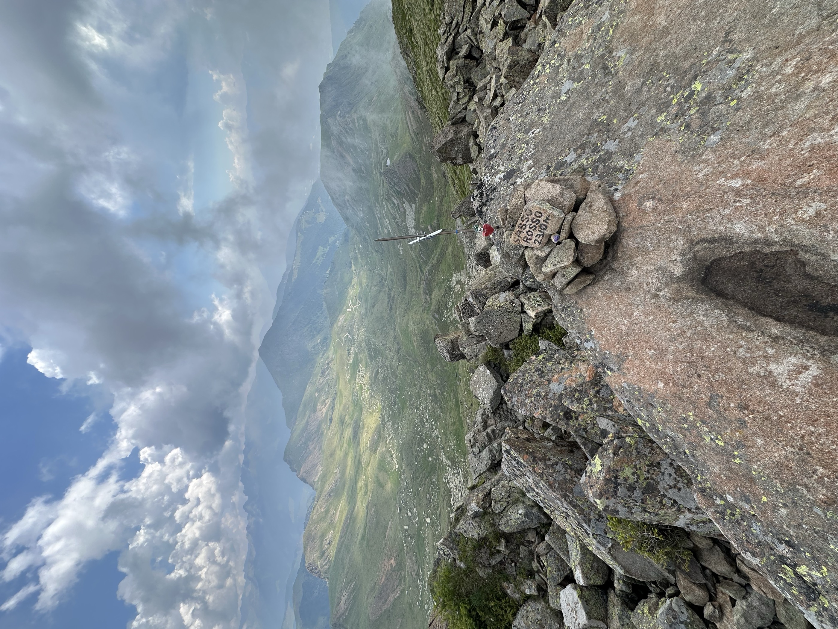
- Featured summit · Sasso Rosso
Routes
Colle di San Pietro
A brief walk to the Colle San Pietro, the wooded knoll above Torcegno in the Valsugana.
- 3.6 km
- Distance
- 108 m
- Ascent
- 1 h 6 min
- Duration
Open route APT Valsugana e LagoraiGiro del Sasso Rosso
A loop around the Sasso Rosso above Torcegno, on the Valsugana flank of the Lagorai chain.
- 8.1 km
- Distance
- 579 m
- Ascent
- 3 h 49 min
- Duration
- 32
- Check-ins
 Sasso Rosso 2 320 m
 Forcella Sasso Rotto 2 285 m
- Forcella delle Conelle 2 198 m
 Malga Sette Selle 1 906 m
Open route APT Valsugana e LagoraiPeace Trail 28: From Campestrini to Rifugio Malga Conseria
A long stage from Campestrini, first on a cobbled mule track and then on shaded forest path, up to the Malga Conseria hut in the Lagorai.
- 21.3 km
- Distance
- 1 677 m
- Ascent
- 8 h 51 min
- Duration
- 102
- Check-ins
- Col Scandolera 1 421 m
- Rifugio Malga Consèria 1 848 m
- Bivacco Rifugio Consèria 1 824 m
- Malga Conseria 1 821 m
- Rifugio Carlettini 1 367 m
- Malga Cenon di sotto 1 334 m
- +5
Open route APT Valsugana e LagoraiMTB - Val di Cavé Tour 2348
A gravel-road climb above Torcegno to Malga Colo and its mountain ponds, with Malga Casapinello on a side branch and a paved return.
- 28.4 km
- Distance
- 1 284 m
- Ascent
- 3 h 44 min
- Duration
- 17
- Check-ins
Open route APT Valsugana e LagoraiRoadbike - Roncegno - Ronchi (Mountain of Roncegno)
A road climb from Roncegno Terme to the malghe at Pozze and Trenca, dropping to Borgo Valsugana for the return.
- 30.2 km
- Distance
- 1 295 m
- Ascent
- 3 h 54 min
- Duration
- 38
- Check-ins
- Rifugio Serot 1 566 m
- Malga Fravort 1 565 m
- Ristorante alle Pozze 1 433 m
- Agritur Paradiso 1 644 m
- Malga Trenca 1 660 m
- Baita Alpini Rocegno 1 414 m
- +1
Open route APT Valsugana e LagoraiNordic Walking - Nature Trail Franco Furlan
A short circular trail on dirt paths through spruce wood at Torcegno, signed with notes on the forest, its plants and animals.
- 1.9 km
- Distance
- 70 m
- Ascent
- 37 min
- Duration
Open route APT Valsugana e LagoraiAnello Malga Casapinello, 7 laghi, Casapinello
A ring from the Malga Casapinello above Ronchi Valsugana to the group of small tarns known as the seven lakes, and back.
- 7.6 km
- Distance
- 463 m
- Ascent
- 3 h 12 min
- Duration
- 6
- Check-ins
Open route APT Valsugana e LagoraiPeace Trail 27: From Rifugio Malga Masi to Campestrini
A stage of the Peace Trail from the Malga Masi over the La Bassa pass, then level through larch woods under the Fravort and Cola summits.
- 21.0 km
- Distance
- 463 m
- Ascent
- 6 h 56 min
- Duration
- 91
- Check-ins
- La Bassa 1 834 m
- Agriturismo Malga Masi 1 719 m
- Rifugio Serot 1 566 m
- Malga Fravort 1 565 m
 Laghetto delle Prese 1 617 m
- Lago delle Carezze 1 764 m
- +1
Open route APT Valsugana e LagoraiMTB - 3TBike Tour 2341
A waymarked route across Colle San Pietro on cobbled lanes and singletrack, linking the four villages of the Ecomuseo del Lagorai.
- 29.8 km
- Distance
- 1 303 m
- Ascent
- 3 h 52 min
- Duration
- 2
- Check-ins
Open route APT Valsugana e LagoraiNordic Walking - Torcegno Tour
A circuit from the Torcegno sports field through old chestnut woods and field lanes, half on dirt and half on asphalt, with the Lagorai above.
- 4.9 km
- Distance
- 115 m
- Ascent
- 1 h 26 min
- Duration
Open route APT Valsugana e LagoraiTorrente Ceggio F
A steep climb on the wooded slopes above Torcegno, in the side valley of the Torrente Ceggio on the Valsugana flank of the Lagorai.
- 10.8 km
- Distance
- 1 205 m
- Ascent
- 5 h 2 min
- Duration
Open route Trentino FishingWalk - Larch Trail
A short high walk in a larch wood above Torcegno, gentle enough for the whole family.
- 1.9 km
- Distance
- 61 m
- Ascent
- 36 min
- Duration
Open route APT Valsugana e Lagorai
No routes of this kind in Torcegno yet.
The region's own picks

Featured route
Colle di San Pietro
A brief walk to the Colle San Pietro, the wooded knoll above Torcegno in the Valsugana.
Planning a trip to Torcegno?
Everything else Trentino-Alto Adige/Südtirol has, in one place


Take Torcegno with you into the mountains
Every route on this page with 3D terrain, GPX navigation and offline maps — including the valleys with no signal.
Data sources
- Official website: visitvalsugana.it ↗
- Routes and highlights: APT Valsugana e Lagorai, Trentino Fishing
- Published as open data by the tourist boards named above.
- Region summary generated from the board's own material.
