
Curated by TVB Paznaun-Ischgl
Spiss
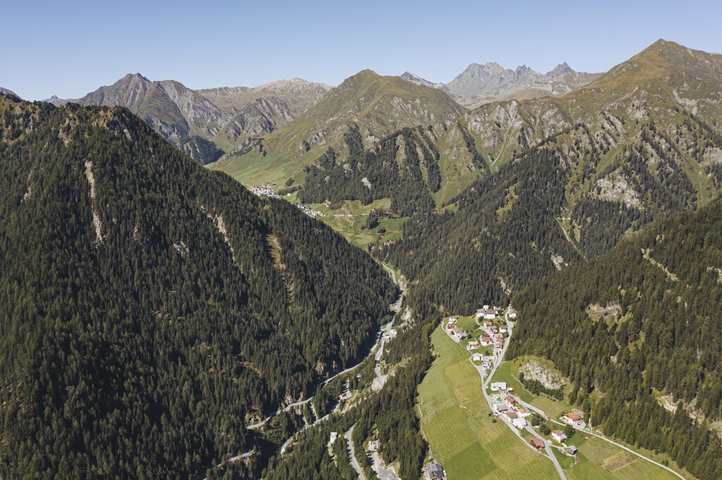
Austria's remote corner of the Samnaun group near the Swiss border — a scatter of farms at about 1630 m that ranks among the country's highest and smallest municipalities.
- 15Highlights
- 5Routes
- Featured summit · Kreuzjoch
Highlights
All 15 from neighbouring places
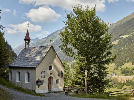
Kapelle auf der Alpe Gampertun
7.7 km away, in See
A chapel on the Alpe Gampertun, a high pasture in a side valley near Kappl, used by herders during the alpine summer.
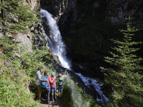
Visnitzwasserfall
9.2 km away, in Kappl
A waterfall on the Visnitzbach in the Paznaun valley near Kappl, a short walking destination on the valley's south side.
Rotwegkapelle
9.2 km away, in Kappl
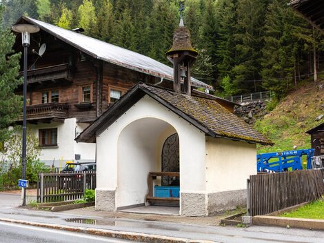
A chapel beside the so-called Rotweg, the red way, near Kappl, one of the wayside chapels of the middle Paznaun valley.
Hubertuskapelle
9.4 km away, in See
A chapel dedicated to St. Hubert on the slopes between Kappl and See, one of several hunters' chapels in the Paznaun valley.
Wegkapelle im Schmittal, Labebene
9.5 km away, in See
A wayside chapel at Labebene in the Schmittal, a side valley near Kappl, serving walkers and farmers on the mountain paths.
Bienenlehrpfad
9.5 km away, in Kappl
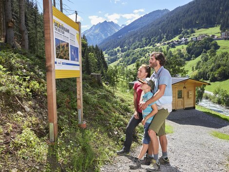
An educational bee trail at Kappl in the Paznaun, with information stations on honeybees and alpine beekeeping.
Wegkapelle in der Holdernacher Au
9.7 km away, in See
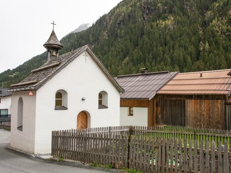
A wayside chapel in the Holdernacher Au near Kappl, built beside the old route along the floor of the Paznaun valley.
Kapelle in Wiese
9.7 km away, in Kappl
A small chapel in the hamlet of Wiese near Kappl, standing among fields whose German name simply means meadow.
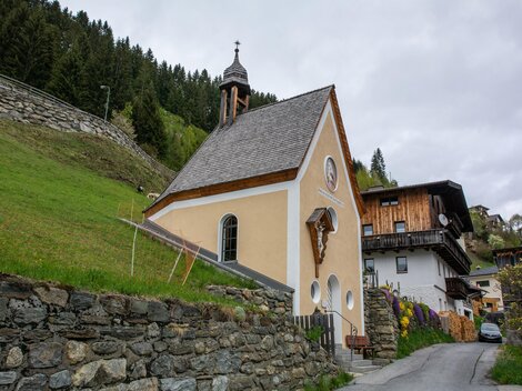
Marienkapelle in Habigen
9.7 km away, in See
A Marian chapel in the hamlet of Habigen in the Paznaun valley, among the chain of small chapels between Kappl and See.
Lourdeskapelle in Untermühl
9.8 km away, in Kappl
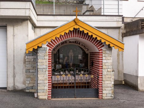
A Lourdes chapel in Untermühl near Kappl, one of several chapels in the Paznaun modelled on the French Marian shrine.
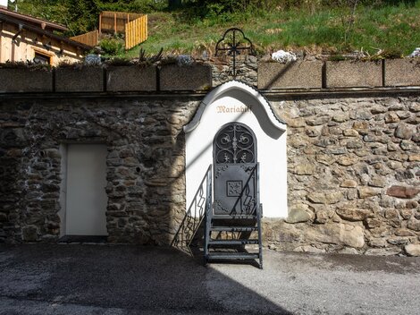
Mariahilf-Kapelle in Bach
9.8 km away, in Kappl
A Mariahilf chapel in the hamlet of Bach near Kappl, dedicated to Mary as helper, a devotion found throughout Tirol.
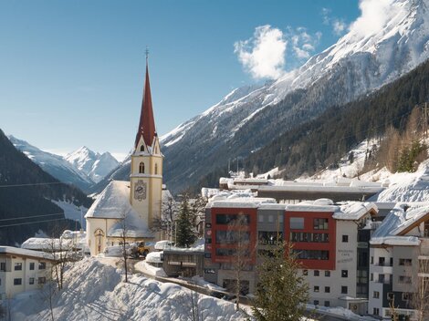
Pfarrkirche Kappl
9.8 km away, in Kappl
The parish church of Kappl, prominently sited above the Paznaun valley at around 1,258 m and a landmark of the widely scattered village.
Kapelle in Niederhof
9.8 km away, in Kappl
A chapel in the hamlet of Niederhof near Kappl, one of the small devotional buildings kept by the valley's farming families.
Friedhofskapelle
9.8 km away, in Kappl
The cemetery chapel beside the parish church of Kappl, used for funerals and quiet prayer in the Paznaun village at about 1,258 m.
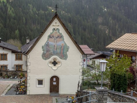
Kerkerkapelle
9.8 km away, in Kappl
A chapel beside the parish church of Kappl, its name referring to the devotional image of Christ in the dungeon before the crucifixion.
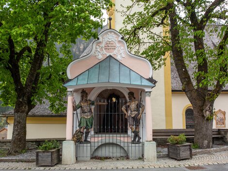
Nothing of this kind in Spiss.
Routes
15 from neighbouring places
Zitatenweg
An easy themed path along the valley floor near Spiss, running past the old mill and the customs post by the Swiss border.
- 5.9 km
- Distance
- 90 m
- Ascent
- 1 h 47 min
- Duration
Samnaun-Compatsch - Spissermühle
A valley walk down from the Swiss side of the border to the old mill and the customs post below Spiss.
- 10.1 km
- Distance
- 338 m
- Ascent
- 3 h 23 min
- Duration
Alp Bella und Fliesseralp
A long day above Spiss crossing the Fuorcla and the Matschiberlesattel between two high dairy huts on either side of the ridge.
- 16.4 km
- Distance
- 1 078 m
- Ascent
- 7 h 17 min
- Duration
- 1
- Check-ins
Samnaun-Compatsch - Spiss Rundtour
A round from Samnaun to Spiss, climbing to the Fließer Alpe at 2,003 m before the drop back.
- 15.5 km
- Distance
- 601 m
- Ascent
- 1 h 56 min
- Duration
- 2
- Check-ins
Kreuzjoch via Muttakopf
A giant ridge day above Spiss, collecting the Muttakopf, Rotspitze and In der Keil on the way to the Kreuzjoch — roughly 2,000 m of climbing on the Samnaun border crest.
- 18.5 km
- Distance
- 1 813 m
- Ascent
- 11 h 12 min
- Duration
Bike & Hike Kappl - Mittagskopf
8.5 km away, in Kappl
A steady ascent from Kappl past the Rotwegkapelle to the Visnitzalpe, where the walking section up to the Mittagkopf begins.
- 11.9 km
- Distance
- 1 079 m
- Ascent
- 2 h 34 min
- Duration
- 5
- Check-ins
7185 Talweg Kappl-See
9.3 km away, in See
A valley cycle route between the two Paznaun villages, ending near the Medrigjochbahn base station and the Bergrausch Hütte.
- 12.7 km
- Distance
- 369 m
- Ascent
- 1 h 29 min
- Duration
- 4
- Check-ins
7091 Durrichalpe Tour
9.8 km away, in Kappl
A forest-road climb out of Kappl in the Paznaun towards the Durrichalpe, with a gravel descent back down to the village.
- 13.6 km
- Distance
- 590 m
- Ascent
- 1 h 46 min
- Duration
- 1
- Check-ins
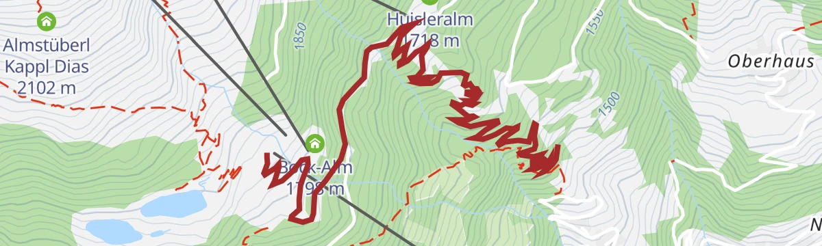
7171 Dias-Flow-Trail
10.7 km away, in Kappl
A lift-served flow trail dropping from the Dias area at Kappl past the Huisleralm, ridden with the gondola doing the climbing.
- 3.8 km
- Distance
- 5 m
- Ascent
- 21 min
- Duration
- 4
- Check-ins
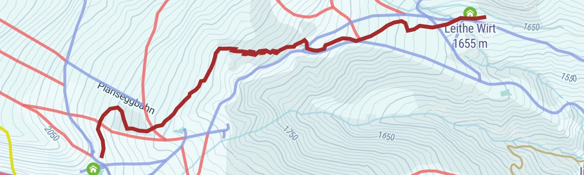
Route 5 - Plansegg
12.2 km away, in Serfaus
Steeper marked touring route to the Plansegg, gaining 700 m beside the Serfaus pistes with the Leithe Wirt as the refreshment stop.
- 3.5 km
- Distance
- 718 m
- Ascent
- 718 m
- Descent
- 2 h 18 min
- Duration
- 9
- Check-ins
Route 6 - Komperdell
12.4 km away, in Serfaus
Designated uphill route in the Serfaus ski area climbing gently to the Panoramarestaurant Komperdell, a short first tour alongside the pistes.
- 2.8 km
- Distance
- 325 m
- Ascent
- 325 m
- Descent
- 1 h 12 min
- Duration
- 23
- Check-ins
Schleck Track
13.9 km away, in Serfaus
A climb of just over 200 m in under 2 km from Serfaus up to Leithe Wirt, beside the Königsleithebahn at about 1,650 m.
- 1.8 km
- Distance
- 213 m
- Ascent
- 29 min
- Duration
- 10
- Check-ins
777 Mittagkopf Tour
9.5 km away, in Kappl
A steep climb above Kappl by the Rotwegkapelle to the Visnitzalpe at 1,824 m under the Mittagkopf.
- 14.7 km
- Distance
- 904 m
- Ascent
- 2 h 22 min
- Duration
- 1
- Check-ins
Kapellenweg rund um Kappl
9.6 km away, in Kappl
Chapel-to-chapel circuit around Kappl's scattered hamlets, an easy round past the Rotwegkapelle and the village shrines on old connecting paths.
- 6.7 km
- Distance
- 290 m
- Ascent
- 2 h 18 min
- Duration
- 4
- Check-ins
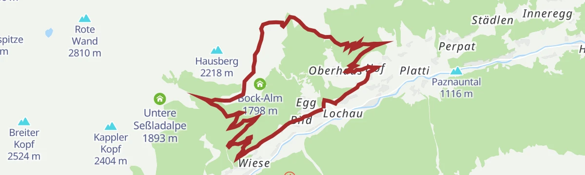
K.9 Egg - Dias
9.8 km away, in Kappl
Balcony route between the hamlet of Egg and the Dias terrace above Kappl, passing the Bock-Alm and the storage pond on a moderate half-day line.
- 11.9 km
- Distance
- 655 m
- Ascent
- 4 h 39 min
- Duration
- 5
- Check-ins
 Speicherteich Dias 1 846 m
 Infobüro 1 270 m
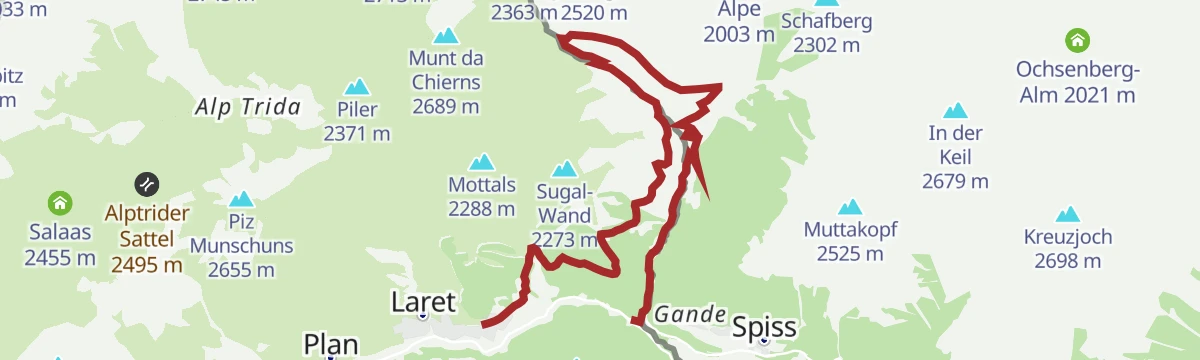
- Bock-Alm 1 798 m
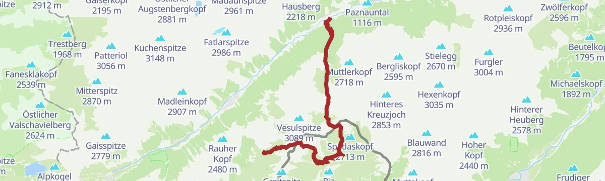
Etappe 3: Schmugglerroute
7.4 km away, in Kappl
Historic smugglers' stage climbing from the Idalp over the border ridge to Alp Trida and on toward Kappl — more than 2,000 m of ascent across old contraband paths between Tyrol and Samnaun.
- 20.0 km
- Distance
- 2 060 m
- Ascent
- 12 h 36 min
- Duration
- 26
- Check-ins
Bike & Hike See - Rotpleiskopf
10.2 km away, in See
A long approach ride to the Ascher Hütte at 2,256 m, from where the summit walk continues along the ridge above the Medrigalm.
- 18.9 km
- Distance
- 1 891 m
- Ascent
- 4 h 25 min
- Duration
- 24
- Check-ins
Bike & Hike Ischgl - Berglisee
13.7 km away, in Ischgl
A bike-and-hike approach from Ischgl, riding the valley to the Wildererhütte before walking on to the Berglisee.
- 12.3 km
- Distance
- 808 m
- Ascent
- 2 h 4 min
- Duration
- 35
- Check-ins
738 Grosse Dias Runde
9.8 km away, in Kappl
The longer of two loops on the Dias plateau above Kappl, past the storage ponds and the small fishing lake at 1,825 m.
- 14.1 km
- Distance
- 632 m
- Ascent
- 1 h 51 min
- Duration
- 8
- Check-ins
- Speicherteich Dias 1 846 m
- Angelteich 1 825 m
- Infobüro 1 270 m
- Speicherteich Dias II 1 825 m
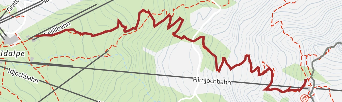
7106 Flimjoch Trail
8.1 km away, in Ischgl
A short lift-served trail on the high ground at the Flimjoch, starting from the gondola top station at 2,735 m.
- 2.9 km
- Distance
- 2 m
- Ascent
- 15 min
- Duration









No routes of this kind in Spiss yet.
The region's own picks
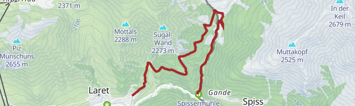
Featured route
Zitatenweg
An easy themed path along the valley floor near Spiss, running past the old mill and the customs post by the Swiss border.
Planning a trip to Spiss?
Everything else Tyrol has, in one place


Take Spiss with you into the mountains
Every route on this page with 3D terrain, GPX navigation and offline maps — including the valleys with no signal.
Data sources
- Official website: ischgl.com ↗
- Routes and highlights: TVB Paznaun-Ischgl, Serfaus-Fiss-Ladis
- Published as open data by the tourist boards named above.
- Region summary generated from the board's own material.
