
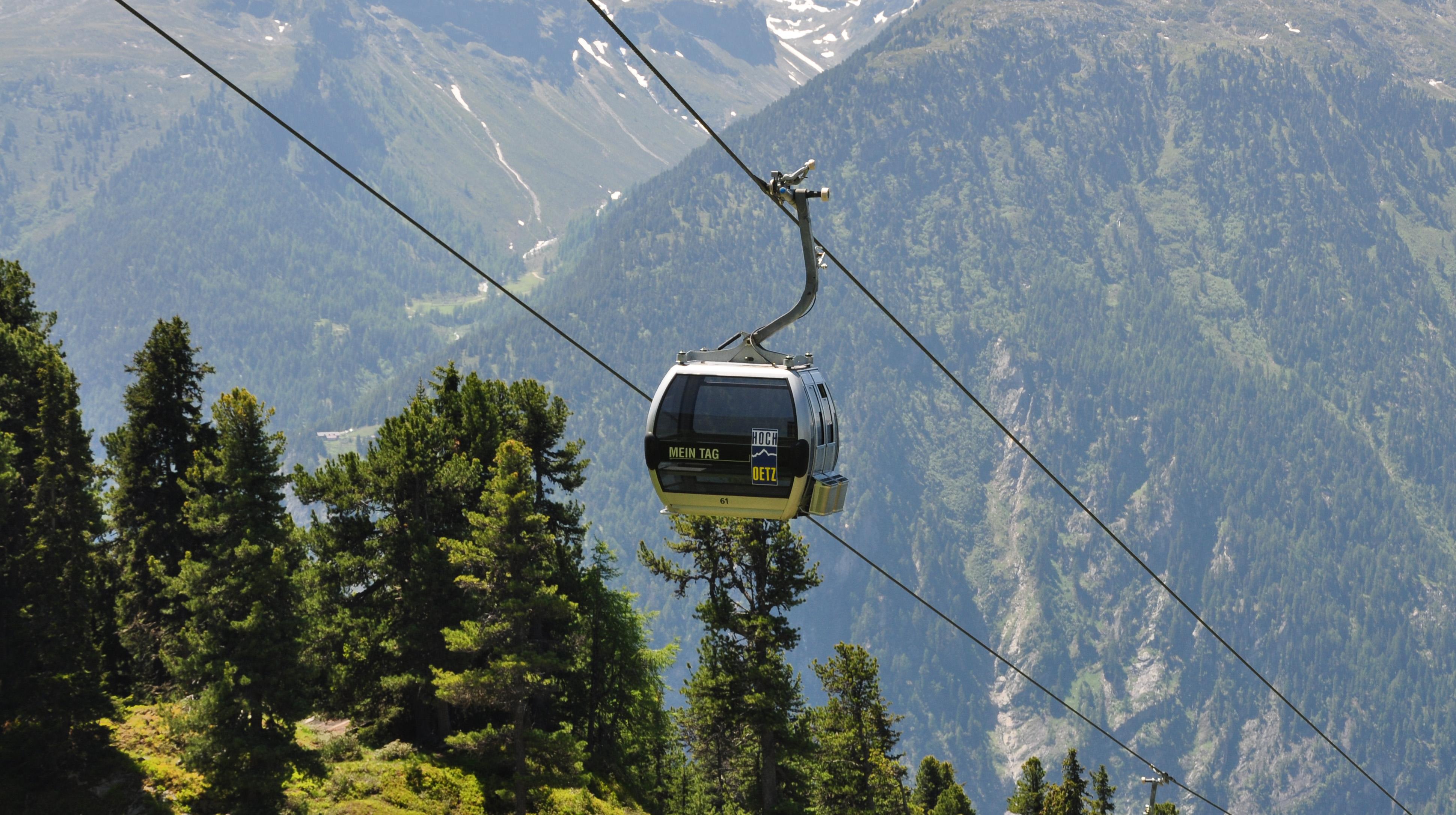
 Cable car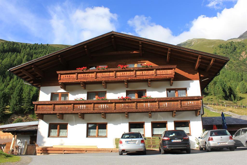
 Historic site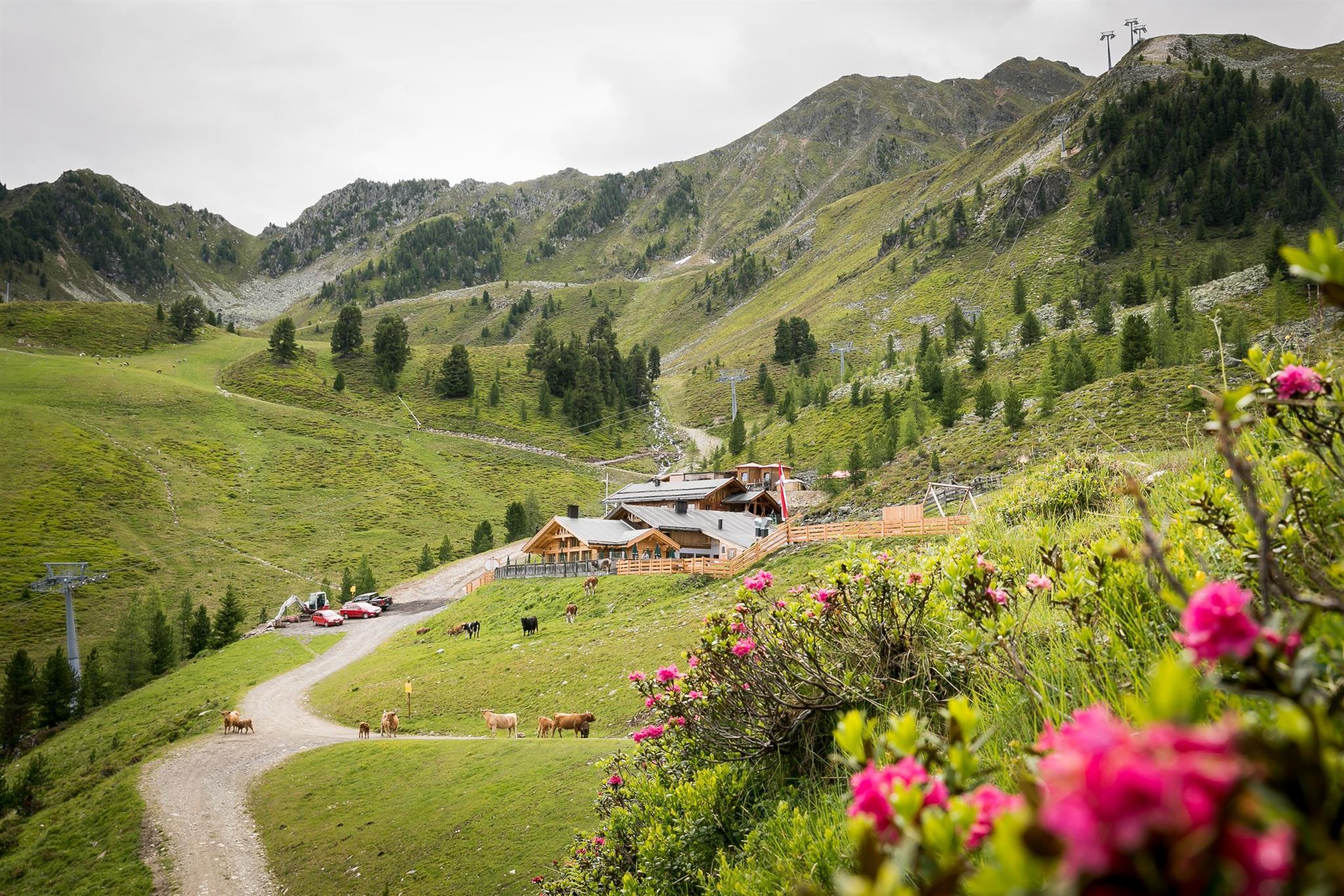

 Viewpoint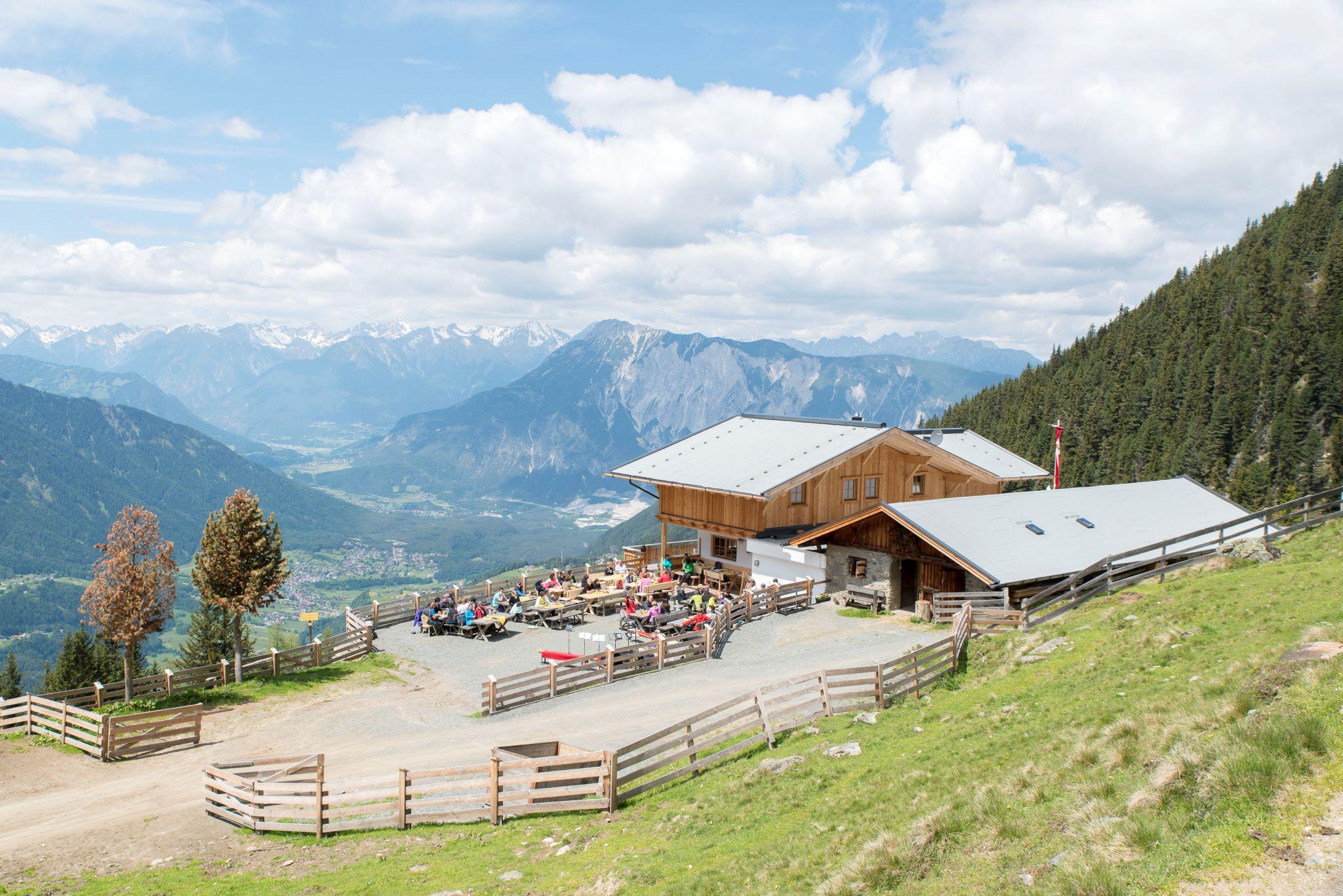

















Curated by Ötztal Tourismus
Silz
An Oberinntal village on the old road between Telfs and Imst whose territory leaps to Kühtai at 2,017 m, among Austria's highest ski resorts, with Burg St. Petersberg guarding the valley.
- 3Highlights
- 72Routes
- Featured summit · Tschirgant
Highlights
12 from neighbouring places
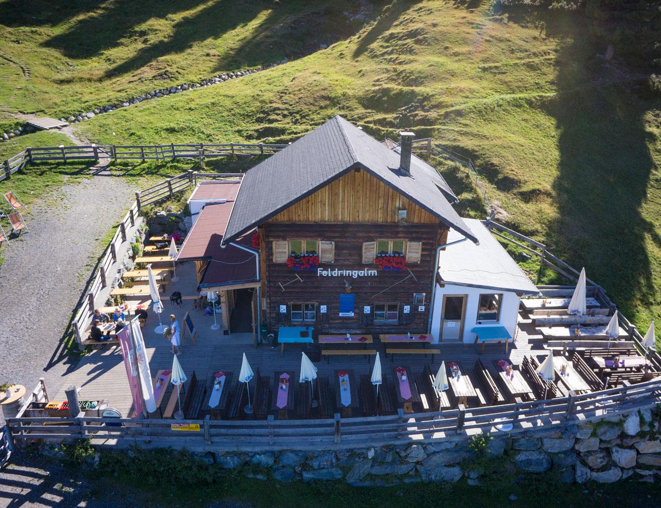
Feldringalm
A traffic-free alpine pasture reached by forest road from the Sattele car park, an easy walk suited to families.
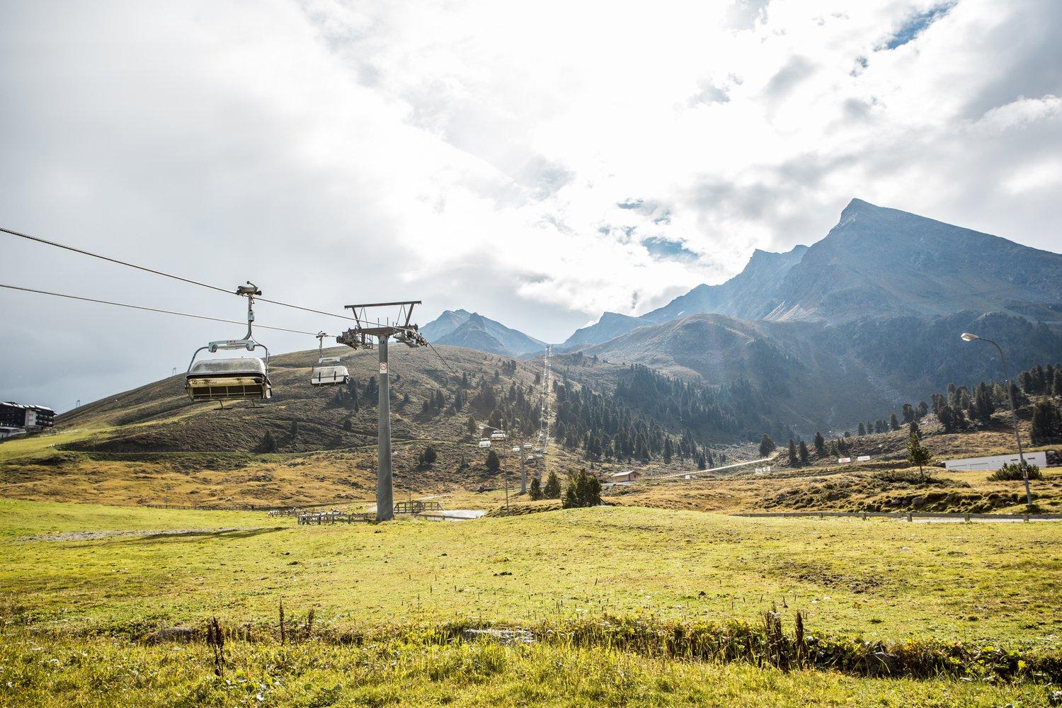
Drei-Seen-Bahn
A four-seat chairlift at Kühtai with weather hoods and bike carriers, serving the three-lakes walk and a large high-alpine playground.
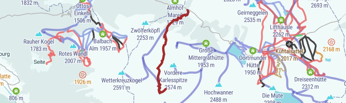
Almhof Mareil
0.1 km away, in Haiming
An inn between Ochsengarten and Kühtai on the Kaiser-Franz-Josef, Höllwiesen and Knappen paths, with its own bus stop below.
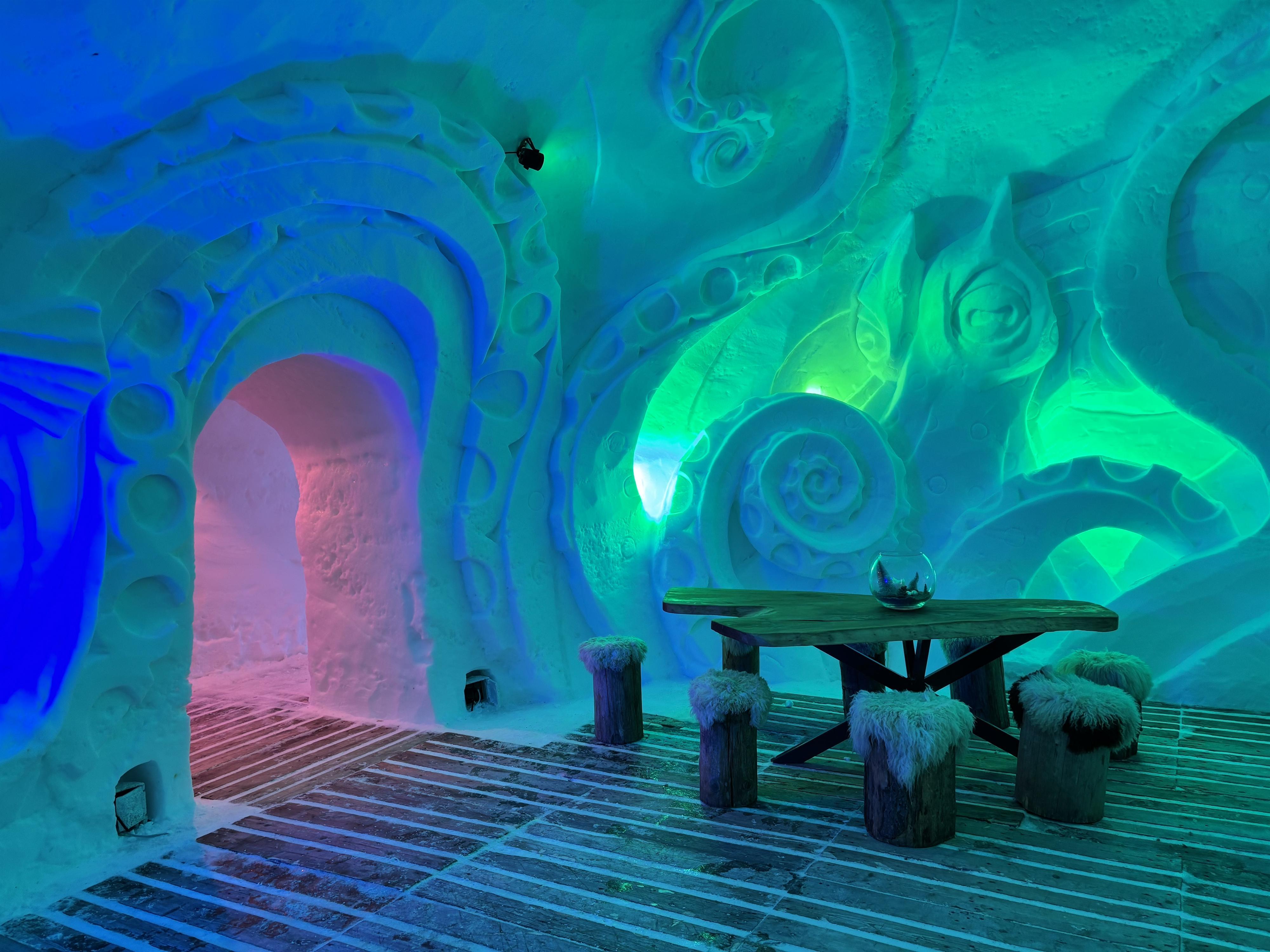
Schneedorf Hochoetz
2.6 km away, in Haiming
Austria's first igloo village, rebuilt each winter at about 2,000 m at Hochoetz, with rooms cut from snow and open for overnight stays.
Balbach Alm
2.7 km away, in Haiming
A hut on the Hochoetz slopes serving traditional Tirolean cooking, with overnight places available.
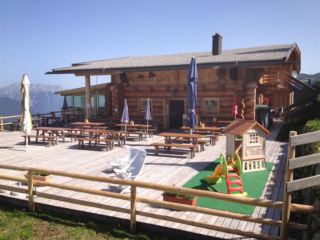
Kühtaile Alm
3.3 km away, in Oetz
A hut reached from the top station of the Acherkogelbahn or the Ochsengartenbahn, with a sun terrace and Tirolean dishes.
Panoramarestaurant Hochoetz
3.6 km away, in Oetz
A restaurant at 2,020 m beside the Acherkogelbahn top station and the WIDIVERSUM, with a terrace facing the Ötztal Alps.
Bielefelder Hütte
3.7 km away, in Oetz
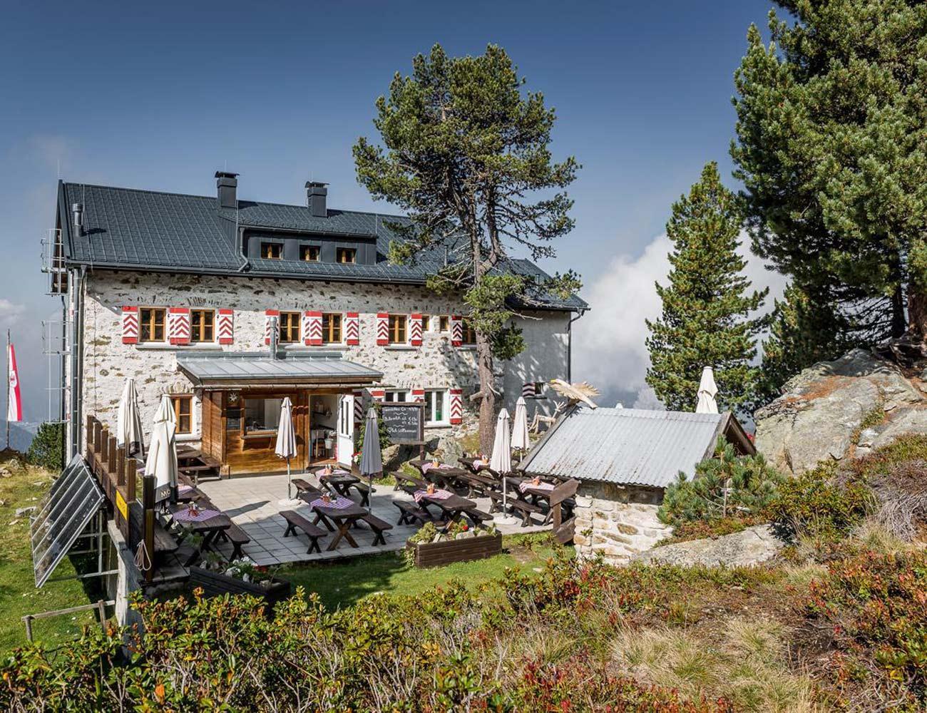
A hut on the Hochoetz slopes above Oetz serving Tirolean dishes, with a large sun terrace facing the surrounding Alps.
Rotes Wandl
3.8 km away, in Oetz
A viewpoint 45 minutes from the Hochoetz top station, looking over the lower Ötztal and Inn valley to the Lechtal Alps and the Arlberg.
Acherberg Alm
4 km away, in Oetz
An alpine pasture hut at 1,888 m above Oetz, serving regional dishes and run by new tenants since 2023.
Kapelle am Kalvarienberg
5.7 km away, in Oetz
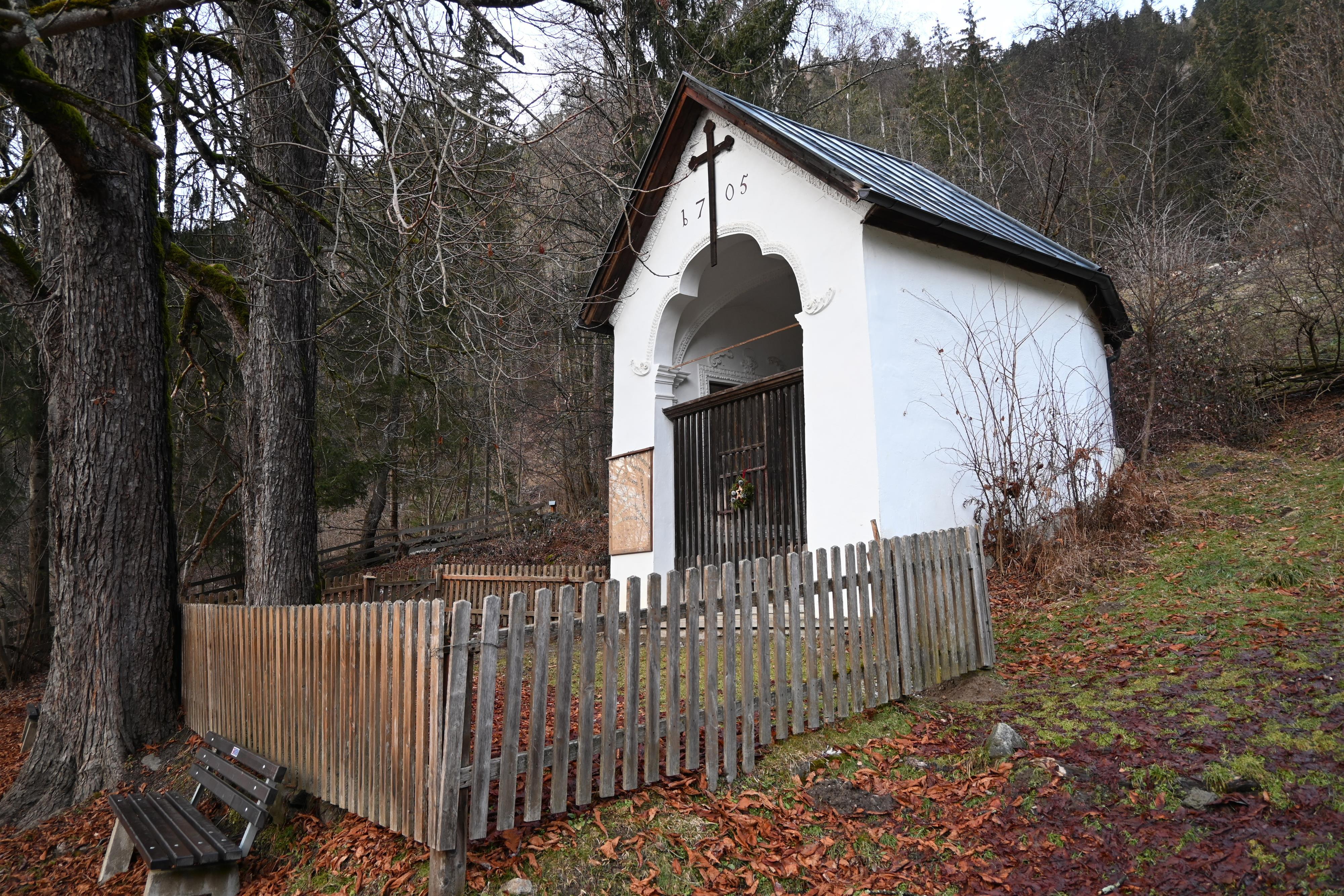
A chapel about ten minutes up a forest track from Oetz, on a circular walk that continues past the Ebele viewpoint to Habichen.
Ebele - Aussichtsplattform
5.8 km away, in Oetz
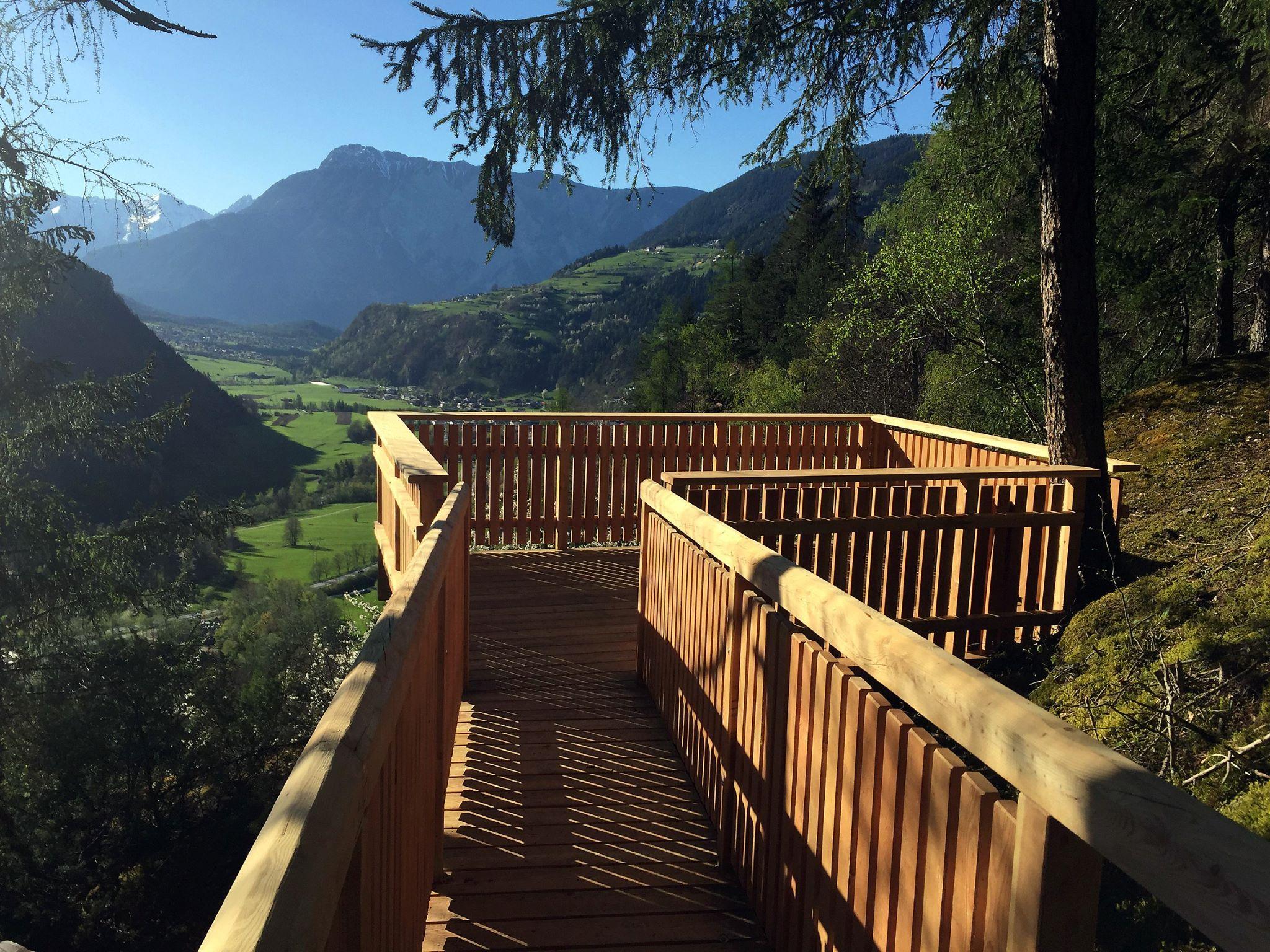
A platform on the slope facing the Piburger See, a few minutes above the chapel on the Kalvarienberg.
eBike Park Oetz
5.9 km away, in Oetz
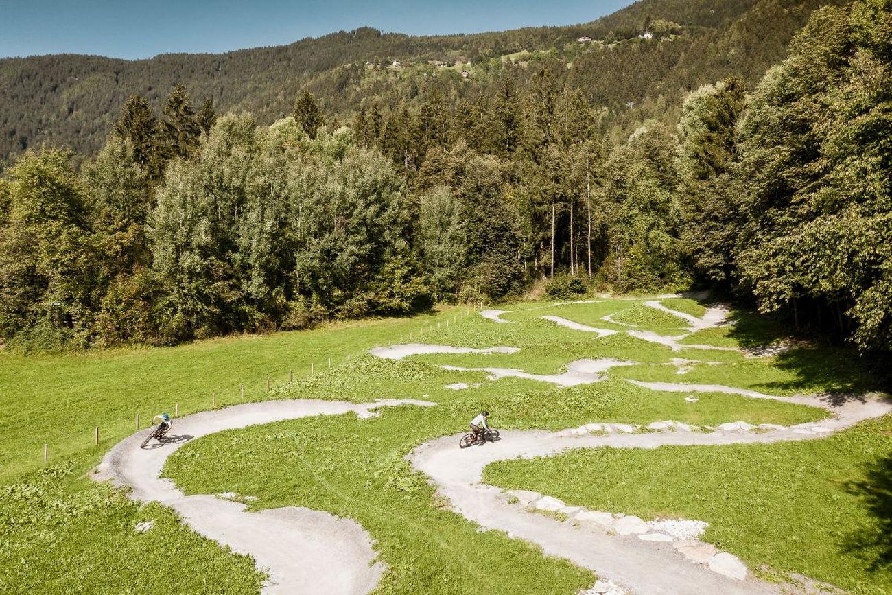
The first e-bike training park in Tirol, with graded loops and an uphill flow line for learning to handle an electric mountain bike.
Ochsengartenbahn
6.1 km away, in Oetz
An eight-seat gondola serving Hochoetz, running on Wednesdays, Fridays and Sundays in summer.
Nothing of this kind in Silz.
Routes
50 routes, an even mix of activities · see the rest on innsbruck.info ↗
Kühtai Panorama Klettersteig
Short via ferrata above Kühtai reached with the Drei-Seen-Bahn, climbing from the scree below the Gaiskogelscharte; the descent passes the Finstertal reservoir and the Drei-Seen-Hütte.
- 767 m
- Distance
- 287 m
- Ascent
- 1 h 52 min
- Duration
Kühtai - Drei-Seen-Hütte
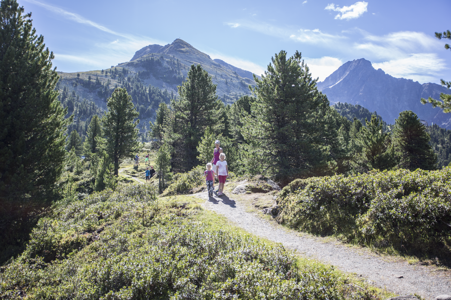
Family walk from the Kühtai saddle to the hut at the Plenderle lakes, passing the Hirschebensee - short enough for an afternoon, with bus stops at the trailhead.
- 5.0 km
- Distance
- 334 m
- Ascent
- 2 h 15 min
- Duration
- 45
- Check-ins
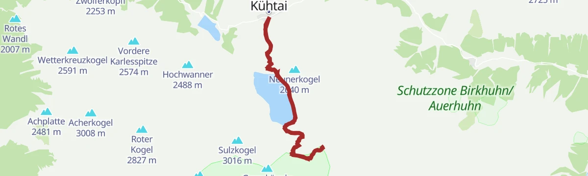
Neunerkogel
From the Kühtai saddle a varied round past the Plenderle lakes and the Dreiseenhütte onto a quiet summit above the Finstertal reservoir, then back to the resort.
- 10.9 km
- Distance
- 796 m
- Ascent
- 5 h 14 min
- Duration
- 66
- Check-ins
Knappenweg
Full mining-trail loop above Hochoetz taking in the Rossköpfe, the Wetterkreuzkogel and the Rotes Wandl, linking the Bielefelder Hütte with the Kühtaile and Balbach alms high above the Ötztal.
- 11.8 km
- Distance
- 807 m
- Ascent
- 5 h 25 min
- Duration
- 86
- Check-ins
Faltegartenköpfl (01)
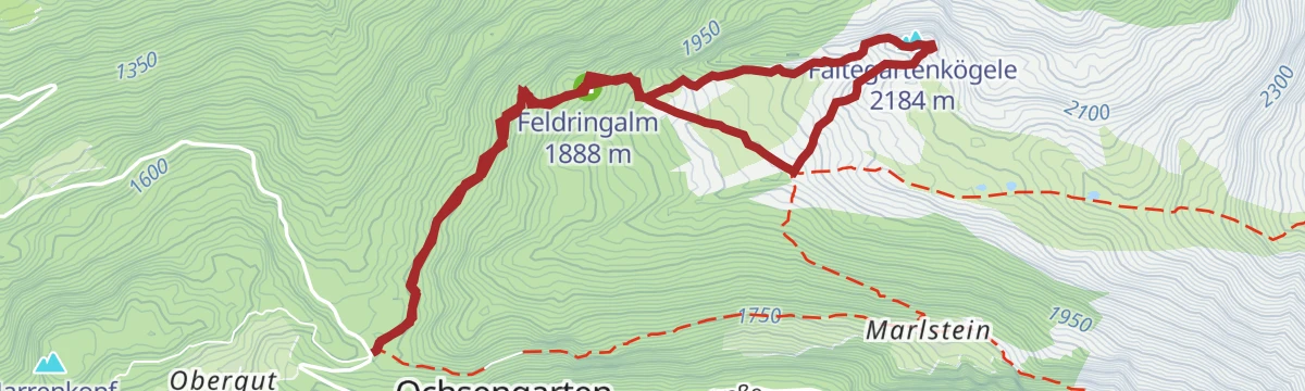
Mellow ski tour from the Sattele above Ochsengarten, following the sledding run to the Feldringalm and crossing the wide, open Feldringer Böden to a summit that stays in view almost the whole way.
- 4.2 km
- Distance
- 481 m
- Ascent
- 0 m
- Descent
- 1 h 33 min
- Duration
- 37
- Check-ins
Sulzkogel
One of Kühtai's big ski-touring goals: up past the Finstertal dam and across the upper cirque to a summit over 3,000 m, with a long, open descent back to the resort.
- 6.6 km
- Distance
- 1 095 m
- Ascent
- 1 095 m
- Descent
- 3 h 40 min
- Duration
- 37
- Check-ins
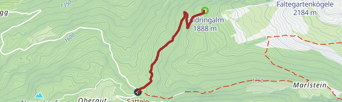
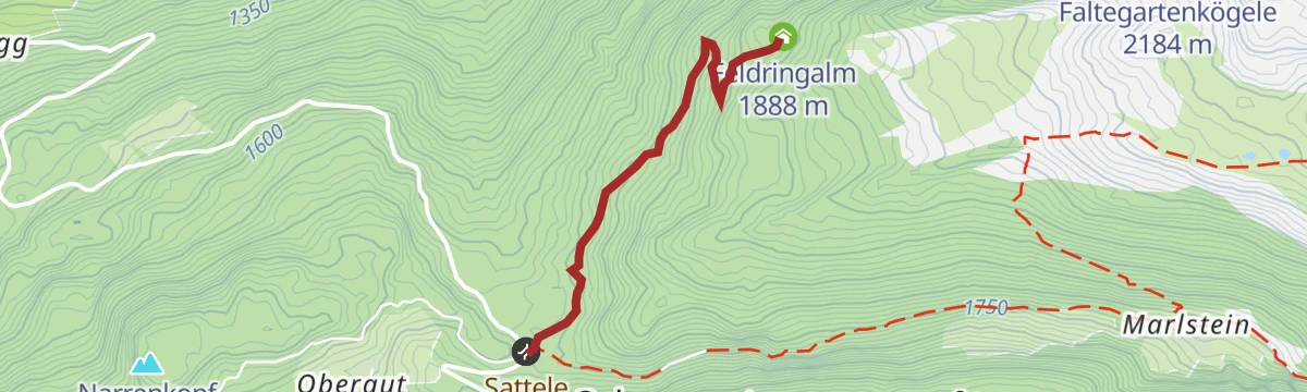
6051 Sattele-Feldring Alm
A short, easy link from the Sattele saddle across to the alm at 1,888 m, with only a couple of hundred metres to climb.
- 4.2 km
- Distance
- 190 m
- Ascent
- 33 min
- Duration
- 17
- Check-ins
Gravelbike Tour - Ötztal Plus
A long gravel ride through the lower Ötztal, passing the Habicher See and the Waldcafe Stuböbele high on the valley side.
- 63.2 km
- Distance
- 889 m
- Ascent
- 6 h 27 min
- Duration
- 22
- Check-ins
Familien Radtour Haiming Apfelmeile
A flat family tour through the orchards on the valley floor at Haiming, passing the rafting base beside the Inn.
- 9.3 km
- Distance
- 11 m
- Ascent
- 50 min
- Duration
- 7
- Check-ins
Von Innsbruck nach Kühtai
A long road ride out of the Inn valley, climbing to the saddle at 2,017 m with the Dortmunder Hütte just below it.
- 106.6 km
- Distance
- 1 930 m
- Ascent
- 11 h 16 min
- Duration
- 86
- Check-ins
Silzer Energieweg
Gentle themed walk with information stations on the Sellrain-Silz hydropower scheme, passing the Plenderle lakes and the Finstertal dam works above Kühtai.
- 4.6 km
- Distance
- 150 m
- Ascent
- 1 h 27 min
- Duration
- 44
- Check-ins
Drei-Seen-Runde Kühtai
Circuit above Kühtai collecting three tarns - the two Plenderle lakes and the Hirschebensee - with a break possible at the Dreiseenhütte midway.
- 7.1 km
- Distance
- 441 m
- Ascent
- 3 h 1 min
- Duration
- 62
- Check-ins
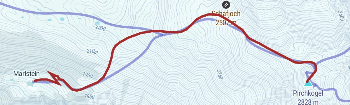
Kühtai - Pirchkogel - Marlstein
Ridge crossing from Kühtai over the Pirchkogel and Hinterer Grieskogel, descending to Marlstein above Ochsengarten — a long day linking two valleys.
- 14.9 km
- Distance
- 1 127 m
- Ascent
- 7 h 21 min
- Duration
- 64
- Check-ins
Faltegartenkögele
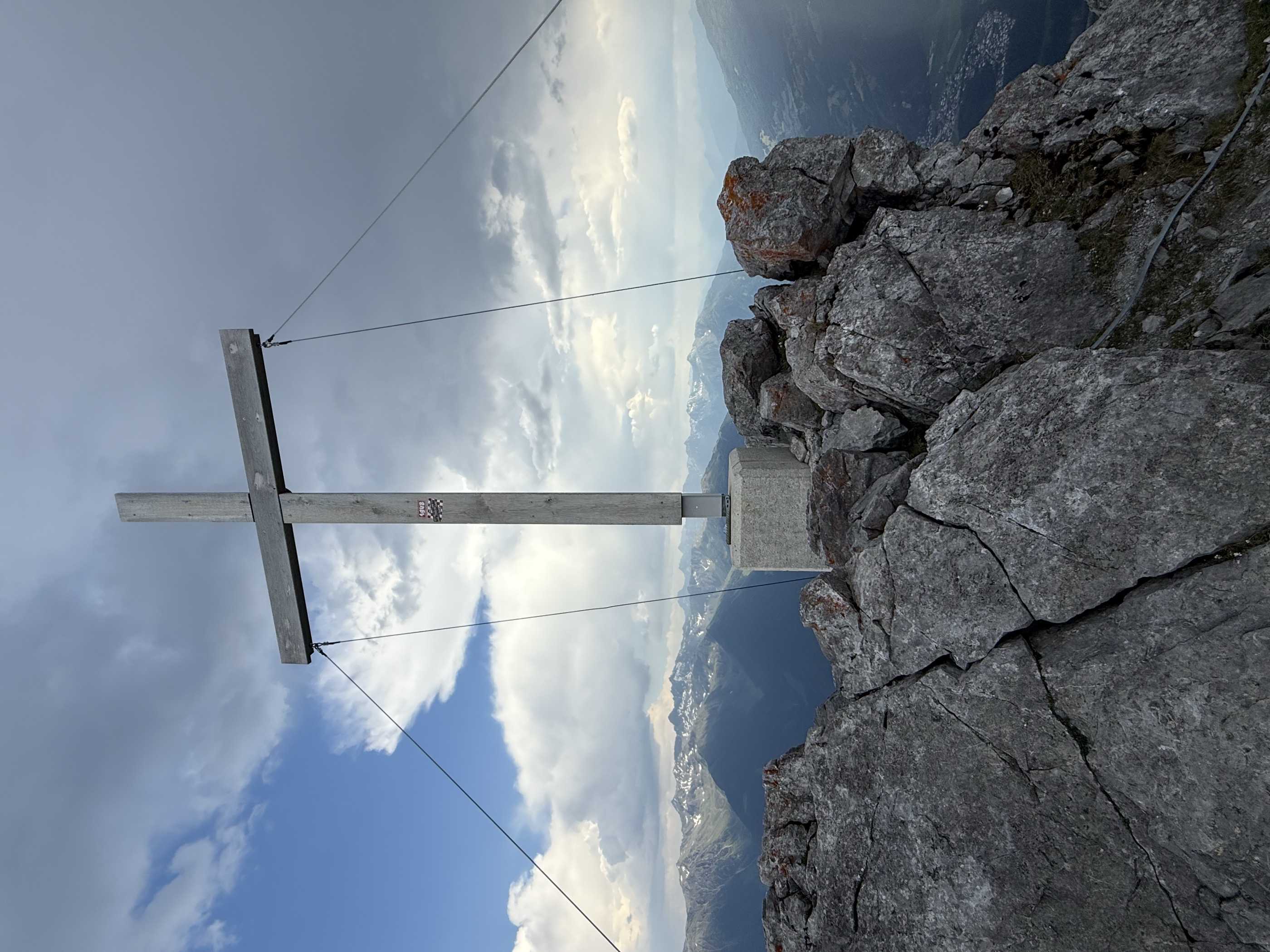
Compact ski tour from the Sattele saddle to the panorama summit above Ochsengarten — under 500 m of climbing, with wide views over the surrounding valleys.
- 3.3 km
- Distance
- 484 m
- Ascent
- 484 m
- Descent
- 1 h 40 min
- Duration
- 24
- Check-ins
Kraspesspitze
Classic Sellrain ski summit reached from Kühtai over the Finstertaler Scharte - a long day with almost 1,200 m of climbing and a high traverse above the reservoir.
- 7.9 km
- Distance
- 1 167 m
- Ascent
- 1 167 m
- Descent
- 4 h 1 min
- Duration
- 31
- Check-ins
Gravelrunde Tschirgantmassiv
A gravel circuit right around the Tschirgant massif, passing the Rafting Alm on the Inn and the mouth of the Pitztal.
- 56.0 km
- Distance
- 691 m
- Ascent
- 5 h 37 min
- Duration
- 20
- Check-ins
Rennradtour - Oetz - Kühtai - Sattele Runde
A road circuit over two passes, the Kühtaisattel at 2,017 m and the lower Sattele, returning to the floor of the Ötztal.
- 45.2 km
- Distance
- 1 484 m
- Ascent
- 5 h 24 min
- Duration
- 72
- Check-ins
Feldring Alm
Easiest of the Ochsengarten alm walks: a comfortably rising forest road from the Sattele to the Feldring Alm, with a narrow-path shortcut near the top.
- 2.1 km
- Distance
- 196 m
- Ascent
- 51 min
- Duration
- 17
- Check-ins
Knappenweg - Naturpark Jubiläumstour - mit Audioguide
Audio-guided mining-history circuit from the Hochoetz panorama restaurant via the Bielefelder Hütte to the Wetterkreuz, descending the Wörgetal past the Pochersee and the old Knappenhaus miners' house to the Iss bridge.
- 7.6 km
- Distance
- 562 m
- Ascent
- 4 h 12 min
- Duration
- 54
- Check-ins
Sellrainer Hüttenrunde: 7. Etappe
Closing stage of the Sellrain hut round, coming down from the high country into Kühtai past the Dortmunder Hütte and on down the valley - nearly 25 km of trail.
- 24.7 km
- Distance
- 973 m
- Ascent
- 8 h 12 min
- Duration
- 64
- Check-ins
Die Mute
Brief ski tour above Kühtai gaining just over 400 m, a favourite quick lap when time is short; the Graf-Ferdinand-Haus stands close to the route.
- 2.1 km
- Distance
- 411 m
- Ascent
- 411 m
- Descent
- 1 h 20 min
- Duration
- 19
- Check-ins
Finstertaler Schartenkopf
From Kühtai past the Finstertal dam into the upper basin, finishing at a high point beside the Finstertaler Scharte - the steep final slopes want stable snow.
- 6.3 km
- Distance
- 947 m
- Ascent
- 947 m
- Descent
- 3 h 15 min
- Duration
- 21
- Check-ins
Tschirgantrunde
A circuit of the Tschirgant on valley tracks, passing the Weiße Haus, Camping Rossbach and the turn-off into the Pitztal.
- 56.0 km
- Distance
- 691 m
- Ascent
- 5 h 37 min
- Duration
- 20
- Check-ins
Rennradtour - Oetz - Kühtai - Finstertaler Stausee
A long road climb from the Ötztal to Kühtai, continuing past the Dortmunder Hütte to the dam wall at 2,344 m above the Finstertal.
- 43.0 km
- Distance
- 1 554 m
- Ascent
- 5 h 17 min
- Duration
- 57
- Check-ins
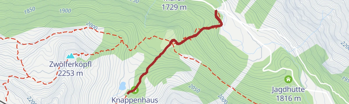
Pochersee und Knappenhaus
Short, steep mining-history walk from the Issbrücke to the Obere Issalm and the Knappenhaus, part museum, where miners lived and crushed ore 350 years ago; the Pochersee lies just below the path.
- 2.9 km
- Distance
- 299 m
- Ascent
- 1 h 50 min
- Duration
- 6
- Check-ins
 Knappenhaus 2 014 m
 Pochersee 1 994 m
- Pochwerk 2 012 m
Höhenweg Hochoetz - Kühtai
Panoramic link from Hochoetz to Kühtai: forest road past the Kühtaile and Balbach alms, then a gently rolling high path via the unstaffed upper Issalm and along the Längental reservoir to the Dortmunder Hütte and the bus home.
- 8.9 km
- Distance
- 282 m
- Ascent
- 2 h 51 min
- Duration
- 51
- Check-ins
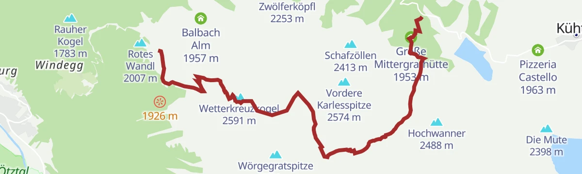
Knappenweg Überschreitung
Ridge crossing from the Acherkogelbahn via the Bielefelder Hütte and a stiff pull onto the Roßköpfe, continuing on a narrow path to the Wetterkreuzkogel and descending the Wörgetal to the Mittergrathütte bus stop.
- 10.6 km
- Distance
- 847 m
- Ascent
- 5 h 51 min
- Duration
- 57
- Check-ins
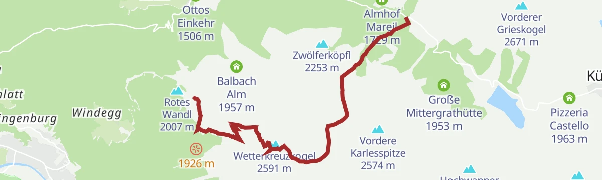
Wetterkreuz (03)
The most popular ski tour in the Wörgetal: from the Issbrücke through light forest to the Obere Issalm, past the Knappenhaus and up broad, moderate slopes to the 2,591 m summit cross.
- 4.3 km
- Distance
- 852 m
- Ascent
- 0 m
- Descent
- 2 h 21 min
- Duration
- 17
- Check-ins
 Wetterkreuzkogel 2 591 m
- Knappenhaus 2 014 m
- Pochersee 1 994 m
- Pochwerk 2 012 m
Pirchkogel (02)
Committing ski tour from Marlstein through glades and up a rolling rib to the Schafjoch, where the broad back narrows to a ridge before a short steep traverse and the final metres to the summit.
- 4.0 km
- Distance
- 1 043 m
- Ascent
- 17 m
- Descent
- 2 h 43 min
- Duration
- 7
- Check-ins
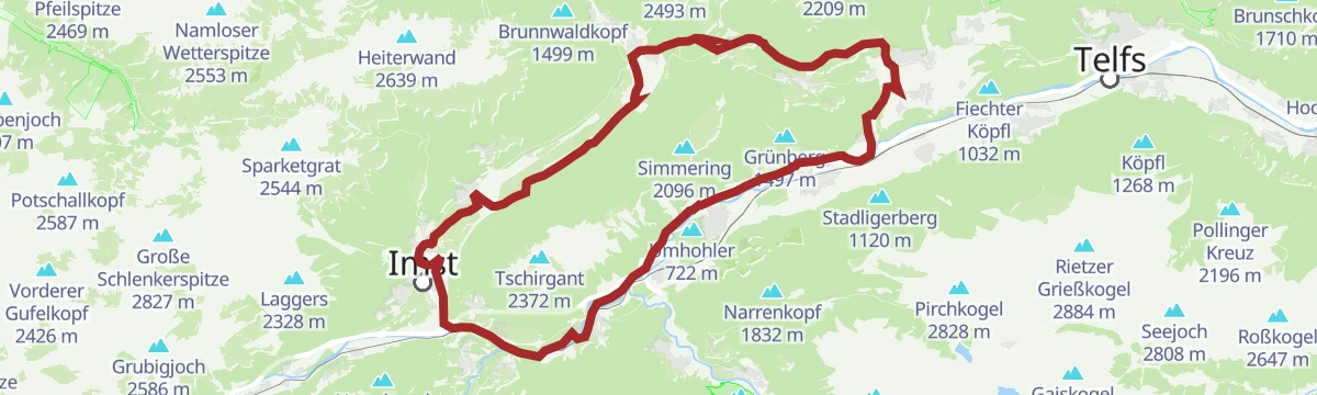
Imster Radmarathon | Panoramarunde (Jubiläum)
A long tour out of Imst over the Holzleitensattel at 1,119 m, looping back down the Inn valley past the mouth of the Pitztal.
- 79.5 km
- Distance
- 727 m
- Ascent
- 7 h 45 min
- Duration
- 14
- Check-ins
Tschirgantrunde
A road circuit around the massif between the Inn and Ötz valleys, climbing to Gasthaus Arzkasten before the run back down the river.
- 54.3 km
- Distance
- 986 m
- Ascent
- 5 h 45 min
- Duration
- 14
- Check-ins
Stams - Naturdenkmal Eichenwald - Stadliger Wasserfall - Stams
Loop from Stams to the protected oak wood and the Stadliger waterfall — an easy round combining two of the village's natural monuments.
- 6.7 km
- Distance
- 229 m
- Ascent
- 2 h 8 min
- Duration
Kühtai - Gaiskogel
From the Kühtaisattel past the Dreiseenhütte and the Plenderle lakes to the Gaiskogel, a moderate summit route through classic high-valley terrain.
- 11.0 km
- Distance
- 878 m
- Ascent
- 5 h 40 min
- Duration
- 51
- Check-ins
Kühtai - Finstertaler Scharte - Schweinfurter Hütte
Crossing from Kühtai past the Finstertal reservoir and over the Finstertaler Scharte to the Schweinfurter Hütte in the Horlachtal — a demanding hut link in the Stubai Alps.
- 18.1 km
- Distance
- 1 677 m
- Ascent
- 10 h 28 min
- Duration
- 49
- Check-ins
Wetterkreuzkogel
Ski tour through Kühtai's old mining grounds — past the Knappenhaus and the Pochwerk — onto a rounded summit above Marlstein.
- 4.5 km
- Distance
- 851 m
- Ascent
- 851 m
- Descent
- 2 h 46 min
- Duration
- 15
- Check-ins
Hintere Karlesspitze
Ski tour from the Kühtai side over the Wörgetalssattel onto the higher of the two Karlesspitzen — around 900 m of skinning into quiet terrain.
- 4.3 km
- Distance
- 903 m
- Ascent
- 903 m
- Descent
- 2 h 53 min
- Duration
- 4
- Check-ins
Tschirgantrunde mit dem Rennrad
A round of the Tschirgant crossing the Holzleitensattel at 1,119 m, with the return along the floor of the Inn valley.
- 51.8 km
- Distance
- 683 m
- Ascent
- 5 h 14 min
- Duration
- 12
- Check-ins
Mieminger Plateau Runde
A near-100 km road round out of the Inn valley, climbing to the terrace villages above Mieming and past Gasthaus Arzkasten.
- 97.1 km
- Distance
- 1 138 m
- Ascent
- 9 h 41 min
- Duration
- 12
- Check-ins
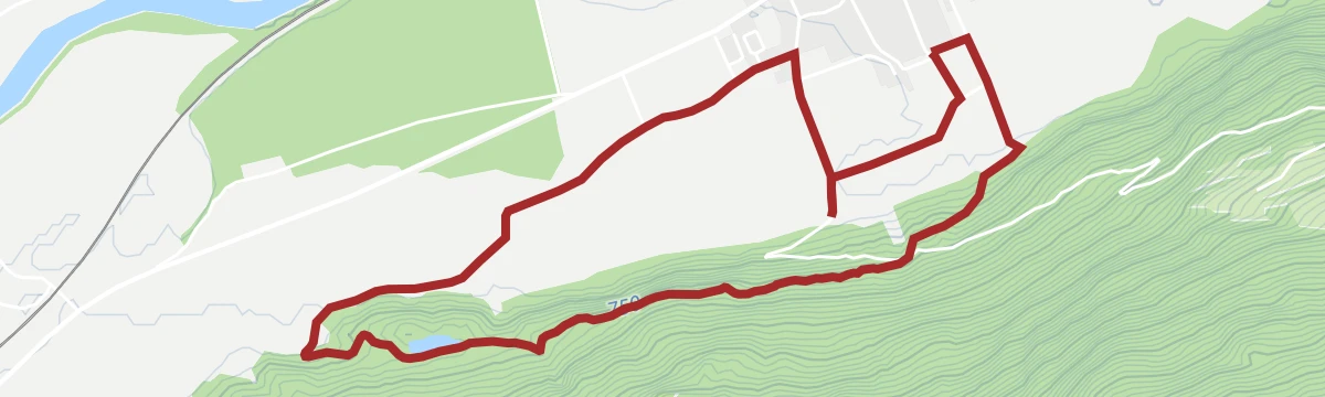
Vom Korn zum Brot
Short themed loop through Silz's fields tracing the path from grain to loaf, with stations aimed squarely at families.
- 2.2 km
- Distance
- 40 m
- Ascent
- 37 min
- Duration
Kühtai - Pockkogel
From the Kühtai saddle up past the Dreiseenhütte and the Plenderle lakes onto a blocky summit above the reservoir basin, one of the resort's most-climbed peaks.
- 8.5 km
- Distance
- 870 m
- Ascent
- 5 h 20 min
- Duration
- 51
- Check-ins
Kühtai - Sulzkogel
Summit route from Kühtai above the Finstertal dam to the Sulzkogel, a three-thousander with a wide sweep over the Stubai Alps.
- 12.8 km
- Distance
- 1 158 m
- Ascent
- 7 h 16 min
- Duration
- 49
- Check-ins
Grieskogelscharte
Short ski tour above Kühtai, skinning from the Kühtaier Alm up to the notch of the Vordere Grießkogelscharte in under 3 km.
- 2.9 km
- Distance
- 582 m
- Ascent
- 582 m
- Descent
- 1 h 52 min
- Duration
- 10
- Check-ins
Inntalrunde
A valley circuit along the Inn from Silz, passing the mouths of both the Ötztal and the Pitztal.
- 55.2 km
- Distance
- 901 m
- Ascent
- 5 h 45 min
- Duration
- 8
- Check-ins
Innradweg
Ninety-seven kilometres of near-level cycle path along the Inn, from Mötz past Telfs and Innsbruck down to Rotholz.
- 86.9 km
- Distance
- 245 m
- Ascent
- 7 h 56 min
- Duration
- 2
- Check-ins
Wanderung zur Burg St. Petersberg
Easy walk from Silz to the medieval castle of St. Petersberg on its wooded knoll, one of the Inn valley's old strongholds.
- 6.2 km
- Distance
- 129 m
- Ascent
- 1 h 47 min
- Duration
Gipfeltour Faltegartenköpfl
Straightforward summit walk from the Sattele car park above Ochsengarten, up the forest road to the Feldringalm and across the Feldringer Böden to the 2,184 m top.
- 4.0 km
- Distance
- 502 m
- Ascent
- 2 h 6 min
- Duration
- 37
- Check-ins
Kühtai - Kraspesspitze
Long summit day from Kühtai over the Finstertaler Scharte to the Kraspesspitze — high, stony terrain deep in the Stubai Alps.
- 14.0 km
- Distance
- 1 197 m
- Ascent
- 7 h 36 min
- Duration
- 43
- Check-ins
Pirchkogel
Short ski tour onto one of Kühtai's classic lookout summits — less than 400 m of skinning to a panorama over the Sellrain.
- 1.5 km
- Distance
- 392 m
- Ascent
- 392 m
- Descent
- 1 h 13 min
- Duration
- 7
- Check-ins
Genuss-Radweg Inntal
A valley cycle path along the Inn between Innsbruck and Mötz, running through Hatting, Telfs and Stams on the flat valley floor.
- 110.0 km
- Distance
- 607 m
- Ascent
- 10 h 19 min
- Duration
Gipfeltour Faltegartenköpfl und Grünwaslkreuz
Loop from the Sattele over the Feldringalm and the moor-dotted alm plateaus, climbing the Bettlersteig to the 2,184 m summit and descending via the lower Grünwasl cross to rejoin the outward route.
- 7.8 km
- Distance
- 525 m
- Ascent
- 3 h 32 min
- Duration
- 37
- Check-ins
No routes of this kind in Silz yet.
The region's own picks

Featured route
Kühtai - Drei-Seen-Hütte
Family walk from the Kühtai saddle to the hut at the Plenderle lakes, passing the Hirschebensee - short enough for an afternoon, with bus stops at the trailhead.
Planning a trip to Silz?
Everything else Tyrol has, in one place


Take Silz with you into the mountains
Every route on this page with 3D terrain, GPX navigation and offline maps — including the valleys with no signal.
Data sources
- Official website: innsbruck.info ↗
- Routes and highlights: Ötztal Tourismus, Innsbruck Tourismus, Imst Tourismus, Serfaus-Fiss-Ladis
- Published as open data by the tourist boards named above.
- Region summary generated from the board's own material.
