
 Historic site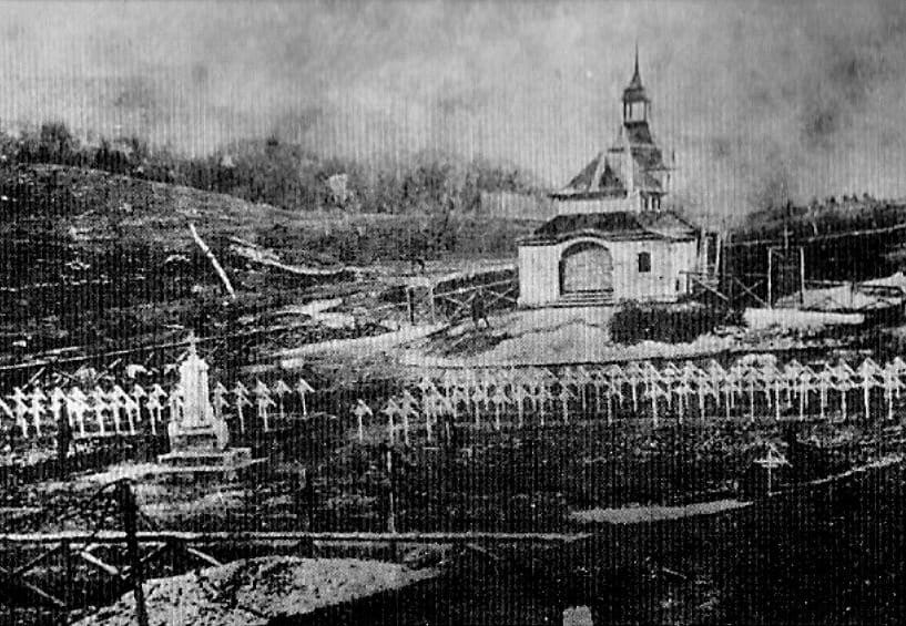
















Curated by APT Valsugana e Lagorai
Pergine Valsugana
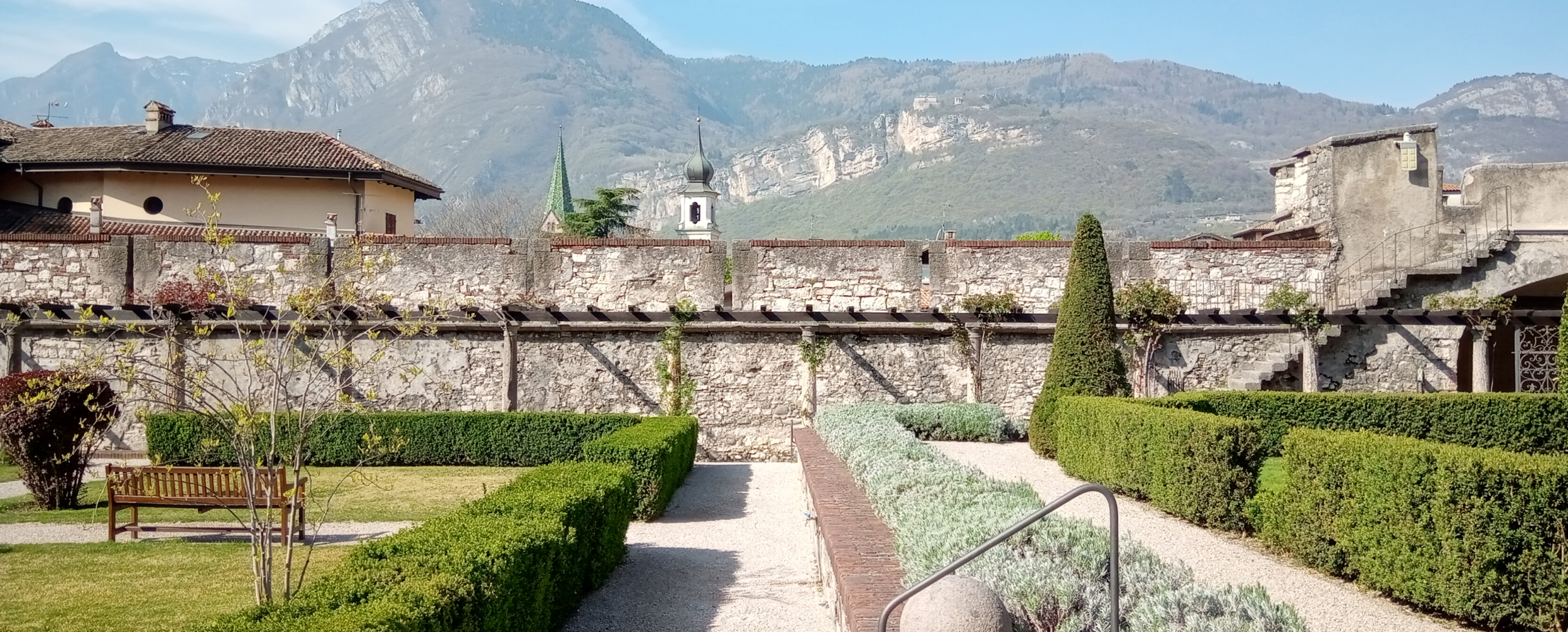
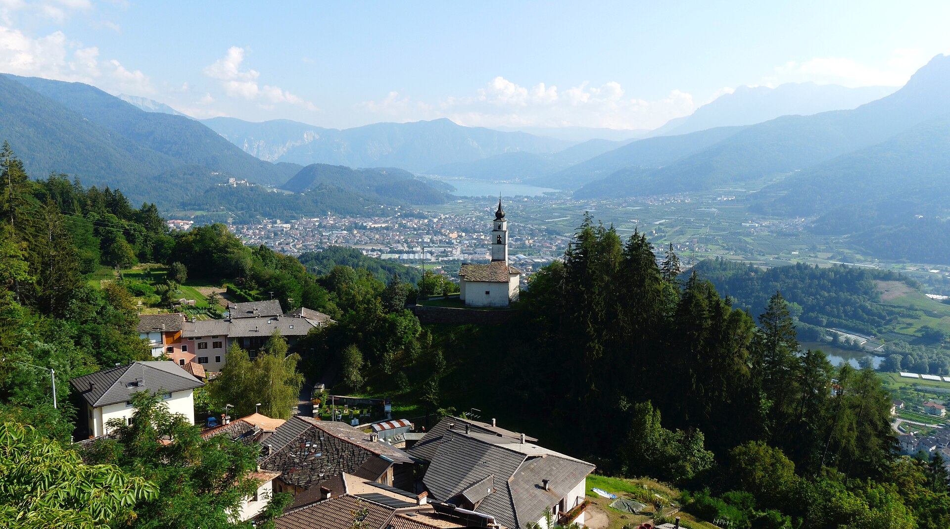
A Valsugana market town below its castle, between Trento and Lake Caldonazzo.
- 3Highlights
- 42Routes
- Featured summit · Fravort
Highlights
All 3 from neighbouring places
Castello del Buonconsiglio
8 km away, in Trento
The residence of Trento's prince-bishops for four centuries, with the Torre Aquila and its Cycle of the Months.
Chiesetta di Santa Zita
14.8 km away, in Levico Terme
A small chapel above Levico Terme, on the path up towards the Panarotta.
Riserva naturale della Scanuppia
12.9 km away, in Besenello
A reserve of fir forest and pasture on the Vigolana slopes above Besenello.
Nothing of this kind in Pergine Valsugana.
Routes
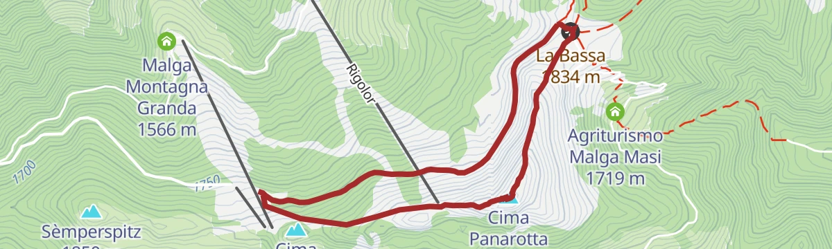
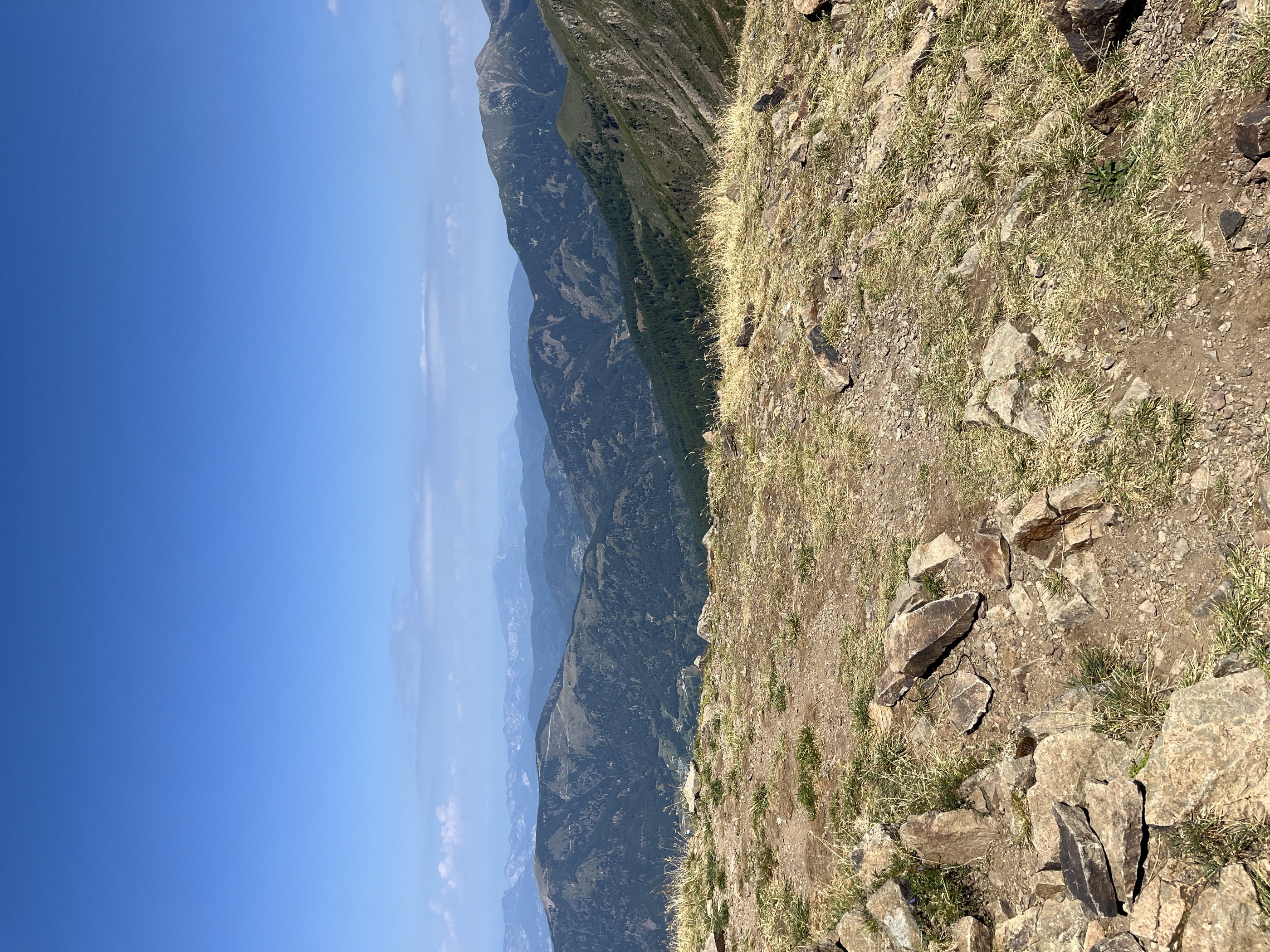
Monte Panarotta
A steady route up to the La Bassa pass, then on to the top of Monte Panarotta, wide open in view although antennas crowd the summit.
- 4.7 km
- Distance
- 254 m
- Ascent
- 1 h 48 min
- Duration
- 61
- Check-ins
Open route APT Valsugana e LagoraiLago di Caldonazzo X
A level circuit of Lake Caldonazzo, the largest lake wholly within Trentino, below Pergine Valsugana.
- 11.5 km
- Distance
- 51 m
- Ascent
- 2 h 48 min
- Duration
- 9
- Check-ins
Open route Trentino FishingTrekking - Monte Fravort
A long climb to Monte Fravort above Pergine Valsugana, the high point of the Panarotta ridge in the western Lagorai.
- 17.6 km
- Distance
- 1 009 m
- Ascent
- 7 h 4 min
- Duration
- 161
- Check-ins
 Fravort 2 347 m
- Prennputz 2 029 m
- La Fontanella 2 037 m
- Monte Gronlait 2 383 m
- Cima Rociondola 2 312 m
 La Bassa 1 834 m
- +4
Open route APT Valsugana e LagoraiMTB - Route of the hamlets of Pergine
A long circuit of the hamlets around Pergine on lanes and mule tracks, taking in the Sella di Vignola and the lakes at Canzolino and Canezza.
- 54.9 km
- Distance
- 1 700 m
- Ascent
- 6 h 28 min
- Duration
- 36
- Check-ins
- Tessara 617 m
- Croz de la Rocca 829 m
 Al Faro 453 m
- Meridiana 455 m
- Sella di Vignola 557 m
- Casa Fersinale 536 m
- +6
Open route APT Valsugana e LagoraiPasso Manghen by way of Val Calamento
A very long day from Levico Terme on the Brenta cycle path, then the one big road climb to the pass at 2,047 m and the Lago di Cadinel.
- 112.0 km
- Distance
- 2 690 m
- Ascent
- 12 h 28 min
- Duration
- 129
- Check-ins
- Baita Manghen Hütte 2 019 m
 Lago di Cadinel 2 014 m
- Passo Manghen 2 047 m
- Parc Hotel Du Lac 454 m
- Sella di Vignola 557 m
- Visitvalsugana 491 m
- +22
Open route APT Valsugana e LagoraiWalk - Panarotta 2002
A ridge path from the Panarotta ski area to Monte Fravort, where trenches from the First World War can still be traced.
- 4.4 km
- Distance
- 253 m
- Ascent
- 1 h 46 min
- Duration
- 61
- Check-ins
Open route APT Valsugana e LagoraiLago di Caldonazzo A
A shoreline route round Lake Caldonazzo, between the reed beds and the villages on the Valsugana floor.
- 11.5 km
- Distance
- 70 m
- Ascent
- 2 h 52 min
- Duration
Open route Trentino FishingTorrente Fersina A
A long, almost flat route following the Fersina torrent down the Mòcheno valley.
- 15.2 km
- Distance
- 37 m
- Ascent
- 5 h
- Duration
- 46
- Check-ins
- Hitt van Sea va Hardimbl - Rifugio Lago di Erdemolo 2 006 m
- Sea va Hardimbl - Lago di Erdemolo 1 994 m
- Casa Fersinale 536 m
- Laghetto Canezza 585 m
- Acquedotto 543 m
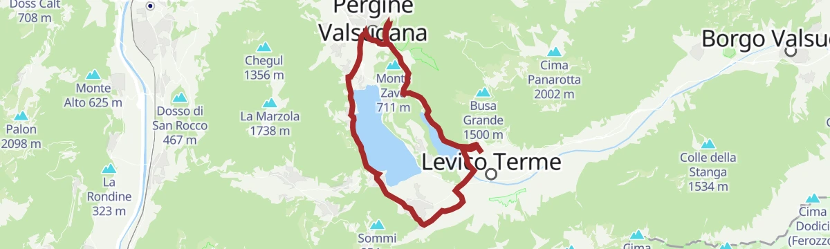
Open route Trentino Fishinge-MTB - Tour around the lakes of Levico and Caldonazzo
A gentle e-mountain-bike circuit linking Levico with Pergine and back along the Caldonazzo shore, past lakeside campsites and the Parco minerario.
- 23.9 km
- Distance
- 164 m
- Ascent
- 2 h 17 min
- Duration
- 27
- Check-ins
- Parc Hotel Du Lac 454 m
- Sella di Vignola 557 m
- Parco minerario Alta Valsugana e Bersntol 475 m
- Visitvalsugana 475 m
- La Rociondola 445 m
Open route APT Valsugana e LagoraiGiro del Manghen
A long road loop from the Piné plateau up to Passo Manghen, a climb used by the Giro d'Italia, dropping back over the Sella di Vignola.
- 106.5 km
- Distance
- 2 824 m
- Ascent
- 12 h 7 min
- Duration
- 124
- Check-ins
- Dos de le Morf 956 m
- Baita Manghen Hütte 2 019 m
- Lago di Cadinel 2 014 m
- Passo Manghen 2 047 m
- Parc Hotel Du Lac 454 m
- Sella di Vignola 557 m
- +20
Open route APT TrentoGIRO DEI PICCOLI LAGHI
An easy round of the small lakes near Pergine Valsugana, on level paths between water and farmland.
- 6.1 km
- Distance
- 75 m
- Ascent
- 1 h 36 min
- Duration
- 3
- Check-ins
Open route APT Valsugana e LagoraiMTB - Tour of the lakes of Levico and Caldonazzo 2342
An easy mountain-bike loop round both Valsugana lakes, crossing the Sella di Vignola and climbing to the castle hill at Pergine.
- 23.5 km
- Distance
- 173 m
- Ascent
- 2 h 15 min
- Duration
- 18
- Check-ins
Open route APT Valsugana e LagoraiHigh altitude route of the Valle dei Mocheni starting from Piné
A circuit on forest and minor roads over Passo del Redebus and up to La Bassa below the Panarotta, past Malga Pletzn and the Scalzerhof.
- 61.3 km
- Distance
- 2 515 m
- Ascent
- 7 h 49 min
- Duration
- 94
- Check-ins
- La Bassa 1 834 m
- Passo del Redebus - Sontbisn 1 455 m
- agritur Scalzerhof 1 534 m
- Malga Pletzn 1 600 m
- Garage Mezzi Battipista sci da fondo 1 461 m
- APT Piné 974 m
- +13
Open route APT TrentoTorrente Fersina B
A near-level walk along the Fersina, the stream running from the Mocheni valley towards Trento.
- 6.9 km
- Distance
- 14 m
- Ascent
- 1 h 47 min
- Duration
- 3
- Check-ins
Open route Trentino FishingMTB - Tour of Tenna hill
A ride over the hill between Pergine and Levico, past the castle and Colle delle Benne, with the Vignola stream crossed on the way back.
- 29.7 km
- Distance
- 904 m
- Ascent
- 3 h 29 min
- Duration
- 16
- Check-ins
Open route APT Valsugana e Lagorai9 lakes route
A long road tour past the lakes of the Pinè plateau and the Valsugana, over the Sella di Vignola and below Segonzano castle.
- 115.9 km
- Distance
- 2 403 m
- Ascent
- 12 h 33 min
- Duration
- 63
- Check-ins
- Dos de le Morf 956 m
- Parc Hotel Du Lac 454 m
- Dolomiti Energia 1 026 m
- Sella di Vignola 557 m
- Visitvalsugana 491 m
- APT Piné 974 m
- +15
Open route APT TrentoLago di Canzolino B
A short circuit of Lake Canzolino, one of the small lakes on the hills above Pergine Valsugana.
- 1.2 km
- Distance
- 30 m
- Ascent
- 21 min
- Duration
- 2
- Check-ins
MTB - Tour of the Oltrefersina
A forest-road round on the far side of the Fersina, past Lago di Madrano and the Laghetto Canezza to the Croz de la Crosara lookout.
- 22.1 km
- Distance
- 714 m
- Ascent
- 2 h 38 min
- Duration
- 8
- Check-ins
- Croz de la Rocca 829 m
- Casa Fersinale 536 m
- Laghetto Canezza 585 m
- Acquedotto 818 m
- Lago di Madrano 542 m
Open route APT Valsugana e LagoraiRoadbike - Coppa d'Oro Grand Prix of the Sports Directors
A long road course through the Valsugana over the Sella di Vignola and past the lakeside hotels, run each year for the Allievi category.
- 87.0 km
- Distance
- 1 254 m
- Ascent
- 8 h 54 min
- Duration
- 38
- Check-ins
- Parc Hotel Du Lac 454 m
- Al Faro 453 m
- Meridiana 455 m
- Sella di Vignola 557 m
- Lagorai Valsugana Orientale 383 m
- APT Valsugana 386 m
Open route APT Valsugana e LagoraiLago di Canzolino PS
A level walk round the shore of Lake Canzolino, in farmland east of Pergine Valsugana.
- 1.2 km
- Distance
- 18 m
- Ascent
- 19 min
- Duration
- 2
- Check-ins
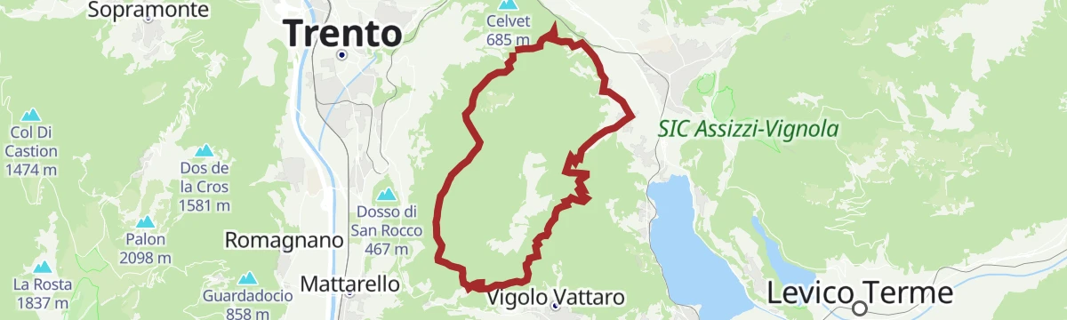
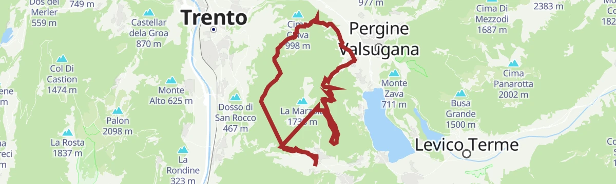
Marzola loop by MTB
A circuit around the mountain dividing Trento from the Valsugana, over the Passo del Cimirlo and past the Malga di Susà, with wartime forts nearby.
- 24.8 km
- Distance
- 870 m
- Ascent
- 3 h 1 min
- Duration
- 8
- Check-ins
Open route APT TrentoThe Valsugana Cycling Path
A valley cycle path from the lake at Caldonazzo down the Brenta to Bassano del Grappa, passing the Grotte di Oliero near the end.
- 82.0 km
- Distance
- 489 m
- Ascent
- 7 h 51 min
- Duration
- 24
- Check-ins
- Al Confin 205 m
- Lagorai Valsugana Orientale 383 m
- APT Valsugana 386 m
- Grotte di Oliero €12 145 m
- Casa Sbara 217 m
- Allevamento suini 272 m
- +2
Open route APT Valsugana e LagoraiWalk - Historic Center of Pergine
A short walk round the old centre of Pergine Valsugana under its castle hill, set out as a treasure hunt for children.
- 4.1 km
- Distance
- 158 m
- Ascent
- 1 h 21 min
- Duration
- 2
- Check-ins
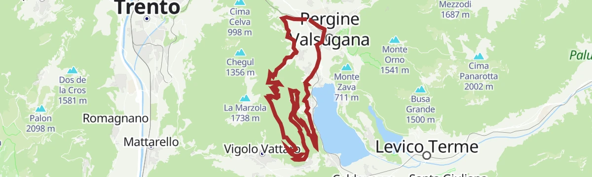
Open route APT Valsugana e LagoraiMTB - Tour on the slopes of Marzola
A climb through the scattered masi on the flanks of the Marzola, reaching the Malga di Susà before the drop back down to Pergine.
- 30.6 km
- Distance
- 986 m
- Ascent
- 3 h 39 min
- Duration
- 2
- Check-ins
Open route APT Valsugana e LagoraiRoadbike - Lakes Levico and Caldonazzo - and Tenna Hill
A road loop from the Valsugana lake shores up to Pergine, back on the cycle path through the apple orchards, with the Colle di Tenna as a variant.
- 37.8 km
- Distance
- 448 m
- Ascent
- 3 h 47 min
- Duration
- 23
- Check-ins
- Parc Hotel Du Lac 454 m
- Sella di Vignola 557 m
- Parco minerario Alta Valsugana e Bersntol 475 m
- Visitvalsugana 475 m
- La Rociondola 445 m
Open route APT Valsugana e LagoraiLago di Madrano A
A very short walk at the small lake of Madrano, in the hills between Pergine and the Valsugana.
- 338 m
- Distance
- 0 m
- Ascent
- 5 min
- Duration
- 1
- Check-ins
MTB Small Fruits Tour 2349
A ride up the val dei Mocheni past the Laghetto Canezza, through the berry fields and Mòcheno villages of the upper Fersina.
- 20.9 km
- Distance
- 893 m
- Ascent
- 2 h 42 min
- Duration
- 2
- Check-ins
- Laghetto Canezza 585 m
Open route APT Valsugana e LagoraieBike - Castle Pergine
An e-bike outing from Levico along the Caldonazzo shore and the orchards, climbing at the end to the castle hill above Pergine.
- 25.4 km
- Distance
- 363 m
- Ascent
- 2 h 36 min
- Duration
- 23
- Check-ins
- Colle del Castello 655 m
- Parc Hotel Du Lac 454 m
- Sella di Vignola 557 m
- Visitvalsugana 491 m
- La Rociondola 445 m
Open route APT Valsugana e LagoraiFrom S. Anna to the Redeemer
A short linear walk along via Domenica Targa in Montagnaga, from Sant'Anna to the sanctuary of the Redeemer looking out over the Valsugana.
- 2.0 km
- Distance
- 44 m
- Ascent
- 35 min
- Duration
Open route APT TrentoPanarotta
A road climb out of the Valsugana over the Passo del Compet to the ski station at 1,773 m, nearly 1,500 m of ascent in under 15 km.
- 14.8 km
- Distance
- 1 520 m
- Ascent
- 2 h 39 min
- Duration
- 16
- Check-ins
Open route VisitTrentinoLaghetto di Canezza N
A very short walk by the pond at Canezza, in the Fersina valley above Pergine.
- 317 m
- Distance
- 0 m
- Ascent
- 5 min
- Duration
Roadbike - Levico Terme / Pergine Valsugana - Panarotta
A long ascent from Levico Terme through Vetriolo to the Passo del Compet, on a road the Giro d'Italia raced in 1989.
- 34.7 km
- Distance
- 1 428 m
- Ascent
- 4 h 26 min
- Duration
- 16
- Check-ins
Open route APT Valsugana e LagoraiMONTESEI DI SERSO
An easy walk to the Montesei di Serso, a prehistoric settlement hill above Pergine Valsugana.
- 3.4 km
- Distance
- 148 m
- Ascent
- 1 h 10 min
- Duration
Open route APT Valsugana e LagoraiValsugana Bike paths
An easy-graded route along the Brenta to the Vicenza provincial border, with bicigrill stops at Levico and Tezze and very little climbing.
- 69.5 km
- Distance
- 113 m
- Ascent
- 6 h 21 min
- Duration
- 10
- Check-ins
- Lagorai Valsugana Orientale 383 m
- APT Valsugana 386 m
- Pro Loco Tezze 230 m
- Allevamento suini 272 m
- Bicigrill Energy Bar 435 m
- BiciGrill Levico 438 m
- +1
Open route VisitTrentinoRio Negro E
A level walk along the Rio Negro, a stream in the woods on the edge of the Pinè plateau.
- 5.4 km
- Distance
- 51 m
- Ascent
- 1 h 47 min
- Duration
Open route Trentino FishingGiro della Marzola
A full circuit of the Marzola from the Cimirlo pass, fast going but with one climb of some seven kilometres.
- 34.0 km
- Distance
- 1 181 m
- Ascent
- 4 h 8 min
- Duration
- 9
- Check-ins
- Passo del Cimirlo 730 m
- Palavento 690 m
- Malga di Susà 1 007 m
- Ex Orto Forestale 987 m
- Ca' Rossa 745 m
Open route Azienda per il Turismo Alpe CimbraRio Rigoloro Q
A flat walk along the Rio Rigoloro, a stream on the Pergine plateau east of the Fersina.
- 4.5 km
- Distance
- 0 m
- Ascent
- 2 h 7 min
- Duration
Open route Trentino FishingRoadbike - Pergine Valsugana - Val dei Mocheni
A road ride up the German-speaking valley of the Fersina, through Frassilongo and Sant'Orsola Terme with the Lagorai chain ahead.
- 28.1 km
- Distance
- 1 048 m
- Ascent
- 3 h 26 min
- Duration
- 5
- Check-ins
- Casa Fersinale 536 m
- Laghetto Canezza 585 m
Open route APT Valsugana e LagoraiTheme trail - The Hidden Lake
An easy walk on farm lanes from Brazzaniga on the Fersina to the hidden lake at Vigalzano, a quiet biotope near Pergine.
- 2.9 km
- Distance
- 41 m
- Ascent
- 47 min
- Duration
Open route APT Valsugana e LagoraiTorrente Fersina Z
A short walk beside the Fersina where it leaves the Valle dei Mocheni below Pergine.
- 1.8 km
- Distance
- 40 m
- Ascent
- 28 min
- Duration
Open route Trentino FishingTorrente Silla D
An easy, flat walk along the Silla stream on the valley floor near Pergine Valsugana, with next to no height gain.
- 4.7 km
- Distance
- 0 m
- Ascent
- 1 h 18 min
- Duration
Open route Trentino FishingVia Romea Germanica: collegamento per Tenna
A link on the Via Romea Germanica to Tenna, passing a Roman milestone of the Via Claudia Augusta, an Austro-Hungarian fort and the chapel of San Valentino.
- 6.8 km
- Distance
- 161 m
- Ascent
- 2 h 2 min
- Duration
Open route APT Valsugana e Lagorai
No routes of this kind in Pergine Valsugana yet.
The region's own picks

Featured route
Monte Panarotta
A steady route up to the La Bassa pass, then on to the top of Monte Panarotta, wide open in view although antennas crowd the summit.
Planning a trip to Pergine Valsugana?
Everything else Trentino-Alto Adige/Südtirol has, in one place


Take Pergine Valsugana with you into the mountains
Every route on this page with 3D terrain, GPX navigation and offline maps — including the valleys with no signal.
Data sources
- Official website: visitvalsugana.it ↗
- Routes and highlights: APT Valsugana e Lagorai, Trentino Fishing, APT Trento, Visit Trentino, VisitTrentino, Italia.it, Astrotourism, Visitrovereto, Azienda per il Turismo Alpe Cimbra
- Published as open data by the tourist boards named above.
- Region summary generated from the board's own material.
