
 Historic site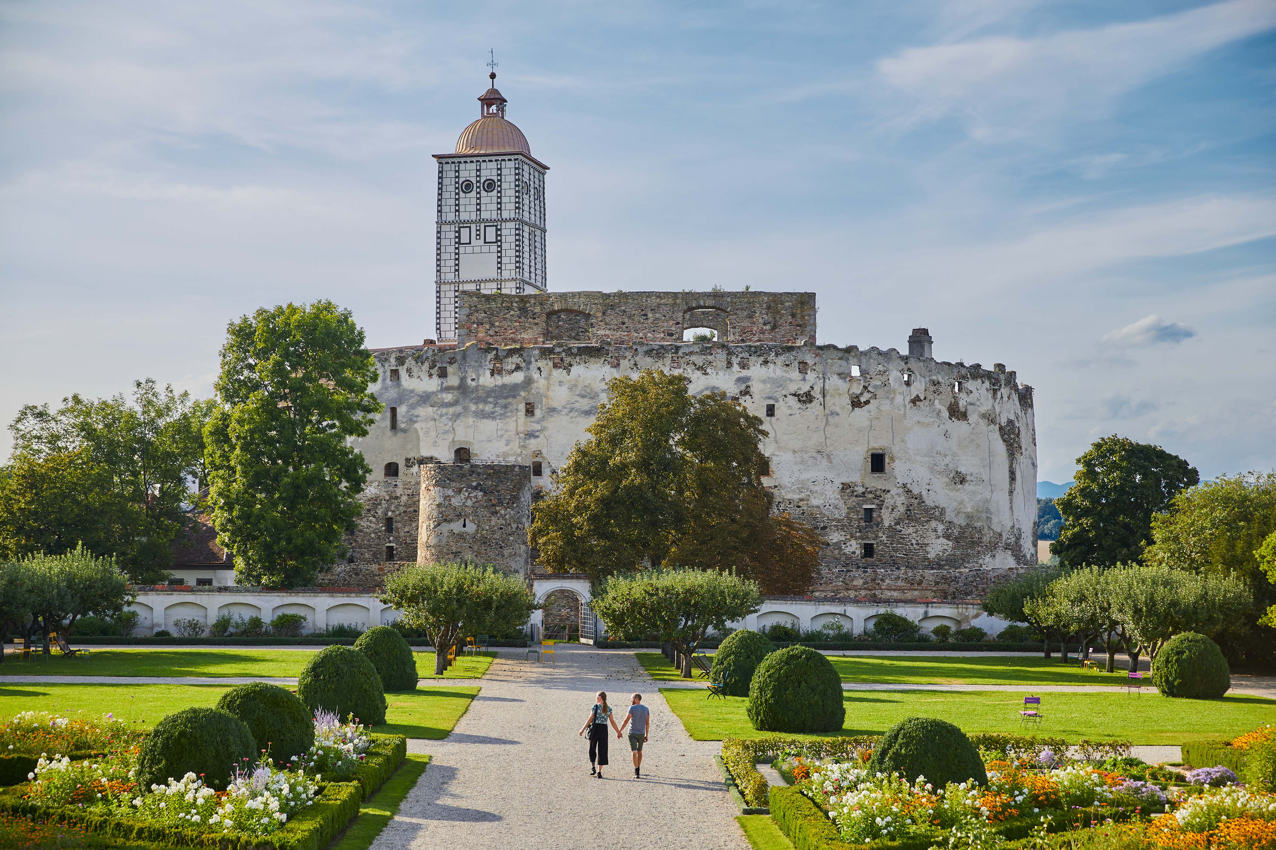






Curated by Krems
Maria Laach am Jauerling
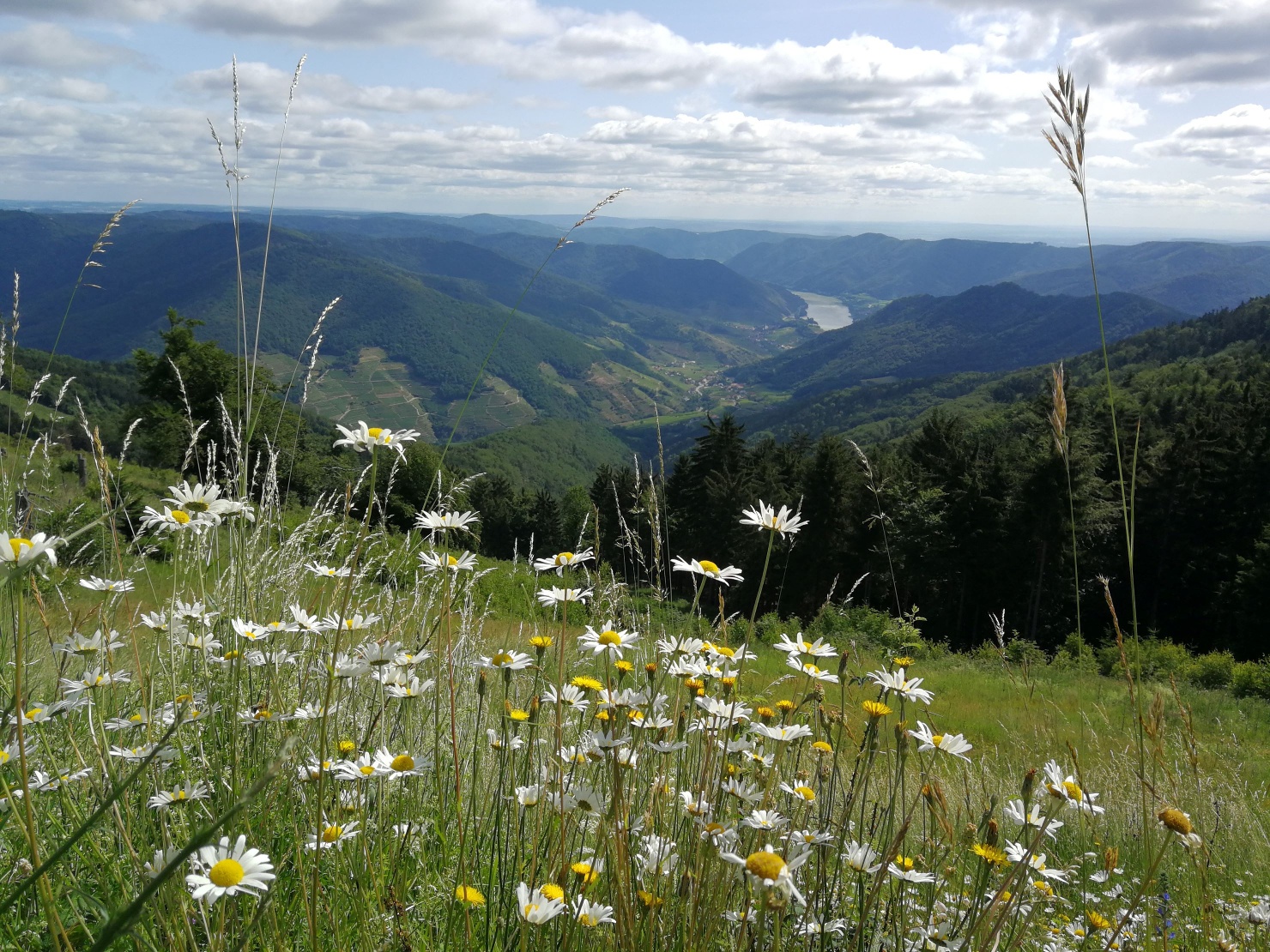
On the flank of the Jauerling, the high hill above the Wachau, at about 590 m, with a pilgrimage church below and a nature park on the summit ridge.
- 4Highlights
- 5Routes
- Featured summit · Jauerling
Highlights
All 4 from neighbouring places
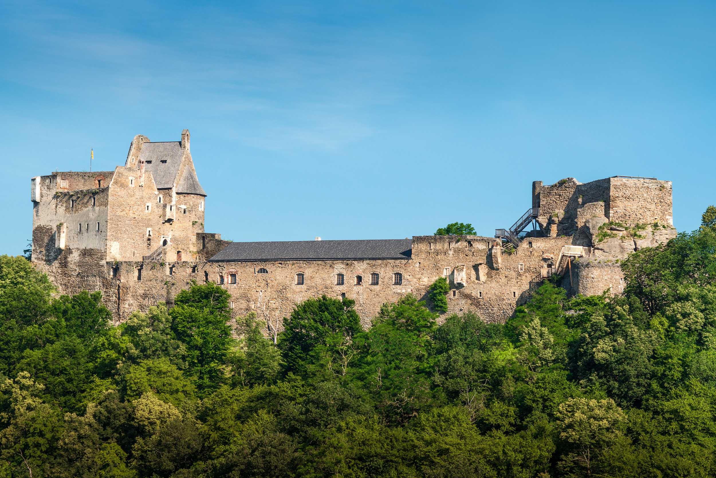
Burgruine Aggstein
6.4 km away, in Schönbühel-Aggsbach
A castle ruin on a crag high above the Danube in the Wachau, with the rock ledge known as the Rosengärtlein and long views along the river.
Castle Aggstein
6.4 km away, in Schönbühel-Aggsbach
The ruined castle of Aggstein above the Danube between Melk and Krems, held in the Middle Ages by lords who levied tolls on river traffic.
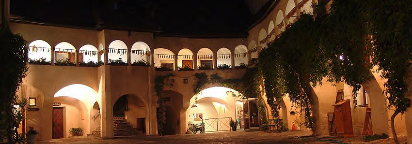
Renaissance Schloss Schallaburg
12.7 km away, in Schollach
A Renaissance castle near Melk whose arcaded courtyard is faced with terracotta figures; it stages a large exhibition each year.
Galerie im Wachaumuseum
14.2 km away, in Weißenkirchen in der Wachau
The gallery of the Wachaumuseum in Weißenkirchen, housed in the Teisenhoferhof and hung with paintings of the Wachau.
Nothing of this kind in Maria Laach am Jauerling.
Routes
15 from neighbouring places
Welterbesteig Wachau 05: Mühldorf-Maria Laach (Naturpark Jauerling-Wachau)
A long stage out of the Danube valley up to the Jauerling and its lookout tower, passing the Jahnhütte and the Leopoldi-Hütte on the ridge.
- 13.3 km
- Distance
- 850 m
- Ascent
- 5 h 48 min
- Duration
- 14
- Check-ins
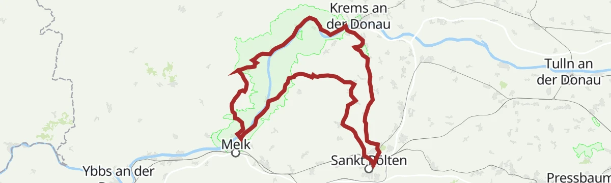
stp Route #5 UNESCO Weltkulturerbe Wachau
A long road route from St. Pölten through the Wachau world heritage landscape, 118 km with 1,710 m of climbing.
- 116.4 km
- Distance
- 523 m
- Ascent
- 10 h 49 min
- Duration
- 1
- Check-ins
 Bischofsteich 269 m
 Naturparkbüro Jauerling-Wachau 590 m
- S-Bar 854 m
- Tourismusverein Römerstadt Mautern 204 m
Wachau World Heritage Trail 06: Maria Laach-Aggsbach Markt (Jauerling-Wachau Nature Park)
A 7.2 km stage through the Jauerling-Wachau nature park, from Maria Laach am Jauerling down to Aggsbach Markt on the Danube.
- 7.2 km
- Distance
- 118 m
- Ascent
- 2 h 19 min
- Duration
Welterbesteig Wachau 06: Maria Laach-Aggsbach Markt (Naturpark Jauerling-Wachau)
7.2 km with only 80 m of ascent, crossing the Jauerling-Wachau nature park past its Naturparkbüro on the way down to the Danube.
- 7.2 km
- Distance
- 80 m
- Ascent
- 1 h 52 min
- Duration
Welterbesteig Wachau 07: Aggsbach Markt-Emmersdorf (Naturpark Jauerling-Wachau)
14.7 km with 547 m of ascent through the Jauerling-Wachau nature park, over the Edelberg and by the Käfermühle down to Emmersdorf.
- 14.7 km
- Distance
- 547 m
- Ascent
- 4 h 48 min
- Duration
Welterbesteig Wachau 10: Aggsbach Dorf-Hofarnsdorf
5.2 km away, in Schönbühel-Aggsbach
A hard 17 km with 777 m of ascent from Aggsbach Dorf, climbing to the Aggstein ruin and its Rittersaal before the run out to Hofarnsdorf.
- 17.0 km
- Distance
- 777 m
- Ascent
- 5 h 55 min
- Duration
- 8
- Check-ins
Pielachtalradweg
8.3 km away, in Melk
The same Pielach valley run from Melk to Loich, following the river up out of the Mostviertel.
- 56.9 km
- Distance
- 190 m
- Ascent
- 5 h 13 min
- Duration
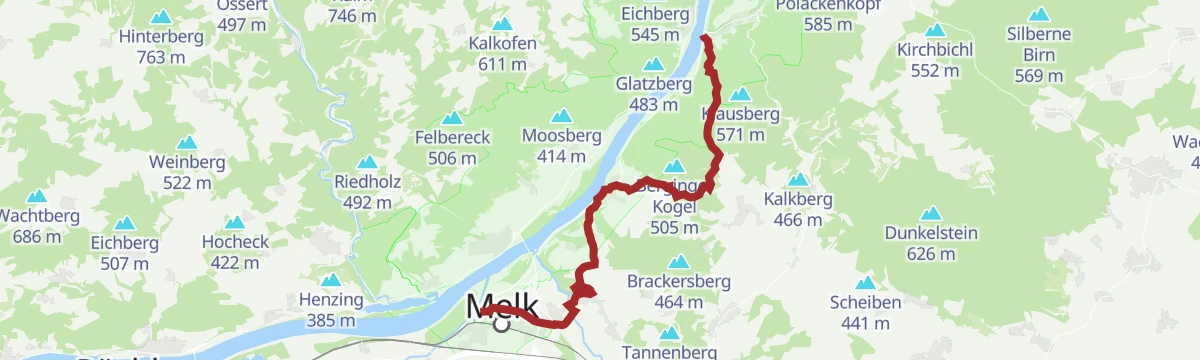
Welterbesteig Wachau 08: Emmersdorf-Melk
6.9 km away, in Emmersdorf an der Donau
10 km with 177 m of ascent, leaving Emmersdorf over the Dachberg and passing the Melk hydro plant into the town of Melk.
- 10.0 km
- Distance
- 177 m
- Ascent
- 2 h 47 min
- Duration
Wachau World Heritage Trail 10: Aggsbach Dorf-Hofarnsdorf
5.2 km away, in Schönbühel-Aggsbach
A 17 km stage on the south side of the Wachau, taking in the Aggstein castle ruin with its Rittersaal and tavern before Hofarnsdorf.
- 17.0 km
- Distance
- 842 m
- Ascent
- 6 h 11 min
- Duration
- 8
- Check-ins
Pielachtal cycle path
8.3 km away, in Melk
The Pielach valley route from Melk up to Loich station, through the pre-alpine valley the river cut.
- 56.9 km
- Distance
- 384 m
- Ascent
- 5 h 20 min
- Duration
Wachau World Heritage Trail 08: Emmersdorf-Melk
6.9 km away, in Emmersdorf an der Donau
A 10 km stage over the Dachberg from Emmersdorf, crossing the Danube at the Melk power station to finish in Melk itself.
- 10.0 km
- Distance
- 245 m
- Ascent
- 2 h 57 min
- Duration
Pilgrim Way: Melk-Persenbeug
8.4 km away, in Melk
A day on the pilgrim route between the abbey at Melk and the Danube town of Persenbeug, passing castles at Leiben and Artstetten.
- 28.0 km
- Distance
- 554 m
- Ascent
- 7 h 54 min
- Duration
Erlauftalradweg
14.8 km away, in Pöchlarn
A river ride up the Erlauf from Pöchlarn on the Danube to Lunz am See, past Kienberg and the old abutment of the Heubergbrücke.
- 59.0 km
- Distance
- 526 m
- Ascent
- 5 h 44 min
- Duration
- 1
- Check-ins
Welterbesteig Wachau 04: Spitz-Mühldorf (Spitzer Graben)
8.9 km away, in Spitz
A Danube hike leaving Spitz for the side valley behind it, over the Burgberg and past the Setzberghütte before dropping to Mühldorf.
- 10.9 km
- Distance
- 463 m
- Ascent
- 3 h 43 min
- Duration
- 1
- Check-ins
Jakobsweg: Melk-Persenbeug
8.4 km away, in Melk
A long pilgrim stage west from Melk Abbey to the Danube at Persenbeug, by way of Schloss Leiben, Schloss Artstetten and Maria Taferl.
- 28.0 km
- Distance
- 388 m
- Ascent
- 7 h 30 min
- Duration
Wachau World Heritage Trail 04: Spitz
8.9 km away, in Spitz
A hilly stage from the wine village of Spitz over the Burgberg and down the Spitzer Graben, with the Zornberghütte along the way.
- 10.9 km
- Distance
- 557 m
- Ascent
- 3 h 49 min
- Duration
- 1
- Check-ins
Wachau World Heritage Trail 09: Melk-Aggsbach Dorf
8.4 km away, in Melk
From the main square below Melk Abbey, a Danube-side stage over the Nordbastei outlook to Schönbühel and on to Aggsbach Dorf.
- 15.7 km
- Distance
- 559 m
- Ascent
- 5 h 4 min
- Duration
Wachau World Heritage Trail 03: Weißenkirchen-Spitz
14.3 km away, in Weißenkirchen in der Wachau
A 10.5 km stage between the Wachau wine villages of Weißenkirchen and Spitz, on the terraced slopes above the Danube.
- 10.5 km
- Distance
- 502 m
- Ascent
- 3 h 44 min
- Duration
Welterbesteig Wachau 09: Melk-Aggsbach Dorf
8.4 km away, in Melk
A stage of the Wachau world heritage route, leaving Melk past the baroque abbey and following the Danube bank by Schönbühel to Aggsbach Dorf.
- 15.7 km
- Distance
- 509 m
- Ascent
- 4 h 56 min
- Duration
Welterbesteig Wachau 03: Weißenkirchen-Spitz
14.3 km away, in Weißenkirchen in der Wachau
10.5 km with 353 m of ascent, linking Weißenkirchen and Spitz across the vineyard terraces of the north bank.
- 10.5 km
- Distance
- 353 m
- Ascent
- 3 h 20 min
- Duration
No routes of this kind in Maria Laach am Jauerling yet.
The region's own picks

Featured route
Welterbesteig Wachau 05: Mühldorf-Maria Laach (Naturpark Jauerling-Wachau)
A long stage out of the Danube valley up to the Jauerling and its lookout tower, passing the Jahnhütte and the Leopoldi-Hütte on the ridge.
Planning a trip to Maria Laach am Jauerling?
Everything else Lower Austria has, in one place


Take Maria Laach am Jauerling with you into the mountains
Every route on this page with 3D terrain, GPX navigation and offline maps — including the valleys with no signal.
Data sources
- Official website: waldviertel.at ↗
- Routes and highlights: Krems, Stpoeltentourismus, Ybbstaler Alpen
- Published as open data by the tourist boards named above.
- Region summary generated from the board's own material.
