
 Historic site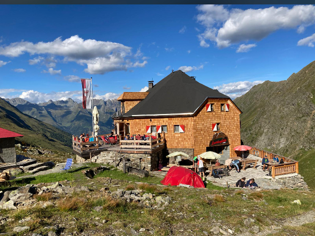





Curated by Osttirol Tourismus
Hopfgarten in Defereggen
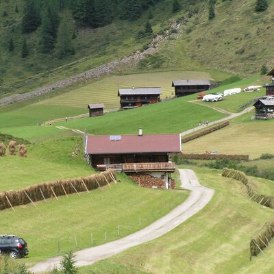
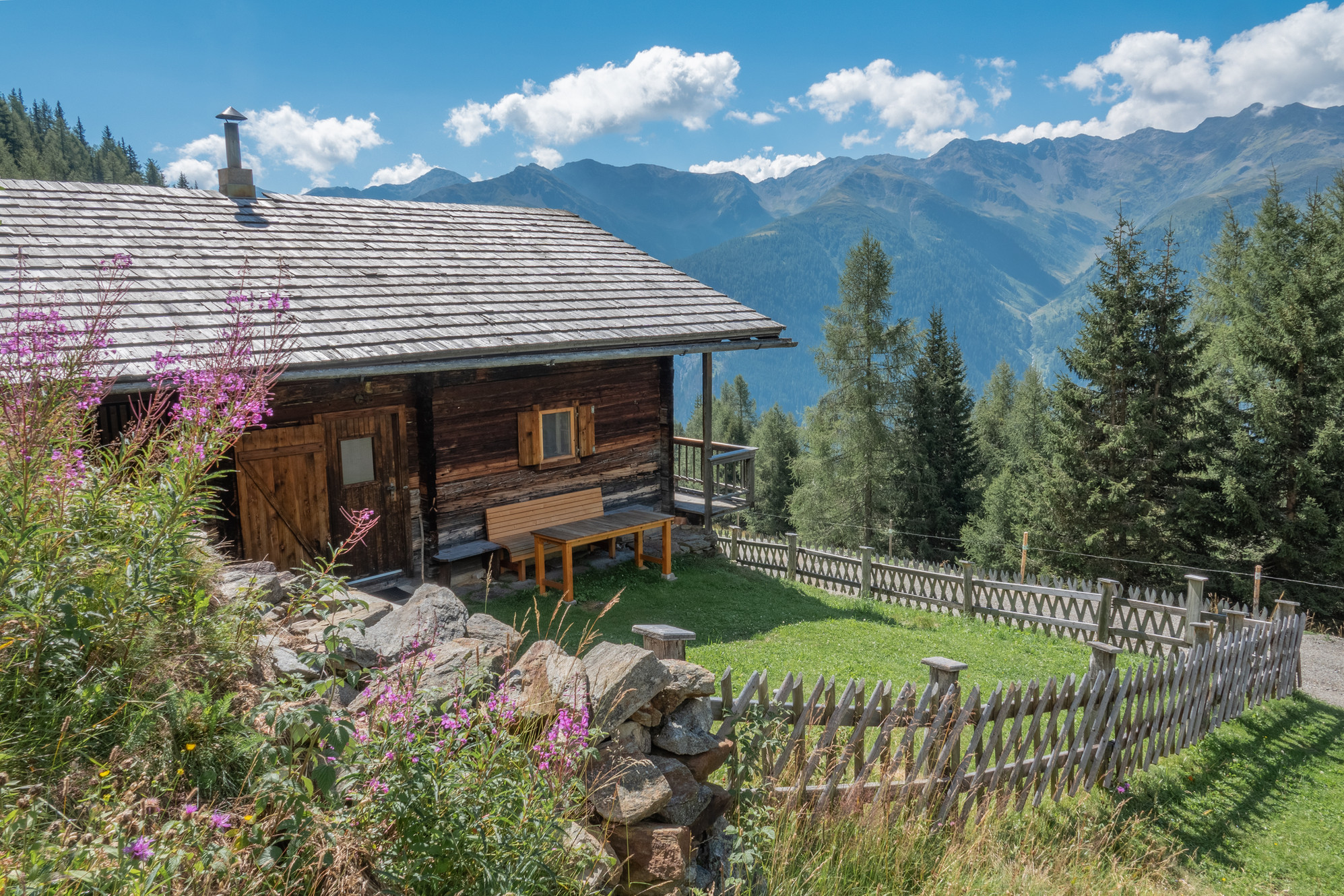
The entrance village of the Defereggen valley on the Schwarzach, at about 1100 m, with alp huts like the Jakoberalm dotting the slopes above.
- 15Highlights
- 8Routes
- Featured summit · Regenstein
Highlights
All 15 from neighbouring places
Oberkoflalm
6.4 km away, in Außervillgraten
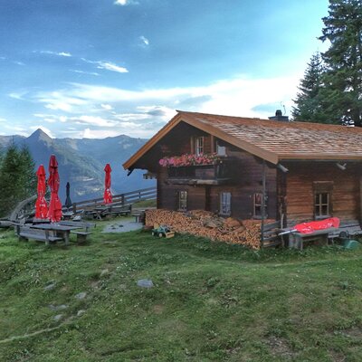
An alm hut on the slopes above Außervillgraten, reached by farm tracks through the Villgraten grazing country.
Geiregg-Alm
6.9 km away, in Außervillgraten
An alm hut in the grazing country above Außervillgraten, reached on foot through the Villgraten valley's slopes.
Almhütte Arnitzalm
7.2 km away, in Matrei in Osttirol
An alm hut on the Arnitz pastures in the mountains south of Matrei in Osttirol, in quiet walking country.
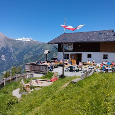
Zunigalm 1.846m
7.9 km away, in Matrei in Osttirol
An alm at 1,846 m on the Zunig mountainside south of Matrei in Osttirol, a managed summer stop below the Lasörling ridge.
Gritzer Alm - Nitzler Almhütte
8.7 km away, in St. Veit in Defereggen
An alm hut on the Gritzer pastures above St. Veit in Defereggen, near paths climbing toward the Gritzer lakes.
Die Brandalm
9.5 km away, in Außervillgraten
An alm hut above Außervillgraten in the Villgraten valley, run through the summer season as a stop for walkers.
Motschendaberhütte
10.5 km away, in Virgen
A simple mountain hut set in the alm meadows above Virgen in the Virgental.
Lehenalm
10.7 km away, in Außervillgraten
An alm hut in the pastures above Außervillgraten, a plain summer building of the Villgraten mountains.
Genusshütte Roatz Bodn 1.880m
11.1 km away, in Matrei in Osttirol
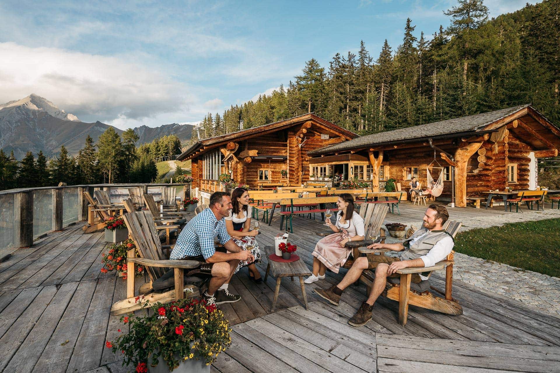
A small hut at 1,880 m on the Goldried slopes above Matrei in Osttirol, serving regional dishes to walkers and skiers.
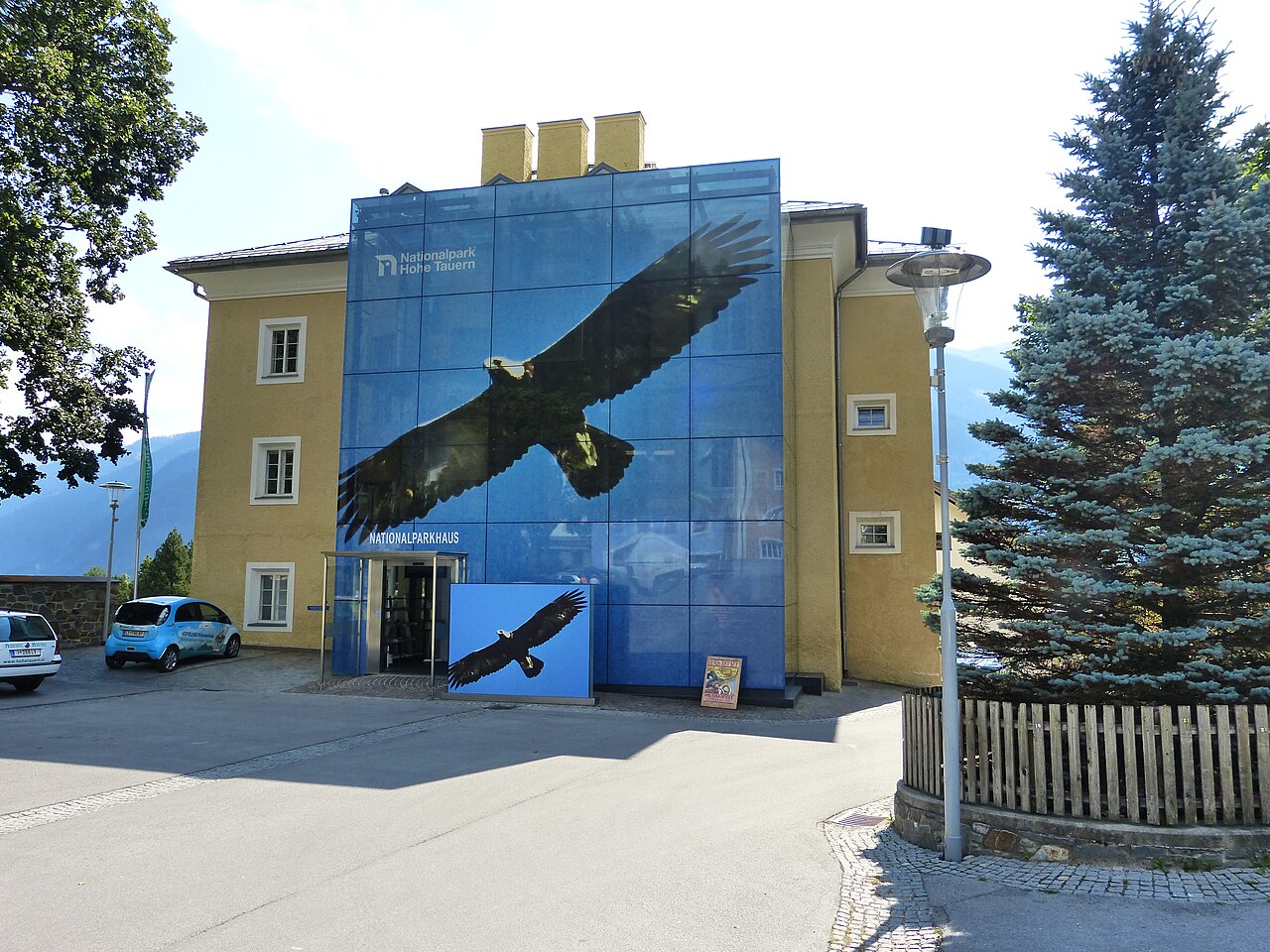
Nationalparkhaus Matrei in Osttirol
11.2 km away, in Matrei in Osttirol
The Hohe Tauern National Park visitor centre in Matrei in Osttirol, with exhibitions on the park's glaciers, wildlife and alpine habitats.
Lasörlinghütte 2.350m
11.6 km away, in Virgen
A hut at 2,350 m below the Lasörling summit, a stage on the Lasörling high trail running along the south side of the Virgental.
Weißspitzhütte
11.8 km away, in St. Veit in Defereggen
A hut high above the Defereggen valley near St. Veit, named after the Weiße Spitze and reached on marked paths from the valley.
Bruggeralm 1.818m
12.3 km away, in St. Veit in Defereggen
An alm hut at 1,818 m above the Defereggen valley near St. Veit, serving walkers through the summer grazing season.
Wodenalm 1.825m
12.4 km away, in Matrei in Osttirol
A managed alm at 1,825 m above Matrei in Osttirol, set amid the summer grazing pastures of the Hohe Tauern foothills.
Almhütte Raneburg
12.4 km away, in Matrei in Osttirol
An alm hut in the high pastures above Matrei in Osttirol, a summer building typical of the region's mountain farming.
Nothing of this kind in Hopfgarten in Defereggen.
Routes
12 from neighbouring places
Wasserwanderweg Hopfgarten i. D.
A nearly flat water-themed walk at Hopfgarten in Defereggen, linking springs and streams with the national park information point in the village.
- 3.9 km
- Distance
- 36 m
- Ascent
- 60 min
- Duration
- 1
- Check-ins
Regenstein 2.891m
A demanding climb from the Defereggen valley past the Geigenseehütte and the Geigensee tarn to a 2,891 m summit, gaining almost 1,800 m in under 10 km.
- 19.2 km
- Distance
- 1 783 m
- Ascent
- 11 h 8 min
- Duration
- 1
- Check-ins
Skitour Gagenhöhe 2.463m
Steep ski tour above Hopfgarten in Defereggen that crosses the Zeigerle before the final push to a 2,463 m summit — over 1,300 m of skinning.
- 7.0 km
- Distance
- 1 351 m
- Ascent
- 1 351 m
- Descent
- 4 h 23 min
- Duration
Zwenewaldweg Nr. 108
A forest-road climb from Hopfgarten in Defereggen up to the Bloshütte, with a view back over the village on the way.
- 6.9 km
- Distance
- 710 m
- Ascent
- 1 h 39 min
- Duration
- 1
- Check-ins
Bike & Hike Regenstein 2.891m
A ride up from the Defereggental past the Bloshütte and a waterfall to the Geigensee and its hut at 2,400 m, with the summit walked from there.
- 23.9 km
- Distance
- 1 851 m
- Ascent
- 4 h 34 min
- Duration
- 2
- Check-ins
Themenweg "Im Reich des Apollo"
Family theme trail at Hopfgarten devoted to the Apollo butterfly, climbing over the Bretterkofel knoll past Tröglis Schupfen; bus line 953 links start and finish.
- 4.4 km
- Distance
- 272 m
- Ascent
- 1 h 52 min
- Duration
Stanzling 2.716m
From the hamlet of Hof above Hopfgarten this route climbs more than 1,100 m to a 2,716 m viewpoint over the Defereggen valley — short, steep and quiet.
- 6.5 km
- Distance
- 1 124 m
- Ascent
- 6 h 22 min
- Duration
Grünalmtal Nr. 128
A short, steep forest-road climb up a side valley of the Defereggental above Hopfgarten, gaining nearly 700 m in under 6 km.
- 5.8 km
- Distance
- 673 m
- Ascent
- 1 h 32 min
- Duration
Wanderung zur Speikbodenhütte 2.050m
7.4 km away, in St. Veit in Defereggen
Hut walk on the sunny St. Veit side of the Defereggental — about 550 m of steady climbing from Oberholz to a pasture hut at 2,050 m.
- 5.4 km
- Distance
- 552 m
- Ascent
- 3 h 23 min
- Duration
- 2
- Check-ins
Speikbodenhütte - Gritzer Alm Nr. 159 - Alternative Gritzer Alm
8.4 km away, in St. Veit in Defereggen
A short alternative link on the Defereggen bike route network, joining the track up to the Gritzer Alm at just over 2,000 m.
- 1.7 km
- Distance
- 80 m
- Ascent
- 14 min
- Duration
- 2
- Check-ins
Klaunzerberg Nr. 147
11.1 km away, in Matrei in Osttirol
A long forest-road climb from Matrei up the Goldried slopes to the Kuenzeralm and Berggasthaus Goldried, topping the Klaunzer Berg.
- 24.1 km
- Distance
- 1 287 m
- Ascent
- 3 h 30 min
- Duration
- 22
- Check-ins
Skitour zur Compedal Schihütte
14.6 km away, in Assling
A short, beginner-friendly ski tour from Bichl above Assling to the Compedal ski hut, about 400 m of ascent on gentle, mostly wooded terrain.
- 2.4 km
- Distance
- 413 m
- Ascent
- 413 m
- Descent
- 1 h 22 min
- Duration
- 1
- Check-ins
E-Bike & Klettersteig Burg Heinfels 1.130m
14.7 km away, in Assling
Short sport via ferrata below Burg Heinfels in the Pustertal, ridable to the base from the Punbrugge; a key wall provides the brief crux before the walk-off.
- 63.0 km
- Distance
- 52 m
- Ascent
- 22 h 48 min
- Duration
- 11
- Check-ins
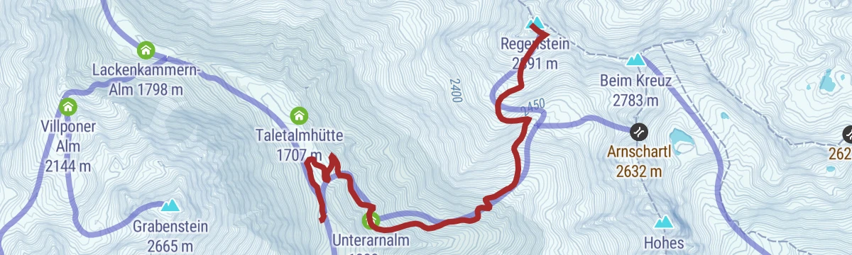
Skitour Regenstein 2.891m
5.9 km away, in Außervillgraten
A ski tour from Außervillgraten via the Unterarnalm to the Regenstein at 2,891 m, a long, steady skin to a high Villgraten viewpoint.
- 5.1 km
- Distance
- 1 248 m
- Ascent
- 1 248 m
- Descent
- 3 h 53 min
- Duration
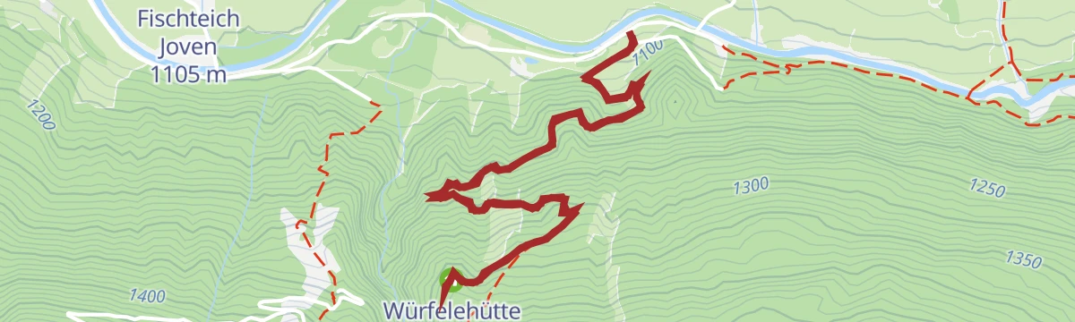
Bike & Hike Zupalseehütte 2.350m
11 km away, in Virgen
A steep climb above Virgen from the Würfelehütte up to the hut at 2,350 m, with the Zupalsee lying just beyond it.
- 15.8 km
- Distance
- 1 409 m
- Ascent
- 3 h 22 min
- Duration
- 15
- Check-ins
 Zupalseehütte 2 350 m
- Würfelehütte 1 378 m
 Zupalsee 2 340 m
Speikbodenhütte 159
7.6 km away, in St. Veit in Defereggen
A steep forest-road climb out of the Defereggental to the hut and viewpoint at just over 2,000 m, more than 600 m of ascent in 6 km.
- 5.8 km
- Distance
- 618 m
- Ascent
- 1 h 25 min
- Duration
- 2
- Check-ins
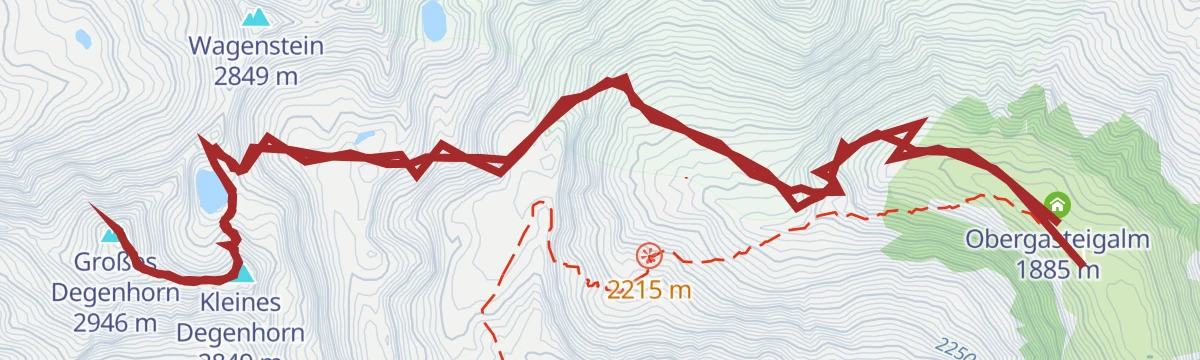
Gr. Degenhorn 2.946 m
7.8 km away, in Außervillgraten
From the Volkzeiner Hütte past the Degenhornsee to the Großes Degenhorn at 2,946 m, a remote Villgraten summit day with its smaller neighbour taken en route.
- 13.1 km
- Distance
- 1 230 m
- Ascent
- 7 h 40 min
- Duration
- 9
- Check-ins
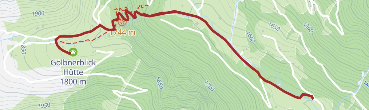
Gölbnerblick Hütte über den neuen Wasserfallpfad Celar
9 km away, in Anras
A short walk in the Kristeinertal to the Gölbnerblick Hütte, using the new Celar waterfall path for a scenic, family-friendly approach.
- 3.7 km
- Distance
- 296 m
- Ascent
- 1 h 54 min
- Duration
- 1
- Check-ins
Wanderung zur Volkzeiner Hütte
7.5 km away, in Außervillgraten
A long but gentle valley walk in the Villgraten mountains to the Volkzeiner Hütte, passing a string of alps deep in the Winkeltal.
- 13.4 km
- Distance
- 386 m
- Ascent
- 4 h 6 min
- Duration
- 6
- Check-ins
Würfelehütte Nr. 109
11 km away, in Virgen
A short, easy forest-road climb out of Virgen in East Tirol, gaining a little under 300 m to the hut at 1,378 m above the Virgental.
- 4.3 km
- Distance
- 280 m
- Ascent
- 43 min
- Duration
- 4
- Check-ins
No routes of this kind in Hopfgarten in Defereggen yet.
The region's own picks

Featured route
Wasserwanderweg Hopfgarten i. D.
A nearly flat water-themed walk at Hopfgarten in Defereggen, linking springs and streams with the national park information point in the village.
Planning a trip to Hopfgarten in Defereggen?
Everything else Tyrol has, in one place


Take Hopfgarten in Defereggen with you into the mountains
Every route on this page with 3D terrain, GPX navigation and offline maps — including the valleys with no signal.
Data sources
- Official website: osttirol.com ↗
- Routes and highlights: Osttirol Tourismus
- Published as open data by the tourist boards named above.
- Region summary generated from the board's own material.
