






Curated by Valtellina Outdoor
Grosio
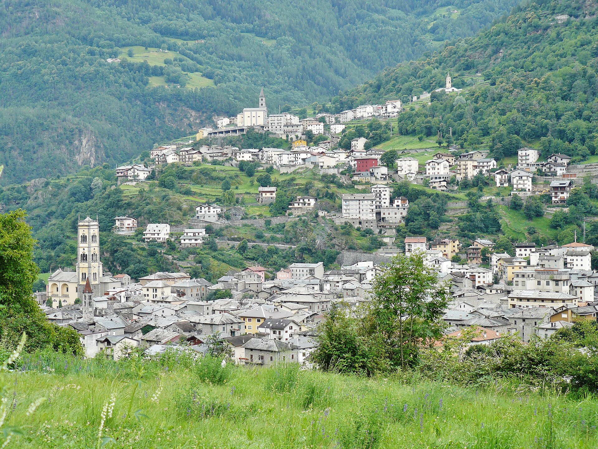
Valtellina comune with a Bronze Age rock-art park and the ruins of two castles above the vineyards.
Photo: qwesy qwesy · CC BY 3.0 licence
- 1Highlights
- 27Routes
- Featured summit · Cima Viola
Highlights
All 1 from neighbouring places
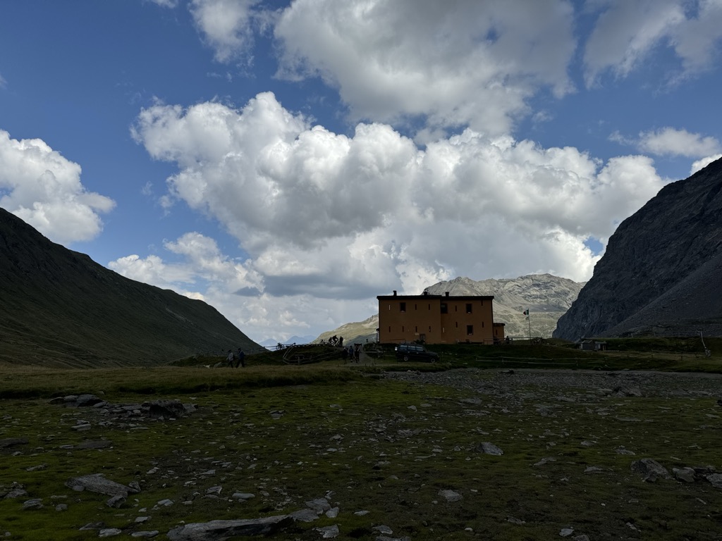
Rifugio Viola
8.2 km away, in Valdidentro
A refuge in the Val Viola above Arnoga, in the Alta Valtellina, a base for the Cima Viola and the pass over into the Val Poschiavo.
Nothing of this kind in Grosio.
Routes
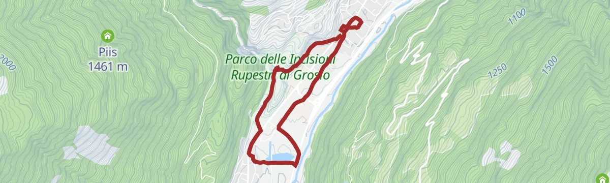
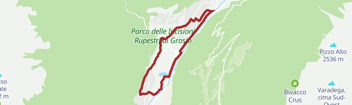
Grosio and Grosotto, a journey back in time more than 5,000 years
A walk from Grosio through the last Valtellina vineyards to the two castles and the Rupe Magna, the largest carved rock in Europe.
- 6.9 km
- Distance
- 101 m
- Ascent
- 1 h 52 min
- Duration
- 3
- Check-ins
Open route Valtellina OutdoorView of Eita and the Lago delle Acque Sparse
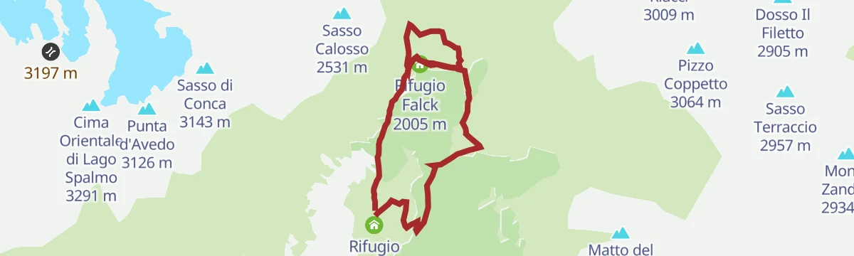
A walk from Eita in the Val Grosina on dirt road N259 into the Cassavrolo valley, past its alpine huts to the Lago delle Acque Sparse.
- 7.5 km
- Distance
- 352 m
- Ascent
- 2 h 38 min
- Duration
- 13
- Check-ins
 Rifugio Eita 1 703 m
 Lago Acque Sparse 2 009 m
- Rifugio Falck 2 005 m
Open route Valtellina OutdoorSentiero Italia D32N - Stage Malghera - Rifugio Federico in Dosdè
A long Sentiero Italia stage from the Malghera hut over the Passo di Vermolera at 2,732 m, past the Tres lakes and Lago Nero into the Val Viola.
- 19.8 km
- Distance
- 1 403 m
- Ascent
- 8 h 59 min
- Duration
- 60
- Check-ins
- Rifugio Federico Valgoi 2 133 m
 Passo Dosdè 2 828 m
- Capanna Dosdè 2 824 m
- Baita del Pastore 2 369 m
- Rifugio Malghera 1 952 m
- Bivacco Pian del Lago m.2330 2 325 m
- +4
Open route Valtellina OutdoorAlpine Gravel: Val di Campo
A very long gravel ride from Bormio on white roads, climbing past Baita Viola and the Baite Altumeira to the Rifugio Saoseo and Sfazù.
- 110.0 km
- Distance
- 2 125 m
- Ascent
- 11 h 46 min
- Duration
- 110
- Check-ins
- Baita Viola 1 883 m
- Ristoro Baita Altumeira 2 118 m
- Rifugio SAC Lungacqua Saoseo 1 985 m
- Sfazù 1 622 m
- Zarera 1 602 m
- Baite Altumeira 2 131 m
- +10
Open route Valtellina OutdoorOratory Palio Walk of Grosio 2025
An easy circuit on the flat ground around Grosio in the Valtellina, laid out for the parish palio.
- 5.0 km
- Distance
- 80 m
- Ascent
- 1 h 23 min
- Duration
- 3
- Check-ins
Open route Valtellina OutdoorIl Sentiero Valtellina
The Colico end of the Sentiero Valtellina, where the route along the Adda leaves the head of Lake Como for the valley.
- 113.6 km
- Distance
- 1 108 m
- Ascent
- 28 h 24 min
- Duration
- 12
- Check-ins
Via Alpina Stage R72. Arnoga - Eita
A Via Alpina stage from Arnoga through Val Viola and over the Verva pass, dropping to Eita at the head of the Val Grosina.
- 15.3 km
- Distance
- 468 m
- Ascent
- 4 h 56 min
- Duration
- 49
- Check-ins
- Baita Viola 1 883 m
- Rifugio Eita 1 703 m
- Agriturismo Val Verva 2 124 m
- Baita Verva Sotto 1 955 m
- Lago Acque Sparse 2 009 m
- Passo di Verva 2 300 m
Open route Valtellina OutdoorAlpine Gravel: Verva Loop
A long gravel loop out of Bormio crossing Passo di Verva at 2,300 m, with Baita Viola and Rifugio Eita on the high dirt roads.
- 70.8 km
- Distance
- 1 761 m
- Ascent
- 7 h 57 min
- Duration
- 63
- Check-ins
- Baita Viola 1 883 m
- Rifugio Eita 1 703 m
- Blu Note 1 358 m
- Agriturismo Val Verva 2 124 m
- Baita Verva Sotto 1 955 m
- Passo di Verva 2 300 m
- +6
Open route Valtellina OutdoorPizzo Matto 2993m
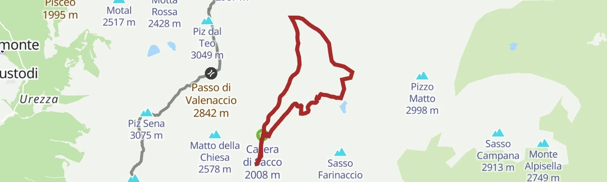
A climb from Malghera past the Sacco and Mandri Vegi huts to the Pian del Lago plateau, then on faint ground to the Pizzo Matto at 2,993 m.
- 11.4 km
- Distance
- 793 m
- Ascent
- 5 h 17 min
- Duration
- 11
- Check-ins
- Rifugio Malghera 1 952 m
- Bivacco Pian del Lago m.2330 2 325 m
- Passo di Vermolera 2 732 m
- Casera di Sacco 2 008 m
Open route Valtellina OutdoorVia Alpina Stage R73. Eita - Malghera
A Via Alpina stage from Eita up the Val d'Avedo past Stabine and Alpe Vermolera to the Tres lakes, then over to Malghera; sure footing needed.
- 13.3 km
- Distance
- 1 092 m
- Ascent
- 6 h 29 min
- Duration
- 25
- Check-ins
- Rifugio Eita 1 703 m
- Rifugio Malghera 1 952 m
- Bivacco Pian del Lago m.2330 2 325 m
- Passo di Vermolera 2 732 m
- Laghi di Tres 2 194 m
- Lago Venere 2 408 m
- +1
Open route Valtellina OutdoorEnergy Cycle Path - Green Route
A hard route past the Valtellina hydro schemes, crossing the Passo di Verva at 2,300 m.
- 39.3 km
- Distance
- 1 865 m
- Ascent
- 4 h 47 min
- Duration
- 61
- Check-ins
- Baita Viola 1 883 m
- Passo Torri di Fraele 1 941 m
- Rifugio Eita 1 703 m
- Agriturismo Val Verva 2 124 m
- Baita Verva Sotto 1 955 m
- Passo di Verva 2 300 m
- +2
Open route Valtellina OutdoorMalghera circular val di Sacco with joëlette
A loop in the Val di Sacco from Malghera, reached by the toll road up from Fusino, on ground broad enough for a joëlette wheelchair.
- 9.4 km
- Distance
- 391 m
- Ascent
- 3 h 10 min
- Duration
- 8
- Check-ins
Open route Valtellina OutdoorSentiero Italia D31N - Stage Rifugio Schiazzera - Malghera
A long stage on a Great War mule track from Rifugio Schiazzera past its cold lake and Alpe Salina, crossing into the isolated Val Grosina.
- 25.0 km
- Distance
- 801 m
- Ascent
- 7 h 56 min
- Duration
- 23
- Check-ins
 Monte Croce 2 269 m
- Rifugio Schiazzera 2 075 m
- Rifugio Malghera 1 952 m
- Bivacco Alpe Piana 1 880 m
- Alpe Guinzana 1 932 m
- Schiazzera Invernale 2 110 m
- +3
Open route Valtellina OutdoorEnergy Cycleway - Red Route
A long Valtellina route past the A2A hydroelectric sites, climbing to the Passo Torri di Fraele and the lake at 1,928 m.
- 63.3 km
- Distance
- 1 661 m
- Ascent
- 6 h 37 min
- Duration
- 44
- Check-ins
- Monte delle Scale 1 953 m
- Passo Torri di Fraele 1 941 m
- Lago delle Scale 1 928 m
- Villa Valania 1 931 m
- Agriturismo Rini 1 180 m
- Pro Loco 1 140 m
- +2
Open route Valtellina OutdoorMalghera lakes circuit
An easy loop on the Sentiero Italia into the upper Val di Sacco from the Malghera hut, past the casera and Pian di Mezzo, walkable or ridable.
- 9.4 km
- Distance
- 391 m
- Ascent
- 3 h 10 min
- Duration
- 8
- Check-ins
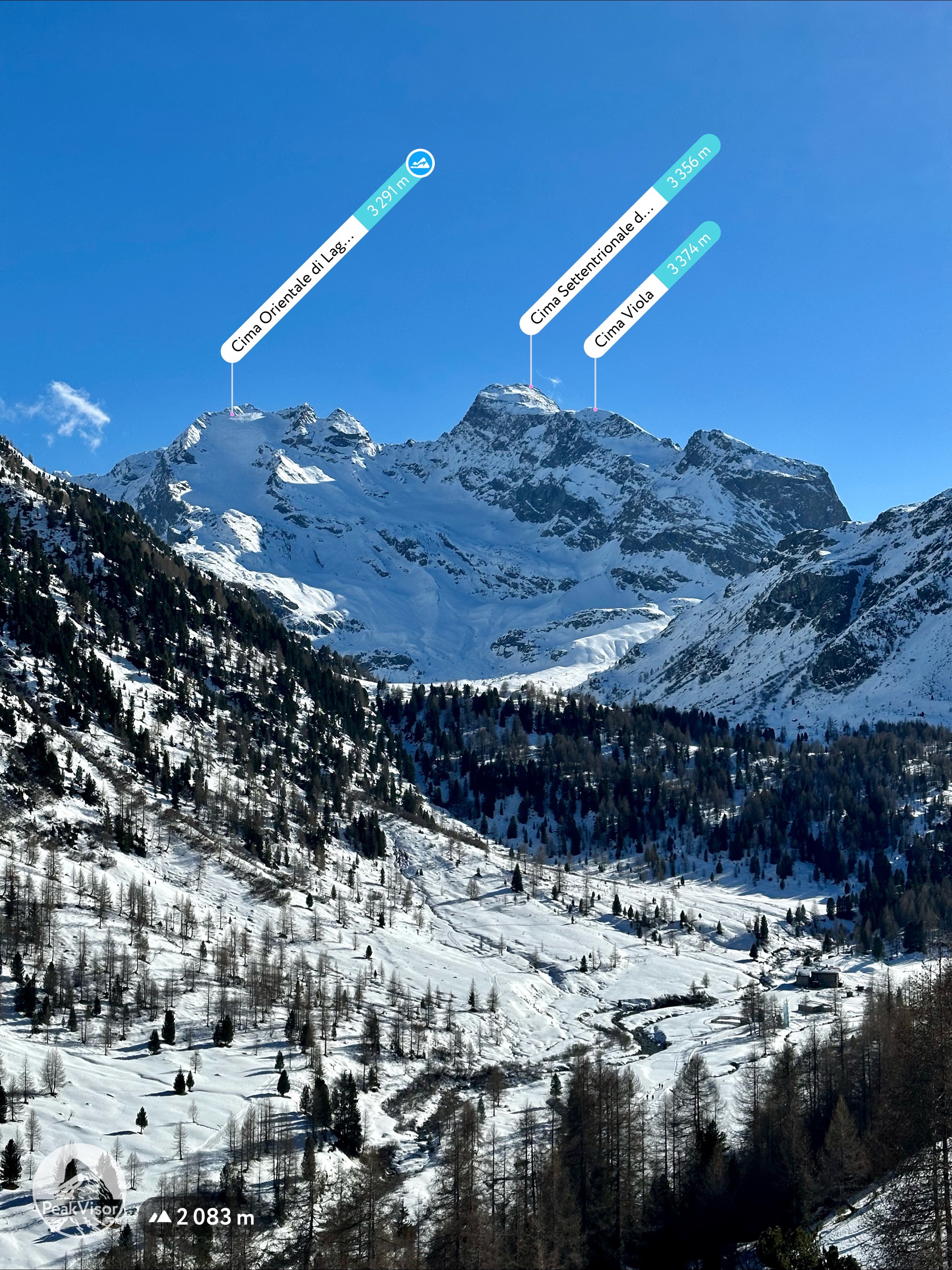
Open route Valtellina OutdoorCima Viola 3374m
An ascent of Cima Viola, the most alpine peak in the Grosio commune, iced on the north side and walled with 500 m of rock to the south.
- 14.5 km
- Distance
- 1 490 m
- Ascent
- 9 h 7 min
- Duration
- 15
- Check-ins
- Cima Viola 3 374 m
- Passo Dosdè 2 828 m
- Capanna Dosdè 2 824 m
- Laghi di Tres 2 194 m
Open route Valtellina OutdoorStelvio E-Bike Tour: Arnoga - Passo di Verva - Grosio
A dirt-road crossing from the Valdidentro side over a 2,300 m pass, with a stop at the Agriturismo Val Verva, then down past the Rifugio Falck.
- 30.2 km
- Distance
- 989 m
- Ascent
- 4 h 5 min
- Duration
- 39
- Check-ins
- Baita Viola 1 883 m
- Agriturismo Val Verva 2 124 m
- Baita Verva Sotto 1 955 m
- Passo di Verva 2 300 m
- Rifugio Falck 2 005 m
- Ca' del Cap 667 m
- +1
Open route Valtellina OutdoorPian del Lago Ring
A quiet loop from Malghera to the lake on the Pian del Lago plateau, with a shepherds' hut for shelter and water cold enough for a swim.
- 9.3 km
- Distance
- 423 m
- Ascent
- 3 h 13 min
- Duration
- 8
- Check-ins
Open route Valtellina OutdoorLa Grosina Five Crazy Down
A very long climb from Grosio up the eastern Val Grosina by way of Ravoledo and Fusino to Eita, on asphalt nearly the whole way.
- 28.4 km
- Distance
- 1 499 m
- Ascent
- 10 h 48 min
- Duration
- 12
- Check-ins
Open route Valtellina OutdoorStelvio Epic Rides: Mortirolo from Bormio
The Mortirolo pass taken from Grosio, its more scenic side, twelve kilometres averaging above ten percent.
- 36.0 km
- Distance
- 1 173 m
- Ascent
- 4 h 4 min
- Duration
- 11
- Check-ins
Open route Valtellina OutdoorSassalbo 2862 m
A climb from Malghera past its lake to the Sassalbo, named for the white limestone of its west flank, with Lago di Poschiavo and the Bernina beyond.
- 6.9 km
- Distance
- 633 m
- Ascent
- 3 h 57 min
- Duration
- 7
- Check-ins
Open route Valtellina OutdoorMortirolo Pass (from Grosio)
The gentlest of the roads up to the Mortirolo, climbing about 1,220 m from Grosio at an average of 8 per cent, raced by the Giro only in 2012.
- 15.4 km
- Distance
- 1 192 m
- Ascent
- 5 h 31 min
- Duration
- 7
- Check-ins
Open route Valtellina OutdoorSentiero Valtellina
A valley-floor cycleway following the Adda upstream from the plain at Colico for well over 100 km into the upper Valtellina.
- 113.4 km
- Distance
- 1 068 m
- Ascent
- 10 h 43 min
- Duration
- 6
- Check-ins
- Agriturismo Rini 1 180 m
- Pro Loco 1 140 m
- A2A 504 m
- Visit Valtellina 434 m
- Il Bisteca - Agriturismo 242 m
Open route Valtellina OutdoorVia della Vernuga e dei Soldati
A climb from Grosio past a 17th-century chapel dedicated to the Baptist and an old lever press, then on path N256 to the stone houses of Vernuga Alta.
- 6.8 km
- Distance
- 578 m
- Ascent
- 3 h 41 min
- Duration
- 2
- Check-ins
Open route Valtellina OutdoorMarian Path of the Eastern Alps - Stage Cepina Grosotto
A long valley stage from Cepina to Grosotto through the Serravalle narrows, over ground reshaped by the 1987 landslide that buried Sant'Antonio Morignone.
- 29.3 km
- Distance
- 461 m
- Ascent
- 8 h 29 min
- Duration
- 5
- Check-ins
Open route Valtellina OutdoorSan Giacomo of Grosio (1054 m)
A short, steep climb from the Rock Engraving Park at Grosio, up through chestnut woods above the Roasco to the church of San Giacomo.
- 3.6 km
- Distance
- 427 m
- Ascent
- 1 h 45 min
- Duration
Open route Valtellina OutdoorMonte Storile (2471 m) seen from Ravoledo
A long climb from the church square at Ravoledo on path N254, over the Grom knoll and up switchbacked track to Monte Storile at 2,471 m.
- 16.8 km
- Distance
- 1 658 m
- Ascent
- 10 h 13 min
- Duration
- 4
- Check-ins
Open route Valtellina Outdoor
No routes of this kind in Grosio yet.
The region's own picks
Featured route
Grosio and Grosotto, a journey back in time more than 5,000 years
A walk from Grosio through the last Valtellina vineyards to the two castles and the Rupe Magna, the largest carved rock in Europe.
Planning a trip to Grosio?
Everything else Lombardy has, in one place


Take Grosio with you into the mountains
Every route on this page with 3D terrain, GPX navigation and offline maps — including the valleys with no signal.
Data sources
- Official website: la-valtellina.com ↗
- Routes and highlights: Valtellina Outdoor, YesAlps, Sondrio e Valmalenco
- Published as open data by the tourist boards named above.
- Region summary generated from the board's own material.
