

 Via ferrata








Curated by TVB Paznaun-Ischgl
Grins
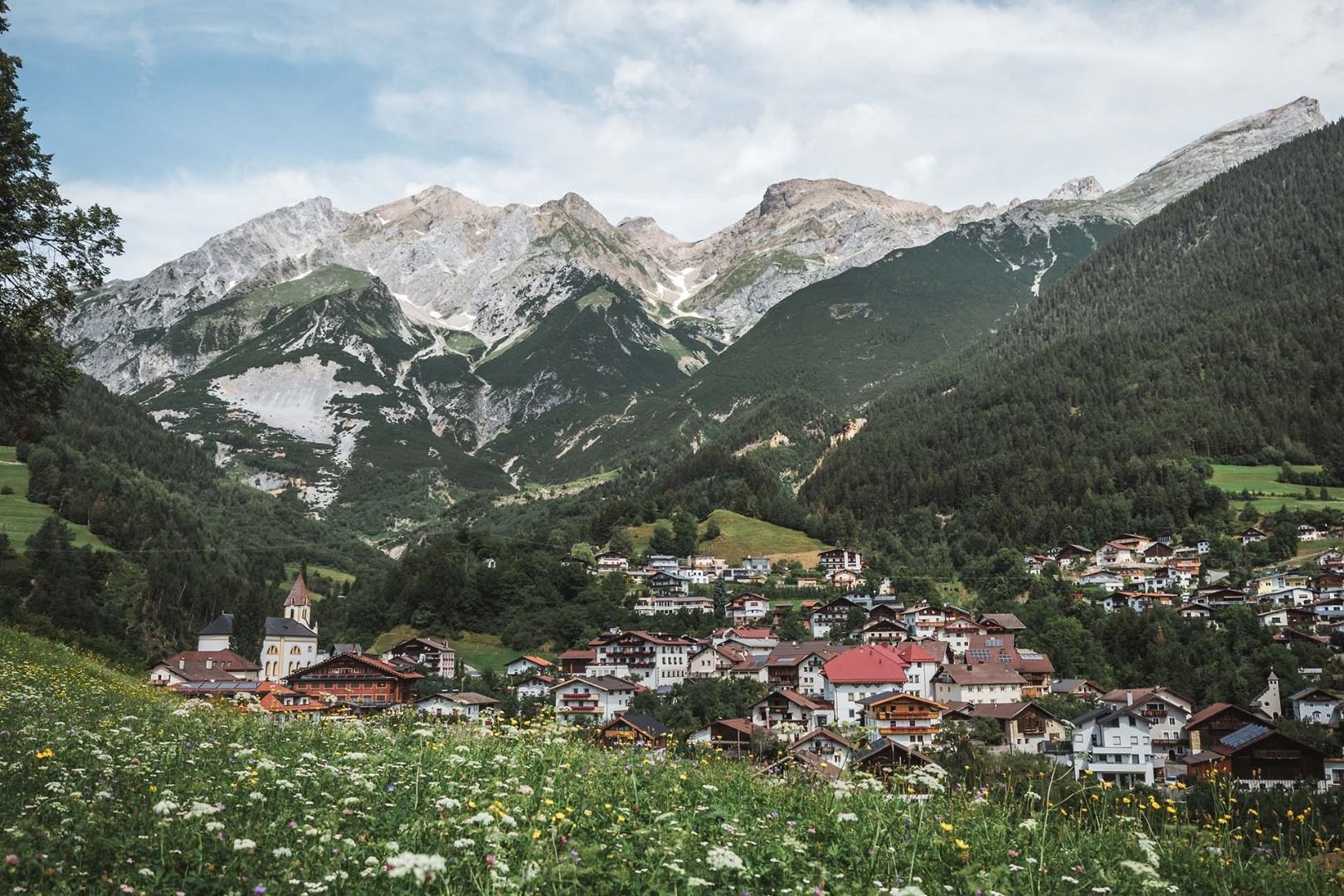
A terraced village at just over 1000 m above the Sanna west of Landeck, an old stop on the Roman road, with the Augsburger Hütte high in the Lechtal Alps.
- 2Highlights
- 3Routes
- Featured summit · Gatschkopf
Highlights
13 from neighbouring places
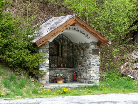
Unteres Kappali in Quadratsch
The lower of two small chapels in Quadratsch, a hamlet above Pians at the mouth of the Paznaun valley; 'Kappali' is Paznaun dialect for chapel.
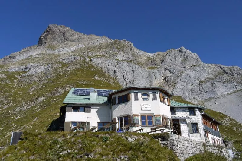
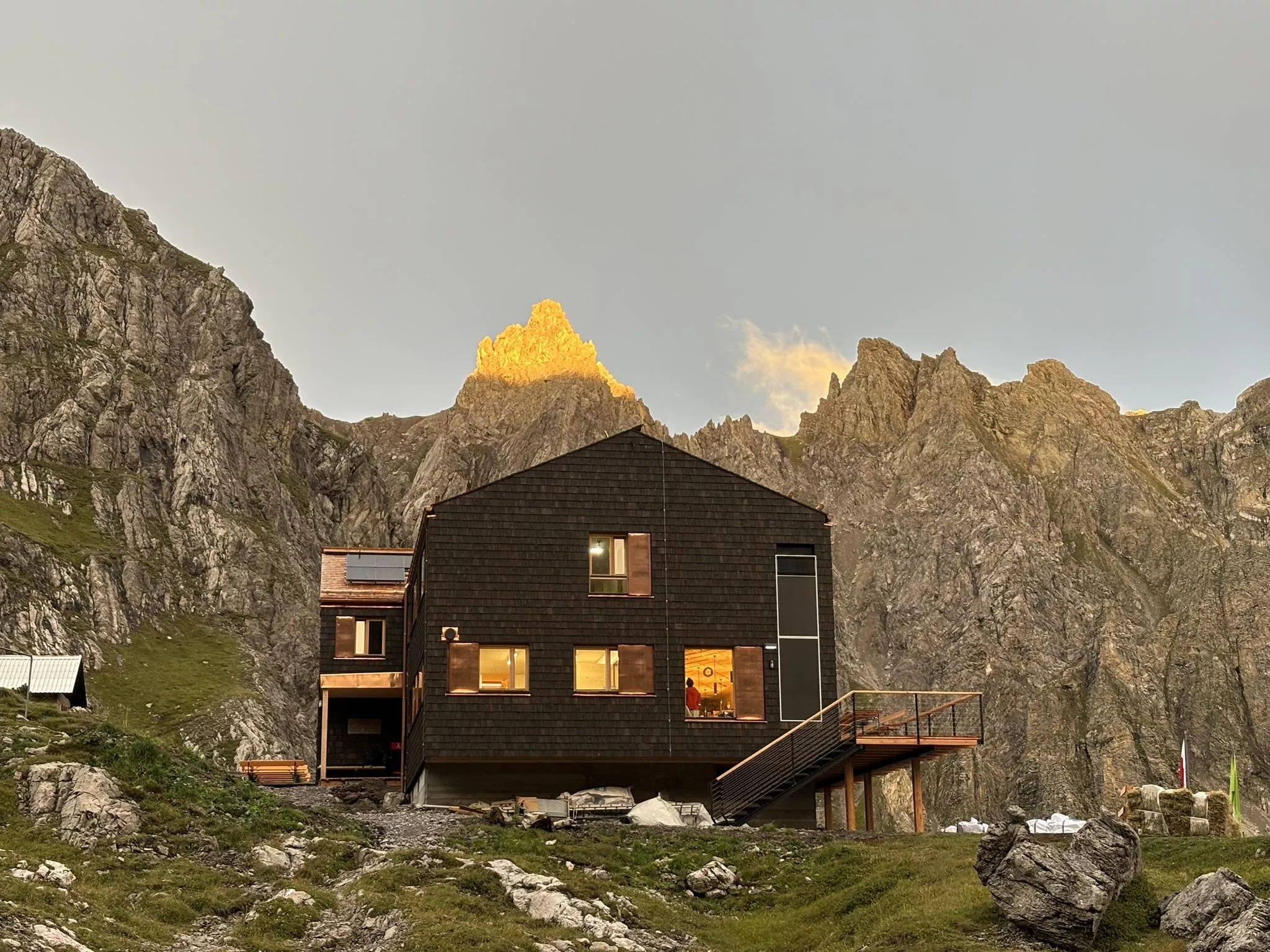
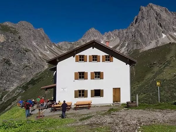
Augsburger Hütte 2.298 m
An alpine club refuge at 2,298 m above Grins, the base for the Parseierspitze, at 3,036 m the highest summit of the Lechtal Alps.
Herz-Jesu-Kapelle
1.7 km away, in Pians
A Sacred Heart chapel near Pians at the lower end of the Paznaun valley, a small devotional stop close to the old valley routes.
Antoniuskirchlein in Quadratsch
1.8 km away, in Pians
A little church dedicated to St. Anthony in the hamlet of Quadratsch above Pians, at the lower end of the Paznaun valley in Tirol.
Gottesdienste Pfarrkirche Pians
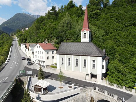
1.8 km away, in Pians
The parish church of Pians at the entrance to the Paznaun valley, where regular services are celebrated for the small community.
Margarethenkapelle
1.9 km away, in Pians
A chapel of St. Margaret in Pians at the mouth of the Paznaun valley, a small church building with medieval origins.
Bärenkapelle
2.1 km away, in Pians
A small chapel near Pians whose German name means bear chapel, standing at the lower entrance of the Paznaun valley.
Quadratscher Kappali
2.2 km away, in Pians
A small chapel in the hamlet of Quadratsch above Pians, at the lower end of the Paznaun valley; 'Kappali' is the local dialect word for chapel.
Wegkapelle Hl. Josef
2.2 km away, in Pians
A wayside chapel of St. Joseph near Pians at the lower end of the Paznaun valley, a small stop beside the old route into the valley.
Gondakappali
2.6 km away, in Tobadill
A tiny chapel at Gonda near Pians in the lower Paznaun valley, typical of the small dialect-named 'Kappali' found beside farmsteads here.
Gföllkapelle
4.9 km away, in Tobadill
A small chapel at Gföll on the slopes above See in the lower Paznaun valley, reached by farm lanes and walking paths.
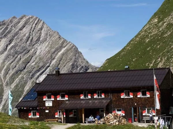
Memminger Hütte 2.242 m
5.8 km away, in Zams
An alpine club refuge at 2,242 m above the Madau valley near Bach, a well-known overnight stop on the E5 crossing of the Lechtal Alps.
Württemberger Haus 2.220 m
7 km away, in Zams
A refuge at 2,220 m in the central Lechtal Alps above Zams, a quiet overnight stop on the high-route crossings of the range.
Steinseehütte 2.061 m
10.4 km away, in Zams
A refuge at 2,061 m near the Steinsee lake in the Lechtal Alps, a base for the surrounding climbing routes, reached from the Zams side.
Steinsee Klettersteig
10.4 km away, in Zams
A via ferrata near the Steinsee and the Steinseehütte in the Lechtal Alps above Zams, a protected route in high lake scenery.
Nothing of this kind in Grins.
Routes
17 from neighbouring places
Augsburger Hütte - Memminger Hütte
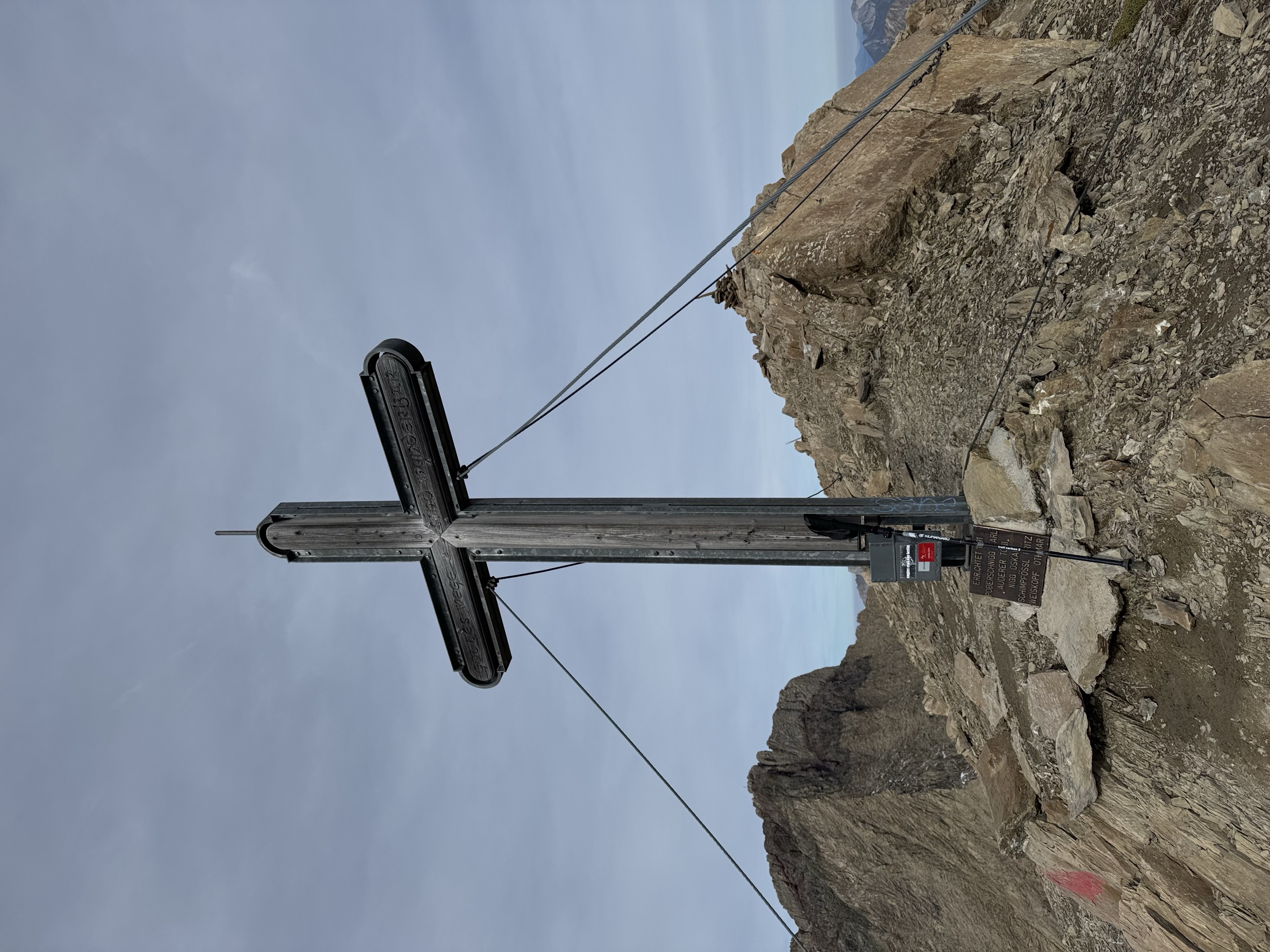
Airy Spiehlerweg link between two Lechtal refuges, topping the 2,945 m Gatschkopf before threading the Patrolscharte and Wegscharte down past the Seewisee lakes; scree and lingering snowfields call for sure feet.
- 6.9 km
- Distance
- 768 m
- Ascent
- 4 h 44 min
- Duration
- 26
- Check-ins
 Gatschkopf 2 945 m
 Augsburger Hütte 2 289 m
- Memminger Hütte 2 242 m
 Mittlerer Seewisee 2 425 m
 Wegscharte 2 585 m
- Patrolscharte 2 846 m
- +1
Ansbacher Hütte - Augsburger Hütte
The Lechtaler Höhenweg's toughest stage: over the Winterjöchl and the Parseierscharte, where a bivouac box stands, then across the Dawinscharte and the 2,968 m Dawinkopf to the Augsburger Hütte.
- 11.2 km
- Distance
- 1 010 m
- Ascent
- 6 h 31 min
- Duration
- 15
- Check-ins
Memminger Hütte - Augsburger Hütte
A serious alpine link from the Memminger Hütte to the Augsburger Hütte, crossing the Wegscharte, Parseierjoch and Patrolscharte beneath the Lechtal's highest summits.
- 6.2 km
- Distance
- 756 m
- Ascent
- 4 h 21 min
- Duration
- 23
- Check-ins
- Augsburger Hütte 2 289 m
- Memminger Hütte 2 242 m
- Mittlerer Seewisee 2 425 m
- Wegscharte 2 585 m
- Patrolscharte 2 846 m
- Parseierjoch 2 560 m
Hoch über Landeck (Tobadill)
2.9 km away, in Tobadill
A long circuit above the Inn valley between Landeck-Zams and Schönwies, starting from the tourist office in Tirol West.
- 61.1 km
- Distance
- 577 m
- Ascent
- 5 h 58 min
- Duration
- 4
- Check-ins
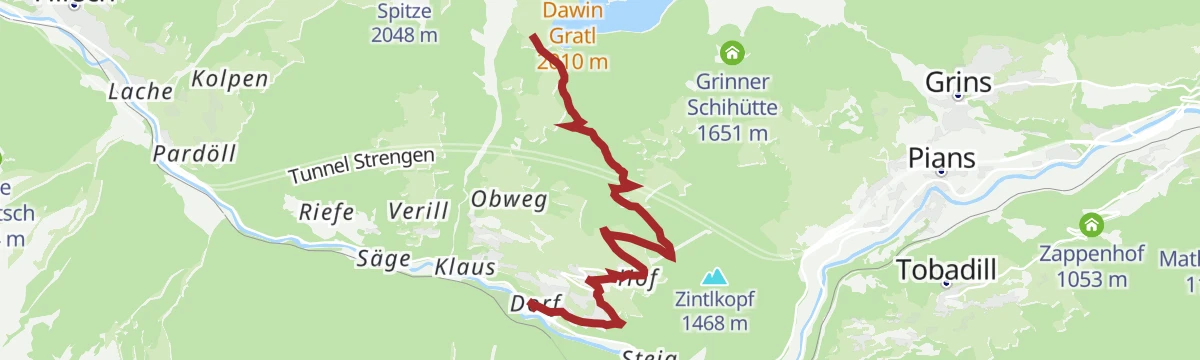
Bike & Hike Strengen - Dawinalm - Strenger Skihütte - Grosser See
3.7 km away, in Strengen
A steep climb out of Strengen to the Dawinalm and the Strenger Skihütte, with the Dawin Gratl viewpoint and a lake just above 2,000 m.
- 19.2 km
- Distance
- 1 030 m
- Ascent
- 2 h 48 min
- Duration
- 2
- Check-ins
- Großer See 2 009 m
- Dawinalm 1 820 m
- Strenger Skihütte 1 819 m
791: Landeck-See
4.5 km away, in Tobadill
A forest-road climb from Landeck into the Paznaun to the village of See, passing the Medrigjochbahn base and the Zappenhof at about 1,050 m.
- 14.5 km
- Distance
- 821 m
- Ascent
- 2 h 12 min
- Duration
- 3
- Check-ins
704: Singletrail Tobadill
5.4 km away, in Tobadill
A short waymarked singletrack on the hillside above Tobadill, west of Landeck in Tirol.
- 1.5 km
- Distance
- 38 m
- Ascent
- 12 min
- Duration
Flirsch - Hoher Riffler
6.9 km away, in Flirsch
The full climb from Flirsch to the Hoher Riffler, 2,053 m of ascent in 11.2 km from the valley floor at 1,123 m to 3,148 m.
- 9.9 km
- Distance
- 0 m
- Ascent
- 0 m
- Descent
- 2 h 24 min
- Duration
Open route PeakVisor tTRL (OpenStreetMap piste_type=skitour)Abschnitt 2: Kronburg - Mils
9.6 km away, in Zams
The gentle second stage of the Starkenberger Panoramaweg, from the Kronburg pilgrimage site down the Inn valley to Mils with barely any climbing.
- 6.6 km
- Distance
- 71 m
- Ascent
- 1 h 55 min
- Duration
- 2
- Check-ins
7185 Talweg Kappl-See
12.2 km away, in See
A valley cycle route between the two Paznaun villages, ending near the Medrigjochbahn base station and the Bergrausch Hütte.
- 12.7 km
- Distance
- 369 m
- Ascent
- 1 h 29 min
- Duration
- 4
- Check-ins
Edmund-Graf-Hütte - Hoher Riffler
12.3 km away, in Pettneu am Arlberg
The summit leg above the Edmund-Graf-Hütte: 2.1 km and 738 m on skis onto the Hoher Riffler, topping out at 3,134 m.
- 1.8 km
- Distance
- 0 m
- Ascent
- 0 m
- Descent
- 27 min
- Duration
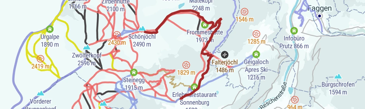
Open route PeakVisor tTRL (OpenStreetMap piste_type=skitour)Route 1 - Frommes
12.3 km away, in Fiss
Backbone of the resort's touring network: a 1,000 m ascent from Fiss to the Frommeshütte via the Frommesalp, with a piste descent to close the loop.
- 6.9 km
- Distance
- 1 009 m
- Ascent
- 1 009 m
- Descent
- 3 h 29 min
- Duration
- 4
- Check-ins
Finesweg - beleuchteter Radweg
13.6 km away, in Fiss
A short lit cycle path on the edge of Fiss, rideable after dark and gentle enough for an evening family spin.
- 2.2 km
- Distance
- 31 m
- Ascent
- 13 min
- Duration
Laudecksteig
13.9 km away, in Prutz
Short practice via ferrata below the castle rock at Ladis, an easy line that pairs naturally with the neighbouring village steigs.
- 611 m
- Distance
- 88 m
- Ascent
- 38 min
- Duration
Strengen - Kleingfallalm
4.9 km away, in Strengen
A steep, direct route from Strengen to the Kleingfall alp, nearly 1,000 m of climbing packed into a short forest ascent.
- 5.3 km
- Distance
- 952 m
- Ascent
- 5 h 22 min
- Duration
Strengen - Dawinalpe
3 km away, in Strengen
A steady 800 m climb from Strengen to the Dawinalm pastures, a straightforward alp hike at the quiet lower end of the Stanzertal.
- 6.4 km
- Distance
- 813 m
- Ascent
- 4 h 48 min
- Duration
- 1
- Check-ins
Via Claudia Augusta
4.5 km away, in Landeck
A long ride over the Fernpass at 1,215 m, passing the Weißensee and the lakes at Fernstein on the way down.
- 48.5 km
- Distance
- 685 m
- Ascent
- 4 h 50 min
- Duration
- 29
- Check-ins
Arlberg Runde
4.8 km away, in Landeck
A 67.7 km ride from Landeck through the Stanzertal villages to St. Anton, returning along the Rosanna on a mostly downhill road.
- 55.4 km
- Distance
- 591 m
- Ascent
- 5 h 28 min
- Duration
Open route Tirol WerbungZirbentrail 7083
9.8 km away, in Fiss
A gravity descent from the 12-er Bahn at 2,533 m, dropping past the Zirbenhütte and on to the Schöngampalm above Fiss.
- 9.1 km
- Distance
- 14 m
- Ascent
- 49 min
- Duration
- 111
- Check-ins
Emmerich-Pale-Weg 7076
9.6 km away, in Fiss
A lift-served descent from the Fisser Joch, dropping past the Zirbenhütte to the Schöngampalm above Fiss.
- 5.5 km
- Distance
- 4 m
- Ascent
- 30 min
- Duration
- 79
- Check-ins
No routes of this kind in Grins yet.
The region's own picks

Featured route
Augsburger Hütte - Memminger Hütte
Airy Spiehlerweg link between two Lechtal refuges, topping the 2,945 m Gatschkopf before threading the Patrolscharte and Wegscharte down past the Seewisee lakes; scree and lingering snowfields call for sure feet.
Planning a trip to Grins?
Everything else Tyrol has, in one place


Take Grins with you into the mountains
Every route on this page with 3D terrain, GPX navigation and offline maps — including the valleys with no signal.
Data sources
- Official website: lechtal.at ↗
- Routes and highlights: TVB Paznaun-Ischgl, Lechtal Tourismus, Serfaus-Fiss-Ladis, Imst Tourismus, St. Anton am Arlberg, PeakVisor tTRL (OpenStreetMap piste_type=skitour), Tirol Werbung
- Published as open data by the tourist boards named above.
- Region summary generated from the board's own material.
