
 Historic site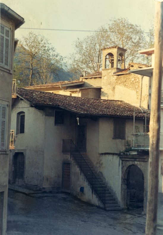




Curated by Val Seriana
Fino del Monte
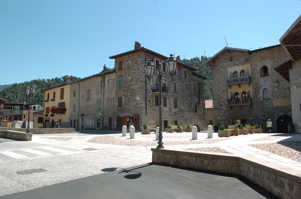
Village on the Clusone plateau below the Presolana, with a fortified house at its centre.
- 3Highlights
- 3Routes
- Featured summit · Corna Cava
Highlights
12 from neighbouring places
Castello di Fino del Monte
A fortified house at Fino del Monte on the Clusone plateau, below the Presolana.
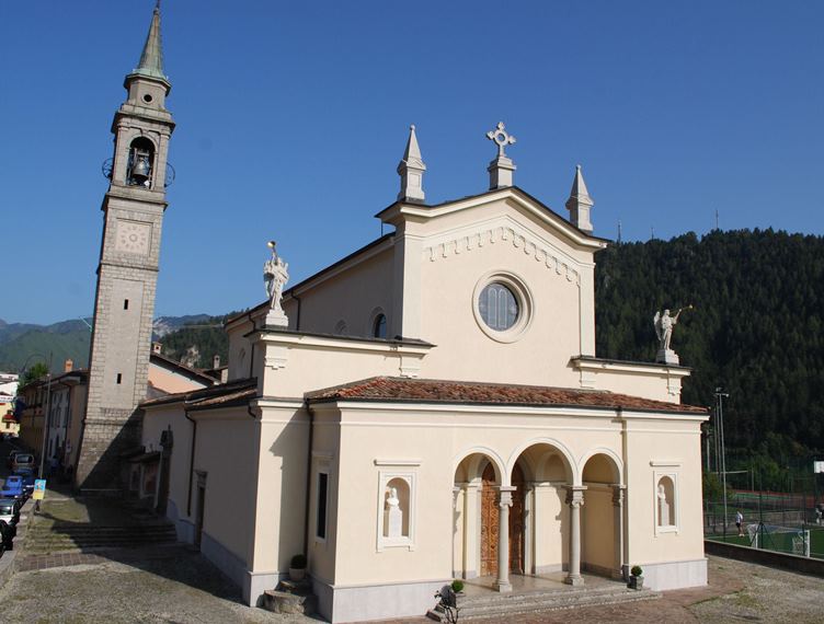
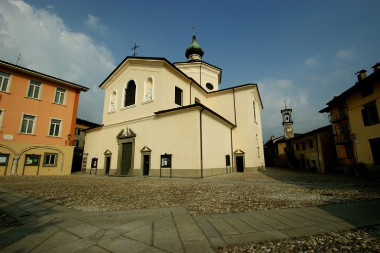
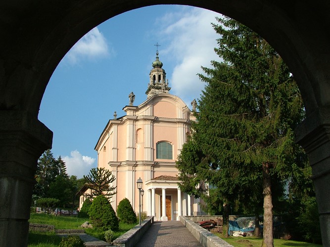
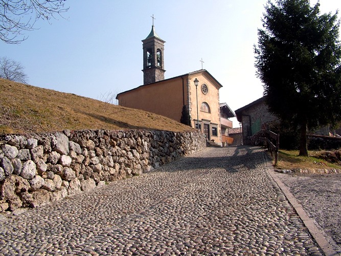
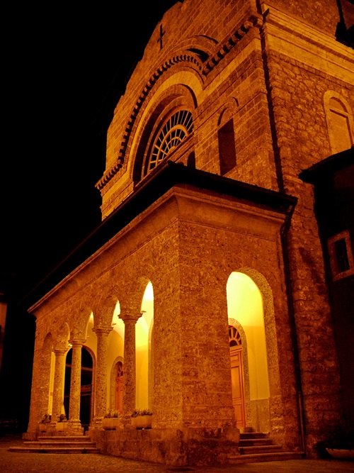
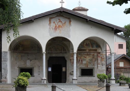
Chiesa parrocchiale dedicata a S. Andrea Apostolo
The parish church of Fino del Monte, below the Presolana.
Casa museo Fantoni
1.9 km away, in Rovetta
A house-museum in Rovetta holding the drawings, wooden and marble works and terracotta models of the Fantoni, a dynasty of Val Seriana sculptors.
Chiesa dei Disciplini
1.9 km away, in Rovetta
The church of the Disciplini confraternity in Rovetta, in the upper Val Seriana below the Presolana.
Chiesa parrocchiale dedicata a Ognissanti
1.9 km away, in Rovetta
The All Saints parish church of Rovetta on the Clusone plateau.
Chiesa parrocchiale di S. Alessandro Martire
2.5 km away, in Castione della Presolana
The parish church of Sant'Alessandro at Castione della Presolana, below the Presolana massif.
La valle dei mulini e la chiesa di San Péder (San Pietro)
3.1 km away, in Castione della Presolana
The mill valley below Castione della Presolana and its church of San Peter, on the old paths to Rusio.
Chiesa di San Rocco
3.2 km away, in Castione della Presolana
The church of San Rocco at Castione della Presolana, in the Val Seriana below the Presolana.
Rusio e la chiesa di San Giacomo
3.3 km away, in Castione della Presolana
The hamlet of Rusio above Castione della Presolana, with its church of San Giacomo.
Chiesa parrocchiale della Natività di Maria Vergine a Bratto
5.1 km away, in Castione della Presolana
The parish church of the Nativity of Mary at Castione della Presolana.
Rifugio del Risol
5.4 km away, in Castione della Presolana
A hut on the Risol pastures above Castione della Presolana, below the Presolana's south face.
Il Santuario di Lantana
5.9 km away, in Castione della Presolana
A pilgrimage church at Lantana above Castione della Presolana, kept for the miracles credited to the Virgin there.
Chiesa di San Defendente
3.4 km away, in Clusone
A small church on the slope east of Clusone, on the old track to the Val Borlezza.
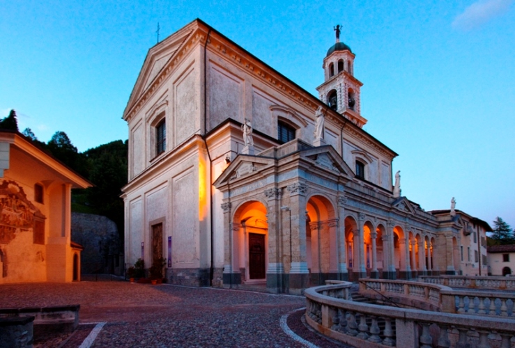
Basilica di Santa Maria Assunta e San Giovanni Battista
3.9 km away, in Clusone
Clusone's basilica, whose oratory wall carries the Triumph of Death and Dance of Death frescoes of 1485.
Nothing of this kind in Fino del Monte.
Routes
17 from neighbouring places
Dal Rifugio Olmo a Clusone Il ritorno tra natura, borghi e storia
The closing stage of the green route, descending from the Rino Olmo hut over Monte Polenta through pasture and woods to Clusone.
- 14.9 km
- Distance
- 359 m
- Ascent
- 5 h 48 min
- Duration
- 95
- Check-ins
Dal Rifugio Olmo a Clusone Il ritorno tra creste, boschi e borghi storici
The third stage of the red route, dropping from the Rino Olmo hut across pastures and over Monte Polenta to the old town of Clusone.
- 15.0 km
- Distance
- 347 m
- Ascent
- 5 h 45 min
- Duration
- 95
- Check-ins
Giro naturalistico intorno a Castione
A long round on the Presolana plateau above Castione, from the Val di Tede by Lantana and Romentaregh to Canechet.
- 28.1 km
- Distance
- 1 062 m
- Ascent
- 9 h 13 min
- Duration
- 49
- Check-ins
Via del Latte in Mountain Bike
2.4 km away, in Castione della Presolana
A climb from Castione della Presolana through woodland and open pasture to the dairy huts of Malga di Campo and Malga Pozzetto below the Corna Cava.
- 21.1 km
- Distance
- 937 m
- Ascent
- 2 h 46 min
- Duration
- 194
- Check-ins
Altopiano Tour
4.2 km away, in Clusone
A short circuit of the Clusone plateau, ridden or walked, through its fields and old lanes.
- 17.8 km
- Distance
- 212 m
- Ascent
- 1 h 47 min
- Duration
- 10
- Check-ins
Ciclabile dell'Alta Val Seriana
7.6 km away, in Clusone
A valley cycle path through the upper Val Seriana, following the floor of the valley from Clusone as far as Valbondione at 869 m.
- 24.3 km
- Distance
- 565 m
- Ascent
- 2 h 34 min
- Duration
- 51
- Check-ins
Sentiero per tutti
7.9 km away, in Castione della Presolana
A short accessible loop above Castione della Presolana, with tactile maps and benches placed along the way.
- 2.4 km
- Distance
- 267 m
- Ascent
- 1 h 7 min
- Duration
- 113
- Check-ins
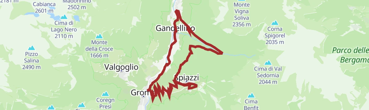
Val Sedornia in MTB
8.5 km away, in Gromo
A climb out of Gromo into the Val Sedornia, passing the Ristorante Posta al Castello and the barns at Stalle del Flesco.
- 21.0 km
- Distance
- 884 m
- Ascent
- 2 h 42 min
- Duration
- 43
- Check-ins
Da Colere alla Malga Polzone
9.5 km away, in Colere
A short ski-touring line from Colere up to Malga Polzone, laid out for beginners and keeping clear of the pisted runs.
- 2.3 km
- Distance
- 482 m
- Ascent
- 0 m
- Descent
- 1 h 19 min
- Duration
- 80
- Check-ins
Via ferrata from Toline to Corna Trentapassi
15 km away, in Pisogne
A via ferrata above the hamlet of Toline, approached on the CAI 212 path through the woods, then cabled rock to the top of the Corna Trentapassi.
- 8.1 km
- Distance
- 1 086 m
- Ascent
- 7 h 57 min
- Duration
- 144
- Check-ins
 Corna Trentapassi 1 248 m
- Anticima Est Corna Trentapassi 1 192 m
- Forcelle di Coloreto 992 m
- Anticima Nord Corna Trentapassi 1 175 m
 Toline 194 m
 Forcella Occidentale Trentapassi 964 m
Open route VisitlakeiseoDa Rovetta alla Cappella Alpini Monte Blum
1.3 km away, in Rovetta
A climb from Rovetta in the Val Seriana to the Alpini chapel on Monte Blum.
- 5.7 km
- Distance
- 608 m
- Ascent
- 3 h 42 min
- Duration
- 6
- Check-ins
Lungo la Via del latte
2.4 km away, in Castione della Presolana
A long loop on CAI 317, the old milk road, from Castione della Presolana by way of Rusio up to the high dairy pastures.
- 21.1 km
- Distance
- 937 m
- Ascent
- 7 h 17 min
- Duration
- 194
- Check-ins
In bici in Presolana
3.3 km away, in Castione della Presolana
A mountain bike climb from Castione della Presolana to the Rino Olmo hut, then a long traverse to the Carlo Medici hut at the Cassinelli.
- 19.2 km
- Distance
- 1 067 m
- Ascent
- 2 h 52 min
- Duration
- 255
- Check-ins
MTB Bossico - yellow route
9.6 km away, in Bossico
An easy circuit from Bossico, out on tarmac to Località Volpi above the lake and back on forest track past the picnic ground at Pila.
- 6.7 km
- Distance
- 207 m
- Ascent
- 48 min
- Duration
Open route VisitlakeiseoCycle path of river Serio
7.6 km away, in Clusone
A long ride beside the Serio, on the cycleway that runs from the lower valley up through Clusone towards Valbondione.
- 53.9 km
- Distance
- 716 m
- Ascent
- 5 h 25 min
- Duration
- 51
- Check-ins
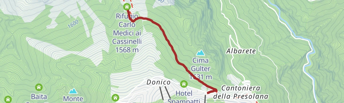
Rifugio Carlo Medici vista Presolana
8 km away, in Castione della Presolana
A short climb from the Presolana pass, between Val Seriana and Val di Scalve, up to the Carlo Medici hut facing the south wall.
- 2.3 km
- Distance
- 272 m
- Ascent
- 1 h 7 min
- Duration
- 113
- Check-ins
MTB Bossico - red route
9.6 km away, in Bossico
A mountain-bike loop from the middle of Bossico into the pine forest, passing the Pozza d'Ast pool and the campsite at Placàt.
- 8.7 km
- Distance
- 330 m
- Ascent
- 1 h 5 min
- Duration
- 15
- Check-ins
 Pozza d'Ast 1 027 m
- Mountain restaurant 981 m
Open route VisitlakeiseoL'anello di Cima Carnet
3.3 km away, in Castione della Presolana
A loop to Cima Carnet above Castione della Presolana, on pastures and wooded slopes facing the Presolana wall.
- 9.0 km
- Distance
- 826 m
- Ascent
- 5 h 11 min
- Duration
- 92
- Check-ins
Presolana Tour
3.2 km away, in Castione della Presolana
A long circuit around the Presolana massif from Castione, linking the pass, the Cassinelli basin and the ridges below Corna Cava.
- 24.3 km
- Distance
- 928 m
- Ascent
- 8 h
- Duration
- 239
- Check-ins
MTB Bossico - black route
9.6 km away, in Bossico
The black route from the Bossico tourist office, climbing through the upper village to the Sette Colli.
- 20.0 km
- Distance
- 1 095 m
- Ascent
- 2 h 57 min
- Duration
- 50
- Check-ins
- Cascina Ciar 798 m
- Forcellino di Bossico 1 174 m
- Il Cadì de la pèst 1 216 m
- Agriturismo "La Selva" 1 253 m
- Passo delle Croci 560 m
- Azienda agrituristica Cinque Abeti 1 022 m
- +1
Open route Visitlakeiseo
No routes of this kind in Fino del Monte yet.
The region's own picks
Featured route
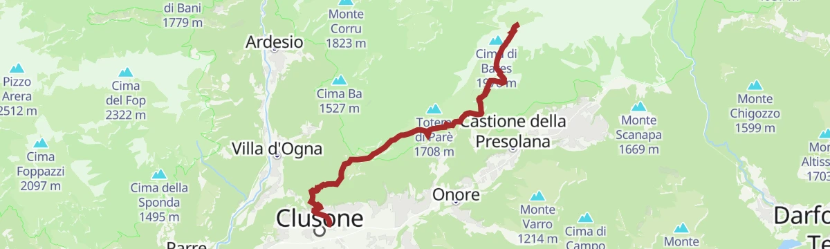
Dal Rifugio Olmo a Clusone Il ritorno tra natura, borghi e storia
The closing stage of the green route, descending from the Rino Olmo hut over Monte Polenta through pasture and woods to Clusone.
Planning a trip to Fino del Monte?
Everything else Lombardy has, in one place


Take Fino del Monte with you into the mountains
Every route on this page with 3D terrain, GPX navigation and offline maps — including the valleys with no signal.
Data sources
- Official website: valseriana.eu ↗
- Routes and highlights: Val Seriana, in Lombardia, Visitlakeiseo, Trekkingpresolana
- Published as open data by the tourist boards named above.
- Region summary generated from the board's own material.
