
Curated by Garda Trentino
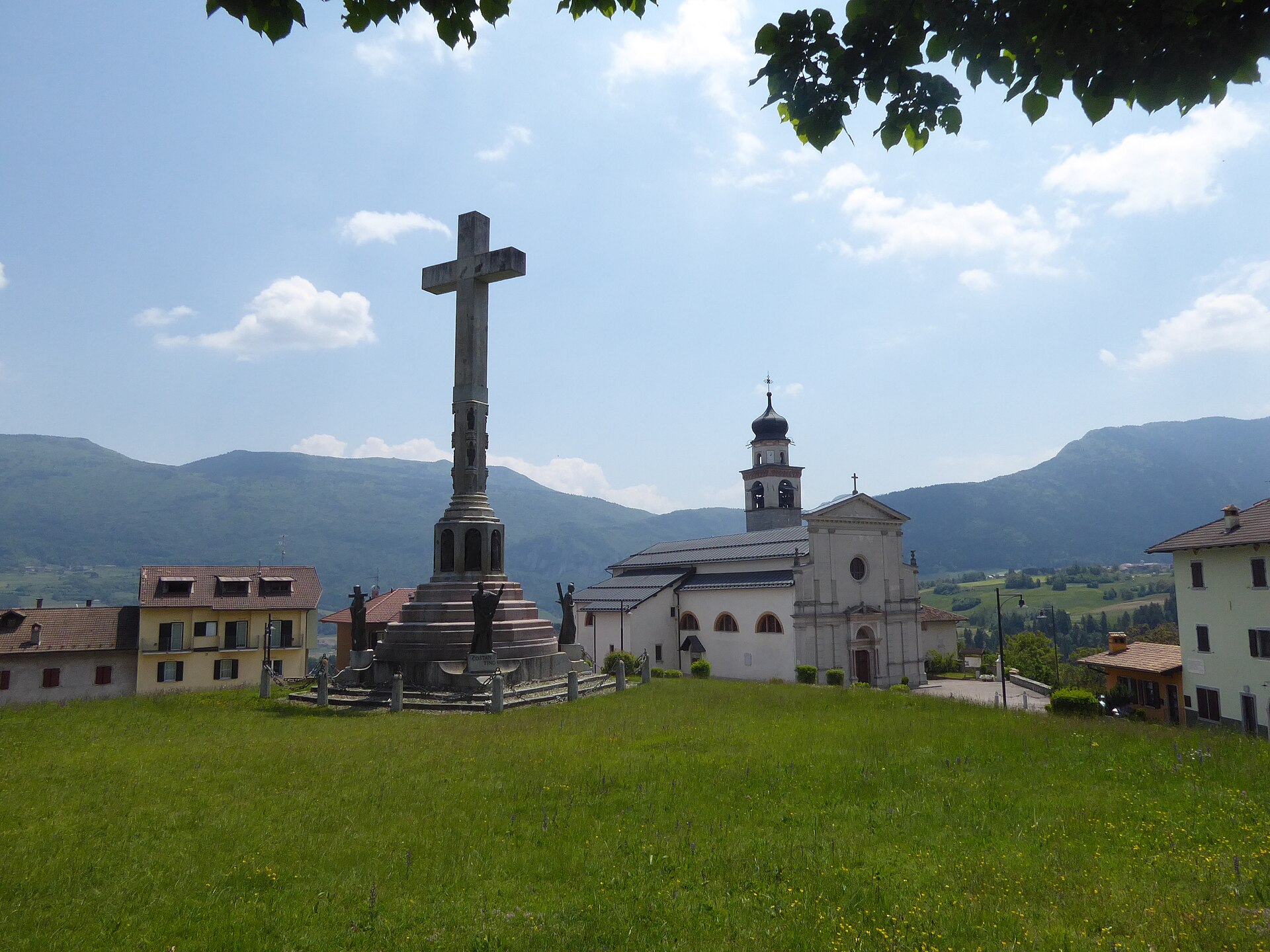
Bleggio Superiore
Giudicarie comune of hamlets on the Bleggio plateau, walnut country above the Sarca, seated at Santa Croce.
Photo: Syrio · CC BY-SA 4.0 licence
- 5Highlights
- 26Routes
- Featured summit · Cima Sera
Highlights
All 5 from neighbouring places
Baita Valon
13.1 km away, in Comano Terme
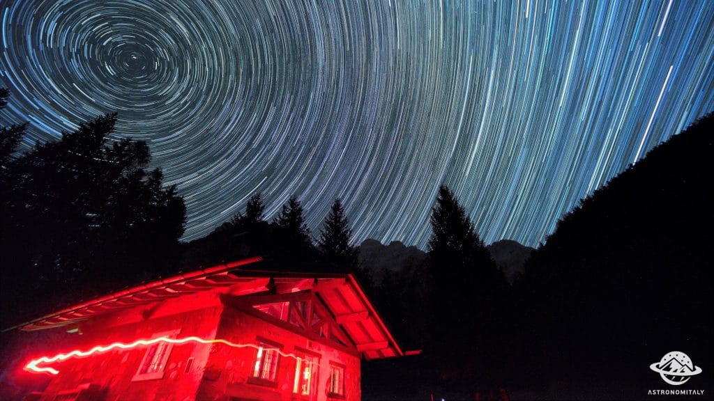
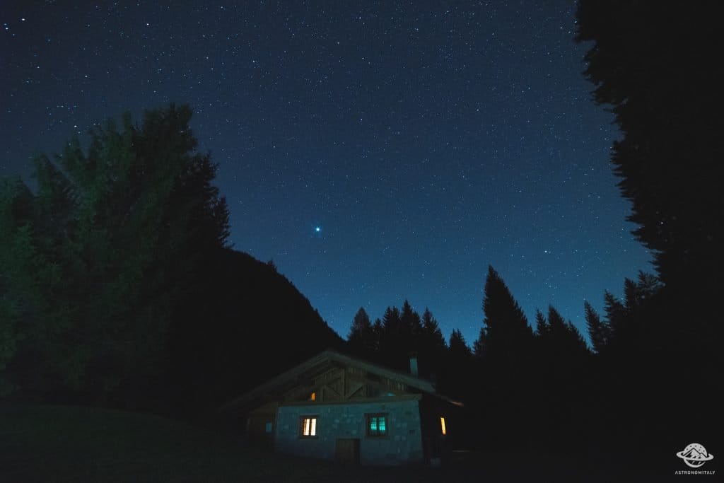
A hut on the Valon meadows above Comano, used for walks and for its dark night skies.
Stargazing a Baita Valon, Trentino
13.1 km away, in Comano Terme
Night-sky watching from the Valon meadows above Comano Terme, away from valley lights.
Lago di Ledro
14.5 km away, in Ledro
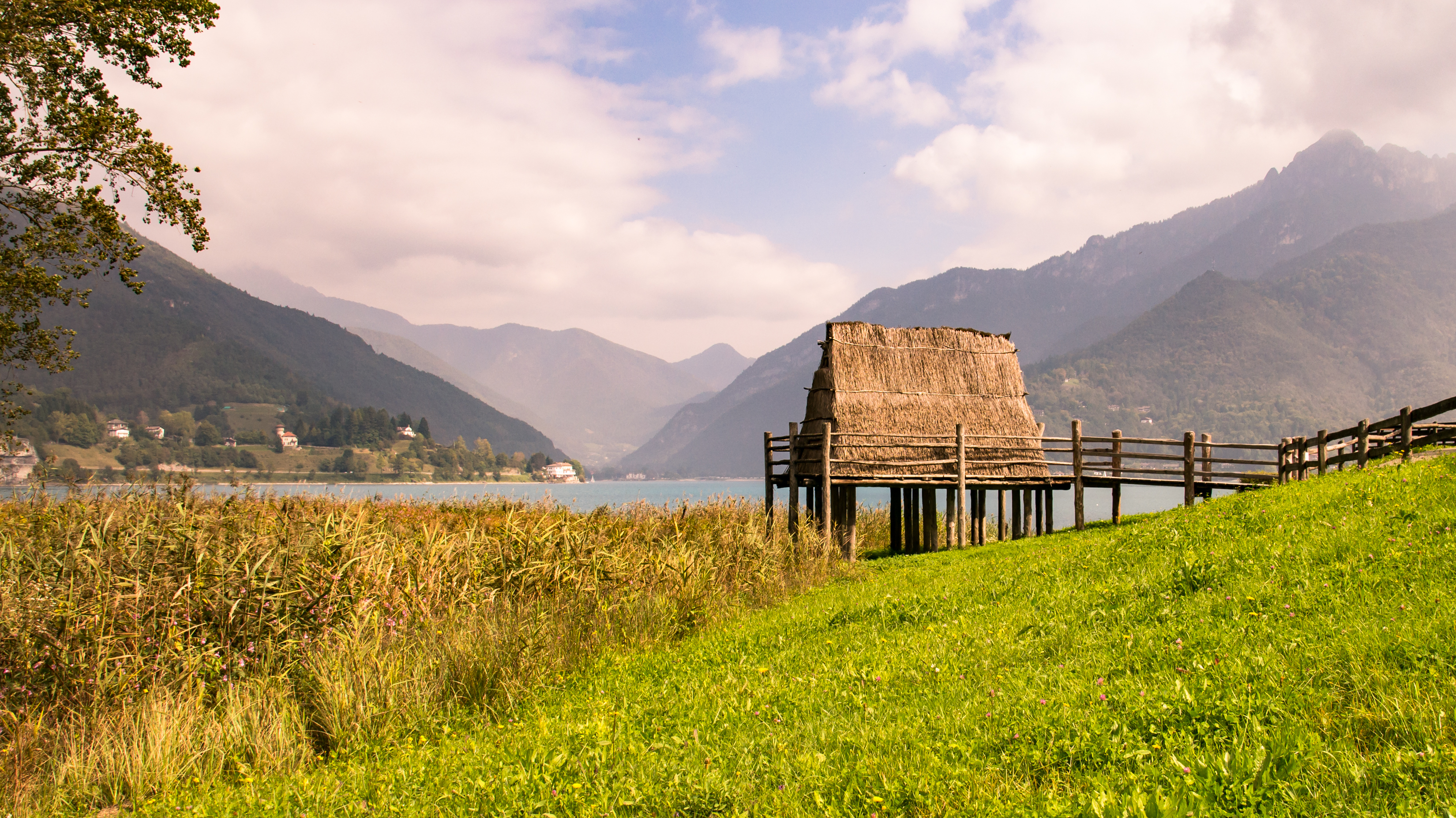
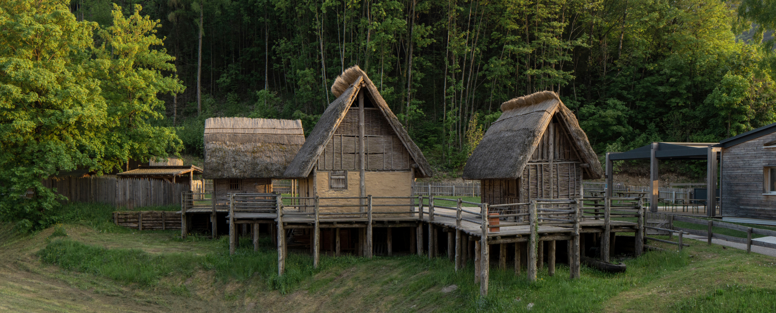
A lake at 655 m in the Ledro valley west of Riva del Garda, with a Bronze Age pile-dwelling site on its shore.
Museo delle Palafitte del Lago di Ledro
14.7 km away, in Ledro
A museum on the Bronze Age pile dwellings found in Lake Ledro, built over part of the excavated site.
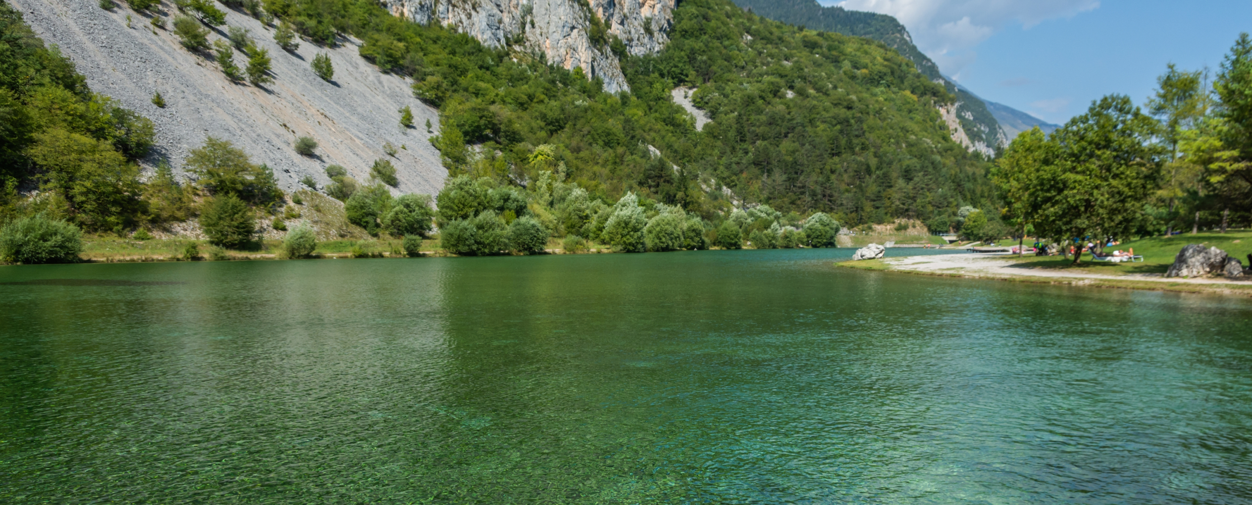
Lago di Nembia
14.8 km away, in San Lorenzo Dorsino
A small lake in the Sarca gorges near San Lorenzo Dorsino, on the edge of the Adamello-Brenta park.
Nothing of this kind in Bleggio Superiore.
Routes
Cooperazione Path
An old road from Larido to the Passo Durone, once the main link towards the Rendena, with the first Cassa Rurale and cooperative house along the way.
- 6.5 km
- Distance
- 281 m
- Ascent
- 2 h 13 min
- Duration
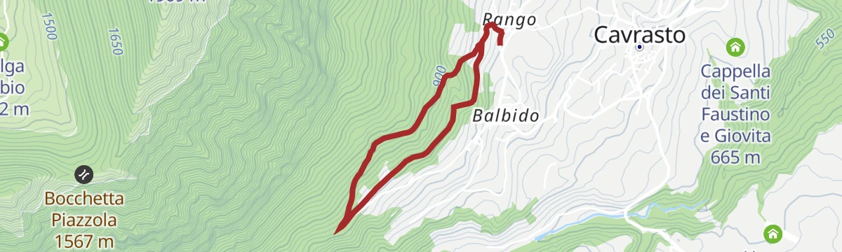
Open route Garda TrentinoRango, Balbido and Passo Durone
A loop from Rango, one of the old stone villages of the Bleggio, through Balbido to the Durone pass and back.
- 8.3 km
- Distance
- 331 m
- Ascent
- 2 h 46 min
- Duration
- 6
- Check-ins
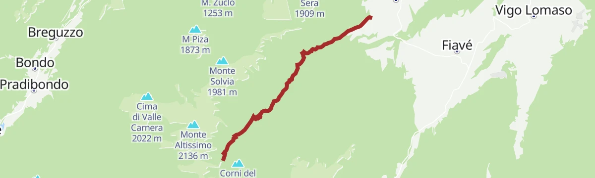
Open route Garda TrentinoMalga Stabio e Cima Sèra
From the Durone pass by the Malga Stabio to the top of Cima Sèra, along an interpretive route with stones set to explain the local landscape and its past.
- 12.0 km
- Distance
- 919 m
- Ascent
- 5 h 58 min
- Duration
- 16
- Check-ins
Open route Garda TrentinoPasso Durone
A steady road climb out of the Comano Terme basin to the 1,010 m pass, where a bar and restaurant stand at the top.
- 10.2 km
- Distance
- 602 m
- Ascent
- 1 h 15 min
- Duration
- 9
- Check-ins
Open route VisitTrentinoRoad bike tour of Campiglio and Comano
A long road day from Pinzolo down the Sarca to Comano Terme, then back over Passo Durone and the steeper Passo Daone above Preore.
- 106.9 km
- Distance
- 3 187 m
- Ascent
- 12 h 30 min
- Duration
- 205
- Check-ins
 Falesia Fontanella 1 384 m
 Fortini 1 629 m
- LAB Après-Ski 1 632 m
 Laghetto Conca Verde 1 496 m
 Passo Campo Carlo Magno 1 682 m
- La Cantina di Suisse 1 506 m
- +18
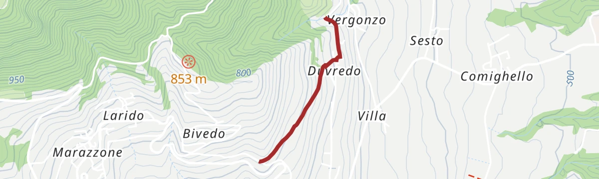
Open route APT Madonna di Campiglio, Pinzolo, Val RendenaDuvredo Shortcut
A short connection from Bivedo to Vergonzo by way of Duvredo, on the terrace of the Bleggio.
- 1.1 km
- Distance
- 0 m
- Ascent
- 19 min
- Duration
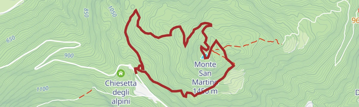
Monte S. Martino
An out-and-back from the Durone pass to the top of Monte San Martino, on the wooded ridge above the Bleggio.
- 6.2 km
- Distance
- 434 m
- Ascent
- 2 h 53 min
- Duration
- 5
- Check-ins
Open route Garda TrentinoMalga Nardis
A long ring by the Malga Nardis over the Dosso d'Enziana and Monte Cogorna, where the mild air off Garda meets the colder Dolomite side.
- 15.3 km
- Distance
- 1 280 m
- Ascent
- 8 h 9 min
- Duration
- 1
- Check-ins
- Dosso d'Enziana 1 971 m
- Monte Cogorna 1 872 m
- Doss della Ruzza 1 308 m
- Pinzon 1 584 m
- Malga Cogorna 1 668 m
- Malga Nardis 1 784 m
- +2
Open route Garda TrentinoThe stage of 2022 Giro d'Italia Women.
A race-length road route from the Rotaliana plain to San Lorenzo Dorsino, with three long climbs by way of Andalo, Molveno and Passo Santel.
- 113.6 km
- Distance
- 3 474 m
- Ascent
- 13 h 10 min
- Duration
- 137
- Check-ins
- Fontanella 845 m
- Lago Park Hotel 826 m
- Grand Hotel Molveno 838 m
- Tre3 1 037 m
- Albergo El Paso 1 036 m
- Passo Santel 1 040 m
- +20
Open route APT Dolomiti di Brenta e PaganellaI Sentieri dei Piccoli Camminatori: "La strada delle streghe"
A small loop for children through the lanes of Rango and the woods above, past traces of the old farming life.
- 3.1 km
- Distance
- 124 m
- Ascent
- 1 h 1 min
- Duration
Val Marcia: The Witches Trail
The climb from Balbido by Livez to the Malga Dablino, up the Val Marcia, returning by the way of ascent.
- 7.0 km
- Distance
- 907 m
- Ascent
- 3 h 51 min
- Duration
- 1
- Check-ins
Open route Garda TrentinoVal Marcia Trail-Tour
A varied tour from Santa Croce through the villages of the Bleggio into the Val Marcia, the wooded trough of the Duina between Altissimo and Cogorna.
- 15.5 km
- Distance
- 514 m
- Ascent
- 4 h 55 min
- Duration
- 1
- Check-ins
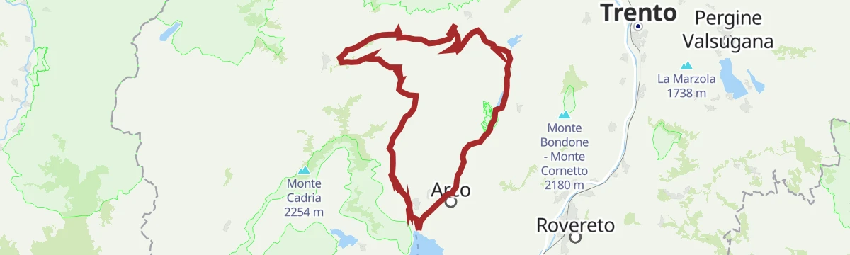
Open route Garda TrentinoDurone - Valle del Chiese - Valle di Ledro
A demanding day from Riva del Garda over the Passo Ballino and on through Tione, five lakes along the way and a constant up and down on quiet roads.
- 91.7 km
- Distance
- 2 309 m
- Ascent
- 10 h 12 min
- Duration
- 112
- Check-ins
- Garda Dolomiti Azienda per il turismo S.p.A. 69 m
- Info Point Gardatrentino 657 m
- Info Point Riva del Garda 69 m
- Ingarda 603 m
- Bar Ristorante Passo Durone 995 m
- Passo dell'Ampola 747 m
- +13
Open route Garda TrentinoTorrente Duina PP2
A very short stretch of bank on the Duina torrent below the Bleggio villages, used mainly for fishing access.
- 400 m
- Distance
- 11 m
- Ascent
- 7 min
- Duration
Open route Trentino FishingAl Sass de Santa Cross
A devotional route above Santa Croce with stations of the cross, climbing to the rock named for the wonder-working crucifix.
- 7.1 km
- Distance
- 440 m
- Ascent
- 3 h 2 min
- Duration
From Paganella to Giudicarie
A long road day from the Andalo plateau into the Giudicarie, with the climb to the Passo Durone as the main effort.
- 74.9 km
- Distance
- 2 360 m
- Ascent
- 8 h 52 min
- Duration
- 80
- Check-ins
- Fontanella 845 m
- Lago Park Hotel 826 m
- Grand Hotel Molveno 838 m
- Sella di Andalo 1 042 m
- APT Dolomiti Paganella 1 021 m
- Bar Ristorante Passo Durone 995 m
- +7
Open route APT Dolomiti di Brenta e PaganellaTorrente Duina dalla porcilaia di Cavrasto alla confluenza con Fiume Sarca N1
A streamside route following the Duina down from Cavrasto to where it joins the Sarca near Ponte Arche.
- 5.0 km
- Distance
- 221 m
- Ascent
- 1 h 30 min
- Duration
Open route Trentino FishingFrom Cornelle through the surrounding woods
A quiet round from Cornelle past potato and maize fields into beech and conifer woodland, skirting the Carera wetland biotope.
- 8.0 km
- Distance
- 391 m
- Ascent
- 2 h 54 min
- Duration
Open route Garda TrentinoBallino - Durone - Stenico
A road circuit from Riva over the Ballino and Durone passes, holding height across to Stenico.
- 87.5 km
- Distance
- 2 198 m
- Ascent
- 9 h 50 min
- Duration
- 71
- Check-ins
- Garda Dolomiti Azienda per il turismo S.p.A. 69 m
- Info Point Riva del Garda 69 m
- Ingarda 603 m
- Bar Ristorante Passo Durone 995 m
- Casa sociale 248 m
- Info Point - Garda Trentino - Arco 90 m
- +7
Open route Garda TrentinoTorrente Duina e affluenti N
A level route along the Duina and its feeder streams under the Bleggio plateau, close to the water throughout.
- 6.6 km
- Distance
- 0 m
- Ascent
- 2 h 28 min
- Duration
Open route Trentino FishingThe walnut trail
A signed route through the walnut orchards of the Bleggio, linking Santa Croce, Bivedo, Larido and Cavrasto.
- 9.6 km
- Distance
- 261 m
- Ascent
- 2 h 54 min
- Duration
Open route Garda TrentinoTenno - Ballino - Comano
A circuit from Riva over the Ballino pass to Comano, without a level metre and almost traffic-free.
- 59.4 km
- Distance
- 1 400 m
- Ascent
- 6 h 35 min
- Duration
- 48
- Check-ins
- Garda Dolomiti Azienda per il turismo S.p.A. 69 m
- Info Point Riva del Garda 69 m
- Ingarda 603 m
- APT Terme di Comano 399 m
- Passo Del Ballino 750 m
- Hotel La Pineta - Ristorante Bar Pizzeria 660 m
- +2
Open route Garda TrentinoMedium Route - Top Dolomites Gran Fondo
The shorter of the granfondo road courses, running from Pinzolo over the Passo del Durone and finishing with the climb to Madonna di Campiglio.
- 83.5 km
- Distance
- 2 519 m
- Ascent
- 9 h 31 min
- Duration
- 45
- Check-ins
- Falesia Fontanella 1 384 m
- La Cantina di Suisse 1 506 m
- Panorama Hotel Fontanella 1 434 m
- Bar Ristorante Passo Durone 995 m
- Passo del Durone 1 010 m
- Chiesetta degli alpini 1 029 m
- +3
Open route APT Madonna di Campiglio, Pinzolo, Val RendenaDolomiti di Brenta Bike Explorer - Terme di Comano: il monte Casale, Lomaso e Bleggio
A road tour out of Stenico over the Passo del Durone and Passo del Ballino, taking in the farmed uplands of Bleggio and Lomaso.
- 64.2 km
- Distance
- 3 020 m
- Ascent
- 8 h 33 min
- Duration
- 21
- Check-ins
- Bar Ristorante Passo Durone 995 m
- Malga Vigo 1 087 m
- Passo Del Ballino 750 m
- Passo del Durone 1 010 m
- Malga Val Bona 1 270 m
- Hotel La Pineta - Ristorante Bar Pizzeria 660 m
- +1
Open route APT Dolomiti di Brenta e PaganellaKm0 UNESCO Comano Gravel Tour
A gravel loop from Comano Terme climbing to Stenico, then down the Limarò gorge and on through the farming villages of the Lomaso.
- 39.6 km
- Distance
- 942 m
- Ascent
- 4 h 24 min
- Duration
- 5
- Check-ins
Open route Garda TrentinoMonte Guarda - Tour
A long ride from Ponte Arche up the Duina stream onto the sunny Bleggio plateau, through orchards, vineyards and cornfields between its villages.
- 21.5 km
- Distance
- 703 m
- Ascent
- 2 h 34 min
- Duration
Open route Garda Trentino








No routes of this kind in Bleggio Superiore yet.
The region's own picks

Featured route
Cooperazione Path
An old road from Larido to the Passo Durone, once the main link towards the Rendena, with the first Cassa Rurale and cooperative house along the way.
Planning a trip to Bleggio Superiore?
Everything else Trentino-Alto Adige/Südtirol has, in one place


Take Bleggio Superiore with you into the mountains
Every route on this page with 3D terrain, GPX navigation and offline maps — including the valleys with no signal.
Data sources
- Official website: visittrentino.info ↗
- Routes and highlights: Garda Trentino, Italia.it, Visit Trentino, APT Dolomiti di Brenta e Paganella, Trentino Fishing, Astrotourism, APT Madonna di Campiglio, Pinzolo, Val Rendena, VisitTrentino
- Published as open data by the tourist boards named above.
- Region summary generated from the board's own material.
