
Curated by Consorzio Val di Zoldo Turismo
Agordo
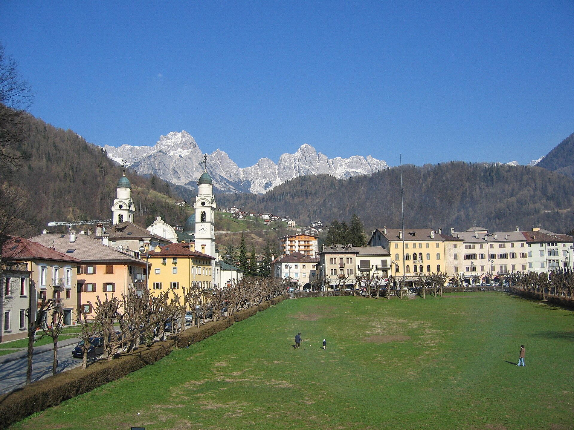
Agordino's main town in a broad basin below the Civetta and the Pale di San Lucano, and the seat of Luxottica.
- 2Highlights
- 8Routes
- Featured summit · Colle Pan D'orso
Highlights
All 2 from neighbouring places
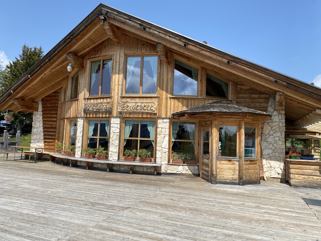
Rifugio Ristoro Belvedere
12.6 km away, in Alleghe
A hut on the lower slopes of the Civetta above Alleghe, reached from the Piani di Pezzè lift and looking across to the lake.
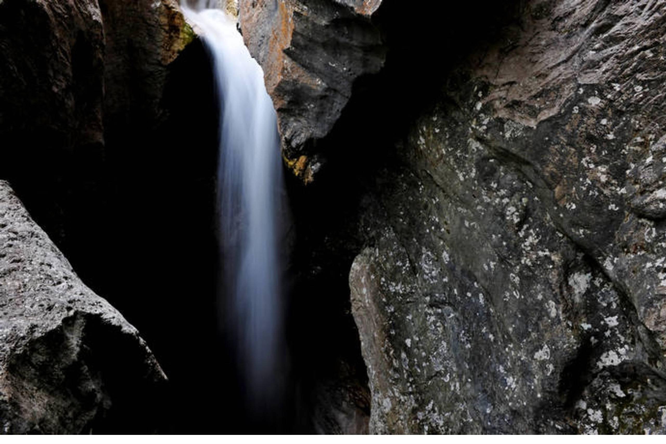
Cascata della Soffia
13.7 km away, in Sospirolo
A waterfall on the Torrente Mis in the Valle del Mis, inside the Dolomiti Bellunesi national park at Sospirolo.
Nothing of this kind in Agordo.
Routes
12 from neighbouring places
Giro del Col di Foglia
A short loop around the Col di Foglia, a wooded knoll on the edge of Agordo in the Agordino.
- 1.8 km
- Distance
- 95 m
- Ascent
- 40 min
- Duration
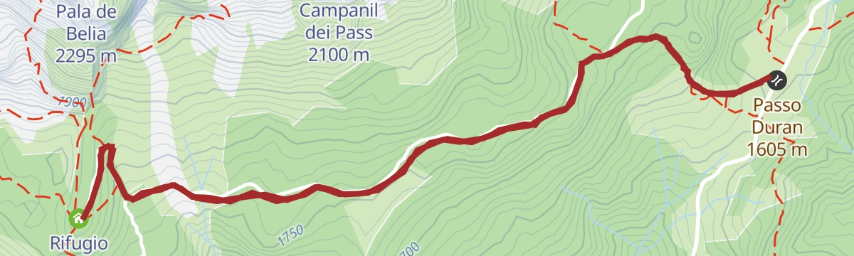
Open route Conca AgordinaAlta Via no.1 - Stage 9
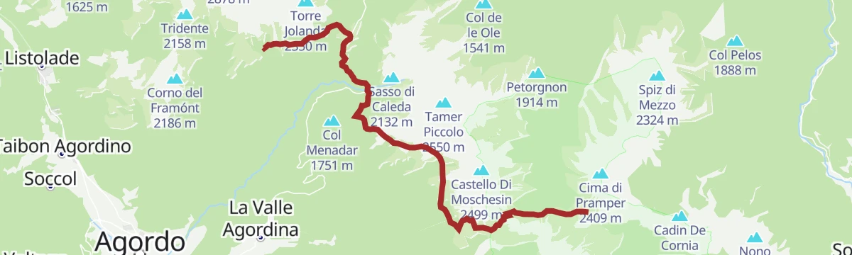
A stage of the Alta Via 1 from the Carestiato hut across open pastures and down to the Duran pass, where the Cesare Tomè hut stands.
- 13.2 km
- Distance
- 645 m
- Ascent
- 4 h 42 min
- Duration
- 153
- Check-ins
 Colle Pan D'orso 1 770 m
 Rifugio Bruto Carestiato 1 834 m
- Rifugio Passo Duran "C.Tomè" 1 604 m
- Rifugio Sommariva al Pramperet 1 857 m
- Malga Caleda Vecchia 1 519 m
- Malga Moschesin 1 800 m
- +3
Open route Cortina Marketing Se.Am.Road Bike Alleghe 3 - Pale di San Martino Loop
A three-climb road circuit from Alleghe, crossing Passo Valles and the Rolle Pass on the ring around the Pale group above Paneveggio.
- 112.0 km
- Distance
- 2 990 m
- Ascent
- 12 h 46 min
- Duration
- 520
- Check-ins
 Rolle Pass 1 971 m
- Passo Valles 2 032 m
- Malga Rolle 1 905 m
- Rifugio Capanna Passo Valles 2 037 m
- Bierstube 977 m
- Hotel Venezia 1 957 m
- +18
Open route Consorzio Operatori Turistici Alleghe - CaprileAlta Via no.1 - Stage 8
A stage of Alta Via 1 north from the Vazzolèr hut, under the Civetta walls.
- 9.0 km
- Distance
- 604 m
- Ascent
- 3 h 52 min
- Duration
- 117
- Check-ins
Open route Cortina Marketing Se.Am.Road Bike Alleghe 1 - The Civetta Loop
A long road circuit out of Alleghe over Passo Duran and Passo Staulanza, two Dolomite climbs that the Giro d'Italia has used.
- 77.3 km
- Distance
- 2 029 m
- Ascent
- 8 h 46 min
- Duration
- 516
- Check-ins
- Passo Staulanza 1 766 m
- Rifugio Passo Staulanza 1 770 m
- Rifugio Monte Pelmo 1 520 m
- Passo Duran 1 605 m
- Rifugio San Sebastiano 1 596 m
- Bierstube 977 m
- +13
Open route Consorzio Operatori Turistici Alleghe - CaprileRoad-Bike Alleghe 8 Monti del Sole Route
A long road ride down the Valle del Cordevole to Ponte Mas, then up the Valle del Mis past Lago del Ghirlo before the climb to Gosaldo.
- 102.4 km
- Distance
- 1 682 m
- Ascent
- 10 h 40 min
- Duration
- 152
- Check-ins
- Bierstube 977 m
- Alla Caminada 970 m
- Water inlet for Ghirlo powerplant 971 m
- Pizzeria Al Fornel 934 m
- Ristorante alla Stanga 436 m
 Polane 563 m
- +5
Open route Consorzio Operatori Turistici Alleghe - CaprileDuran Pass
A cycling climb to the Duran pass at 1,601 m between the Agordino and the Val di Zoldo, steady and hard, used more than once by the Giro d'Italia.
- 12.7 km
- Distance
- 985 m
- Ascent
- 1 h 44 min
- Duration
- 80
- Check-ins
Open route Dolomiti Bellunesi - The Mountains of VeniceConca Tour Hike&Bike
A loop on back roads around the Conca Agordina, linking its villages over the Forcella Aurine and the Forcella Franche.
- 76.0 km
- Distance
- 2 189 m
- Ascent
- 8 h 48 min
- Duration
- 12
- Check-ins
- Forcella Aurine 1 299 m
- Al Rustico Ristorante 776 m
- Agriturismo Busa dei Sbràse 679 m
- Forcella Franche 991 m
Open route Conca AgordinaZoldano Ring - Stage 3: Rif. San Sebastiano - Rif. Sonnino al Coldai
3.5 km away, in Val di Zoldo
From the Duran pass on the Angelini trail 578 below the Moiazza, past the Grisetti bivouac and over the Forcella Inferiore towards the Coldai hut.
- 12.4 km
- Distance
- 1 301 m
- Ascent
- 6 h 56 min
- Duration
- 219
- Check-ins
- Crodolon 2 311 m
- Col Del Vant 2 324 m
- Rifugio Adolfo Sonino al Coldai 2 135 m
- Passo Duran 1 605 m
- Rifugio San Sebastiano 1 596 m
- Bivacco Grisetti 2 007 m
- +1
Open route Consorzio Val di Zoldo TurismoDONT – CASERA BIDOCH by E-BIKE (02)
8.4 km away, in Val di Zoldo
A loop into the Valle di Goima to Casera Bidoch below Monte San Sebastiano, coming back down to the valley on the SP 347 road.
- 10.0 km
- Distance
- 510 m
- Ascent
- 1 h 24 min
- Duration
Open route Consorzio Val di Zoldo TurismoPECOL - BAITA CIVETTA by E-BIKE (11)
9.7 km away, in Val di Zoldo
An easy ride through meadow and larch wood to Le Palanche on the Maè, where a picnic area sits just short of the baita at 1,578 m.
- 5.4 km
- Distance
- 233 m
- Ascent
- 42 min
- Duration
- 41
- Check-ins
Open route Consorzio Val di Zoldo TurismoCIVETTA E-BIKE ROUTE (14)
9.7 km away, in Val di Zoldo
An e-bike loop in the Ski Civetta area up to Cima Fertazza at over 2,000 m, calling at Rifugio Col dei Baldi and Malga Staulanza.
- 24.0 km
- Distance
- 1 084 m
- Ascent
- 3 h 9 min
- Duration
- 394
- Check-ins
- Col Dei Baldi 1 918 m
- Cima dei Viai - Cima Fertazza 2 101 m
- Casera di Pioda 1 820 m
- Ristoro Belvedere - Cima Fertazza 2 076 m
- Rifugio Col dei Baldi 1 922 m
- Ristoro La Ciasela 2 050 m
- +4
Open route Consorzio Val di Zoldo TurismoMtb Alleghe 3 - At the village of Bramezza
11.1 km away, in Alleghe
A climb from the lake shore and cycle path up a steep municipal road to a hamlet on the far bank of the Cordevole, facing Alleghe.
- 14.9 km
- Distance
- 674 m
- Ascent
- 1 h 57 min
- Duration
- 3
- Check-ins
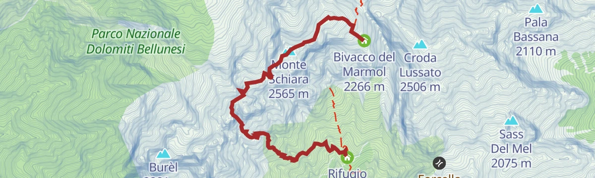
Open route Consorzio Operatori Turistici Alleghe - CaprileAlta Via no.1 - Stage 12
13.4 km away, in Belluno
The Marmol via ferrata, the usual way down from the Marmol bivouac to the Settimo Alpini hut, some 500 m of rock in bare surroundings and serious in bad weather.
- 4.0 km
- Distance
- 509 m
- Ascent
- 5 h 34 min
- Duration
- 25
- Check-ins
- Monte Schiara 2 565 m
- Gusèla del Vescovà 2 365 m
- Rifugio 7° Alpini 1 498 m
- Bivacco Sperti 2 000 m
- Bivacco Ugo Dalla Bernardina 2 320 m
- Bivacco del Marmol 2 266 m
Open route Cortina Marketing Se.Am.Ferrata del Canalone
14.3 km away, in Primiero San Martino di Castrozza
A short, steep equipped gully on the Pale di San Martino, above San Martino di Castrozza in the Primiero valley.
- 1.1 km
- Distance
- 318 m
- Ascent
- 2 h 5 min
- Duration
- 44
- Check-ins
Open route APT San Martino di Castrozza, Primiero e VanoiDolomiti Palaronda Ferrata Classic - 4th stage
14.3 km away, in Primiero San Martino di Castrozza
A long, steeply climbing stage of the Palaronda Classic circuit, crossing the Pale di San Martino from one hut of the group to the next.
- 10.1 km
- Distance
- 1 419 m
- Ascent
- 8 h 3 min
- Duration
- 145
- Check-ins
- Rifugio Rosetta "Giovanni Pedrotti" 2 580 m
- Rifugio Treviso 1 631 m
- Passo di Pradidali basso 2 658 m
- Passo Canali 2 467 m
- Passo della Fradusta 2 680 m
Open route APT San Martino di Castrozza, Primiero e VanoiEXCURSION TO THE CARESTIATO REFUGE
3.5 km away, in La Valle Agordina
A pasture and forest walk to the Rifugio Carestiato below the Moiazza, with the option of going on to Forcella Camp.
- 5.3 km
- Distance
- 287 m
- Ascent
- 2 h 3 min
- Duration
- 152
- Check-ins
- Rifugio Bruto Carestiato 1 834 m
- Passo Duran 1 605 m
- Rifugio San Sebastiano 1 596 m
- Rifugio Passo Duran "C.Tomè" 1 604 m
Open route Consorzio Val di Zoldo TurismoSPIZ ZUEL (FROM CASERA LA GRAVA)
6.5 km away, in Val di Zoldo
A climb to the Spiz Zuel at 2,033 m, grazed by cattle and horses, past Italian yellow-line defences, facing the Civetta and the Pelmo.
- 5.8 km
- Distance
- 392 m
- Ascent
- 2 h 38 min
- Duration
- 22
- Check-ins
Open route Consorzio Val di Zoldo TurismoPECOL - ZOPPE – RIF. TALAMINI by E-BIKE (07)
9.7 km away, in Val di Zoldo
A long, demanding link over the Forcella Tamai to Zoppè di Cadore, then a wide forest road to the refuge on the saddle of Col Botéi.
- 32.9 km
- Distance
- 1 590 m
- Ascent
- 4 h 28 min
- Duration
- 87
- Check-ins
- Col Botei 1 616 m
- Malga Livan 1 544 m
- Rifugio Giampietro Talamini 1 582 m
- Tourism Info 1 377 m
- Forcella Chiandolada 1 585 m
- Forcella Ciandolada 1 565 m
- +1
Open route Consorzio Val di Zoldo TurismoAVDB - Stage 4: Miniere Val Imperina - Malga Erera
5.8 km away, in Rivamonte Agordino
A long stage from the old mine workings of Valle Imperina over the Forcella Franche, then across the Mis and up past Casera Vallon to Malga Erera.
- 18.2 km
- Distance
- 1 761 m
- Ascent
- 8 h 44 min
- Duration
- 10
- Check-ins
- Malga Erera 1 709 m
- Forcella Franche 991 m
- Casera Campotorondo 1 767 m
- Casera Vallon 1 314 m
- Forcella Pelse 1 847 m
Open route Dolomiti Bellunesi - The Mountains of Venice






No routes of this kind in Agordo yet.
The region's own picks

Featured route
Giro del Col di Foglia
A short loop around the Col di Foglia, a wooded knoll on the edge of Agordo in the Agordino.
Planning a trip to Agordo?
Everything else Veneto has, in one place


Take Agordo with you into the mountains
Every route on this page with 3D terrain, GPX navigation and offline maps — including the valleys with no signal.
Data sources
- Official website: agordinodolomiti.it ↗
- Routes and highlights: Consorzio Val di Zoldo Turismo, Consorzio Operatori Turistici Alleghe - Caprile, Cortina Marketing Se.Am., Conca Agordina, Dolomiti Bellunesi - The Mountains of Venice, APT San Martino di Castrozza, Primiero e Vanoi, YesAlps, Dolomitiprealpi
- Published as open data by the tourist boards named above.
- Region summary generated from the board's own material.
