
Scan the QR code and open PeakVisor on your phone
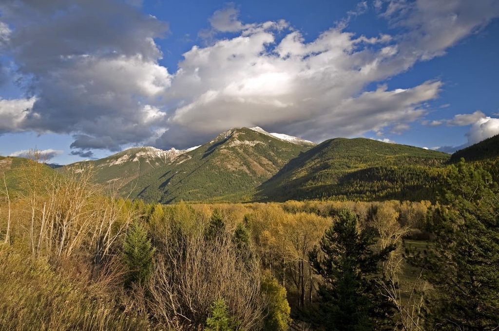
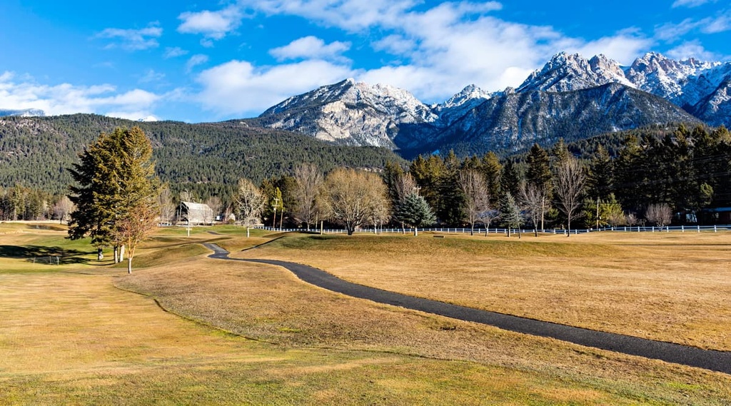
The Taylor Range is a collection of peaks located in southwest British Columbia, Canada. It is one of the many ranges of the Canadian Rockies. The range is a bit of an anomaly in the region as all 6 of its named highpoints are ridges that are located at relatively low elevations. The tallest point in the range is Fernie Ridge, which has an elevation of 2,239 m (7,346 ft) and a prominence of only 556 m (1,824 ft).
Southwest British Columbia is filled with many famous mountain ranges, including the Columbia Mountains and the Canadian Rockies. The Taylor Range is one of the many subranges of the southern Canadian Rockies, and it is situated near the province’s border with Alberta and the United States.
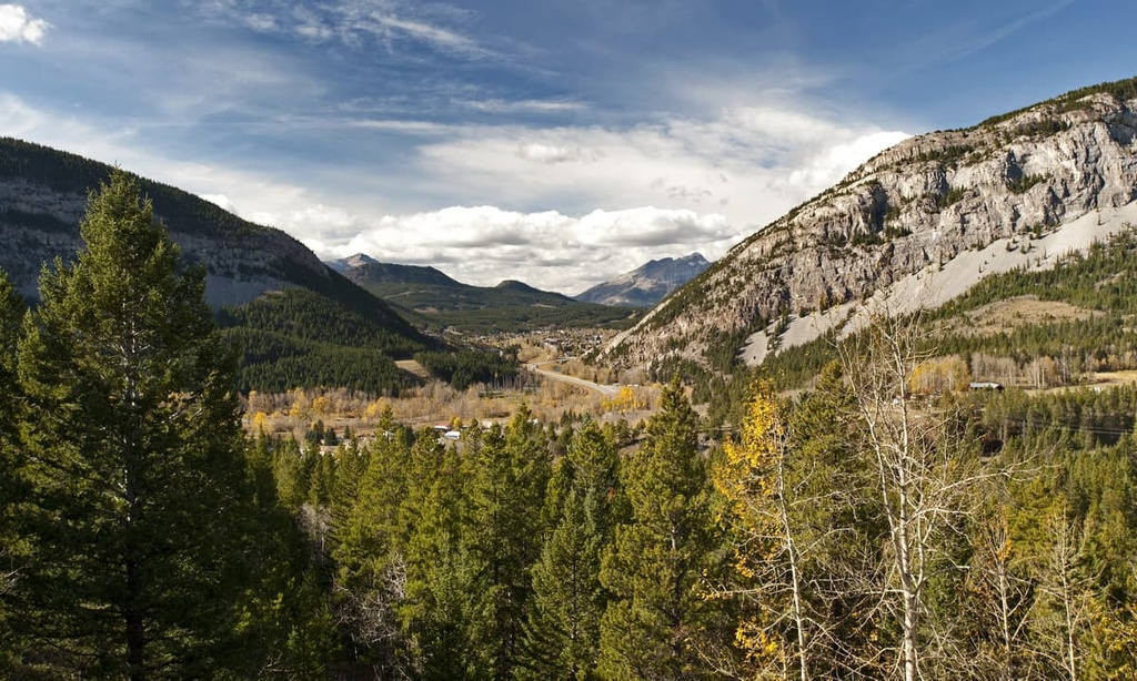
The Elk River follows most of the range's eastern border while the town of Fernie is located at the range’s western edge. Highway 3 is the main access route to the range, and it follows the Elk River along the western side of the range.
The forests of the range are composed of trees that are mainly destined for timber mills as there are only small protected areas in the range, such as Morrissey Provincial Park. Near the range, there are many other parks and wilderness areas that preserve portions of the regional ecology. Some of these nearby parks include the following protected areas:
As part of the Rocky Mountains, the Taylor Range started forming about 75 million years ago during the Laramide orogeny. The formation of the Rockies occurred when tectonic plates under the Pacific Ocean collided with the coast of North America. As the tectonic plates subducted beneath the continent, the continental crust was compressed, folded, buckled, and broken into pieces.
As land was added to the Pacific coast of Canada, the ancient continental margin, which roughly follows the Alberta–British Columbia border, was compressed. This compression caused the region’s Paleozoic layers of limestones and dolomites to fracture and slide up and over the younger, Cretaceous surface of shales and sandstones.
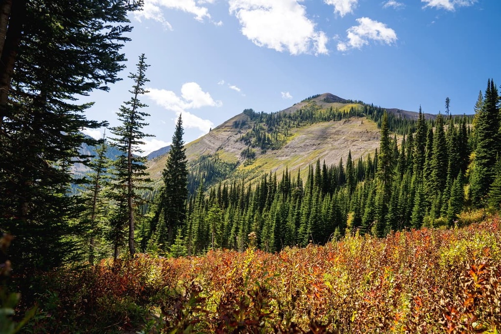
The softer layers of rock, which include the shale and sandstone, were gradually eroded away, leaving behind the precipitous limestone peaks that are commonly viewed throughout the Rockies to this day. However, the Taylor Ranges are slightly different from many of the surrounding ranges in that there is no significant alpine area in the range. Additionally, the tallest summit in the range is Fernie Ridge, which is only 2,239 m (7,346 ft) in elevation.
There is evidence that the entire area was overridden by the Pleistocene ice sheet, as glacial erratics have been encountered as high as 2,250 m (7,500 ft) in the surrounding ranges. Aside from glacial erratics, there is no significant evidence of glaciation in the range, which would usually include U-shaped valleys and alpine cirques.
An interesting note about the Taylor Range is that there is no significant alpine area in the range. Rather, the entire range is part of the Engelmann Spruce–Subalpine Fir ecological zone. The winters in the Taylor Range are cold; however, the lower elevations allow for a short, but relatively warm and productive summer growing season.
Engelmann, hybrid Engelmann-white spruce, and subalpine fir are the most common tree species found across the range. These species are also a staple of the forestry activities in the range. Additionally, these forests support stands of lodgepole pine, Douglas-fir, and trembling aspen. Lodgepole pine and aspen are common pioneer species that supplant previous forests after wildfires.
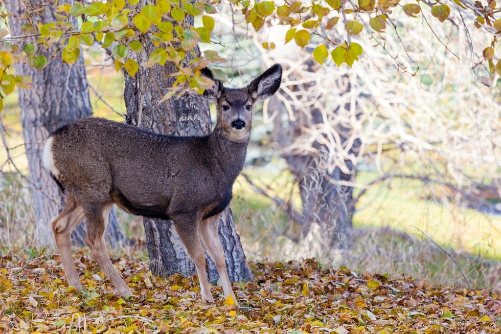
White-tailed deer, mule deer, and elk are the most common ungulates in the Taylor Range, which features noticeably fewer bighorn sheep and mountain goats than the surrounding ranges. These small populations of mountain goats and bighorn sheep in the region can be explained by the lack of their natural alpine habitat in the Taylor Range.
Pika, marmots, and Columbian ground squirrels are also found in the Taylor Range; however, like the mountain goats and bighorn sheep, the alpine is their natural habitat. The Taylor Range doesn’t have any significant alpine, which limits these species’ ability to populate the region.
Grizzly and black bears, wolves, cougars, wolverines, fishers, ermine, and other small mammals inhabit the Taylor Range alongside many bird species such as Forster’s terns, ospreys, western grebes, and long-billed curlews.
Archeological and cultural evidence suggests that people migrated to the Kootenay Valley about 11,500 years ago, as the glaciers melted. The earliest physical evidence of human habitation in the region was found in the southern Purcell Mountains, which are located to the east of the Taylor Range. These artifacts are part of the Goatfell Complex, which is a collection of sites situated across the Kootenays.
The Taylor Range is part of the traditional territory of the Ktunaxa Nation. A leading theory suggests that the present-day Ktunaxa Nation are direct descendants of the people who inhabited the valley 11,500 years ago.
The Ktunaxa traditionally had a vast territory that reached from the Kootenay Valley to the prairies on the eastern side of the Canadian Rockies, where they traveled to hunt buffalo in the summer. The English name ‘Kootenay’ (US spelling: Kootenai) stems from the pronunciation of Ktunaxa. The Kootenay Ranges, Kootenay River, and the valley all get their name from that of the First Nation.
While it is possible that the modern Ktunaxa are descendants of the original inhabitants of the valley, a second theory suggests otherwise. The strength of the first theory that the modern Ktunaxa have literally dwelt in the valley for the past 11,000 years lies in the fact that there has been no break in the 11,500-year archeological record. This means that all the discovered ancient technologies originated in the area and that there is no indication of emigration from the region.
The second theory argues the Ktunaxa Nation was forced westward by the Blackfoot Confederacy. The Blackfoot Confederacy came to dominate the prairies and were especially powerful along the eastern slopes of the Rockies, where the Ktunaxa once hunted buffalo. Historical and cultural evidence shows regular and even annual migration of many Ktunaxa people across the mountains for hunting.
Within the region, there are many cultural sites, including petroglyphs, ancient quarries, and workshops, as well as many artifacts including tools, arrow tips, and spearheads. Artifacts have been discovered in British Columbia and Alberta, which showcase the large size of the traditional territory of the Ktunaxa people.
The first Europeans to enter the area were possibly led by Alexander Mackenzie during his expedition in the late eighteenth century, making European contact with many First Nations for the first time. Captain John Palliser further mapped the area during his expeditions of the nineteenth century.
Prospectors and surveyors entered the region searching for natural resources to extract around this time. Gold was found not long afterward, and this discovery spurred a gold rush in the valley. Much of the European settlement of this region is a result of this gold rush period. Not long afterward, vast coal and gypsum deposits were discovered, too, helping to bolster the mining industry in the region.
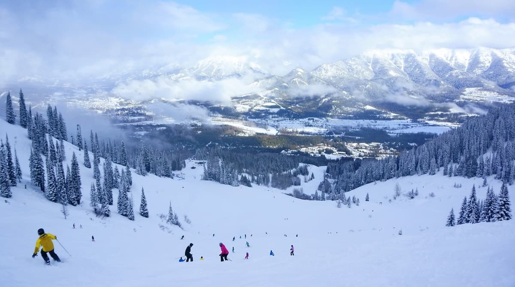
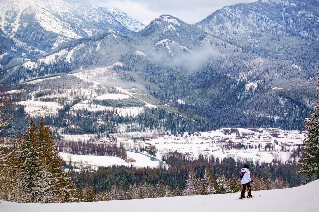
Currently, there are many towns and small cities found throughout the area that cater to the logging and mining industry in the region. Most of the region’s cities have now expanded their tourism industries, too, so they now boast resorts that cater to skiers and other outdoor enthusiasts.
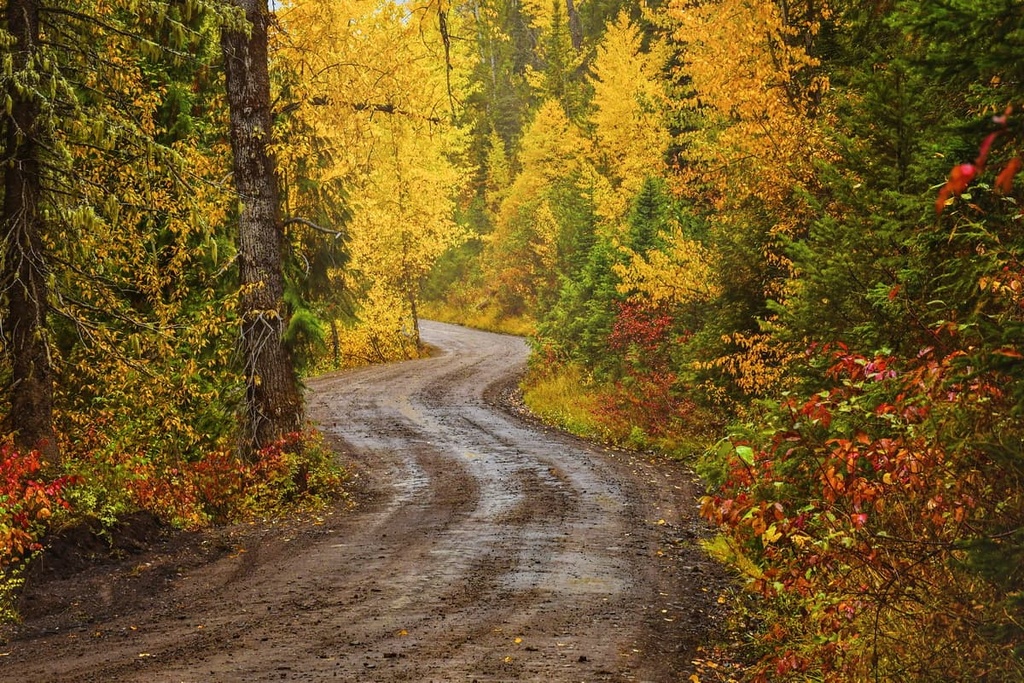
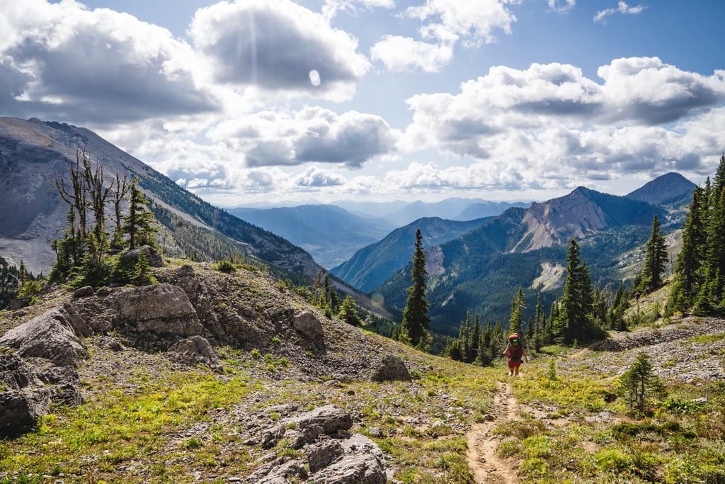
The Taylor Range is home to a variety of mountain trails, many of which are especially popular for cyclists. The following are some of the popular trails and attractions in the Taylor Range to check out during your next trip to the region.
There are two main routes that lead to the giant ammonite fossil, which is located to the east of Fernie.
The Direct Route is a moderate 1.6 km (1 mi) out-and-back trail that follows the creek directly. Meanwhile, the Coal Creek Trail is a moderate 4 km (2.4 mi) out-and-back hike through the forest. The giant ammonite fossil is the main attraction of these hikes, and there are other nearby fossils to see as well.
Fernie Ridge is accessible via a 5 km (3 mi) trail that leads to the summit of the ridge. The ridge is a fantastic viewpoint for observing the other peaks and valleys of the Taylor Range as well as the Elk River Valley. The trail is steep and is considered difficult; however, it is still enjoyed by many hikers and trail runners each year.
The trail to the abandoned Elk River Colliery #9 Mine is a moderate 6.6 km (4 mi) out-and-back trail with minimal elevation gain.
While the trailhead is not well marked, the trail is wide and accommodating for families and bikes. There are no good views of the surrounding mountains while on this hike; however, the destination is the historic ruins of an old coal mine.
The short hike to Matheson Falls is just over 1 kilometer (0.6 mi) long round trip. This quaint trail is beautiful and peaceful and there are several waterfalls to admire at the end of the trail.
This is one of the many short hikes in the area that can be combined for a full day of beautiful hikes or visitors can come out here for a nice morning or evening stroll.
Looking for a place to stay near the Taylor Range? Here are some of the best towns to check out in the region.
Cranbrook is the largest city in the region around the Taylor Range. It is located about 100 km (60 mi) west of the Taylor Range and the settlement was originally established by Colonel James Baker, who hailed from Cranbrook, Kent in England.
Cranbrook lies in the Kootenay River Valley in the Canadian Rockies Trench of British Columbia. It is surrounded by incredibly beautiful and scenic wilderness and mountains. Some of the hiking and wilderness areas that are located near Cranbrook include Kianuko Provincial Park, Kimberley Nature Park, Top of the World Provincial Park, and Purcell Wilderness Conservancy Provincial Park.
At the end of the nineteenth century, Colonel Baker convinced the Canadian Pacific Railway to run their Crowsnest Pass line through Cranbrook, which made the town the commercial and industrial center of the region. The Cranbrook History Center showcases the importance of the railway in the town’s early history as well as natural history specimens and artifacts from the earliest residents of the region.
Located along the west side of the Taylor Range, Fernie was founded in 1898 by William Fernie. Fernie was incorporated as a city in 1904, and, to this day, it is the only city-class municipality to be completely surrounded by the Rocky Mountains.
Fernie has embraced the mountain culture like the towns of Banff and Canmore, in Alberta, to become a tourist hotspot, especially during the winter months. Thanks to the Fernie Alpine Resort, which was originally created in the 1960s, skiing is especially popular near Fernie.
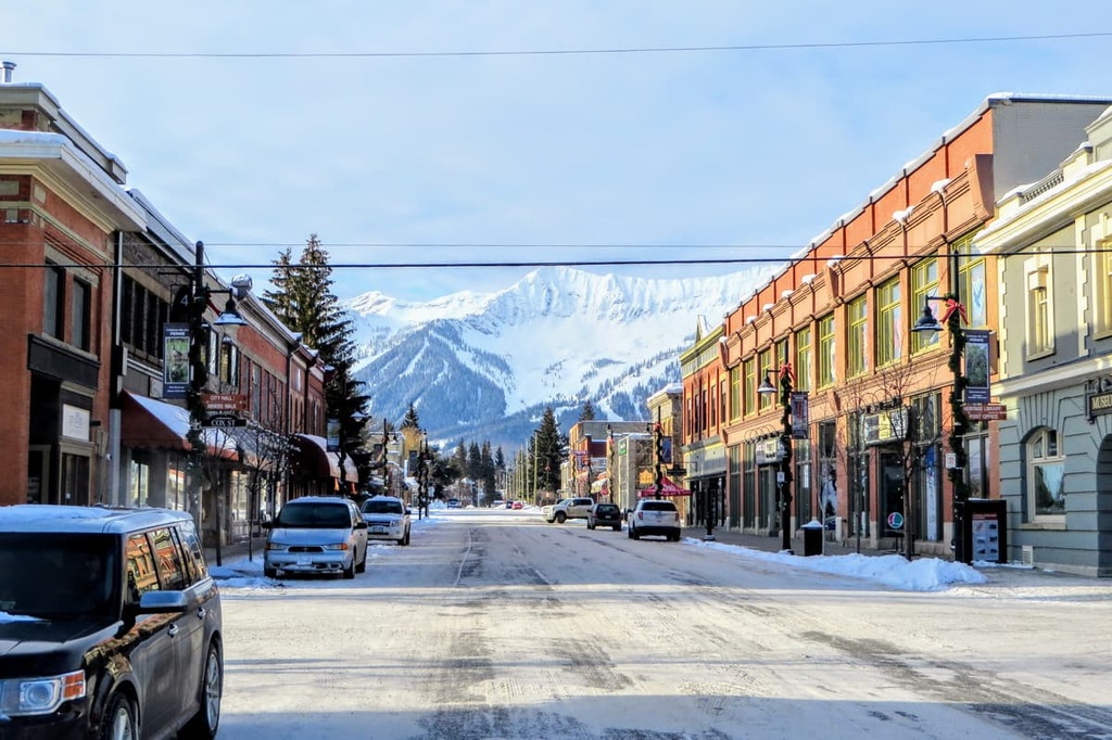
Fernie has an incredible collection of outdoor activities, amazing scenery and wildlife, and an adorable downtown filled with charming stone buildings for visitors to enjoy. Some of the hikes located around Fernie include trails to Fernie Ridge in the Taylor Range and Mount Fernie in the Harrison Range, which is located across the Elk River Valley.
Sparwood was nothing more than a railway stop in the late nineteenth century. It was named for the lumber that was harvested from the area and sent to the shipyards to make spars for ocean liners. Forestry and mining are the primary industries in the region and Sparwood has fully embraced both its history and mining culture.
Putting their appreciation for mining on display, along the Crowsnest Highway on the edge of Sparwood sits a giant green monster of a dump truck called the Terex Titan. The Titan serviced the coal mines from 1978 to 1991 and at one time was the largest truck in the world. It is now an iconic landmark and tourist stop. Next to the Titan is the visitor center, where you can get advice about local adventure opportunities.
The visitor center in Sparwood has a great map of the regional and local trails that are created and maintained by the Sparwood Trails Association. There are kilometers of trails for hiking and cycling around the town and during the winter, the trails are groomed for fat biking, cross-country skiing, and snowshoeing. While it’s not technically a city, Sparwood is a good-sized town that will have everything you need for an adventure into the mountains.


