
Scan the QR code and open PeakVisor on your phone
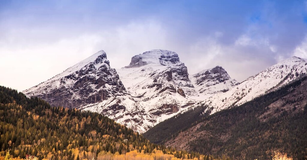
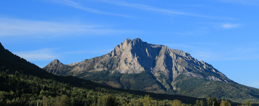
The Harrison Range is a collection of peaks located in the southeastern part of the province of British Columbia in Canada. The range consists of the four subranges—Harrison Group, Harrison Group East, Harrison Northeast, and the Quinn Range—all of which cover a total of 2,119 sq. km (818 sq. mi), and contain a total of 44 named mountains, the tallest of which is Mount Harrison (3,360 m/ 11,024 ft).
Found within the southern ranges of the Canadian Rockies, the Harrison Range is in southeast British Columbia near the border with Alberta and the United States.
The town of Fernie sits at the range’s southern tip while part of Highway 3 and Highway 43 run along the southeastern edge. The Elk River follows most of the range's eastern border and both the Bull River and North Galbraith Creek run along the west. The range is remote with limited access, except for a number of forestry roads that criss-cross the region.
Due to the fact that the Harrison Range is located within a highly mountainous part of British Columbia, it is also surrounded by a number of other named mountain ranges, the most notable of which is the Hughes Range to the west.
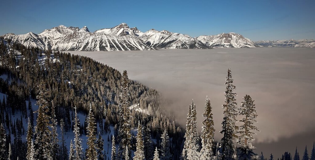
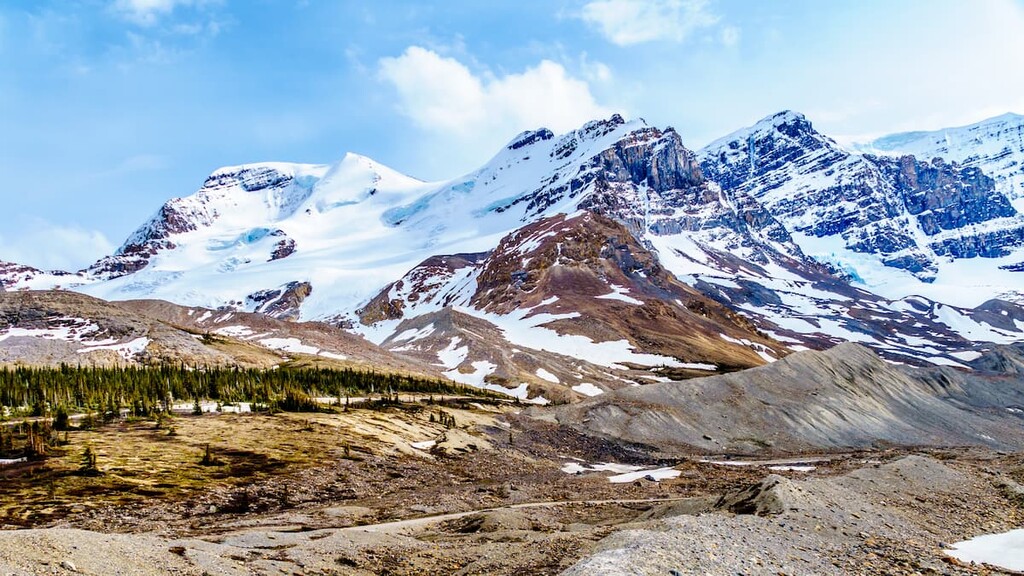
The Rocky Mountains started forming about 75 million years ago when the tectonic plates under the Pacific Ocean tried to occupy the space held by the North American continental plates. Like siblings fighting over a chair, they smashed together and crumpled into a heap. The older Paleozoic layers of limestone and dolomite slid over the younger Cretaceous shales and sandstones.
The layers of limestone stacked up forming the basis of the Rocky Mountains. The erosive forces of wind and water started wearing down the mountains as they were forming; however, it’s the glaciers that created the mountains as we see them today.
Just over 2.5 million years ago, the world was cooling, and periods of glaciation were cycling, forming glaciers and ice sheets, such as the Laurentide ice sheet, which covered most of North America. The ice sheet, which was over a kilometer thick in places over the Rocky Mountains finished grinding away the softer Cretaceous stone, leaving the durable limestone and dolomite peaks.
Ending about 12,000 years ago, the most recent glacial cycle of the Pleistocene epoch created the current topography of the Rocky Mountains and the Harrison Range. The glaciers carved out mountain sides creating cirques and moved enormous amounts of stone debris, leaving deposits as kames and sinuous eskers when they melted.
The Harrison Range of mountains are a sibling range to the Crowsnest Range to the south and the Kootenay Range to the west. The famous Royal Group is north of the Harrison Range, while the High Rock Range is to the east, along the Continental Divide.
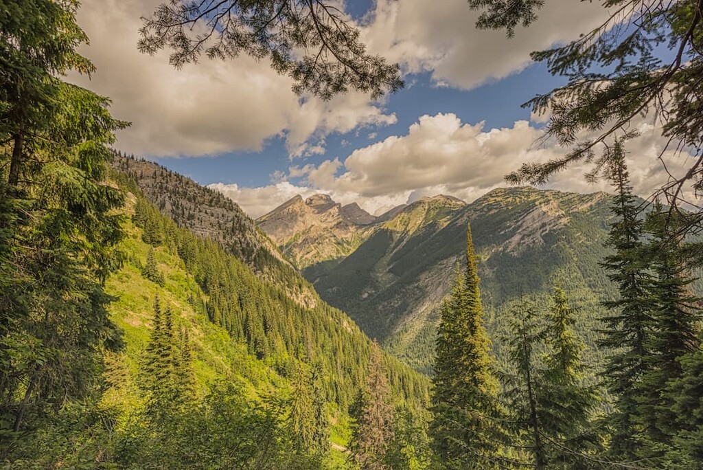
From the barren rocky peaks to the dense cedar forests, the Harrison Range has diverse ecosystems and habitats. The alpine and subalpine occur at the highest elevations and the climate is severe with cool summers and long, cold winters. The tops of the mountains are dominated by rocks with limited growth of sedge and lichen.
Below the alpine rocks the landscape is open parkland, with trees clumped and interspersed with meadow, heath, and grassland. Engelmann spruce, subalpine fir, and lodgepole pine are the dominant trees.
The montane zone covers middle elevation valleys within the Harrison Range, below the subalpine. While the winters are cold, the lower elevations allow for a short, but relatively warm summer. Engelmann, hybrid Engelmann-white spruce, and subalpine fir are the common tree species, however, forests of lodgepole pine, Douglas-fir and trembling aspen commonly supplant previous forests after wildfires.
The valleys and lower slopes of the southern half of the Harrison Range are part of the Interior Cedar–Hemlock Zone. The winters are cool and wet, while the summers are dry and warm. This zone has the widest variety of coniferous tree species in the range and out of all the ecological zones of British Columbia.
As the name indicates, western red cedar and western hemlock are the predominant tree species. White-Engelmann spruce hybrids and subalpine fir are common, while Douglas-fir and lodgepole pine are found on drier sites.
Mountain goats are the most common ungulate within the range; however, there are substantial populations of white-tailed and mule deer, bighorn sheep, and elk. Small populations of caribou have managed to survive in the region and generally live in the old-growth spruce forests.
Grizzly and black bears are common in the range, as well as numerous small mammals. Pika, marmots, ground squirrels, and voles all live in the area. There are also many bird species such as Forster’s tern, osprey, western grebe, and long-billed curlew.
As the world was gripped in an ice age, or as geologists say, a glacial maximum, the sea level was an estimated 120 m (393 ft) lower than the current level. During this time, it is believed that some early humans migrated from the Asian continent through Beringia, into modern day Alaska and Yukon Territory.
Around 14,000 years ago, a gap started to open between the continental ice sheet and the glaciers that covered the mountains. As the ice receded from the valleys of the mountains, people followed the migrating ancient animals into the recently thawed areas.
Evidence of the early inhabitants is found throughout the East Kootenay region in the form of ancient quarries, workshops, and campsites. These ancient groups would quarry chert, which is an opaque grey sedimentary stone, which when fractured can produce a very sharp edge. Chert was valuable for tools and trading, as it can be into durable and sharp hunting points and blades.
The Harrison Range and District of East Kootenay are the traditional lands of the Ktunaxa Nation. The name Kootenay, which are names of the river, valley, and adjacent mountain range is the anglicized derivation of their spoken name.
During the early nineteenth century European explorers entered the region of the Harrison Range and made the first European contact with the local First Nations. Adventurers and surveyors such as Thompson, Simpson, and Palliser created the first common maps of the region.
By the beginning of the twentieth century, a railroad had been built through the region, connecting the natural resources to the Pacific coast and the rest of Canada. The town of Sparwood, which is just outside the Harrison Range, was named for the lumber which was taken from the area and shipped to the coast to manufacture spars for ocean vessels.
The region was settled for the lumber industry and coal mining by William Fernie and Colonel James Baker. Mining was the driving force that brought settlers to the area and is still important to the economy. In the 1960s, in addition to coal mining, the region started developing a ski hill, which is the basis of the current Fernie Alpine Resort and their outdoor recreation industry.
By the 1930s after Mount Andromeda was climbed, it was believed that all the peaks above 11,000 feet (3,353 m) in the Canadian Rockies had been surveyed and climbed. However, in the early 1960s, the British Columbia mapping branch had noticed a peak in a remote valley east of Canal Flats that was believed to be over 11,000 feet (3,353 m) in elevation.
While the Rocky Mountains in the United States boast many mountains over 14,000 ft (4,267 m), the Canadian Rockies only have 54 peaks which reach above 11,000 ft (3,353 m). They are referred to as the 11,000ers, and Mount Harrison is number 53 on that list. As of 2020, the 11,000-foot (3,353 m) elevation has been disputed, and may fall just short of the mark, to become delisted and only an honorable mention on the 11,000ers list.
On August 11, 1964, a group from Vancouver climbed the peak for the first time, and within a couple months, the mountain was officially named Mount Harrison, and the surrounding mountains are referred to as the Harrison Range.
While the range is remote and there are no preserved natural areas within the range, there area is worthwhile to visit for the following adventure-based attractions:
The Fernie Ridge Trail is a popular hike, because it is very close to the town of Fernie. The trail is about 4 km (2.5 mi) to the summit with 927 m (3,040 ft) of elevation gain. The hike is deemed difficult and best hiked from May until October. The views of the valleys and peaks make this grueling hike worthwhile.
The Elk Valley Trail is a 130 km (81 km) section of the Trans-Canada Trail (The Great Trail), which connects the Elk Lakes/High Rockies Trail in the north to the Cranbrook/Wardner Trail in the south. The trail comes from the north through the town of Elkford and follows the Elk River through the towns of Sparwood and Fernie to Elko.
The trail traverses mountainsides and runs through the Elk River Valley connecting single track, backcountry roads, and community trails forming an impressive signed route. The trail can be traveled in segments or as a whole, staying overnight in municipal campgrounds or hotels along the way. The Trans-Canada Trail as a whole, and this section in particular, are a wonderful way to connect with the country and region.
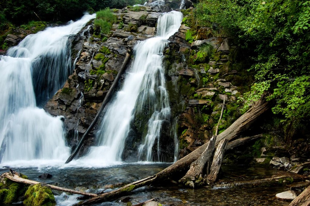
For a nice adventure to the Fairy Creek Waterfall, start from the visitor information center in Fernie and follow the Fairy Creek Trail. To reach Fairy Creek Waterfall, continue up the trail for just over 2 km (1.5 mi) to the waterfall. Thanks to its minimal elevation gain of 105 m (344 ft), this trail is recommended for hikers of all skill levels.
If you desire something a bit more difficult, following the trail beyond the falls will take you up the ridge to the peak of Mount Procter. However, there is 1,428 m (4,683 ft) of elevation to gain, to reach the summit, making it a strenuous hike.
Once atop Mount Procter, enjoy your view of the Elk River Valley and the surrounding ranges before you continue the loop down and experience new views and trails almost all the way back. The Mount Procter trail is a loop and can be hiked in either direction dependent upon your preference for either ascending or descending steep slopes.
An interesting note on the name of Mount Procter, which is often spelled incorrectly as “Proctor”. The mountain was named after Thomas Gregg Procter, an entrepreneur, rancher, and the founding postmaster at the railway stop, which was named after him.
The name was often misspelled as “Proctor” on maps, and even town signs. There are many places named after him with the spellings as “Procter” and “Proctor” and they refer to the same man; however, the official name of the mountain is Mount Procter.
Looking for a place to stay near the Harrison Range? Here are some of the best towns to check out:
Originally established by Colonel James Baker, from Cranbrook, Kent in England, the city of Cranbrook lies in the Kootenay River valley in the Canadian Rockies Trench in British Columbia. Cranbrook is the largest city in the region and it is located about 100 km (60 mi) west of Fernie and the Harrison Range.
At the end of the nineteenth century, as the railways were expanding westward, Colonel Baker convinced the Canadian Pacific Railway to run their Crowsnest Pass line through Cranbrook. The railway cemented the town's importance and by 1905, Cranbrook had become the commercial and industrial center of the region and was incorporated as a city.
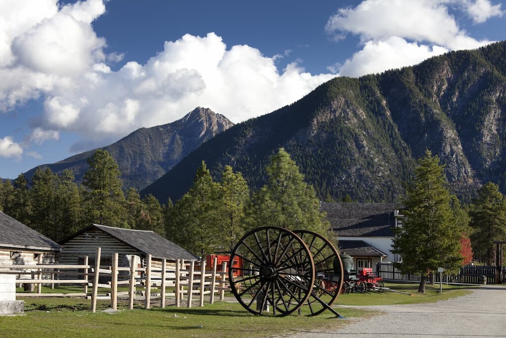
If you have some time between outdoor hikes and adventures, the Cranbrook History Center is worthwhile to visit. It is a museum that exhibits passenger rail cars from the early 1900s, natural history specimens, and artifacts from early human habitation. The museum is considered to be of national and international importance for the cultural exhibits that it contains.
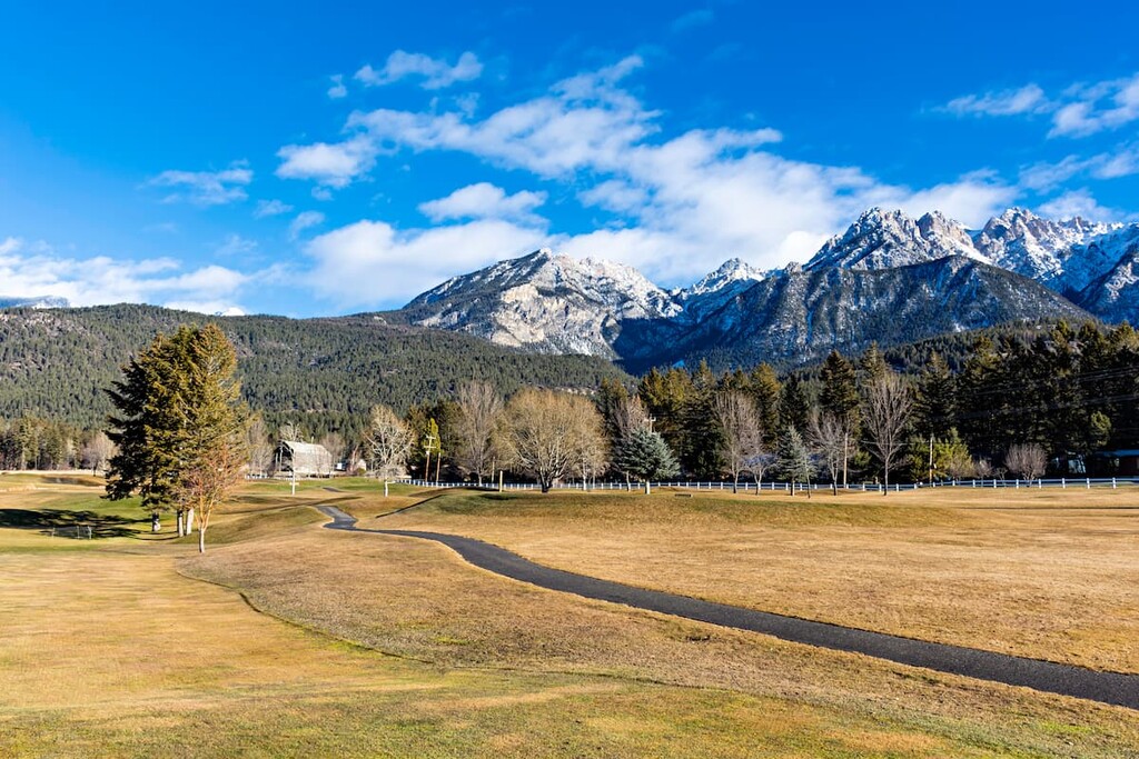
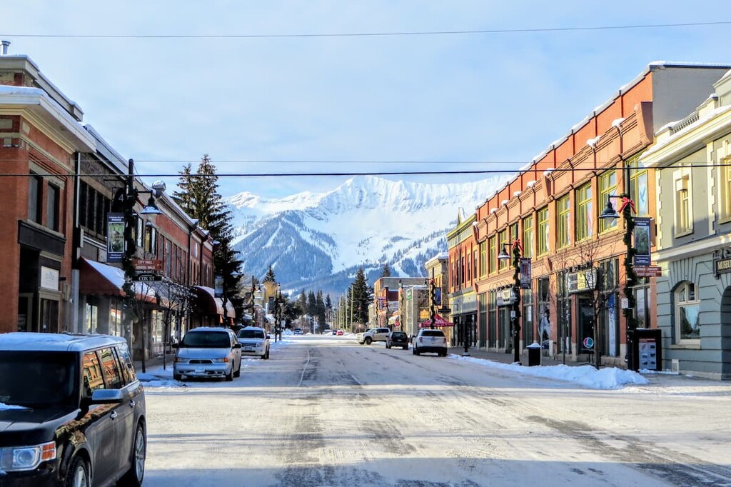
Located along Highway 3, in British Columbia at the south end of the Harrison Range, Fernie was founded in 1898 by William Fernie as he made claims to the land and started mining the nearby coal reserves. By 1904, Fernie was incorporated as a city, and, to this day, it is the only city-class municipality to be completely surrounded by the Rocky Mountains.
While Fernie started as a coal mining town, it has embraced the mountain culture like the towns of Banff and Canmore, in Alberta, to become a tourist hotspot, especially during the winter months. Skiing is especially popular near Fernie, thanks to the Fernie Alpine Resort, which was originally created in the 1960s and has since grown to be the modern ski resort that we all know and love.
An interesting historical note about Fernie is the reason for which the buildings downtown are all constructed of stone. In 1904 a fire demolished the densely built wooden buildings of Fernie’s original commercial district; however, they were rebuilt with similar wooden construction. In 1908, a second fire obliterated the town in 90 minutes.
The Fernie Fire Department was only four years old at this point and could not contain the blaze. Only 16 homes and the offices of the Crow’s Nest Pass Coal Company (now city hall) remained standing. Reconstruction started immediately with a requirement that the commercial buildings be built of brick and stone.
Fernie has incredible activities, amazing scenery and wildlife, and an adorable downtown filled with charming stone buildings.
Sparwood is a neat wilderness town with a fascinating history. Initially Sparwood was nothing more than a railway stop in the late nineteenth century named for the lumber that was harvested from the area and sent to the shipyards to make spars for the ocean liners. Mining coal and lumber have been the primary economic drivers of the region and Sparwood has fully embraced their history and the mining culture.
Officially incorporated in 1966, the population of Sparwood increased significantly as two nearby towns were shuttered because of their proximity to the coal mines and the residents were encouraged to move to Sparwood.
Putting their appreciation for mining on display, along the Crowsnest Highway on the edge of Sparwood sits a giant green monster of a dump truck called the Terex Titan. The Titan serviced the coal mines from 1978 to 1991 and at one time was the largest truck in the world and is now an iconic landmark and tourist stop. Next to the Titan is the visitor center in which you can be directed towards local adventure.
From the visitor center you should pick yourself up a map of the Sparwood trails. Created and maintained by the Sparwood Trails Association, there are kilometers of trails for hiking and cycling. During the winter, the trails are groomed for fat biking, cross-country skiing, and snowshoeing. While not a city, Sparwood is a good-sized town that will have everything you need for an adventure into the mountains.


ultra
11ers-bc
11ers-ca-rockies
british-columbia-ultras
ultra
11ers-bc
11ers-ca-rockies
british-columbia-ultras


