Scan the QR code and open PeakVisor on your phone
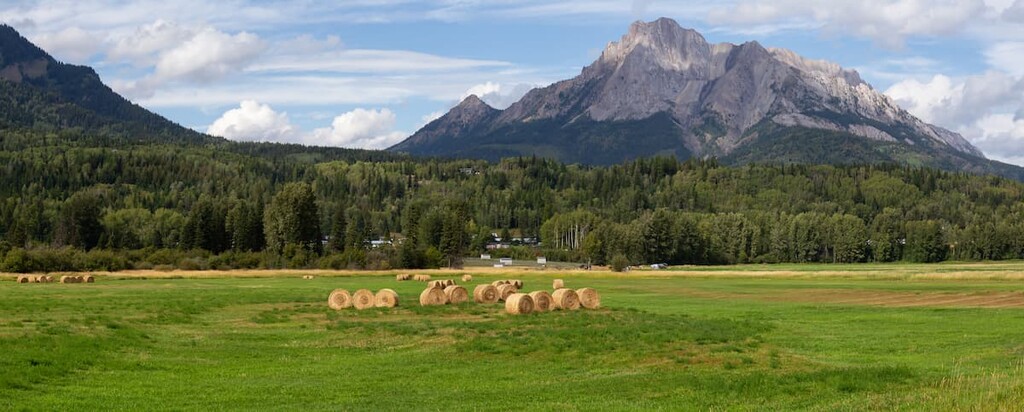
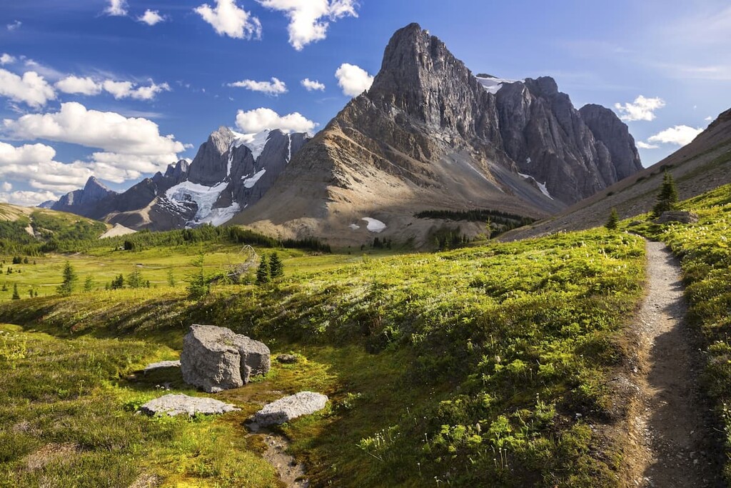
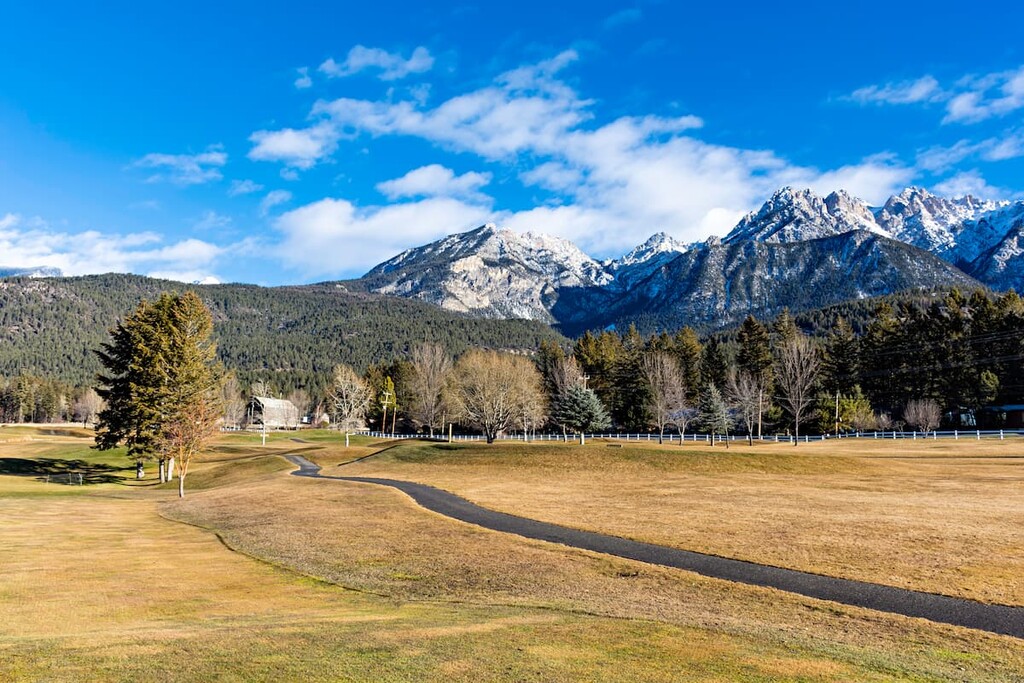
Located along the edge of the Rocky Mountain Trench in southeast British Columbia, Canada, the Hughes Range covers 765 sq. km (295 sq. mi) of land and contains four provincial parks among its 50 named peaks. The highest peak in the range is Mount Morro (2847m/9341ft) and the most prominent mountain is Blue Knight Peak (2630m/8625ft).
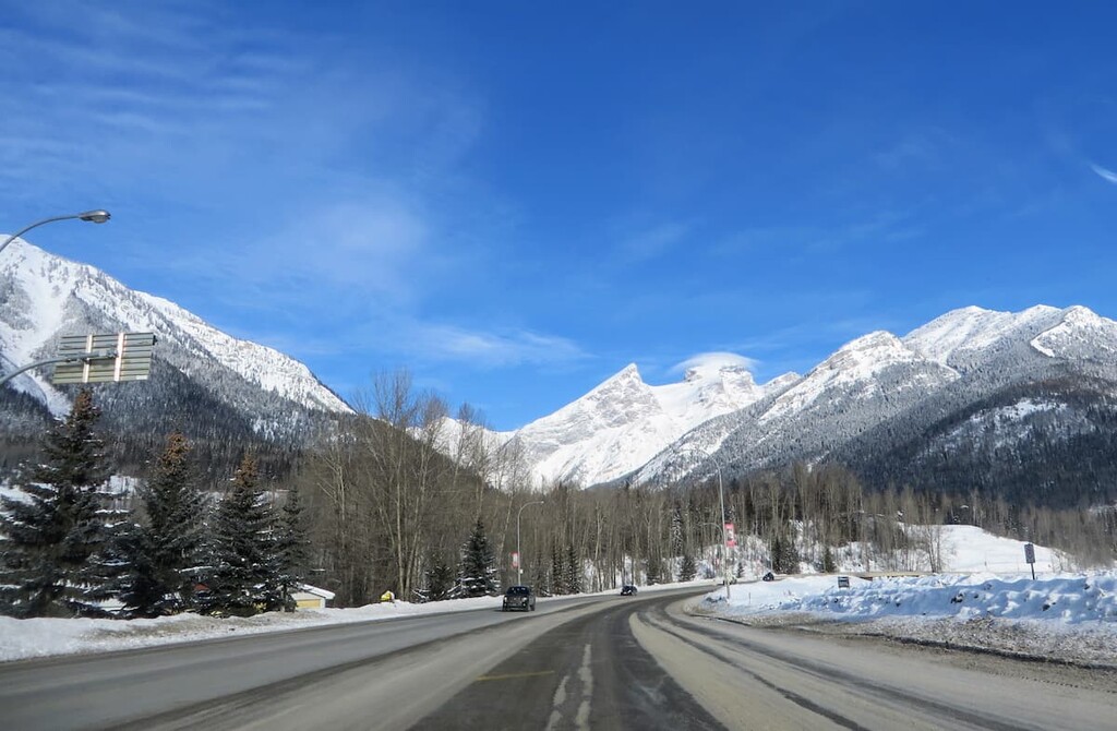
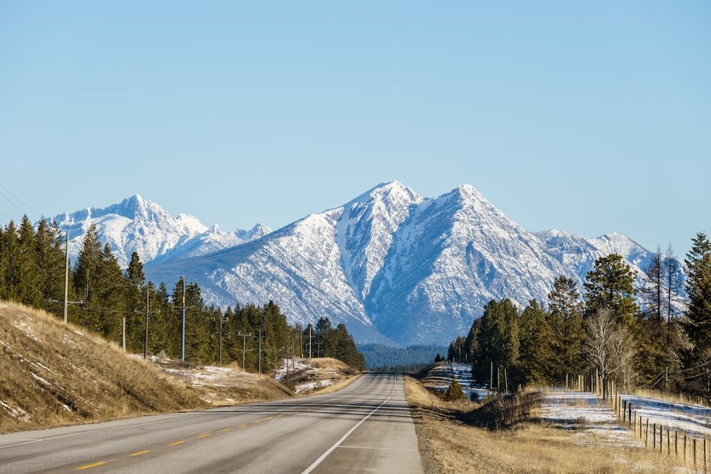
Highway 93 in southern British Columbia borders the western edge of the Hughes Range from Canal Flats to Cranbrook. Highway 3 wraps around the southern edge of the range from Cranbrook to Sparwood.
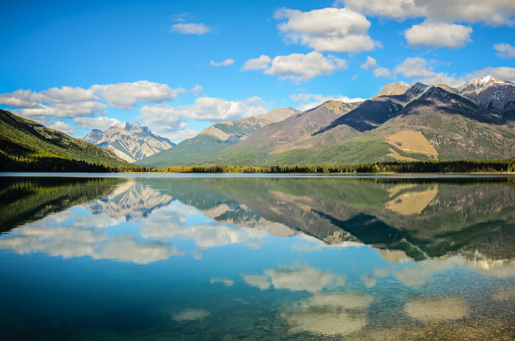
The Hughes Range is home to four provincial parks and one ecological reserve. The largest park within the range is Top of the World Provincial Park, covering part of the Top of the World Plateau where the elevation is higher than 2,200m (7,200 ft).
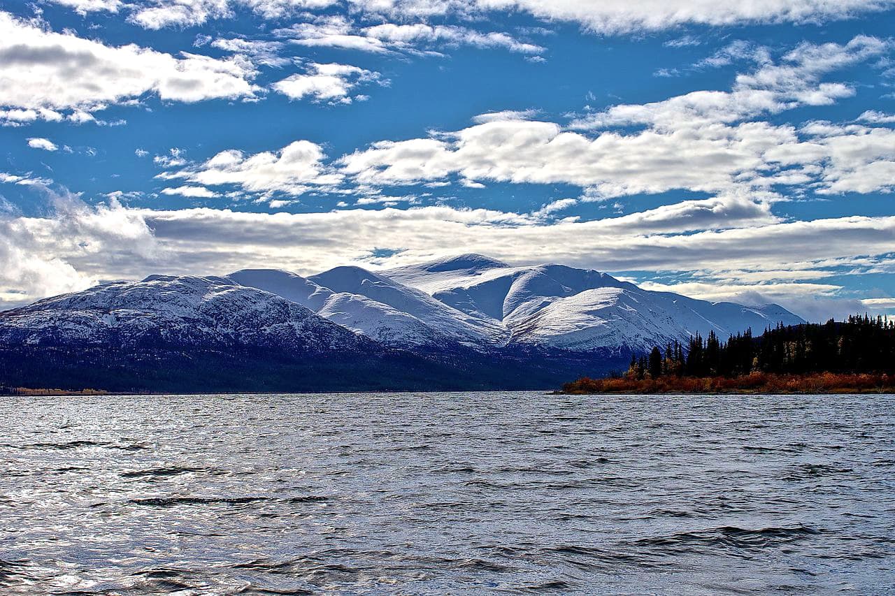
Protection of the ecosystems and habitats around several of the lakes in the range seem to be the primary focus of the remaining parks—Whiteswan Lake Provincial Park, Premier Lake Provincial Park, and Columbia Lake Provincial Park. Ram Creek Ecological Reserve was created to preserve the delicate ecosystem and habitats surrounding hot springs.
The Hughes Range is not near any major cities, and it has been home to resource extraction for over 100 years. So, the demand for preservation of landscape and habitat has been limited to small areas. Most of the range is open to mining and logging which allows for off-highway vehicle use and random camping within the range.
The history of the Hughes Range can be traced back billions of years through the records left behind as stone. You can read the mountains to uncover their history as you would read a book, you just need to learn their language. The following information will hopefully help you understand the formation and geology of the Hughes Range.
The Hughes Range forms part of the Kootenay Ranges. These are part of the western edge of the Rocky Mountains. The Rocky Mountain Trench to the west of the range separates the Canadian Rockies from British Columbia’s interior mountains.
Within the Kootenay Ranges, the Van Nostrand Range is due east of the Hughes Range, and the Stanford Range is to the North. The Lizard Range and the McGillivray Range are to the south east and south west respectively, and all these ranges form part of the Southern Continental Ranges of the Canadian Rocky Mountains.
To the west of the Hughes Ranges are the Purcell Mountains, which are a subrange of the Columbia Mountains. The Purcell Mountains are geologically distinct from the mountains in the Hughes Range and the Rocky Mountains in general. Though geographically close, the Rocky Mountains are about 85 million years younger than the mountains to the west of the Rocky Mountain Trench.
Around 100 million years ago the Columbia Mountains were already a significant mountain range when the Rocky Mountains started to form, during what is called the Laramide orogeny. The mountain building process, or orogeny, of the Rocky Mountains finished about 55 million years ago when the tectonic plates from the west stopped their collision with the North American plate.
Over the next millions of years, the fault between the Canadian Rocky Mountains and the Columbia Mountains was stretched instead of compressed as it had been for tens of millions of years. The stretching at the fault is what created the Rocky Mountain Trench which is unique to the Canadian Rocky Mountains and doesn’t significantly extend into the United States.
As the Laramide orogeny was nearing its end, the trailing (western) edge of the Cambrian and Devonian age rock slid smoothly and horizontally over the younger Cretaceous rock. The flat movement of the plate created horizontal bands of sedimentary stone that resist erosion more than the vertical thrust sheets that formed the mountains to the east. With slower erosion, the western mountains remained taller and created prime storm conditions that increased glaciation of the range.
The Pleistocene epoch, with its characteristic glaciation, lasted until about 12,000 years ago, at which time the glaciers had mostly melted. The glaciation and erosion from the melting ice scoured the mountains creating the dog tooth and horn shape mountains, and the steep valleys of the range.
The rocks that form the Hughes Range were created 100s of millions of years ago as cyanobacteria (blue green algae) thrived in the warm shallow seas along the western continental shelf. As the cyanobacteria died, they would fall to the seafloor and accumulate and compress into thick layers of rock, particularly limestone. If there was magnesium present, then dolomite would’ve formed in place of the limestone. These layers would be spaced with layers of siltstones and sandstones.
The major rock type found in the Hughes Range is dolomite, usually grey or black, but sometimes with hues of red, green, yellow, or purple. The colors in the dolomite come from colonies of cyanobacteria that collected argillite sediments within their colony structure. The rest of the rocks in the range are colored argillite, quartzite, sandstones, and shales. There is very little limestone in the range, unlike the mountains to the east.
The ecology of the Hughes Range is divided into three primary ecological regions and one additional, more minor ecosystem. The range consists of the alpine, subalpine, and montane ecological regions, along with a unique ecosystem around the Ram Creek Hot Springs. The following are descriptions of each region along with their characteristic flora and fauna.
Plants and animals are sparse in the alpine areas of the range and consist mainly of lichen covered rocks, grassy meadows, mat vegetation, shrubs, and krummholz.
Sedges and heathers grow on the edges of snowbeds and grouseberry grows in protected areas. Stunted subalpine fir and Engelman spruce may be spotted amongst the rocky outcrops and grasses. Lengthy snow cover and cold temperatures prevent most flora from thriving in the area.
Birds are the only animals known to regularly inhabit the alpine areas of the Hughes Range. White-tailed ptarmigan, gray-crowned rosy finch, horned lark, and the American pipit are found in the area during nesting season.
Below the tree line there is expectedly more flora and fauna. Engelmann spruce and subalpine fir grow in open stands upon the mountains. Dense lodgepole pine forests inhabit the lower altitudes. Whitebark pine can occasionally be found at high elevations and subalpine larch will crest the tree line.
Buffaloberry, grouseberry, and five-leaved bramble are common undergrowth in the subalpine forests. Stands of dwarf birch and willow are common to moister sites.
The forests and meadows of the subalpine natural region are home to many large animals, including elk, grizzly bears, black bears, deer, mountain goats, bighorn sheep, wolves, and cougars. Wet meadows and streamside shrubbery provide habitat to small mammals such as long-tailed vole, northern bog lemming, and heather vole.
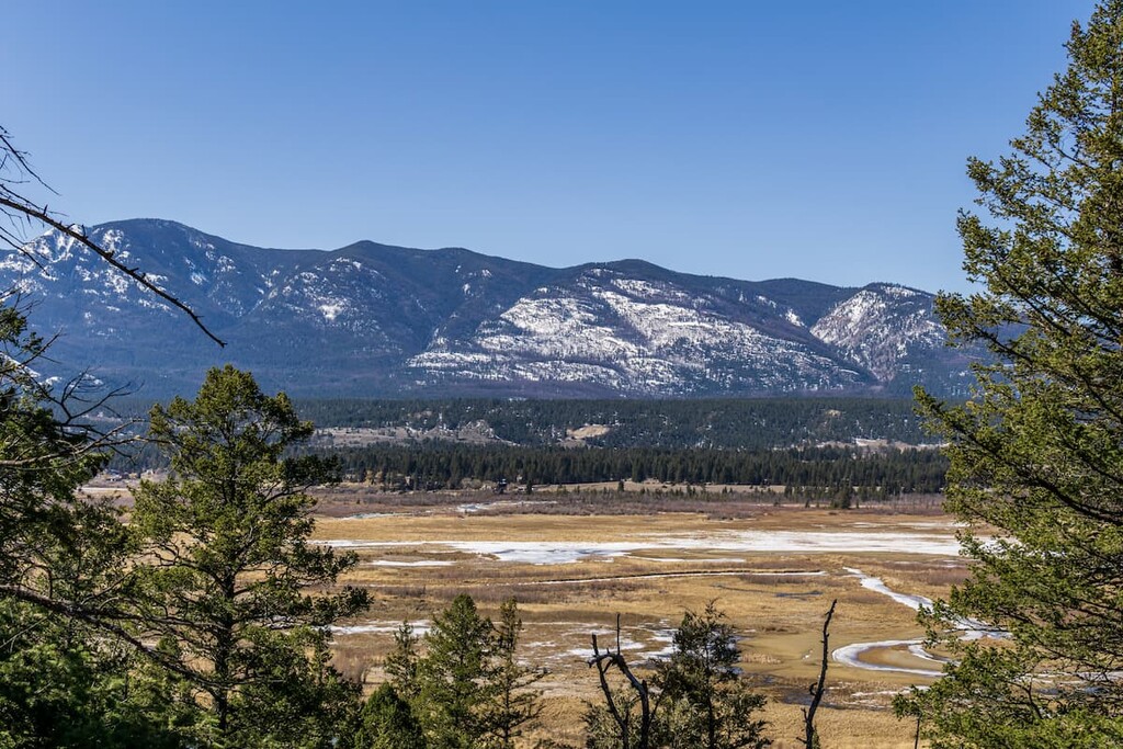
The montane region of the Hughes Range covers the lower slopes and valleys of the range. Valleys are characterized by mixed forest and grassland where the grasslands occur on dry, exposed sites and forests fill the rest of the space.
The primary trees that inhabit this area are Douglas fir and lodgepole pine. Spruce tends to grow along stream banks and hold onto the north facing slopes and aspen are usually found in stands upon terraces.
Where the trees start to falter, creeping juniper and bearberry fill the ground until the ground is too dry and the grasses have taken over. Bluebunch wheatgrass, fescue grasses and oat grasses dominate the grasslands and meadows.
The same animals that inhabit the subalpine region live and move through the montane region, too. The valleys are major wildlife corridors, and most animals tend to spend the winter in the valleys as opposed to the slopes of the mountains.
The ecosystem around the hot springs in the Ram Creek Ecological Reserve deserve a special mention for the unique flora and fauna the warmth allows to thrive.
The most unique vegetation in the ecosystem grows right around the hot springs and beside the stream flowing from the springs. The warmth allows this vegetation to develop earlier and lusher than the vegetation several meters further from the springs. Some of the vegetation around the springs can only exist in this region because of the unusual warmth from the springs.
Common plants around the hot springs are poison ivy, bluegrass, and field mint. You will also find Canadian butterweed, Kalm’s lobelia, leafy aster, slender rush, and white geranium. A rare sedge, carex crawei, is also found around the springs.
The fauna around the springs is not particularly different from the rest of the range, with the exception of the vivid dancer, which is regarded as a species of Special Concern in Canada.
Vivid dancers are a type of damselfly that looks like a dragonfly except for their wings. The easiest way to tell the difference is that when perched, damselflies will have their wings together and dragonflies will have their wings spread out. The vivid dancer’s range in Canada is restricted primarily to thermal springs in southern British Columbia and Alberta.
Human habitation of the Hughes Range began around 11,500 years ago when the glaciers were melting and vegetation and animals began to inhabit the lands. It is believed that the first people to inhabit the area came from the southeast through the recently thawed valleys. Some of the earliest artifacts of human habitation in Canada are found just west of the Hughes Range.
The Hughes Range is within the traditional territory of the Ktunaxa Nation. An iteration of the spoken word Ktunaxa gives us the modern name of Kootenay for the name of the mountain range, river, and valley. There is debate as to the origins of the modern Ktunaxa Nation who consider the region to be their ancestral homelands.
One origin theory proposes that there has been no break in the archeological record. This would mean that there is no indication that the original inhabitants emigrated to the region. This theory argues that the modern Ktunaxa Nation are the descendants of the original occupants of the region who came to the area nearly 12,000 years ago.
The second theory of the origin of the modern Ktunaxa Nation immigrated to the area in the eighteenth century. It is hypothesized that the Ktunaxa were forced west out of the eastern Rocky Mountains and the plains by the ancestors of the Blackfeet Nation. There is historical evidence showing regular, even annual migration of many Ktunaxa people across the mountains for hunting; however, the evidence as to the origins of the Ktunaxa Nation are still the matter of some debate.
The first Europeans to enter the area were likely led by Alexander Mackenzie during his expedition in the late eighteenth century, making European contact with many First Nations for the first time. Following the first European contact with the First Nations in the area, Jesuit missionaries traveled westward to pontificate their beliefs to local First Nations. Captain John Palliser further mapped the area during his nineteenth century expeditions.
Prospectors and surveyors entered the land searching for natural resources to extract not long after Palliser published his maps of the region. They soon found gold, spurring a gold rush in the valley. Not long afterward, prospectors also found vast coal deposits and, by the twentieth century, loggers had also made their way to the region.
Colonel James Baker, emigrated from England to British Columbia and purchased the land that the city of Cranbrook is now on, in the 1880s. Baker named the land after his home Cranbrook, Kent, England.
Through Baker’s initiative, in 1898, the Canadian Pacific Railway was convinced to run their Crowsnest Pass line through Cranbrook instead of the nearby Fort Steele. With the railway came a boom in commerce and industry, and by 1905 Cranbrook was a city and considered the commercial center of the Kootenay area.
Currently, there are many towns and small cities through the area that cater to the logging and mining industries in the region. Several towns, like Fernie and Invermere have expanded as resort towns catering to skiers and other tourists.
The Hughes Range is home to several unique landscapes and ecosystems. The following are a list of a few places that one might find appealing.
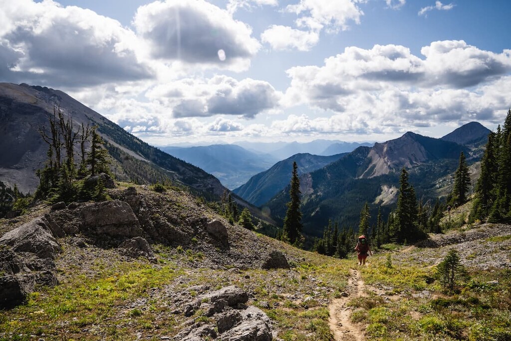
Established in 1973 and covering 8,790ha (21,711 acres), Top of the World Provincial Park is part of the Top of the World Plateau. Known for great beauty among the rugged landscape, which is located more than 2,200m (7,216ft) above sea level.
The park is home to a variety of wildlife such as moose, elk, deer, and bear, all of which tend to live in the valleys and drainages. Mountain goats and bighorn sheep can be sighted among the peaks.
The park is popular in the summertime for the many hiking opportunities as well as the winter for cross-country skiing. A popular destination for visitors to the park is Fish Lake. The trail is easy and well maintained and leads to backcountry campsites and a public cabin.
Ram Creek Ecological Reserve encompasses 122 ha (301 acres) around the confluence of the Ram Creek with Marmalade Creek and the hot springs. An old forestry road serves as the primary trail through the reserve and there is no vehicular access to the park.
The highlight of the reserve is the hot springs and the unique ecosystem that thrives with the increased temperature. There are two main pools to the hot springs, which were manually enlarged before receiving the protected status of the area. The hot springs have been a popular site since the 1970s.
Down from the springs, the damselfly known as the vivid dancer is abundant among the plants and flowers. This insect is rare in Canada and can only live in this region because of the thermal springs in the area that create the perfect habitat for its survival.
The ecosystem surrounding the hot springs is fragile and care should be taken while visiting the area. Recreational use of the hot springs is discouraged to prevent further damage to the area.
A 6.5 km (4 mi) trail leads to Ptarmigan Lake at the base of White Knight Peak. Starting off gently, the last few kilometers of the trail get steeper as you head toward the lake.
To arrive at the trailhead, you must first travel to Whiteswan Lake Provincial Park. From the park you follow White Moscow Forest Service Road to a junction and then follow the road west. The end of this road is the trailhead. The length of the hike may increase as parts of the road are decommissioned.
Much of the trail follows old forest roads until you reach the steep parts of the trail. The last two kilometers (1.5 mi) of the trail is where the trail gains elevation, with the final kilometer being particularly steep. The trail ends as you crest the final ridge to see a shimmering Ptarmigan Lake framed by near vertical cliffs, and backdropped by White Knight Peak.
The Hughes Range has been commercially mined and logged for over 100 years. Over that century, many towns and cities were established in the vicinity of the range. Here are two of the popular cities in the area:
Originally settled by Colonel James Baker, from Cranbrook, Kent, England, the city of Cranbrook lies in the Kootenay River valley in the Canadian Rockies Trench in British Columbia.
At the end of the nineteenth century, as the railways were expanding westward, Colonel Baker convinced the Canadian Pacific Railway to run their Crowsnest Pass line through Cranbrook. The railway cemented the town's importance and by 1905, Cranbrook had become the commercial and industrial center of the region and was incorporated as a city.
Presently, there are a couple of notable attractions in Cranbrook for tourists and locals. First is the “rails to trails” trail leading from Cranbrook along the old Canadian Pacific Railway right of way that was donated to create a paved trail between towns.
Second is the Cranbrook History Center, which is a museum that exhibits passenger rail cars from the early 1900s, natural history specimens, and artifacts from early human habitation. The museum is considered to be of national and international importance for the cultural exhibits that it contains.
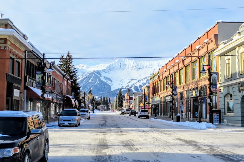
Located along Highway 3, in British Columbia at the south end of the Hughes Ranges, Fernie was founded in 1898 by William Fernie as he made claims to the land and started mining the nearby coal reserves. By 1904, Fernie was incorporated as a city, and, to this day, it is the only city-class municipality to be completely surrounded by the Rocky Mountains.
Fernie started as a coal mining town; however, the town currently caters to outdoor enthusiasts, especially during the winter season. The city’s population of 5,000 swells during the winter months. The recreation opportunities from Fernie are ample and the scenery is incredible. Any time of year, Fernie has something for everyone to enjoy.