Scan the QR code and open PeakVisor on your phone
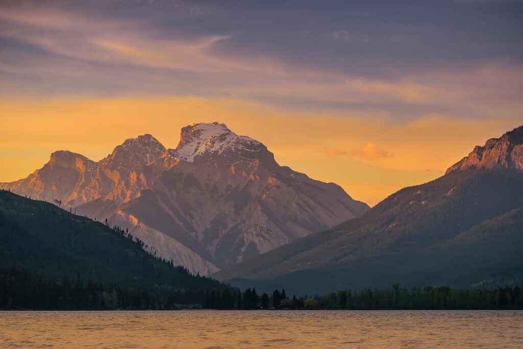
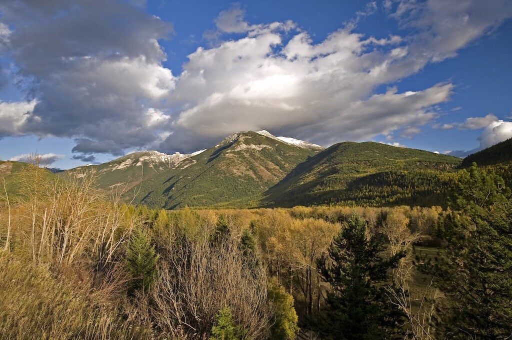
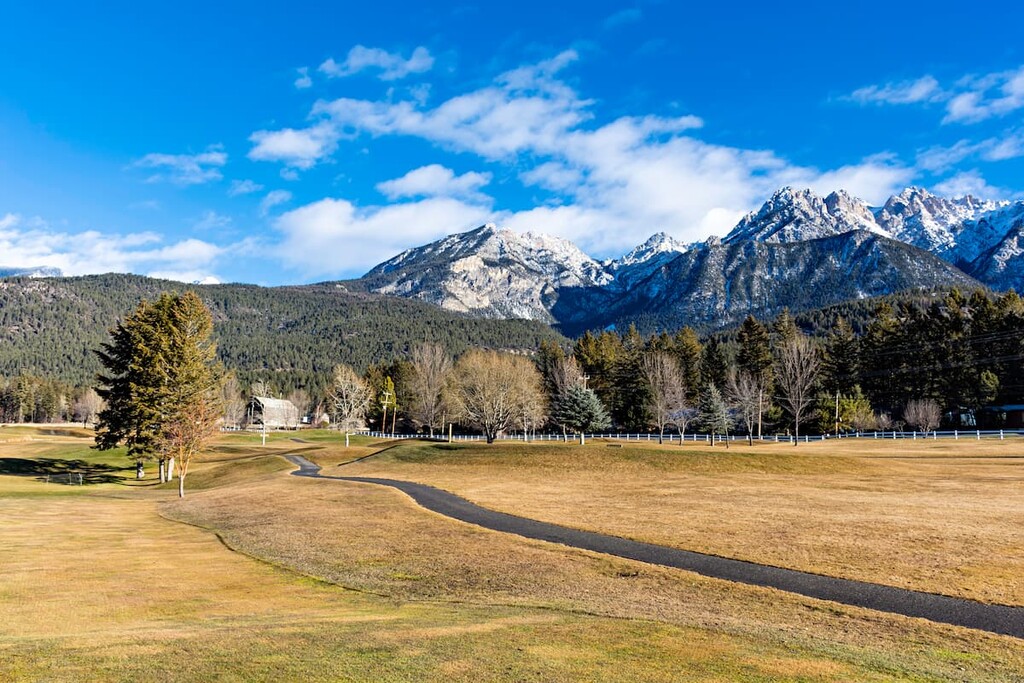
The Van Nostrand Range is a collection of peaks located in southeastern British Columbia, Canada, in the District of East Kootenay. It is one of five ranges that make the Kootenay Range of the Canadian Rocky Mountains. There are five named peaks in the range, of which Mount Gagnebin is the tallest (2960 m /9,708 ft).
The Van Nostrand Range is situated in the southeastern part of the province of British Columbia in western Canada. It is located within the Regional District of East Kootenay and it is a part of the Kootenay Range.
Furthermore, the Van Nostrand Range is located about 130 km (78 mi) to the northeast of the city of Cranbrook in British Columbia. The main access road to the range is the Lussier Forest Service Road, which is accessible from Canal Flats some 85 km (52mi) to the north of Cranbrook.
It’s possible that the range was given its English-langauge name after B.T. Van Nostrand, a sportsman from the US state of New York whose name appears in, "Camp-Fires in the Canadian Rockies" by W.T. Hornaday, a book that describes a trip that Nostrand took in the area in 1905.
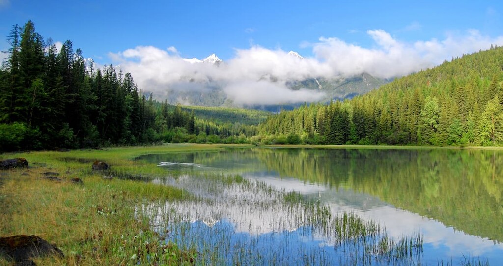
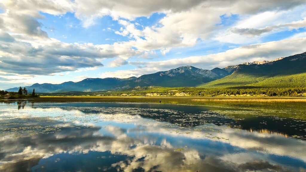
The range covers 370 sq. km (143 sq. mi) of land and runs roughly north to south. The range is bounded by Coyote Creek and Galbraith Creek on the west, Quinn Creek and Blackfoot Creek on the west, and Whites River on the north. The range contains parts of Whiteswan Lake Provincial Park and Top of the World Provincial Park.
The Van Nostrand Range is a subrange of the Kootenay Range in the Canadian Rocky Mountains. Van Nostrand is bounded by its sibling Hughes Range on the west and Quinn Range of the Harrison Range on the east.
The rocks in the Van Nostrand Range started forming billions of years ago as marine sediment from cyanobacteria (blue-green algae) that lived in shallow seas would sink to the bottom when they died. This sediment eventually formed layers of limestone and dolomite that were thousands of meters thick.
Starting around 80 million years ago, the tectonic plates under the Pacific Ocean collided with the North American plate, and for the next 40 million years, the colliding and compressing of the plates would form the Rocky Mountains.
The plates from the west slid under the North American plate, in a process called flat-slab subduction, meaning that there were no significant channels created for magma to reach the surface. As such, there is little evidence of volcanic activity and igneous rocks in the Canadian Rockies.
While there was insignificant volcanic activity in the region, massive slabs of layered limestone and shale broke apart at fault lines and were thrust into the air, to create the mountains. Over millions of years glaciers, wind, rain, and flowing water carved the topography of the Van Nostrand Range. While there are currently no glaciers in the range, the mountains were generally formed from glacial movement and subsequently created creeks and rivers during the Pleistocene epoch.
Within the range, glaciers and water eroded away the softer shales and sandstones, leaving the limestone behind. The peaks are composed of the durable limestone layers, while the valleys are where the softer shale and sandstone was removed. The process is referred to as differential erosion and is the major force that created the peaks and valleys throughout the Rocky Mountains.
The four peaks in the range are Mount Gagnebin, Mount Nicholas, Canis Peak, and Melvin Peak.
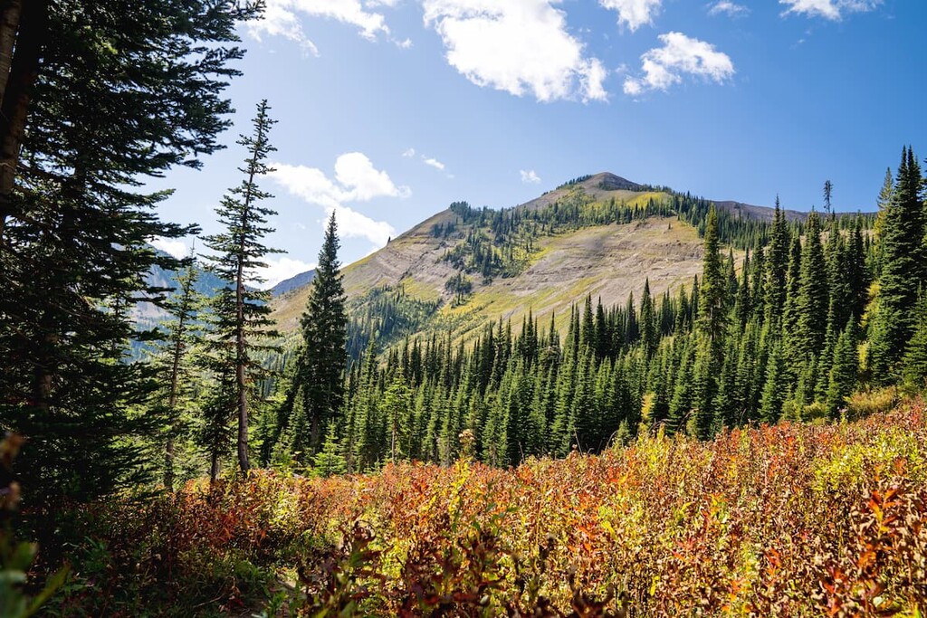
After the glaciers melted about 12,000 years ago, plants and animals started to move into the valleys and onto the slopes. Nevertheless, due to the drastic changes in elevation found within the range, the Van Nostrand Range contains both alpine and subalpine ecological regions.
The alpine region of the range is the rocks above the treeline, and it is characterized by cold weather, strong winds, and high precipitation, usually in the form of snow. The alpine flora consists mainly of sedges and mountain heath, both of which are usually found in protected outcroppings and along summer snow fields. There are several birds that will nest amongst the alpine rocks and mountain goats and bighorn sheep will often roam the peaks.
The subalpine region has much more diverse flora and fauna than the alpine region. The higher slopes are often covered with forests of old-growth balsam, Douglas fir, and Engelmann spruce. The lower slopes have mixed forests of lodgepole pine, Sitka alder, alpine larch, white bark pine, as well as fir and spruce.
The mountain plateaus are carpeted with seasonal wildflowers such as glacier lilies, mountain forget-me-nots, and western anemone. The lower meadows will also grow globe flowers, Indian paintbrush, arnica, bunchberries, and yellow columbines.
Small mammals, such as voles, chipmunks, and ground squirrels inhabit the meadows and slopes, as do many different bird species. Clark’s nutcrackers, Steller’s jays, grey jays, thrushes, pine grosbeaks, bald eagles, and golden eagles can be spotted across the range. Loons, red necked grebes, belted kingfishers, and blue herons can be found at the mountain lakes.
The range is prime habitat for many large mammal species, such as the many herds of mountain goats and bighorn sheep that roam the range. Moose, elk, and deer are common in the range, especially along the creeks and marshy areas. Both grizzly and black bears also inhabit the Van Nostrand Range, feeding mainly on berries, small mammals, and fish.
The Van Nostrand Range is part of the traditional territory of the Ktunaxa Nation, who currently reside in the region. There is evidence that people started inhabiting the region around 12,000 years ago, with one belief that the modern Ktunaxa Nation are descendants of the first people to inhabit the area.
Archaeological evidence suggests that a group of people immigrated into the Kootenay region from what is now the United States, following the migration of animals, as the glaciers were receding from the valleys around 12,000 years ago. There is significant evidence of this culture found around the Kootenay area and the collection of cultural sites are referred to as the Goatfell Complex.
The ancient inhabitants of the area would mine chert from the slopes and peaks, even from the area now known as Top of the World Provincial Park. Chert was valuable because it breaks in a way that creates sharp edges, which was useful for tools and hunting points.
The locals would trade chert to other groups, so much so that the chert from the Kootenay region has been discovered in archaeological sites across British Columbia and Alberta.
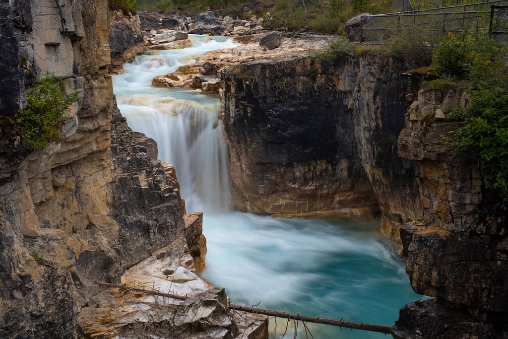
In addition to evidence of ancient mining activity, a seasonal hunting camp was discovered near the Lussier Hot Springs, which suggests continued use of the hot springs and area for the last 5,000 years. Since the 1800s, trappers, prospectors, and guides working in the area have used the hot springs to relax and rejuvenate themselves. The hot springs are currently part of Whiteswan Lake Provincial Park, at the north end of the Van Nostrand Range.
Logging and mining have continued since the late nineteenth century throughout the range, and the government of British Columbia set aside Top of the World Provincial Park in 1973 and Whiteswan Lake Provincial Park in 1978 to protect the landscape.
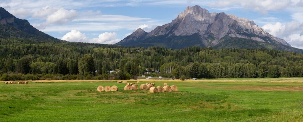
There are no settlements within the range; however, there are many towns that cater to outdoor recreation, mining, and logging in the valley below the range.
The Van Nostrand Range is a small remote mountain range amid the mining and logging territory of East Kootenay in southeastern British Columbia. Many of the gems of this range require off road vehicles or at least travel along logging roads. The following are some attractions that are a little easier to get to.
Lussier Hot Springs is located about 100 km (60 mi) to the northeast of Cranbrook, British Columbia in Whiteswan Lake Provincial Park. The access is a 17 km (10.6 mi) logging road off Highway 93, south of Canal Flats.
Seasonal hunting camps have been discovered that date back over 5,000 years and suggest that local inhabitants have been continuously using these hot springs for at least five millennia. Rock pools have been created along the banks of the Lussier River to harness the warm water in relaxing pools.
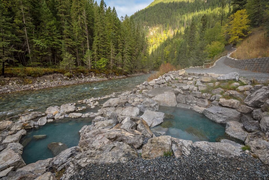
The park and pools are free and open to the public; however, there are no facilities nearby. These are truly natural hot springs, and we can relax in them as the settlers from hundreds of years ago, and the hunters from thousands of years ago did.
Top of the World Provincial Park covers a small area of the Hughes Range and the Van Nostrand Range. It is part of the greater geological area referred to as the Top of the World Plateau, where the elevation is generally above 2200 m (7,200 ft). The park is a small area encompassed by several peaks, the tallest of which is Mount Morro (2912m / 9,991ft).
The park has hiking trails, backcountry campgrounds, a popular fishing lake called Fish Lake, and several peaks to climb.
There are cultural sites within the park, from where ancient people mined chert for their tools and weapons. Furthermore, there is a lot of wildlife in the area, including herds of bighorn sheep and mountain goats and during the summer, the plateau meadows are carpeted with colorful wildflowers.
Galbraith Creek runs the western border of the Van Nostrand Range, with many of its headwaters high in the mountains. Accessible from a logging access road, the Galbraith Creek Trail follows the creek and allows access for fishing.
The creek is full of cutthroat trout year-round. Meanwhile, bull trout and mountain whitefish are found there in the fall. The creek is particularly popular with locals and visitors because 40 cm (16 in) cutthroat are not uncommon to catch.
The second tallest mountain in the range, Mount Morro (2912m / 9,991ft) is accessible through Top of the World Provincial Park. While it is rather remote, it is a surprisingly popular peak to climb.
The documented route to the peak leads over the Alpine Lookout and through the meadows; however, there are less direct trails to access the base of Mount Morro that don’t require that you climb to the Alpine Lookout. Once at the base of the mountain, the route is fairly clear as it leads up the main western ridge.
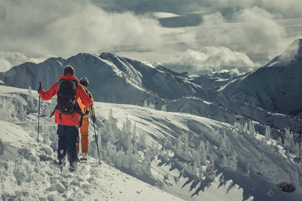
The route is unmaintained and frequent route finding closer to the summit is necessary. The route to the peak is considered a scramble, which is a low level of mountaineering, not just a difficult hike. There are areas where exposure is high and frequent climbing is required to reach the summit.
If you have the skills and endurance required to make this trek, the view from the summit is amazing. You’ll have clear views across much of the Van Nostrand Range, with its highest peak Mount Gagnebin to the north as well as many tarns, meadows, and the Rocky Mountains that surround you.
The Van Nostrand Range is remote and doesn’t border any highways, so access into the range is by forestry access roads that cross the region. There are several small cities and towns in the nearby region in which you can find lodging and supplies for your adventure into the range. Here are some of the best places to check out during your visit:
Located south of the Van Nostrand Range, Cranbrook is the largest city in the region. It was originally settled in the late 1800s and it experienced a boom when the railway was built through town.
Within Cranbrook, there are many places to stay, and the city will have everything that you need for your next adventure. If you want to take a time out from the wilderness, the museum holds an internationally renowned collection of train cars, cultural artifacts, and relics from the miners and homesteaders that lived in the region.
Fairmont Hot Springs is a small town north of the Van Nostrand Range on Highway 93. It is the closest town to the village of Canal Flats, which is the major access point to the forestry roads that lead to the range.
Fairmont is a resort town that caters to outdoor enthusiasts. There is a ski resort and golf courses as well as hiking and biking trails. The town offers RV lots as well as hotels for visitors to stay at. There are stores to purchase what you’ll need for your adventures and the hot springs and spas will give you a place to relax, once you’re done with your travels.
Top of the World Provincial Park has a number of backcountry campgrounds for visitors to choose from. It also has a reservable cabin that holds 14 people. While there are no other facilities in the park, once you’re provisioned, it offers a great basecamp to explore the surrounding ranges and mountains.
While in the park, Mount Morro is a tempting peak to summit if you have the necessary experience. If you’re not up for climbing a mountain there are many other activities in the park, including trails for hiking, cycling, and horseback riding, as well as lakes and creeks to fish in. Winter in Top of the World Provincial Park is beautiful and there are many great cross-country ski trails.