
Scan the QR code and open PeakVisor on your phone
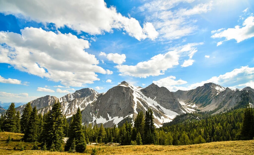
Located along the eastern edge of the Rocky Mountain Trench in southeast British Columbia, Canada, the Stanford Range is a collection of mountains that covers 765 sq. km (295 sq. mi) of land and contains four provincial parks among its 50 named peaks. The highest peak in the range is Indian Head Mountain (2697 m/8,846 ft).
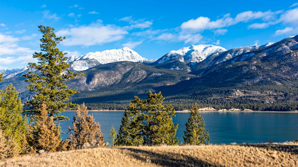
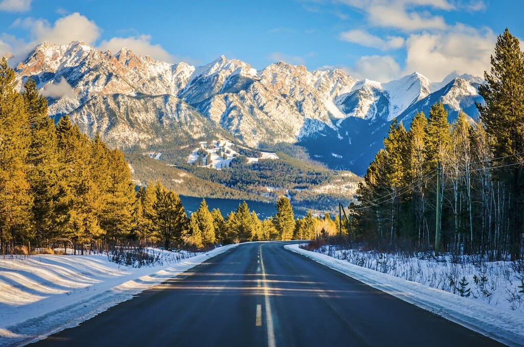
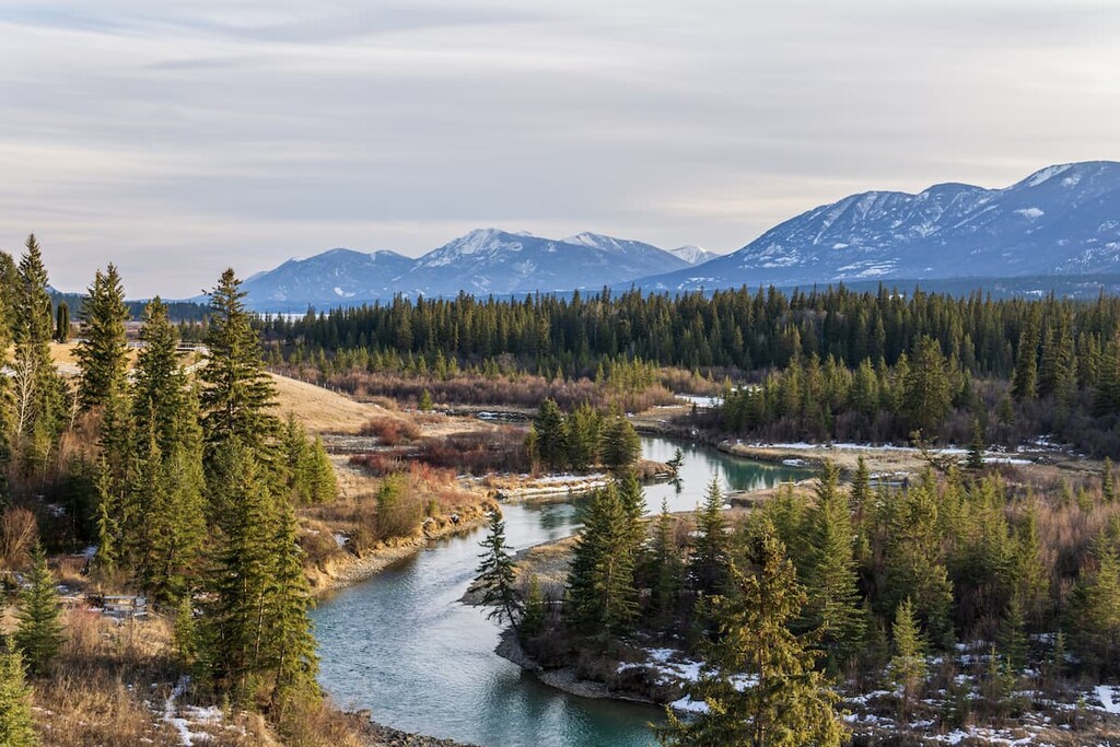
Photo of Highway 3 with Kootenay Range
Situated in the southeastern part of the Canadian province of British Columbia, near the province’s border with Alberta, the Stanford Range is a small collection of peaks within the greater Canadian Rockies system.
The range is bordered to the west by Highway 93 and it extends from Radium Hot Springs to Canal Flats. The Stanford Range was given its English language name by John Palliser in 1867 who named it after Edward Stanford, a London based map publisher.
The northern tip of the range is part of Kootenay National Park, while the rest of the range is provincial crown land with a couple of conservation reserves protecting wildlife areas.
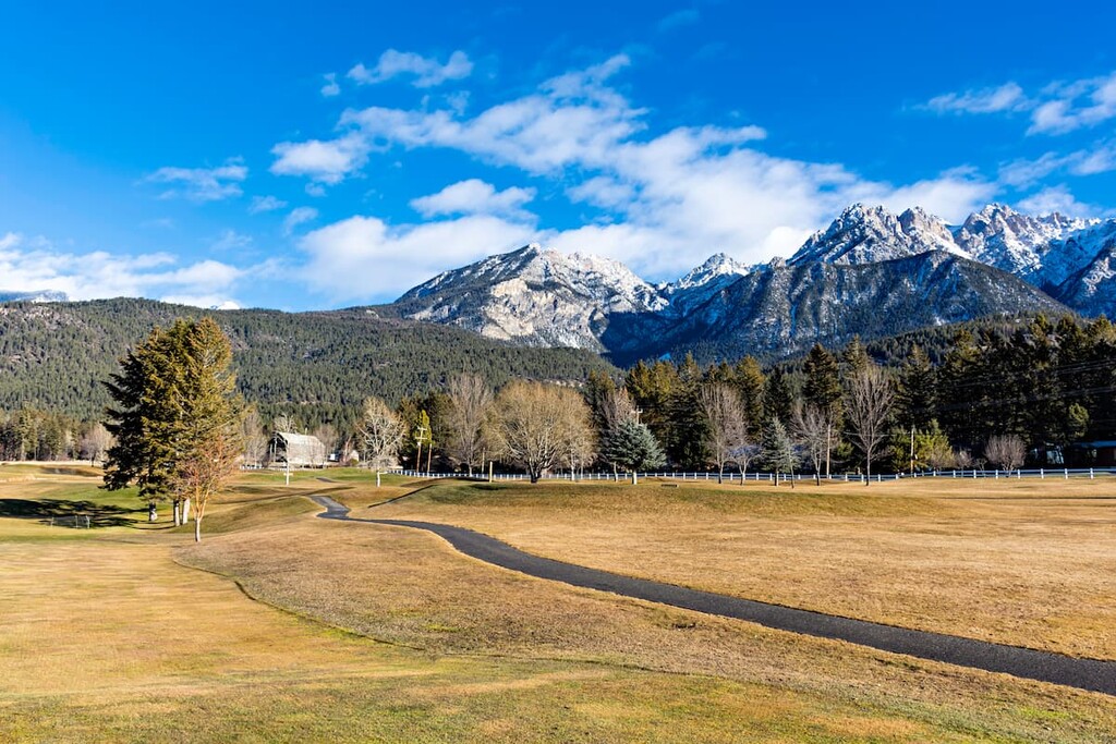
There are many small cities and towns in the Rocky Mountain Trench to the west of the range which were initially founded as logging and mining settlements. As such, the area around the towns is used for resource extraction and, more recently, for the development of ski resorts.
The Stanford Range started to emerge from the bottom of a sea some 80 million years ago during the Cretaceous. Over the course of millions of years, the rocks that took billions of years to form were pushed, folded, compressed, and eventually raised up. Subsequently, throughout the next few millions of years, the abrasive forces of ice, water, and wind gave us the mountains that we see today.
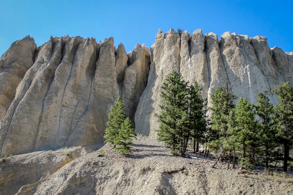
Here’s a quick overview of the different geological features in the Stanford Range that you might encounter during your travels:
The Stanford Range is part of the Kootenay Range, which is part of the western edge of the Rocky Mountains. The Rocky Mountain Trench to the west of the range separates the Canadian Rockies from British Columbia’s interior mountains.
Within the Kootenay Ranges, the Hughes Range and Van Nostrand Range are south of the Stanford Range, and the Brisco Range is to the north. The Royal Group is to the east, and all these ranges form part of what is known as the Southern Continental Ranges of the Canadian Rocky Mountains.
To the west of the Stanford Range are the Selkirk Mountains, which are a subrange of the Columbia Mountains. The Selkirk Mountains are geologically distinct from the mountains in the Stanford Range and the Rocky Mountains in general. Though geographically close to each other, the Rocky Mountains are about 85 million years younger than the mountains to the west of the Rocky Mountain Trench.
Around 80 million years ago the Columbia Mountains were already a significant mountain range when the Rocky Mountains started to form during what is called the Laramide orogeny. The mountain building process, or orogeny, of the Rocky Mountains finished about 55 million years ago, when the tectonic plates from the west stopped their collision with the North American plate.
Over the next millions of years, the fault between the Canadian Rocky Mountains and the Columbia Mountains was stretched instead of compressed, as it had been for tens of millions of years. The stretching at the fault is what created the Rocky Mountain Trench which is unique to the Canadian Rocky Mountains and doesn’t extend south along the Rocky Mountains in the United States.
As the Laramide orogeny was coming to an end, the trailing (western) edge of the Cambrian- and Devonian-age rock slid smoothly and horizontally over the younger Creataceous rock. The flat movement of the plate created horizontal bands of sedimentary stone that resist erosion more than the vertical thrust sheets that formed the mountains to the east. With slower erosion, the western mountains remained taller and created prime storm conditions that increased glaciation of the range.
The Pleistocene Epoch, with its characteristic glaciation, lasted until about 12,000 years ago, at which time the glaciers had mostly retreated. There are no significant features of glacial erosion in the Stanford Range; however, the presence of erratics (rocks in an area that are different in size and type from the regional rock) at high altitudes indicate glaciers covered the range at one time.
All the rocks that form the Stanford Range are sedimentary which were created hundreds of millions of years ago as cyanobacteria (blue green algae) thrived in the warm shallow seas along the western continental shelf.
As the cyanobacteria died, they would fall to the seafloor and accumulate and compress into thick layers of rock. When left alone, this mud would form limestone. If there was magnesium present, then dolomite would form in place of the limestone.
The major gypsum deposits in the range started forming as the oceans receded from the continents and inland “dead” seas were left behind with no outflow to the ocean. As the water evaporated from the dead seas, the salts would precipitate and form gypsum that would sink and accumulate into thick layers.
The major rocks that are found in the range are limestone, dolomite, and shales. Quartzites, argillites, slates, conglomerates, and gypsum compose the remainder of the range. Enormous quantities of commercial-grade gypsum are present and have been mined for decades. Additionally, there is a small area that contains a unique metamorphic rock that resembles phyllite.
The ecology of the Stanford Range is classified as being part of the alpine and subalpine ecological regions. Alpine ecosystems are found above the tree line, while subalpine ecosystems are found along the slopes below the tree line.
Plants and animals are sparse in the alpine areas of the range and consist mainly of lichen covered rocks, grassy meadows, mat vegetation, shrubs, and krummholz ( stunted trees that are desperately trying to survive). Sedges and heathers cling to the edges of snowbeds and grouseberry grows in protected areas. Birds are the only animals known to regularly inhabit the alpine areas of the Stanford Range.
In the subalpine region below the tree line, there is expectedly more flora and fauna. Engelmann spruce and subalpine fir grow in open stands upon the mountains. Dense lodgepole pine forests inhabit the lower altitudes. Buffaloberry, grouseberry, and five-leaved bramble are common undergrowth in the subalpine forests.
The forests and meadows of the subalpine natural region are home to many large animals, including elk, grizzly bears, black bears, deer, mountain goats, bighorn sheep, wolves, and cougars. Wet meadows and streamside shrubbery provide habitat to small mammals such as long-tailed vole, northern bog lemming, and heather vole.
Human habitation near the Stanford Range began around 11,500 years ago when the glaciers started to melt, and vegetation and animals were beginning to inhabit the lands. It is believed that the first people to inhabit the area came from the southeast through the recently thawed valleys. Some of the earliest artifacts of human habitation in Canada are found just west of the Stanford Range in the Goatfell Complex.
The Stanford Range is within the traditional territory of the Ktunaxa Nation. An iteration of the spoken word Ktunaxa gives us the modern name of Kootenay for the name of the mountain range, river, and valley. There is debate as to the origins of the modern Ktunaxa Nation that currently resides in the area.
One origin theory proposes that there has been no break in the archeological record. This means that all ancient technologies that have been found, originate in the area, and that there is no indication that the original inhabitants emigrated. This theory concludes that the modern Ktunaxa Nation are the descendants of the original occupants of the region from nearly 11.500 years ago.
The second theory of the origin of the modern Ktunaxa Nation immigrated to the area in the eighteenth century. It is hypothesized that the Ktunaxa were forced west out of the eastern Rocky Mountains and the plains by the Blackfoot Confederacy. There is historical and cultural evidence showing the regular, even annual migration of many Ktunaxa people across the mountains for hunting.
The first Europeans to enter the area were possibly led by Alexander Mackenzie during his expedition in the late eighteenth century, making European contact with many First Nations for the first time. Captain John Palliser further mapped the area during his expeditions of the 19th century.
Prospectors and surveyors entered the land searching for natural resources to extract. The found gold, an event that spurred a gold rush in the valley, which triggered settlement of the region. Not long after, vast coal and gypsum deposits were discovered, too, helping to bolster the mining industry in the region.
Colonel James Baker, who emigrated from England to British Columbia, purchased the land that the city of Cranbrook is now on in the 1880s. Baker named the land after his home Cranbrook, Kent, England. In 1898 Baker convinced the Canadian Pacific Railway to run their Crowsnest Pass line through Cranbrook instead of the nearby Fort Steele. With the railway came a boom in commerce and industry, and by 1905, Cranbrook was a city and considered the commercial center of the Kootenay area.
Currently, there are many towns and small cities through the area that cater to the logging and mining industry in the region. Most cities have now expanded their tourism industry, creating resorts that cater to skiers and other outdoor enthusiasts.
The Stanford Ranges are rather remote unless you happen to live in the Columbia Valley, so the following trails and attractions are either a good place to stretch your legs from driving, though they are also worthy destinations in their own right.
The Kimpton Creek Trail and Redstreak Creek Trail are two relatively short trails within Kootenay National Park that are good hikes to stretch your legs after driving. Found off Highway 3, east of Radium Hot Springs there are parking lots as the trailheads.
Kimpton Creek Trail is 9.6 km (6 mi) roundtrip with about 300 m (984 ft) of elevation gain and Redstreak Creek Trail is 5.2 km (3.2 mi) roundtrip with 160 m (525 ft) of elevation gain. Both trails lead you along their respectively named creeks through the dense forest. There are occasional views of the mountains around, but otherwise the scenery is close-up in the forest.
The trails lead you through the forest and both end rather abruptly, at which point you turn around and head back to your car. There is wildlife in the area so hikers should take precautions such as carrying bear spray, even on short trails like these.
Located along Highway 93 Windermere Lake hosts many popular tourist activities. Upon the shores of Windermere lake are Windermere and Invermere, which have accommodations so you can explore the area.
The usual water-based activities of resort towns are offered upon the lake, as are sandy public beaches and parks for relaxation. Just outside of town are countless trails for hiking, biking, and skiing. Additionally there are opportunities to use off-highway vehicles to explore the mountains. The activities and sights around Windermere Lake can be enjoyed year round.
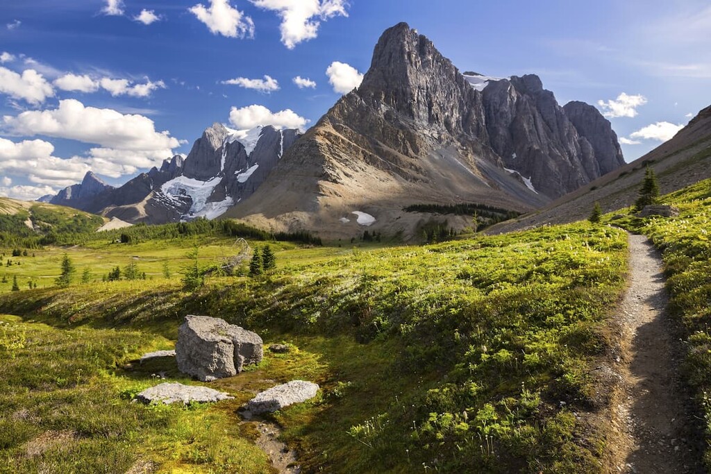
The trails on Mount Aeneas give several trail options that you can cater to your goals and your abilities. From the trailhead, one trail ascends through the forest to the northeast and another trail to the south leads more directly up the slope.
The nice part is these trails can be done in a loop across the ridge, so you get new scenery the whole way. Additional benefits to this hike are that you can hike either trail to its respective peak as an out and back or you can continue further to a third peak. Alternatively, if three peaks aren’t enough of an adventure, you can scramble the rest of the way and reach the summit of Mount Aeneas.
The Hughes Range has been commercially mined and logged for over 100 years. Over that century, many towns and cities were founded. Here are two of the popular cities in the area:
Originally settled by Colonel James Baker, from Cranbrook, Kent, England, the city of Cranbrook lies in the Kootenay River valley in the Canadian Rockies Trench in British Columbia.
At the end of the nineteenth century as the railways were expanding west, Colonel Baker convinced the Canadian Pacific Railway to run their Crowsnest Pass line through Cranbrook. The railway cemented the town's importance and by 1905, Cranbrook had become the commercial and industrial center of the region and was incorporated as a city.
Presently, there are a couple of notable attractions in Cranbrook for tourists and locals. The first attraction is the “rails to trails” trail leading from Cranbrook along the old Canadian Pacific Railway right of way that was donated to create a paved trail between towns.
The second attraction is the Cranbrook History Center, which is a museum that exhibits passenger rail cars from the early 1900s, natural history specimens, and artifacts from early human habitation. The museum is considered to be of national and international importance for the exhibits it houses.
Found at the junction of Highway 93 and Highway 95 in British Columbia, Radium Hot Springs is a small village named after the nearby springs in Kootenay National Park.
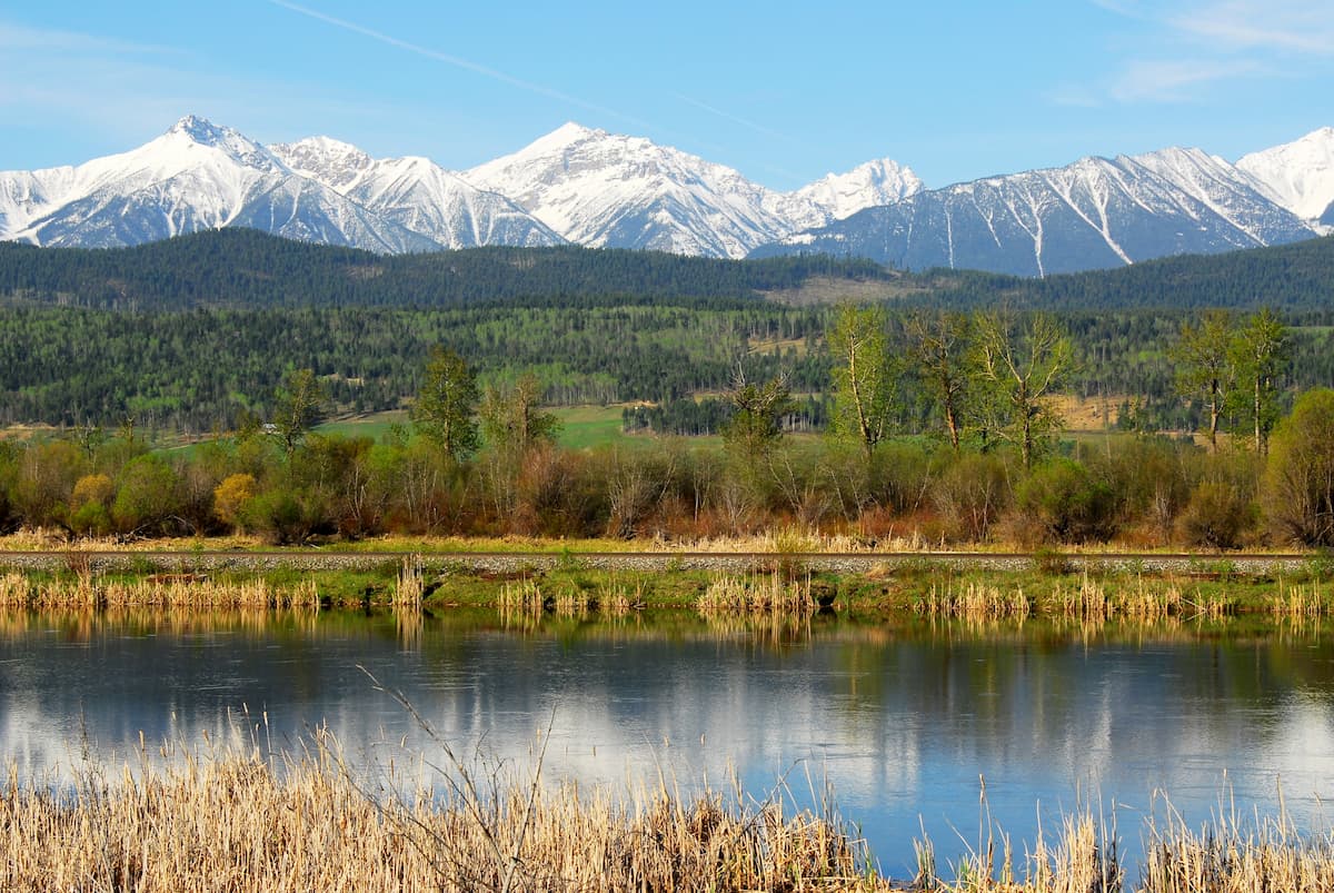
Located just south of Kootenay National Park, Radium Hot Springs is located in the geological formation known as the Rocky Mountain Trench. This valley, which is visible from space, separates the Rocky Mountains in the east from the Columbia Mountains to the west. The trench is also known as the Valley of a Thousand Peaks.
Situated in this valley, Radium Hot Springs has doorstep access to incredible mountain scenery, wildlife, and excursions. Some of the notable hikes in the area include trails in Kootenay National Park, The Old Coach Trail, and Sinclair Canyon Trails.


