
Scan the QR code and open PeakVisor on your phone
The Brisco Range is in the District of East Kootenay in southeast British Columbia, Canada, near Radium Hot Springs. The range covers about 706km2 (273 sq mi) in the Kootenay Range, and has seven named peaks, the tallest of which is The Judge at 2739m (8986ft).
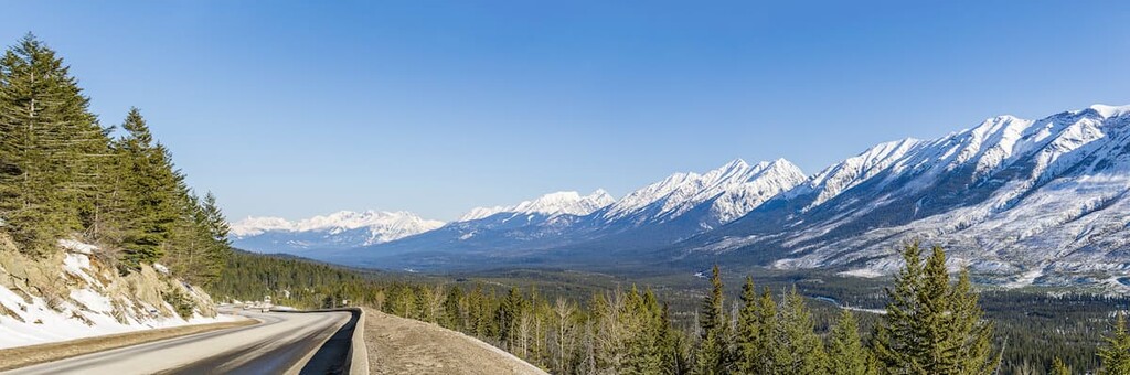
The Brisco Range runs parallel to Highway 95 and the Columbia River in the District of East Kootenay in British Columbia. Radium Hot Springs is the largest town near the range, and the larger town of Golden is north of the range. The southern end of the range is part of Kootenay National Park and ends at Highway 93, where the Stanford Range begins.
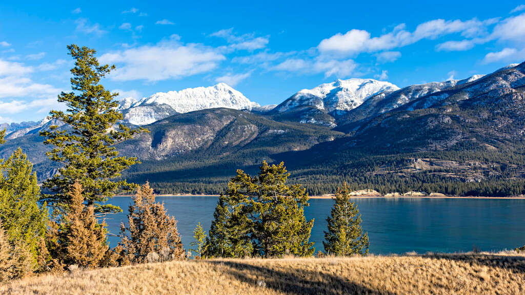
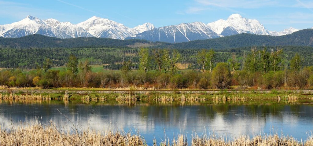
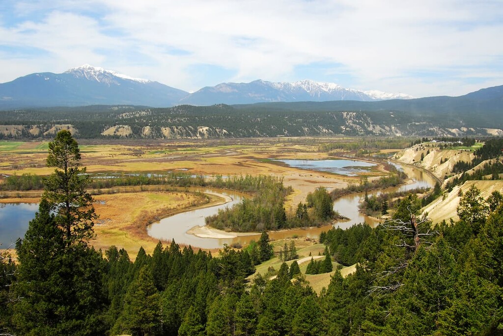
The Brisco Range is a narrow mountain range on the western edge of the Rocky Mountains. It’s sibling ranges, the Beaverfoot Range to the north and the Stanford Range to the south form a more-or-less continuous row of peaks for about 160km (100mi), from the confluence of the Kicking Horse River and the Columbia River to Columbia Lake.
The south end of these ranges is delineated by the Kootenay River and the Columbia River. An interesting note, on a map is it easy to mistake the river running through the Rocky Mountain Trench as a single river; however, they are two rivers which flow in different directions. The Columbia River flows north, while the Kootenay River flows south, even though they appear connected south of Columbia Lake.
The mountains that form the Brisco Range started as marine sediment was forming hundreds of millions of years ago. Sediment accumulated as layers of limestone and dolomite from marine organisms, layered with sand and silt that washed into the shallow seas from the continent. About 75 million years ago some of the tectonic plates under the Pacific Ocean collided with the North American plate and started to form the Rocky Mountains.
For about 40 million years the plates would compress, until the energy was released as a series of fault thrusts that raised the layers of rock up, stacking them, bending them, and pushing them high above the sea. A mountain forming event is called an orogeny, and the event that formed the Rocky Mountains was the Laramide orogeny.
Around 35 million years ago the tectonic plates stopped pushing against each other and started to pull apart. Over millions of years, the Rocky Mountain Trench formed along the fault line that separates the Rocky Mountains, that were formed during the Laramide Orogeny, from the older Columbia Mountains to the west, that were formed during the Sevier orogeny.
The Rocky Mountains were formed from thick slabs of limestone and dolomite with deposits of quartz and argillite. Layered with the durable limestone was softer sandstones and shales which, when exposed, eroded faster than the limestone, creating valleys between the peaks.
Glaciers played a large role in the erosion of the mountains and the final glacial maximum of the Pleistocene is responsible for the current topography of the Brisco Range. An ice sheet 1000m (3280ft) thick covered the range and scoured the softer rock away leaving the peaks and wide valleys. As the glaciers melted, the runoff flowed quickly down to the Pacific, eroding the limestone to form deep V-shaped valleys, characteristic of the Brisco Range and mountains west of the Continental Divide.
There is a large deposit of barite that is currently being mined from the Brisco Range. Barite is a dense mineral that will block x-rays and gamma rays, so it is commonly used to make concrete shielding in hospitals and laboratories.
The ecology of the Brisco Range is generally divided as alpine above the tree line, and subalpine on the slopes to the valleys. Above the treeline, the Brisco Range is rock-dominated with pockets of sedge, heath, and white-mountains avens. The highest areas are only barren, or lichen covered rock. Mountain goats and bighorn sheep will roam among the peaks and several bird species find safety among the barren rocks for nesting.
Most animals live in the forests and meadows upon the slopes; however, marmots and pika are found living just above the treeline, favoring the alpine rocks for their burrows. The marmots and pika will feed on the grasses, moss, flowers, and other herbaceous plants that grow in the protection of the treeline. While hiking or scrambling, the call of a marmot can be quite startling, and they are surprisingly loud for such a small animal.
Meadows and forests are intermixed along the slopes of the Brisco Range. The higher forests are dominated by Engelmann spruce and subalpine fir, with whitebark pine and alpine larch at the treeline. Douglas fir, western larch, and lodgepole pine add to the forests of the lower slopes, and dense Sitka alder is common in avalanche paths. The meadows contain fescue grasses, sedges, and heaths.
Mountain goats, bighorn sheep, mule and white-tail deer, and elk are all common ungulates in the Brisco Range. The range is habitat for both grizzly and black bears, as well as coyotes, cougars, wolves, and other smaller carnivores.
Logging, forest fires, and a changing climate are changing the diversity of habitats and wildlife in the range. Areas that were previously covered in forests of Engelmann spruce and subalpine fir are being replaced by “dry” forests, dominated by Douglas fir, ponderosa pine, and juniper trees.
Human history in the Brisco Range starts at the end of the Pleistocene, when the glaciers had receded from the valleys. About 12,000 years ago, plants were growing in valleys which were once covered by a kilometer thick ice sheet. Large animals such as giant bisons and mammoths migrated into the Rocky Mountain trench, and a group of people came to the Kootenay region to hunt them.
Archeological sites throughout the region and district suggest that the first inhabitants were members of the Clovis Culture. Many ancient sites and artifacts have been found in the region, which are part of the Goatfell Complex. These are a group of ancient quarries, workshops, hunting camps, and other artifacts and sites that were created by the first inhabitants of the region.
The Kootenay region and Brisco Range are traditional territory of the Ktunaxa Nation. One archaeological theory suggests that the modern Ktunaxa Nation are direct descendants of the original inhabitants from 11,500 years ago. A second theory suggests that the modern Ktunaxa were forced to emigrate from the prairies during the 1800s as the Blackfoot Confederacy was growing in power and territory.
The main locations that show continued use for thousands of years, are the areas around the hot springs, such as those at Fairmont, Lussier, and Radium Hot Springs. For thousands of years, the springs were used to cure ailments and rejuvenate wearied bodies. The larger hot springs likely hosted many people during the times of the summer salmon run on the Columbia River and during the winter burbot spawning season.
David Thompson entered the region by 1807 on his search for a route to the Pacific and made the first European contact with the Ktunaxa Nation. Within decades of the first European contact, rumor of a hot spring was heard by Sir George Simpson, the general of the Hudson’s Bay Company, who made the first recorded visit to the Radium Hot Springs in 1841.
As the nineteenth century progressed, European settlers came to the area to stake their claim in mining and farming. Thanks to the Palliser Expedition of the mid nineteenth century, the region was surveyed and the railway lines from east to west coast were under construction. The railway increased the population during the gold rushes and was the infrastructure through which the mining and logging companies could export their product to the rest of Canada.
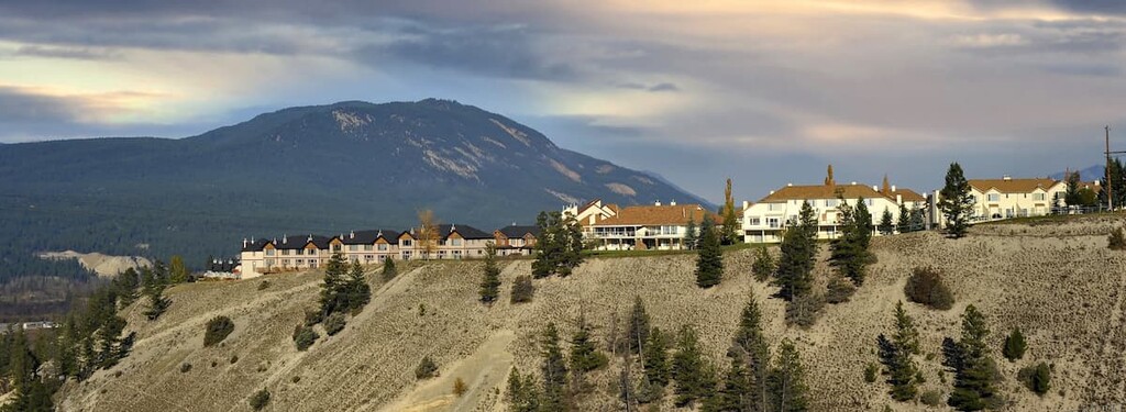
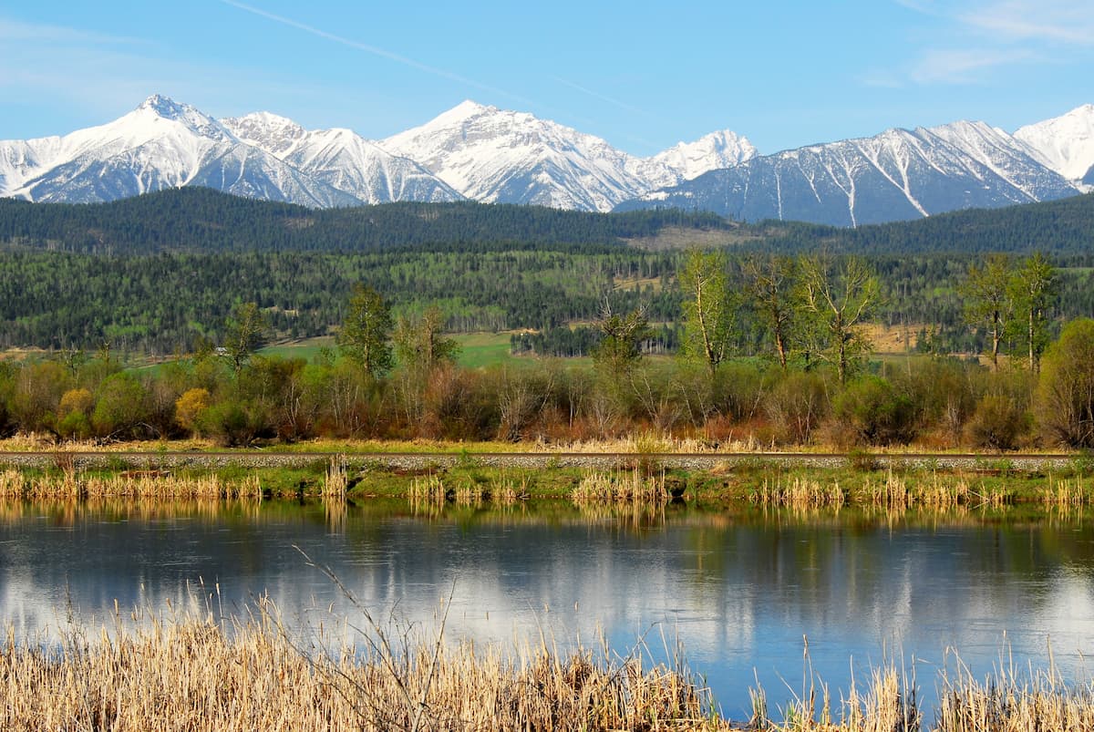
The Columbia River valley that parallels the Brisco Range currently has several small towns that cater to tourism, such as Radium Hot Springs, and the mining and logging industries.
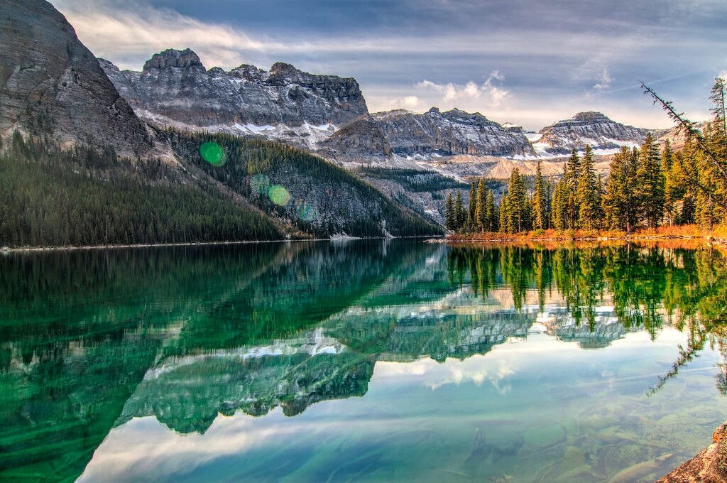
The Columbia River valley in the Rocky Mountain Trench is a stunningly beautiful place. There are some great places to visit and some fantastic adventures to be had in the Brisco Range.
Bordering the Highway 93 corridor from Alberta, Kootenay National Park was created in 1922. The national park was created when the provincial government of British Columbia requested that the federal government construct a road through the mountains, and in return the province ceded the encompassing lands to become a new national park. The southern end of the Brisco Range is within Kootenay National Park.
There are many incredible natural features to visit within the national park such as the Paint Pots, Radium Hot Springs, and the Rockwall. Kootenay National Park has many popular backcountry campsites and backcountry trails that lead into the neighboring Yoho and Banff National Park and Mount Assiniboine Provincial Park.
The town of Radium Hot Springs is on the edge of Kootenay National Park and is named for the hot springs that are located within the park. The springs are named from the trace amounts of radium that is found in the water, and they are popular because unlike many hot springs, the Radium Hot Springs don’t carry the strong sulfur smell.
The Radium Hot Springs have been used freely for thousands of years by locals. It was in 1890 that Roland Stuart purchased the hot springs for $160 and by 1914 had constructed a concrete pool, a log bathhouse, and a store to commercialize the springs.
With the creation of Kootenay National Park in 1922, the hot springs were expropriated and integrated into the park. Modern pools and infrastructure, including a spa, have been built to accommodate visitors.
The Kindersley Pass / Sinclair Creek trail is a 17km (10mi) loop that takes you to the southern peak of Mount Kindersley and along the Sinclair Creek. With forested trails, avalanche slopes, rocky ridges, and alpine meadows, this is Kootenay National Park’s top rated loop hike and one of the best day hikes in the park.
Starting from the Sinclair Creek parking lot about 11km (6mi) east of Radium Hot Springs, allows you to hike up the open ridge to the summit, taking in the breathtaking views as you try and catch your breath during the ascent. Descending towards the Kindersley Pass parking lot allows for a peaceful walk down through the forested trail. By midsummer, the Group of 4 Access is usually in place because of bear activity.
While Kootenay National Park is a popular tourist destination, the featured activities are some amazing hiking trails that require backcountry camping. If you decide that you require something more comfortable than a backcountry campsite, the following places allow for great excursions during the day and a comfortable bed at night.
The town of Radium Hot Springs is at the southern end of the Brisco Range, where Highway 93 from Alberta meets Highway 95, which comes down from Golden. It is a small town that caters to visitors of Kootenay National Park.
The town has hotels, restaurants, shops, and museums to visit; however, most people come for the hot springs and outdoor adventures. There are many hikes from the edge of town, such as the Sinclair Canyon trails, and many other paths to adventure in Kootenay National Park and the valley.
At the north end of the Beaverfoot-Brisco-Stanford trio of mountain ranges, the town of Golden, sits at the confluence of the Kicking Horse River and Columbia River. Established as an outpost along the Canadian Pacific Railway, Golden has grown into a mountain biking mecca.
With humble beginnings, Golden initially supplied the railway with lumber for ties, trestles, snow sheds, and other railway buildings. With the completion of the railway, Canadian Pacific Railway hired Swiss mountain guides to lure tourists to the region, who led over 1000 ascents between 1899 and 1954 without a single fatality. While forestry is still important to the economy, many people move to and visit Golden for the relaxed lifestyle and growing mountain bike culture.
While it may seem counterintuitive to stay in Banff, Alberta to visit and explore the Brisco Range in British Columbia, by Canadian standards, they are practically neighbors. The drive from Banff is only 140km (86mi), in fact the distance from Calgary is only 260km (156mi) to reach Radium Hot Springs.
Banff is a tourist hotspot and is home to incredible wilderness and mountain scenery and opportunities to view wildlife. There are many recreational opportunities from the edge of Banff as well as many cultural and historical sites and museums to visit within the town.

While Radium is a lovely place and much closer to the Brisco Range, the luxurious hotels, golf courses, restaurants and other attractions of Banff are on a different level. A day trip from Banff, or even Calgary, is a great option for visiting Kootenay National Park and the Brisco Range.


